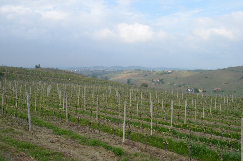
This is the third trip in a row that we visit Northern Italy. We always make round trips to this region in spring time. After last year's round trip "Veneto", we went to Piedmont this year. We were amazed at the religious wealth of this region. Not only the magnificent buildings but also the beautiful landscapes are worth seeing. From the imposing mountain world to the Po plain, in between the hilly landscape with the wine-growing areas, you will find everything here.
Day
Rottweil, Deutschland
48° 9' 54.9" N 8° 37' 42.4" E
48.1652577 8.6284530
• Head toward Wilhelmstraße on Königstraße. Go for 447 m.
• Take the 2nd exit from roundabout onto Königstraße. Go for 668 m.
• Continue on Tuttlinger Straße. Go for 2.0 km.
• Take the 2nd exit from roundabout onto B27. Go for 7.1 km.
• Take ramp onto A81 toward Singen. Go for 42.1 km.
• Take exit 40 toward Konstanz/Radolfzell/Gewerbegebiet Singen/B33 onto A81. Go for 1.9 km.
• Continue on B33. Go for 29.8 km.
• Continue on A7. Go for 709 m.
• Take the 2nd exit from Anschlussstelle Kreuzlingen Nord roundabout toward Romanshorn/13/Schaffhausen/Tägerwilen. Go for 199 m.
• Take the 2nd exit from roundabout onto Tägerwilerstrasse (13) toward 1/Frauenfeld/Romanshorn/Kreuzlingen/Konstanz. Go for 346 m.
• Take the 1st exit from roundabout onto Konstanzerstrasse (1/13). Go for 304 m.
• Take the 3rd exit from roundabout onto Bahnhofstrasse (13). Go for 354 m.
• Pass 4 roundabouts and continue on Seetalstrasse (13). Go for 2.9 km.
• Take the 3rd exit from roundabout onto Romanshornerstrasse (13). Go for 346 m.
• Pass 2 roundabouts and continue on Hauptstrasse (13). Go for 1.4 km.
• Take the 1st exit from roundabout onto Dorfstrasse. Go for 699 m.
• Turn left onto Schulstrasse. Go for 1.7 km.
• Continue on Neuhof. Go for 655 m.
• Continue on Scherzingerstrasse. Go for 907 m.
• Continue on Güttingerstrasse. Go for 1.3 km.
• Continue on Altnauerstrasse. Go for 1.1 km.
• Take the 1st exit from roundabout onto Hauptstrasse (13). Go for 2.6 km.
• Take the 2nd exit from roundabout onto Uttwilerstrasse (13). Go for 2.1 km.
• Take the 3rd exit from roundabout onto Romanshornerstrasse (13). Go for 3.2 km.
• Pass 4 roundabouts and continue on Buch (13). Go for 4.9 km.
• Turn right onto A23 toward St. Margarethen/St. Gallen/Rorschach. Go for 8.1 km.
• Take left exit 84 toward Chur/St. Margrethen/Rheineck onto A1. Go for 18.6 km.
• Continue on A13. Go for 1.2 km.
• Continue on A13. Go for 50.8 km.
• Take the left exit toward Chiasso/San Bernardino/Chur/Bad Ragaz onto A13. Go for 84.1 km.
• Take ramp toward Hinterrhein. Go for 134 m.
• Turn left onto 13. Go for 373 m.
• Turn right toward Hauptstrasse. Go for 48 m.
• Turn left onto Hauptstrasse. Go for 74 m.
• Turn left onto Dorfstrasse. Go for 35 m.
• Turn right onto 13. Go for 267 m.
• Arrive at 13. Your destination is on the right.
☍
273,4 km
(2 hrs. 56 min.)
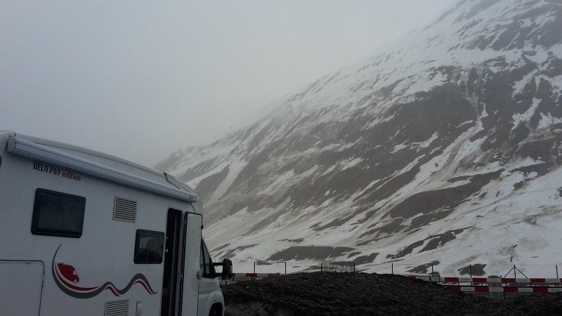
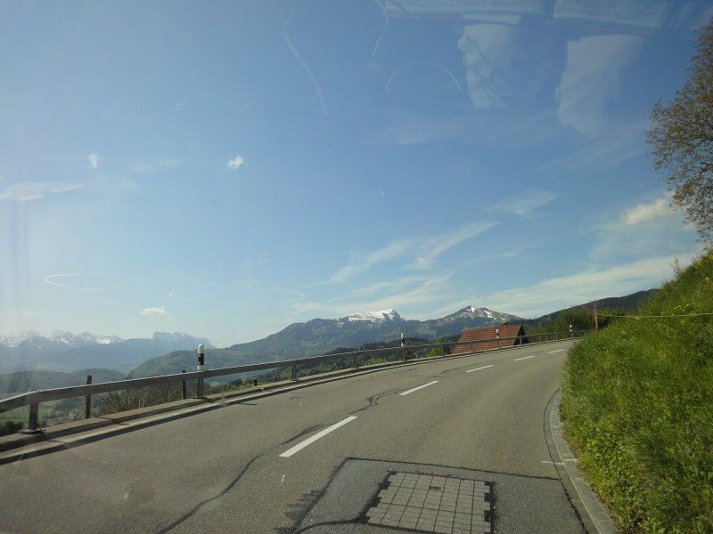
San Bernardino Pass.
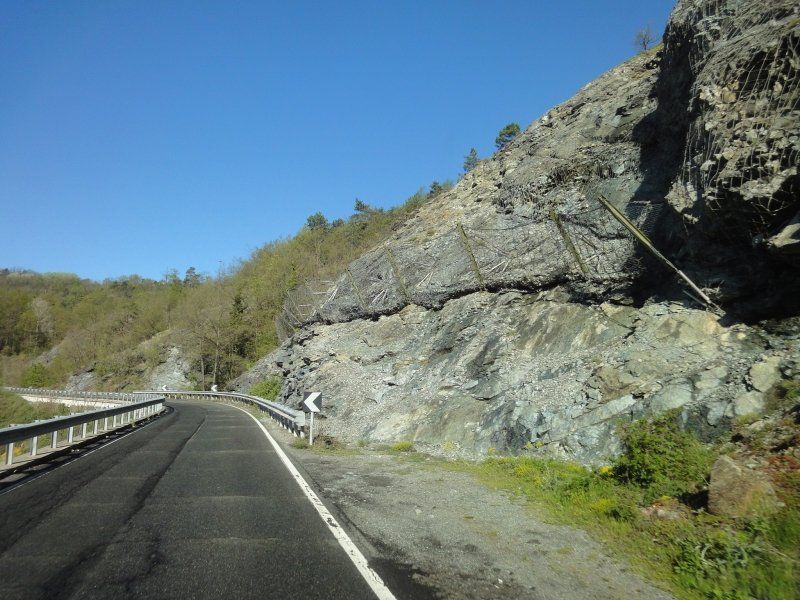
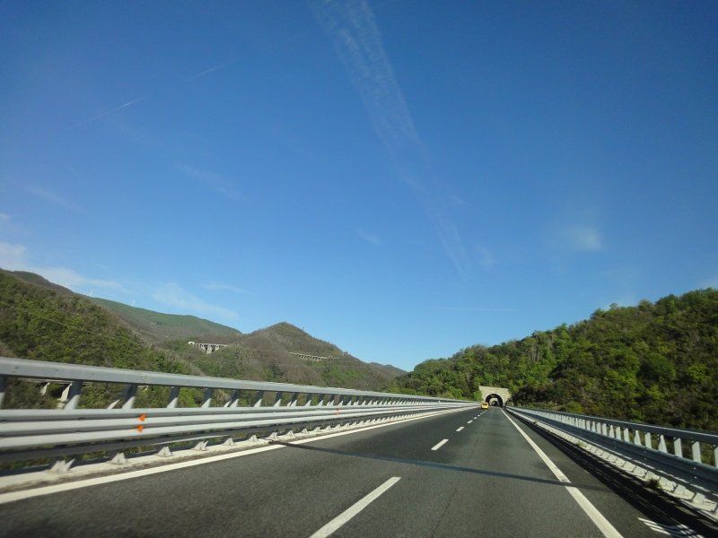
Wir sind bereits am Vorabend gefahren, um am ersten Tag mehr Zeit für die Zwischenstopps zu gewinnen. Der San Betnhardino Pass eignet sich gut für einen Zwischenstopp. Das Übernachten auf dem Platz ist erlaubt (gratis GPS: 46.46267, 9.18587). Unterwegs nach Chur fing es an zu regnen, die Temperatur fiel auf +4 Grad. Für die Nacht war Frost auf dem Pass angesagt.
Hinterrhein, Schweiz
46° 31' 48.6" N 9° 11' 38.1" E
46.5301671 9.1939166
• Head toward Dorfstrasse on 13. Go for 708 m.
• Take ramp onto A13 toward Chur. Go for 3.2 km.
• Take ramp toward Nufenen. Go for 250 m.
• Turn left onto 13. Go for 35 m.
• Turn left and take ramp onto A13 toward San Bernardino. Go for 56.1 km.
• Take the left exit toward E35/Milano/Lugano/Locarno/Bellinzona Sud onto A2. Go for 55.7 km.
• Continue on A9 (Autostrada dei Laghi). Go for 19.3 km.
• Take the exit toward Strada Statale dei Giovi/SS35/Lentate S.S. onto A36 (Autostrada Pedemontana Lombarda). Go for 7.9 km.
• Continue on Strada Provinciale dei Giovi Nord (SPEXSS35). Go for 14.6 km.
• Take ramp toward Nova Milanese. Go for 205 m.
• Take the 3rd exit from roundabout onto Via Valassina toward Como/SS35/Nova M. Go for 411 m.
• Pass 3 roundabouts and continue on Via per Incirano. Go for 1.5 km.
• Continue on Via Giacomo Brodolini (SP131). Go for 125 m.
• Arrive at Via Giacomo Brodolini (SP131). Your destination is on the left.
☍
159,9 km
(1 hrs. 44 min.)
Day
20834 Monza
The rain lasted all night, violent gusts of wind shook the Womo quite violently. There was little traffic on Bernhardino Strasse during the night and so we spent a quiet night.
When we got up the parking lot was empty and all the parked trucks were gone.
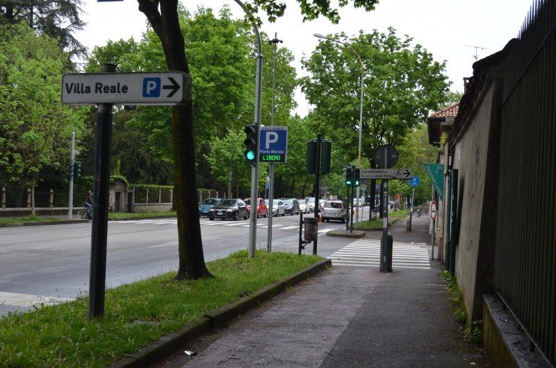
On the way to Como it rained, from then on the weather became more and more friendly. In order not to lose any time, we used the toll motorway to Monza.
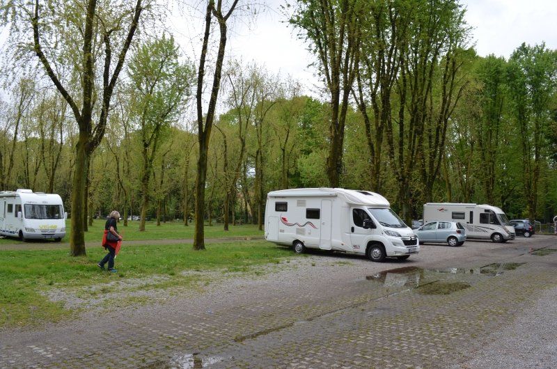
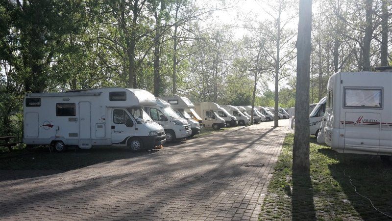
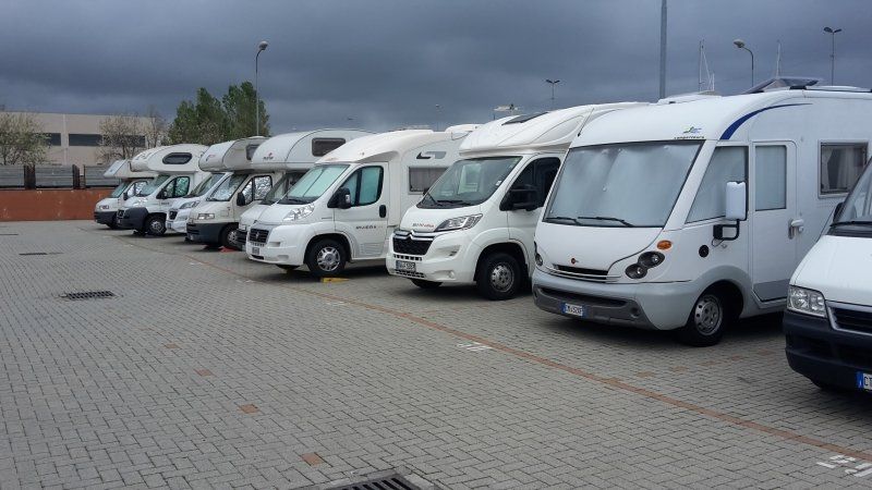
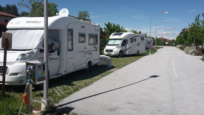
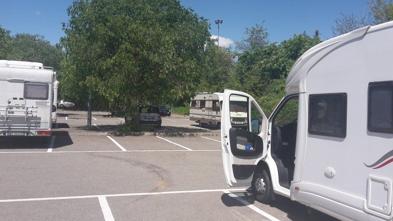
The parking lot (GPS: 45.596834,9.2725) was easy to drive into. Parking fee 3.- €. all day. Not allowed to stay overnight.
Upon arrival, we set out for a city tour.
Via Giacomo Brodolini, 3, 20834 Nova Milanese MB, Italien
45° 34' 59.7" N 9° 11' 47.5" E
45.5832472 9.1965232
• Head east on Via Giacomo Brodolini (SP131). Go for 219 m.
• Take the 2nd exit from roundabout onto Via Giacomo Brodolini (SP131) toward Autostrade/Muggio/Cinisello Balsamo. Go for 551 m.
• Take the 1st exit from roundabout onto Via per Cinisello (SP131) toward Tangenziale Nord/A52/Milano/Cinisello. Go for 543 m.
• Take the 2nd exit from roundabout onto Via per Cinisello (SP131) toward A52/Tangenziale Nord/Cinisello B. Go for 269 m.
• Take ramp onto A52 (Tangenziale Nord) toward Torino/A4/Milano Bruzzano/SP44/Como-Meda/SS35/Bollate-Rho/Aeroporto Malpensa. Go for 16.2 km.
• Take ramp onto A50 (Tangenziale Ovest) toward E64/Torino/A4/Venezia/A4/E70/Genova/A7/Bologna/A1/Aeroporto Linate. Go for 17.9 km.
• Take the exit toward Genova onto A7 (Autostrada Milano-Genova). Go for 18.0 km.
• Take the exit toward Bereguardo/Pavia Nord onto A53 (Raccordo Autostradale Pavia Bereguardo). Go for 9.9 km.
• Take the exit toward Ospedali Pavia/Piacenza/A1/A21/Tang. Nord Pavia/Cremona-Lodi/Milano onto A54 (Tangenziale Ovest di Pavia). Go for 427 m.
• Take the exit toward Pavia Centro/Ospedali onto SP11 (Via Abbiategrasso). Go for 256 m.
• Continue on Via Gaspare Aselli. Go for 78 m.
• Take the 1st exit from roundabout onto Via Gaspare Aselli. Go for 456 m.
• Turn left onto Via Francesco Flarer. Go for 274 m.
• Continue on Via Cesare Lombroso. Go for 203 m.
• Continue on Via Camillo Golgi. Go for 146 m.
• Take the 1st exit from Rondò Dei Longobardi roundabout onto Via Damiano Chiesa (SPEXSS35). Go for 116 m.
• Turn left onto Via Indipendenza. Go for 290 m.
• Turn left. Go for 85 m.
• Turn left. Go for 20 m.
• Arrive at your destination on the left.
☍
65,9 km
( 41 min.)
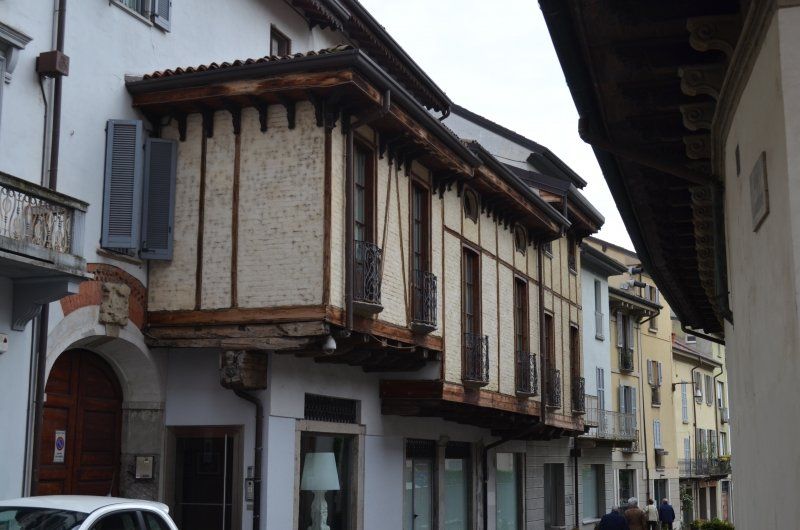
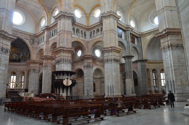
Monza Besichtigung
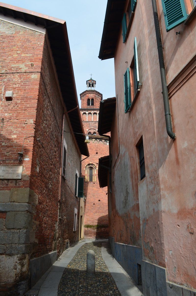
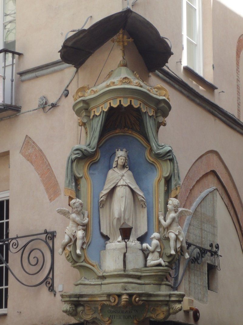
We walked to the center of Monza, with the aim of visiting the cathedral.
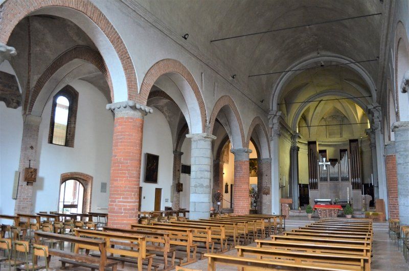
On the way we saw the church of San Pietro which we also had to look at.
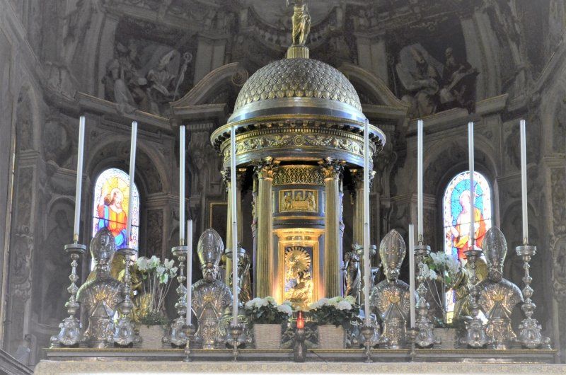
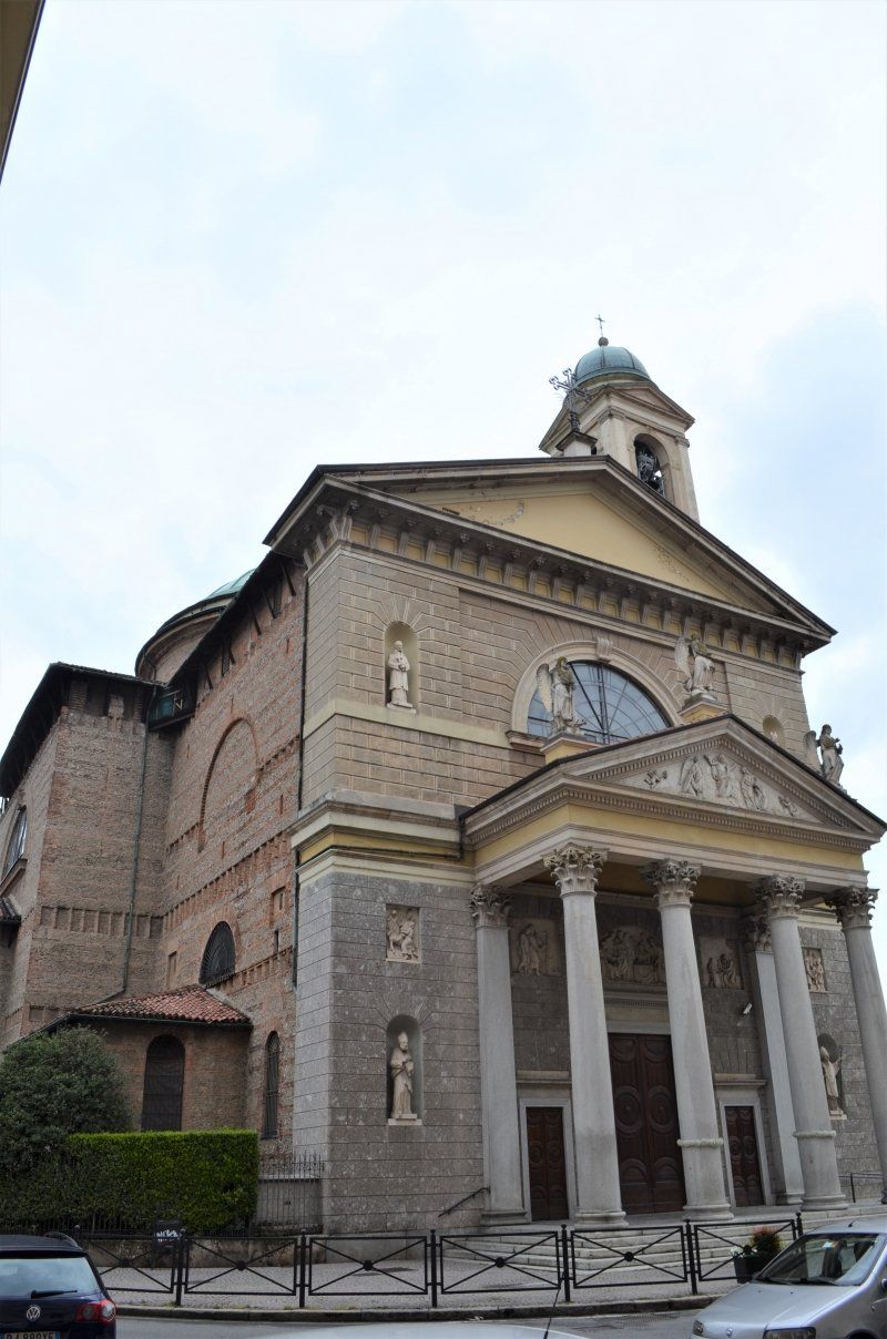
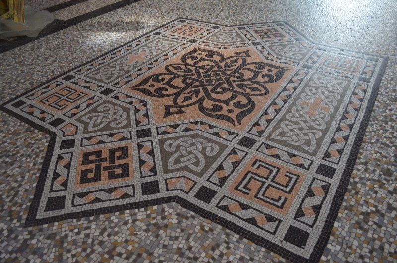
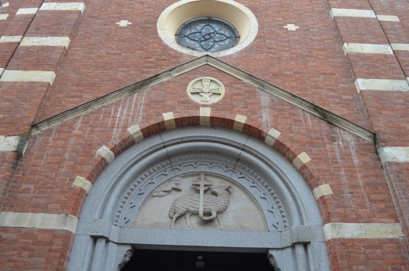
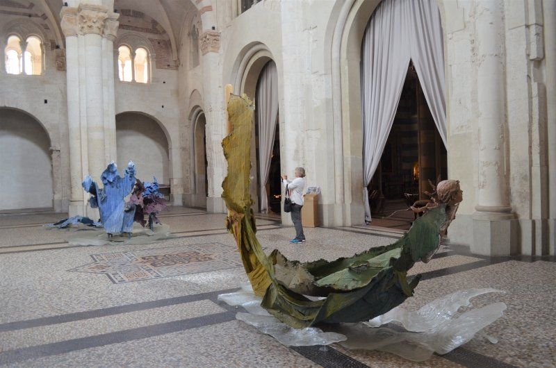
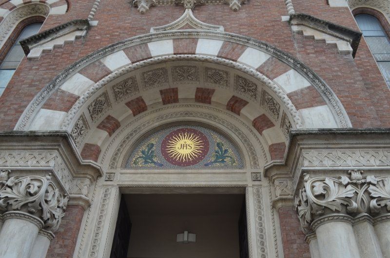
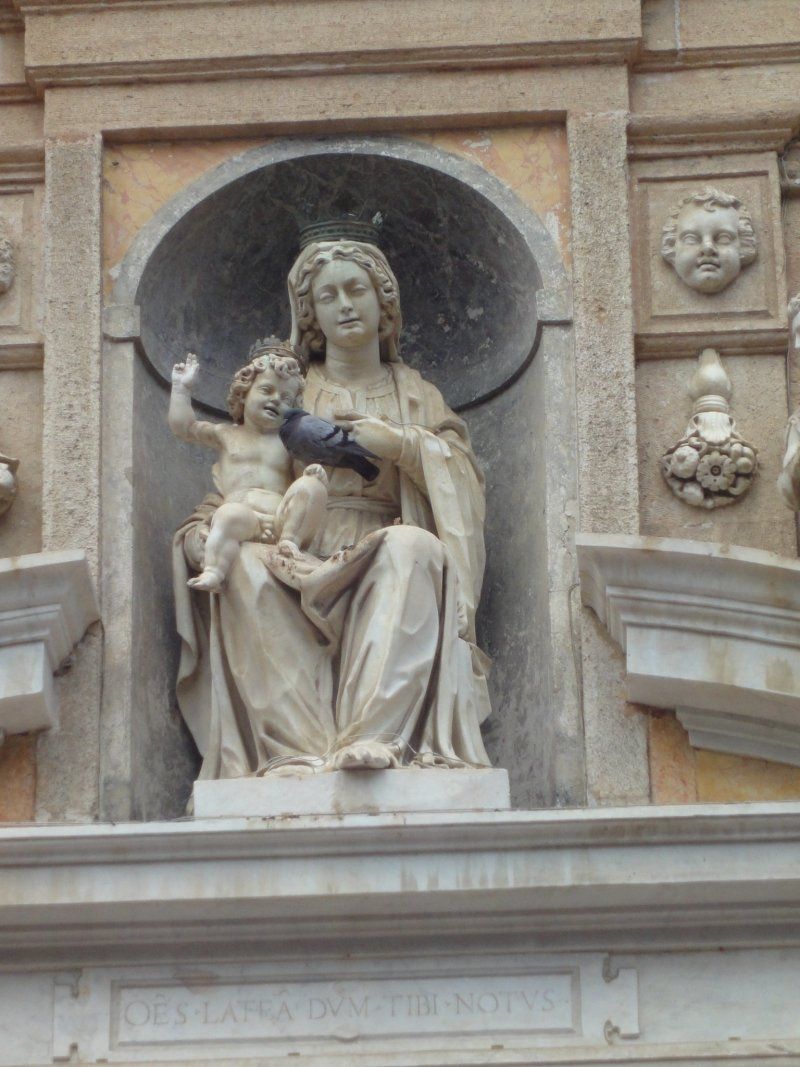
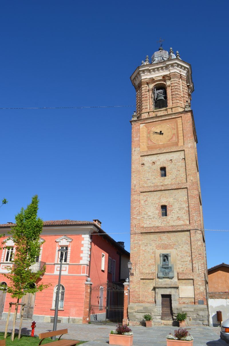
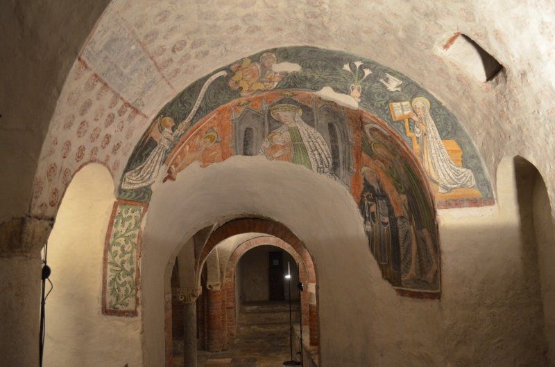
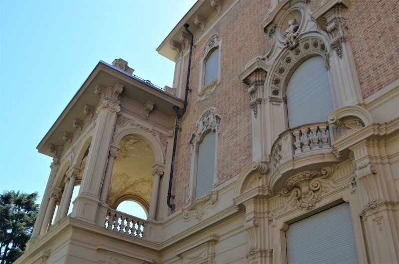
The Duomo sports a green and white banded facade with rich decor. Unfortunately we saw little of the facade, it is completely scaffolded. The interior is baroque, but the Cappella di Teodolinda shows late Gothic frescoes depicting the life of the Longobard queen Teodolinda, who used Monza as a summer residence in the 6th century. A tabernacle encloses the iron crown of the Lombards, their inner ring was once a nail from the cross of Christ.
We strolled through imposing streets and squares, along the banks of the Lambro to the church "Chiesa di S.Getado al Corpo". It was around noon when the churches in Italy are closed.
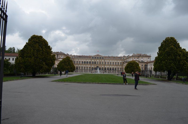
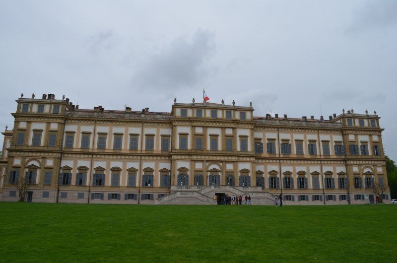
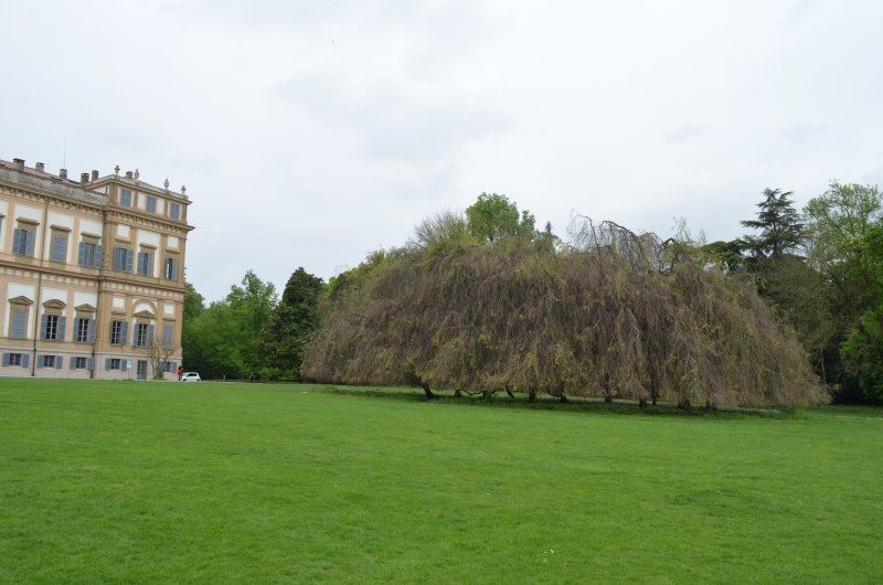
On the way back we passed the Villa Reale di Monza, with a huge park. Monza Park is one of the largest walled parks in Europe, at least the largest in Italy. The Royal Villa (Villa Reale) is a palace built between 1777–1780 and commissioned by Empress Maria Theresa.
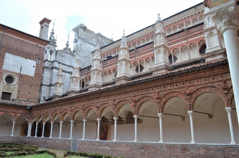
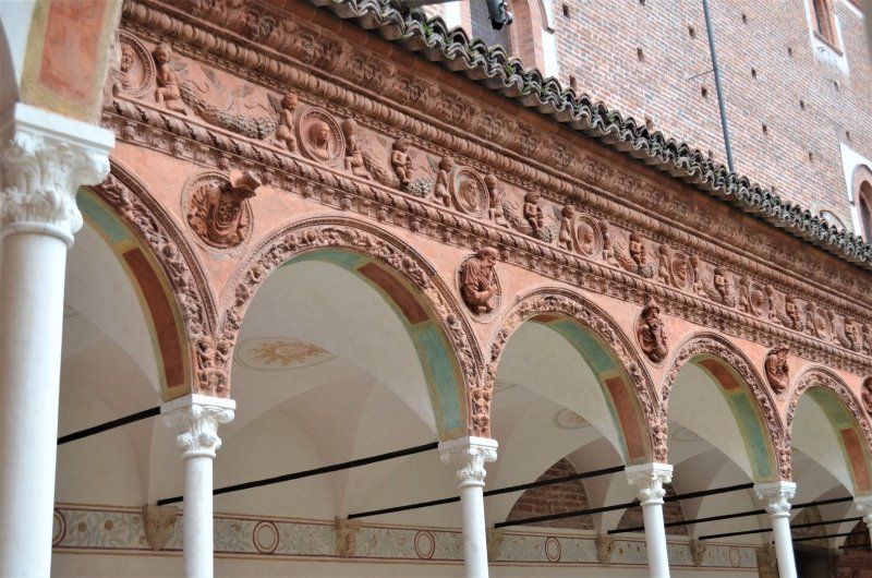
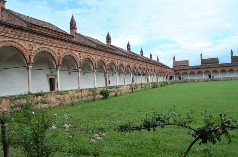
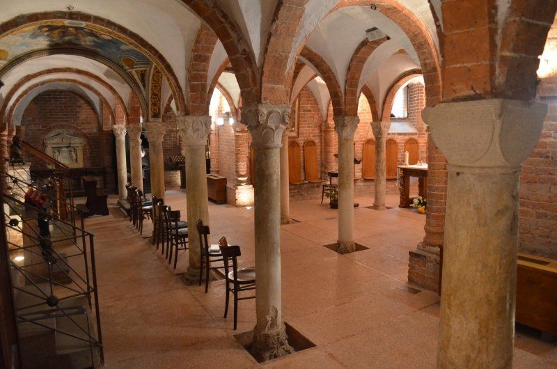
27100 Certosa (Kloster)
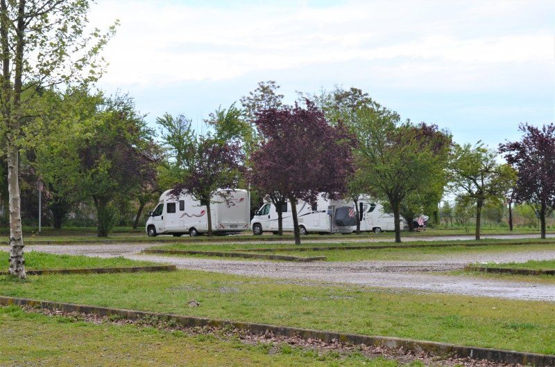
Actually we wanted to visit the city of Pavia first, then drive to the parking space at the monastery and use it as an overnight stay. I had mixed up the coordinates for the navigation system and so we drove to the Certosa monastery as our next destination.
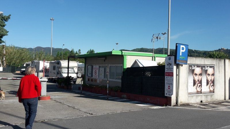
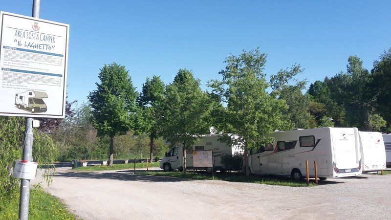
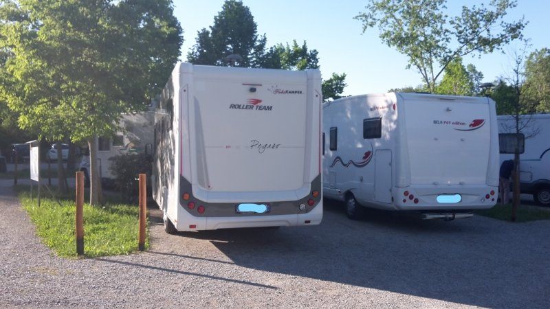
On arrival the pitch was almost empty. After the coffee break, we went to visit the monastery extensively. We also decided not to go any further to Pavia, but to spend the night on the pitch. Costs 16.- € with electricity / water and disposal.
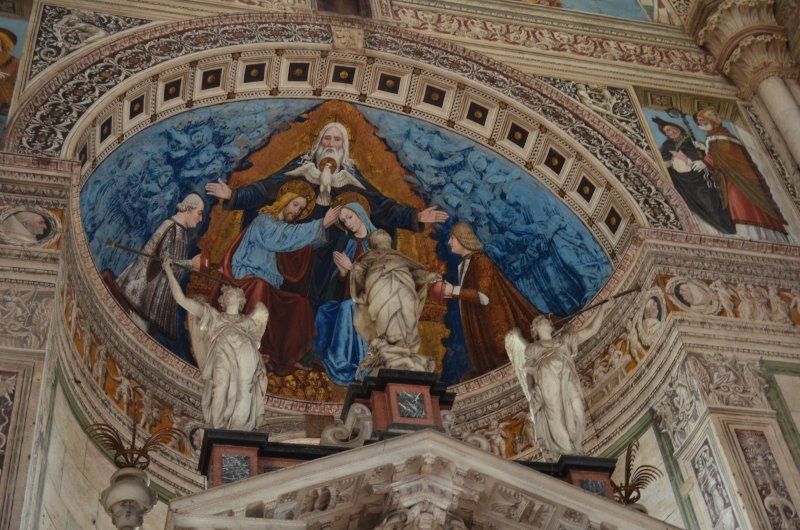
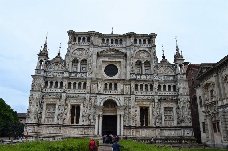
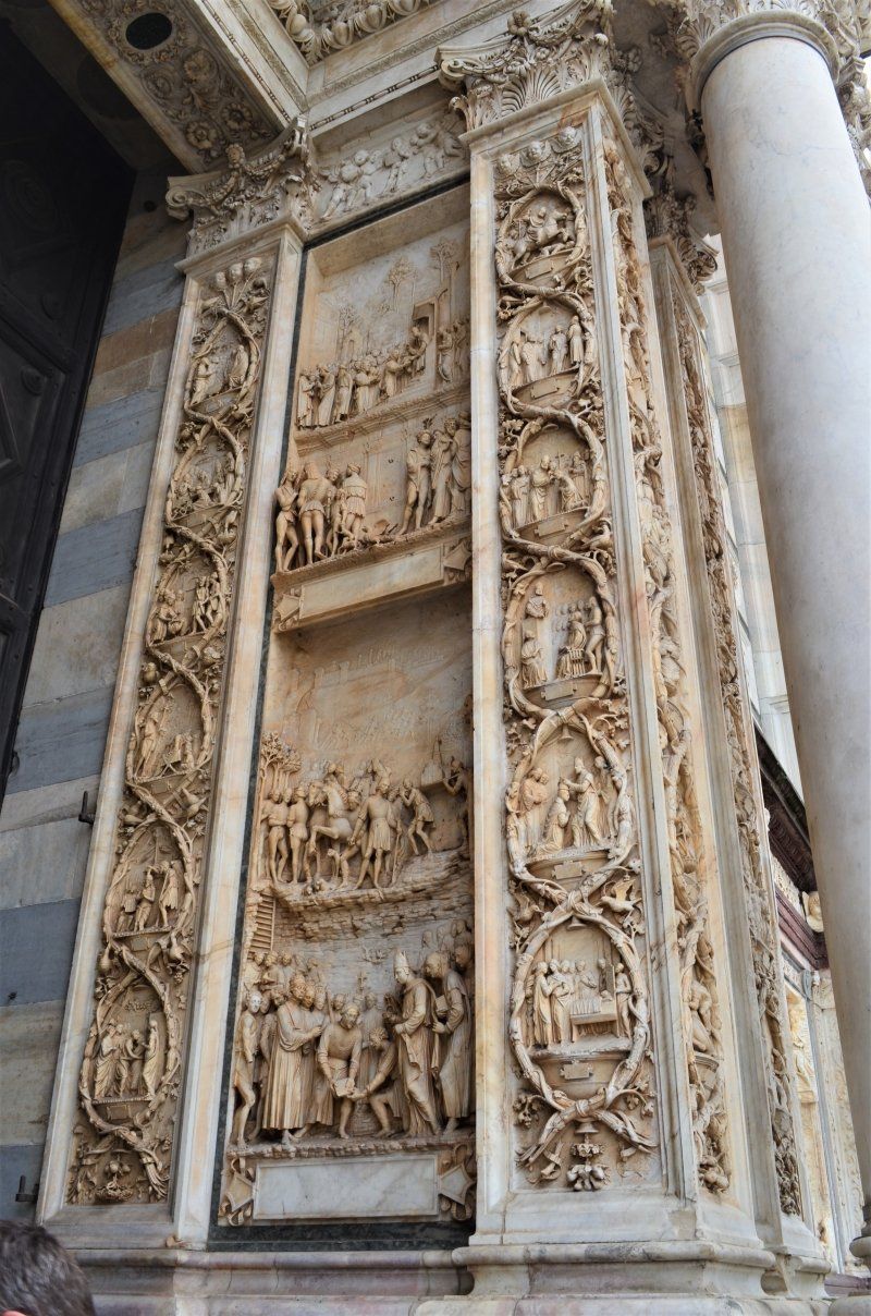
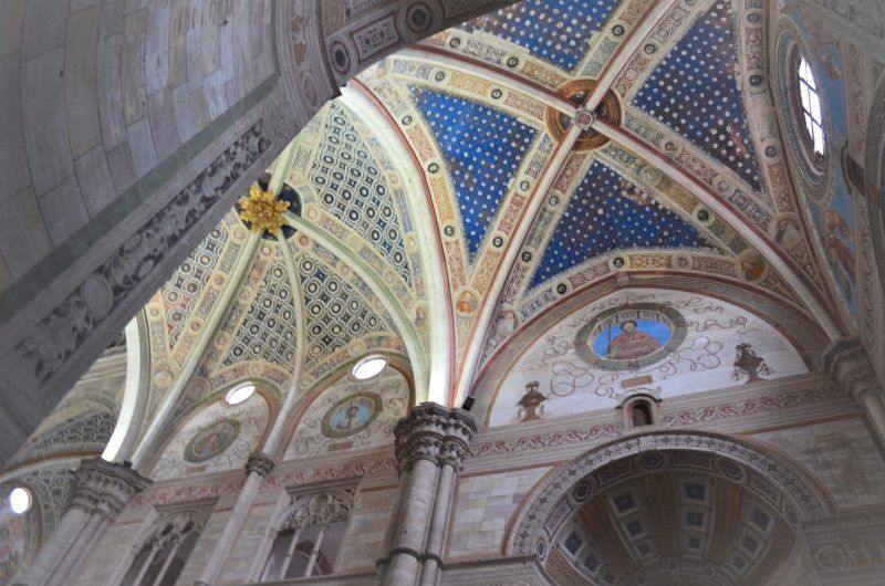
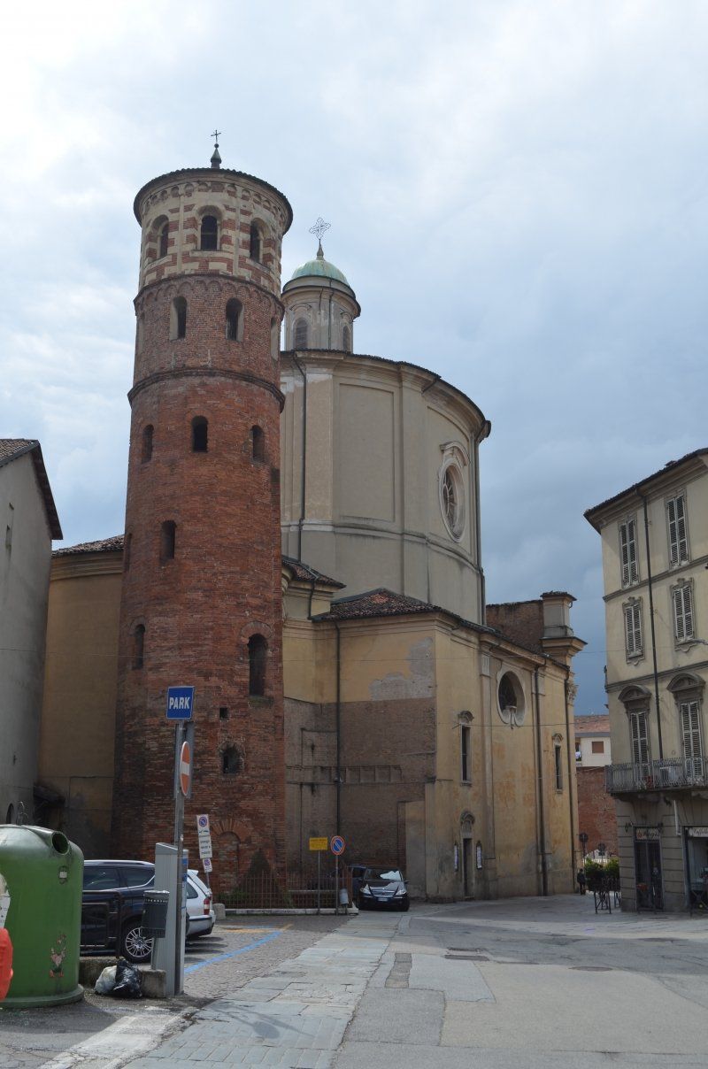
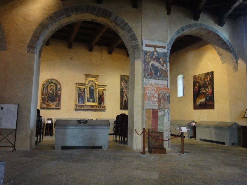
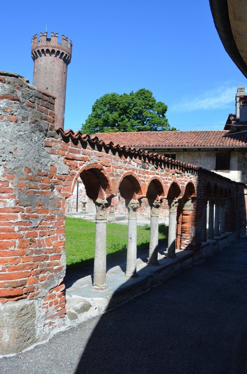
The Certosa di Pavia is a monastery originally built for the Carthusian Order. The monastery is an extensive complex. In the small cloister next to the church, a terracotta statue crowns each column. Above are the arcades and towers of the church. The 23 monastery cells are grouped around the large cloister. They are arranged as identical houses around the large cloister. The monastery complex was built for 170 years. The magnificent facade of the monastery church "Madonna delle Grazie" is adorned with different colored marble, figures of saints, reliefs with biblical scenes.
Quiet place near the monastery. 16 euros per night is ok. There are toilets during the day and a small cafe on the square.
Via Indipendenza, 13, 27100 Pavia PV, Italien
45° 11' 43" N 9° 9' 12.8" E
45.1952835 9.1535449
• Head northeast. Go for 20 m.
• Turn left toward Via Indipendenza. Go for 68 m.
• Turn right onto Via Indipendenza. Go for 162 m.
• Turn right onto Via Damiano Chiesa (SPEXSS35). Go for 108 m.
• Take the 1st exit from Rondò Dei Longobardi roundabout onto Via Alessandro Brambilla (SPEXSS35). Go for 1.2 km.
• Take left ramp onto A54 (Tangenziale Ovest di Pavia) toward Milano. Go for 1.1 km.
• Continue on Strada Provinciale dei Giovi (SPEXSS35). Go for 4.5 km.
• Turn right onto Viale Certosa. Go for 977 m.
• Turn left onto SP27. Go for 145 m.
• Arrive at SP27. Your destination is on the left.
☍
8,2 km
( 9 min.)
Day
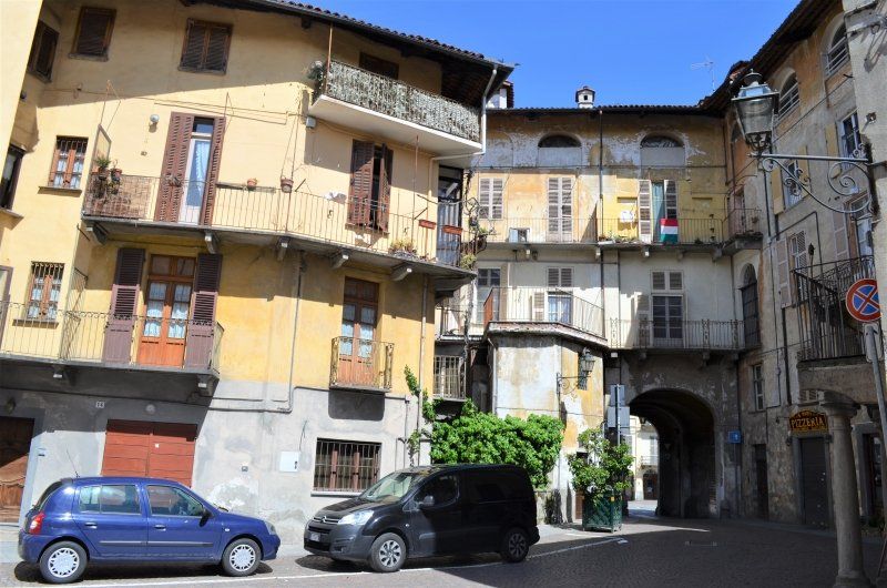
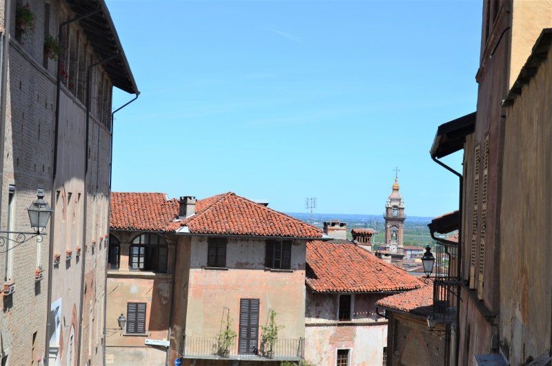
Pavia
Nach einer ruhigen Nacht, fuhren wir weiter nach Pavia. Der Stellplatz hatte sich über Nacht voll belegt, es parkten weitere Wohnmobile am angrenzenden Parkplatz.
Der Parkplatz in Pavia war sehr gut anzufahren und überraschend ziemlich leer. (Parkplatz: GPS: 45.195770 9.152962 ) Wir waren erstaunt, dass an einem Werktag kein Stadtverkehr vorlag. Bei dem Stadtrundgang fiel uns auf des in Italien ein Feiertag war.
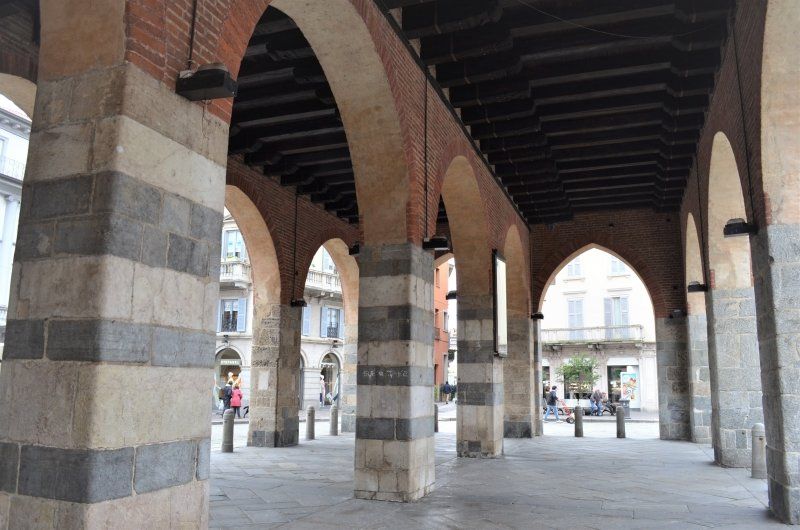
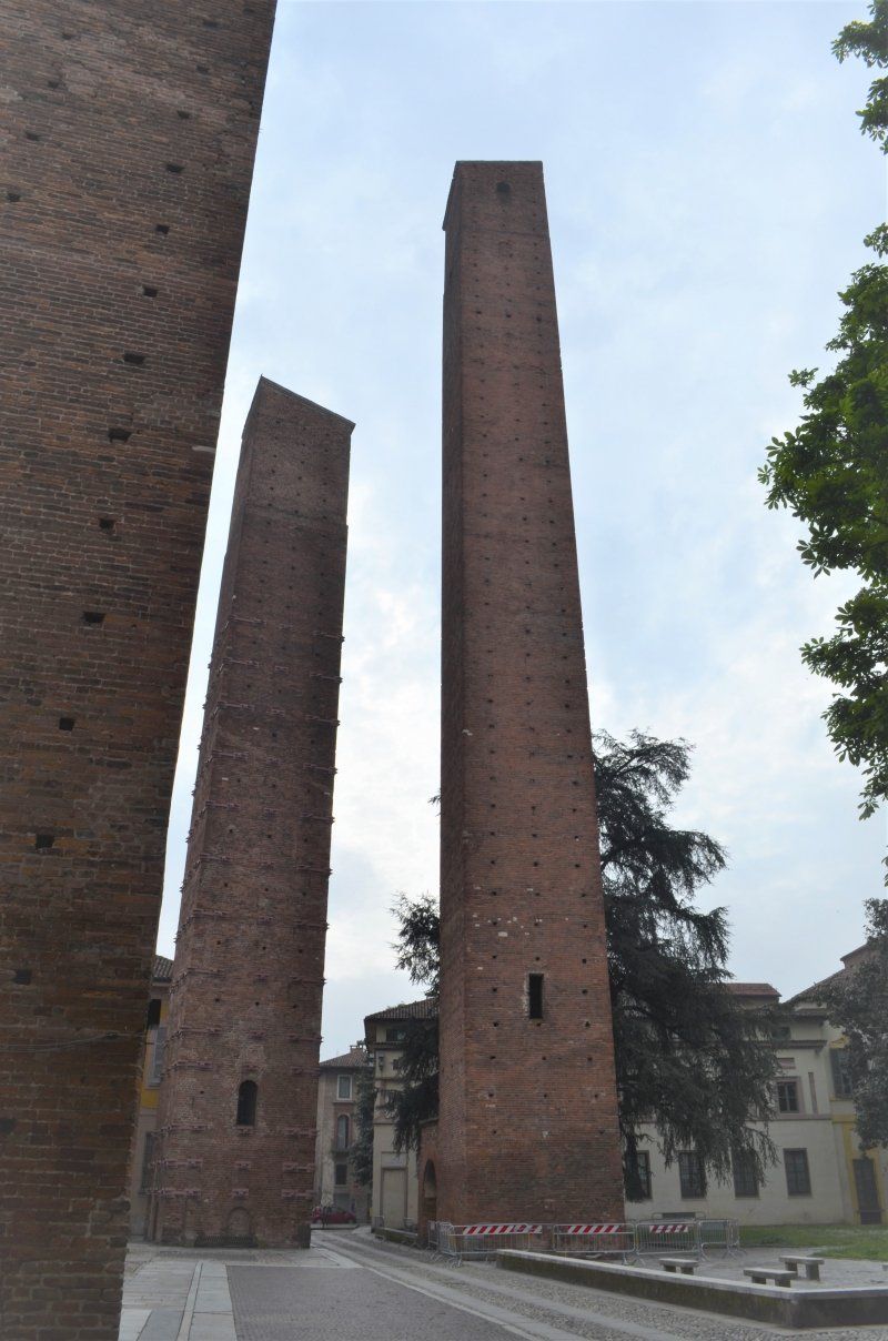
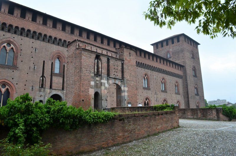
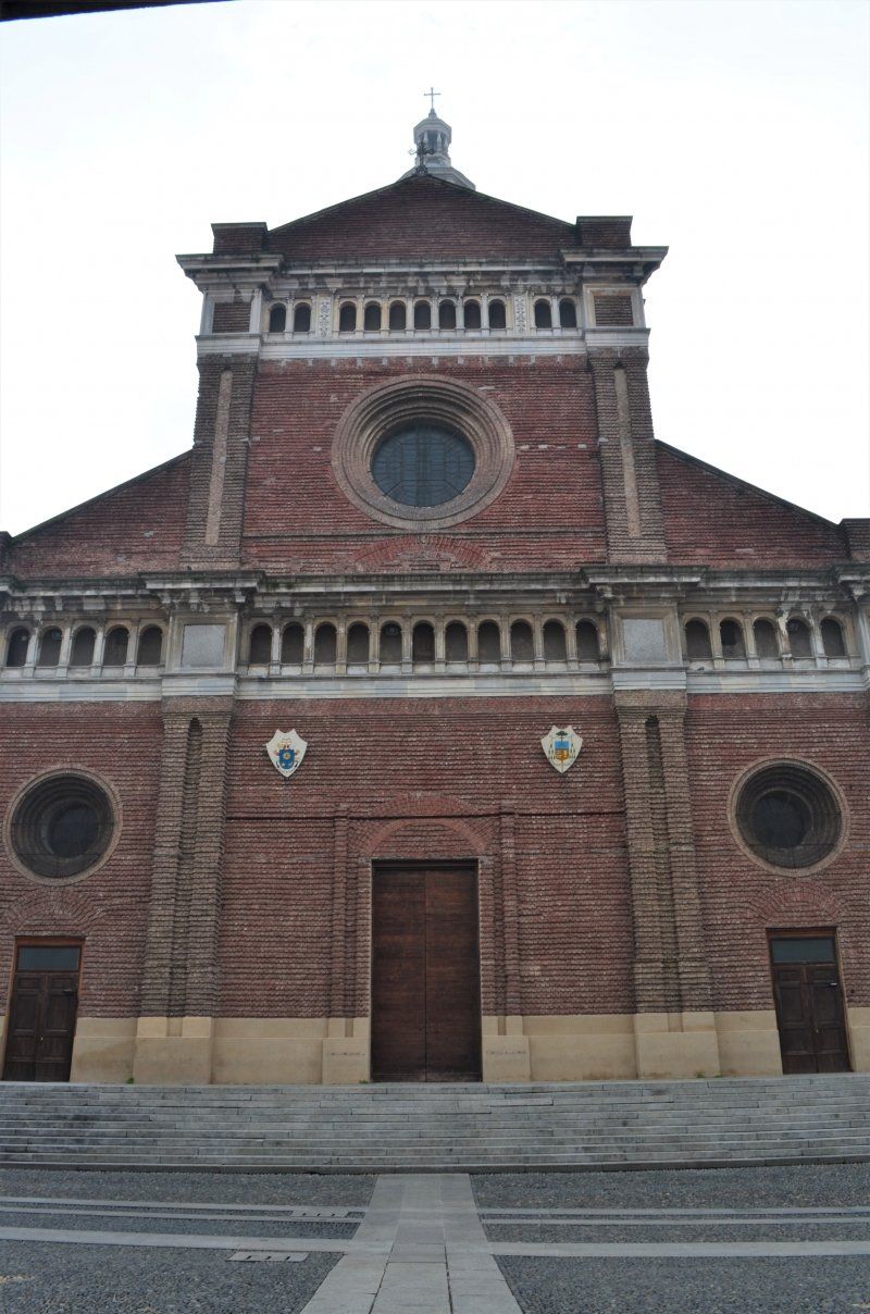
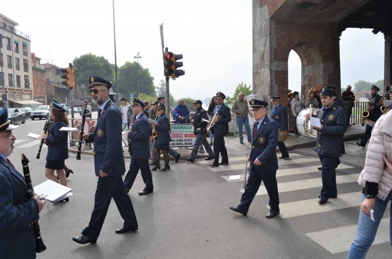
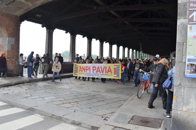
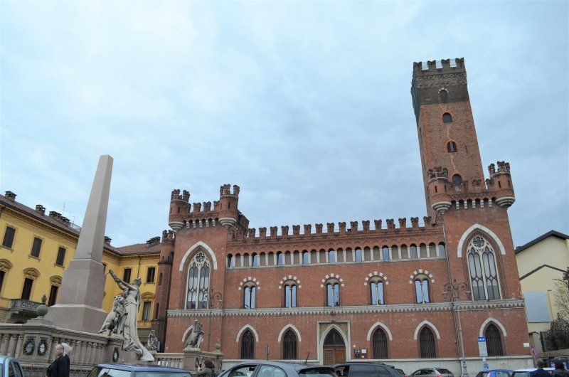
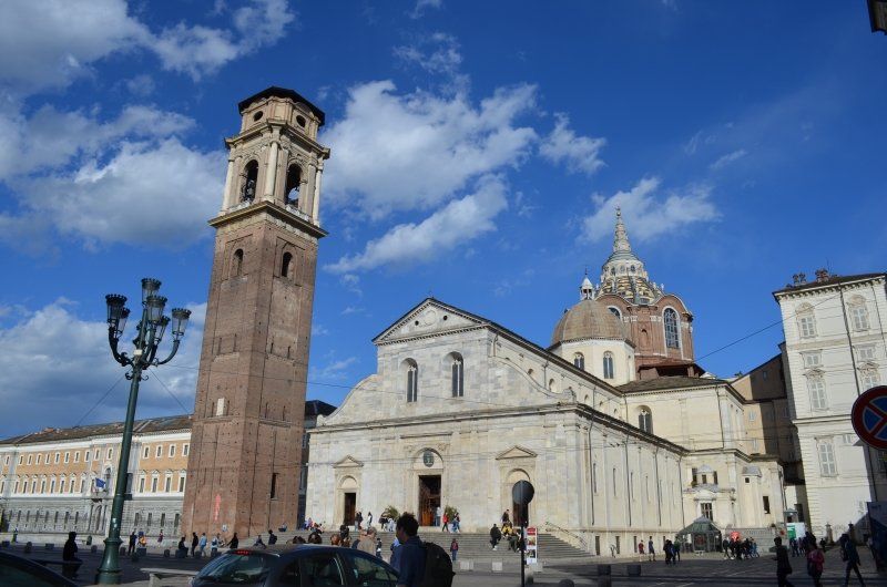
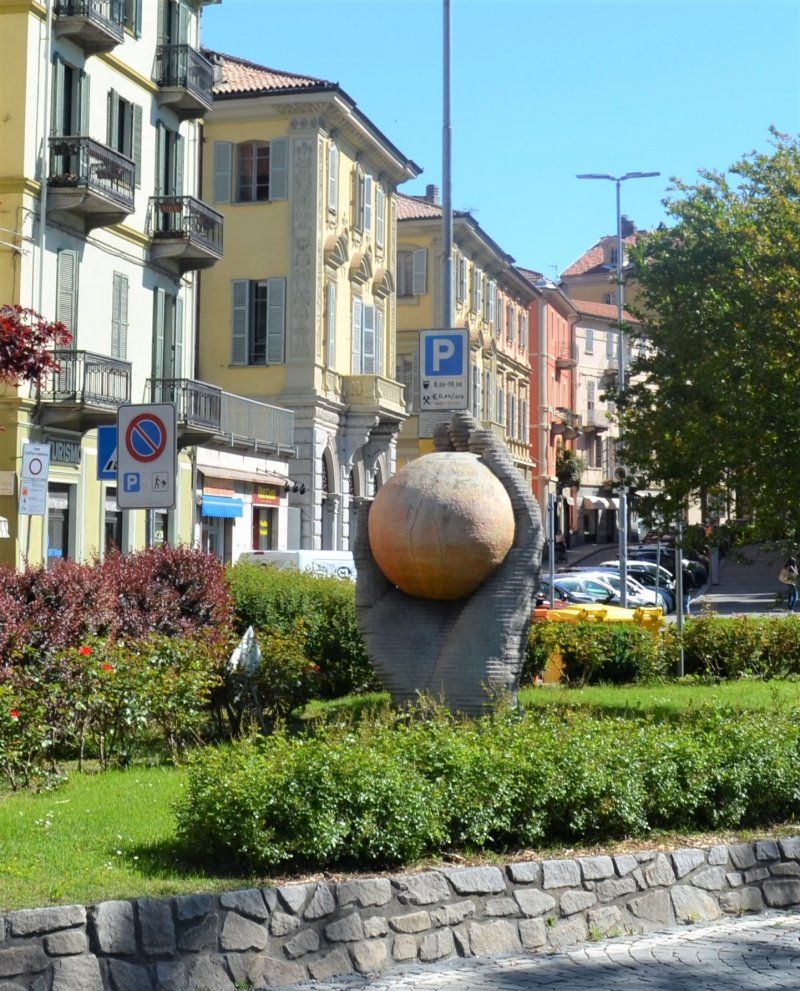
Die erste Sehenswürdigkeit war das Visconti Kastell, eine viereckige Backsteinburg. Durch Zufall kamen wir zu den Geschlechtertürme hinter der Universität. Von den ehemals 200 Türme stehen nur noch drei Geschlechtertürme der freien Stadtrepublick des 12./13. Jh. Im weiteren Stadtrundgang suchten wir den Dom von Pavia der aus dem 15.Jh. stammt. Den Dom krönt eine mächtige Kuppel. Pavias Dom ist ein imposantes Bauwerk mit dem Grundriss in der Form eines griechischen Kreuzes. Wir machten noch einen Abstecher zum Fluß "Ticino" über den die Ponte Coperto die beiden Stadtteile verbindet. Eine friedliche Demo zog über die Brücke angeführt von einer Musikkapelle.
Via di Vittorio, 27012, Certosa di Pavia, Italien
45° 15' 25" N 9° 8' 30" E
45.2569444 9.1416667
• Head toward Località Mezzaporta on SP27. Go for 145 m.
• Turn right onto Viale Certosa. Go for 977 m.
• Turn left onto Corso Partigiani (SPEXSS35SUD). Go for 4.5 km.
• Keep left onto Tangenziale Ovest di Pavia toward Autostrade/A1/A7/A21/Tangenziale Nord Pavia/Pavia Sud/Genova/Cremona. Go for 2.5 km.
• Take the exit toward Milano-Genova/A7/Staz. di Bereguardo onto A53 (Raccordo Autostradale Pavia Bereguardo). Go for 9.4 km.
• Take the left exit toward Genova onto A7 (Autostrada Milano-Genova). Go for 41.0 km.
• Take the exit toward Torino/Gravellona T./A26/E25 onto A21 (Autostrada Torino-Piacenza-Brescia). Go for 22.9 km.
• Take the exit toward Gravellona T./Vercelli/Aosta/A5 onto A26 (Autostrada Genova Voltri-Gravellona Toce). Go for 22.6 km.
• Take the exit toward Casale M. Sud/Valenza/Casale onto SP55 (Strada Valenza). Go for 1.4 km.
• Pass 2 roundabouts and continue on Strada Valenza. Go for 421 m.
• Keep left onto Via Francesco Negri. Go for 228 m.
• Take the 2nd exit from roundabout onto Via Francesco Negri. Go for 485 m.
• Take the 3rd exit from roundabout onto Via Francesco Negri. Go for 391 m.
• Continue on Strada Cavalcavia. Go for 222 m.
• Take the 2nd exit from roundabout onto Corso Indipendenza. Go for 284 m.
• Pass 2 roundabouts and continue on Corso Indipendenza. Go for 249 m.
• Take the 2nd exit from roundabout onto Piazza Martiri della Libertà (SP31). Go for 90 m.
• Pass 2 roundabouts and continue on Piazza Medaglie d'Oro (SP31). Go for 436 m.
• Take the 1st exit from roundabout onto Corso Luigi Manacorda (SP31). Go for 95 m.
• Continue on Piazza Castello. Go for 156 m.
• Turn right onto Piazza Castello. Go for 12 m.
• Arrive at Piazza Castello. Your destination is on the left.
☍
108,5 km
(1 hrs. 3 min.)
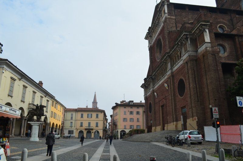
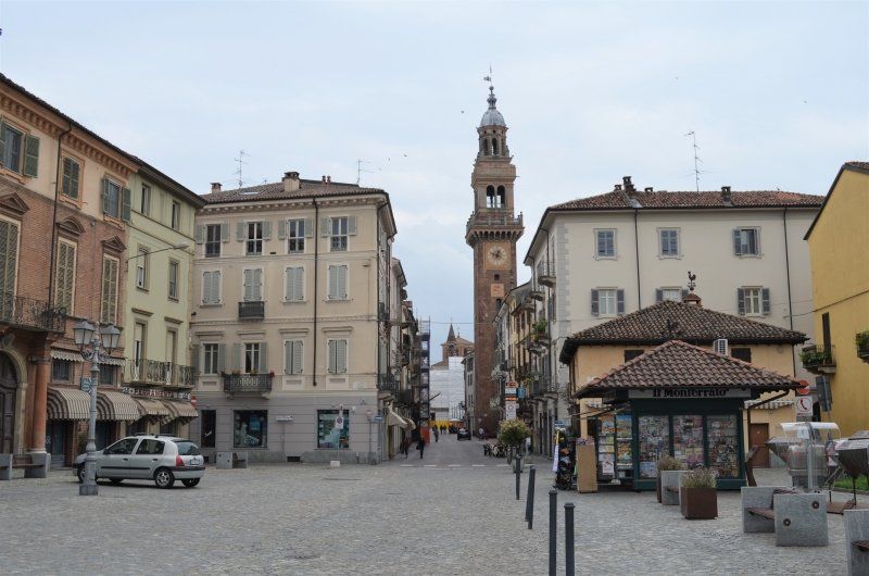
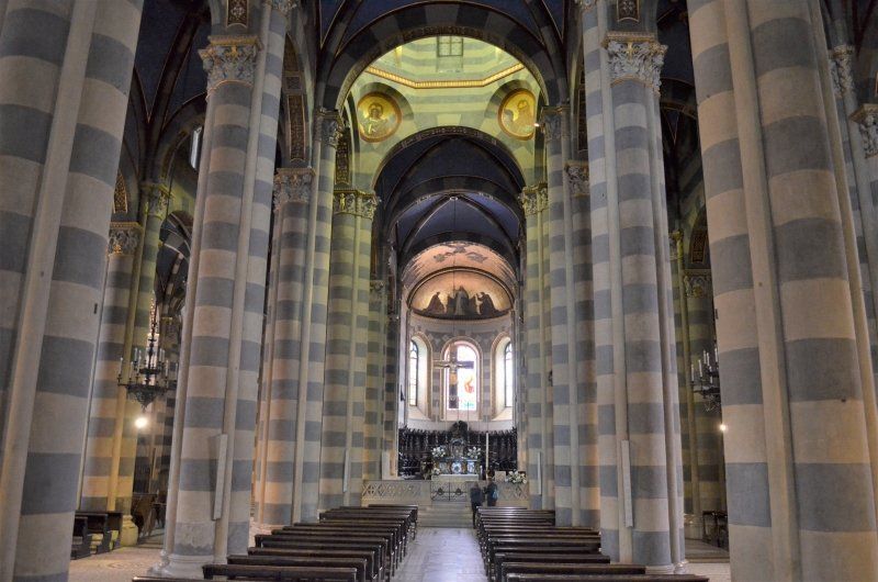
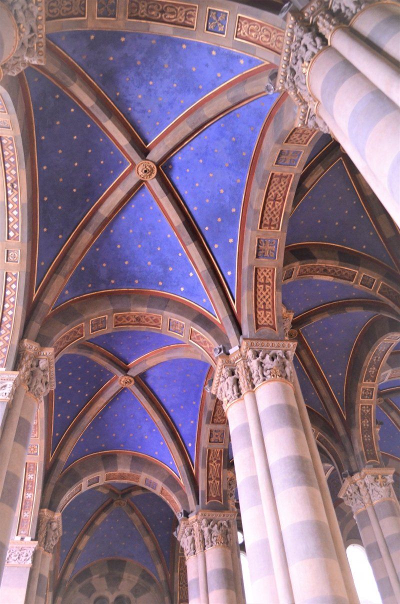
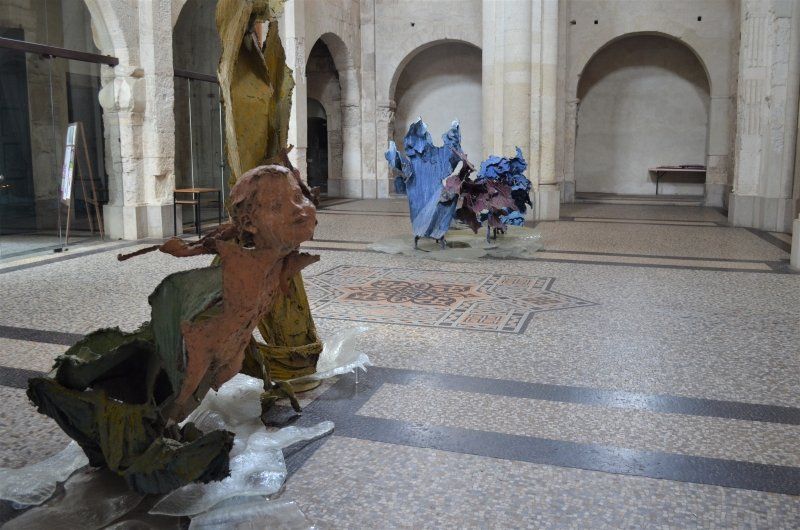
15033 Casale Monferrato
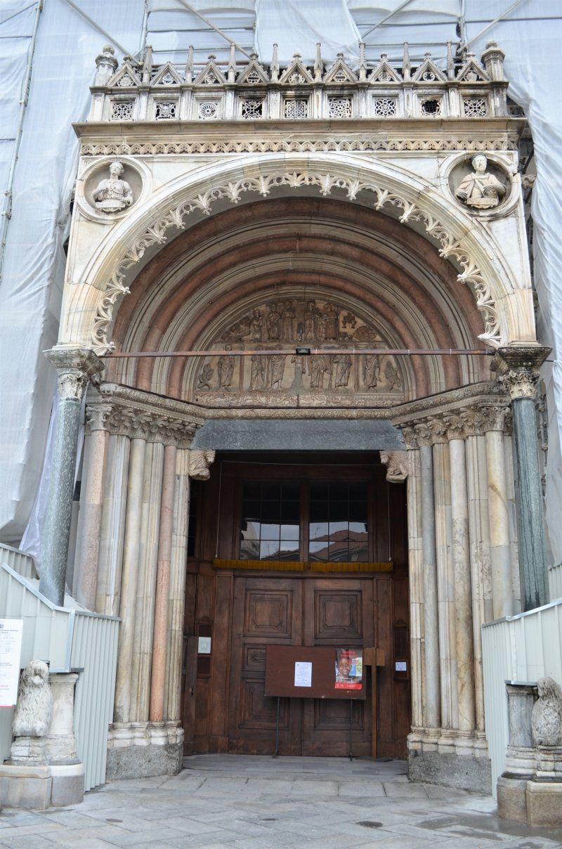
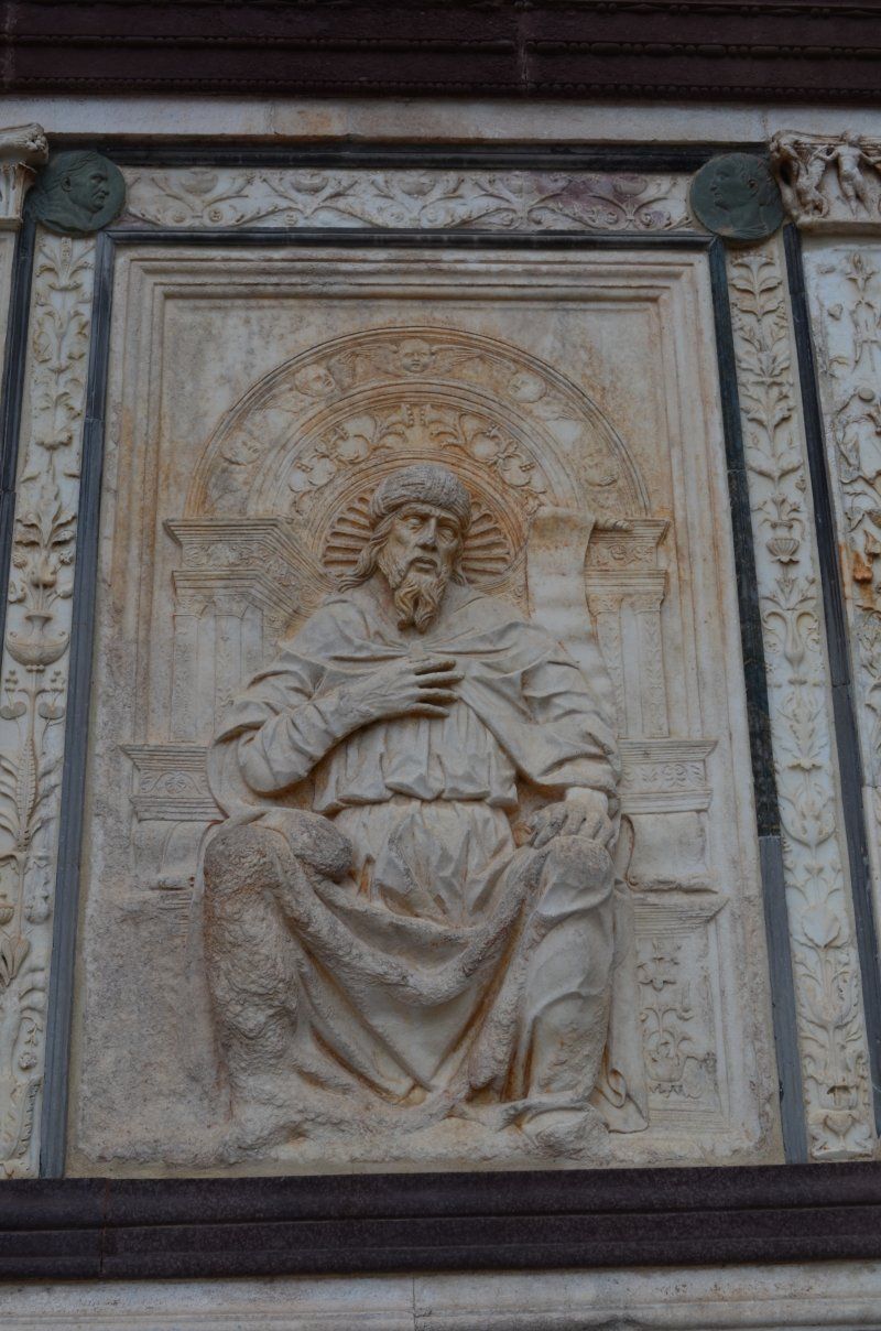
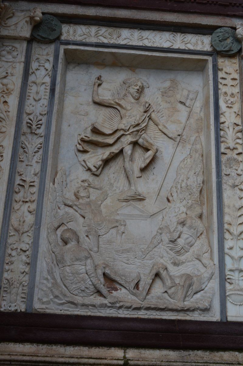
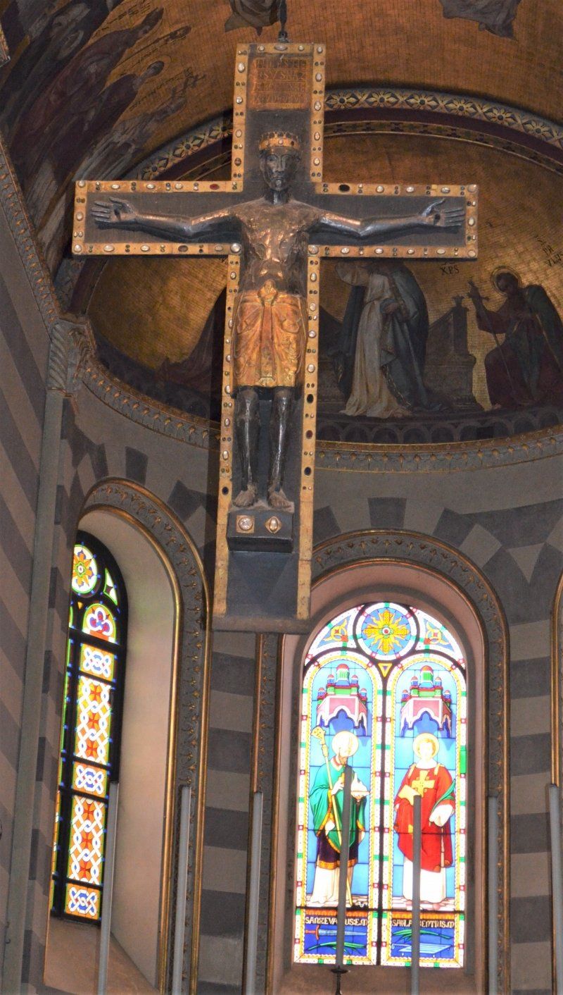
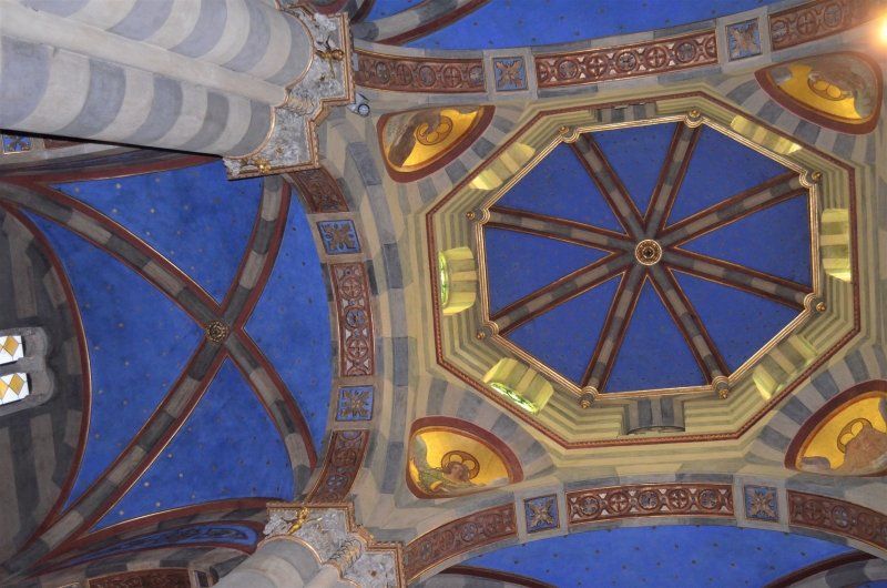
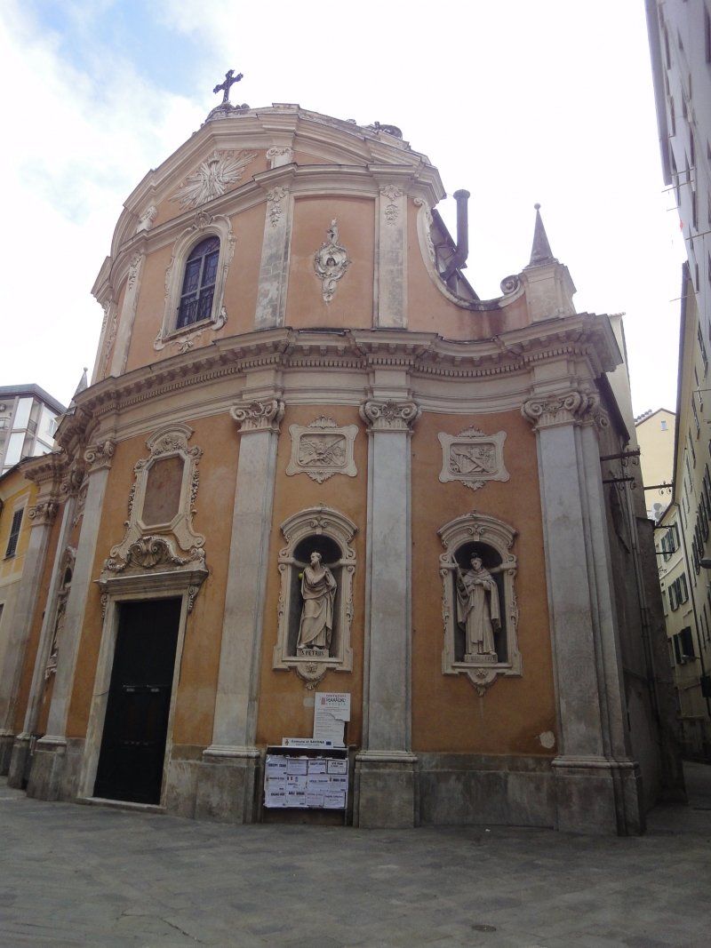
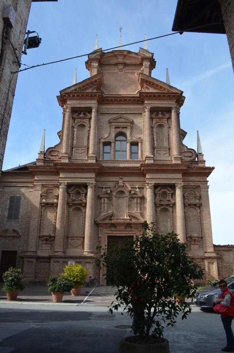
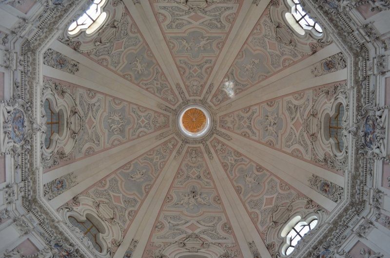
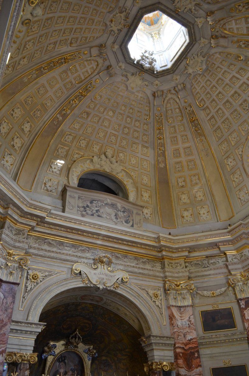
It was worth taking the detour to Casale Monferrato. Unfortunately, the outside of the cathedral was scaffolded and encased, but the inside of the cathedral is worth seeing. The cathedral surprises with a great vestibule that is unique in size. The wooden cross is platinum-plated with silver and comes from the Rhineland. We were very enthusiastic about this church, as well as the entire old town of this fantastic city.
Parking lot GPS: 45.136880,8.446998 (free)
Piazza Castello, 34A, 15033 Casale Monferrato AL, Italien
45° 8' 11.5" N 8° 26' 51.9" E
45.1365274 8.4477592
• Head toward Via Fassati di Balzola on Piazza Castello. Go for 45 m.
• Continue on Via Ferrante Aporti. Go for 105 m.
• Continue on Via Quintino Sella. Go for 136 m.
• Take the 4th exit from roundabout onto Corso Luigi Manacorda (SP31). Go for 259 m.
• Take the 3rd exit from roundabout onto Piazza Martiri della Libertà (SP31). Go for 90 m.
• Take the 2nd exit from roundabout onto Corso Indipendenza. Go for 138 m.
• Take the 2nd exit from roundabout onto Corso Indipendenza. Go for 131 m.
• Take the 2nd exit from roundabout onto Corso Indipendenza. Go for 283 m.
• Take the 3rd exit from roundabout onto Strada Cavalcavia. Go for 267 m.
• Continue on Via Francesco Negri. Go for 357 m.
• Take the 3rd exit from roundabout onto Via Francesco Negri. Go for 479 m.
• Take the 2nd exit from roundabout onto Via Francesco Negri. Go for 262 m.
• Continue on Strada Valenza. Go for 28 m.
• Pass 2 roundabouts and continue on Strada Valenza (SP55). Go for 547 m.
• Take the 3rd exit from roundabout onto A26 (Autostrada Genova Voltri-Gravellona Toce) toward Genova. Go for 22.9 km.
• Take the exit toward Torino onto A21 (Autostrada Torino-Piacenza-Brescia). Go for 32.6 km.
• Take the exit toward Asti Ovest onto Svincolo Asti Ovest. Go for 919 m.
• Take the 2nd exit from roundabout onto Padana Inferiore (SR10) toward Asti/Acqui Terme/Nizza Monferrato. Go for 365 m.
• Take the 2nd exit from roundabout onto Corso Torino (SR10). Go for 429 m.
• Take the 2nd exit from roundabout onto Corso 25 Aprile. Go for 493 m.
• Take the 2nd exit from Rotonda Del Pippo Bianco roundabout onto Corso 25 Aprile. Go for 534 m.
• Take the 3rd exit from roundabout onto Corso 25 Aprile. Go for 164 m.
• Take the 1st exit from roundabout onto Via Conte Verde. Go for 102 m.
• Take the 3rd exit from Piazza Paolo Lugano roundabout onto Viale dei Partigiani. Go for 307 m.
• Continue toward Piazza Vittorio Veneto. Go for 46 m.
• Take the 1st exit from Piazza Vittorio Veneto roundabout onto Corso Dante Alighieri. Go for 361 m.
• Take the 2nd exit from Largo Martiri della Liberazione roundabout onto Corso Dante Alighieri. Go for 301 m.
• Arrive at Corso Dante Alighieri.
☍
62,6 km
( 40 min.)
Asti
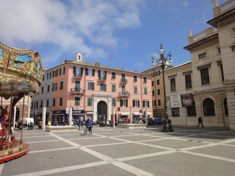
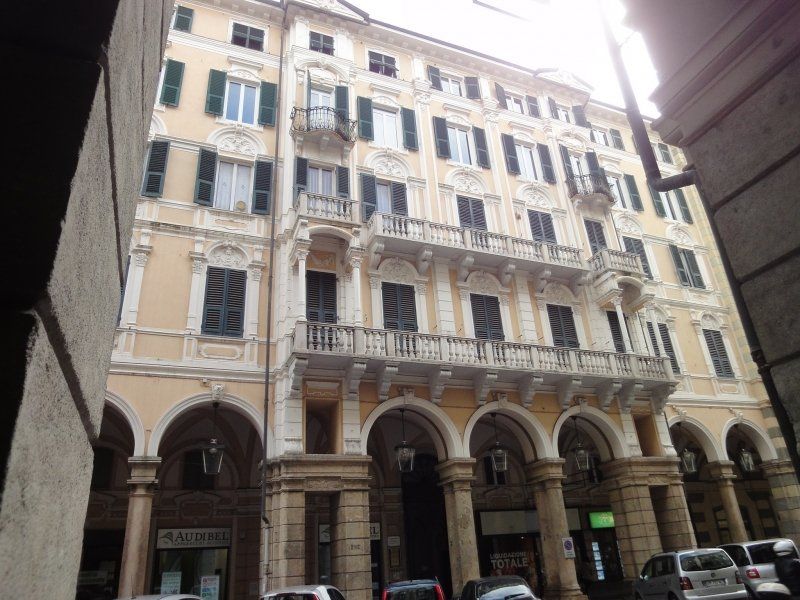
The next stage on our round trip through Piedmont is Asti.
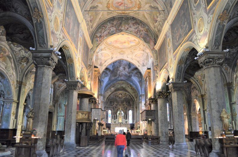
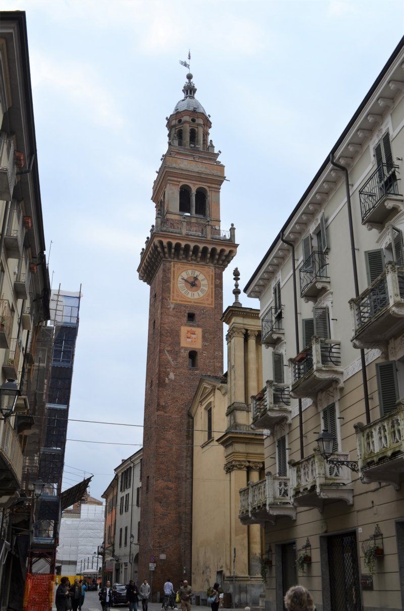
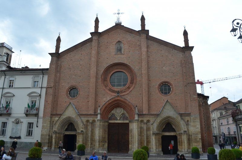
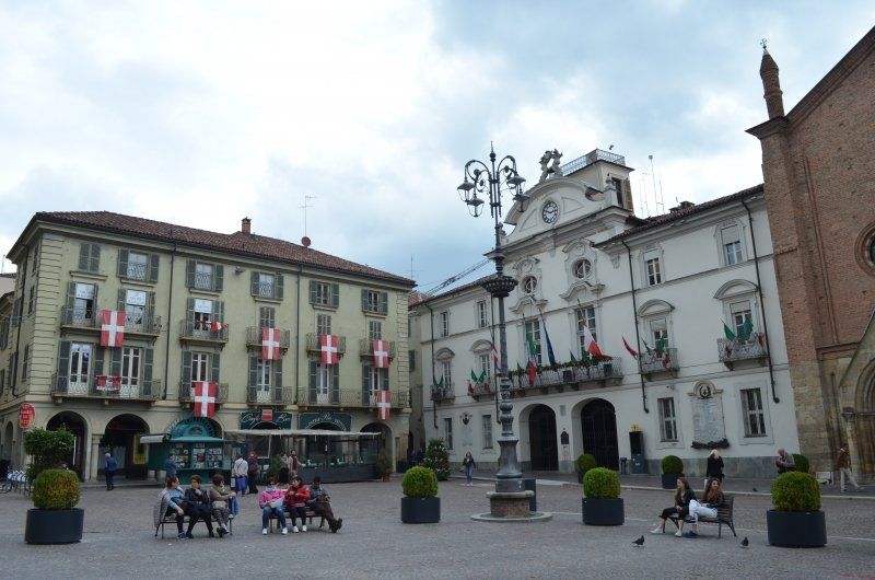
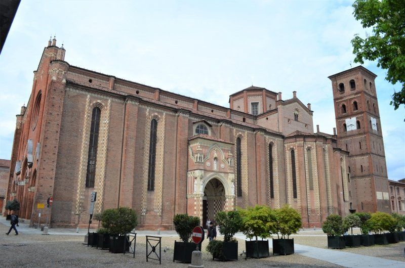
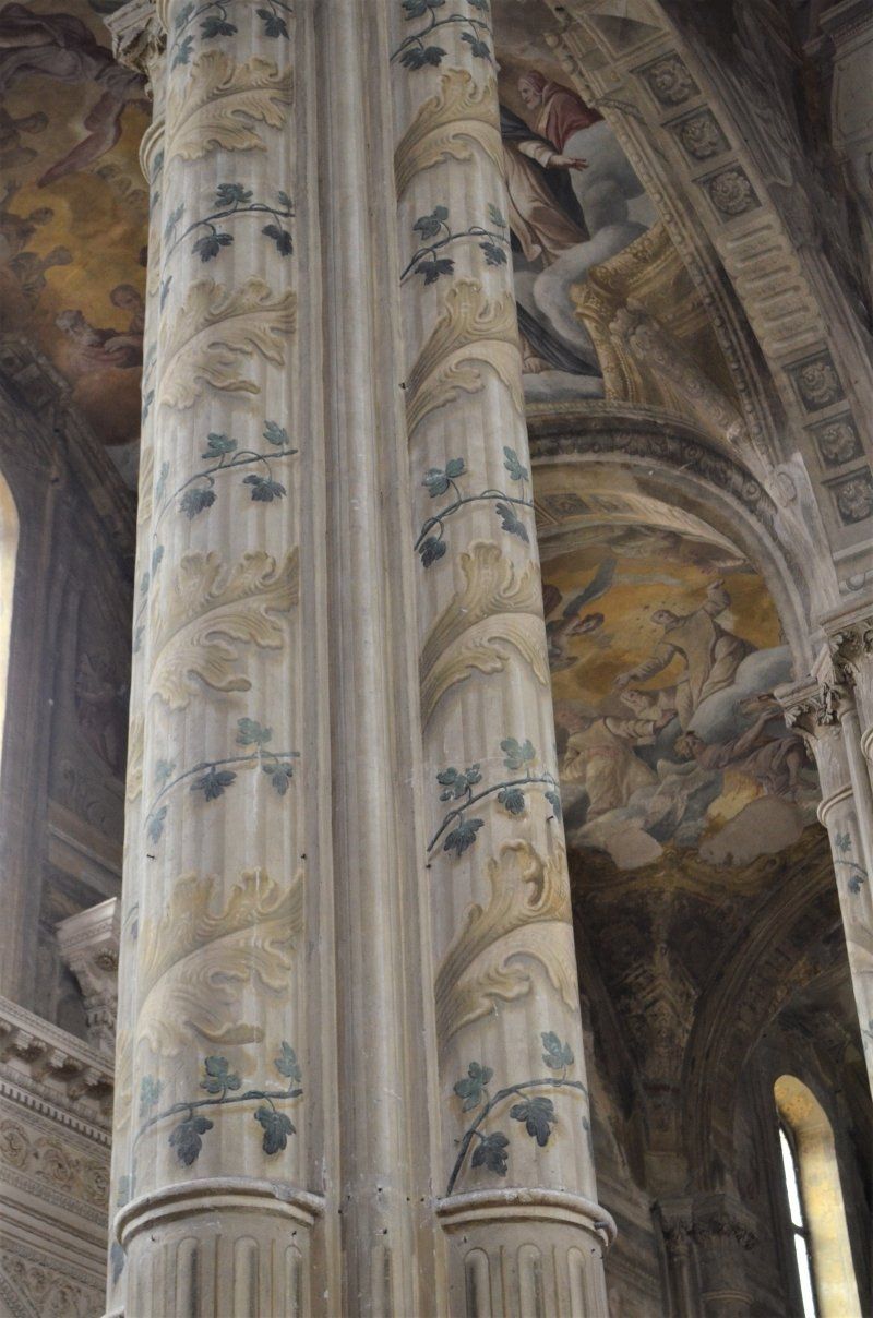
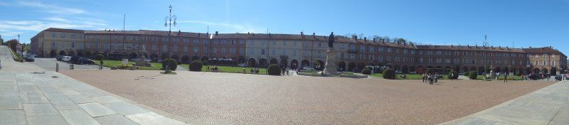
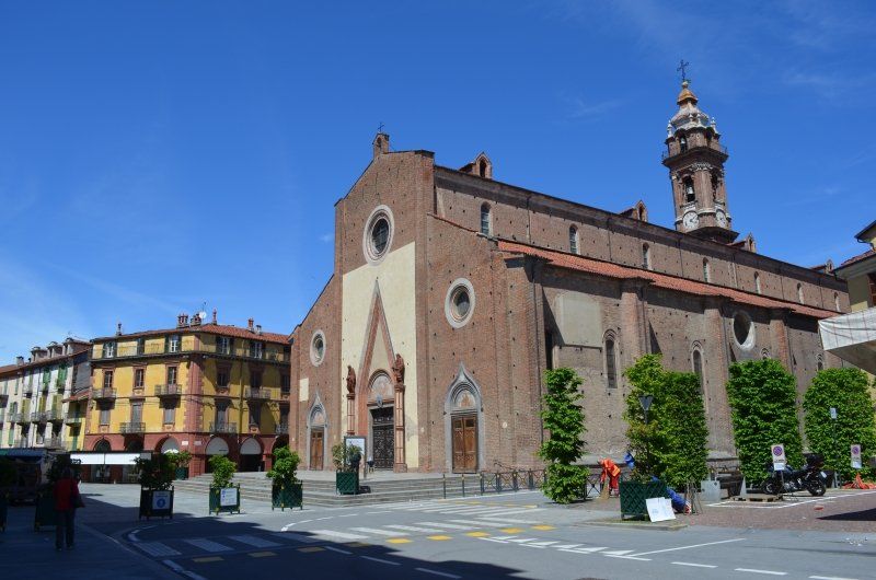
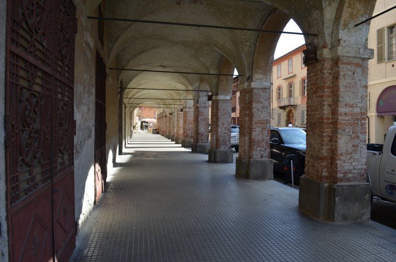
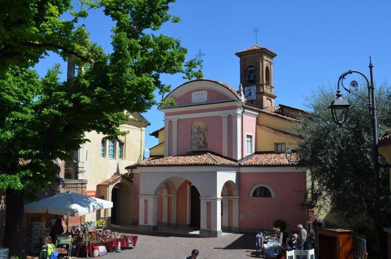
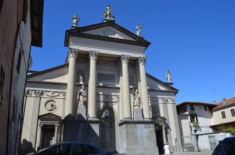
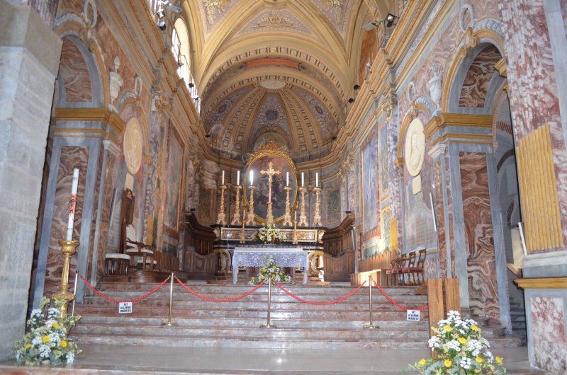
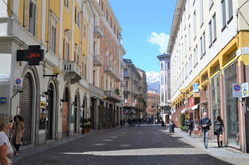
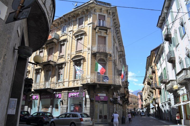
The city tour began at Campo del Palio. The spacious place is used for. Z. as a parking lot, ( GPS: 44.897301,8.210690) which will be transformed into the venue of the Palio in September. Past the “most important” building - the tax office, we first went through wonderful arcades to the church of San Secondo, which was consecrated to the eponymous saint, the patron saint of Asti, and is said to have been built on the spot where he was martyred in 119. We strolled through narrow streets and came to the Torre Comentina from the 13th century, one of the 12 remaining towers of the 125 that were occupied for the city in 1682. Torre Romana, a tower from the 1st century BC Chr .; it is the only significant testimony from Roman times. We also visited some remains of the medieval city wall in front of the baroque church of Santa Caterlina. We make our way to the cathedral, which is affectionately called the Rebstock Cathedral. The cathedral (cathedral) - Santa Maria Assunta - is the largest church complex in Piedmont and was built from 1309 to 1354. Stylized vine leaves surround the high pillars on which the three-aisled Gothic step hall rests. That we weren't the only Germans in Asti could be heard from the tour groups that were led through Asti. So we also got something historical during visits.
Asti, Italien
44° 54' 2.8" N 8° 12' 23.2" E
44.9007652 8.2064315
• Head toward Corso Vittorio Alfieri on Corso Dante Alighieri. Go for 6 m.
• Turn left onto Corso Vittorio Alfieri. Go for 23 m.
• Take the 2nd exit from roundabout onto Piazza Vittorio Alfieri. Go for 191 m.
• Take the 1st exit from roundabout onto Corso Alla Vittoria. Go for 159 m.
• Turn slightly left onto Corso Luigi Einaudi. Go for 287 m.
• Turn left onto Piazza Campo del Palio. Go for 163 m.
• Turn right onto Corso Savona toward Canelli-Alba-Cuneo/Nizza M.-Acqui T. Go for 469 m.
• Take the 2nd exit from Rotonda Tanarina roundabout onto Corso Savona toward Alessandria/Alba-Cuneo/Casale M.To/Vercelli. Go for 623 m.
• Take the 3rd exit from Rotonda Del Mulino roundabout onto Corso Savona. Go for 1.2 km.
• Take ramp onto Strada Statale di Santa Vittoria (SS231) toward Alba/A33/SP456/Strada Statale del Turchino/Cuneo. Go for 2.0 km.
• Continue on Autostrada Delle Langhe (A33). Go for 1.8 km.
• Take ramp onto SP456var toward Strada Statale del Turchino. Go for 873 m.
• Continue on SP456var. Go for 2.2 km.
• Continue on SP456. Go for 1.4 km.
• Take the 2nd exit from roundabout onto Via Asti Mare (SP456). Go for 7.2 km.
• Take the 3rd exit from roundabout onto Via Opessina (SP456). Go for 5.0 km.
• Take the 1st exit from roundabout. Go for 1.3 km.
• Take the 2nd exit from roundabout. Go for 160 m.
• Keep left toward Strada Provinciale del Turchino/SP456. Go for 123 m.
• Continue on Strada Provinciale del Turchino (SP456). Go for 927 m.
• Take the 1st exit from roundabout onto Corso Acqui (SP456). Go for 4.0 km.
• Turn right onto SP45. Go for 2.6 km.
• Turn left onto Strada Bogliona (SP45). Go for 4.9 km.
• Continue on SP230. Go for 2.9 km.
• Take the 3rd exit from roundabout onto Strada Provinciale di Valle Bormida (SP30). Go for 3.1 km.
• Take the 3rd exit from roundabout onto Via Circonvallazione (SP30). Go for 249 m.
• Take the 3rd exit from roundabout onto Via Circonvallazione. Go for 859 m.
• Take ramp toward Sassello/Cartosio/Cavatore. Go for 204 m.
• Take the 1st exit from roundabout onto Viale Acquedotto Romano. Go for 242 m.
• Take the 3rd exit from roundabout onto Viale Luigi Einaudi. Go for 225 m.
• Arrive at Viale Luigi Einaudi.
☍
45,1 km
( 43 min.)
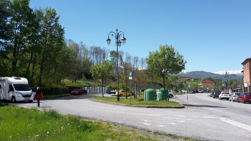
Acqui Terme
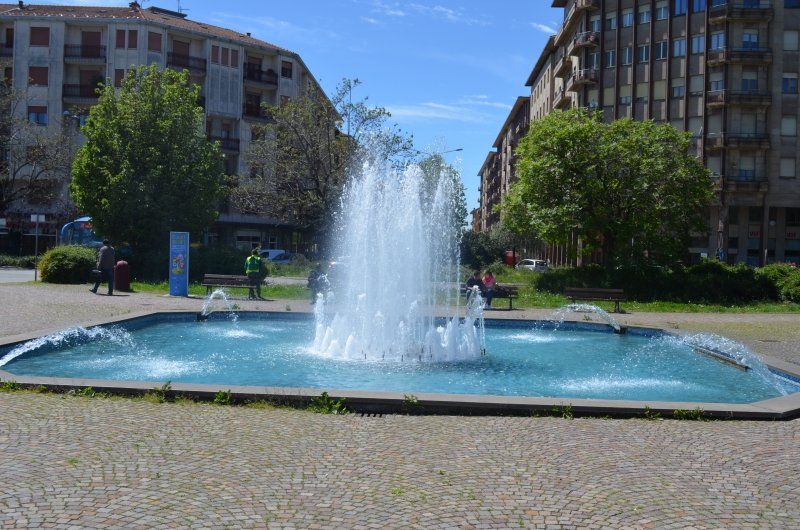
The last destination of today was the parking space ( GPS: 44.665401,8.472350) in Acqui Therme. The journey led across the hilly landscape of Asti, and when we got there it was almost full, only a few places were free. We parked next to a German camper that we could plug in our power cord. The power sockets on the square were all occupied by other campers. We didn't arrive until 6:30 p.m., after dinner we walked into the center of town. As soon as we arrived we saw that a festival was being held in the old town that we wanted to visit. It was no longer worth it, some stalls were already cleaning up. On this walk we got to know the city with its many old buildings, alleys and fountains. We did not find the hot spring from which the water comes out of the ground at around 73 ° C.
Viale Einaudi, 15011 Acqui Terme AL, Italien
44° 39' 54.5" N 8° 28' 16.9" E
44.6651435 8.4713547
• Head east on Viale Luigi Einaudi. Go for 565 m.
• Continue on Strada Provinciale del Turchino (SP456). Go for 4.5 km.
• Take the 1st exit from roundabout onto Via Acqui (SP456). Go for 7.2 km.
• Turn left onto Via Priarona (SP204). Go for 3.4 km.
• Continue on Strada Monteggio (SP204). Go for 705 m.
• Continue on Strada Grillano (SP204). Go for 1.0 km.
• Take the 1st exit from roundabout onto Via Bernardo Ruffini. Go for 294 m.
• Turn right onto Via Nicolò Vela. Go for 128 m.
• Turn left onto Corso Saracco. Go for 224 m.
• Take the 1st exit from roundabout onto Corso Martiri della Libertà. Go for 441 m.
• Take the 2nd exit from roundabout onto Strada Voltri. Go for 268 m.
• Take the 2nd exit from roundabout onto Strada Voltri (SP456). Go for 1.1 km.
• Take the 2nd exit from roundabout onto SP170. Go for 232 m.
• Take the 3rd exit from roundabout onto Strada Comunale del Ponte toward Autostrada. Go for 145 m.
• Take ramp onto A26 (Autostrada Genova Voltri-Gravellona Toce) toward Genova. Go for 29.6 km.
• Take the exit toward Ventimiglia onto A10 (Viadotto Cerusa). Go for 31.2 km.
• Take the exit toward Savona onto Strada di Scorrimento. Go for 1.8 km.
• Take ramp. Go for 138 m.
• Turn left onto Strada Provinciale di Quiliano (SP58) toward Aurelia/SP1. Go for 410 m.
• Take the 1st exit from roundabout onto Via Aurelia (SS1). Go for 581 m.
• Turn right onto Via Tecnomasio. Go for 377 m.
• Arrive at Via Tecnomasio.
☍
84,4 km
(1 hrs. 4 min.)
Day
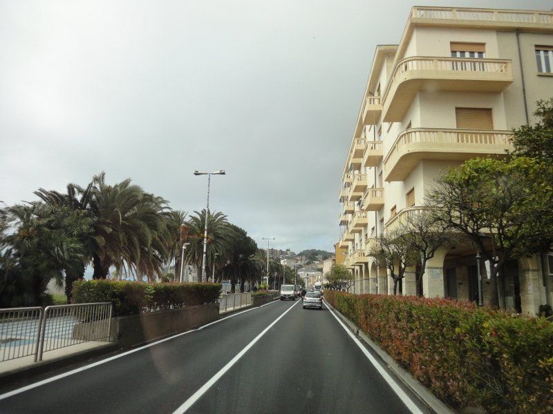
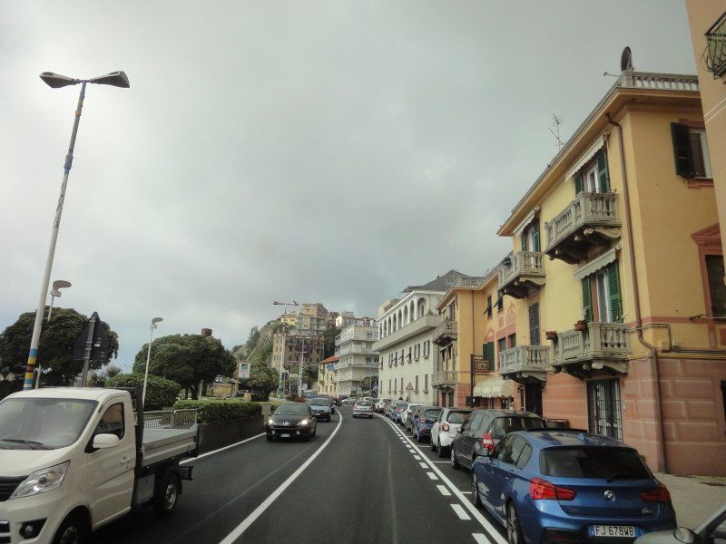
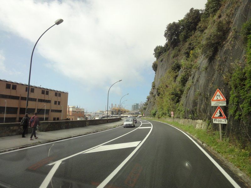
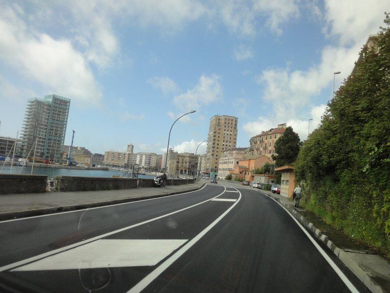
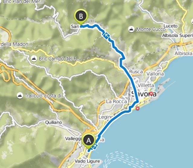
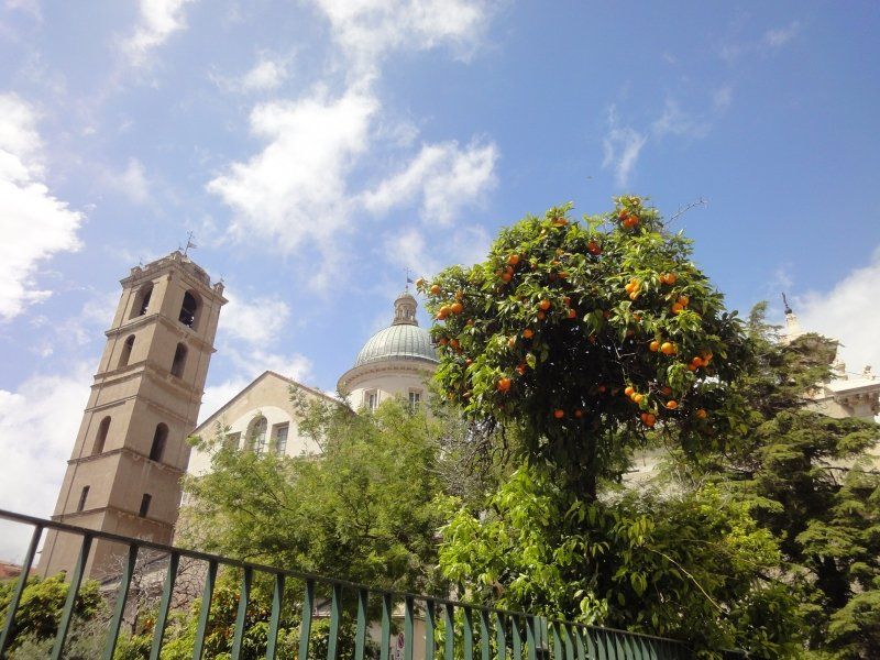
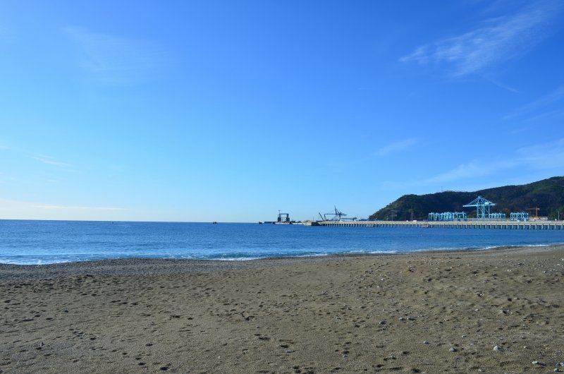
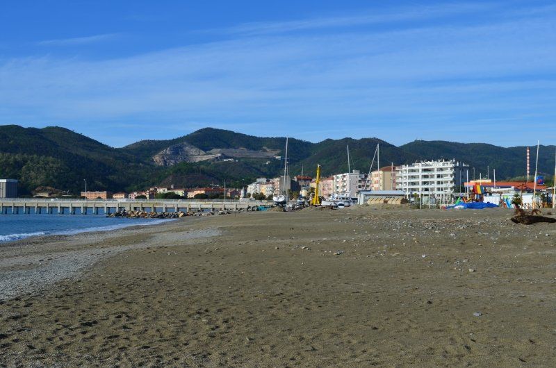
Ligure, Savona
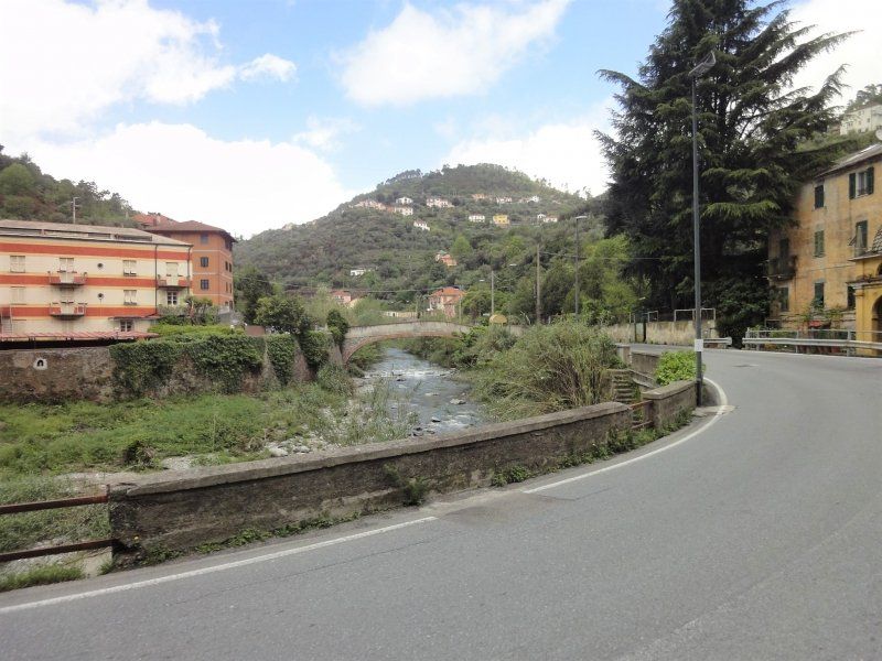
Today it started early, our destination is Savona, the city on the Ligurian Riviera. We are leaving Piedmont for one day. For the outward journey, we chose thoroughfares free of charge. In retrospect, we regretted it, potholes, curvy, narrow places where no two cars can pass each other.
GPS: 44.278198,8.441010
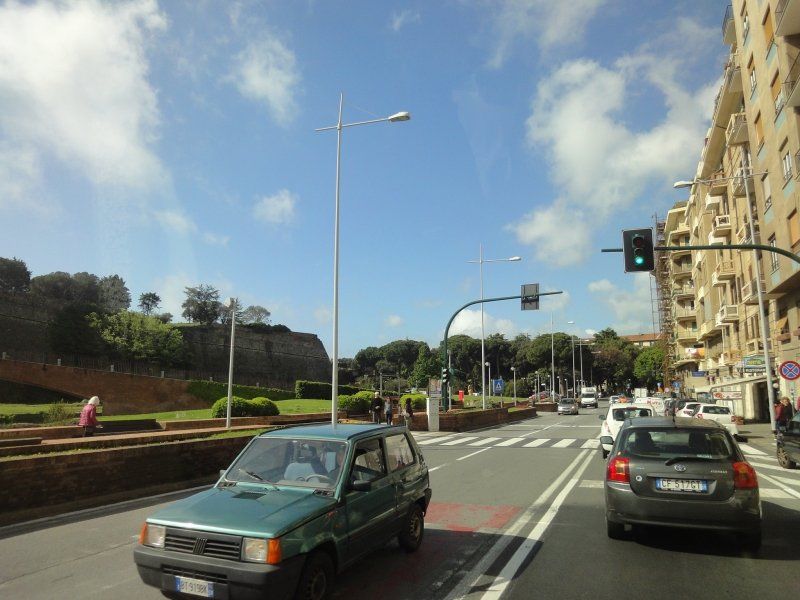
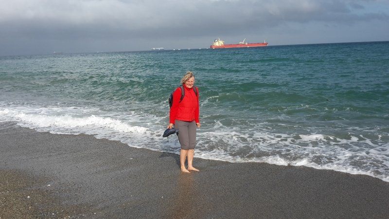
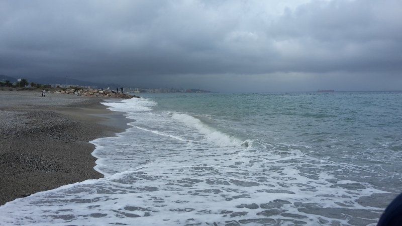
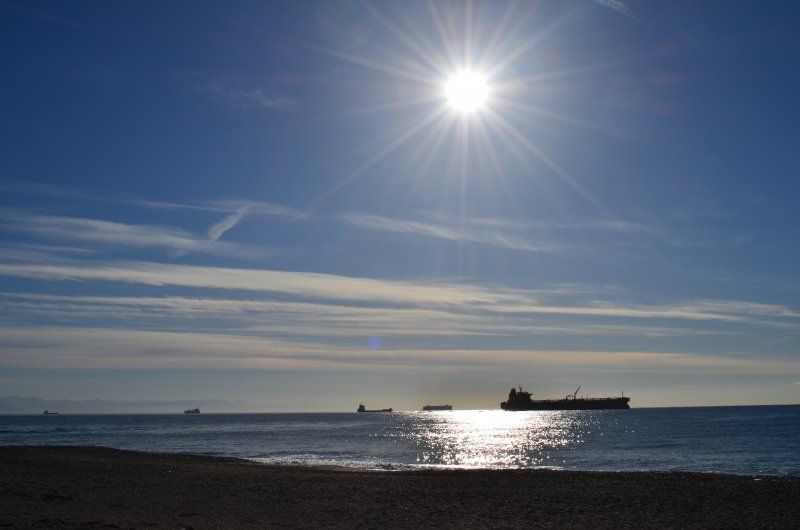
Not many people consider Savona a tourist destination, but even if you look closely, the city on the Ligurian Riviera offers much more than just a large and important port. The history and natural beauties do not disappoint, thanks also to the European Blue Flag recognition for the beaches that are among the best in Italy. The medieval center develops not far from the harbor and finds its main attraction in the Finess of Primar, south of the old dock, a 16th century fortress overlooking the sea. Then there are a number of towers along the streets, the most interesting of which are the 15th century Torretta, the Torre del Brandale, the Torre dei Corsi or the Torre Pancalda. Savona is also home to its own Sistine Chapel, built in honor of Pope Sixtus. It is adjacent to the Assumption Cathedral, which is famous for its beautiful neo-baroque facade, the wooden choir and the sacred works of art stored in it.
Via Tecnomasio, 16, 17047 Vado Ligure SV, Italien
44° 16' 37.2" N 8° 26' 21.1" E
44.2770125 8.4391905
• Head toward Via Aurelia on Via Tecnomasio. Go for 377 m.
• Turn left onto Via Aurelia (SS1). Go for 571 m.
• Take the 1st exit from roundabout onto Via Aurelia (SS1). Go for 1.2 km.
• Take the 2nd exit from roundabout onto Corso Svizzera toward Genova/Torino. Go for 239 m.
• Turn right onto Piazzale Amburgo toward Torino/Genova. Go for 172 m.
• Turn right onto Via Stalingrado. Go for 220 m.
• Continue toward Centro. Go for 56 m.
• Take the 1st exit from roundabout onto Via Stalingrado toward Centro. Go for 569 m.
• Pass 2 roundabouts and continue on Via Stalingrado. Go for 762 m.
• Take the 3rd exit from roundabout onto Via Vittime di Brescia toward Torino. Go for 1.1 km.
• Continue on Sottopasso Cenisio. Go for 107 m.
• Take the 2nd exit from roundabout onto Via Risorgimento. Go for 203 m.
• Turn right onto Via Francesco Baracca toward Torino. Go for 132 m.
• Turn left onto Corso Agostino Ricci (SP29) toward Torino. Go for 838 m.
• Take the 2nd exit from roundabout onto Via Ciantagalletto toward Loc. Ciatti. Go for 596 m.
• Take the 1st exit from roundabout. Go for 71 m.
• Continue on Via Santuario (SP12). Go for 4.1 km.
• Turn right onto Piazza Santuario (SP12). Go for 67 m.
• Turn right onto Piazza Santuario. Go for 29 m.
• Arrive at Piazza Santuario. Your destination is on the left.
☍
11,4 km
( 18 min.)
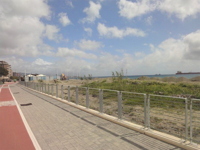
Santuario, Radtour zur Walfahrtskirche
Cycling tour:
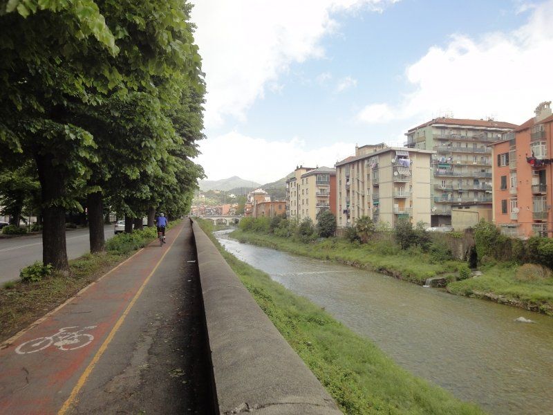
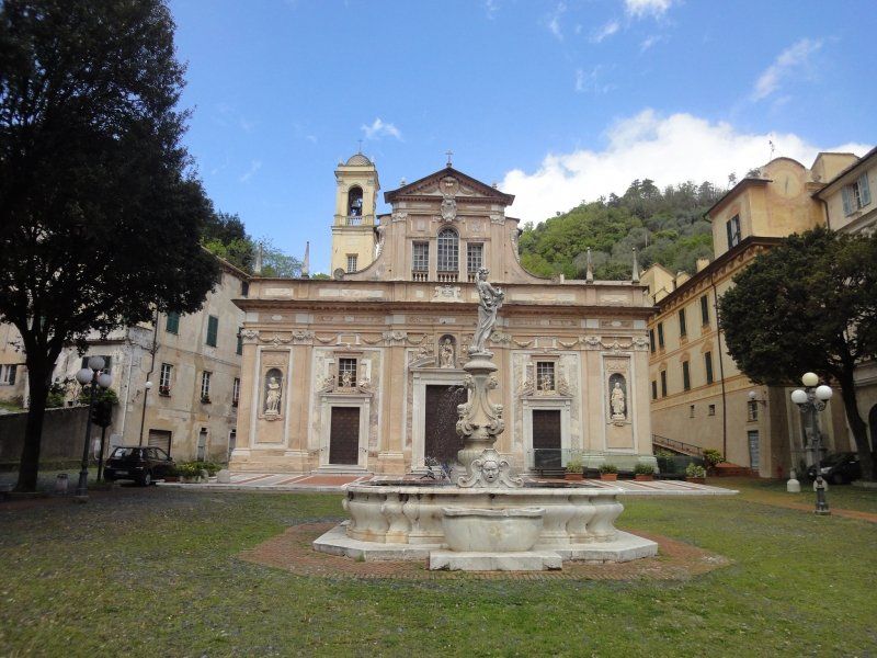
Upon arrival we got our bikes out of the garage and got ready for the bike tour. At first we drove on a nice bike path from the pitch, along the beach promenade, towards the center of Savona. Through the center it was a bit annoying with the heavy traffic, no precise route guidance until we came across a sign that showed the direction to the place of pilgrimage. From then on it was always uphill to the Sanctuary. When leaving, we hadn't considered that we would arrive at the church at lunchtime and that it could be closed then. And so it was, the doors were locked before our eyes. The sanctuary of the Blessed Virgin Mary, about 6 kilometers from the city, was built around the church that appeared in 1536 on the site of the apparition of Our Lady to Blessed Antonio Botta. The three-door baroque facade with three niches in which there are the statues of St. John the Baptist, St. John the Apostle and the Evangelist and the Virgin. We took a closer look at the facade and cycled back to Savona.
Santuario, Savona, Italien
44° 20' 41.1" N 8° 26' 2.5" E
44.3447529 8.4340380
• Head toward Via Cimavalle on Piazza Santuario. Go for 29 m.
• Turn left onto Piazza Santuario (SP12). Go for 67 m.
• Continue on Via Santuario (SP12). Go for 4.2 km.
• Take the 2nd exit from roundabout. Go for 341 m.
• Continue on Via Ciantagalletto. Go for 272 m.
• Take the 2nd exit from roundabout onto Corso Agostino Ricci (SP29) toward Centro/Autostrade. Go for 866 m.
• Turn right onto Via Francesco Baracca toward Imperia. Go for 132 m.
• Continue on Via Risorgimento. Go for 167 m.
• Take the 1st exit from roundabout onto Sottopasso Cenisio toward Imperia. Go for 121 m.
• Continue on Via Vittime di Brescia. Go for 427 m.
• Turn right onto Via Clelia Corradini. Go for 229 m.
• Turn right onto Via Fontanassa. Go for 92 m.
• Take the 2nd exit from roundabout onto Via Luigia Comotto toward Autostrade. Go for 200 m.
• Take the 1st exit from roundabout onto Via Giovanni Tissoni toward Autostrade. Go for 384 m.
• Take the 1st exit from roundabout onto Via alla Rocca di Legino toward Autostrade. Go for 160 m.
• Continue on Piazza Caduti del Lavoro. Go for 52 m.
• Continue on Via Bruno Buozzi toward Autostrade. Go for 179 m.
• Continue on Via Isidoro Bonini. Go for 642 m.
• Take the 4th exit from roundabout onto Via Luigi Cadorna toward Centro/Autostrade. Go for 410 m.
• Take the 2nd exit from roundabout onto Via Stalingrado toward Autostrade/Ventimiglia. Go for 276 m.
• Continue on Piazzale Amburgo. Go for 124 m.
• Turn left onto Corso Svizzera toward Ventimiglia. Go for 273 m.
• Take the 1st exit from roundabout onto Via Aurelia (SS1) toward Vado Ligure/Ventimiglia/Nizza. Go for 1.2 km.
• Take the 2nd exit from roundabout onto Via Aurelia (SS1). Go for 600 m.
• Turn right onto Via Tecnomasio. Go for 377 m.
• Arrive at Via Tecnomasio.
☍
11,8 km
( 20 min.)
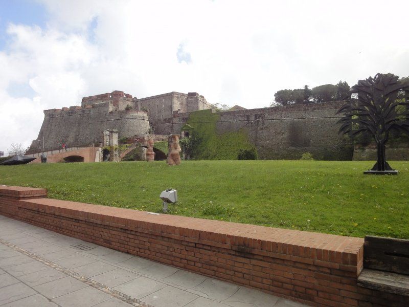
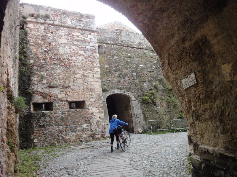
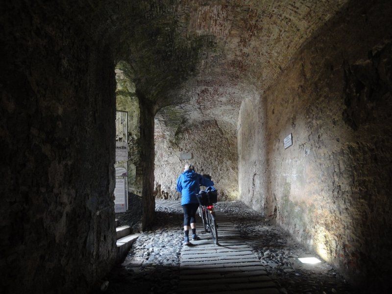
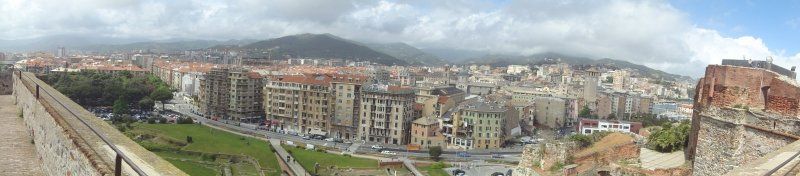
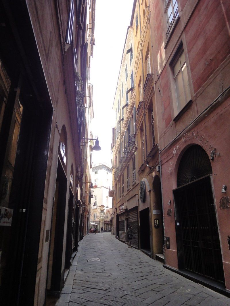
Savona Stadrundgang
The fort was cycled to the first sight. We were amazed that you can get to the top viewing platform with the bikes without stairs. Above is the magnificent 360 ° panorama.
Via Tecnomasio, 16, 17047 Vado Ligure, Savona, Italien
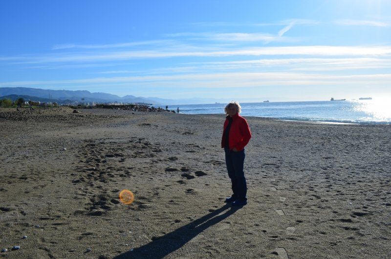
Back at the pitch there was a coffee break before we went on a little walk on the beach. The sea had high waves, the temperature was 16 ° C
In the evening there was a thunderstorm with hail, the grains were the size of a fingernail.
Via Tecnomasio, 16, 17047 Vado Ligure SV, Italien
44° 16' 37.2" N 8° 26' 21.1" E
44.2770125 8.4391905
• Head toward Via Aurelia on Via Tecnomasio. Go for 377 m.
• Turn left onto Via Aurelia (SS1). Go for 571 m.
• Take the 1st exit from roundabout onto Via Aurelia (SS1). Go for 1.2 km.
• Take the 2nd exit from roundabout onto Corso Svizzera toward Genova/Torino. Go for 239 m.
• Turn right onto Piazzale Amburgo toward Torino/Genova. Go for 172 m.
• Turn right onto Via Stalingrado. Go for 220 m.
• Continue toward Centro. Go for 56 m.
• Take the 1st exit from roundabout onto Via Stalingrado toward Centro. Go for 569 m.
• Pass 2 roundabouts and continue on Via Stalingrado. Go for 762 m.
• Take the 3rd exit from roundabout onto Via Vittime di Brescia toward Torino. Go for 1.1 km.
• Continue on Sottopasso Cenisio. Go for 107 m.
• Take the 2nd exit from roundabout onto Via Risorgimento. Go for 203 m.
• Turn right onto Via Francesco Baracca toward Torino. Go for 132 m.
• Turn left onto Corso Agostino Ricci (SP29) toward Torino. Go for 838 m.
• Take the 3rd exit from roundabout onto Via Nazionale Piemonte (SP29) toward Torino. Go for 13.3 km.
• Keep left onto Strada Provinciale Cairo Montenotte-Scaletta Uzzone (SP29) toward Torino-Cairo M./SS29/Ceva/SS28bis/Carcare/SS29/Torino/SS29. Go for 74 m.
• Keep right onto Strada Provinciale Cairo Montenotte-Scaletta Uzzone (SP29) toward Torino-Cairo M./SS29/Ceva/SS28bis/Torino/Ceva/Carcare. Go for 334 m.
• Take the 2nd exit from roundabout onto Strada Provinciale Cairo Montenotte-Scaletta Uzzone (SP29) toward Carcare Centro/Ceva/Millesimo. Go for 1.6 km.
• Take the 1st exit from roundabout onto Strada Provinciale Cairo Montenotte-Scaletta Uzzone (SP29) toward Torino/Acqui/Cairo M.Tte/Carcare Centro. Go for 2.2 km.
• Take the 2nd exit from roundabout onto Strada Provinciale Colle di Nava (SP28bis) toward Ceva/Millesimo. Go for 410 m.
• Pass 2 roundabouts and continue on Strada Provinciale Colle di Nava (SP28bis). Go for 7.7 km.
• Turn right and take ramp onto A6 (Autostrada Torino-Savona) toward Torino/Savona. Go for 32.1 km.
• Take the exit toward Niella Tanaro. Go for 463 m.
• Turn left onto Via San Michele (SP60) toward Torino/SS20/San Michele/Roburent. Go for 668 m.
• Continue on Via Rocchini (SP60). Go for 3.6 km.
• Continue on Via Angelo Nielli (SP60/SP218). Go for 993 m.
• Take the 1st exit from roundabout onto Via Nazionale (SS28) toward Cuneo/Mondovì/Vicoforte. Go for 1.1 km.
• Pass 2 roundabouts and continue on Strada Statale del Colle di Nava. Go for 2.7 km.
• Take the 1st exit from roundabout onto Via Nazionale. Go for 77 m.
• Turn right onto Via Francesco Gallo. Go for 60 m.
• Turn left onto Via Guglielmo Marconi. Go for 115 m.
• Arrive at Via Guglielmo Marconi.
☍
74,0 km
(1 hrs. 13 min.)
Day
Vicoforte, Wallfahrtskirche
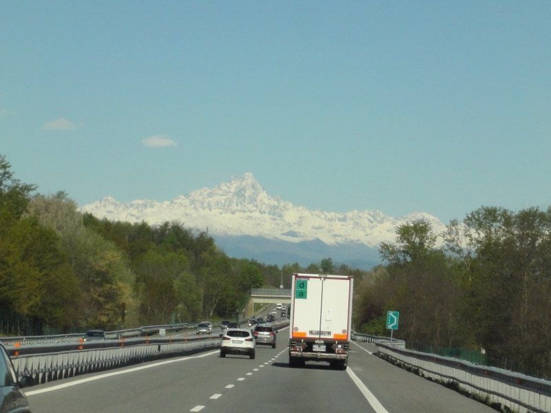
Today it was difficult for us to decide whether we should continue or spend another day at the sea. The decision to continue driving was the right one, we had seen the city and the sights, the wind couldn't swim and the water was too cool, the only thing that would have been remembered was the water and the sunny day. We didn't miss out on a short visit to the beach before heading back to the Piedmont region. We had chosen the Vicoforte pilgrimage church as the first destination for the day. This time we chose the motorway for the route, which brought us a time reduction of over an hour. On the drive we noticed that the landscape can be seen just as well as on the SS roads. I only knew the place of pilgrimage Vicoforte from the travel guide and what we encountered here exceeded everything we had read. Just looking at the approach made us curious.
Via Statale, 13, 12080 Vicoforte CN, Italien
44° 21' 49.2" N 7° 51' 42.1" E
44.3636800 7.8617000
• Head toward Piazza Carlo Emanuele on Via Guglielmo Marconi. Go for 115 m.
• Turn right onto Via Francesco Gallo. Go for 161 m.
• Turn left toward Via Statale 28/SS28. Go for 26 m.
• Take the 1st exit from roundabout onto Via Statale 28 (SS28) toward TO-SV/A6/Mondovì/Cuneo. Go for 5.9 km.
• Take the 1st exit from roundabout onto Corso Dello Statuto (SS28). Go for 430 m.
• Take the 3rd exit from roundabout onto Via Luigi Einaudi (SS28) toward Cuneo/Torino. Go for 114 m.
• Take the 2nd exit from roundabout onto Via Luigi Einaudi (SS28). Go for 192 m.
• Take the 1st exit from roundabout onto Via Luigi Einaudi (SS28) toward Autostrada/A6/Cuneo/Torino. Go for 599 m.
• Take the 1st exit from Piazza Mellano roundabout onto Via Torino (SS28) toward Fossano/Torino. Go for 204 m.
• Take the 2nd exit from roundabout onto Via Torino (SS28) toward Ospedale/Torino/Fossano/Tangenziale. Go for 297 m.
• Pass 2 roundabouts and continue on Via Colle di Nava (SS28). Go for 8.6 km.
• Turn left onto SP43. Go for 6.3 km.
• Take the 1st exit from roundabout onto Via Circonvallazione Paolo Barbero (SP3). Go for 1.9 km.
• Turn left onto Strada Statale del Colle di Nava (SS28). Go for 1.6 km.
• Pass 2 roundabouts and continue on Via Circonvallazione (SS28). Go for 1.9 km.
• Take the 3rd exit from roundabout onto Via Villafalletto (SP184) toward Aeroporto/Villafalletto/Marene/Bra/Asti. Go for 8.6 km.
• Take the 2nd exit from roundabout onto Località Mellea (SP184). Go for 5.4 km.
• Take the 1st exit from roundabout onto Via Circonvallazione Est (SP25). Go for 814 m.
• Take the 2nd exit from roundabout onto Via Circonvallazione Est (SP25). Go for 1.7 km.
• Continue on Via Termine (SP161). Go for 2.3 km.
• Take the 2nd exit from roundabout onto SP161. Go for 2.0 km.
• Take the 3rd exit from roundabout onto Via Villafalletto (SP161). Go for 2.0 km.
• Take the 2nd exit from roundabout onto Via Gerbola (SP161). Go for 2.0 km.
• Take the 3rd exit from roundabout onto Regione Colombaro dei Rossi (SP161). Go for 854 m.
• Take the 3rd exit from roundabout onto Via Lagnasco (SP137). Go for 323 m.
• Take the 2nd exit from roundabout onto Via Lagnasco (SP137). Go for 250 m.
• Take the 1st exit from roundabout onto Strada Regionale Dei Laghi di Avigliana (SR589) toward Savigliano/Torino/Pinerolo/Centro/Ospedale. Go for 258 m.
• Take the 1st exit from roundabout onto Corso Roma (SR589) toward Torino/Pinerolo/Savigliano. Go for 95 m.
• Turn left onto Via Piave. Go for 164 m.
• Turn right onto Via Spielberg. Go for 250 m.
• Continue on Piazza Risorgimento. Go for 20 m.
• Take the 1st exit from roundabout onto Piazza Risorgimento. Go for 65 m.
• Turn right onto Via Martiri della Liberazione. Go for 3 m.
• Arrive at Via Martiri della Liberazione. Your destination is on the left.
☍
55,5 km
( 59 min.)
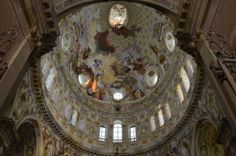
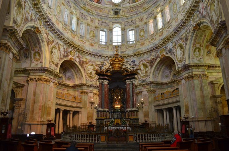
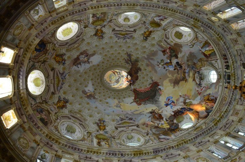
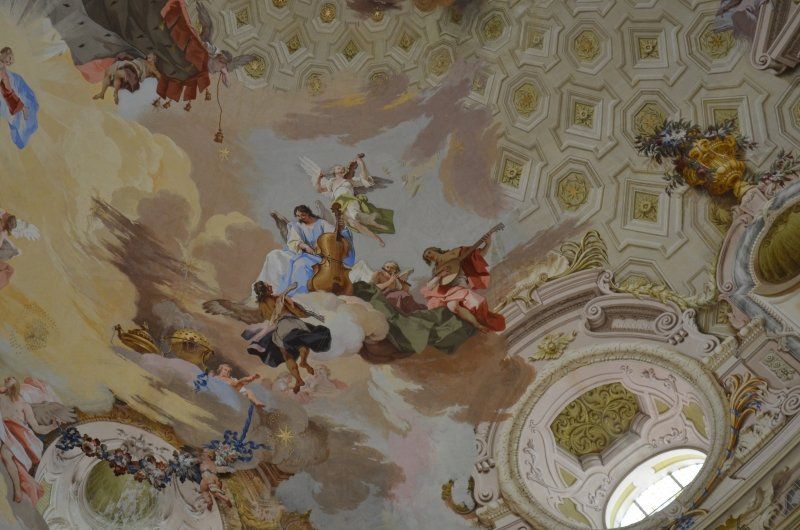
Besichtigung Santuario della Nativita di Maria (Vicoforte)
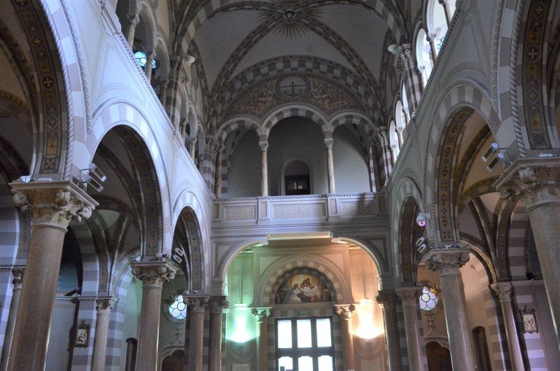
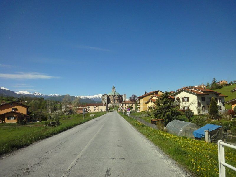
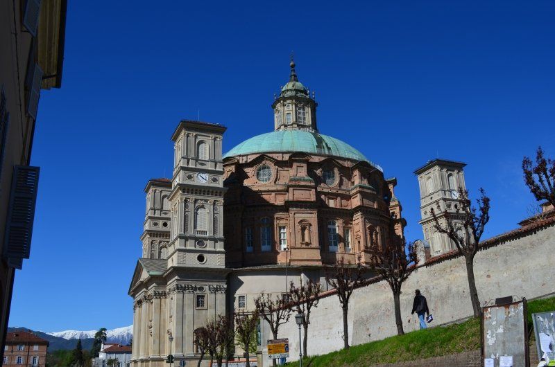
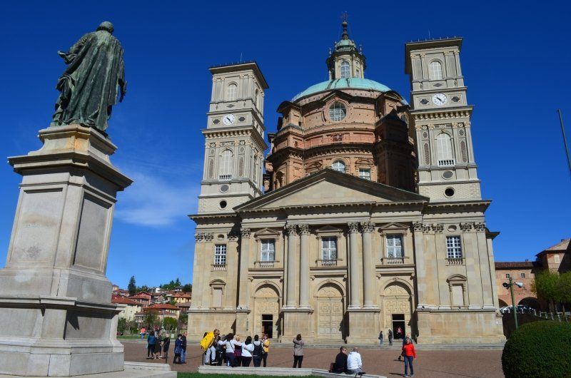
We were very impressed by this church. The dome is the largest elliptical dome in the world and is beautifully painted. The sanctuary of many people ... an imposing structure that was erected over 300 years ago, an elliptical dome which, at 77,000 tons, is one of the largest in the world and is only supported by a few columns. 8 the prophets depicted in the dome, 64 stars with 8 points (number that keeps recurring in the Christian project, symbol of perfection). After an extensive tour we walked through Victoforte to a hill to see the Maritime Alps.
Saluzzo,
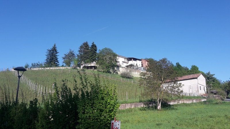
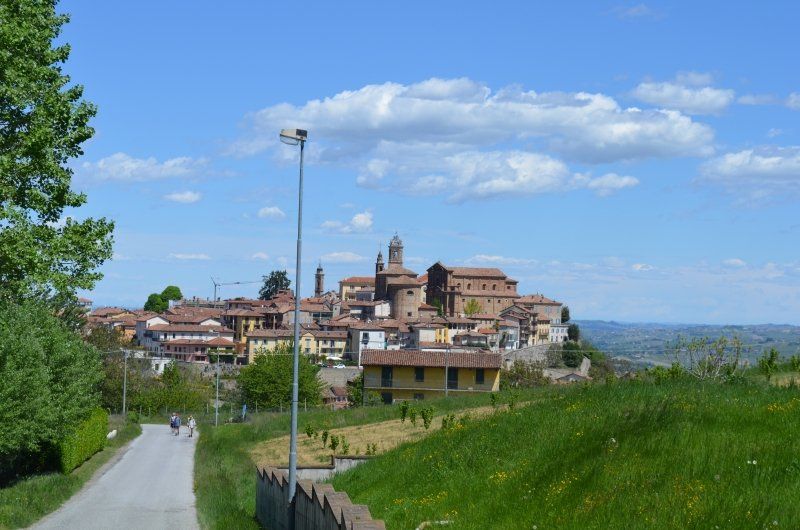
Our next destination was Saluzzo, one of the most beautiful places in Piedmont. The GPS had first led us past the parking space, the parked mobile homes could be seen from the street. After turning, the navigation system led us over a roundabout to the parking space. (GPS: 44.637440,7.492572 free) We allowed ourselves a break before we went on an exploration tour. Old buildings line the narrow streets, and beyond the medieval roofs you can see green hills and the snow-capped peaks of the Alps. The city is divided into a lower modern part and the medieval-looking old town above on a Monviso foothill. At the end of the 16th century, Saluzzo was the center of a flourishing principality: today it is a bishopric. In the former fortifications high above you can visit several interesting churches, some of which are uniquely beautiful. You also have a wonderful overview of Saluzza, which is "at your feet". We strolled slowly downhill on poorly accessible cobblestone alleys and streets, only partially covered with narrow pavement slabs through the beautiful old town. In the more modern lower town, we paid a visit to the church of S. Giovanni from 1330 with the burial chapel of the Dukes of Saluzzo and cloister.
Parking: free
12037 Saluzzo, Cuneo, Italien
44° 38' 40.3" N 7° 29' 33.8" E
44.6445404 7.4927355
• Head northeast on Via Martiri della Liberazione. Go for 87 m.
• Take the 1st exit from roundabout onto Via Martiri della Liberazione. Go for 180 m.
• Take the 2nd exit from roundabout onto Via Savigliano (SP662) toward Torino-Savona/A6/Savigliano/Bra/Torino. Go for 1.3 km.
• Continue toward To-Sv/A6/Savigliano/Alba/Bra. Go for 36 m.
• Take the 2nd exit from roundabout toward Torino-Savona/A6/Savigliano/Alba/Bra. Go for 128 m.
• Continue on Frazione Ruata Eandi (SP662). Go for 4.9 km.
• Continue toward Strada Provinciale di Savigliano/SP662. Go for 39 m.
• Take the 2nd exit from roundabout onto Strada Provinciale di Savigliano (SP662) toward Autostrada/A6/Savigliano/Torino. Go for 3.3 km.
• Pass 2 roundabouts and continue on Via della Morina (SP662). Go for 3.4 km.
• Take the 1st exit from roundabout onto Strada Regionale del Colle di Tenda (SP20/SP662). Go for 1.1 km.
• Take the 2nd exit from roundabout onto Strada Provinciale di Savigliano (SP7/SP662). Go for 1.7 km.
• Pass 2 roundabouts and continue on Strada Provinciale di Savigliano (SP662). Go for 5.1 km.
• Take the 3rd exit from roundabout onto Strada Provinciale di Savigliano (SP662) toward Autostrade/E74/Asti/Cuneo/A33/Alba/Bra/Torino-Savona/A6. Go for 5.5 km.
• Take the 1st exit from roundabout toward Asti/A33/Cuneo/E74/Torino/A6/Savona/E717/A21/Piacenza/E70. Go for 236 m.
• Take the 3rd exit from roundabout onto Svincolo Bra-Marene toward Autostrade/Asti/Cuneo/A6/Torino/Savona/A21/Piacenza. Go for 362 m.
• Take ramp onto A33 (Autostrada Asti-Cuneo) toward Asti. Go for 5.4 km.
• Take the exit toward Cherasco. Go for 1.6 km.
• Take the 1st exit from roundabout onto Via Moglia (SP58) toward Asti/A33/Alba/Cherasco. Go for 292 m.
• Turn right toward SP58. Go for 31 m.
• Take the 3rd exit from roundabout toward Narzole/Cherasco. Go for 76 m.
• Turn right onto Via Moglia (SP661). Go for 1.4 km.
• Turn left onto Via Vittorio Emanuele (SP661). Go for 281 m.
• Turn right onto Viale Salmatoris. Go for 256 m.
• Turn left. Go for 49 m.
• Arrive at your destination.
☍
36,8 km
( 36 min.)
Cherasco
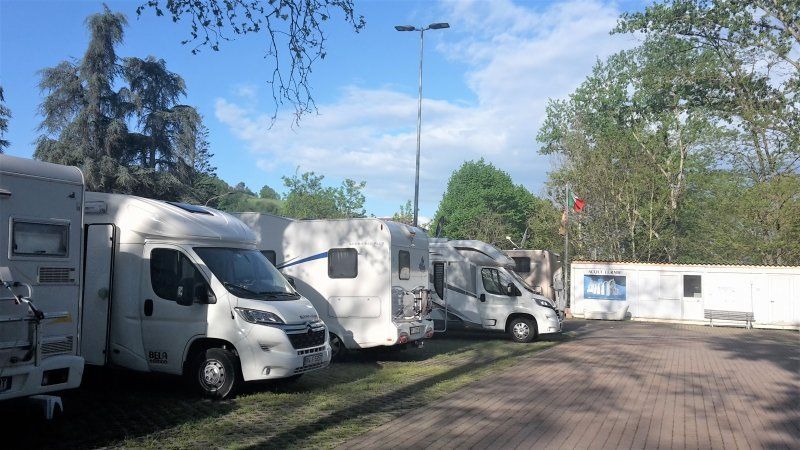
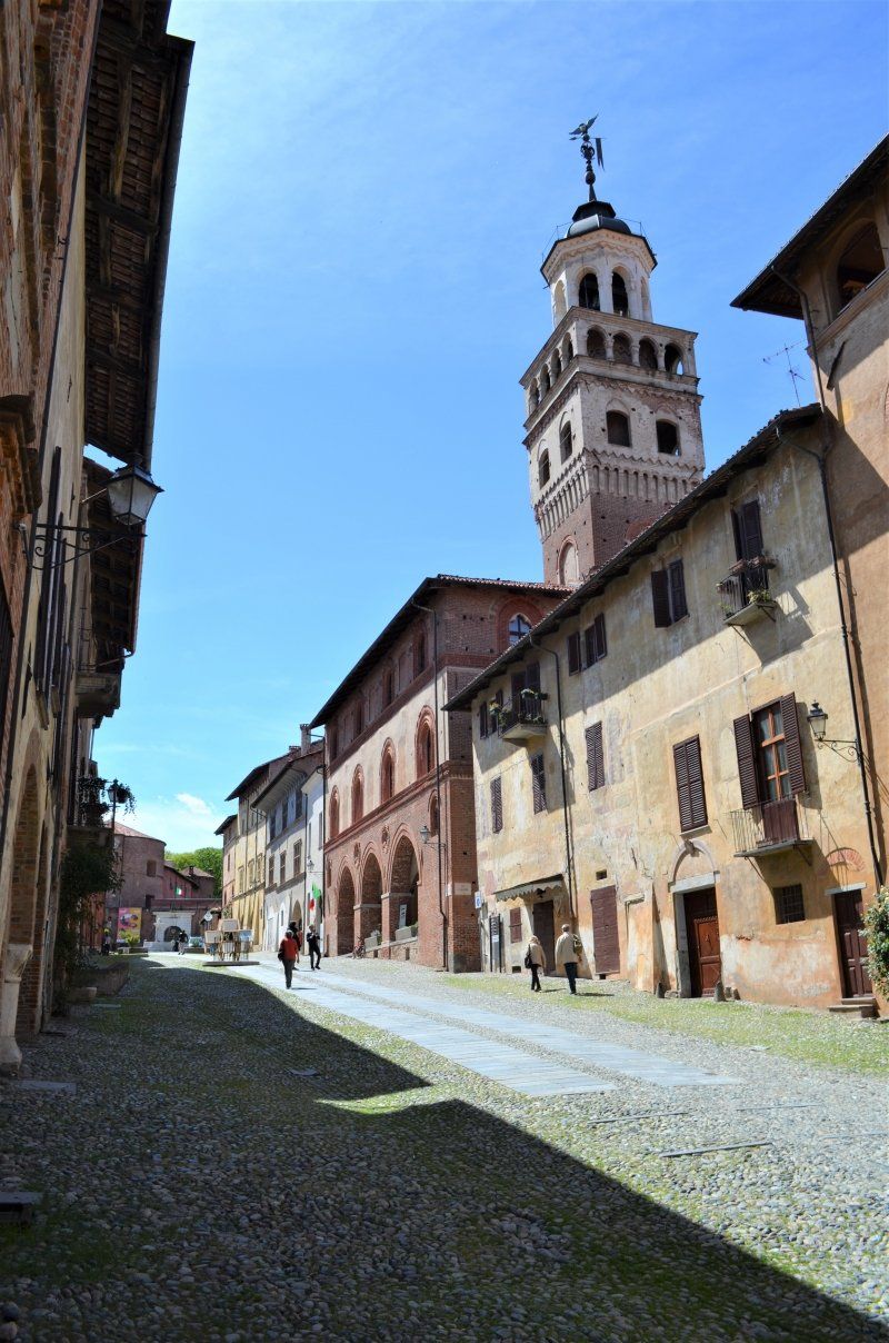
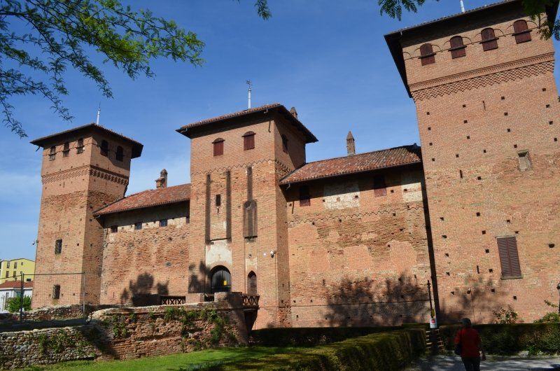
The onward journey to Cherasco was initially on the same route as the approach to Saluzzo. The last kilometers before Cherasco a 10% gradient with tight bends still had to be overcome. The most beautiful there in Piedmont, Cherasco towers on a hilltop. There were already several mobile homes in the free parking lot (GPS: 44.648800,7.854980). You can't name it there, it's a beautiful old town with a castle, a city wall with an archway and offers a wide view of the Piedmont hills.
When we were there, there was a flea market, a flower market at the castle and a deposit of old Celts in front of the city wall.
Piazza Giovanni Paolo II, 12062 Cherasco CN, Italien
44° 38' 56.6" N 7° 51' 17.8" E
44.6490438 7.8549365
• Head toward Viale Salmatoris. Go for 49 m.
• Turn right onto Viale Salmatoris. Go for 256 m.
• Turn left onto Via Vittorio Emanuele (SP661). Go for 281 m.
• Turn right onto Via Camillo Benso di Cavour (SP661). Go for 1.4 km.
• Take the 1st exit from roundabout onto Via Moglia (SP58) toward E74/A33/Cuneo/Monforte/Dogliani/Barolo/Monachino/Novello/La Morra. Go for 299 m.
• Take the 2nd exit from roundabout onto Via Moglia (SP58) toward La Morra. Go for 586 m.
• Continue on Via La Morra (SP58). Go for 3.3 km.
• Continue on Via La Morra (SP58). Go for 822 m.
• Continue on Mascarelli (SP58). Go for 211 m.
• Continue on SP58. Go for 579 m.
• Continue on Regione Cerreto (SP58). Go for 937 m.
• Take the 2nd exit from roundabout onto Strada Provinciale Barolo la Morra Cherasco (SP58). Go for 673 m.
• Turn right onto Via Roma (SP58). Go for 37 m.
• Arrive at Via Roma (SP58).
☍
9,5 km
( 14 min.)
La Morra,
After an extensive tour of Cherasco, the arrival at the La Morra parking lot (GPS: 44.637699,7.928440) was delayed. When approaching the square, we thought everything was reserved, there was a garden chair on each square. We first parked our mobile home in an adjoining free area. The owner pointed us to a place where there was a chair on which we could stand the night. We spent the rest of the evening at the mobile home.
Parking fees: € 10 / 24h
12064 La Morra CN, Italien
44° 38' 20.2" N 7° 56' 1.7" E
44.6389416 7.9338054
• Head southwest on Via Roma (SP58).
• Turn right onto Via Richieri (SP58). Go for 688 m.
• Take the 3rd exit from roundabout onto Via Bra (SP58). Go for 420 m.
• Continue on Strada Provinciale Barolo la Morra Cherasco (SP58). Go for 561 m.
• Turn right onto SP58. Go for 579 m.
• Continue on Mascarelli (SP58). Go for 211 m.
• Continue on Strada Provinciale La Morra Barolo (SP58). Go for 4.1 km.
• Continue on Via Moglia (SP58). Go for 469 m.
• Take the 2nd exit from roundabout onto Via Moglia (SP58) toward Asti/A33/E74/Cherasco. Go for 390 m.
• Turn right toward A33/Torino/A21. Go for 31 m.
• Take the 2nd exit from roundabout onto Strada Provinciale delle Langhe (SP661) toward A33/Torino/A21. Go for 1.8 km.
• Take the 3rd exit from roundabout onto Strada Provinciale delle Langhe (SP661) toward Asti. Go for 499 m.
• Take the 3rd exit from roundabout onto Via Bergoglio (SP7) toward Cuneo/Savigliano/Roreto/Aeroporto Cuneo Levaldigi. Go for 1.6 km.
• Take the 2nd exit from roundabout onto Via Bra (SS231) toward Aeroporto Cuneo Levaldigi/Cuneo/Fossano/Savigliano. Go for 690 m.
• Take the 1st exit from roundabout toward Aeroporto Cuneo Levaldigi/Torino-Savona/A6/Savigliano/Marene. Go for 42 m.
• Continue on Via Savigliano (SP662). Go for 661 m.
• Take the 3rd exit from roundabout onto Via Savigliano (SP662) toward Asti/E74/Cuneo/A33/Torino/A6/Savigliano. Go for 1.7 km.
• Continue toward Marene. Go for 49 m.
• Take the 2nd exit from roundabout onto Strada Provinciale di Savigliano (SP662) toward Marene. Go for 1.8 km.
• Turn left toward E717/A6/Torino/Savona. Go for 44 m.
• Turn left toward E717/A6/Torino/Savona. Go for 75 m.
• Continue on Strada Provinciale di Savigliano (SP662) toward E717/A6/Torino/Savona. Go for 63 m.
• Take ramp onto A33 (Autostrada Asti-Cuneo) toward E717/A6/Torino/Savona. Go for 600 m.
• Take the exit toward Torino onto A6 (Autostrada Torino-Savona). Go for 35.0 km.
• Continue on A55. Go for 5.7 km.
• Continue on Corso Trieste. Go for 942 m.
• Take the 2nd exit from Rotonda Piero Maroncelli roundabout onto Corso Unità d'Italia toward Aeroporto/Centro/Susa/Aosta/Milano. Go for 564 m.
• Keep left onto Sottopassaggio Lingotto toward Aeroporto/Susa/Milano/A4/Aosta/A5/Stadio Olimpico. Go for 299 m.
• Arrive at Sottopassaggio Lingotto. Your destination is on the left.
☍
59,7 km
( 44 min.)
Day
Wanderung nach Barolo
We used the beautiful day for a hike from the pitch to Barolo.
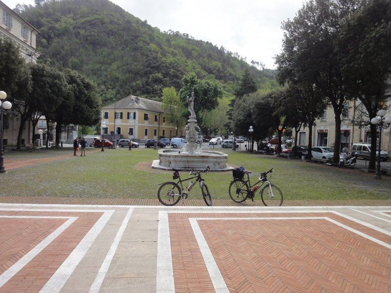
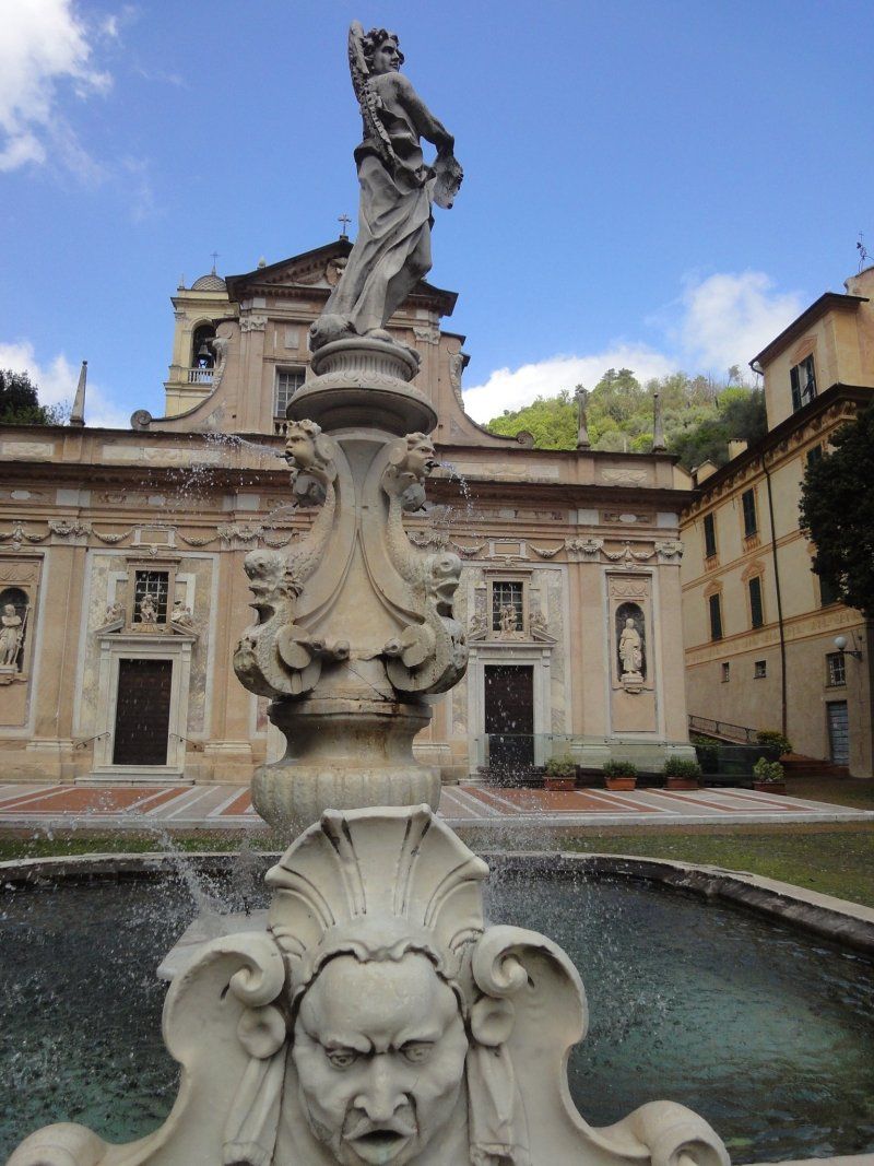
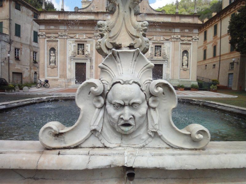
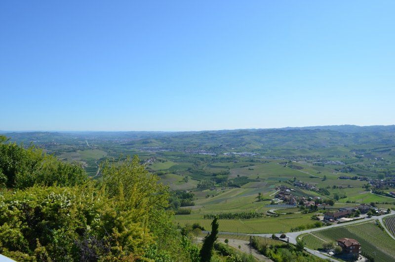
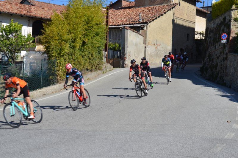
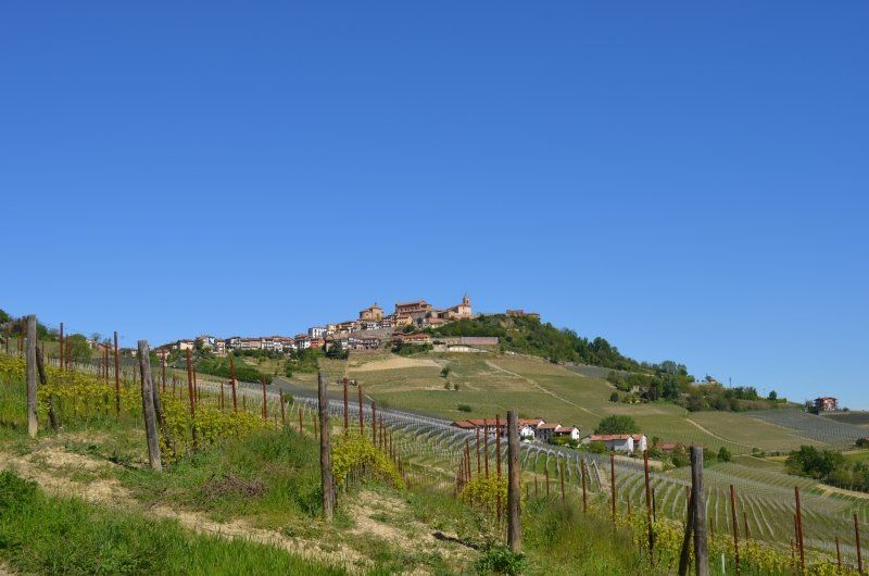
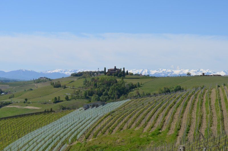
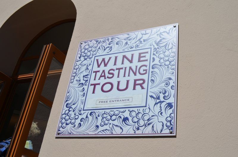
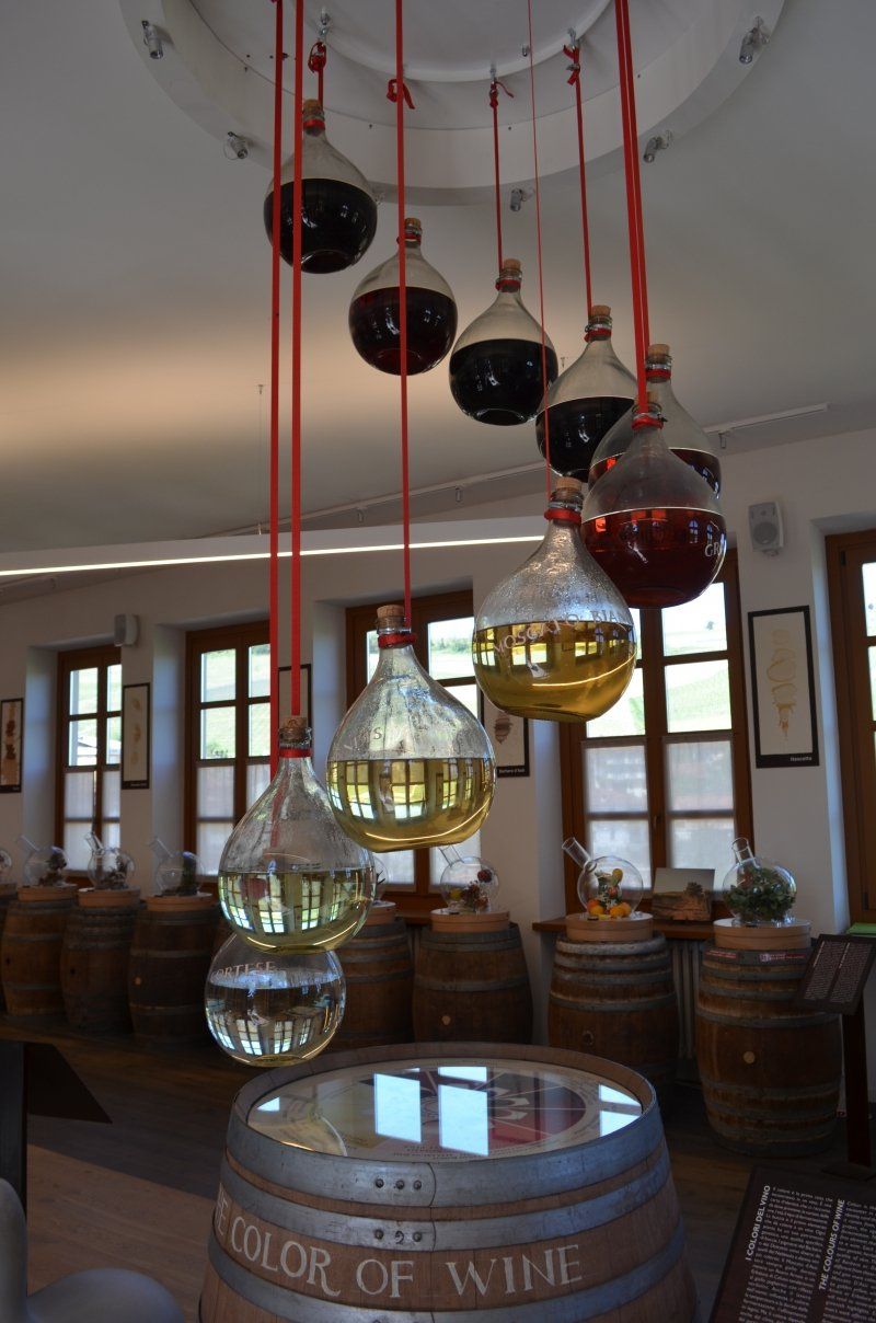
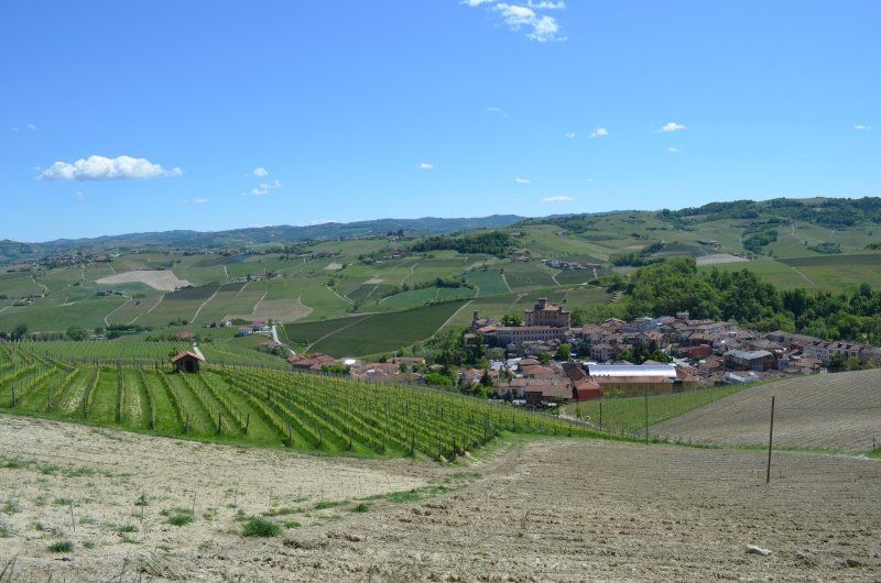
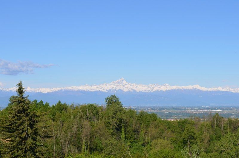
First we visited the wine village of La Morra with a wonderful view towards the Maritime Alps with the summit of the Montivo. La Morra is one of the most important wine-growing communities in Piedmont. Many of the best wines in the Barolo region come from here. The place La Morra with the Belvedere on the Schloßplatz. The village has not only retained its charming medieval town center, but also offers a spectacular view from the top of the hill (513m above sea level). It goes without saying that we also took a small incline to enjoy this magnificent view. The parish church of San Martino was the first point of contact, past the Torre La Morra, with a total height of 31 meters. The main square is a wonderful piazza with a sensational panoramic terrace with a wonderful view of the valley and several wine villages. After an extensive tour we looked for the starting point, the hiking trail to Barolo, which I had saved on my mobile phone. During our sightseeing tour, a bike race moved through the town and the narrow thoroughfare could no longer be used. The hike ran on its own route, so to speak, through steep vineyards and small farms. Shortly before Barolo we came across our intended hiking trail which finally led us on a good path to Barolo. In Barolo we visited the castle, the "wine tasting tour" and a small market where local products were offered, including pickled truffles. For the way back to La Morra we chose a signposted hiking trail. In the early afternoon we were back from our tour and got ready to continue our journey to Turin.
Torino, Turin
We drove towards the city center, where there is a parking lot near the center. It was Sunday afternoon and the parking spaces we drove to were occupied. After a desperate search for a parking space, we found one at a large shopping center about 20 minutes from the center. I wasn't quite comfortable parking here, not far from our mobile home, gypsies were parked with a neglected motorhome without a license plate, with flat tires on the front wheel. They sat in a circle on the paved ground.
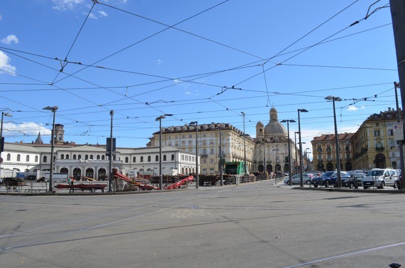
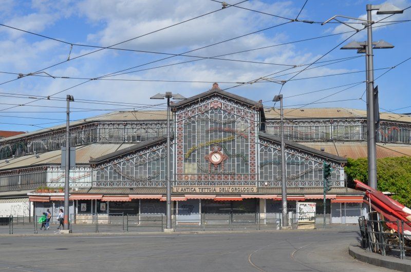
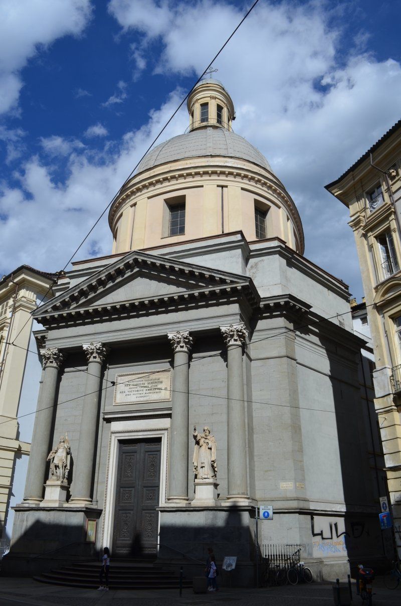
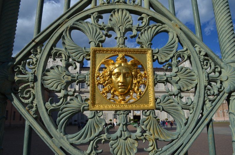
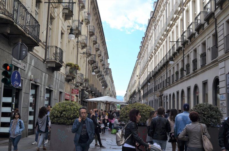
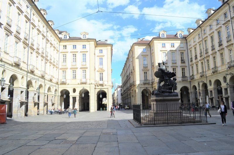
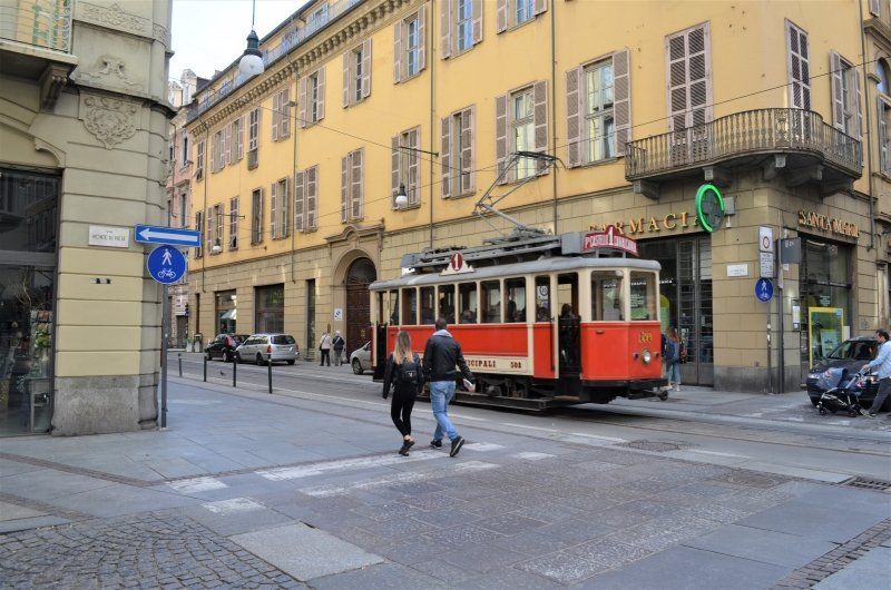
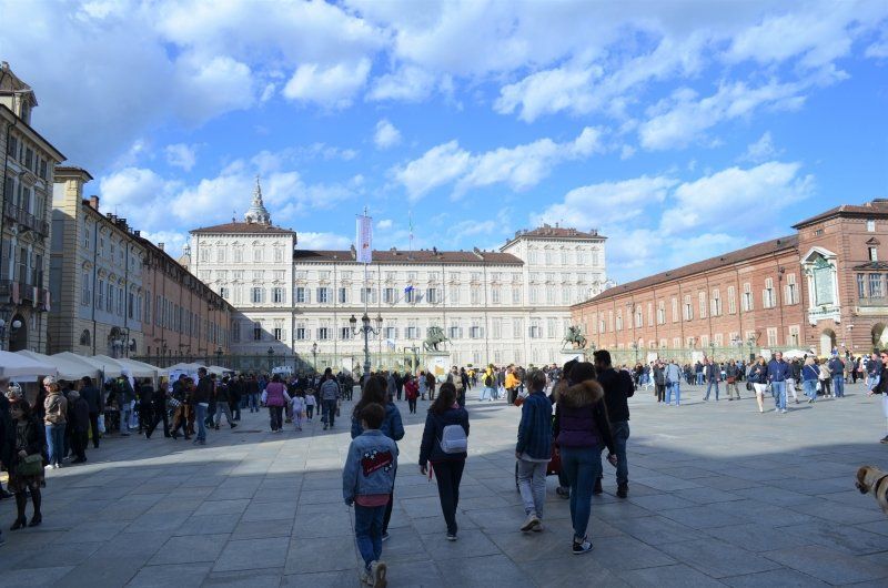
Turin is changing more and more from a gray industrial city to a dynamic metropolis that is home to history, art and culture. First we went to the main square of Turin, a large area around the Palazzo Madama and lined with the Palazzo Reale, the royal palace of the House of Savoy. We strolled past the theater - Teatro Regio - where opera performances take place. Via Garibaldi, Turin's most beautiful shopping street, which is the longest pedestrian zone in Europe.
Corso Unità d'Italia, 10127 Torino TO, Italien
45° 1' 28.2" N 7° 40' 15.4" E
45.0244927 7.6709505
• Head north on Sottopassaggio Lingotto. Go for 831 m.
• Take the 1st exit from roundabout onto Sottopassaggio Lingotto. Go for 861 m.
• Continue on Corso Eusebio Giambone. Go for 475 m.
• Continue on Corso Cosenza toward Aeroporto/Milano/A4/Aosta/A5/Vercelli/SS11/Cuorgnè/SS460/Lanzo/SP2/Susa/SS25. Go for 1.2 km.
• Continue on Piazza Pitagora. Go for 65 m.
• Turn left onto Corso Orbassano (SP6). Go for 1.6 km.
• Keep left onto Corso Orbassano (SP6) toward Beinasco/Tangenziale/Corso Settembrini. Go for 1.0 km.
• Take left ramp onto A55 (Autostrada Torino-Pinerolo) toward Piacenza/A21/E717/Savona/A6/E25/Aosta/A5/Milano/A4/T4. Go for 668 m.
• Take the exit toward Aosta/A5/E25/Milano/A4 onto A55 (Tangenziale Sud). Go for 9.0 km.
• Take the exit toward Frejus/T4/Bardonecchia/A32/Strada Statale del Moncenisio/SS25 onto Interscambio Bruere. Go for 951 m.
• Continue on A55 (Tangenziale Nord). Go for 3.3 km.
• Continue on A32 (Autostrada Torino-Bardonecchia). Go for 8.5 km.
• Take the exit toward Avigliana Ovest. Go for 627 m.
• Take the 3rd exit from roundabout onto Via Moncenisio (SP24) toward Susa. Go for 2.0 km.
• Take the 2nd exit from roundabout. Go for 80 m.
• Continue toward Corso Moncenisio/SS25. Go for 899 m.
• Turn right onto Corso Moncenisio (SS25). Go for 1.9 km.
• Take the 2nd exit from roundabout onto Corso Moncenisio (SS25). Go for 1.6 km.
• Turn left onto Viale Monte Pirchiriano. Go for 283 m.
• Turn right onto Via Pragallo. Go for 80 m.
• Arrive at Via Pragallo.
☍
35,9 km
( 32 min.)
Day
10050 Chiusa di San Michele,
After visiting Turin we drove to the parking lot San Michele. (GPS: 45.103001, 7.330320) We actually wanted to drive to the parking space, which was closed for inexplicable reasons. Not far away was a nice parking lot where we stayed for two nights. Without supply but free of charge. We refrained from visiting the site, the sun had already disappeared behind the mountains and we moved it to tomorrow with the hike connected.
Via Pragallo, 42, 10050 Chiusa di San Michele TO, Italien
45° 6' 10.5" N 7° 19' 47.5" E
45.1029229 7.3298530
• Head west on Via Pragallo. Go for 52 m.
• Turn right toward Via Ex Combattenti. Go for 142 m.
• Turn right onto Via Ex Combattenti. Go for 131 m.
• Turn left onto Viale Monte Pirchiriano. Go for 125 m.
• Turn right onto Via Torino (SS25). Go for 1.5 km.
• Take the 2nd exit from roundabout onto Corso Moncenisio (SS25). Go for 2.0 km.
• Turn left toward Strada Provinciale di Villardora/SP198. Go for 53 m.
• Continue on Strada Provinciale di Villardora (SP198). Go for 859 m.
• Continue toward Via Cuminie/SP24. Go for 39 m.
• Take the 1st exit from roundabout onto Via Cuminie (SP24). Go for 1.9 km.
• Take the 1st exit from roundabout toward Traforo Frejus/T4/Bardonecchia/Torino. Go for 366 m.
• Take ramp onto A32 (Autostrada Torino-Bardonecchia) toward Torino/Tangenziale. Go for 9.0 km.
• Continue on A55 (Tangenziale Nord). Go for 3.4 km.
• Take the left exit toward Stadio Juventus/Milano/A4/E64/Aosta/A5/E25/Monte Bianco/A5 onto A55 (Tangenziale Nord). Go for 17.2 km.
• Continue on A5 (Autostrada Torino-Aosta). Go for 35.9 km.
• Take the exit toward Ivrea/Torino/A5. Go for 1.0 km.
• Take the 1st exit from roundabout onto Strada Provinciale di Castellamonte (SPEXSS565) toward Ivrea. Go for 1.6 km.
• Take the 2nd exit from roundabout toward Ivrea. Go for 123 m.
• Continue on Strada Provinciale di Pavone (SP77). Go for 533 m.
• Continue toward Via Pavone. Go for 31 m.
• Take the 2nd exit from roundabout toward Ivrea Centro/Biella/Vercelli/Milano. Go for 36 m.
• Continue on Via Pavone. Go for 202 m.
• Continue on Via Guglielmo Jervis. Go for 327 m.
• Turn left onto Via Emilio Pinchia. Go for 380 m.
• Turn right onto Via delle Miniere. Go for 730 m.
• Continue on Piazza Alfonso La Marmora. Go for 64 m.
• Take the 2nd exit from roundabout onto Corso Costantino Nigra (SS26). Go for 228 m.
• Turn right onto Corso Camillo Benso di Cavour. Go for 272 m.
• Continue on Corso Re Umberto I. Go for 388 m.
• Turn left onto Corso Botta. Go for 209 m.
• Enter the roundabout. Go for 39 m.
• Arrive at your destination on the right.
☍
78,8 km
( 55 min.)
Day
Wanderung
A wonderful day began with sunshine and a beautiful mountain backdrop. We couldn't stay in bed any longer, we had to get out into nature. It was also the first time on our tour through Piedmont where we could have breakfast outside. Not because of the weather, no, the atmosphere on the previous pitches wasn't right.
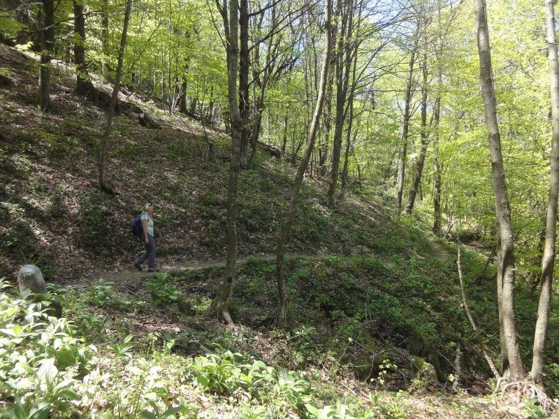
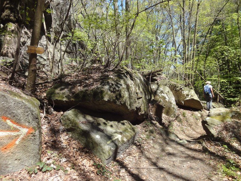
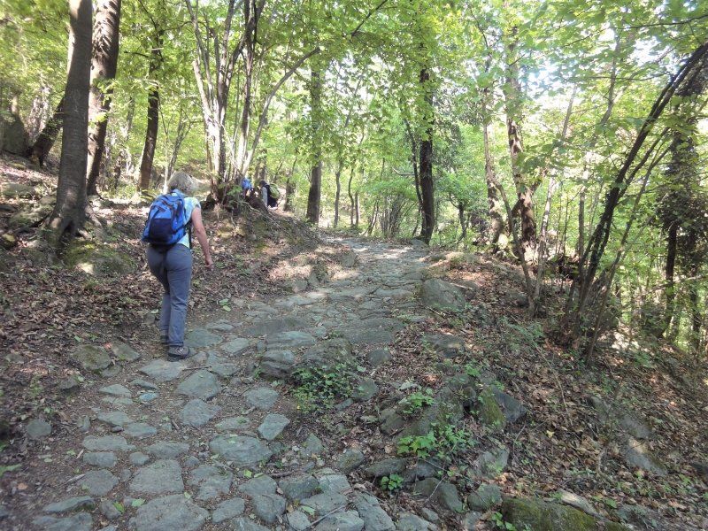
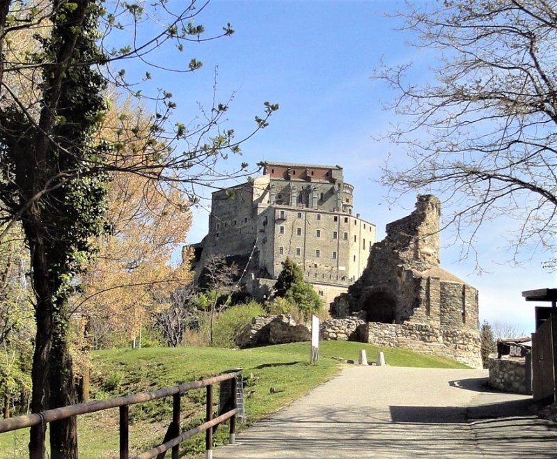
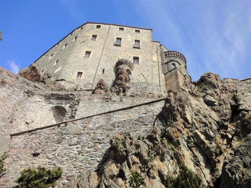
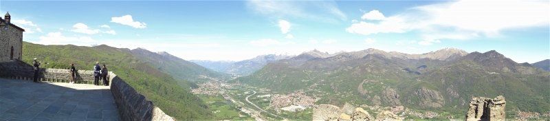
On a hiking board at the parking lot we asked about the hiking trail we would like to go. We liked the path with the no. 4, it is a larger round and led to the monastery complex Chiusa di San Michele and the surrounding area. At the beginning of the tour we went through the village with its narrow streets and its church. At the church there was also the entrance to the path with the number 4, which went up steeply, serpentine-like. From the parking lot to the monastery you have to climb 600 m. The way was easy to walk we followed the signs "Chiusa di San Michele", the still leafless beech forest made it possible to see the nearby mountains opposite only the monastery complex remained hidden, the more beautiful it was when we reached the top, the mighty building in front to have us. This building, majestically situated on a rocky mountain above the Val di Sosa within sight of Turin and against the backdrop of the Alps, is one of the most impressive things you can visit in Italy. Grandiose architecture, a beautiful spiritual atmosphere in the church and the view of the valley and of the mountains make this hike an unforgettable experience. We could hardly part with the facility, we were always shown new insights. We had to go on, after all, we wanted to go the circular route and get to know the landscape. The landscape with the Susa valley is similar to the Adige valley near Bozen. The river, the villages, the orchards. It continued downhill and uphill. The circular route ran a lot in the beech forest, two smaller valleys on beautiful paths had to be crossed, whereby in the second valley we chose the descent towards the parking lot. It was a short shortcut and came back on circular route 4. The last part of the path, which was rocky and steep downhill, was difficult to walk. We were happy when we got back to the parking lot at the cemetery down in the village.
Day
10015 Ivrea, Parkplatz
The Piedmont city of Ivrea, a Roman foundation, is the gateway to the Valle d'Aosta. The townscape is dominated by the four-cornered 14th century castello. The Romanesque cathedral was built in the 10th century. has a classical facade. The church of San Bernhardino is located on the site of the former Olivetti typewriter factory. The Dora Balta River flows through the city.
10015 Ivrea, Turin, Italien
45° 28' 2.2" N 7° 52' 48.2" E
45.4672764 7.8800589
• Follow the roundabout. Go for 42 m.
• Take the 3rd exit from roundabout onto Piazza Aldo Balla (SPEXSS228). Go for 230 m.
• Turn right onto Viale Monte Stella. Go for 199 m.
• Continue on Via Sirio Lago. Go for 1.2 km.
• Continue on Via Panoramica. Go for 817 m.
• Turn left onto Via Sirio Lago (SP75) toward Torino/Autostrade/A4/A5/Cascinette. Go for 1.8 km.
• Continue on Via Bienca (SP74). Go for 850 m.
• Turn right toward Biella/Andrate. Go for 455 m.
• Continue on Casale Richeda-Casale Bugliacco. Go for 80 m.
• Continue on Casale Bugliacco. Go for 2.2 km.
• Turn right onto Strada Provinciale della Serra (SPEXSS419) toward Biella/Mongrando. Go for 1.5 km.
• Continue on Strada Statale della Serra (SS419). Go for 7.1 km.
• Take the 2nd exit from roundabout onto Via Martiri della Libertà (SS338). Go for 488 m.
• Take the 1st exit from Via della Cerchia roundabout onto Via Repubblica. Go for 435 m.
• Take the 2nd exit from Via della Cerchia roundabout. Go for 328 m.
• Continue on Via per Borriana. Go for 401 m.
• Pass 2 roundabouts and continue on Via Maghetto (SP402). Go for 1.5 km.
• Take the 1st exit from roundabout onto Via Cascine (SP401). Go for 1.2 km.
• Take the 4th exit from roundabout. Go for 260 m.
• Continue on Strada Provinciale Biella Cerrione (SP400/A). Go for 1.2 km.
• Take the 1st exit from roundabout onto Tangenziale di Biella (SP338dir). Go for 2.0 km.
• Keep right toward Cossato. Go for 267 m.
• Continue on Strada Ara. Go for 29 m.
• Continue on Corso Novellino Casalvolone. Go for 176 m.
• Take the 4th exit from roundabout onto Via San Giuseppe Cottolengo. Go for 800 m.
• Take the 3rd exit from Piazza Adua roundabout onto Via Torino. Go for 315 m.
• Take the 2nd exit from roundabout onto Via Torino. Go for 600 m.
• Take the 1st exit from roundabout onto Via Bertodano. Go for 19 m.
• Arrive at Via Bertodano. Your destination is on the left.
☍
26,5 km
( 31 min.)
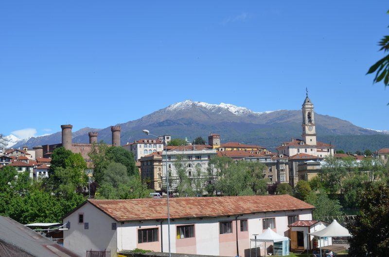
Biella, Italien
Today we drive on our way to Biella over the Po, an imposing river and with 652 km also the longest in Italy. We parked in a large car park at the train station, a 30-minute walk to the center. By chance we passed the tourist information office, where we got a city map. The lady in the office was so nice and marked the way to the sights on the map. How could it be any different. it was noon again and the churches were closed. We had no choice but to look at the churches from the outside. Biella has a rich religious, cultural and artistic heritage. It is a country with a remarkable spirituality, as can be seen from the numerous places of worship such as the Marian Shrine of Oropa , one of the most important Marian shrines in Europe. Bielle is divided into two cores: Biella-Piazzo is the medieval village dominated by the magnificent Palazzo Cisterna and ancient churches. The cathedral is in Biella-Piano , the pre-Roman baptistery. The two parts of the city are connected by a cable car. Our city tour was limited to Biella piano.
13900 Biella, Italien
45° 33' 46.4" N 8° 3' 30" E
45.5628842 8.0583397
• Head northeast on Via Bertodano. Go for 72 m.
• Take the 3rd exit from Via Bertodano roundabout onto Via della Repubblica. Go for 258 m.
• Take the 3rd exit from roundabout onto Via della Repubblica. Go for 724 m.
• Continue on Via Galileo Galilei. Go for 167 m.
• Continue on Via Carlo Marocchetti. Go for 78 m.
• Take the 1st exit from Piazza Annibale Battiani roundabout onto Via Eriberto Ramella Germanin. Go for 176 m.
• Take the 1st exit from roundabout onto Via Eriberto Ramella Germanin. Go for 637 m.
• Continue on Strada della Nera. Go for 82 m.
• Keep right onto Via Filippo Juvarra (SP144). Go for 3.2 km.
• Turn left onto Via Pietro Arduzzi (SP144). Go for 7.7 km.
• Turn right onto Via Anna Ludovica Brucco. Go for 379 m.
• Turn right onto Piazza Santo Stefano. Go for 59 m.
• Arrive at Piazza Santo Stefano. Your destination is on the left.
☍
13,5 km
( 21 min.)
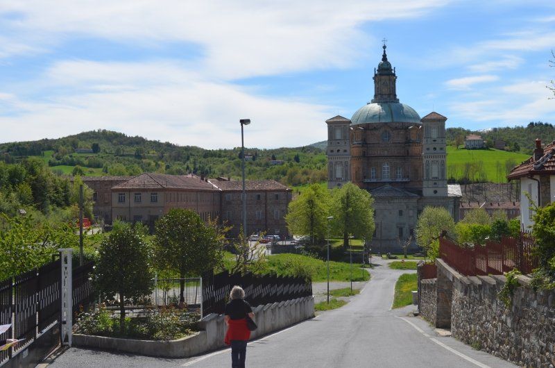
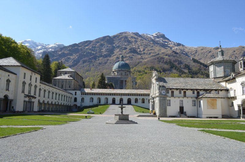
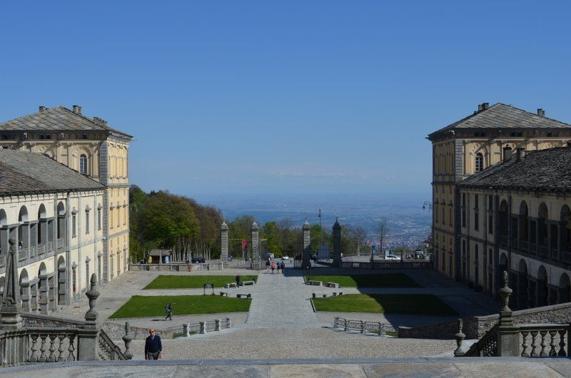
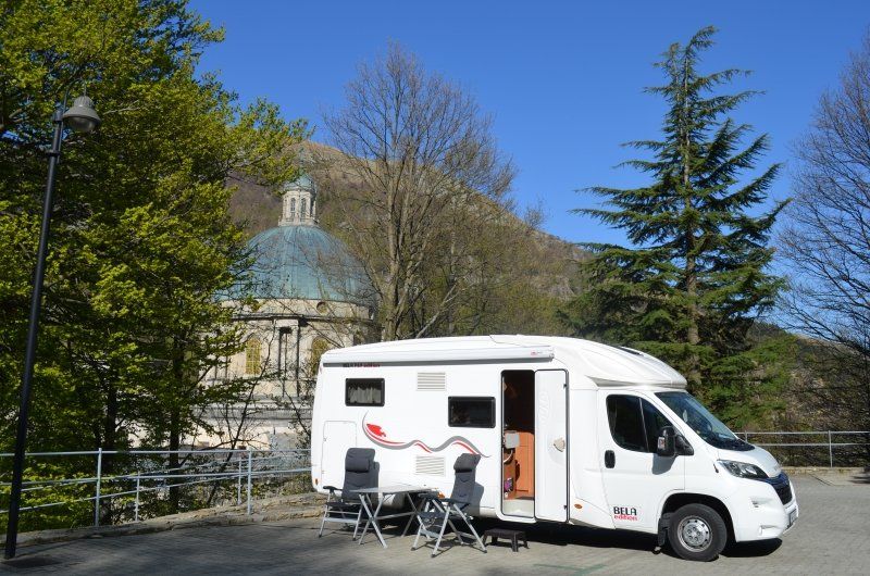
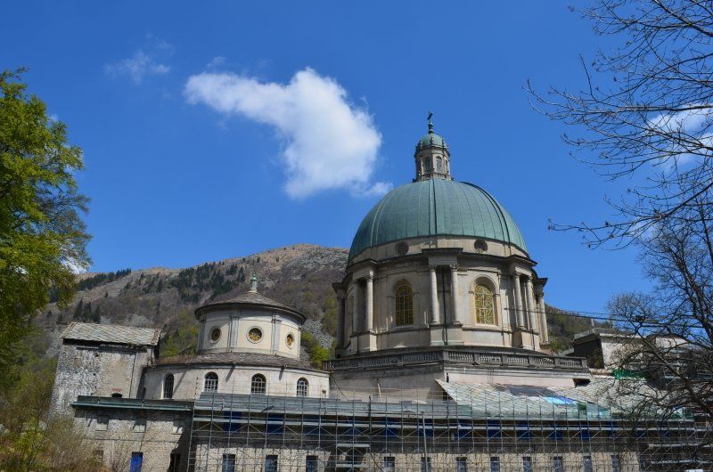
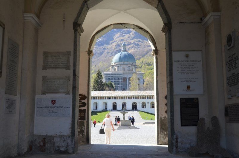
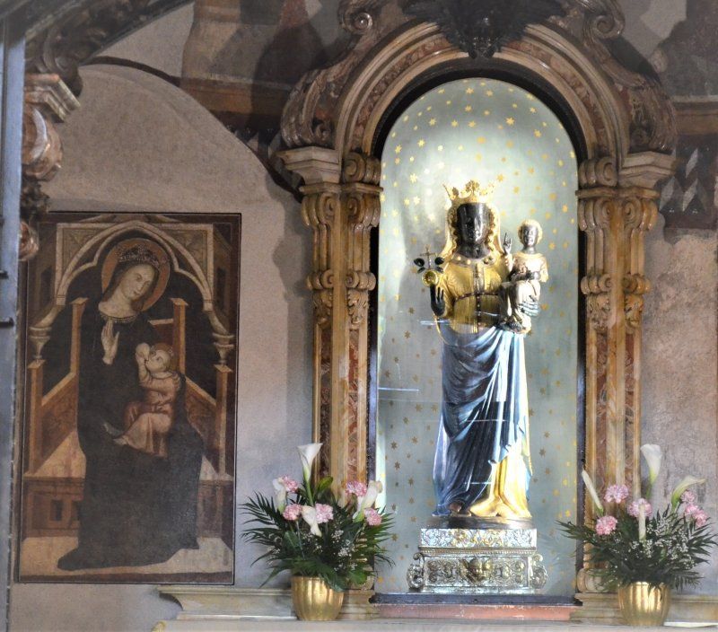
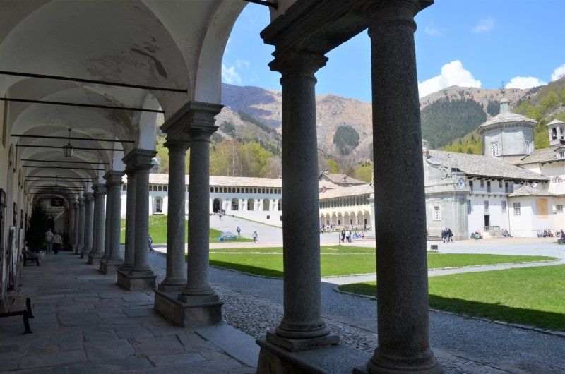
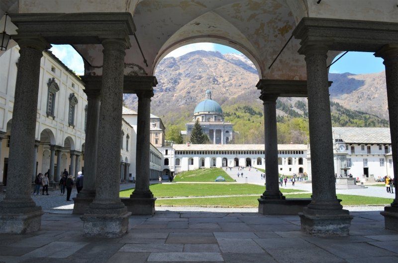
Oropa, Italien
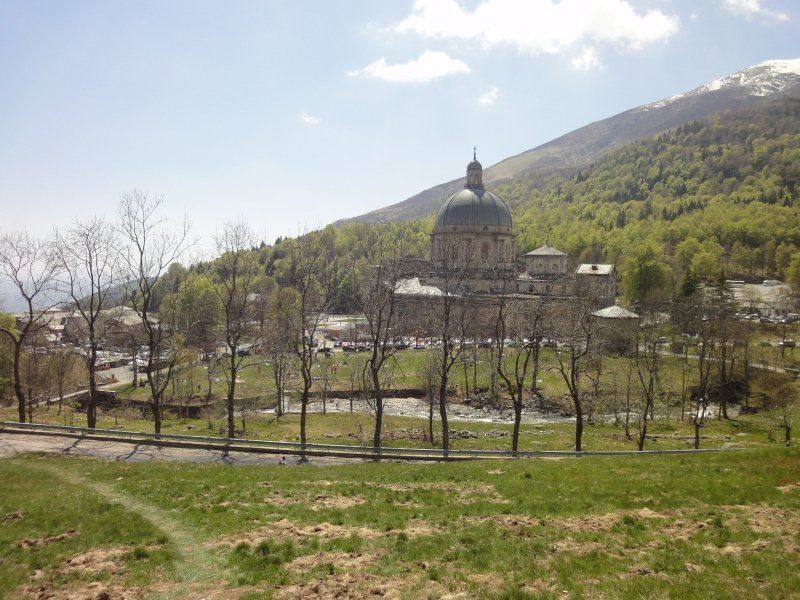
Unser Ziel ist die Wallfahrtsstätte von Oropa, die wichtigste Wallfahrtskirche der Alpen, sie befindet sich in 1200 Metern Höhe und ist eng mit der Verehrung der Schwarzen Madonna verbunden.
Wir fanden Platz auf dem schöngelegenen Stellplatz mit Blick auf die Basilika und den Schneebedeckten Berge.
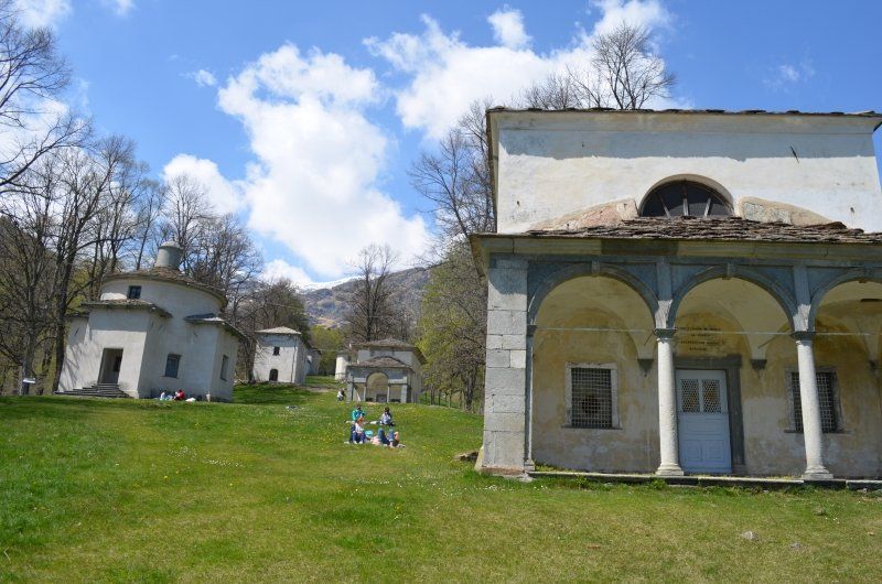
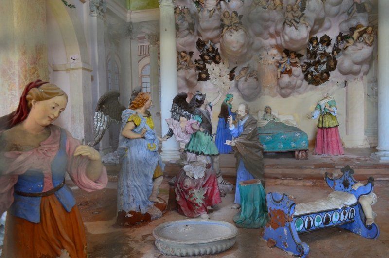
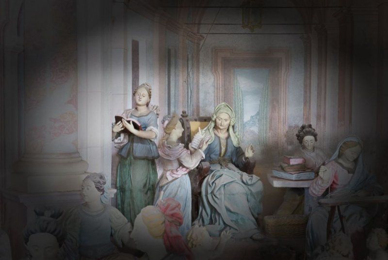
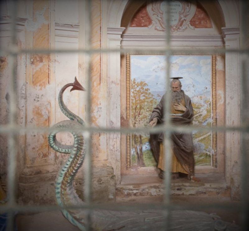
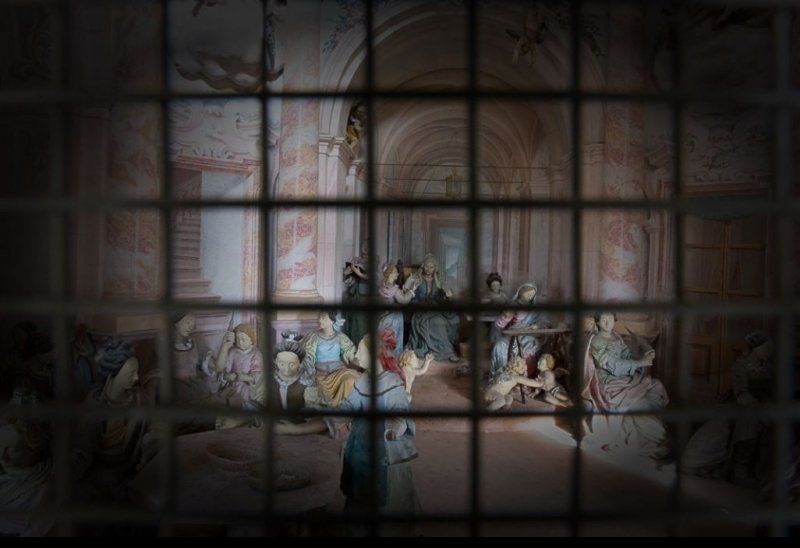
Der Sacro Monte besteht aus zwölf Kapellen, die dem Leben der Jungfrau gewidmet sind. Der ursprüngliche Entwurf umfasste einen Zyklus von zwanzig Kapellen, die eine umfangreiche erzählerische Darstellung von wichtigen Ereignissen aus dem Leben Marias bilden sollten. Beeindruckend ist der gute Zustand der Darstellungen in den Kapellen, geschaffen zwischen 1600 und 1640, sie waren immer verschlossen und können auch heute nur durch Gitter betrachtet werden.
Biella Oropa Basilica Superiore, 13900 Oropa BI, Italien
45° 37' 41.8" N 7° 58' 43.6" E
45.6282789 7.9787773
• Head toward Strada alla Teleferica on Piazza Santo Stefano. Go for 59 m.
• Turn left onto Via Anna Ludovica Brucco. Go for 379 m.
• Continue on Via Santuario di Oropa. Go for 199 m.
• Continue on Strada Provinciale di Oropa (SP144). Go for 9.5 km.
• Continue on Via Filippo Juvarra (SP144). Go for 1.0 km.
• Continue on Strada della Nera. Go for 82 m.
• Continue on Via Eriberto Ramella Germanin. Go for 625 m.
• Take the 2nd exit from roundabout onto Via Eriberto Ramella Germanin. Go for 183 m.
• Take the 3rd exit from Piazza Annibale Battiani roundabout onto Via Carlo Marocchetti. Go for 114 m.
• Turn left onto Via Italia. Go for 328 m.
• Take the 1st exit from roundabout onto Via Giovanni Battista Serralunga. Go for 759 m.
• Take the 3rd exit from roundabout onto Via Milano. Go for 138 m.
• Take the 1st exit from roundabout onto Via Milano. Go for 962 m.
• Take the 3rd exit from roundabout onto Via Milano. Go for 241 m.
• Take the 1st exit from roundabout onto Via Milano. Go for 447 m.
• Take the 1st exit from roundabout onto Corso Lago Maggiore. Go for 624 m.
• Take ramp onto Strada Regionale Biellese e Variante (SR142) toward Gravellona T./A26/Milano/A4/Arona/Cossato/Vigliano B.Se. Go for 8.1 km.
• Take ramp onto SR232 toward Torino Milano/A4/Vercelli/Mottalciata. Go for 3.7 km.
• Take the 3rd exit from roundabout. Go for 1.6 km.
• Continue on Via della Repubblica (SR232). Go for 1.6 km.
• Take the 2nd exit from roundabout onto Via della Repubblica (SR232). Go for 4.2 km.
• Take the 3rd exit from roundabout onto Strada Regionale di Masazza (SR230). Go for 568 m.
• Continue on Strada Statale di Massazza (SS230). Go for 2.2 km.
• Continue toward Strada Provinciale Saluggia-Gattinara/SP3. Go for 32 m.
• Take the 1st exit from roundabout onto Strada Provinciale Saluggia-Gattinara (SP3). Go for 1.0 km.
• Turn left toward Torino/Milano/Alessandria/A26/Gravellona Toce. Go for 50 m.
• Take the 1st exit from roundabout toward Torino/Milano. Go for 54 m.
• Take ramp onto A4 (Autostrada Torino-Trieste) toward Milano. Go for 66.8 km.
• Take the exit toward A8/A9/Aeroporto Malpensa onto A50 (Tangenziale Ovest). Go for 4.4 km.
• Take the exit toward Varese/Gravellona T./A26/Como-Chiasso/A9 onto A8 (Autostrada dei Laghi). Go for 4.9 km.
• Take the exit toward Como/Chiasso onto A9 (Autostrada dei Laghi). Go for 32.0 km.
• Continue on A2. Go for 55.2 km.
• Take exit 45 toward E43/Chur/San Bernardino/Bellinzona Nord onto A13 (Diramazione Bellinzona Nord). Go for 44.7 km.
• Take ramp onto San Bernardino toward San Bernardino. Go for 111 m.
• Turn left onto San Bernardino (13/558). Go for 7.0 km.
• Arrive at Passo del San Bernardino (13/558). Your destination is on the right.
☍
254,0 km
(2 hrs. 57 min.)
Day
Wanderung auf den Sport Oropa
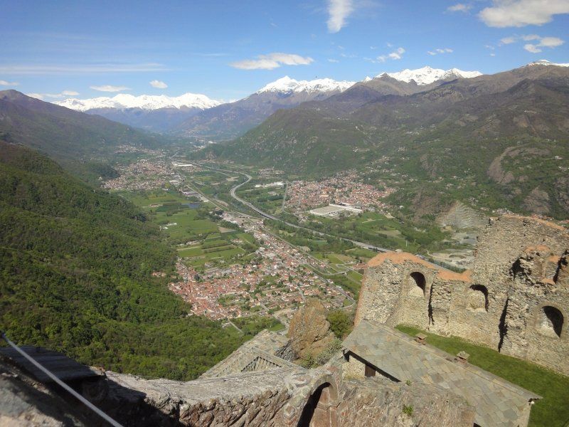
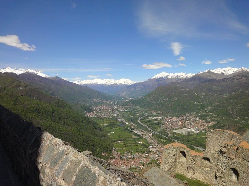
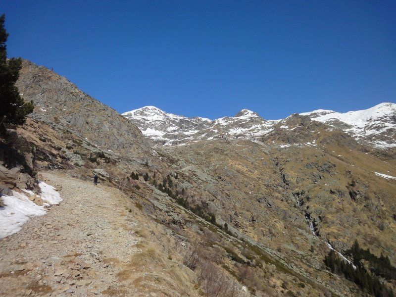
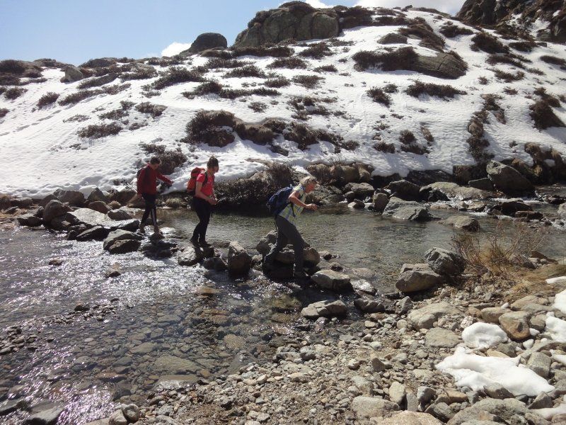
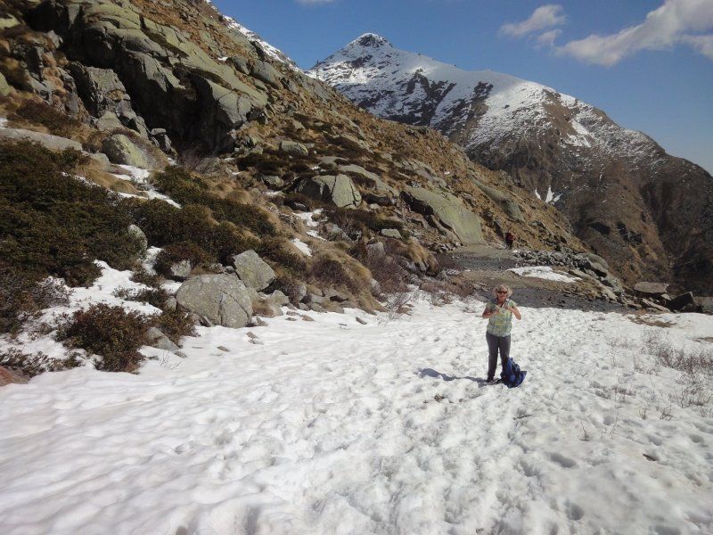
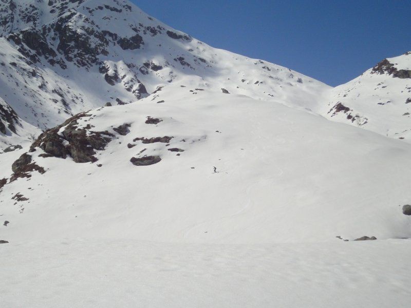
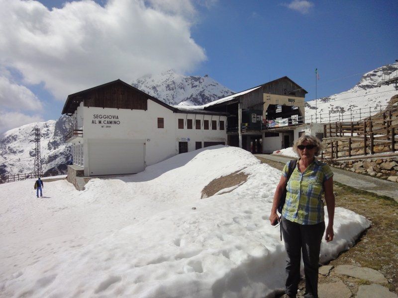
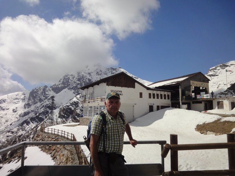
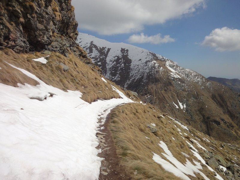
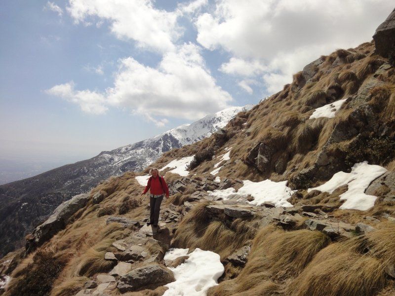
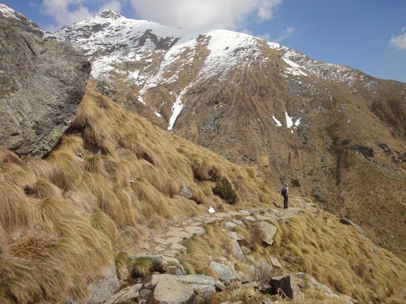
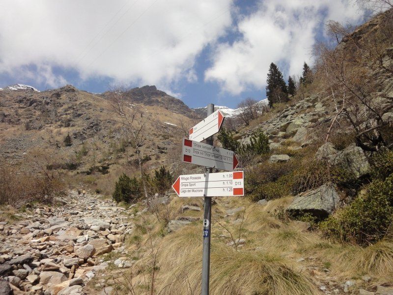
The evening before our arrival it was already clear to us that we would go on a mountain tour the next day. Hikers passed the motorhome early in the morning and we didn't hesitate and after breakfast we also set out into the magnificent mountains. The evening before, we looked around for the hiking opportunities and hiking trails, so we chose the slope path to the Sport Oropa mountain station at 1900 meters. The path is not marked, we saw that several hikers followed this path so we decided to look at them. It was pretty steep and stony and from 1800 meters we had to cross one and the other snow field. We actually wanted to reach the 2000 limit, it was difficult to walk on the closed snowfield without hiking sticks, the risk of slipping was too great. We were amazed that quite a few skiers came down the mountain, they have to be able to ski well to avoid the visible rocks. There was a lot going on when we met the mountain station, large crowds of people who came up with the cable car enjoyed the wonderful mountain world with the magnificent view. For the descent we chose the marked mountain path (2 hours descent). The path was longer than the one on the ascent and you could clearly see the vegetation from the mountain station down to the valley. The mountain path was easy to walk on and also a lot.
When we arrived at the pilgrimage basilica Oropa, we couldn't miss a visit to the 12 chapels and paid a visit to them. We were disappointed that the inside of the chapels could only be seen through a close-meshed grid, the chapels were closed. We were also amazed that there was no properly laid-out footpath connecting the chapels. When I read the brochure with the chapels the night before, I thought it must be something worth seeing. The story of Mary is beautifully presented in the chapels in which you saw something, there were also chapels that were covered with tarpaulin due to renovation work.
After the disappointing Kapellenweg we then handed in the keys we received for the toilet and shower in the reception area of the pilgrimage site and set off on our way home towards San Berhardino, where we stayed again in the large car park.
San-Bernardino-Pass, Mesocco, Schweiz
Overnight on the San Berhardino
San-Bernardino-Pass, 6565 Mesocco, Schweiz
46° 29' 45.2" N 9° 10' 14.8" E
46.4959000 9.1707900
• Head toward San Bernardino Passo on Passo del San Bernardino (13/558). Go for 7.0 km.
• Turn right onto San Bernardino toward Chur/Zürich. Go for 36 m.
• Take ramp onto A13 toward Chur. Go for 92.1 km.
• Take exit 11 toward St. Gallen/St. Margrethen/München/Feldkirch/Vaduz onto A13. Go for 34.1 km.
• Take exit 5 toward Oberriet/Rüthi/Meiningen. Go for 359 m.
• Turn left onto Rheinstrasse (434) toward Oberriet/Rüthi. Go for 828 m.
• Take the 1st exit from roundabout onto Staatsstrasse (13) toward Appenzell/Altstätten. Go for 1.6 km.
• Turn left onto Eichbergstrasse toward Eichberg/Kobelwies/Hub/Hard. Go for 3.0 km.
• Turn right onto Kobelwiesstrasse. Go for 721 m.
• Continue on Eichbergstrasse. Go for 146 m.
• Turn left onto Härdlistrasse. Go for 849 m.
• Continue on Hölzlisbergstrasse. Go for 4.5 km.
• Continue on Eichbergstrasse. Go for 1.8 km.
• Turn right onto Eggerstandenstrasse. Go for 2.8 km.
• Turn right onto Hirschbergstrasse. Go for 340 m.
• Take the 2nd exit from roundabout onto 448. Go for 565 m.
• Pass 2 roundabouts and continue on Entlastungsstrasse (448). Go for 6.0 km.
• Continue on Hargarten. Go for 488 m.
• Continue on Sönderli. Go for 13 m.
• Continue on Gmeinwerk. Go for 172 m.
• Continue on Schooss. Go for 168 m.
• Continue on Sondertal. Go for 806 m.
• Continue on Sonder. Go for 700 m.
• Take the 2nd exit from roundabout onto Sonderau (463). Go for 677 m.
• Arrive at Dorf (463). Your destination is on the right.
☍
159,8 km
(1 hrs. 55 min.)
Day
Hundwil, Schweiz
We use the detour to Hundwil to visit our relatives.
47° 21' 57.1" N 9° 19' 14.6" E
47.3658642 9.3207148
• Head west on Dorf (463). Go for 2.9 km.
• Turn right onto Herisauerstrasse (8). Go for 6.5 km.
• Keep left onto Appenzellerstrasse (8) toward St. Margrethen/St. Gallen/Zentrum/Zürich. Go for 562 m.
• Take left ramp onto A1 toward Zürich. Go for 51.6 km.
• Take exit 70 toward Schaffhausen/Henggart onto A4. Go for 26.4 km.
• Keep left onto A4 toward Stuttgart/Singen/Thayngen. Go for 5.6 km.
• Continue on E41/E54. Go for 990 m.
• Continue on Zollstraße (B34). Go for 2.0 km.
• Take the 2nd exit from roundabout onto A81. Go for 54.6 km.
• Take exit 35 toward Rottweil-Süd/Deißlingen onto B27. Go for 7.5 km.
• Take the 2nd exit from roundabout toward Rottweil-Süd/Stadtmitte/Gewerbegebiet Saline/Süd. Go for 95 m.
• Continue on Tuttlinger Straße. Go for 1.9 km.
• Continue on Königstraße. Go for 619 m.
• Take the 1st exit from roundabout onto Königstraße. Go for 476 m.
• Arrive at Königstraße. Your destination is on the right.
☍
161,8 km
(1 hrs. 43 min.)
Rottweil, Deutschland
48° 9' 54.9" N 8° 37' 42.4" E
48.1652577 8.6284530