During our trip through Normandy and Brittany we experienced picturesque cities, imposing cathedrals and fascinating coastal landscapes. We also visited places from the history of the world wars of the past century.
Day
Rottweil, Deutschland
⛅ 15°C
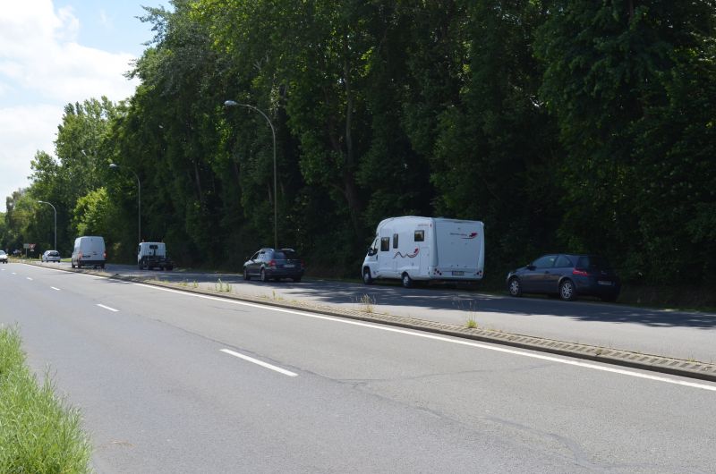
After a late departure, we headed towards France through the Kinzig valley to Kehl. We were lucky, little traffic to Offenburg (1.5 hours). We use the national roads, some of which are well developed and encountered relatively little traffic. You have to put up with the many roundabouts.
48° 9' 54.9" N 8° 37' 42.4" E
48.1652577 8.6284530
• Head toward Wilhelmstraße on Königstraße. Go for 213 m.
• Turn right onto Lorenz-Bock-Straße. Go for 240 m.
• Turn right onto Kaiserstraße. Go for 180 m.
• Turn left onto Marxstraße (L423). Go for 707 m.
• Take the 2nd exit from roundabout onto Schramberger Straße (K5540). Go for 762 m.
• Take ramp onto B14. Go for 1.3 km.
• Keep left onto B462 toward Schramberg/Dunningen/A81/Gewerbegebiet Zimmern o.R. Go for 22.2 km.
• Turn slightly right onto Bahnhofstraße (B462) toward Offenburg/Freudenstadt/Schiltach. Go for 8.0 km.
• Continue on B294 toward Offenburg/Wolfach/Schiltach-West. Go for 14.1 km.
• Turn right and take ramp toward A5/Freiburg/B33/Offenburg/Haslach/Gewerbegebiet Hausach-West/Gewerbegebiet Hechtsberg. Go for 228 m.
• Continue on B33/B294. Go for 7.9 km.
• Continue on Schwarzwaldstraße (B33) toward A5/Offenburg/Gewerbegebiet Schleifmatt. Go for 1.8 km.
• Turn left onto B33 toward Karlsruhe-Basel/Offenburg. Go for 23.0 km.
• Take ramp onto B3/B33 toward A5/Strasbourg/Offenburg. Go for 2.3 km.
• Take ramp onto B3 toward A5/Straßburg. Go for 375 m.
• Keep left onto B33A toward Karlsruhe-Basel/Straßburg/Kehl. Go for 2.1 km.
• Keep right onto L98 toward Strasbourg/Flughafen/Kehl/Neuried/Schutterwald. Go for 6.1 km.
• Pass 2 roundabouts and continue on L98. Go for 4.6 km.
• Continue on Pont Pierre Pflimlin (M353). Go for 5.3 km.
• Take ramp toward M83/St Dié Par Col/Strasbourg/Aéroport Entzheim. Go for 928 m.
• Continue on M83. Go for 1.8 km.
• Take ramp onto A35 toward Strasbourg. Go for 9.4 km.
• Continue on A4 (Autoroute de l'Est) toward Nancy/Metz/Paris/Haguenau/Karlsruhe/Bischheim/Schiltigheim. Go for 338 km.
• Take the exit toward E46/Charleroi/Charleville-M./Reims-Centre/Cormontreuil onto A34 (Autoroute de l'Est). Go for 3.3 km.
• Continue on A344 (Voie Jean Taittinger). Go for 2.8 km.
• Take exit 24 toward Reims-Cathédrale. Go for 298 m.
• Continue on Pont de Venise (N31). Go for 106 m.
• Keep left onto Avenue Paul Marchandeau (N31). Go for 70 m.
• Continue on Place Bruno Bonhuil. Go for 281 m.
• Take the 1st exit from Rond-Point de l'Ordre National du Mérite roundabout onto Rue de Courlancy. Go for 655 m.
• Turn right onto Avenue du Général de Gaulle. Go for 416 m.
• Turn right onto Chaussée Bocquaine (N31). Go for 57 m.
• Arrive at Chaussée Bocquaine (N31). Your destination is on the left.
☍
459,7 km
(4 hrs. 35 min.)
Reims
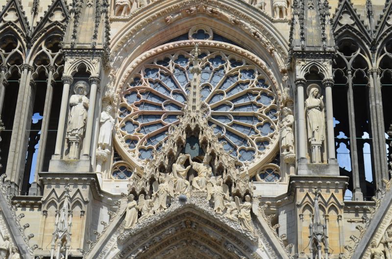
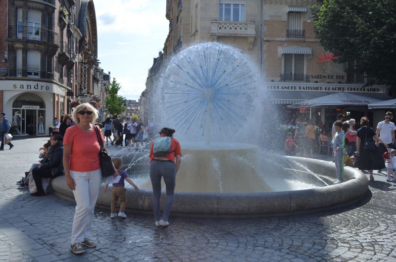
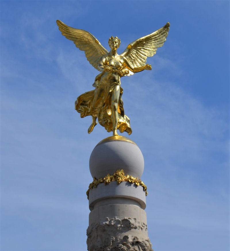
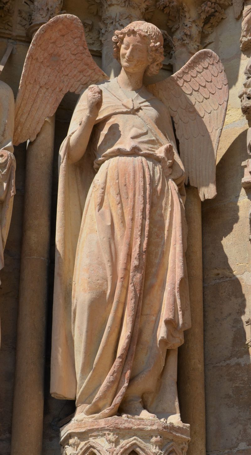
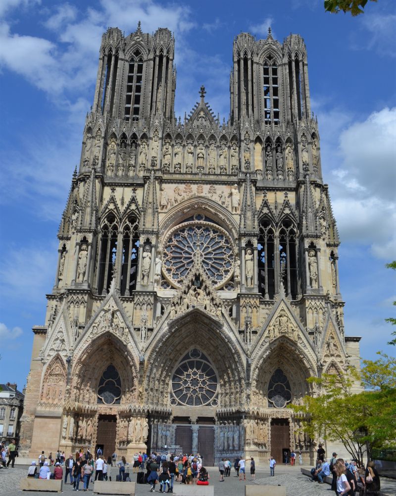
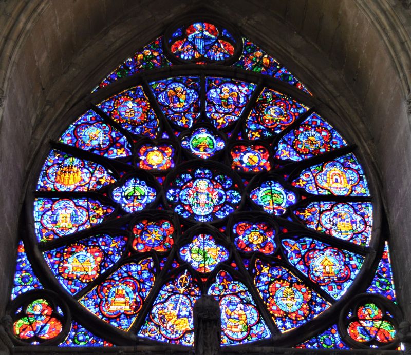
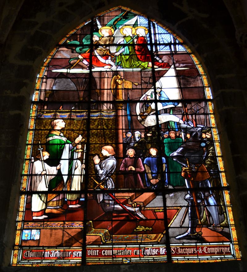
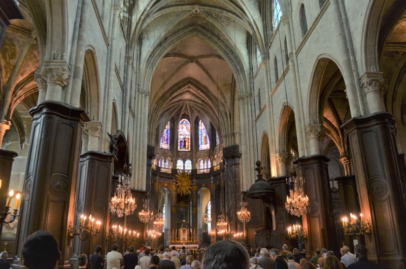
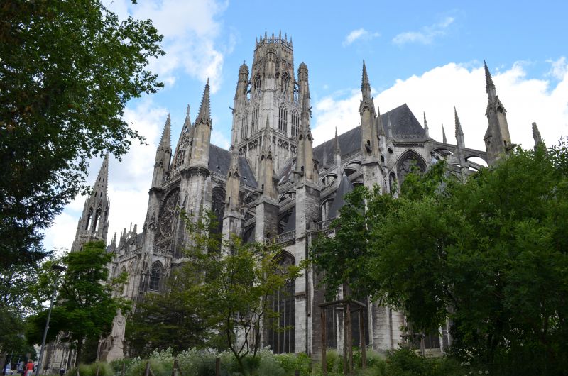
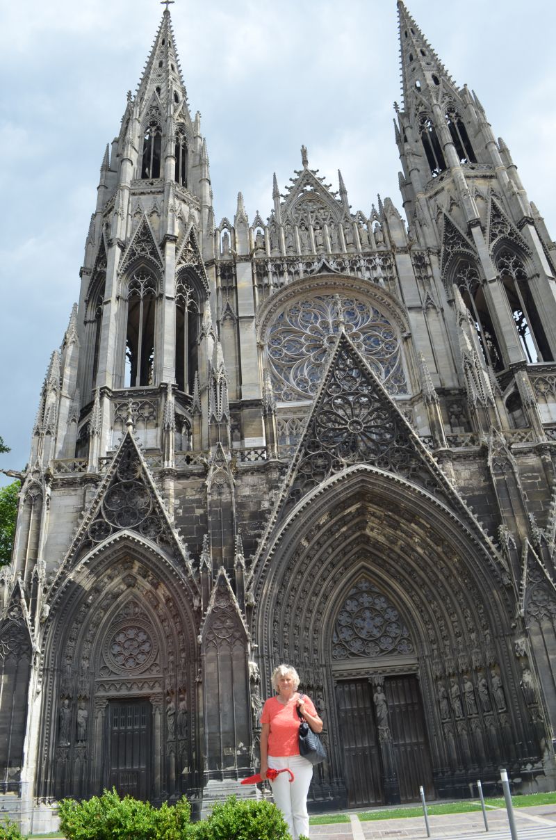
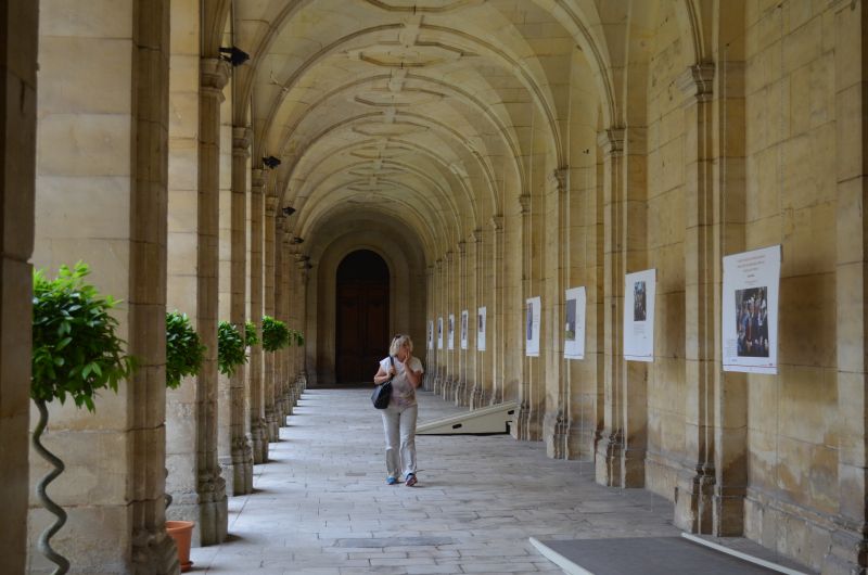
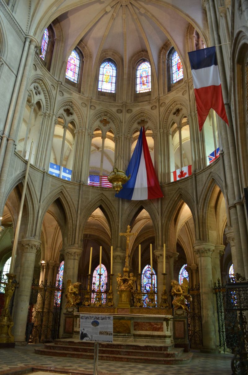
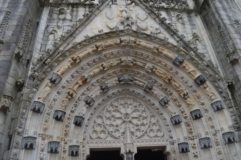
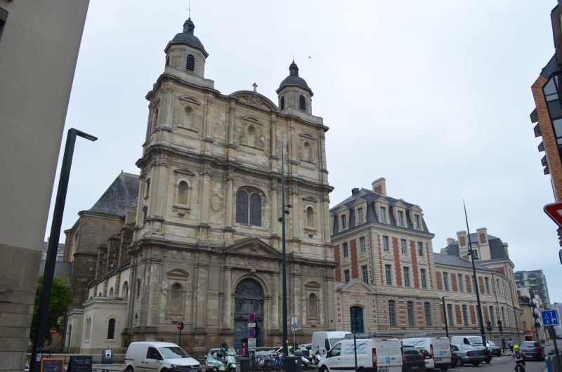
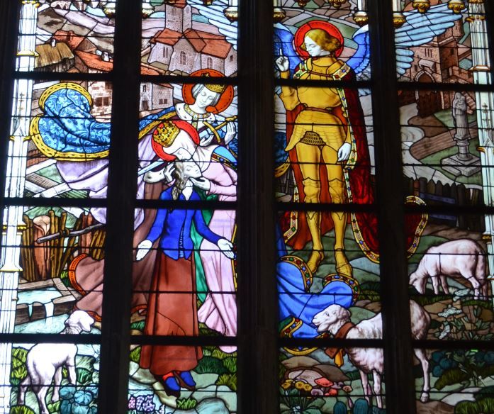
In the early afternoon we reached Reims in the Champagne region for an overnight stay. In Reims we found the selected pitch right away. Unfortunately, it was occupied and we were assigned a nice free parking space by the stadium from the tourist information. (GPS: 49.23533333,4.02815) It was not an official parking space, when we arrived there were already several mobile homes on the site. Immediately afterwards we went on a city walk with a visit to the cathedral and the center. The cathedral, a High Gothic masterpiece, a UNESCO World Heritage Site since 1991, where 29 French kings were crowned. And with the greeting of the smiling angel we said goodbye into the night. After returning we had something to eat and went to bed after a hard day.
The night was quite noisy due to the proximity of the passing freeway. After breakfast we continued to Rouen.
Chaussee Bocquaine , 51100, Reims, Frankreich
49° 14' 53" N 4° 1' 20" E
49.2480556 4.0222222
• Head northwest on Chaussée Bocquaine (N31). Go for 57 m.
• Turn slightly right onto Chaussée Bocquaine (N31). Go for 251 m.
• Turn sharp left onto Rue du Colonel Fabien (N31). Go for 1.5 km.
• Pass 4 roundabouts and continue on N31. Go for 3.9 km.
• Take the 3rd exit from roundabout onto N31 toward Soissons/Fismes/Muizon. Go for 5.2 km.
• Take the 2nd exit from roundabout onto N31. Go for 9.5 km.
• Continue on N31. Go for 4.7 km.
• Pass 2 roundabouts and continue on Allée des Missions (N31). Go for 2.7 km.
• Continue toward Soissons/Rouen/Mt Notre-Dame/Braine/Anizy-Pinon. Go for 32 m.
• Pass 4 roundabouts and continue on Route de Reims (N31). Go for 26.1 km.
• Turn right onto Rue des Moines (E46) toward Compiègne/Paris/Château-Th/Rouen/Villeneuve St G./Soissons-Presles. Go for 166 m.
• Turn right and take ramp onto N2. Go for 4.5 km.
• Take the 2nd exit from Carrefour de l'Archer roundabout onto N31 toward Compiègne/Rouen/Mercin et Vaux. Go for 2.9 km.
• Take the 3rd exit from roundabout onto Avenue de Compiègne (N31) toward Compiègne. Go for 21.2 km.
• Pass 2 roundabouts. Go for 10.9 km.
• Continue on Avenue de l'Armistice. Go for 58 m.
• Continue on Carrefour Bellicart. Go for 49 m.
• Continue on Avenue de l'Armistice. Go for 920 m.
• Continue on Rue de Soissons. Go for 577 m.
• Continue on Cours Guynemer. Go for 414 m.
• Turn left onto Rue Othenin. Go for 290 m.
• Turn right onto Rue d'Ulm. Go for 78 m.
• Turn left onto Place du Général de Gaulle. Go for 164 m.
• Continue on Avenue Royale. Go for 30 m.
• Turn slightly right onto Boulevard Victor Hugo. Go for 60 m.
• Turn right onto Boulevard Victor Hugo. Go for 44 m.
• Arrive at Boulevard Victor Hugo. Your destination is on the left.
☍
96,3 km
(1 hrs. 23 min.)
Day
Durch die Champagne nach Rouen 15 °C
We took the state roads which, on a somewhat longer journey, give a better impression of the landscape. Already on the route you can see the first signs, military cemeteries that remind of the great battle.
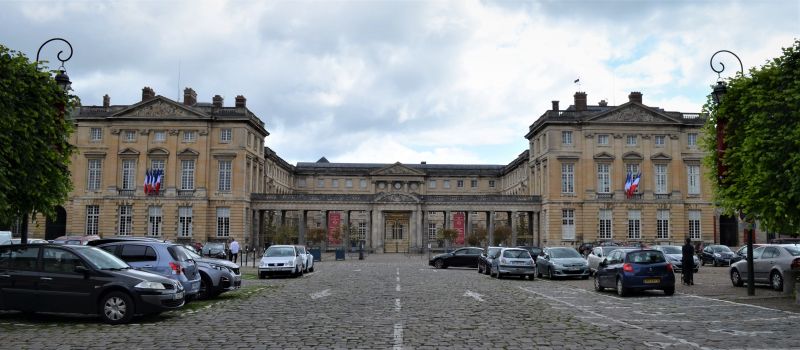
Compiègne 17 °C
Before Rouen we made a sightseeing stop in the town of Compiègne. Difficulty entering a parking lot, height restrictions or narrow driveways.
Parking :(49.41641667,2.83101667)
Former royal residence, the Castle of Compiègne, built in the 18th century. Built in the 19th century, it houses imperial and royal residences, but also a car and tourism museum and the Second Empire Museum.
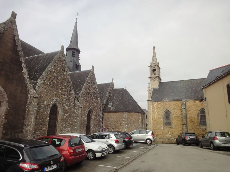
With a visit to the Jakobskirche we were able to celebrate the end of the Sunday service.
The Saint-Jacques church was originally one of the town's two parish churches. The 12th-century building has many references to its namesake, the Apostle James, and to the pilgrimage tradition of the Way of St. James to Santiago de Compostela in its decorative figures. The 15th-century bell tower was raised in the 17th century, and the statues of 14 saints were placed in its upper part. Its role as a royal church in the immediate vicinity of the castle caused extensive reconstruction in the 18th century and lavish furnishings. Since 1998, the church has been recognized as part of the UNESCO World Heritage Site "Way of St. James in France".
The town hall, finished Gothic style, is surmounted by a watchtower containing one of the oldest municipal bells of France.
4 Impasse d'Alger, 60200 Compiègne, Frankreich
49° 25' 0.1" N 2° 49' 50.9" E
49.4166810 2.8308132
• Head toward Rue de la Sous-Préfecture on Boulevard Victor Hugo. Go for 105 m.
• Turn right onto Rue de la Sous-Préfecture. Go for 256 m.
• Continue on Rue Pierre Sauvage. Go for 198 m.
• Turn left onto Rue Sainte-Marie. Go for 102 m.
• Turn right onto Rue Solférino. Go for 195 m.
• Continue on Pont Solférino. Go for 102 m.
• Turn left onto Place du 54ème Rég. d'Infanterie. Go for 210 m.
• Pass 4 roundabouts and continue on Rue du Maréchal Leclerc (D932). Go for 3.9 km.
• Take the 2nd exit from roundabout toward Beauvais. Go for 221 m.
• Take the 1st exit from roundabout onto N31 toward A1/Beauvais/Estrées St. D./Clermont/Arsy. Go for 3.0 km.
• Pass 4 roundabouts and continue on N31. Go for 16.9 km.
• Take the 1st exit from roundabout onto N31 toward Beauvais/Clermont. Go for 514 m.
• Take the 1st exit from roundabout onto N31 toward Beauvais/Clermont. Go for 31.5 km.
• Take the 3rd exit from roundabout onto D901 toward Amiens/Eu/Le Tréport/Beauvais-Centre/St Just en Ch. Go for 9.4 km.
• Take ramp toward Formerie/Songeons/Milly S/Th./Herchies. Go for 286 m.
• Take the 2nd exit from roundabout toward Formerie/Songeons/Milly S/Th./Herchies. Go for 340 m.
• Take the 2nd exit from roundabout toward D133/Formerie/Songeons/Milly S/Th./Herchies. Go for 745 m.
• Take the 1st exit from roundabout onto D133. Go for 8.1 km.
• Turn left onto Rue du Maréchal de Boufflers (D133). Go for 4.8 km.
• Turn left onto D930. Go for 12.3 km.
• Take the 2nd exit from roundabout onto D930. Go for 504 m.
• Take the 3rd exit from roundabout onto Avenue de l'Europe (D930). Go for 348 m.
• Turn right onto Boulevard de Verdun (N31). Go for 2.1 km.
• Turn left onto Route de Rouen (N31) toward Rouen/La Feuillie. Go for 4.0 km.
• Continue on Route de Rouen (N31). Go for 10.3 km.
• Pass 6 roundabouts and continue on Route de Gournay (N31). Go for 31.4 km.
• Take ramp onto Rocade Nord-Est (N28) toward E46/Rouen-Centre. Go for 905 m.
• Take ramp onto Boulevard Gambetta toward D928/Bois-Guillaume/Mont St Aignan/C.H.U. Ch. Nicolle. Go for 433 m.
• Take the 2nd exit from roundabout onto Place Saint-Hilaire. Go for 60 m.
• Continue on Boulevard de Verdun. Go for 81 m.
• Turn right onto Rue des Sapins. Go for 26 m.
• Turn slightly left onto Rampe Saint-Hilaire. Go for 474 m.
• Turn right onto Place Gustave Robert. Go for 86 m.
• Continue on Avenue Georges Metayer. Go for 259 m.
• Arrive at Avenue Georges Metayer. Your destination is on the right.
☍
144,1 km
(1 hrs. 56 min.)
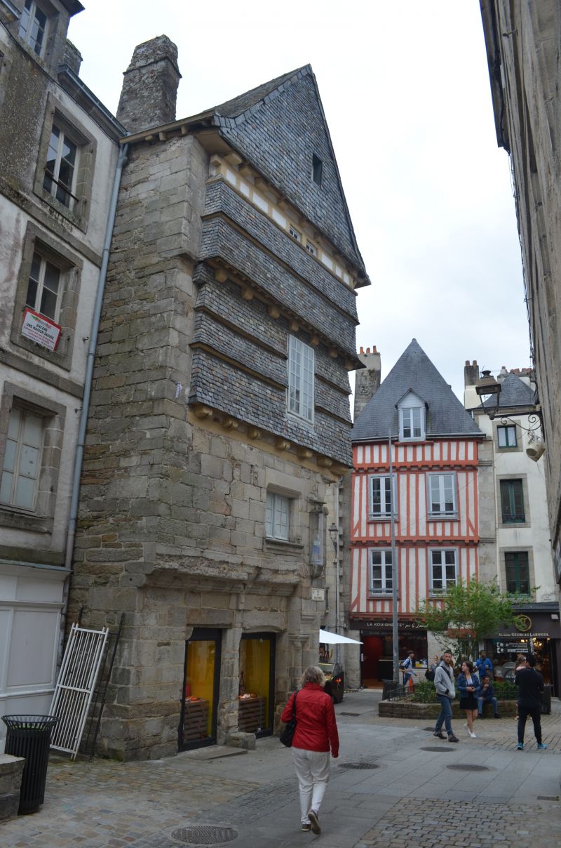
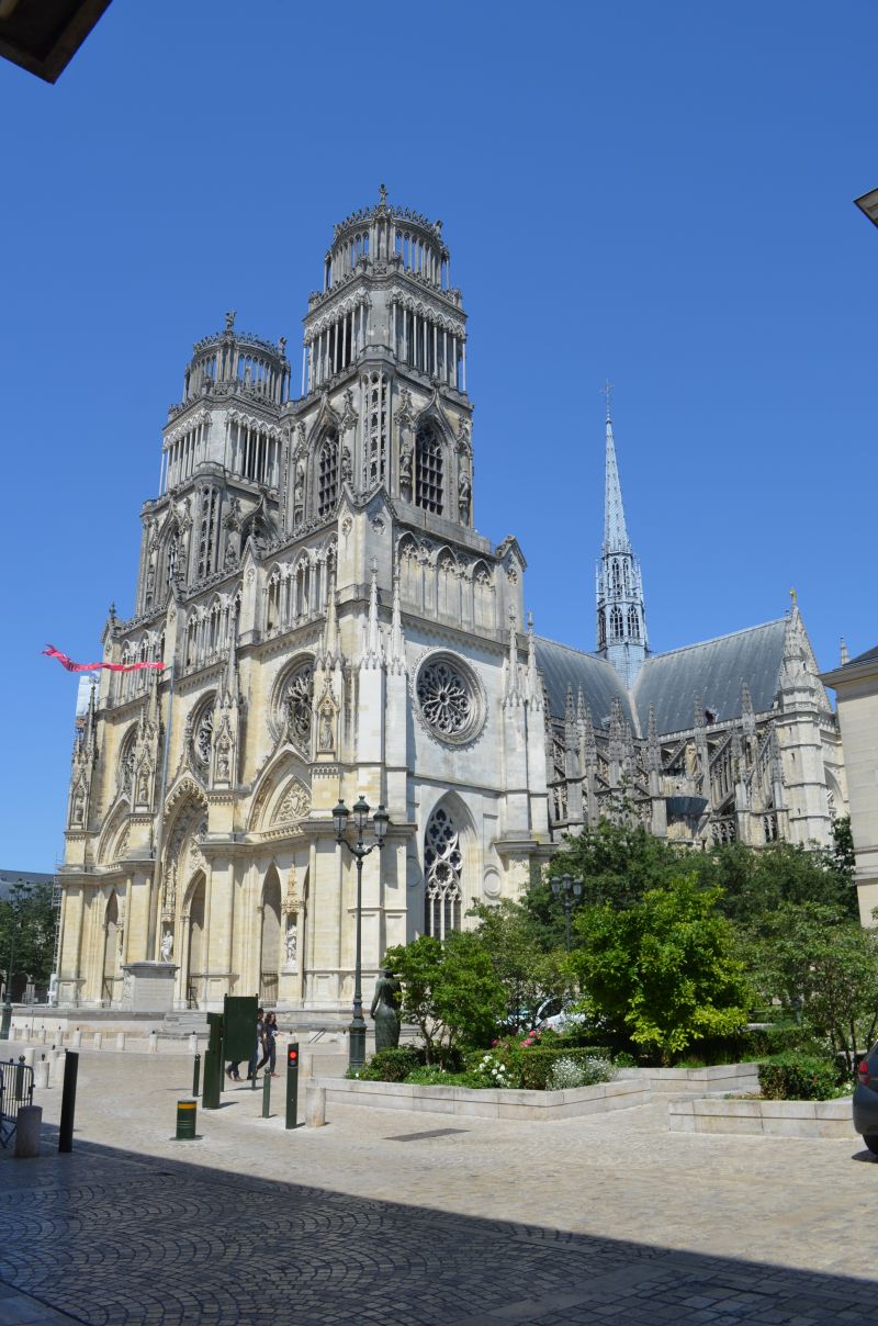
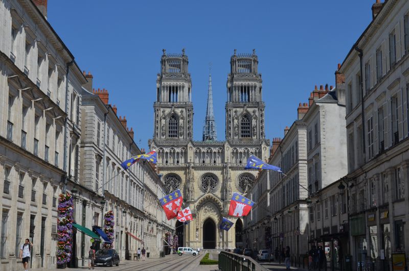
Rouen
⛅ 15°C
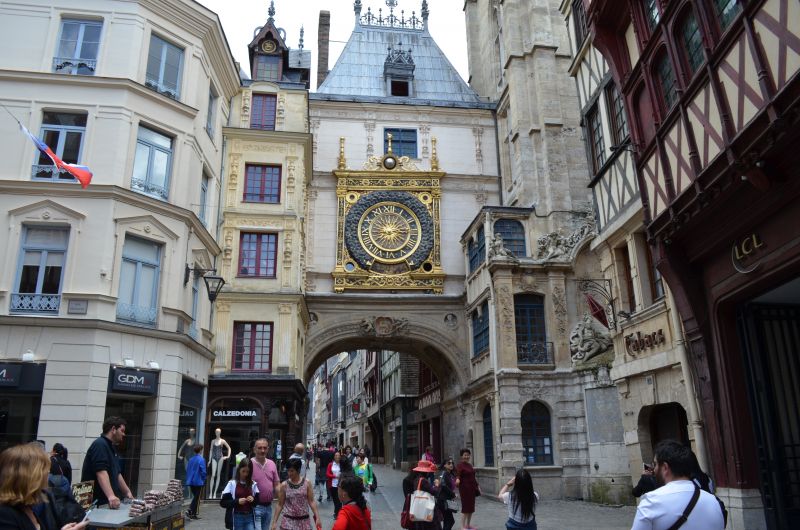
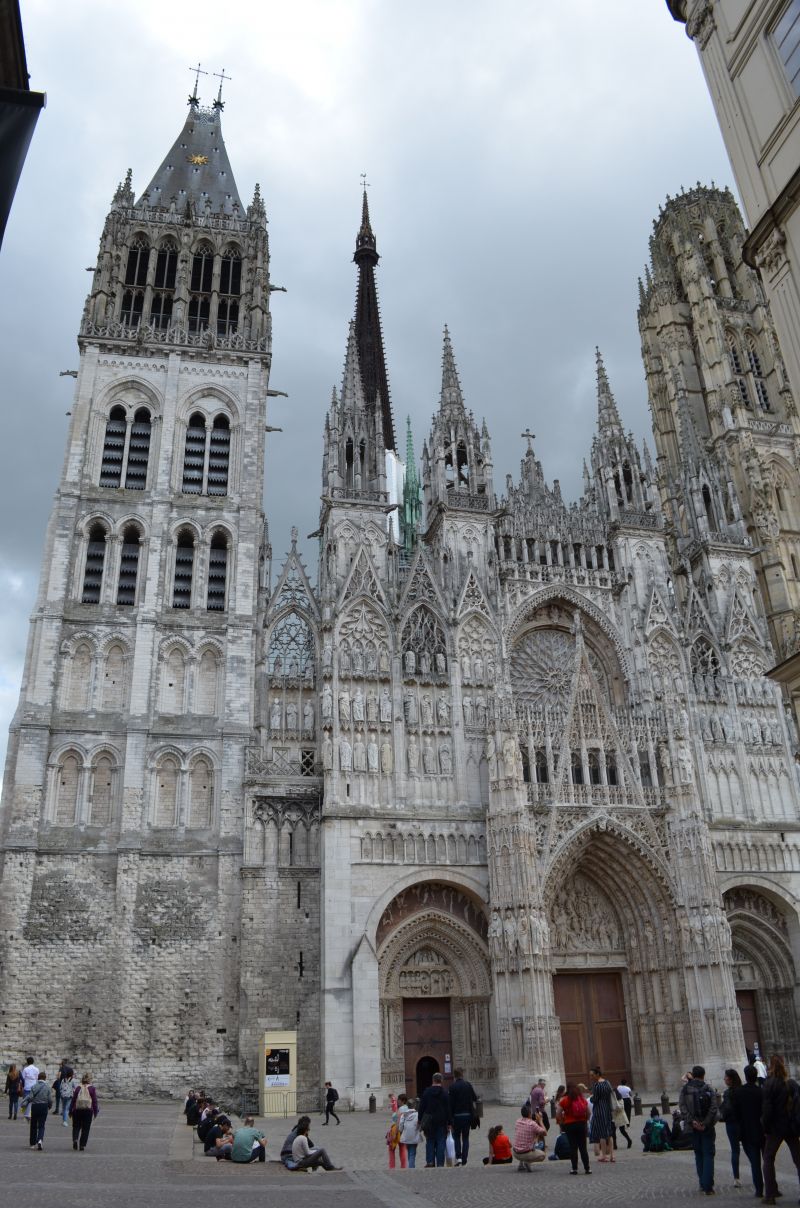
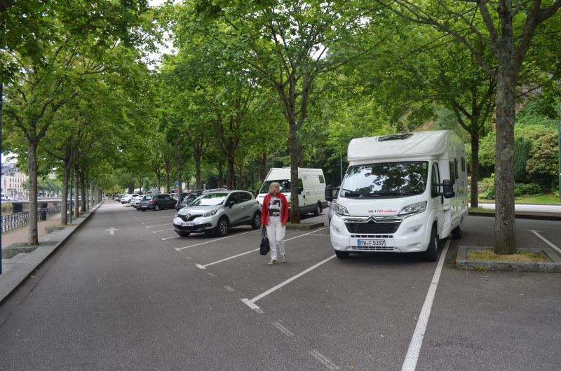
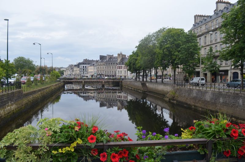
Finding a parking space in the city center is hopeless. By chance we saw a coach parked in a gravel parking lot on Avenue Georges Metayer (GPS:49.44953333,1.11435) and we stood next to it. (free) center about 30 minutes walk away. The old town of Rouen, the old Norman residence and today's capital of the Normandy region. Downtown Rouen is an open-air museum. Sights such as Notre-Dame Cathedral, Saint-Ouen Abbey, the Gros-Horloge and the Historial Joan of Arc.
> Notre Dame Cathedral: Its facade spans all Gothic styles. Another special feature are the surrounding buildings: they were built at the same time as the cathedral and have been preserved.
The Clock Tower (Gros Horloge): This popular attraction right in the city center invites you to travel back in time by visiting its inner workings.
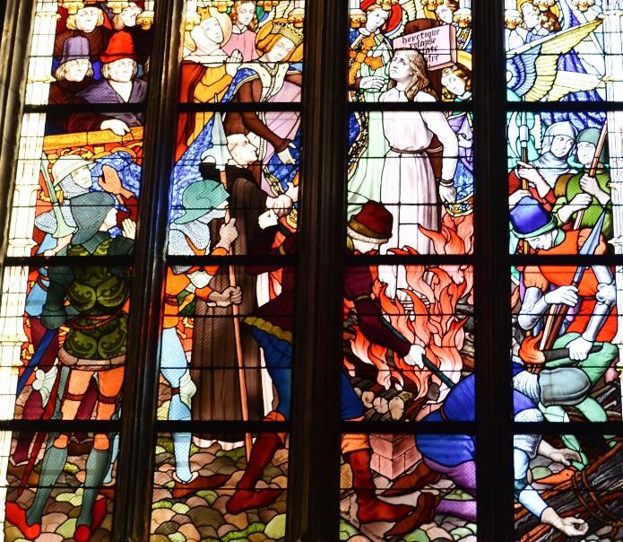
Saint Joan of Arc Church: Completed in 1979, this church with its clean lines and 16th-century windows was built on the Old Market on the site where Saint Joan of Arc was burned.
Avenue Georges Métayer, 76000 Rouen, Frankreich
49° 26' 53.3" N 1° 6' 43.5" E
49.4481494 1.1120865
• Head toward Rue du Réservoir on Avenue Georges Metayer. Go for 259 m.
• Continue on Place Gustave Robert. Go for 86 m.
• Continue on Rampe Saint-Hilaire. Go for 136 m.
• Turn right onto Boulevard de l'Yser. Go for 595 m.
• Turn left onto Boulevard de l'Yser (D938). Go for 1.6 km.
• Turn right onto Quai Gaston Boulet (D6015) toward A150/Le Havre/Dieppe. Go for 245 m.
• Keep left onto Quai Gaston Boulet (D6015). Go for 1.5 km.
• Keep left toward Canteleu-Nord/Maromme/Dieppe/Le Havre. Go for 312 m.
• Continue on A150. Go for 31.7 km.
• Continue on A29. Go for 25.9 km.
• Take exit 7 toward Bolbec/Lillebonne/Étretat/Pont de Tancarville. Go for 1.2 km.
• Take the 4th exit from roundabout onto D910 toward Fécamp/Beuzeville la Grenier/Goderville/Étretat. Go for 3.2 km.
• Take the 2nd exit from roundabout onto Route de Goderville (D910). Go for 5.4 km.
• Take the 3rd exit from roundabout onto D910. Go for 1.2 km.
• Take the 2nd exit from roundabout onto D910. Go for 850 m.
• Take the 2nd exit from roundabout onto D925 toward Fécamp/Épreville/St Léonard/Étretat. Go for 1.0 km.
• Take the 4th exit from roundabout onto D139 toward Étretat/Criquetot l'Esneval/Écrainville. Go for 6.6 km.
• Turn right onto Rue de la Victoire (D39). Go for 2.2 km.
• Take the 2nd exit from roundabout onto Route d'Étretat (D39). Go for 5.9 km.
• Arrive at Rue Guy de Maupassant (D39).
☍
89,9 km
(1 hrs. 3 min.)
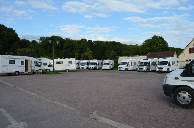
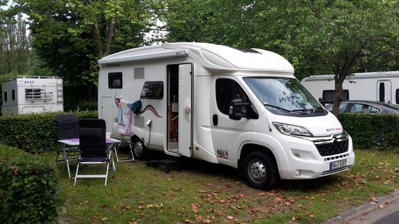
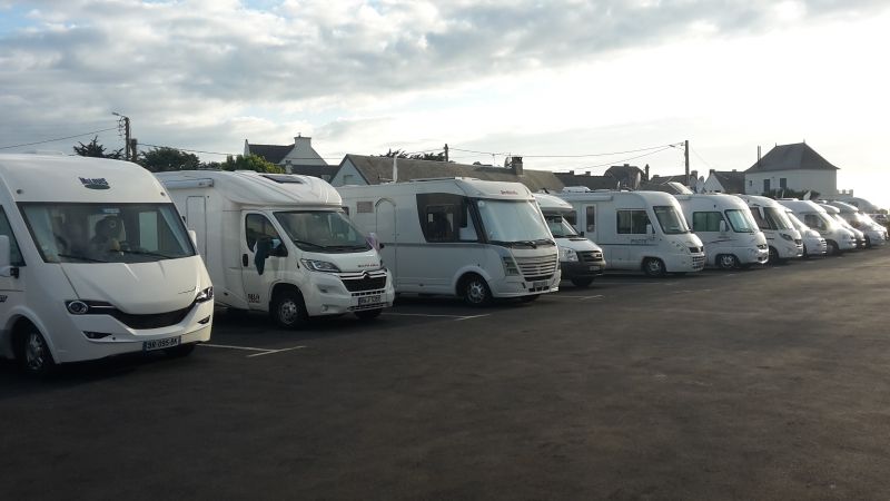
Aire de Camping-cars (Stellplatz)
⛅ 16 °C
The RV park (GPS:49.69868333,0.18406667) is right next to the Camping Municipal. The parking space was well occupied when we arrived, we found a place to stand next to the disposal station. Because of the narrow access to the disposal, for larger motorhomes we changed the next morning to another space that had become free.
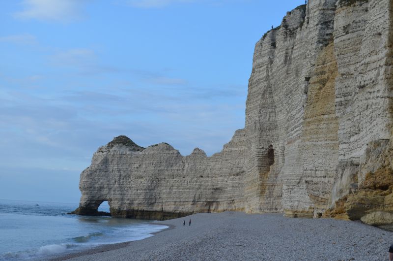
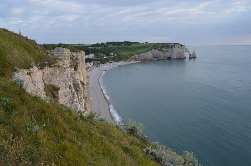
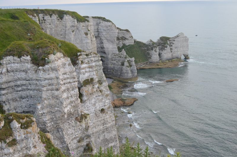
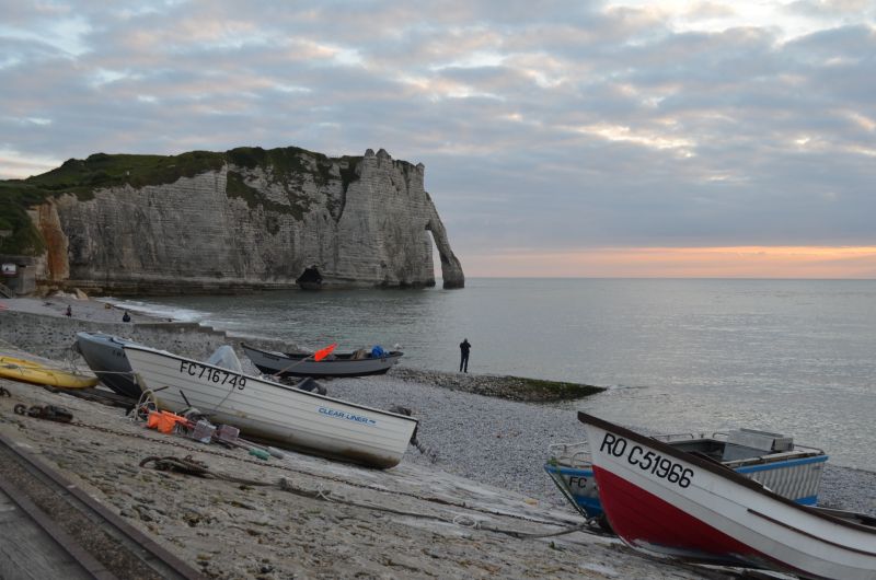
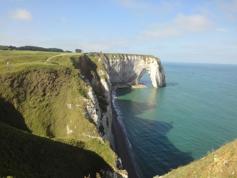
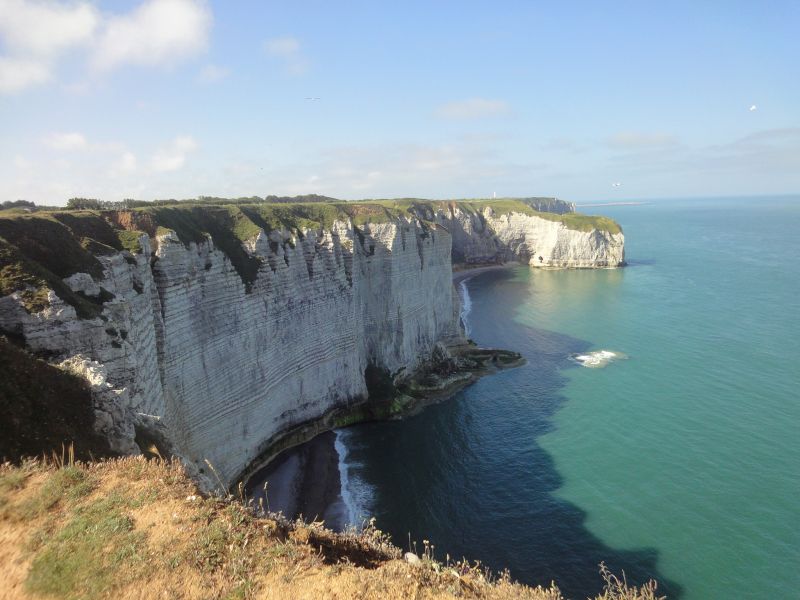
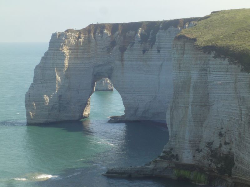
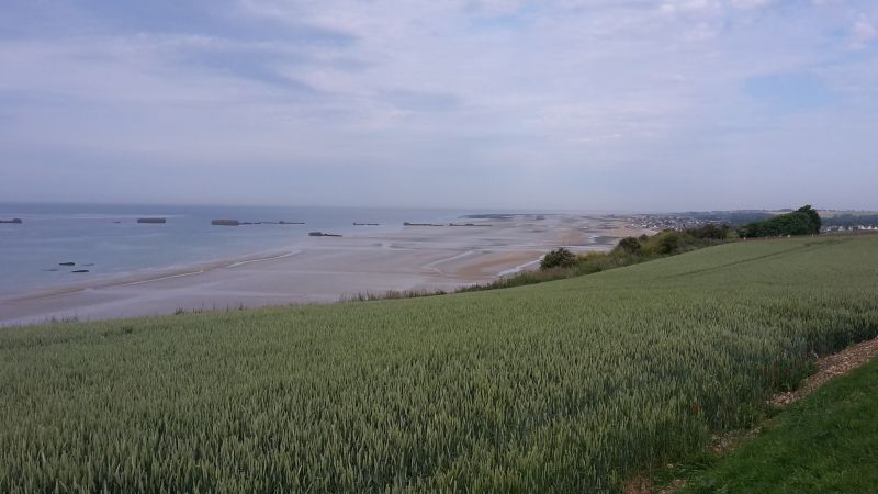
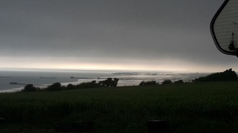
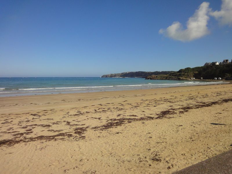
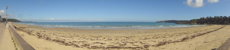
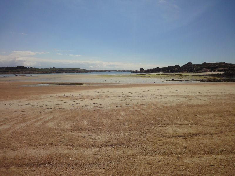
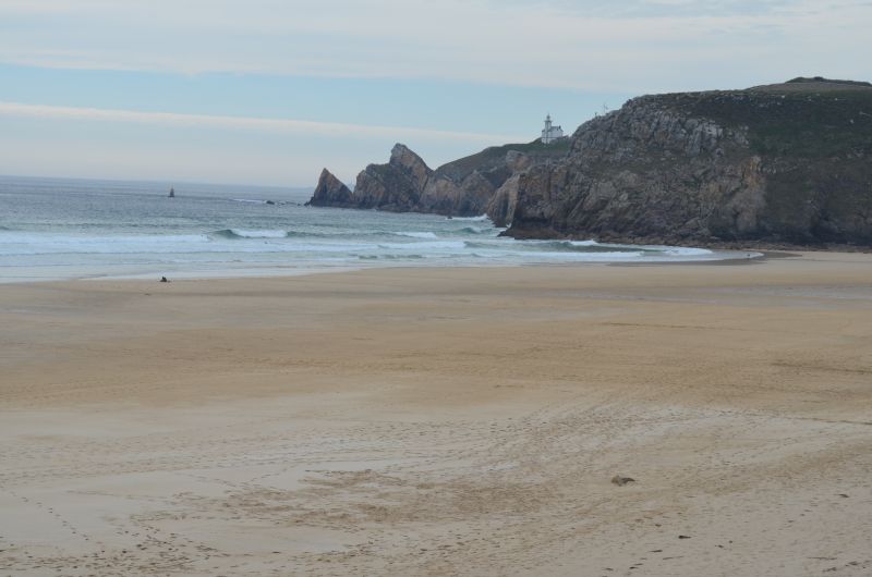
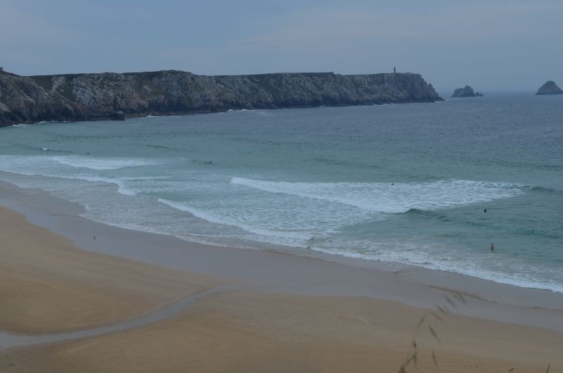
With sunny weather and pleasant temperatures, we experienced the scenic highlight of Normandy - the rock needles in Etretat. These chalk cliffs come from a sea of the Cretaceous period, on the bottom of which calcareous sediments collected. The cliffs of the Falaise d'Aval rise to the left of the beach and the Falaise d'Amont to the right. Huge rock arches open in the limestone and the sun shining in from the west produces brilliantly pale rock and (actually) emerald green waters of the English Channel. The ascent to the coast was rewarded for our efforts and we were able to take some beautiful vacation pictures. The next morning we undertook a small coastal hike on the cliffs of Calauer d'Aval, which always showed new perspectives. Irmgard took advantage of a short dip in the sea on the beach at Etretat.
The town itself with its half-timbered buildings is also worth seeing.
Rue Guy de Maupassant, 76790, Étretat, Frankreich
49° 42' 5" N 0° 12' 51" E
49.7013889 0.2141667
• Head toward Rue des Floralies on Rue Guy de Maupassant (D39). Go for 5.9 km.
• Take the 2nd exit from roundabout onto Chemin de Grande (D39). Go for 2.3 km.
• Turn right onto Route de Vergetot (D39). Go for 257 m.
• Continue on Place de Europe (D39). Go for 3.9 km.
• Turn right onto D925. Go for 2.6 km.
• Take the 2nd exit from roundabout onto Route du Havre (D925) toward Le Havre/Épouville/Montivilliers. Go for 2.7 km.
• Take the 3rd exit from roundabout onto D489 toward Le Havre/Harfleur/Montivilliers. Go for 9.3 km.
• Continue on D6382. Go for 775 m.
• Take ramp onto D6015. Go for 977 m.
• Keep left toward A131/A29/Pont de Normandie/Port 1000-3000/Port 4000-6000. Go for 210 m.
• Continue on Boulevard Jules Durand. Go for 214 m.
• Keep left toward D6382/A131-A29/Pont de Normandie. Go for 1.2 km.
• Take ramp onto N282. Go for 1.1 km.
• Continue on A131. Go for 1.2 km.
• Take the exit toward Caen/Port du Havre/Pont de Normandie onto A29. Go for 3.4 km.
• Continue on N1029. Go for 2.7 km.
• Take ramp. Go for 305 m.
• Take the 1st exit from roundabout toward Amiens/Calais/Le Havre/Port 4000-6000. Go for 88 m.
• Continue on Route de l'Estuaire. Go for 114 m.
• Take the 1st exit from roundabout onto N1029 toward Le Havre/Amiens/Calais. Go for 2.4 km.
• Arrive at N1029.
☍
41,7 km
( 32 min.)
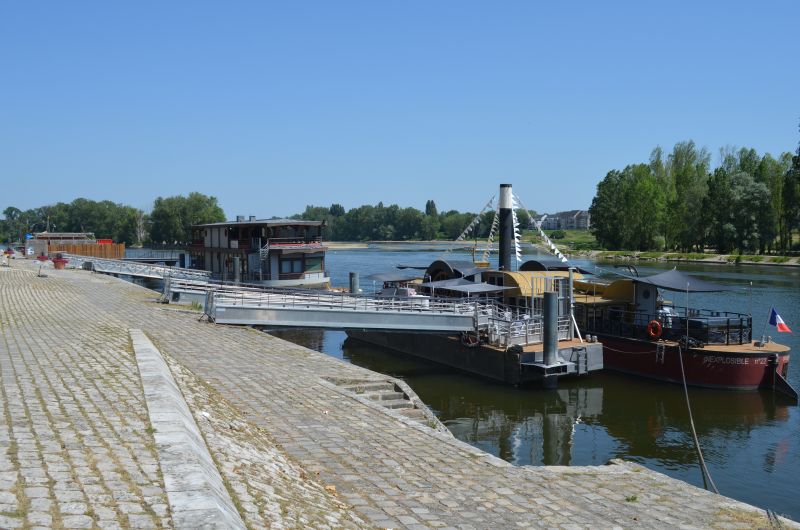
A29 - Sandouville,
Pont de Normandie
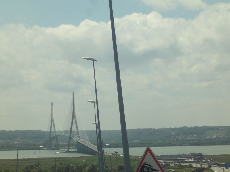
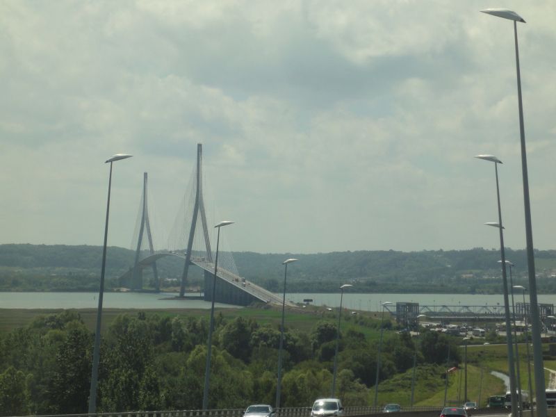
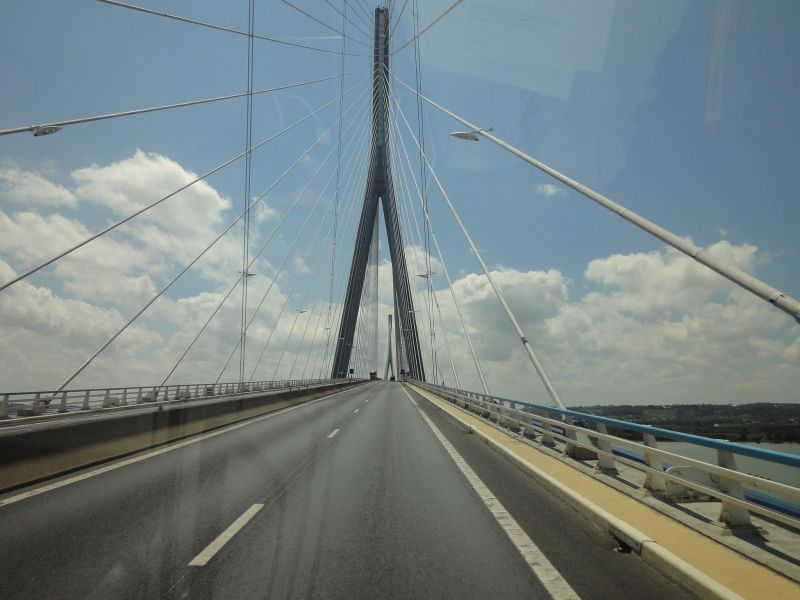
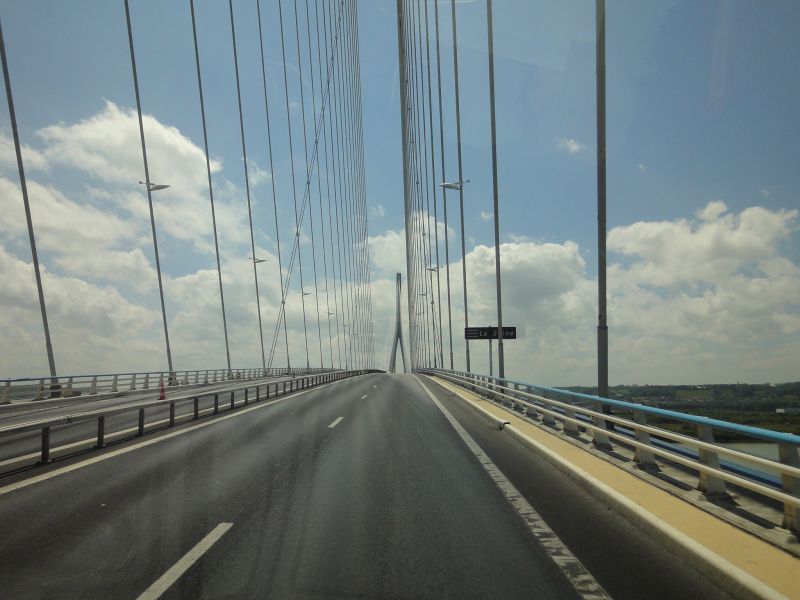
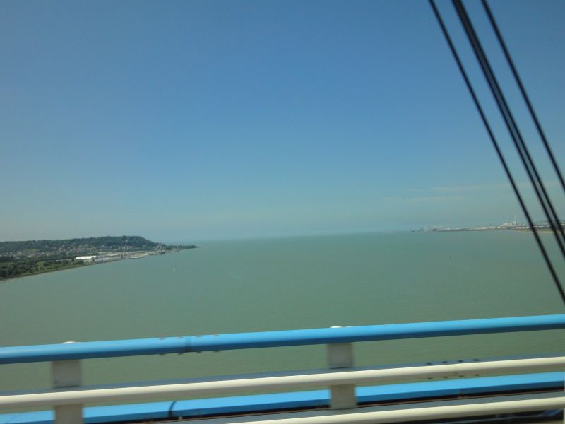
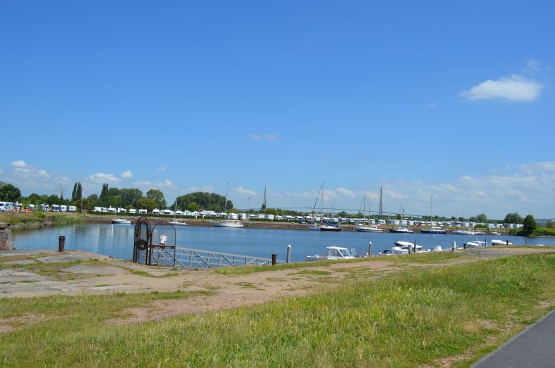
Just south of Le Havre we come to a significant point on the Channel coast: the Seine estuary. The estuary divides Normandy into Upper Normandy and Lower Normandy (Upper... and Lower...). A very large bridge, the Pont de Normandie, crosses the estuary. It is a cable-stayed bridge and at 856 meters the bridge with the longest span in Europe. The bridge itself is subject to a toll, we pay a good €6.20 as a “Class 2” vehicle,
The largest cable-stayed suspension bridge in the world. This bridge then took us across the Seine to the department of Calvados and the fishing town of Honfleur. Continuing our journey we crossed the Saine bridge, an engineering marvel, we were amazed by the architecture of this bridge. Across the bridge is Honfleur, a beautiful old sailing and fishing town.
A29, Sandouville, Frankreich
49° 28' 22.3" N 0° 16' 14.6" E
49.4728651 0.2707321
• Head northwest on N1029. Go for 614 m.
• Continue on A29. Go for 220 m.
• Take exit 5 toward Port 4000-6000/Centre Routier. Go for 680 m.
• Take the 6th exit from roundabout onto A29 toward Pont de Normandie/Caen/Le Mans. Go for 778 m.
• Continue on N1029. Go for 7.1 km.
• Take ramp toward Honfleur. Go for 429 m.
• Take the 1st exit from roundabout onto D580 toward Caen/Trouville/Deauville/Honfleur. Go for 323 m.
• Pass 2 roundabouts and continue on D580. Go for 981 m.
• Take the 4th exit from roundabout onto Rue des 4 Francs (D579) toward Caen/Deauville/Trouville/Lisieux/La Rivière-St Sauveur/Pont-l'Évêque. Go for 318 m.
• Take the 1st exit from roundabout onto Rue Frédéric Leplay (D580 A) toward Canteloup/St Léonard. Go for 989 m.
• Arrive at Rue Émile Renouf (D580 A). Your destination is on the right.
☍
12,5 km
( 11 min.)
Day
Honfleur
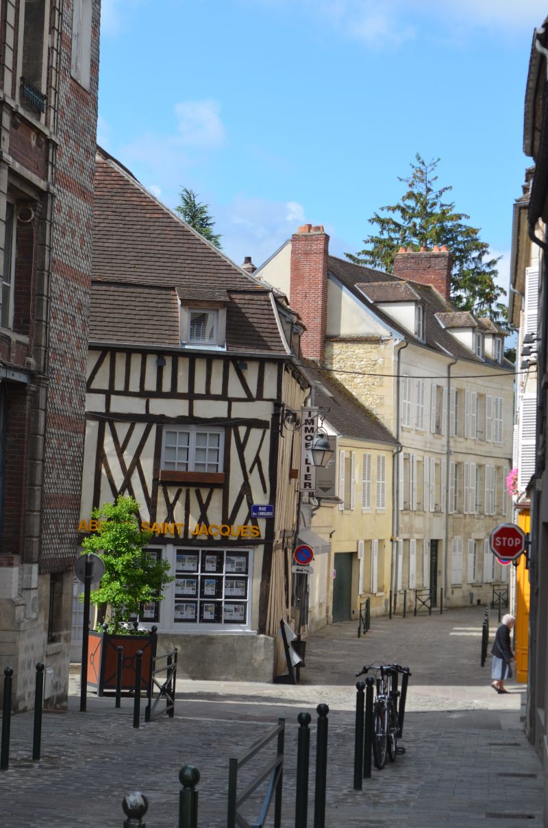
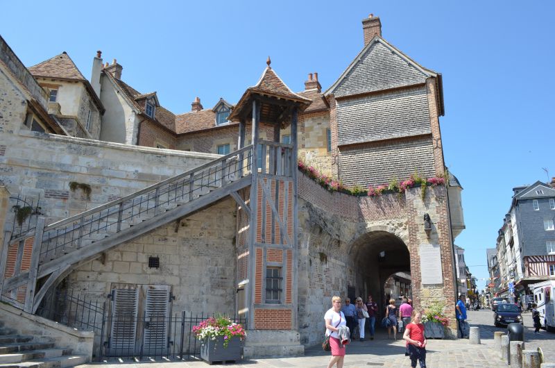
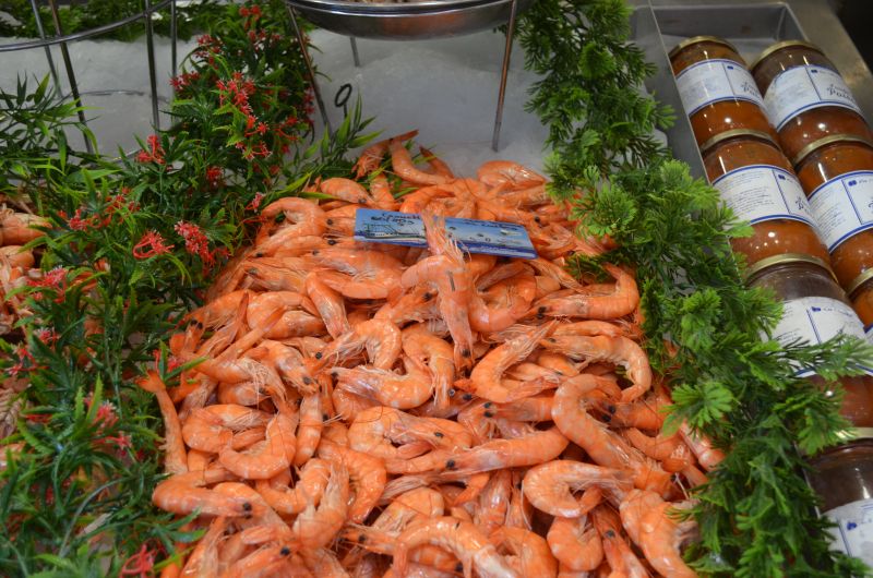
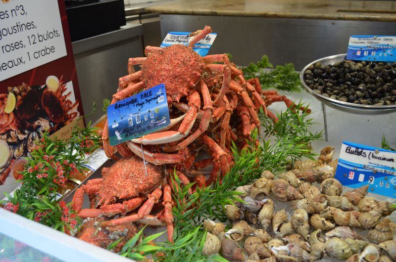
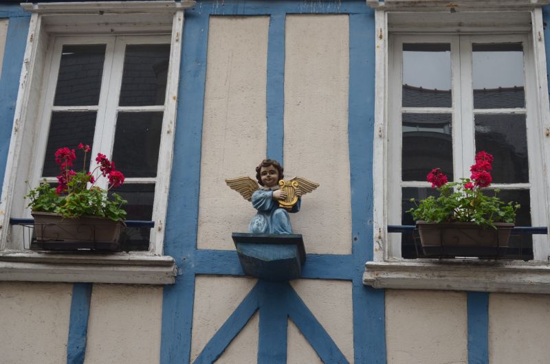
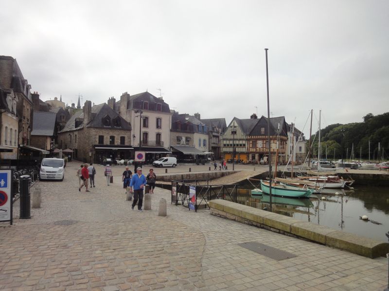
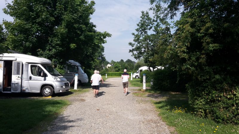
We had headed for the mobile home parking space on the outskirts of town. When we got there, we saw the extent: of what felt like 300 parking spaces on gravel surfaces, 300 were already occupied. One mobile of white goods lined up after the other. We turned around at the next roundabout and headed out of town again. Luckily we found an open area on a gravel shoulder next to the road where we could park our camper and in the shade. (GPS: 49.41641667,0.24251667) After a short lunchtime snack we went on a little tour of the town. There's no mistaking that we're on the coast. In the restaurants, the Plates de Mer pile up with all kinds of crustaceans, mussels, oysters and snails. Narrow streets and colorful half-timbered houses characterize the image of Honfleur
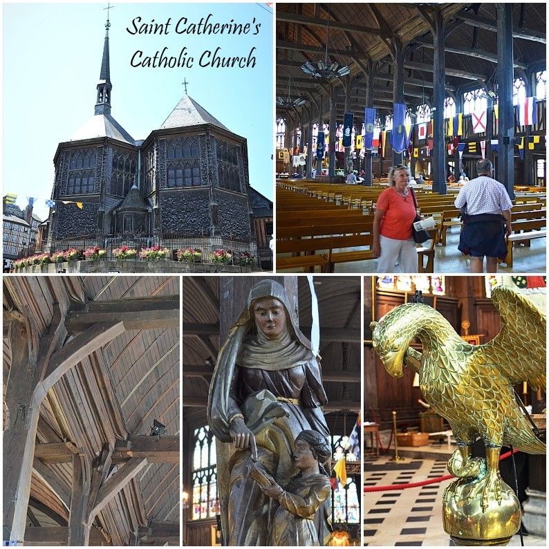
We also paid a visit to the Ste-Cathérine church, which was built entirely of wood.
9 Route Jean Revel, 14600 Honfleur, Frankreich
49° 24' 56.8" N 0° 14' 32.8" E
49.4157675 0.2424406
• Head northwest on Rue Émile Renouf (D580 A).
• Take the 3rd exit from roundabout onto Rue Émile Renouf (D580 A). Go for 1.0 km.
• Take the 1st exit from roundabout onto Rue des 4 Francs (D579) toward Caen/Deauville/Trouville/Lisieux/Gonneville S/Honfleur/Pont l'Évêque/Zone d'Activités du Plateau. Go for 1.1 km.
• Pass 4 roundabouts and continue on Route de Honfleur (D579). Go for 14.4 km.
• Take the 2nd exit from roundabout onto A132 toward Caen/Rouen/Paris. Go for 894 m.
• Keep left onto A132 toward Lisieux/Pont-l'Évêque-Z.A. Go for 850 m.
• Continue on D579. Go for 4.4 km.
• Pass 4 roundabouts and continue on Square François et Michel Pottin (D579). Go for 12.2 km.
• Turn right onto Rue Saint-Jacques. Go for 109 m.
• Turn right onto Rue au Char. Go for 138 m.
• Arrive at Rue au Char. Your destination is on the left.
☍
35,2 km
( 30 min.)
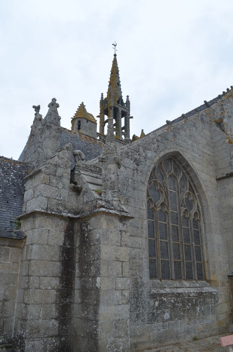
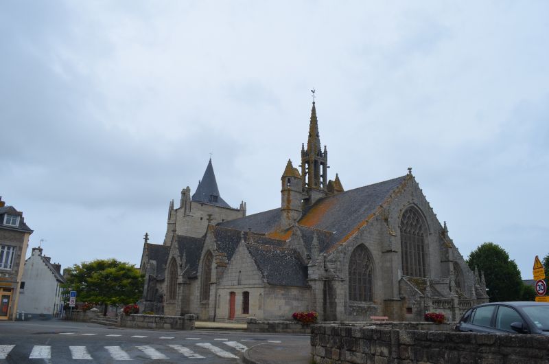
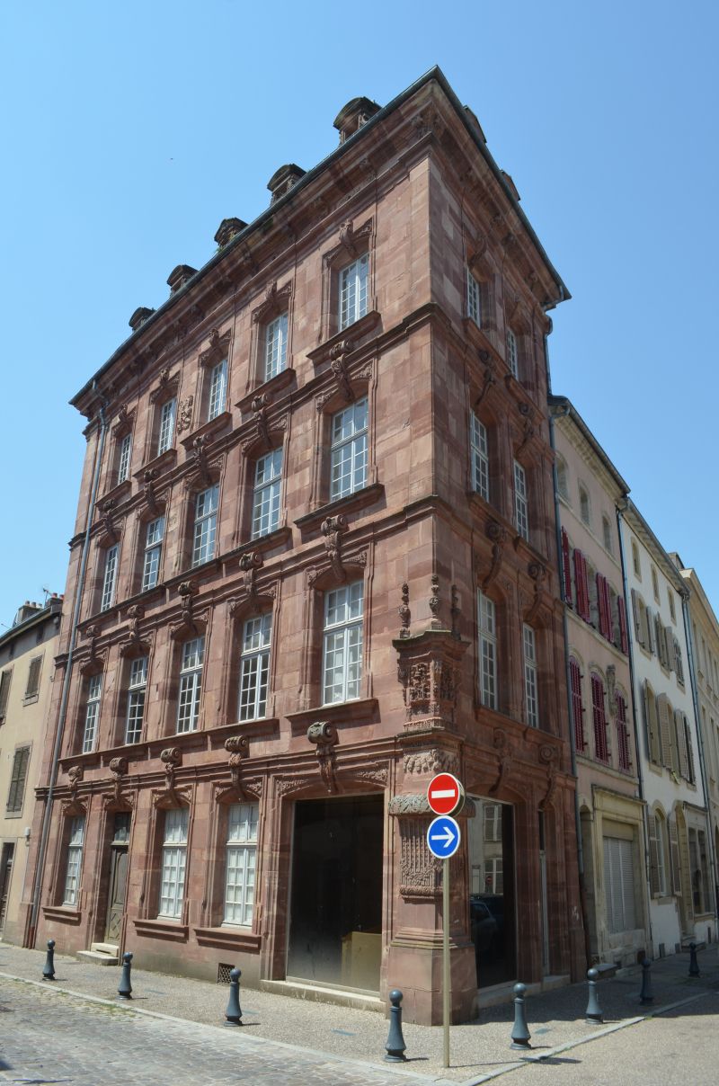
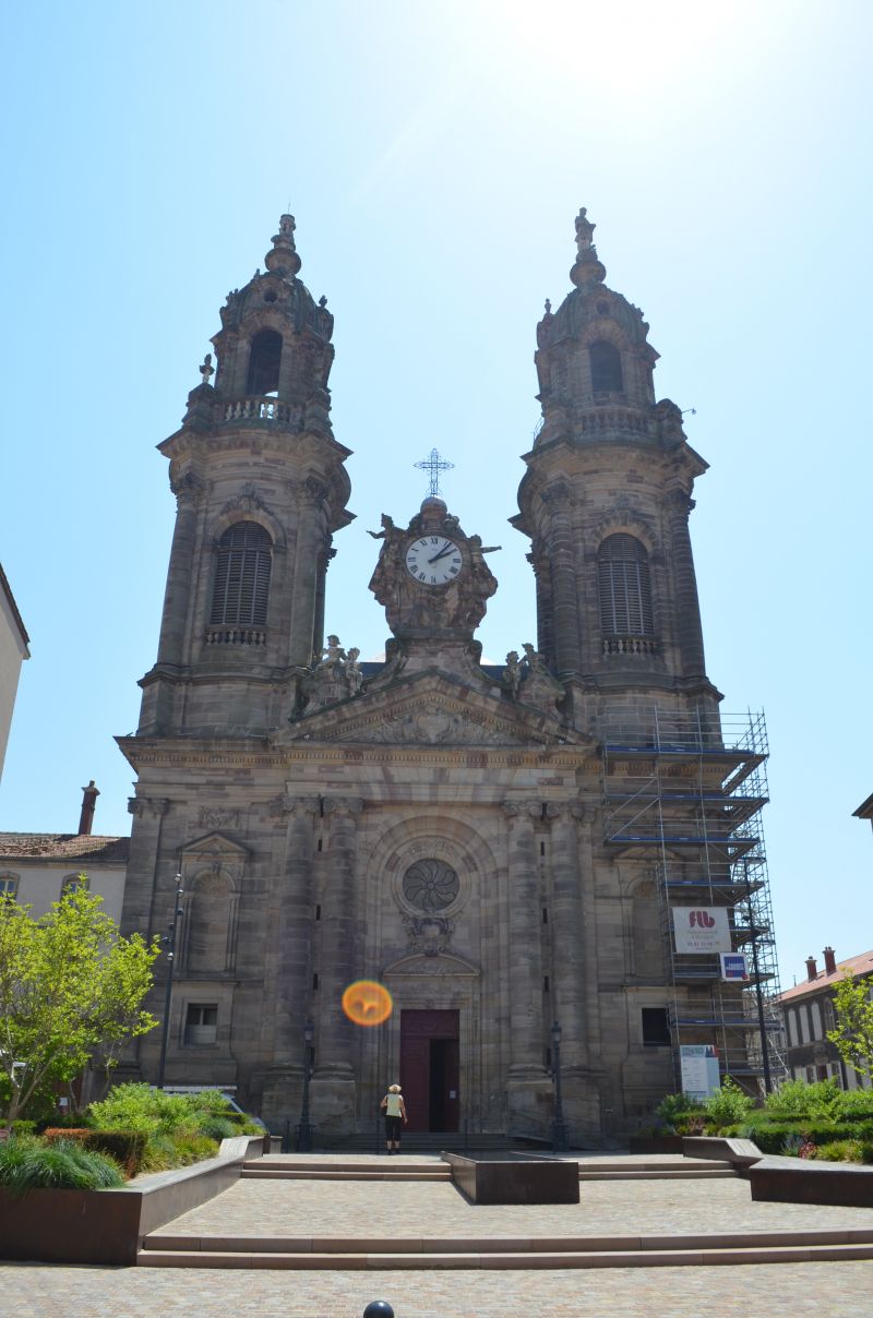
Lisieux, France GPS: 49.141399,0.234203
☁️ 23°C
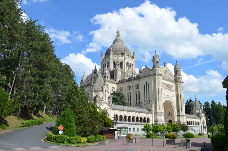
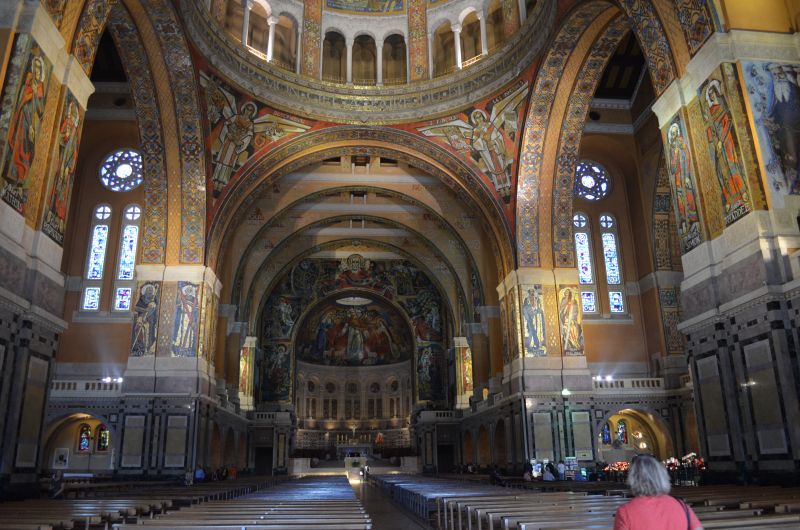
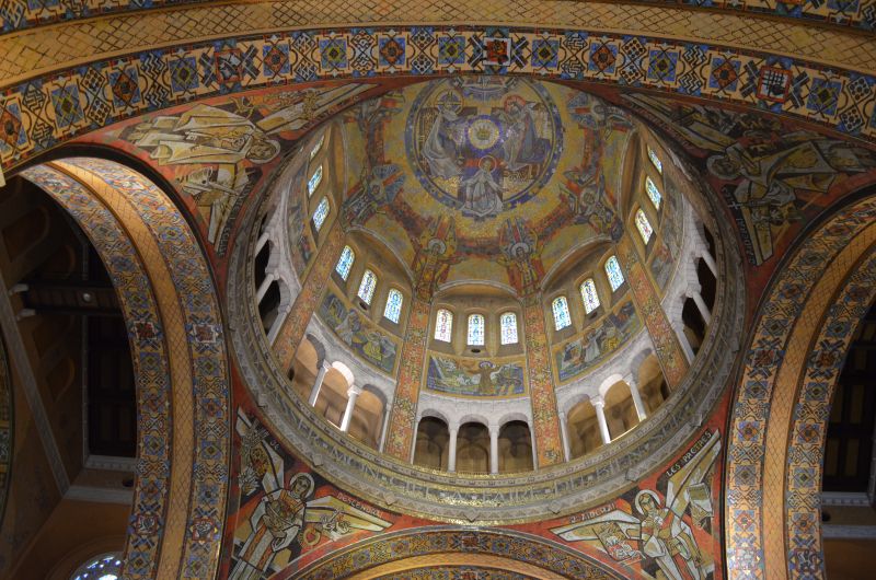
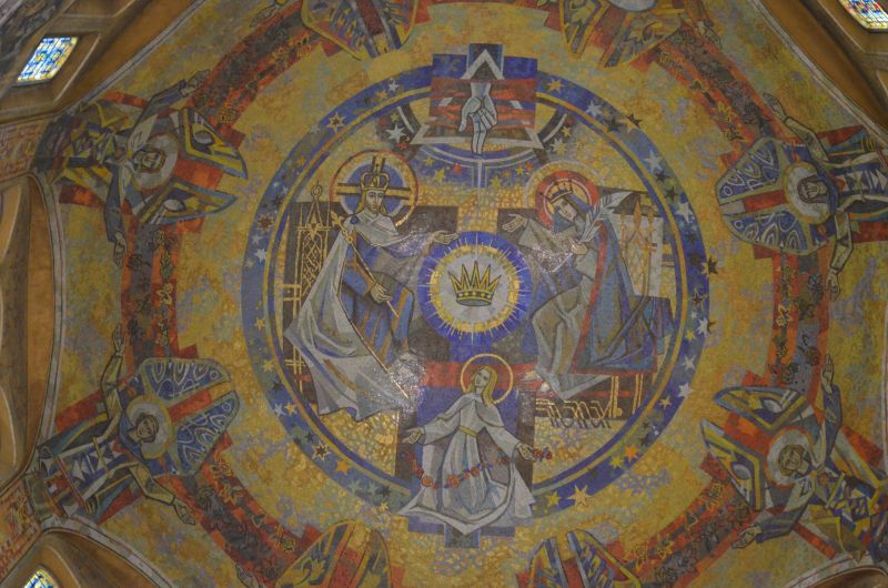
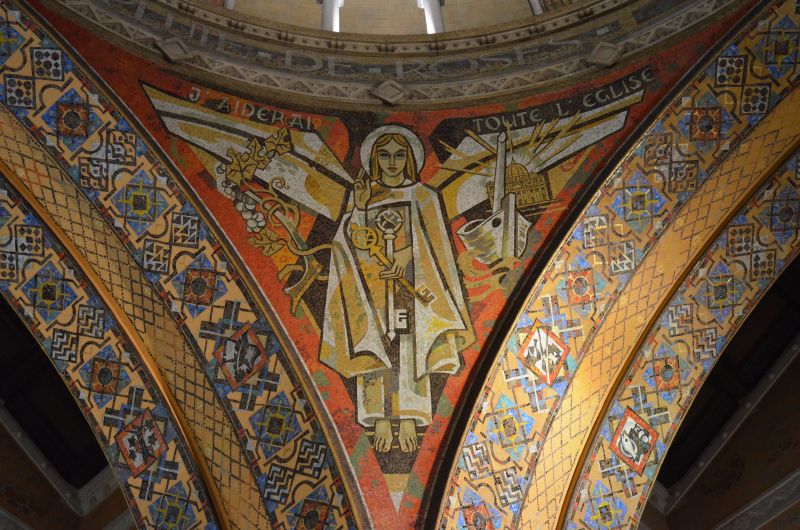
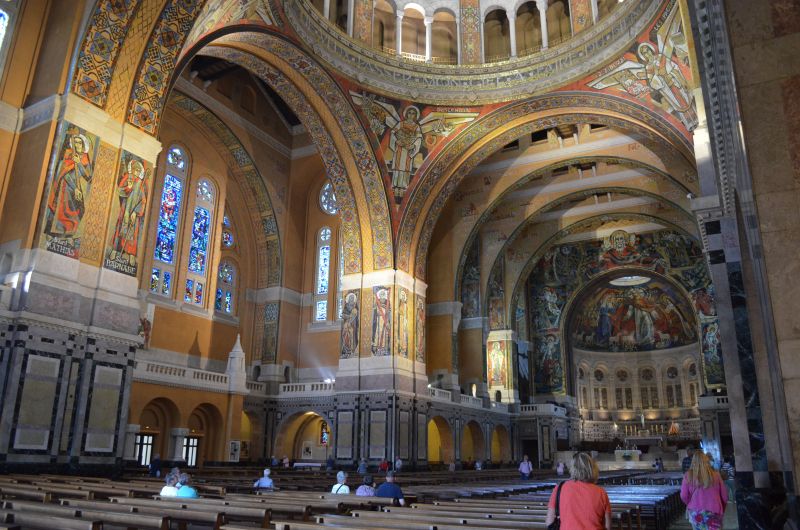
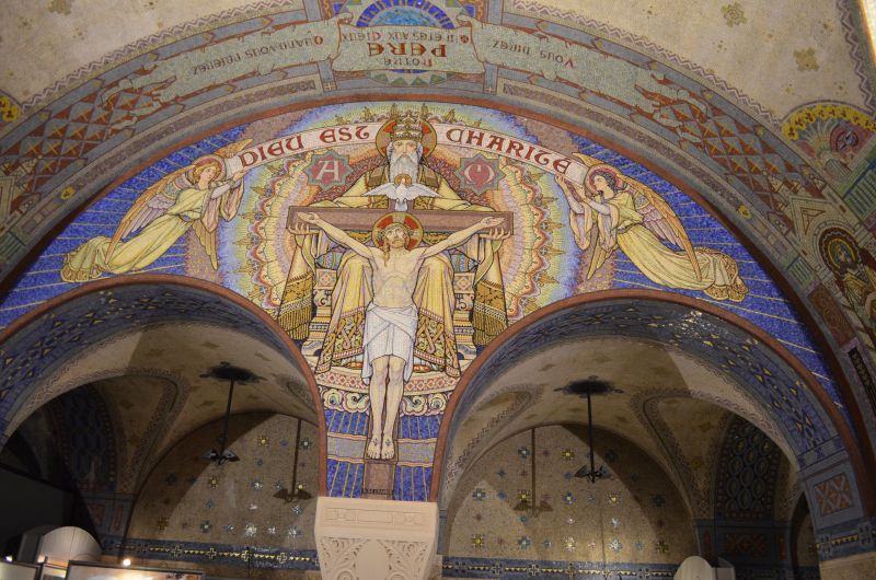
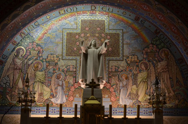
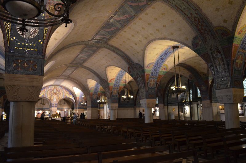
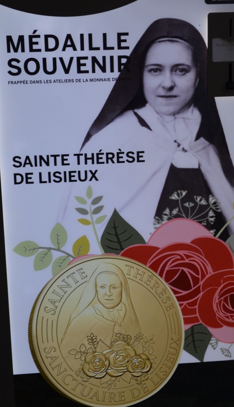
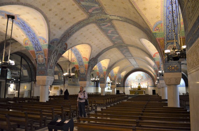
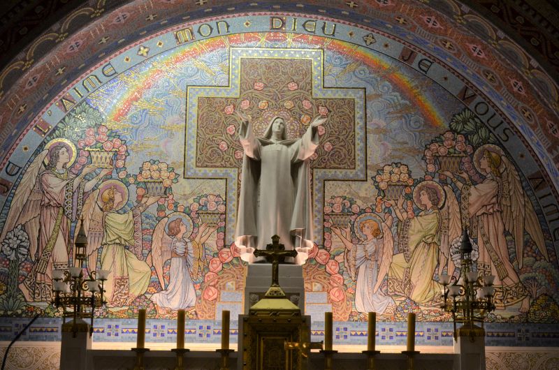
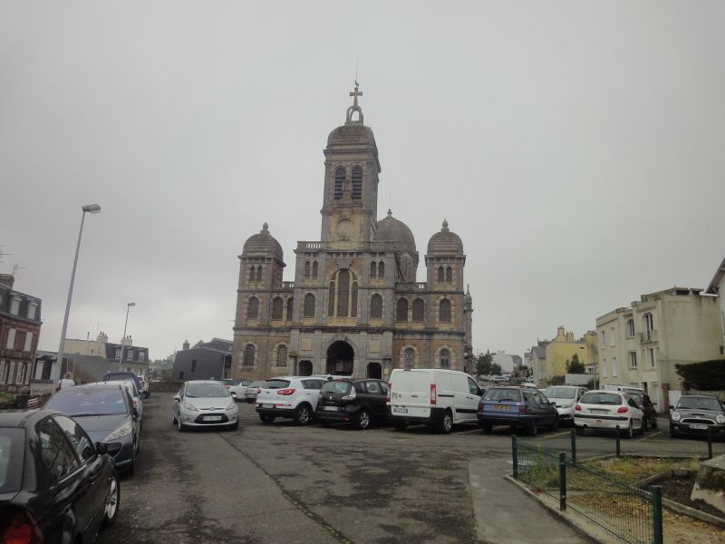
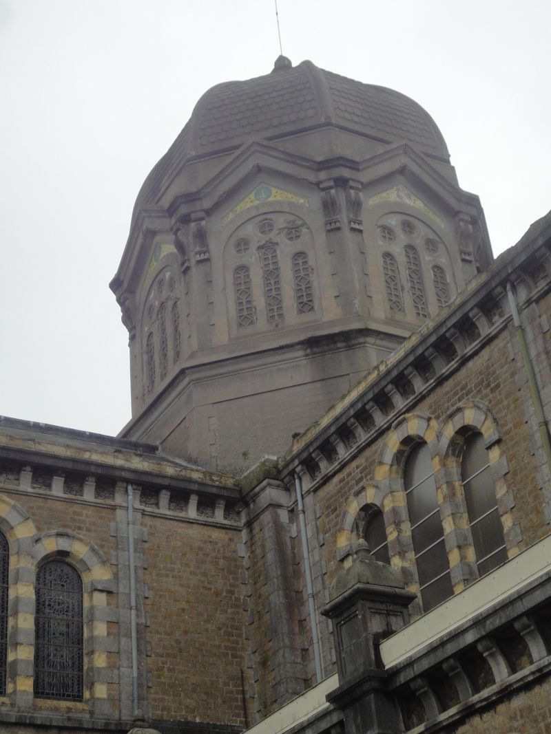
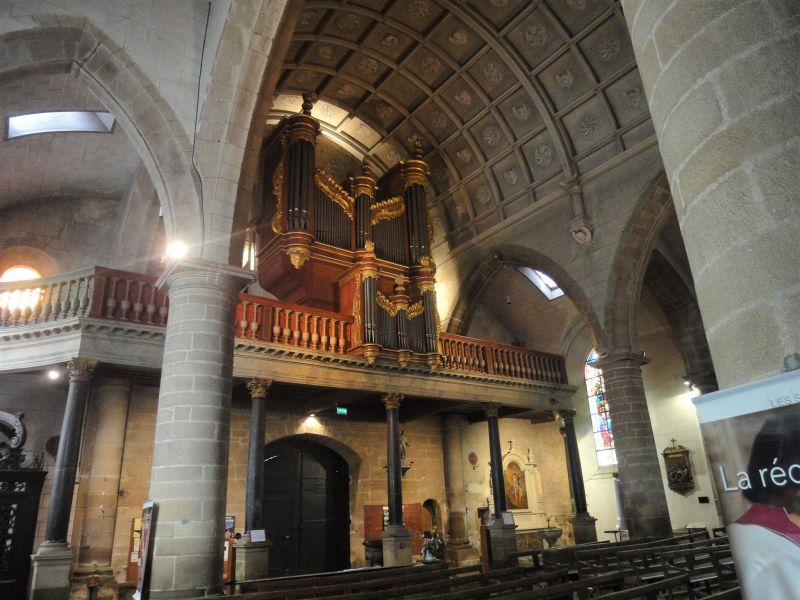
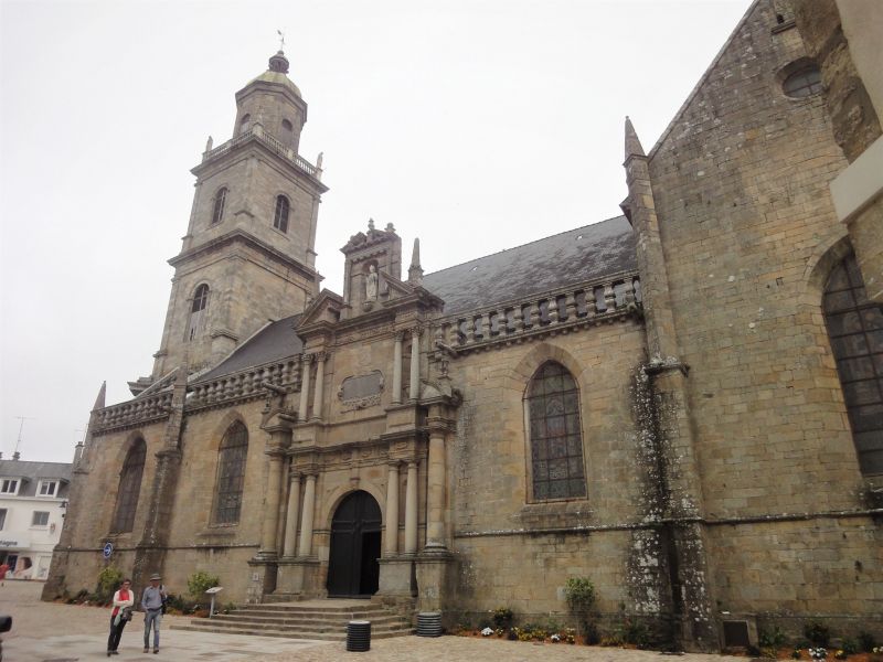
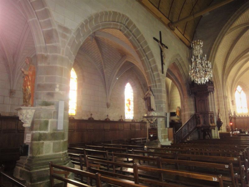
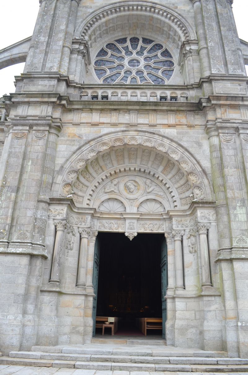
The Sainte-Thérèse Basilica. The basilica is dedicated to Saint Therese of Lisieux. The church building, built in neo-Byzantine style. We were also able to park on the free parking space by the basilica (GPS:49.14975,0.23415) . The basilica is beautiful, its architectural style and interior is a contrast to the churches we have seen in France so far. The crypt is also worth seeing, with the mosaic it is decorated with.
14100 Lisieux, Frankreich
49° 8' 45.3" N 0° 13' 40.3" E
49.1459220 0.2278490
• Head toward Rue Henry Chéron on Rue au Char. Go for 22 m.
• Turn right onto Rue Henry Chéron. Go for 97 m.
• Take the 3rd exit from Porte de Paris roundabout onto Boulevard Duchesne-Fournet (D579). Go for 278 m.
• Turn left onto Boulevard Carnot. Go for 247 m.
• Turn right onto Rue du Général Leclerc (D48). Go for 974 m.
• Continue on Rue Paul Cornu (D48). Go for 989 m.
• Turn right onto Rue de la Vallée. Go for 66 m.
• Turn right onto Rue de la Vallée. Go for 14 m.
• Arrive at Rue de la Vallée. Your destination is on the left.
☍
2,7 km
( 4 min.)
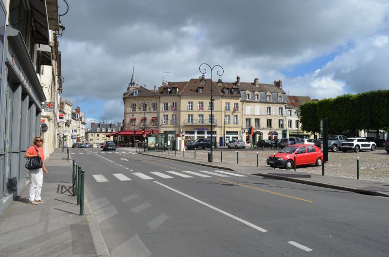
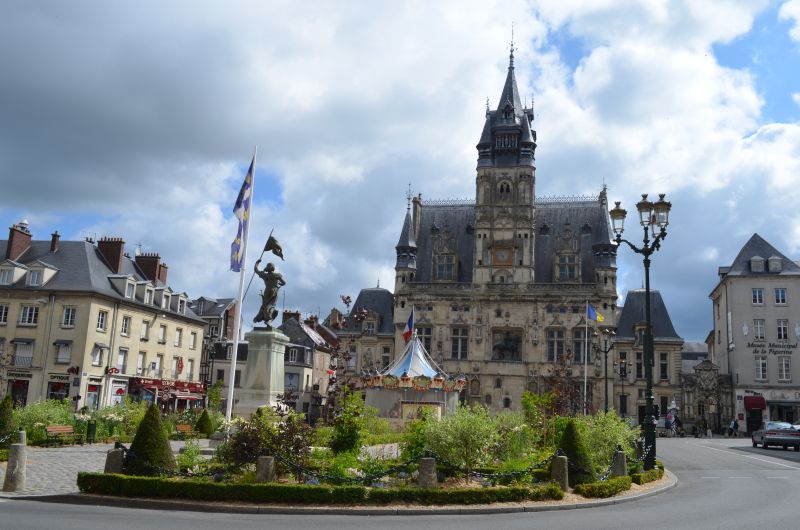
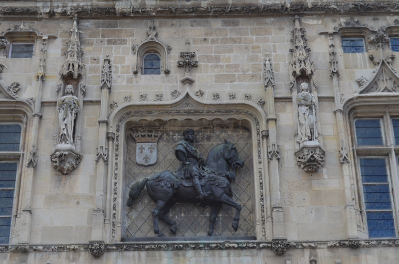
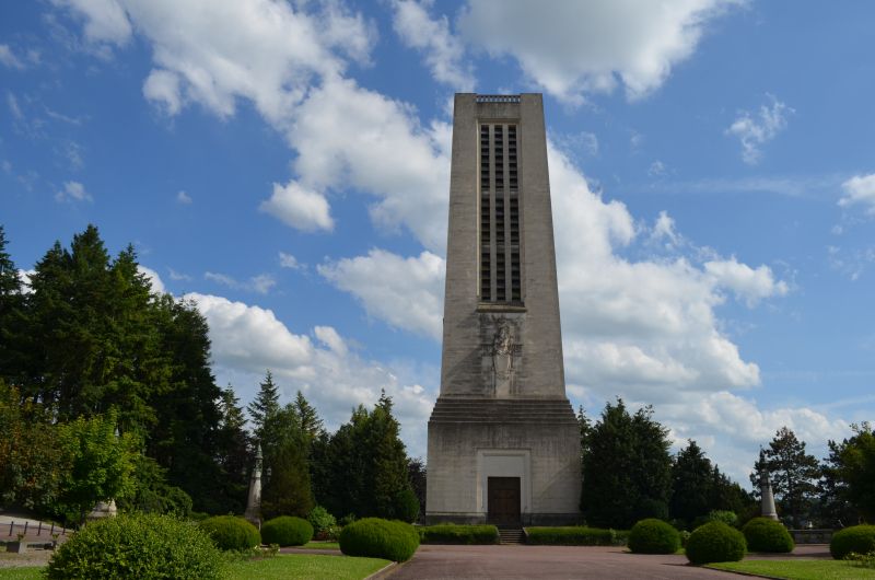
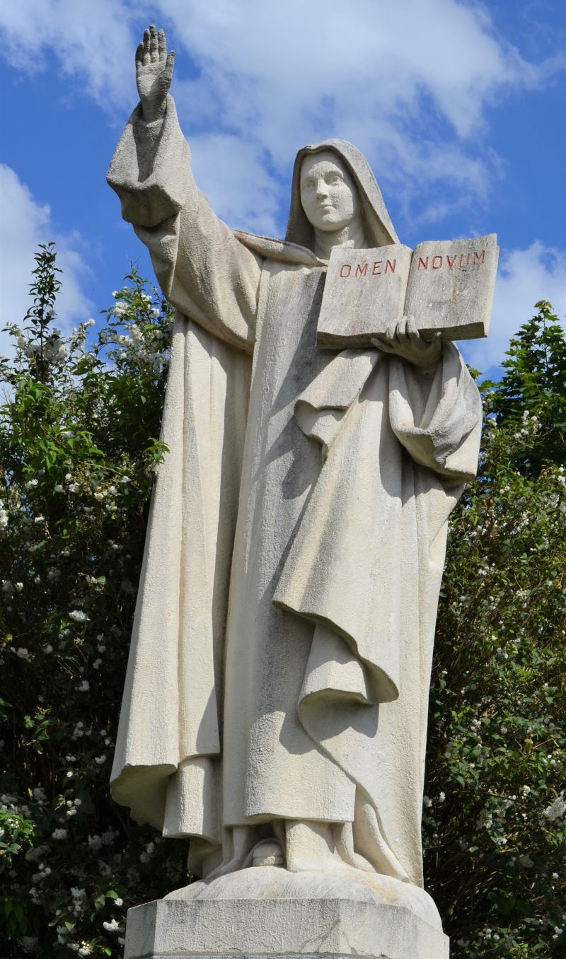
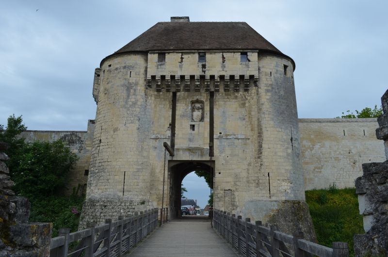
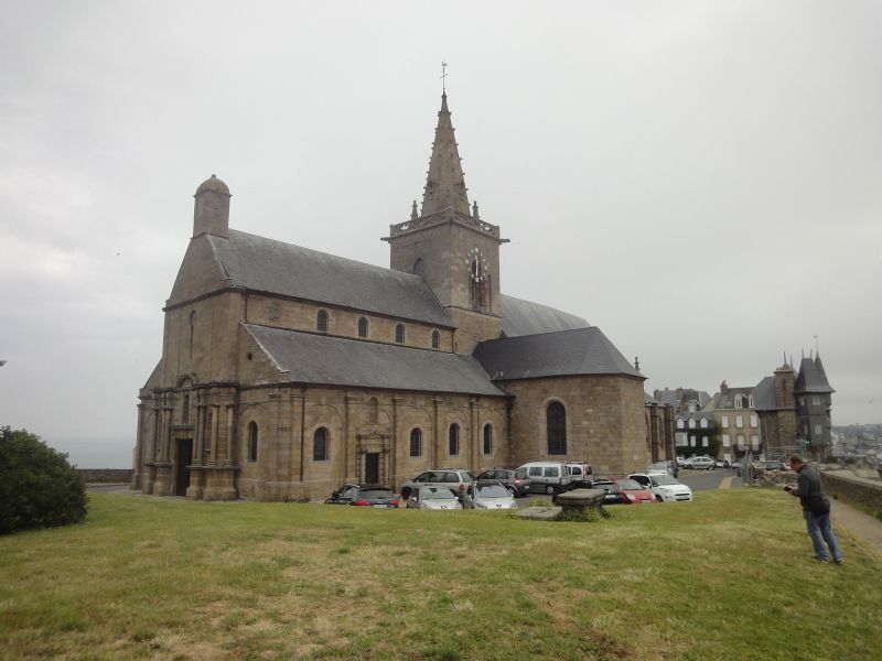
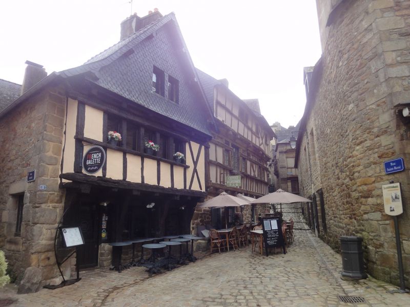
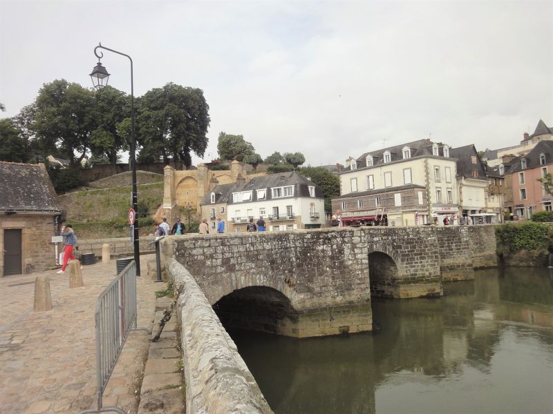
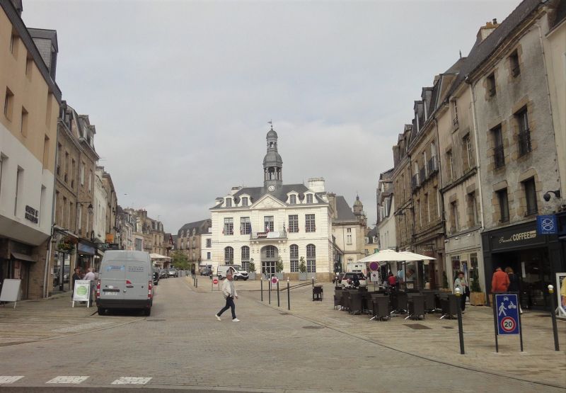
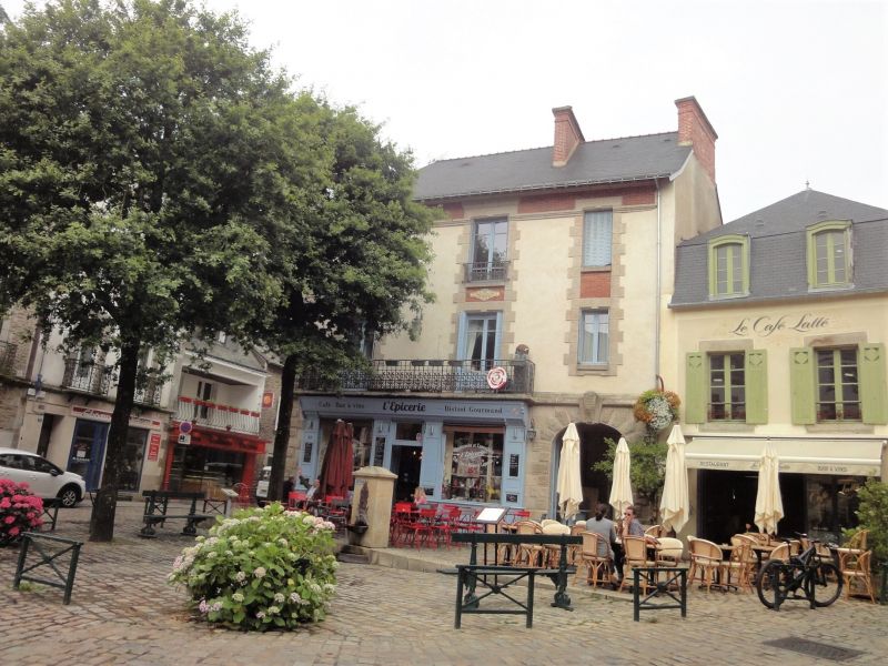
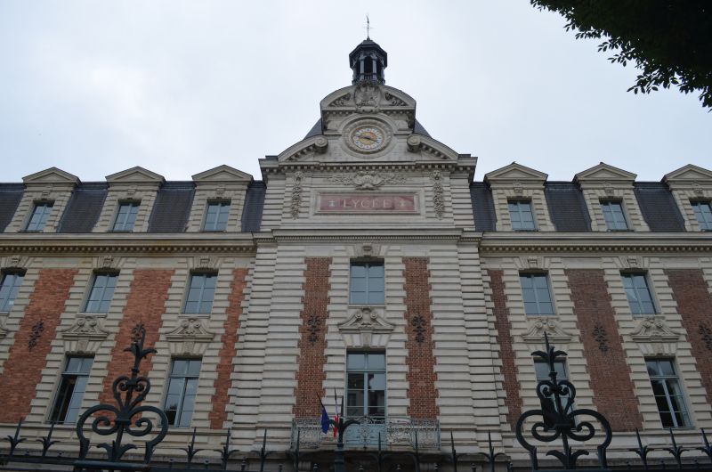
Lisieux
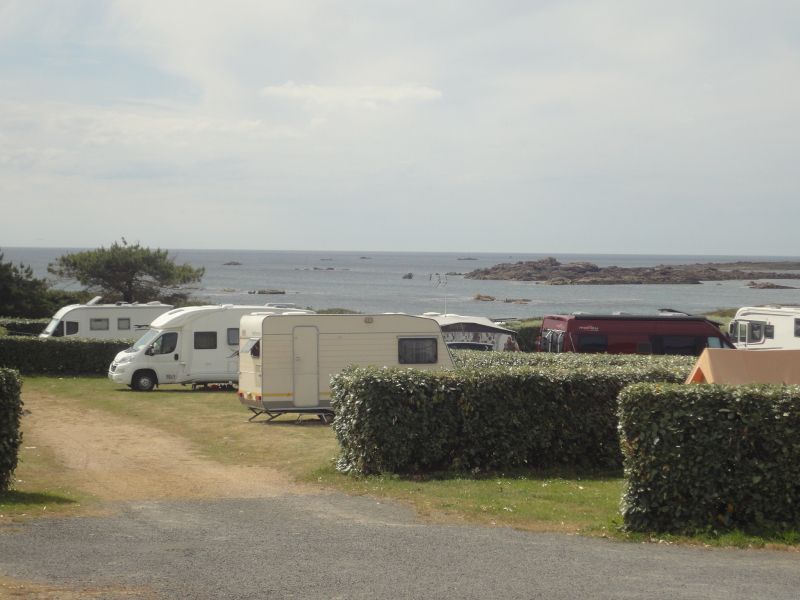
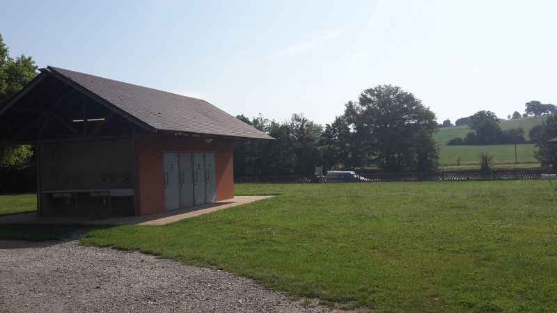
For the overnight stay we decided to drive to the municipal campsite in Lisieux. (GPS: 49.16526667,0.22038333) The place was almost empty, we could choose the place where we would like to stand. The overnight stay cost € 19.20.
Holidays are the order of the day on the square, but on the other hand like on the narrow pitches where there is a mobile home next to a mobile home. It was a mild evening and we sat in front of the mobile home until 10 p.m.
9 Rue de la Vallée, 14100 Lisieux, Frankreich
49° 9' 55" N 0° 13' 14.1" E
49.1652766 0.2205760
• Head north on Rue de la Vallée. Go for 14 m.
• Turn left onto Rue de la Vallée. Go for 66 m.
• Turn right onto Rue Paul Cornu (D48). Go for 645 m.
• Pass 2 roundabouts and continue on Route du Régiment Écossais (D48). Go for 6.7 km.
• Turn right onto Lieu-dit Jourdain (D264). Go for 70 m.
• Continue on Domaine du Breuil (D264). Go for 425 m.
• Take the 3rd exit from roundabout onto D579 toward A13/Fierville les Parcs/Pont-l'Évêque/Blangy le Château. Go for 2.6 km.
• Take the 3rd exit from roundabout onto D579 toward Pont-l'Évêque. Go for 4.5 km.
• Continue on A132. Go for 259 m.
• Take the exit toward Caen onto A13 (Autoroute de Normandie). Go for 41.7 km.
• Take the exit onto N814 (Périphérique). Go for 6.7 km.
• Take ramp toward Caen-Centre. Go for 330 m.
• Keep left toward Courseulles/Creully/Caen-la Folie Couvrechef/Z.I. Caen Nord. Go for 191 m.
• Continue on Esplanade Brillaud de Laujardière. Go for 248 m.
• Take the 2nd exit from Porte de l'Europe roundabout onto Avenue Jean Monnet. Go for 307 m.
• Enter the roundabout. Go for 20 m.
• Arrive at Place de Portsmouth. Your destination is on the left.
☍
64,8 km
( 41 min.)
Day
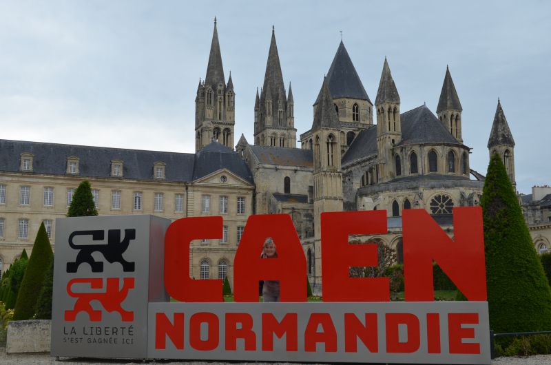
Caen
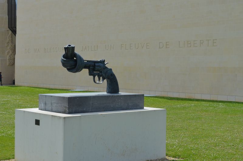
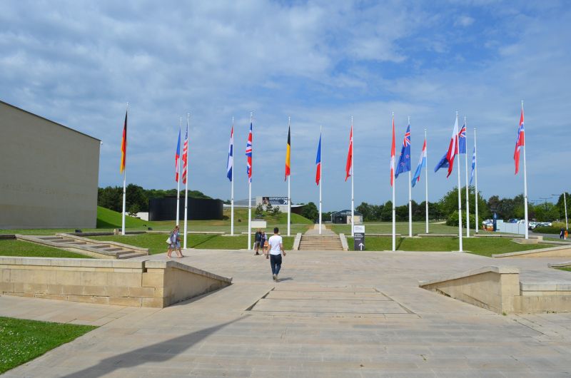
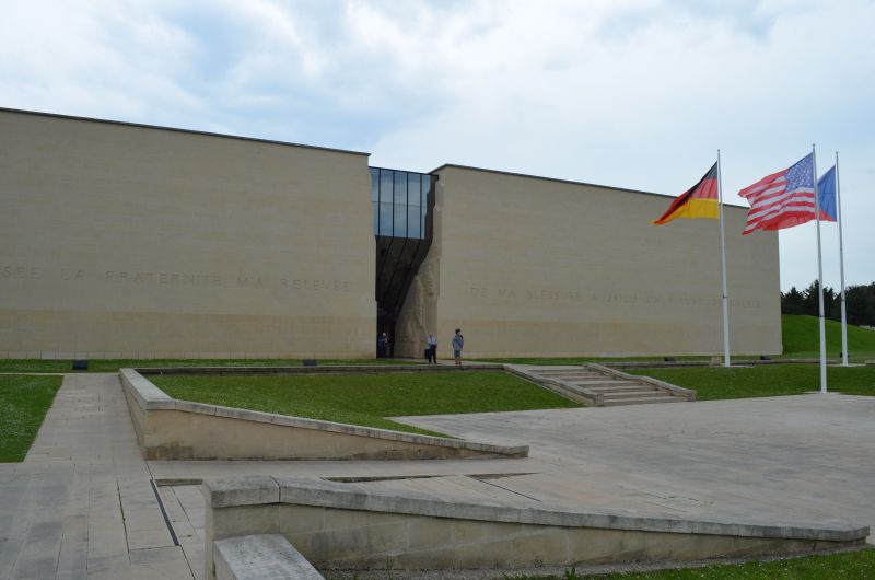
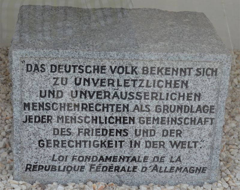
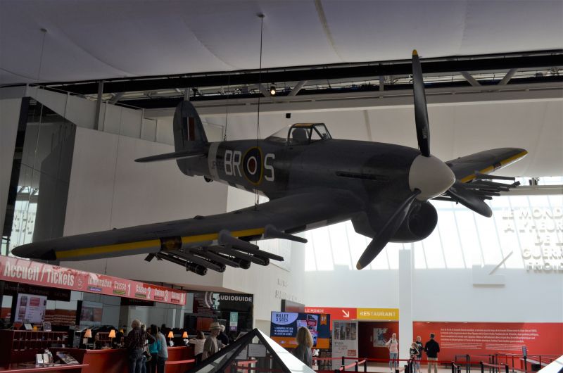
Car park (GPS:49.19973333,0.3872) at the Caens Center for History and Peace around themes such as WWII, the Battle of Normandy and the Cold War.
The Mémorial de Caen aims to provide visitors with the information essential to understanding the Second World War, starting from the causes that lie in the results of the First World War and ending with its impact on the events of 1989. It challenges the visitor to question yourself about the rapidly fading period of history that has changed the face of Europe and the world.
World War II, the most terrible conflict in human history, claimed the lives of some 60 million people, half of them civilians. The violence against the civilian population, be it the massive bombing of cities, the total war in the East, the greatest genocide in history or the first use of atomic bombs in Hiroshima and Nagasaki, ultimately shaped this war to a large extent.
La Folie-Couvrechef, Caen, Frankreich
49° 12' 4.5" N 0° 22' 55.7" W
49.2012408 -0.3821471
• Follow the roundabout. Go for 111 m.
• Take the 3rd exit from roundabout onto Avenue Jean Monnet. Go for 264 m.
• Take the 3rd exit from Porte de l'Europe roundabout onto Esplanade Brillaud de Laujardière. Go for 353 m.
• Take ramp onto Boulevard Jean Moulin. Go for 383 m.
• Take ramp onto Périphérique (N814) toward Périphérique Ouest/Cherbourg/Rennes/Caen-Chemin Vert/Aéroport Carpiquet/Bayeux. Go for 3.4 km.
• Keep left onto N13 toward Bessin/Cherbourg/Bayeux/Aéroport Carpiquet. Go for 18.3 km.
• Take ramp onto D33 toward Bayeux/Arromanches/Port en Bessin/Zone d'Activités-Bayeux Intercom. Go for 642 m.
• Take the 5th exit from roundabout onto D613. Go for 3.7 km.
• Take the 1st exit from Rond-Point Eisenhower roundabout onto Boulevard Winston Churchill (D613). Go for 149 m.
• Take the 3rd exit from Carrefour Saint-Exupère roundabout onto Boulevard Winston Churchill (D613). Go for 132 m.
• Pass 2 roundabouts and continue on Boulevard Winston Churchill (D613). Go for 1.0 km.
• Turn left onto Rue de Courseulles (D12). Go for 515 m.
• Turn left onto Rue du Pont Trubert (D12 B). Go for 304 m.
• Arrive at Rue Saint-Quentin (D12 B). Your destination is on the left.
☍
29,2 km
( 20 min.)
Besichtigung von Cean
☁️ 23°C
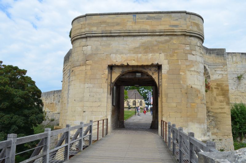
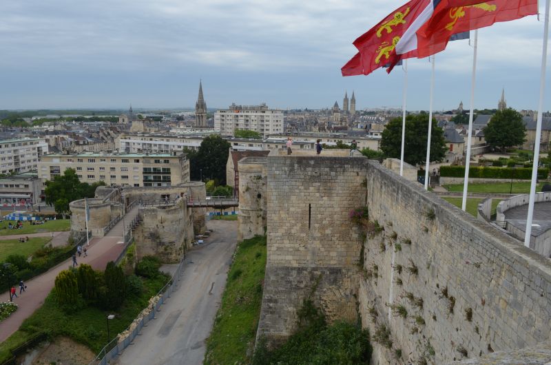
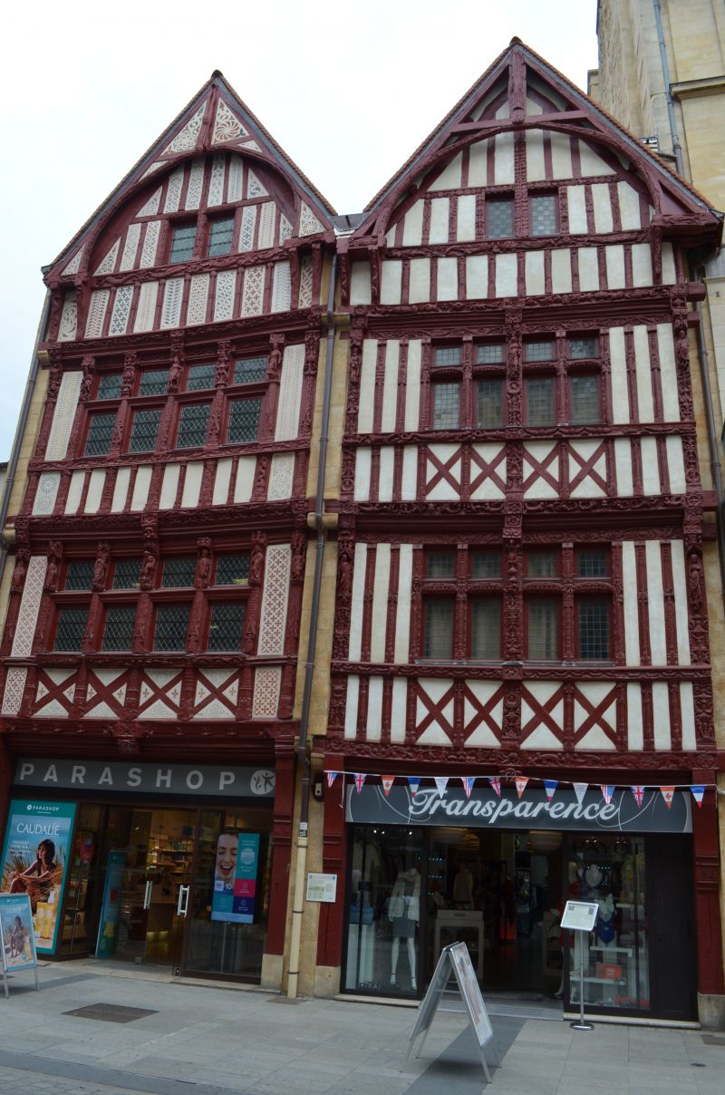
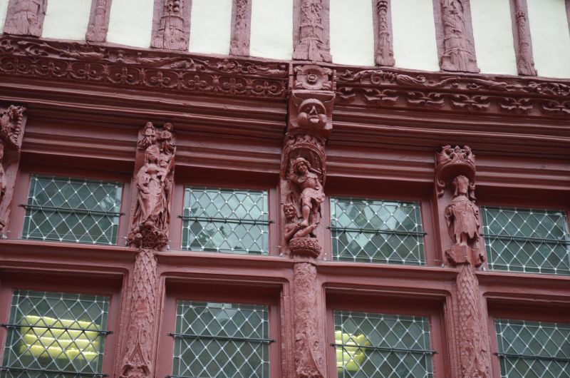
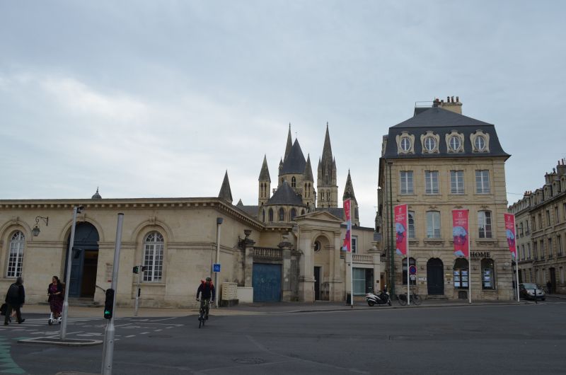
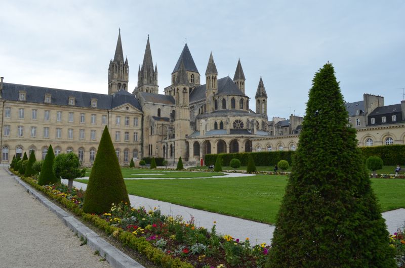
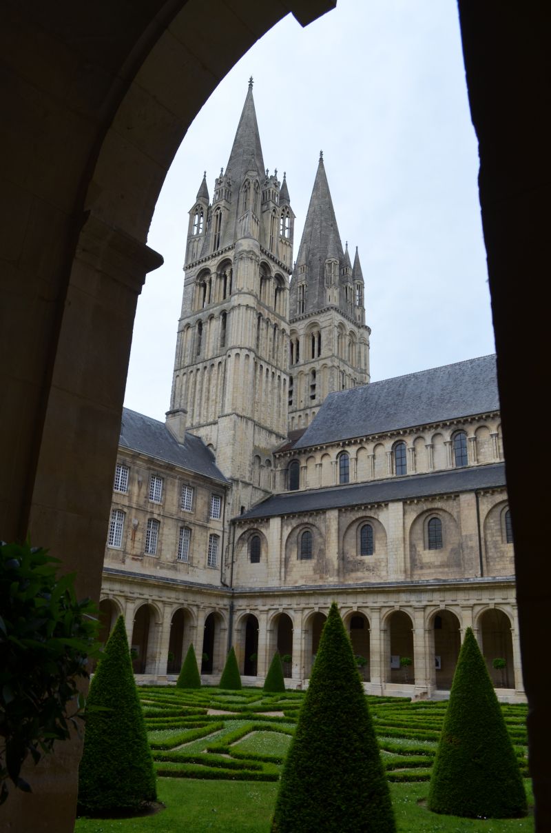
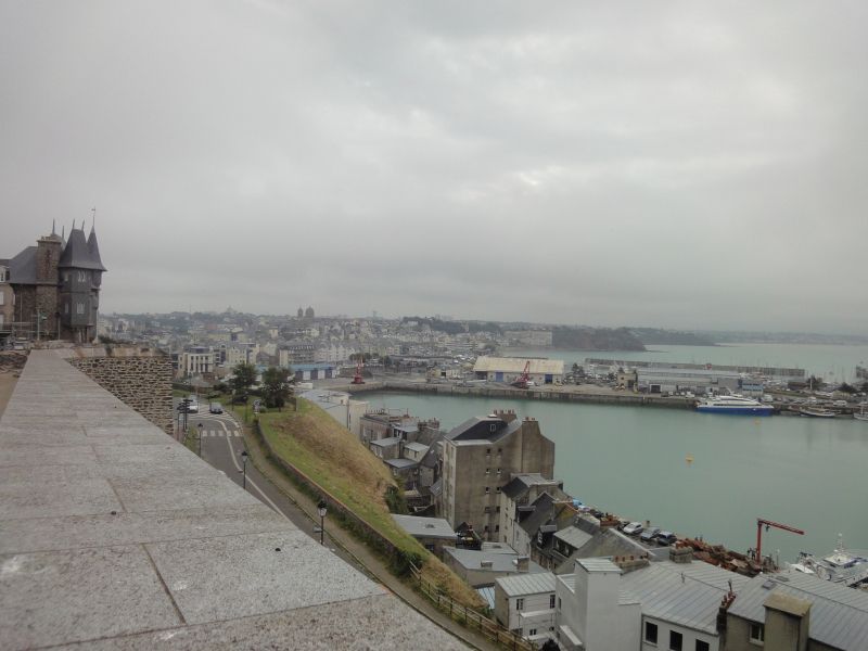
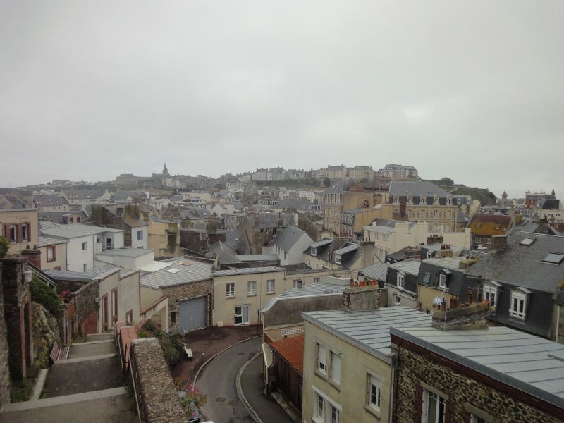
From the parking lot it was three kilometers to the center. We walked on the bike path that led us to the first viewing location. The ruins of the castle of Caen, the largest castle in France, rather the remains of it. The still intact walls are impressive. Afterwards we went through the pedestrian zone to the Piere church and on to the Hotel Ville (town hall), with a beautiful park. The tourist information is also located here, where we got a city map. The building is a former monastery and part is freely accessible with the exhibition detailing the Allied invasion of Normandy. We watched the documentation extensively with great interest. We continued through other alleys of the old town, with a short coffee break in a street cafe and finally we went back to the camper.
Bayeux
☁️ 17°C
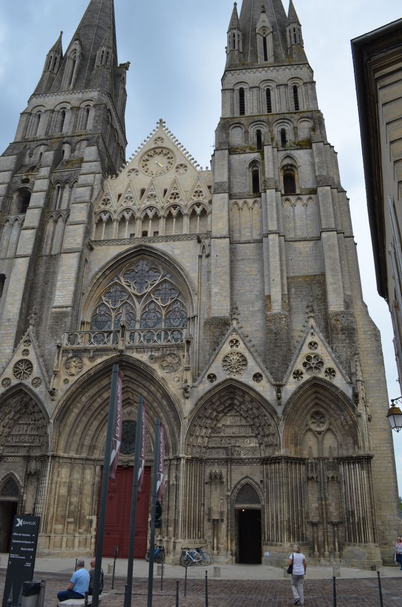
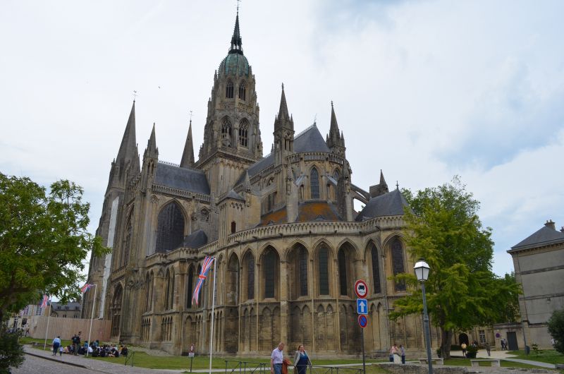
The onward journey to Bayeux was short and yet long until we found a parking space. Either the parking spaces were occupied or the parking bays were too small for our camper. We found a parking space at a larger supermarket and were free to park there. The walk to the cathedral wasn't that far either.
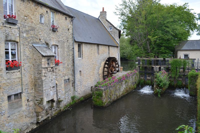
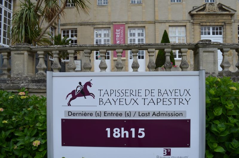
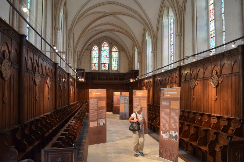
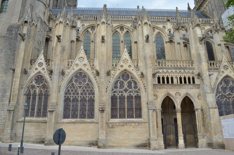
Bayeux can refer to an ancient settlement history, the city owes its name to the Celtic Baiokassen. The districts around the cathedral are particularly worth seeing. A visit to the medieval Bayeux Tapestry should not be missed. The embroidered "comic" from the 11th century depicts the conquest of England by William the Conqueror.
1 Rue Saint-Quentin, 14400 Bayeux, Frankreich
49° 16' 53" N 0° 41' 48.5" W
49.2813994 -0.6968001
• Head toward Voie de la Rivière on Rue Saint-Quentin (D12 B). Go for 304 m.
• Turn left onto Rue de la Pigache (D12 A). Go for 355 m.
• Take the 3rd exit from roundabout onto Route d'Arromanches (D516). Go for 7.2 km.
• Take the 2nd exit from roundabout onto D514. Go for 671 m.
• Turn right onto Rue Marie-Rose Thonnard (D87). Go for 455 m.
• Turn left onto Boulevard Gilbert Longuet. Go for 72 m.
• Turn right onto Rue d'Instow. Go for 126 m.
• Turn left onto Rue Colonel René Michel. Go for 90 m.
• Arrive at Rue Colonel René Michel. Your destination is on the left.
☍
9,3 km
( 9 min.)
Arromanches-les-Bains, Wohnmobilparkplatz
⛅ 18°C
Our last stop today was 14117 Arromanches-les-Bains GPS:49.339298,-0.6147
Paid parking at the panorama board above the city.
Very nice view of the Gold Beach beaches to the east and the remains of the artificial harbor.
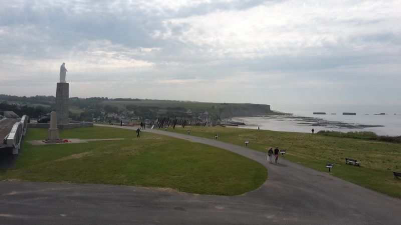
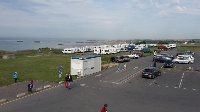
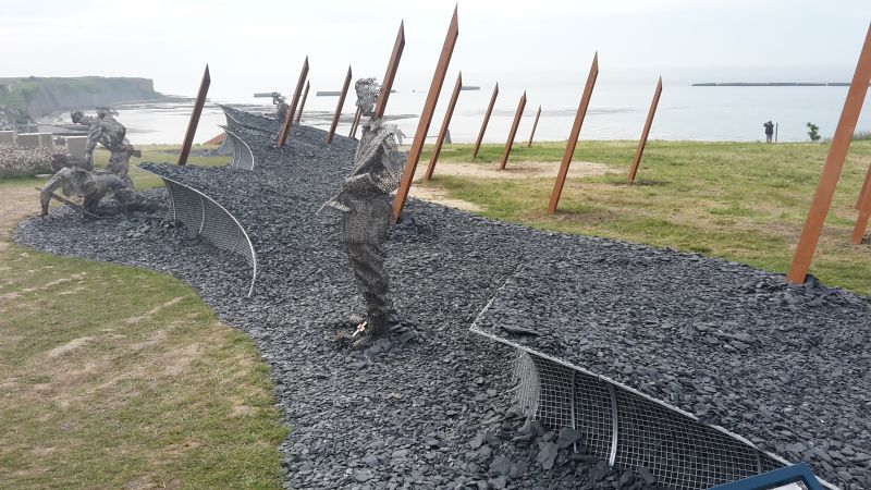
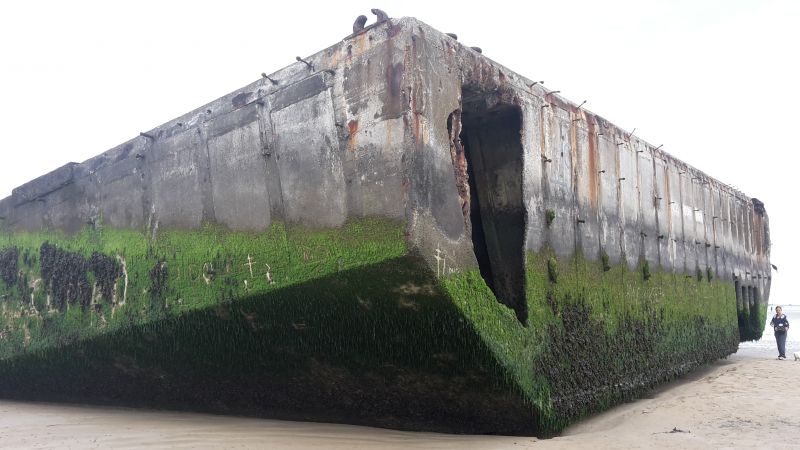
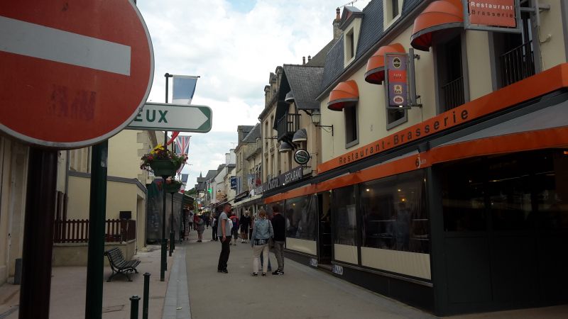
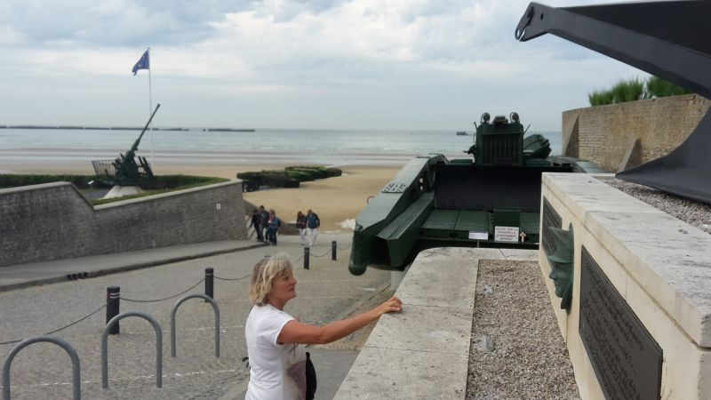
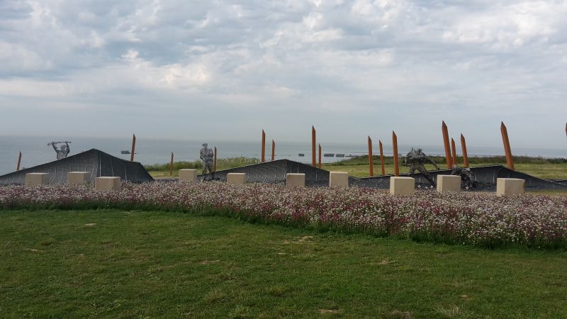
The Normandy coast is vast and beautiful with its beautiful blond sand. But here and there these extensive beaches are interspersed with old bunkers built by the Germans in the last world war. Today these bunkers are witnesses of a war that Europe no longer wants. Arromanches-les-Bains , where there is a memorial and a 360 degree cinema with information and documents about the 1944 Allied landings. This small town, with its Norman charm, with its small gray granite houses and its small streets, has been listed as a UNESCO World Heritage Site.
When we arrived, the first two rows of the site were already occupied by mobile homes. We were able to stand in the third row and still had a view of the sea. It was low tide and we took this opportunity to take a short walk on the mudflats and take a closer look at the remains of the war that stood freely on the beach at low tide. The colossuses of steel and concrete must be what remains of the artificial port.
In the evening, shortly after dinner, a lightning-fast thunderstorm approached, it was just enough to stow the camping chairs in the garage.
During the night another heavy thunderstorm passed over us and that four times. The lightning and especially the thunder was so strong that the Womo trembled. It was a pity that we were not allowed to experience sunrise on the coast but had to have our breakfast in the camper, it was still raining.
Arromanches-les-Bains, Frankreich
49° 20' 20.5" N 0° 37' 20.7" W
49.3390210 -0.6224150
• Head toward Rue du Maréchal Joffre on Rue Colonel René Michel. Go for 107 m.
• Turn right onto Place du 6 Juin 1944 (D514). Go for 29 m.
• Turn right onto Rue du Petit Fontaine. Go for 254 m.
• Turn right onto Rue Maurice Lithare. Go for 89 m.
• Continue on Rue d'Instow. Go for 126 m.
• Turn left onto Boulevard Gilbert Longuet. Go for 72 m.
• Turn right onto Avenue de Verdun (D87). Go for 455 m.
• Turn left onto Lieu-dit La Brèche (D514). Go for 620 m.
• Take the 2nd exit from roundabout onto D516. Go for 7.2 km.
• Take the 3rd exit from roundabout onto Boulevard Winston Churchill (D613). Go for 438 m.
• Pass 4 roundabouts and continue on Boulevard Winston Churchill (D613). Go for 1.5 km.
• Take the 1st exit from Rond-Point Eisenhower roundabout onto Boulevard Maréchal Montgomery (D572). Go for 532 m.
• Take the 2nd exit from roundabout onto Boulevard Sadi Carnot (D572). Go for 457 m.
• Take the 4th exit from Rond-Point d'Ornano roundabout onto Boulevard Maréchal Leclerc (D572). Go for 445 m.
• Take the 2nd exit from roundabout onto Route de Saint-Lô (D572). Go for 536 m.
• Turn left onto D67. Go for 503 m.
• Continue on Route de la Belle Épine (D67). Go for 2.6 km.
• Continue on D67. Go for 1.1 km.
• Continue on Lieu-dit La Coquerie (D67). Go for 97 m.
• Continue on D67. Go for 456 m.
• Continue on Lieu-dit Ferme d'Asnelles (D67). Go for 191 m.
• Continue on D67. Go for 878 m.
• Continue on Lieu-dit Le Haut Buis (D67). Go for 95 m.
• Continue on D67. Go for 1.3 km.
• Continue on Lieu-dit Clos Pain (D67). Go for 161 m.
• Continue on D67. Go for 282 m.
• Continue on Lieu-dit Le Rat (D67). Go for 68 m.
• Continue on D67. Go for 86 m.
• Continue on Lieu-dit Lieu au Rat (D67). Go for 119 m.
• Continue on D67. Go for 841 m.
• Continue on Lieu-dit L'Espagne (D67). Go for 180 m.
• Continue on D67. Go for 291 m.
• Continue on Lieu-dit La Londe (D67). Go for 149 m.
• Continue on D67. Go for 364 m.
• Continue on Lieu-dit La Belle Épine (D67). Go for 617 m.
• Continue on D67. Go for 2.1 km.
• Continue on Lieu-dit Le Pont du Titre (D67). Go for 457 m.
• Continue on Lieu-dit Le Hameau aux Landais (D67). Go for 177 m.
• Continue on D67. Go for 137 m.
• Continue on Lieu-dit Le Ruisseau aux Adams (D67). Go for 893 m.
• Continue on Lieu-dit Tournebride (D67). Go for 1.4 km.
• Turn right onto D187. Go for 930 m.
• Turn right onto Route de Caen (D9). Go for 6.6 km.
• Turn right onto Rue Saint-Martin (D9). Go for 145 m.
• Turn left onto Rue de Vire (D53). Go for 973 m.
• Continue on D53. Go for 569 m.
• Continue on Lieu-dit Les Laurents (D53). Go for 92 m.
• Continue on Rue de Caumont (D53). Go for 318 m.
• Continue on Place de la Mairie (D53). Go for 32 m.
• Turn left onto Rue de Saint-Martin des Besaces (D53). Go for 403 m.
• Continue on Lieu-dit La Ferme Neuve (D53). Go for 109 m.
• Continue on D53. Go for 414 m.
• Continue on Lieu-dit Orval (D53). Go for 91 m.
• Continue on D53. Go for 562 m.
• Continue on Lieu-dit Saint-Laurent (D53). Go for 82 m.
• Continue on D53. Go for 295 m.
• Continue on Lieu-dit La Lasserie (D53). Go for 99 m.
• Continue on D53. Go for 886 m.
• Continue on Lieu-dit Le Calvaire-St-Jean-des-Essartiers (D53). Go for 105 m.
• Continue on D53. Go for 243 m.
• Continue on Lieu-dit La Gare (D53). Go for 157 m.
• Continue on D53. Go for 371 m.
• Continue on Lieu-dit La Hogue (D53). Go for 50 m.
• Continue on D53. Go for 195 m.
• Continue on Lieu-dit Le Becquet (D53). Go for 127 m.
• Continue on D53. Go for 680 m.
• Continue on Lieu-dit La Roque Poret (D53). Go for 90 m.
• Continue on D53. Go for 586 m.
• Continue on Lieu-dit Le Parc-Saint-Ouen-des-Besaces (D53). Go for 137 m.
• Continue on D53. Go for 256 m.
• Take the 2nd exit from roundabout onto A84 toward Villedieu les Poêles. Go for 37.4 km.
• Take exit 37 toward Granville/Gavray. Go for 516 m.
• Take the 2nd exit from roundabout onto D33 toward Villedieu les P./Gavray/Granville. Go for 397 m.
• Take the 1st exit from roundabout onto Route de Granville (D924) toward Fleury/Granville/La Haye-Pesnel. Go for 10.1 km.
• Pass 3 roundabouts and continue on Route de Villedieu (D924). Go for 12.0 km.
• Take the 4th exit from roundabout onto Route de Villedieu (D924). Go for 642 m.
• Pass 7 roundabouts and continue on Avenue du Maréchal Leclerc (D924). Go for 3.2 km.
• Turn right onto Rue Roger Maris. Go for 181 m.
• Turn left onto Boulevard Louis Dior. Go for 61 m.
• Continue on Rue des Moulins. Go for 164 m.
• Continue on Rue Général Patton. Go for 199 m.
• Continue on Rue Georges Clemenceau. Go for 101 m.
• Turn right onto Rue des Juifs. Go for 305 m.
• Turn slightly right onto Boulevard des 2ème et 202ème de Ligne. Go for 135 m.
• Turn slightly right onto Boulevard des 2ème et 202ème de Ligne. Go for 134 m.
• Continue on Boulevard Vaufleury. Go for 86 m.
• Turn right onto Rue Le Mengnonnet. Go for 55 m.
• Turn left onto Rue du Roc. Go for 190 m.
• Arrive at Rue du Roc. Your destination is on the left.
☍
109,8 km
(1 hrs. 32 min.)
Day
Granville
? 15ºC
Pitch: 48.835300,-1.609500 (not found)
We couldn't find the parking space entered in the navigation system, so we parked our camper on a parking space next to the road not far from the center. There was also heavy traffic towards the center, so we were glad to have found this alternative place.
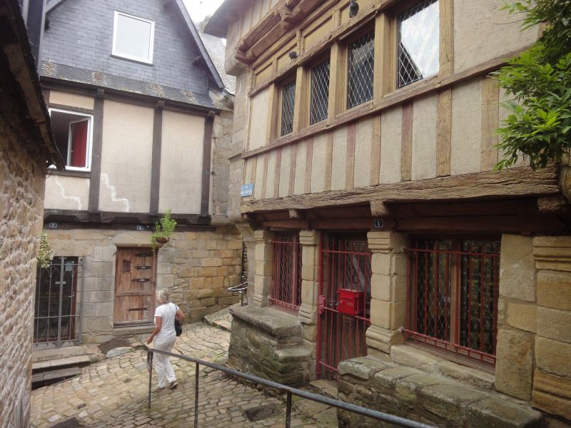
Granville is nothing special, it has a pretty center with small shops. The church stands on a hill from which one has a beautiful view of the fishing town and port. In the travel guides it is written that you can see the rock monastery Saint Michele from here when the visibility is good. Therefore, we chose the place, it should get us in the mood for the next stage destination "Mont Saint Michel" . The church is simply furnished inside. The second church, which appeared larger on the other side of town, was closed for renovation. It was also difficult to find, only a narrow driveway led up to it from the center.
Rue du Roc, 50400 Granville, Frankreich
48° 50' 7.1" N 1° 36' 34.1" W
48.8352960 -1.6094620
• Head southwest on Rue du Roc. Go for 193 m.
• Take the 2nd exit from Rond-Point des Français Libres roundabout onto Rue du Cap Lihou. Go for 337 m.
• Continue on Rue du Port. Go for 470 m.
• Turn slightly left onto Rue du Port. Go for 151 m.
• Turn slightly right toward Place d'Orléans. Go for 31 m.
• Take the 1st exit from roundabout onto Place Albert Godal. Go for 136 m.
• Continue on Boulevard des Amiraux Granvillais. Go for 314 m.
• Take the 2nd exit from Rond-Point des Amiraux Granvillais roundabout onto Boulevard des Amiraux Granvillais. Go for 355 m.
• Continue on Rue Saint-Gaud (D911). Go for 342 m.
• Take the 2nd exit from Rond-Point Saint-Gaud roundabout onto Rue Saint-Gaud (D911). Go for 410 m.
• Take the 2nd exit from Rond-Point d'Hacqueville roundabout onto Rue de la Crête (D911). Go for 525 m.
• Turn left onto Boulevard des Amériques (D135). Go for 347 m.
• Take the 1st exit from roundabout onto Boulevard des Amériques (D135). Go for 351 m.
• Take the 1st exit from Rond-Point de Sherborne roundabout onto Avenue des Vendéens (D973). Go for 561 m.
• Pass 2 roundabouts and continue on Route Nationale (D973). Go for 2.5 km.
• Take the 2nd exit from roundabout onto Route Nationale (D973) toward Le Mont-St Michel/Sartilly/Avranches. Go for 730 m.
• Pass 2 roundabouts and continue on Route de la Havaudière (D973). Go for 7.6 km.
• Take the 3rd exit from roundabout onto D973 toward Le Mont-St-Michel/Avranches. Go for 3.1 km.
• Pass 2 roundabouts and continue on Lieu-dit La Butte Ès Gros (D973). Go for 5.5 km.
• Take the 2nd exit from roundabout onto Route de Granville (D673). Go for 2.1 km.
• Take the 2nd exit from roundabout onto Route de Granville (D973) toward Avranches/Le Mont-St Michel. Go for 625 m.
• Take the 2nd exit from roundabout onto N175 toward Rennes/St Malo/Fougères/St Hilaire du H./Dol de B. Go for 7.6 km.
• Take ramp onto N175 toward St Brieuc/St Malo/Le Mont-St Michel/Pontorson. Go for 10.3 km.
• Turn right onto Rue de la Saint-Côme (D80) toward Les Pas/Beauvoir. Go for 173 m.
• Take the 2nd exit from roundabout onto Rue de la Saint-Côme (D80). Go for 90 m.
• Take the 1st exit from roundabout onto Rue de la Saint-Côme (D80). Go for 990 m.
• Continue on D80. Go for 991 m.
• Continue on Rue de la Forge (D80). Go for 325 m.
• Continue on Rue de Beau Seuil (D80). Go for 216 m.
• Continue on Rue de Beau Seuil les Pas (D80). Go for 987 m.
• Continue on D80. Go for 587 m.
• Continue on Rue de Grandelle (D80). Go for 427 m.
• Continue on Rue d'Astériac (D80). Go for 648 m.
• Turn left onto Route du Mont-Saint-Michel (D776). Go for 395 m.
• Turn right. Go for 112 m.
• Arrive at your destination on the right.
☍
50,5 km
( 49 min.)
Beauvoir
⛅ 14 °C
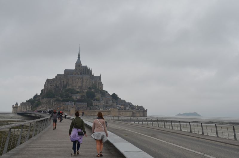
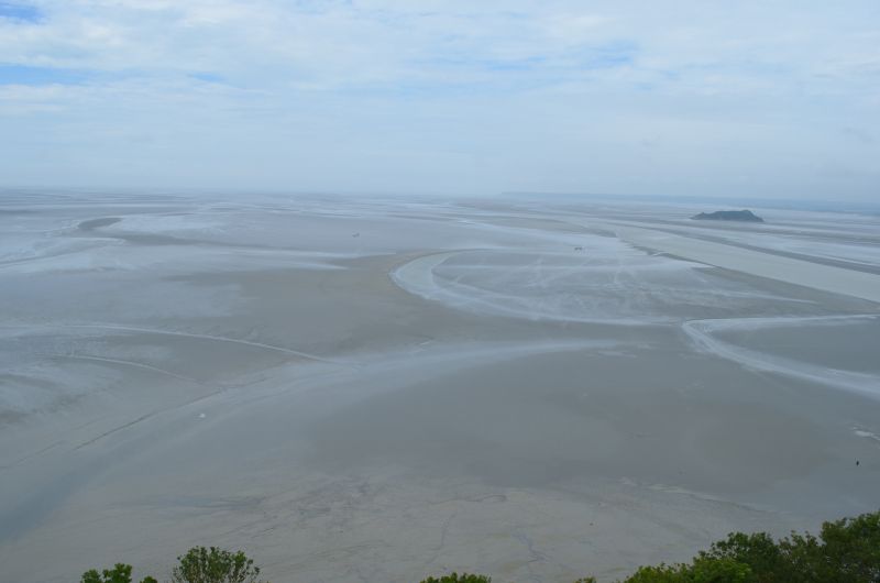
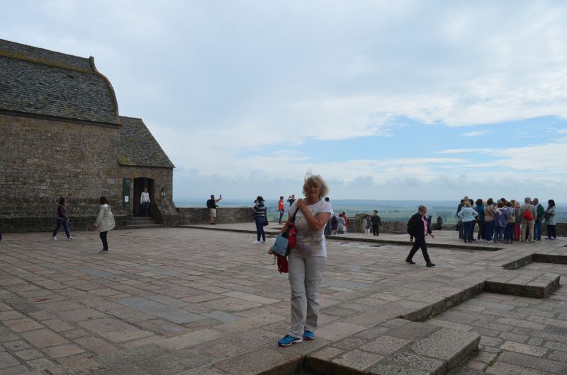
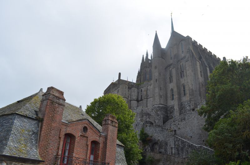
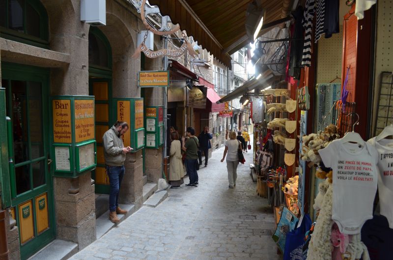
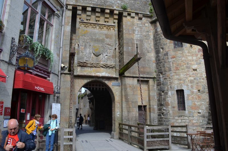
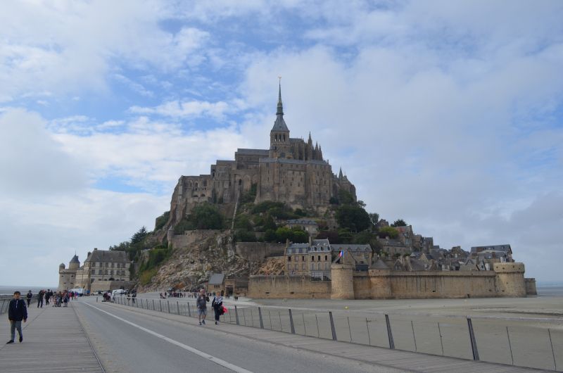
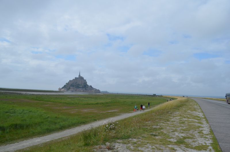
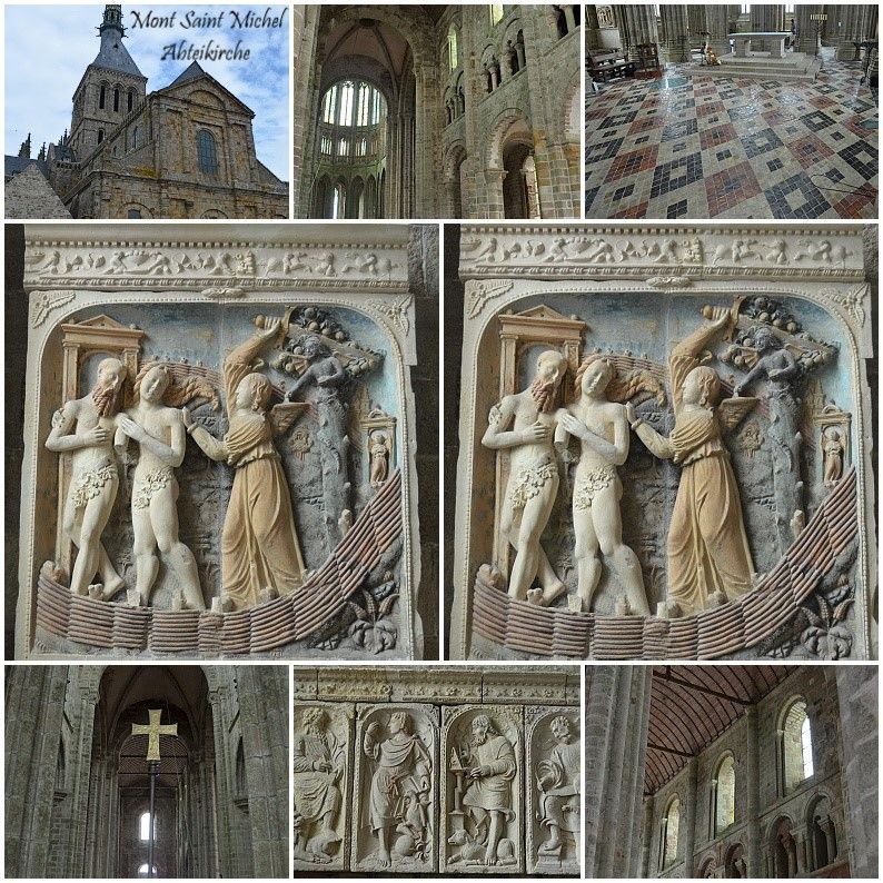
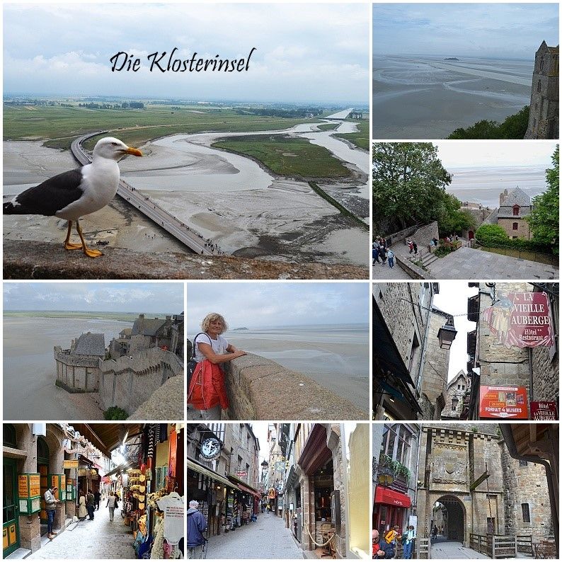
Standing Mont Saint Michel in real life in front of this unusual monastic island is unbelievable, magnificent, glorious and mysterious. From the parking space (GPS:48.5936,1.51246667) we walked (5 km) to the monastery island, first alone and on the jetty with many other people. The Inselberg, which also offers an impressive picture at low tide, and in order to reach the upper abbey church, many steep steps have to be climbed first, but the magnificent view from the top makes up for all the effort! For many years after the French Revolution, the old monastery was a feared state prison. We inspected the monastery in detail and then walked back down to the entrance through old, narrow streets and small shops. Visibly impressed by the width of the low tide, we returned back to the camper place.
8 Route du Mont Saint-Michel, 50170 Beauvoir, Frankreich
48° 35' 36.8" N 1° 30' 44.2" W
48.5935467 -1.5122780
• Head southeast. Go for 176 m.
• Turn right toward Route du Mont-Saint-Michel/D776. Go for 91 m.
• Turn right onto Route du Mont-Saint-Michel (D776). Go for 4.2 km.
• Take the 1st exit from roundabout onto Boulevard du Général Patton (D19). Go for 624 m.
• Take the 1st exit from Rue Couesnon roundabout onto Rue Couesnon (D776) toward St Malo/Dinan/Pleine-Fougères/Dol de B. Go for 250 m.
• Take the 1st exit from roundabout onto Route de Saint-Georges (D997). Go for 1.4 km.
• Take the 1st exit from roundabout onto D797 toward St Malo/Dinan/Dol de Bgne/St Georges de Ggne/Roz S/Couesnon/Cherrueix. Go for 317 m.
• Take the 2nd exit from roundabout onto N176 toward St Malo/Dinan/Dol de Bgne. Go for 28.8 km.
• Take ramp onto D137 toward St Malo/Châteauneuf d'I. et V./Barrage de la Rance. Go for 10.3 km.
• Keep left onto D137 toward Saint-Malo Par Saint-Servan/D168/Dinard/Aéroport Pleurtuit/Barrage de la Rance. Go for 260 m.
• Keep left onto Rue du Général Patton (D137) toward Saint-Malo Par Saint-Servan. Go for 152 m.
• Pass 2 roundabouts and continue on Rue du Général Patton. Go for 845 m.
• Continue on Rue de la Balue. Go for 280 m.
• Take the 1st exit from roundabout onto Rue de la Balue. Go for 296 m.
• Take the 2nd exit from Rond-Point du Mouchoir Vert roundabout onto Rue de la Marne toward St Malo-Centre/Le Port/Centre Hospitalier/Alet. Go for 1.2 km.
• Take the 3rd exit from roundabout onto Rue des Grèves de Chasles (D126) toward Saint-Servan. Go for 159 m.
• Pass 4 roundabouts and continue on Quai Saint-Louis (D126). Go for 1.5 km.
• Turn left onto Porte Saint-Louis. Go for 17 m.
• Continue on Rue de Toulouse. Go for 47 m.
• Turn right onto Rue d'Asfeld. Go for 64 m.
• Turn left onto Rue des Forgeurs. Go for 81 m.
• Continue on Rue Saint-François. Go for 58 m.
• Turn right onto Rue Robert Surcouf. Go for 21 m.
• Turn left onto Rue Sainte-Catherine. Go for 32 m.
• Continue on Place Brevet. Go for 28 m.
• Continue on Rue Saint-Sauveur. Go for 71 m.
• Turn right onto Rue des Bouchers. Go for 75 m.
• Continue on Rue de la Crosse. Go for 113 m.
• Continue on Rue Sainte-Anne. Go for 80 m.
• Continue on Rue Grout de Saint-Georges. Go for 48 m.
• Turn right onto Rue Toullier. Go for 34 m.
• Turn right onto Rue Toullier. Go for 43 m.
• Turn left onto Place Gasnier-Duparc. Go for 51 m.
• Turn right onto Place Jean de Châtillon. Go for 43 m.
• Turn left onto Rue Guillaume Le Gouverneur. Go for 22 m.
• Arrive at Rue Guillaume Le Gouverneur. Your destination is on the left.
☍
51,8 km
( 45 min.)
Day
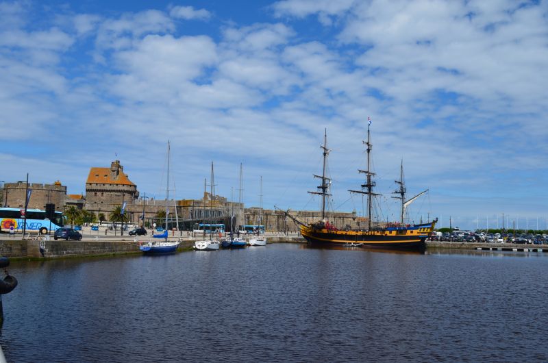
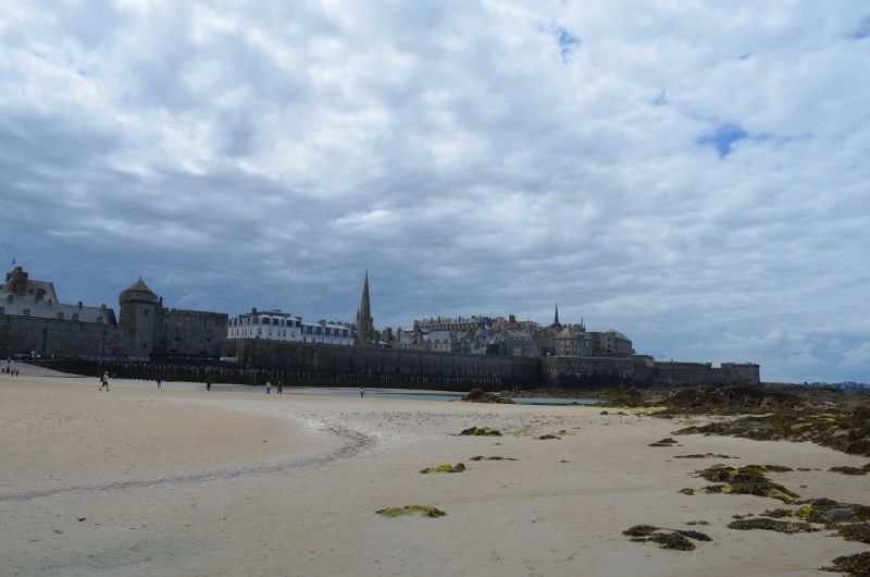
St Malo
GPS: 48.64826667.2.0142
Ideal place for visiting the old town
Costs: €0.50/hour
On the way to St. Malo we crossed the " Border from Normandy to Brittany".
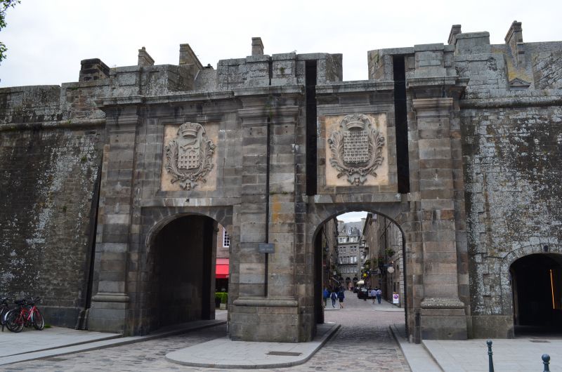
What to discover stronghold of one of King Louis XIV's most famous pirates. Here, too, it is not easy to find a parking space with a Womo. We parked a bit back from the old town and the harbor pier on the side of the road in the industrial port
Walk through the sea
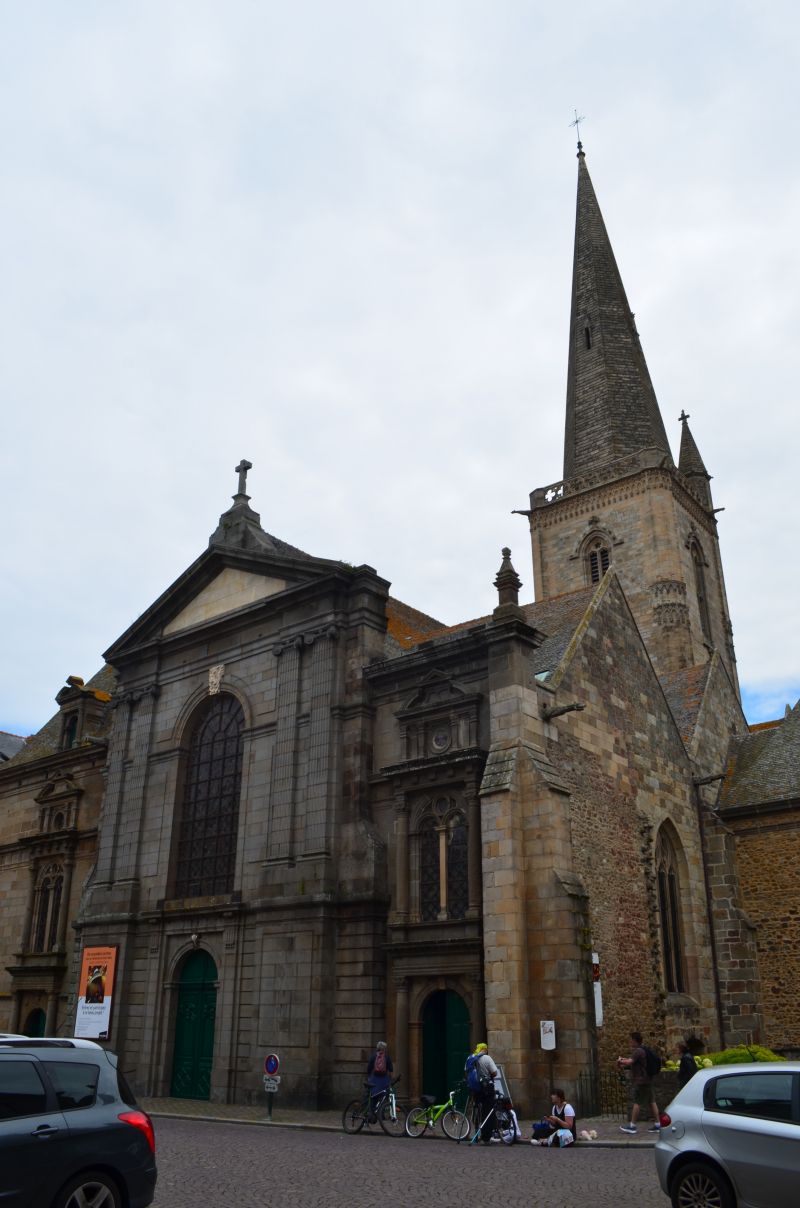
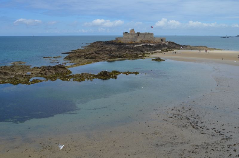
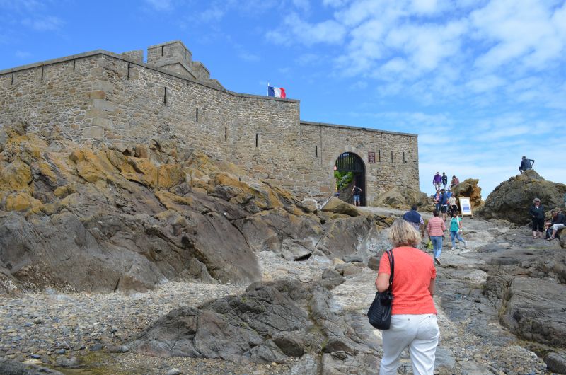
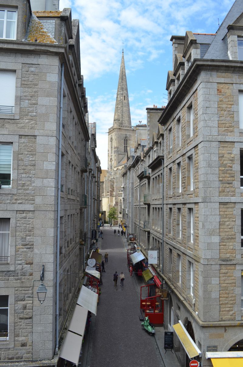
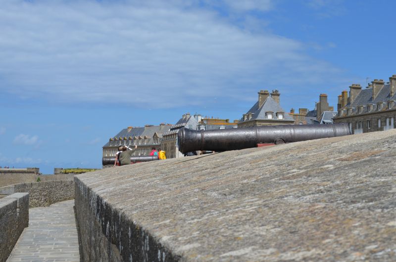
As you walk along the beachfront, Fort National is the obvious sight. Built on a tidal island, this fort was used to defend the coast from an attack by the English. The special thing is that you can walk across to the island at low tide. And we are lucky! We have low tide and of course we make our way, which is not too long. Sure, the rocks and the fort are interesting to look at up close, but the view of the old town of Saint Malo from there is even more beautiful. The fort can be visited for a fee, which we leave out. After a while, the path takes us back to the mainland and along the fortress wall in the direction of the old town. A visit to the Cathédrale Saint Vincent is particularly impressive.
Saint-Malo, Frankreich
48° 38' 57.6" N 2° 1' 32.4" W
48.6493370 -2.0256740
• Head toward Place Jean de Châtillon on Rue Guillaume Le Gouverneur. Go for 22 m.
• Turn left onto Rue du Pourpris. Go for 43 m.
• Continue on Rue Broussais. Go for 121 m.
• Continue on Rue de Dinan. Go for 177 m.
• Continue on Porte de Dinan. Go for 25 m.
• Turn left onto Esplanade de la Bourse. Go for 38 m.
• Turn right onto Esplanade de la Bourse. Go for 141 m.
• Take the 2nd exit from Rond-Point de l'Île Maurice roundabout onto Chaussée Éric Tabarly (D126). Go for 529 m.
• Take the 3rd exit from Rond-Point du Naye roundabout onto Quai de Trichet (D126) toward Les Sablons/La Gare. Go for 467 m.
• Take the 4th exit from roundabout onto Quai de Trichet (D126) toward Barrage de la Rance. Go for 455 m.
• Take the 2nd exit from Giratoire des Quatre Pavillons roundabout onto Rue des Grèves de Chasles (D126) toward Marville/Paramé. Go for 152 m.
• Take the 1st exit from roundabout onto Boulevard des Talards toward Bellevue. Go for 212 m.
• Continue on Rue de la Marne. Go for 959 m.
• Take the 3rd exit from Rond-Point du Mouchoir Vert roundabout onto Rue de la Balue toward Dol-de-Bretagne/Barrage de la Rance/Lorette/La Madeleine. Go for 333 m.
• Take the 1st exit from roundabout onto Rue Doutreleau. Go for 352 m.
• Continue on Boulevard de la Rance. Go for 316 m.
• Take the 2nd exit from roundabout onto Boulevard de la Rance. Go for 395 m.
• Take ramp onto D168. Go for 5.5 km.
• Take the 2nd exit from roundabout onto Rue de la Ville-Ès-Passants (D168) toward Ploubalay. Go for 4.7 km.
• Continue on D768. Go for 1.8 km.
• Take the 1st exit from Giratoire de la Boule d'Or roundabout onto Rue du Général de Gaulle (D768) toward St Brieuc/Plancoët. Go for 60 m.
• Take the 2nd exit from roundabout onto Rue du Général de Gaulle (D768). Go for 402 m.
• Take the 4th exit from Giratoire de la Côte d'Émeraude roundabout onto D768 toward St Brieuc/Trégon/St Jacut-de-la-Mer/Plancoët/Matignon/St Cast-le-Guildo/Cap Fréhel/Château du Guildo. Go for 509 m.
• Pass 3 roundabouts and continue on Rue de la Côte d'Émeraude (D768). Go for 3.6 km.
• Take the 1st exit from roundabout onto D786 toward Matignon/St Cast le Guildo/Cap Fréhel. Go for 4.4 km.
• Pass 2 roundabouts and continue on D786. Go for 4.8 km.
• Turn right onto Place du Général de Gaulle (D786). Go for 173 m.
• Turn right onto Rue Saint-Germain (D786). Go for 7.1 km.
• Pass 2 roundabouts and continue on D786. Go for 5.9 km.
• Take the 2nd exit from roundabout onto Rue des Jeannettes (D34) toward Erquy. Go for 3.7 km.
• Turn right onto Rue des Évettes. Go for 167 m.
• Arrive at Rue des Évettes. Your destination is on the left.
☍
47,7 km
(1 hrs. )
Erquy
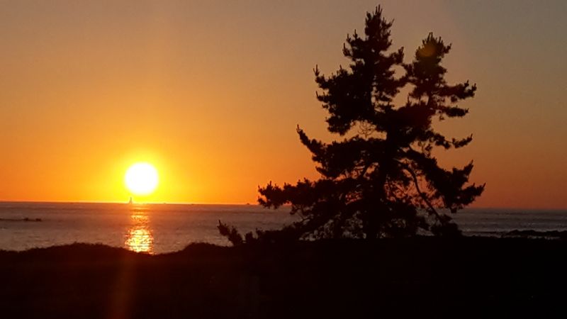
After visiting Saints Malo we drove 40 km further to the pitch in Erqux. (GPS:48.62138333,2.47281667) It was already full when we arrived, but there was still a gap where we could stand. It was only late afternoon and so we took a walk on the beach at low tide and on a fine sandy beach. The sea waves were already violent, Irmgard didn't miss the opportunity to bathe in them for a moment. Emotionally, the water was warmer than the wind. We had an air temperature of 17°C. Around 10 p.m. we were able to end the day with a wonderful sunset.
The night was quiet and those of the campers who planned to stay longer moved early in the morning to a vacated pitch, in the front row with a sea view.
Before leaving, we visited the more distant town center that had a small shop to buy bread.
Rue des Evettes, 22430, Erquy, Frankreich
48° 37' 19" N 2° 28' 20" W
48.6219444 -2.4722222
• Head toward Impasse des Macareux on Rue des Évettes. Go for 50 m.
• Turn left onto Rue des Évettes. Go for 33 m.
• Continue toward Rue de Cavé. Go for 102 m.
• Turn slightly left onto Rue de Cavé. Go for 206 m.
• Turn left onto Avenue de la Plage. Go for 98 m.
• Take the 2nd exit from roundabout onto Avenue de la Plage. Go for 116 m.
• Turn left onto Rue du Rocher. Go for 126 m.
• Turn sharp right onto Route de Pléneuf (D34). Go for 5.2 km.
• Take the 3rd exit from roundabout onto D786 toward St Alban/St Brieuc/Lamballe. Go for 1.5 km.
• Take the 3rd exit from roundabout onto D786 toward St Alban/Lamballe/St Brieuc. Go for 4.1 km.
• Take the 4th exit from Rond-Point du Poirier roundabout onto Rue du Poirier (D786) toward Planguenoual/St Brieuc. Go for 3.6 km.
• Pass 3 roundabouts and continue on Rue des Ponts Neufs (D786). Go for 7.7 km.
• Take the 2nd exit from Rond-Point des Grands Champs roundabout onto N12 toward St Brieuc/Yffiniac/Langueux. Go for 7.7 km.
• Keep left onto N12 toward St Brieuc-Centre/Brest/Plérin/Port de St Brieuc-le Légué. Go for 974 m.
• Keep left onto Avenue de France (N12) toward Lannion/Morlaix/Brest/Plérin/Aéroport St Brieuc-Armor. Go for 38.3 km.
• Take ramp toward Kernilien/Lannion/Tréguier/Bégard. Go for 249 m.
• Take the 2nd exit from roundabout onto D767 toward Lannion/Perros-Guirec/Bégard/Tréguier. Go for 25.8 km.
• Take the 2nd exit from Rond-Point Kroafhent-Tro Boutilh roundabout onto D767 toward Tréguier/Perros-Guirec/Trégastel. Go for 1.3 km.
• Take the 3rd exit from roundabout onto D767. Go for 2.0 km.
• Take the 3rd exit from Rond-Point du Rusquet roundabout onto Rue Saint-Pierre. Go for 351 m.
• Take the 2nd exit from Rond-Point Saint-Pierre roundabout onto Rue Saint-Pierre. Go for 413 m.
• Take the 4th exit from Rond-Point Pégase roundabout onto Avenue Pierre Marzin (D11). Go for 1.3 km.
• Pass 3 roundabouts and continue on Route de Lannion (D11). Go for 8.3 km.
• Take the 1st exit from roundabout onto Rue de Poul Palud (D788). Go for 571 m.
• Turn left onto Rue de Poul Palud. Go for 74 m.
• Arrive at Rue de Poul Palud.
☍
110,2 km
(1 hrs. 24 min.)
Day
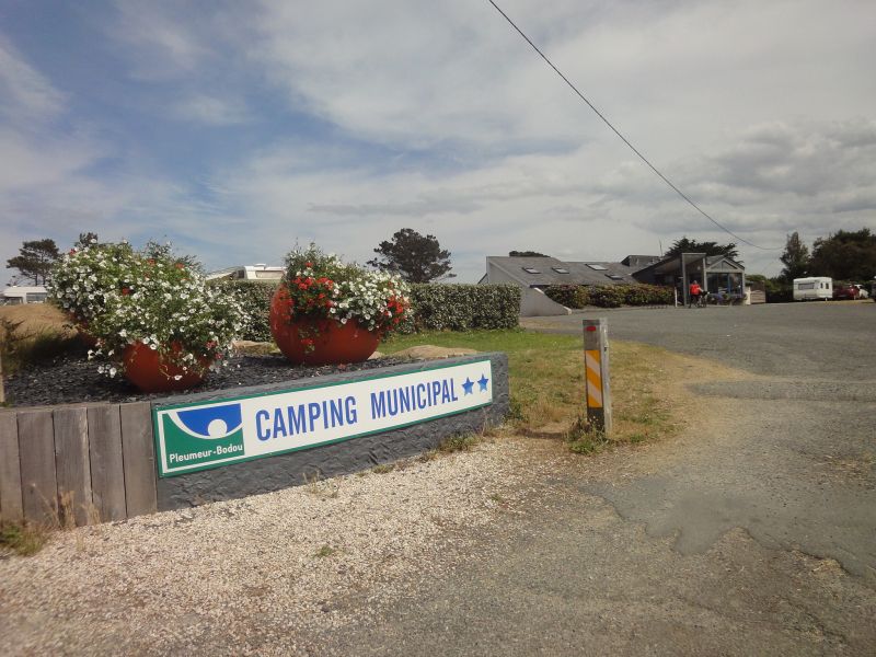
Trégastel Tourony Camping
⛅ 17°C
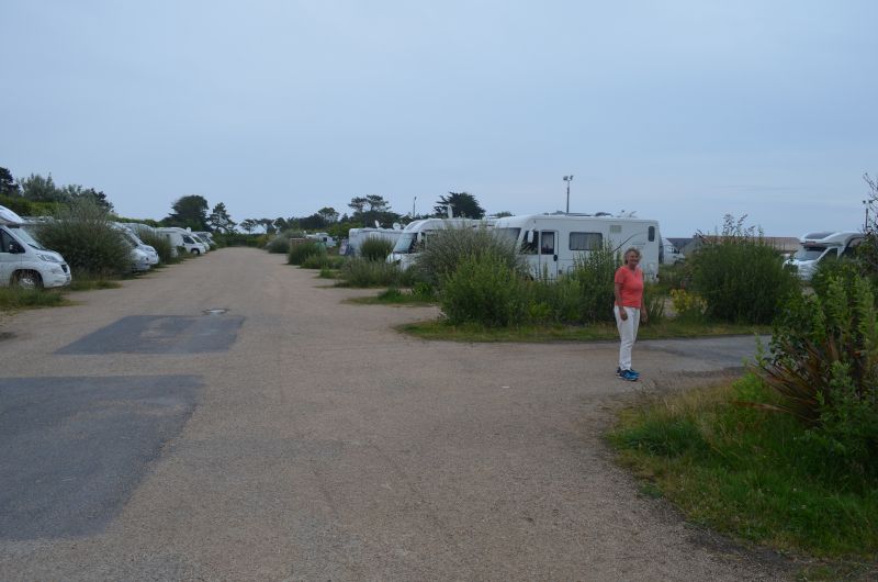
The weather report was decisive that we drove to the campsite. A parking space was provided from which we planned a hike. The weather forecast announced two days of sunny weather for the "Granite of the Rose" region. It was only planned for a later date, on the "Quiberon" peninsula, for a two-day rest day for swimming.
From where we saw the campsite, clean and spacious with a beautiful sandy beach, our decision was correct. Rain was already forecast for the Quiberon Peninsula. We stayed two nights.
(Camping GPS:48.81816667,3.53858333)
Rue de Poul Palud, 22730 Trégastel, Frankreich
48° 49' 26.1" N 3° 30' 10.7" W
48.8239174 -3.5029727
• Head toward Rue des Écoles on Rue de Poul Palud. Go for 74 m.
• Turn right onto Rue de Poul Palud (D788). Go for 560 m.
• Take the 3rd exit from roundabout onto Route de Lannion (D11). Go for 866 m.
• Take the 2nd exit from roundabout onto Route de Lannion (D11). Go for 3.8 km.
• Take the 1st exit from roundabout onto Route de Trégastel (D6). Go for 373 m.
• Keep left onto Route de Trégastel (D6). Go for 3.2 km.
• Take the 3rd exit from Rond-Point de l'Aéroport roundabout onto Avenue Pierre Marzin (D11). Go for 1.2 km.
• Turn right onto Avenue de la Résistance (D788). Go for 752 m.
• Take the 2nd exit from Rond-Point Armor roundabout onto Avenue de la Résistance (D788). Go for 1.9 km.
• Take the 1st exit from roundabout onto Pont Viarmes (D786) toward Gare SNCF. Go for 56 m.
• Pass 2 roundabouts and continue on Route de Morlaix (D786). Go for 2.6 km.
• Take the 3rd exit from Giratoire du Détour du Yaudet roundabout onto Route de Morlaix (D786) toward Morlaix/Plestin les Grèves. Go for 3.3 km.
• Pass 5 roundabouts and continue on D786. Go for 18.4 km.
• Take the 3rd exit from roundabout onto Coat-Ar-Park (D786) toward Morlaix. Go for 9.4 km.
• Take ramp onto N12 toward Brest/Quimper/St Martin/St Pol/Roscoff. Go for 16.1 km.
• Take ramp toward Kermat/Guiclan/Guimiliau. Go for 213 m.
• Turn left onto D31. Go for 399 m.
• Continue on Route de Guiclan (D31). Go for 173 m.
• Turn right onto Route de Saint-Thégonnec. Go for 56 m.
• Turn left onto Route de Guimiliau (D31). Go for 334 m.
• Continue on D31. Go for 219 m.
• Continue on Lieu-dit Kerfaven Kermat (D31). Go for 85 m.
• Continue on D31. Go for 2.4 km.
• Continue on Route de Kermat (D31). Go for 576 m.
• Take the 2nd exit from roundabout onto Route de Kermat (D31). Go for 161 m.
• Turn right onto Rue du Calvaire. Go for 73 m.
• Turn slightly right onto Rue du Calvaire. Go for 257 m.
• Arrive at Rue du Calvaire. Your destination is on the left.
☍
67,5 km
(1 hrs. 7 min.)
Wanderung Halbinsel Presqu'île Renote - Trégastel - rosa Granitküste
⛅ 19 °C
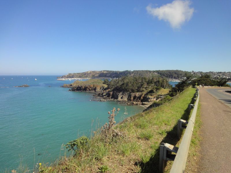
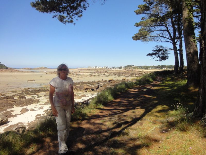
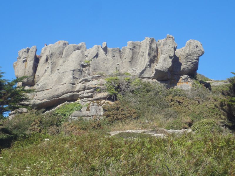
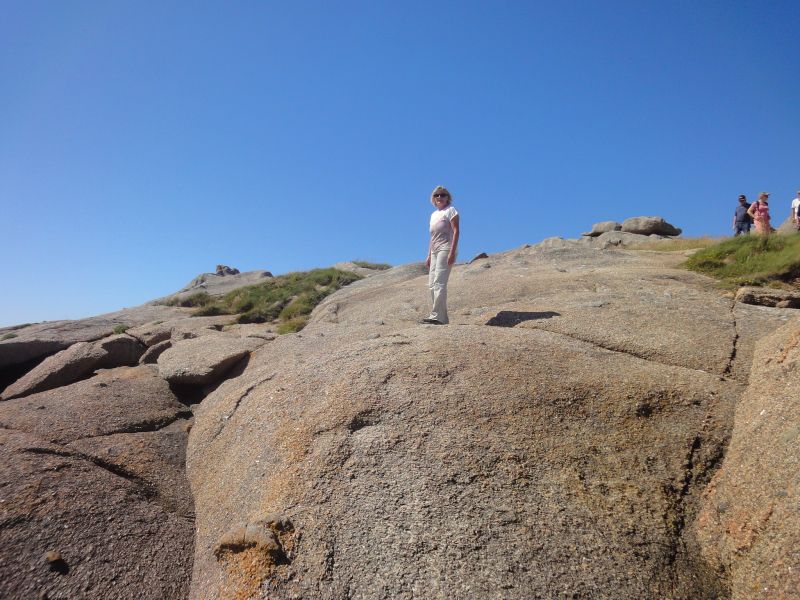
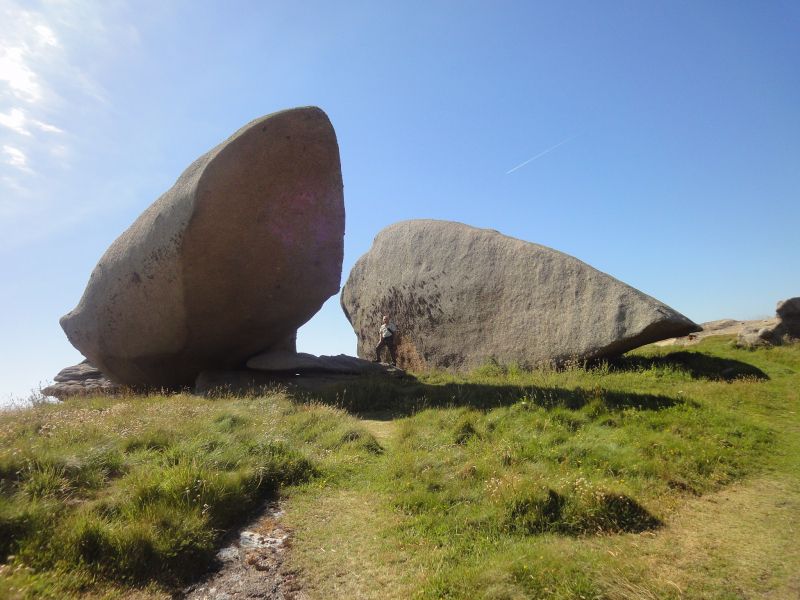
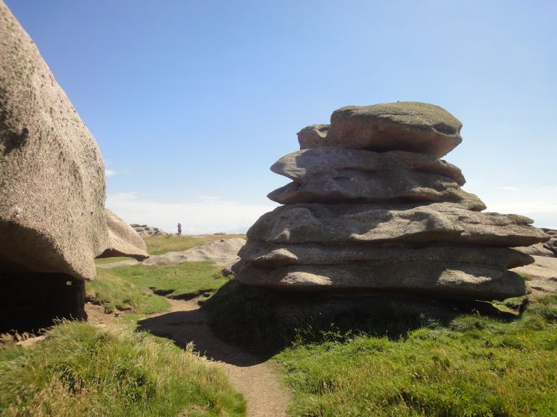
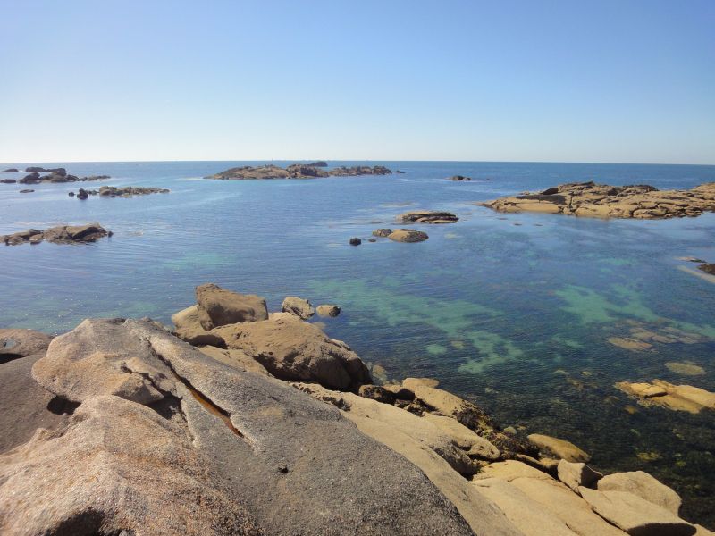
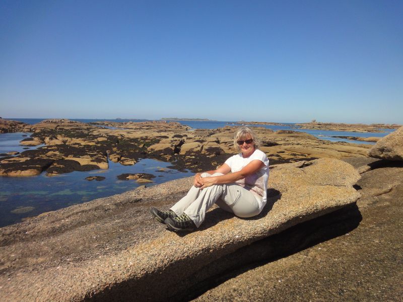
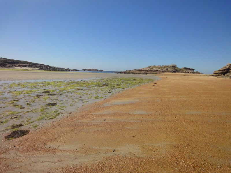
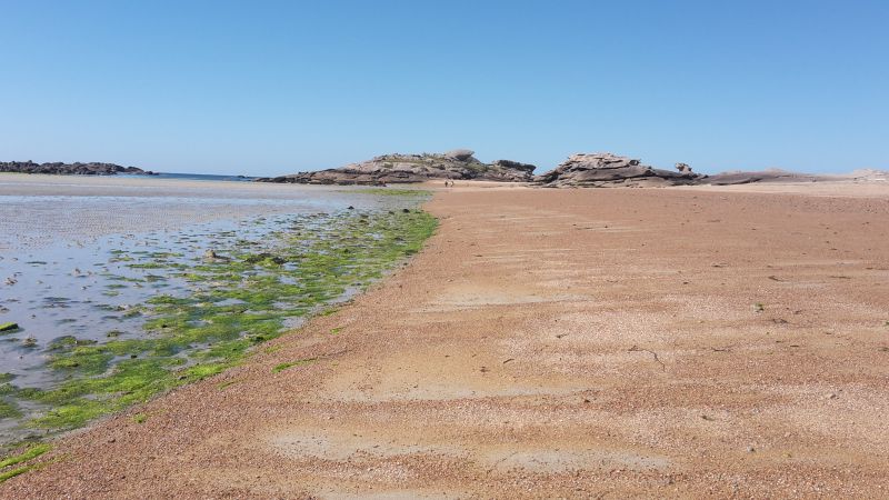
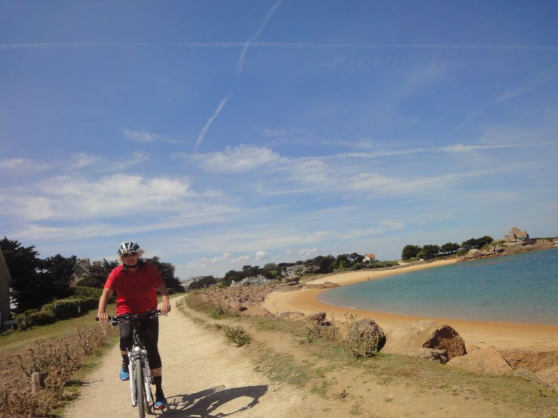
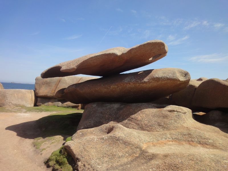
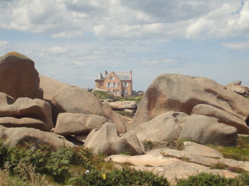
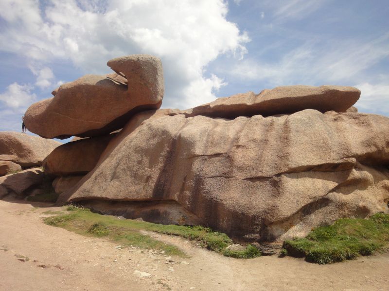
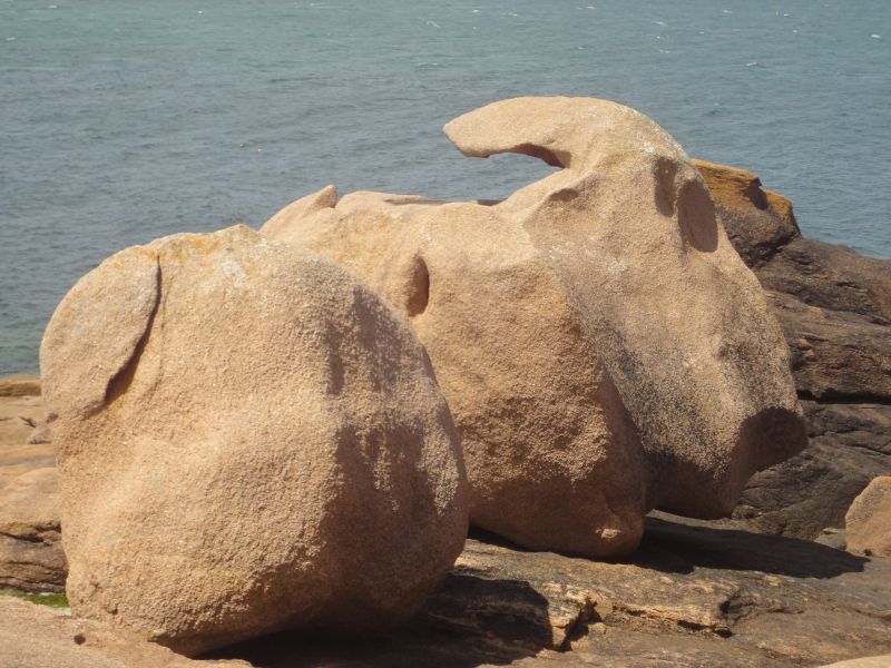
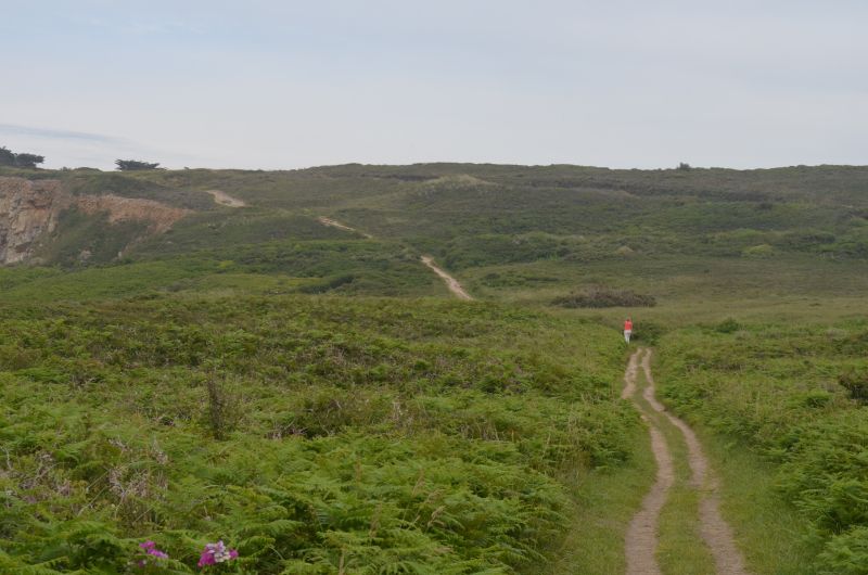
We started the beautiful and first hike of our trip in wonderful weather and pleasant temperatures of 19°. First we walked from the campsite along the beach and through the elegant residential area of Trégastel. This is where the geologically most interesting part began. These stones were formed 300 million years ago, forming bizarre formations as if thrown by a giant hand.
The Renote peninsula on the pink granite coast (Côte de Granit Rose) in Brittany has extraordinary rock formations made of reddish granite. The peninsula of Presqu'île Renote is located in the municipality of Trégastel. Trégastel, Perros-Guirec and Ploumanac'h are the main towns on the Pink Granite Coast in the Côtes d'Armor department of Brittany.
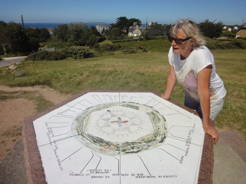
The sign "Bienvenue sur la presqu'ile Renote" (Welcome to the Renote peninsula) welcomes the hiker. When entering the Renote peninsula, you can see the island Île du Grande Gouffre (English: island of the great abyss), which can only be reached at low tide. The transition to the island was not washed over by the water during our visit, so that a visit was possible. There are many rocks in the sea off the coast of the Presqu'île Renote peninsula, some of which look like small offshore islands. The Grève Blanche is a beach with white sand, above is a viewpoint with a great view of the coast and the town of Trégastel. The view of rocks stacked on top of each other by magic in front of the English Channel is impressive. We took advantage of the high tide and were able to walk across the mud flats at low tide, making it a nice circular hike.
Day
Radtour Granit de Rose
⛅ 23°C
The day started with a sunny morning. Had slept late and went into the sea for a swim before breakfast. The water was so cold that we couldn't stay in the water for long. (estimated 15 degrees).
After breakfast we got ready for the bike ride to the granite rocks. The landscape is more of a hiking area, there are very few cycle paths and the signposting is also very incomplete.
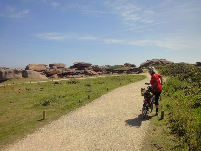
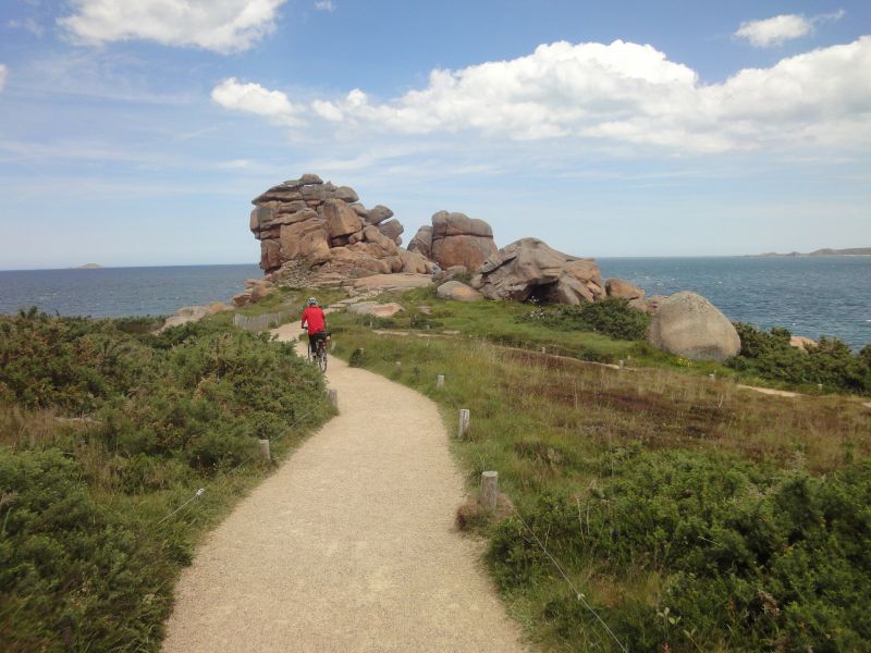
Small bike tour on the smugglers' path.
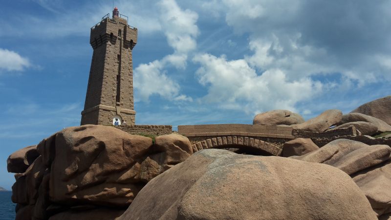
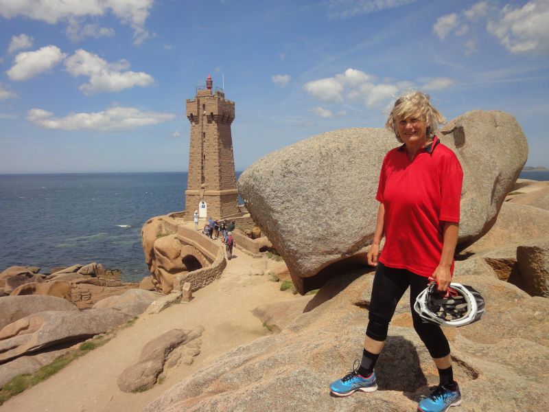
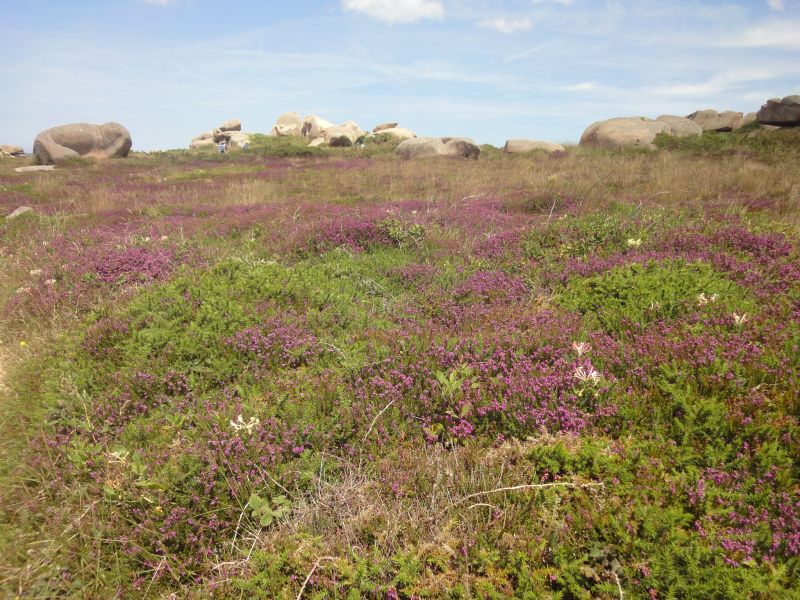
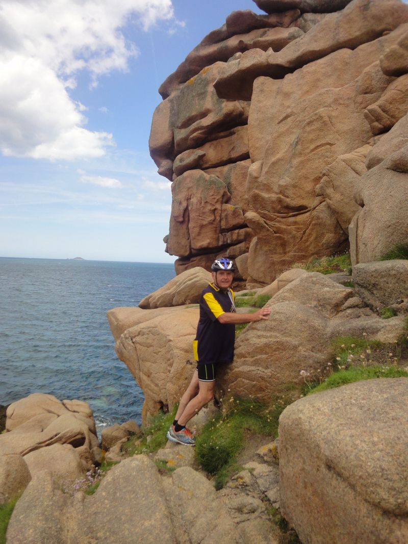
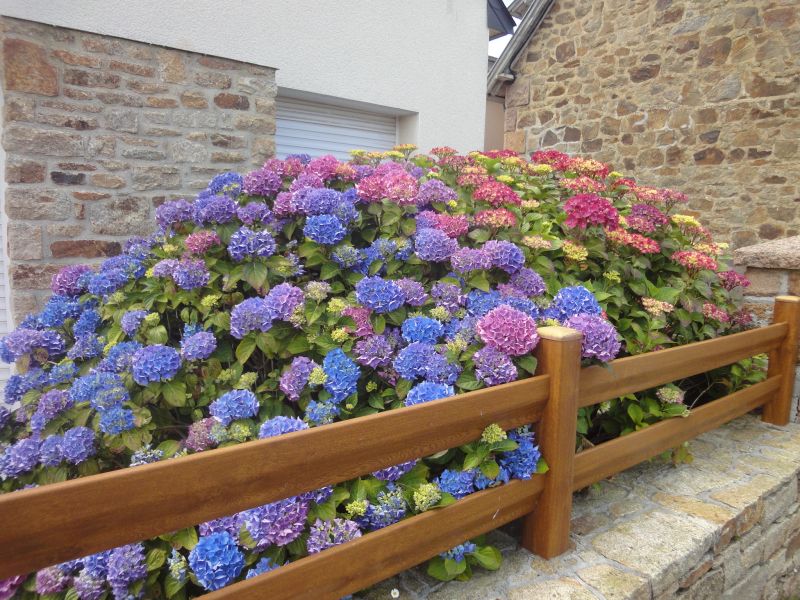
Sleeping giants snore along the way and we cycled along the old customs officer's path, which always offers us wonderful views of the sea and the offshore islands. The whole bike tour, during which we also walked a lot, was a single play of colors: the pink granite, the deep blue sky, the emerald green of the sea, dark green conifers and the blue-violet blooming hydrangeas. In the middle of the beach of Ploumenac'h, at the lighthouse, we climbed over the bare rocks.
We cycled the smugglers' trail, which is designed as a hiking trail, and were often told that it wasn't a bike trail (8km). The Ploumanac'h lighthouse (Phare Mean Ruz) and the former home of Alexandre Gustave Eiffel. Alexandre Gustave Eiffel built the Eiffel Tower in Paris in the 19th century.
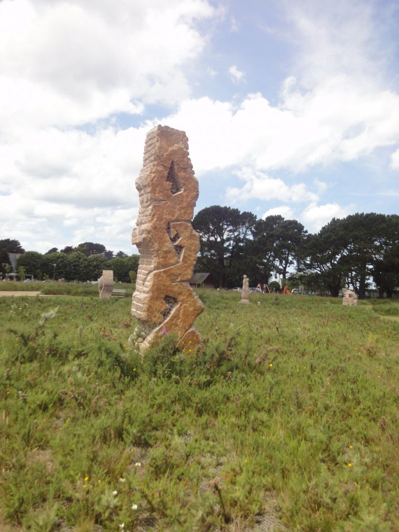
A stone circle made of granite sculptures by the Breton association VALLEY OF THE SAINTS was very interesting
On the way back we had to buy bread and bananas in a supermarket. After returning to the WoMo, we approved our lunchtime coffee with the pastries we had bought. Of course, swimming in the sea was not to be missed. It was still low tide, the tide had already started and will have peaked around 10pm. The water was noticeably warmer than in the morning.
Sitting outside was uncomfortable, a really cold wind was blowing. We got our camper ready for the onward journey the next day.
Day
Saint -Thegonnec
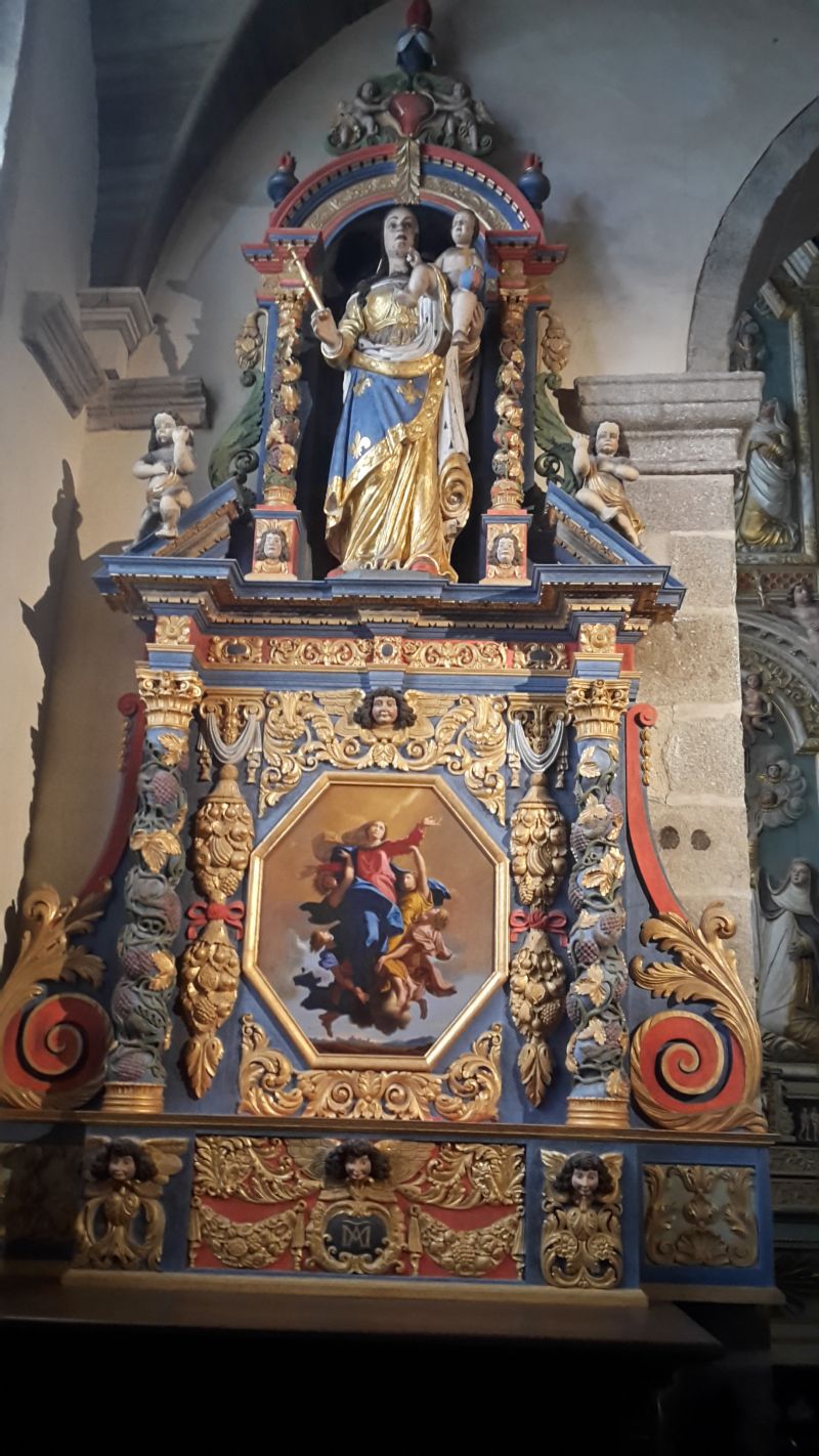
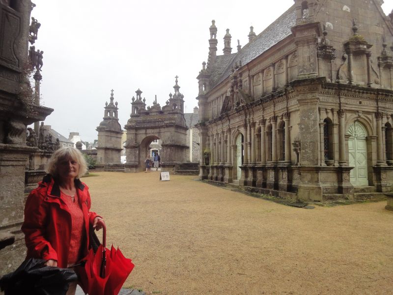
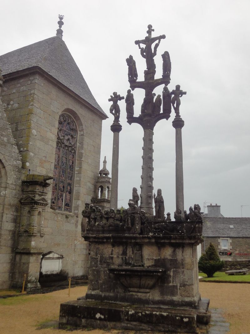
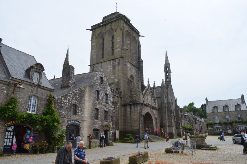
Our onward journey through rural Brittany took us to Saint-Thegonnec. (GPS:48.52125,3.9422833) One of the most important Calvary mountains in France is located in the enclosed parish of the small town. More than forty figures depict the life of Jesus and his last journey on Calvary. The most imposing feature of the parish of Saint-Thégonnec is undoubtedly the two-story ossuary with Corinthian half-columns, built between 1676 and 1682. In contrast, the Calvaire shows only about 40 figures; the scenes depicted are the Passion and the Resurrection. The story of Saint Thégonnec is depicted in the base.
Guimiliau, Frankreich
48° 29' 15.4" N 4° 0' 0.3" W
48.4876199 -4.0000749
• Head toward Rue de la Gare on Rue du Calvaire. Go for 22 m.
• Turn right onto Route de Saint-Jacques. Go for 203 m.
• Turn right onto Place du Porz. Go for 221 m.
• Turn left onto Rue des Genêts. Go for 187 m.
• Take the 1st exit from roundabout onto Route de Kermat (D31). Go for 353 m.
• Take the 2nd exit from roundabout onto Route de Kermat (D31). Go for 237 m.
• Continue on Lieu-dit Kerpont (D31). Go for 151 m.
• Continue on D31. Go for 841 m.
• Continue on Lieu-dit Croaziou Kerven (D31). Go for 53 m.
• Continue on D31. Go for 290 m.
• Continue on Lieu-dit Guerlestan (D31). Go for 114 m.
• Continue on D31. Go for 1.4 km.
• Continue on Lieu-dit Croaz Ruz (D31). Go for 30 m.
• Continue on Lieu-dit La Croix Rouge (D31). Go for 854 m.
• Continue on D31. Go for 135 m.
• Continue on Lieu-dit Kerriou (D31). Go for 963 m.
• Continue on D31. Go for 653 m.
• Turn left onto Lieu-dit Vernhir (D11). Go for 4.6 km.
• Turn left onto Lieu-dit Toulloulan (D764). Go for 846 m.
• Turn right onto Lieu-dit Pontigou (D11). Go for 2.3 km.
• Turn right onto D785. Go for 18.9 km.
• Turn right onto Lieu-dit Ti Gwenn (D48) toward St-Ségal/Lopérec. Go for 446 m.
• Continue on D48. Go for 1.2 km.
• Continue on Lieu-dit Kroaz Nu (D48). Go for 408 m.
• Continue on Lieu-dit Ker Paugam (D48). Go for 688 m.
• Continue on Lieu-dit Kroaz Hent Kerasker (D48). Go for 850 m.
• Continue on Lieu-dit Kerbabu (D48). Go for 99 m.
• Continue on Lieu-dit Killiegou (D48). Go for 2.6 km.
• Continue on D48. Go for 727 m.
• Continue on Lieu-dit Coatiliger (D48). Go for 954 m.
• Continue on D48. Go for 86 m.
• Continue on Z.I. de Lospars (D48). Go for 921 m.
• Continue on D48. Go for 854 m.
• Continue on Lieu-dit Stang Ar Garront (D48). Go for 209 m.
• Continue on D887. Go for 115 m.
• Pass 2 roundabouts and continue on Route de Pleyben (D887). Go for 2.2 km.
• Turn right toward Rue Amiral Bauguen. Go for 370 m.
• Take the 3rd exit from roundabout onto Rue Amiral Bauguen. Go for 177 m.
• Turn right onto Rue Graveran (D887). Go for 1.6 km.
• Turn left onto D7. Go for 5.8 km.
• Take the 1st exit from roundabout onto Rue d'Ys (D7). Go for 830 m.
• Take the 3rd exit from roundabout onto Lieu-dit Treuscoat (D7). Go for 7.4 km.
• Take the 3rd exit from Rond-Point du Ménec roundabout onto Route de Plonévez-Porzay. Go for 415 m.
• Turn left onto Chemin de Ty Lokorn. Go for 10 m.
• Turn slightly left onto Chemin de Ty Lokorn. Go for 28 m.
• Turn right onto Chemin de Ty Lokorn. Go for 25 m.
• Arrive at Chemin de Ty Lokorn. Your destination is on the right.
☍
62,3 km
(1 hrs. 2 min.)
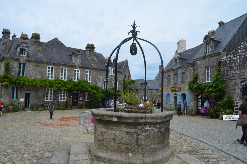
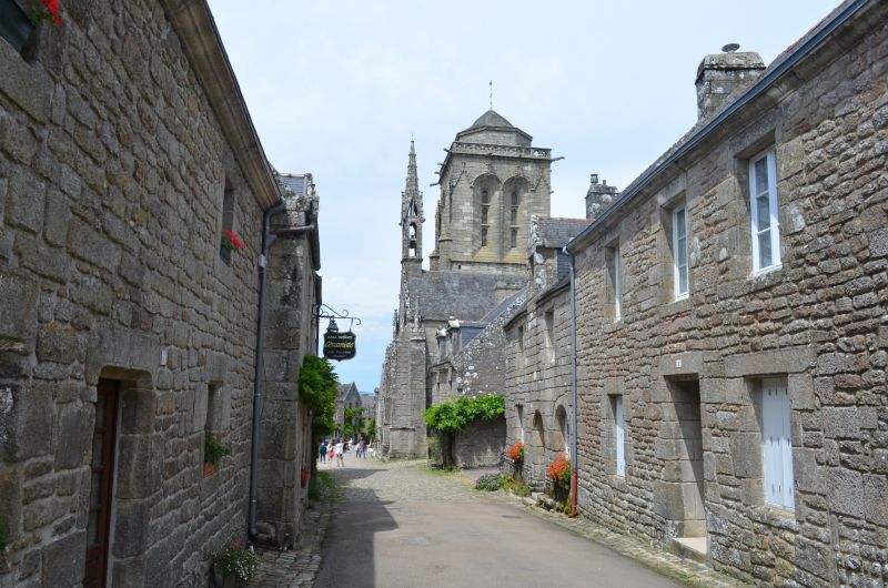
Locronan
The travel guide says you want to go back to the Middle Ages? Then make a stop in Locronan before heading to the Corzon Peninsula. The town can rightly call itself one of the most beautiful villages in France. Narrow, picturesque alleys, creperies and small shops invite you to stroll through the medieval town centre.
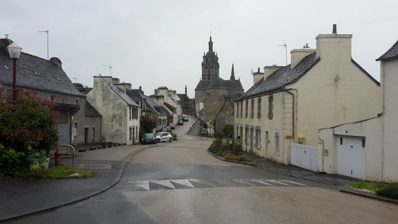
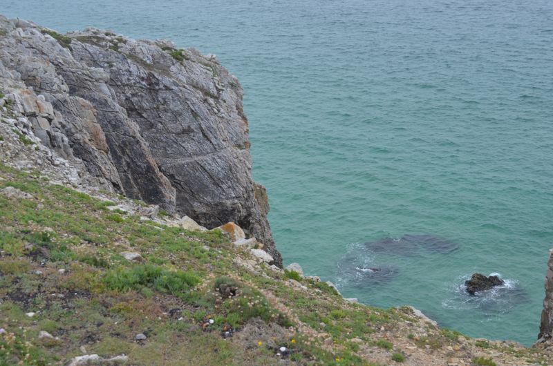
Another highlight of the day was the visit to the town of Locronan. (GPS:48.09941667,4.20538333) In the 11th century Saint Ronan Christianized the site and founded the town: Loc Ronan, the site of Ronan. From the 14th century the town prospered through canvas weaving and trading with all the major navies, reflected in beautiful granite houses and an imposing village church. It is not for nothing that the place was awarded the title "Particularly Picturesque Place" in Brittany and the label of the "Most Beautiful Villages in France". Car traffic in the city of 800 is strictly regulated, giving you the feeling that time has stood still here The appearance of the village is still completely medieval and seems very English to us Steep cliffs and a strong surf, gorse, heather and crouching cottages characterize the peninsula of Crozon.The 70 m high, spectacular cliff Pointe de Penhir offers a view in good weather to the Pointe du Raz.
3 Chemin de Kervellic, 29180 Locronan, Frankreich
48° 5' 58.2" N 4° 12' 19.7" W
48.0994976 -4.2054660
• Head west on Chemin de Ty Lokorn. Go for 150 m.
• Turn slightly left onto Chemin de Kervellic. Go for 100 m.
• Turn right onto Chemin du Styvel. Go for 184 m.
• Turn left onto Route de Kergoat (D7). Go for 234 m.
• Take the 1st exit from Rond-Point de Kervellic roundabout onto Route de la Presqu'Île (D63). Go for 3.6 km.
• Take the 2nd exit from roundabout onto Rue de la Presqu'Île (D63). Go for 2.7 km.
• Turn left onto Lieu-dit Toul Fil. Go for 64 m.
• Turn right toward Lieu-dit Kerherven. Go for 990 m.
• Continue on Lieu-dit Kerherven. Go for 289 m.
• Continue on Lieu-dit Roz al Len Huella. Go for 238 m.
• Continue on Lieu-dit Rozallen. Go for 246 m.
• Continue on Lieu-dit Penfont. Go for 378 m.
• Continue on Lieu-dit Kerlaouéret. Go for 179 m.
• Continue on Lieu-dit Lagonteniat. Go for 841 m.
• Take the 2nd exit from roundabout onto Route de Lestrevet. Go for 254 m.
• Continue on Lieu-dit Ménez Nonn. Go for 54 m.
• Continue on Lieu-dit Croaz Diben. Go for 136 m.
• Continue on Lieu-dit Kroas Diben. Go for 197 m.
• Continue on Lieu-dit Ty Gwen. Go for 113 m.
• Continue on Route de Lestrevet. Go for 175 m.
• Continue on Lieu-dit Keravel Ar Goulit. Go for 146 m.
• Continue on Route de Lestrevet. Go for 226 m.
• Continue on Lieu-dit Reluyen. Go for 121 m.
• Continue on Lieu-dit Lestrevet. Go for 825 m.
• Continue on Chemin d'Exploitation. Go for 438 m.
• Continue on Lieu-dit Lestrevet. Go for 432 m.
• Continue on C4. Go for 63 m.
• Continue on Chemin des Dunes (C4). Go for 1.4 km.
• Turn left onto Rue de la Presqu'Île (C3). Go for 836 m.
• Continue on C3. Go for 802 m.
• Continue on Lieu-dit Kerninet (C3). Go for 60 m.
• Continue on C3. Go for 166 m.
• Continue on Lieu-dit Tal Ar Groas. Go for 462 m.
• Continue on Lieu-dit Mez Meur. Go for 80 m.
• Continue on Lieu-dit Kergo. Go for 235 m.
• Continue on Lieu-dit Pen Ar Stang. Go for 1.3 km.
• Continue on C1. Go for 897 m.
• Turn left onto D887. Go for 6.6 km.
• Take the 3rd exit from roundabout onto Route de Crozon (D887). Go for 2.1 km.
• Take the 2nd exit from roundabout onto D887. Go for 1.9 km.
• Take the 1st exit from Giratoire de Sligo roundabout onto Boulevard Pierre Mendès France. Go for 318 m.
• Take the 3rd exit from roundabout onto Boulevard Pierre Mendès France. Go for 1.4 km.
• Take the 1st exit from roundabout onto Boulevard Pierre Mendès France. Go for 255 m.
• Take the 2nd exit from roundabout onto Boulevard de Pralognan. Go for 713 m.
• Take the 2nd exit from roundabout onto Route de Camaret (D8). Go for 1.7 km.
• Continue on D8. Go for 3.1 km.
• Continue on Lieu-dit Kerloc'h (D8). Go for 1.4 km.
• Continue on Lieu-dit École de Kerloch (D8). Go for 1.2 km.
• Continue on Rue de Crozon (D8). Go for 163 m.
• Take the 3rd exit from roundabout onto Rue de Crozon (D8). Go for 294 m.
• Take the 2nd exit from roundabout onto Rue du Chanoine Bossënec (D8). Go for 373 m.
• Take the 2nd exit from roundabout onto Rue du Chanoine Bossënec (D8). Go for 92 m.
• Take the 3rd exit from roundabout onto Rue André Antoine (D8). Go for 228 m.
• Take the 4th exit from roundabout onto Rue André Antoine (D8). Go for 613 m.
• Turn right onto Rue des Menhirs. Go for 156 m.
• Turn right onto Rue Saint-Pol Roux (D8 A). Go for 11 m.
• Turn left onto Rue Georges Ancey. Go for 100 m.
• Turn right. Go for 57 m.
• Arrive at your destination on the right.
☍
42,4 km
( 49 min.)
Aire camping car Lagatjar - Camaret-sur-Mer
⛅ 19 °C
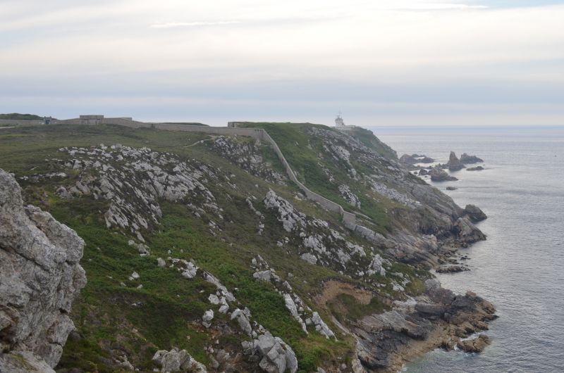
The best comes last in Finistère: the Crozon peninsula in the west is a unique natural experience.
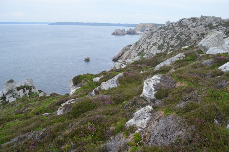
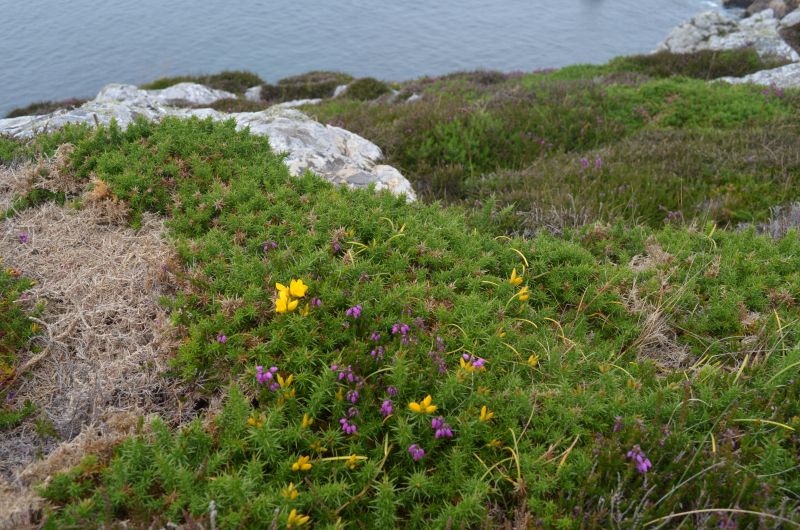
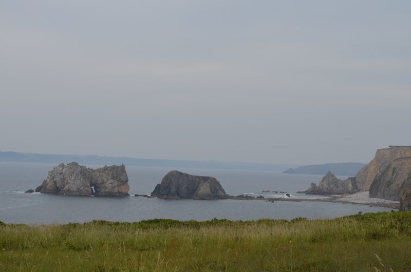
The last destination of the day was the wild coast of Brittany. (GPS:48.2748,4.60768333) The western tip of France is one of the most impressive experiences of Breton nature. Steep cliffs and strong surf, gorse, heather and crouched cottages characterize the Crozon Peninsula. The 70 m high, spectacular cliff Pointe de Penhir offers a view up to the Pointe du Raz in good weather. A short walk brought us to the top of the headland with a view of the offshore Sein Islands and the lighthouse. We were very lucky with the weather this time too. We could enjoy the cape with the blooming heather.
The stone rows of Lagatjar are not far from the parking lot. They are said to have originally consisted of up to 400 stones, so that the total length of the main structure used to be 600 meters. Many of the fallen stones of white quartzite were raised again in 1928 so that the rows now consist of 72 menhirs.
Back in the camper, we enjoyed the evening with a glass of cider.
Rue Georges Ancey, 29570 Camaret-sur-Mer, Frankreich
48° 16' 27.7" N 4° 36' 30" W
48.2743722 -4.6083242
• Head toward Rue Georges Ancey. Go for 57 m.
• Turn left onto Rue Georges Ancey. Go for 100 m.
• Turn right onto Rue Saint-Pol Roux (D8 A). Go for 11 m.
• Turn left onto Rue des Menhirs. Go for 156 m.
• Turn left onto Rue André Antoine (D8). Go for 574 m.
• Take the 2nd exit from roundabout onto Rue André Antoine (D8). Go for 219 m.
• Take the 1st exit from roundabout onto Rue du Chanoine Bossënec (D8). Go for 78 m.
• Take the 2nd exit from roundabout onto Rue du Chanoine Bossënec (D8). Go for 374 m.
• Take the 2nd exit from roundabout onto Rue de Crozon (D8). Go for 280 m.
• Take the 2nd exit from roundabout onto Rue de Crozon (D8). Go for 194 m.
• Continue on Route de Crozon (D8). Go for 1.2 km.
• Continue on Lieu-dit Keranguyader (D8). Go for 1.4 km.
• Continue on D8. Go for 3.1 km.
• Continue on Route de Camaret (D8). Go for 1.7 km.
• Take the 3rd exit from roundabout onto Boulevard de Pralognan. Go for 740 m.
• Take the 2nd exit from roundabout onto Boulevard Pierre Mendès France. Go for 265 m.
• Take the 2nd exit from roundabout onto Boulevard Pierre Mendès France. Go for 663 m.
• Turn slightly right onto Rue de l'Armorique. Go for 125 m.
• Take the 2nd exit from roundabout onto Rue de Poulpatre (D887). Go for 605 m.
• Take the 3rd exit from Giratoire de Sligo roundabout onto Rue de Poulpatre (D887). Go for 1.9 km.
• Take the 2nd exit from roundabout onto D887. Go for 2.1 km.
• Take the 2nd exit from roundabout onto Route de Châteaulin (D887). Go for 6.6 km.
• Turn right onto C1. Go for 2.2 km.
• Continue on Lieu-dit Pen Ar Stang. Go for 52 m.
• Continue on Lieu-dit Kergo. Go for 196 m.
• Continue on Lieu-dit Mez Meur. Go for 235 m.
• Continue on Lieu-dit Tal Ar Groas. Go for 307 m.
• Continue on C3. Go for 166 m.
• Continue on Lieu-dit Kerninet (C3). Go for 60 m.
• Continue on C3. Go for 802 m.
• Continue on Rue de la Presqu'Île (C3). Go for 836 m.
• Turn right onto Chemin des Dunes (C4). Go for 1.4 km.
• Continue on C4. Go for 118 m.
• Continue on Lieu-dit Lestrevet. Go for 377 m.
• Continue on Chemin d'Exploitation. Go for 438 m.
• Continue on Lieu-dit Lestrevet. Go for 825 m.
• Continue on Lieu-dit Reluyen. Go for 121 m.
• Continue on Route de Lestrevet. Go for 226 m.
• Continue on Lieu-dit Keravel Ar Goulit. Go for 146 m.
• Continue on Route de Lestrevet. Go for 175 m.
• Continue on Lieu-dit Ty Gwen. Go for 113 m.
• Continue on Lieu-dit Lezihouarn. Go for 197 m.
• Continue on Lieu-dit Croaz Diben. Go for 136 m.
• Continue on Lieu-dit Ménez Nonn. Go for 54 m.
• Continue on Route de Lestrevet. Go for 182 m.
• Take the 2nd exit from roundabout. Go for 142 m.
• Continue on Lieu-dit Lagonteniat. Go for 745 m.
• Continue on Lieu-dit Kerlaouéret. Go for 429 m.
• Continue on Lieu-dit Penfont. Go for 281 m.
• Continue on Lieu-dit Rozallen. Go for 93 m.
• Continue on Lieu-dit Roz al Len Huella. Go for 238 m.
• Continue on Lieu-dit Kerherven. Go for 289 m.
• Continue toward Lieu-dit Toul Fil. Go for 990 m.
• Turn left onto Lieu-dit Toul Fil. Go for 64 m.
• Turn right onto Lieu-dit Toul Fil (D63). Go for 2.6 km.
• Take the 2nd exit from roundabout onto Rue de la Presqu'Île (D63). Go for 520 m.
• Continue on Rue de Cornouaille (D63). Go for 3.1 km.
• Pass 3 roundabouts and continue on D63. Go for 4.9 km.
• Take the 3rd exit from roundabout onto Route de Quimper (D63). Go for 2.0 km.
• Pass 3 roundabouts and continue on Route de Plogonnec (D39). Go for 8.3 km.
• Take the 2nd exit from Rond-Point de Ti-Pont Kerroue roundabout onto Route de Ty-Nay (D39). Go for 755 m.
• Take the 2nd exit from Rond-Point Croix des Gardiens roundabout onto Avenue de la France Libre (D39). Go for 542 m.
• Take the 2nd exit from Rond-Point du 18 Juin roundabout onto Avenue de la France Libre (D39). Go for 793 m.
• Turn right onto Place de la Tourbie (D39). Go for 156 m.
• Continue on Rue des Douves (D39). Go for 12 m.
• Turn right onto Rue des Douves (D39). Go for 216 m.
• Take the 3rd exit from Place Alexandre Massé roundabout onto Place Alexandre Massé. Go for 83 m.
• Turn right onto Rue de Brest. Go for 153 m.
• Arrive at Rue de Brest. Your destination is on the right.
☍
59,3 km
(1 hrs. 8 min.)
Day
Quimper,
⛅ 17 ° C
(Parking GPS: 47.99238333.4.1077)
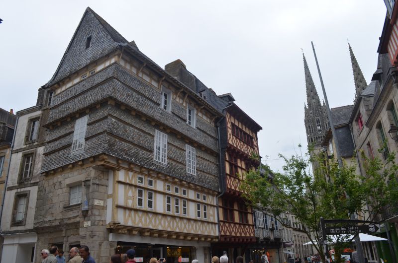
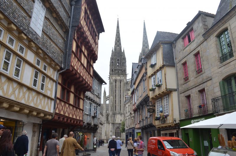
This morning we wanted to take a closer look at Quimper and went along the Odet to the St. Corentin Cathedral. Similar to Rome, the city lies on seven hills. Three rivers meet here and it is only a few kilometers to the sea. Quimper is the capital of the Cornouaille. We strolled through the alleys of the old town with its beautiful half-timbered houses before we visited the interior of the Saint Corentin Cathedral. More than 600 years had to pass before the church got its current shape. What is striking is the slightly bent choir, which leaves plenty of room for speculation, but is unique in terms of building history in this form. Time passed much too quickly and we left Quimper, with its magnificent cathedral, its small streets with half-timbered houses, its canals "à la Venise du Nord".
29000 Quimper, Frankreich
47° 59' 51.2" N 4° 5' 52.4" W
47.9975420 -4.0978990
• Head toward Rue Feunteunic Ar lez on Rue de Brest. Go for 153 m.
• Turn left onto Place Alexandre Massé. Go for 34 m.
• Take the 3rd exit from Place Alexandre Massé roundabout onto Rue François-Marie Luzel (D39). Go for 170 m.
• Turn slightly right onto Rue Juniville (D39). Go for 86 m.
• Turn right onto Boulevard Amiral de Kerguelen (D765). Go for 455 m.
• Turn left onto Quai de l'Odet (D765). Go for 77 m.
• Turn left onto Pont Max Jacob. Go for 35 m.
• Turn right onto Allées de Lokmaria (D34). Go for 825 m.
• Turn right onto Boulevard Louis Le Guennec (D34). Go for 286 m.
• Keep right onto Chemin de Poulguinan. Go for 313 m.
• Continue on Boulevard de Poulguinan (D785). Go for 780 m.
• Take the 3rd exit from Rond-Point de Ludugris roundabout onto Route de Pluguffan (D785). Go for 14.2 km.
• Take the 2nd exit from Rond-Point de Kermaria roundabout onto D785. Go for 2.2 km.
• Take the 3rd exit from roundabout onto D785. Go for 1.1 km.
• Take the 2nd exit from roundabout onto D785. Go for 902 m.
• Take the 1st exit from roundabout onto Route de Plomeur (D785). Go for 3.2 km.
• Pass 5 roundabouts and continue on Route de Plomeur (D785). Go for 4.9 km.
• Continue on Hent Prad Gouzien (D785). Go for 167 m.
• Continue on Rue Edmond Michelet (D785). Go for 187 m.
• Take the 1st exit from roundabout onto Rue Edmond Michelet (D785). Go for 314 m.
• Take the 2nd exit from roundabout onto Avenue de Skibberéen (D53). Go for 241 m.
• Turn left onto Chemin de Penhors. Go for 16 m.
• Arrive at Chemin de Penhors. Your destination is on the left.
☍
30,7 km
( 33 min.)
Penmarch, Frankreich
⛅ 18 ° C
In Penmarc'h you will encounter cultural heritage at every turn. Sights include chapels and churches and the Calvary at the Chapelle de Notre-Dame de Tronoën,
What was described here in the travel guide did not exist. Our navigation system first led us to a parking lot at the harbor in Guilvingec (GPS: 47.799,4.27568333) , where there were also several campers. We stood by them and wanted to explore the sights on foot. But soon we realized that this was not feasible from a distance. So we decided to drive to Penamach directly. We also found a good parking lot (GPS: 47.81361667,4.33868333) near the church. We strolled through the village, the church was closed and disappointed we returned to the Womo. We didn't want to give up completely and followed a signpost to the Notre-Dame chapel. We also came to the chapel on a very narrow street and were so disappointed that we didn't even get out. To save the day we decided to go to Carnac.
9003F Chemin de Penhors, 29760 Penmarch, Frankreich
47° 48' 49" N 4° 20' 19.2" W
47.8136147 -4.3386784
• Head south on Chemin de Penhors.
• Turn left toward Chemin de Penhors. Go for 119 m.
• Turn right onto Chemin de Penhors. Go for 58 m.
• Turn right onto Avenue de Skibberéen (D53). Go for 203 m.
• Take the 2nd exit from roundabout onto Rue Edmond Michelet (D785). Go for 310 m.
• Take the 2nd exit from roundabout onto Rue Edmond Michelet (D785). Go for 218 m.
• Continue on Hent Prad Gouzien (D785). Go for 167 m.
• Continue on Route de Plomeur (D785). Go for 685 m.
• Pass 5 roundabouts and continue on D785. Go for 7.4 km.
• Take the 3rd exit from roundabout onto D785. Go for 969 m.
• Pass 2 roundabouts and continue on D785. Go for 3.3 km.
• Take the 4th exit from Rond-Point de Kermaria roundabout onto D785. Go for 14.1 km.
• Keep right toward Boulevard de Poulguinan. Go for 169 m.
• Continue on Boulevard de Poulguinan. Go for 882 m.
• Take ramp onto Boulevard Louis Le Guennec (D34). Go for 1.6 km.
• Take the 2nd exit from Rond-Point de Kerustum roundabout onto Boulevard Flandres-Dunkerque 1940 (D783 A). Go for 1.1 km.
• Take the 2nd exit from Rond-Point de Gutenberg roundabout onto Avenue du Morbihan (D365). Go for 4.8 km.
• Take the 2nd exit from Rond-Point de Troyalac'h roundabout onto D365. Go for 313 m.
• Take the 1st exit from roundabout onto N165 toward Lorient. Go for 57.4 km.
• Keep left onto Voie Express de Nantes à Brest (N165) toward Vannes/Nantes/Rennes/Hennebont/Auray. Go for 32.3 km.
• Take ramp onto Route de Belz (D22) toward Quiberon/La Trinité S/Mer/Carnac/Auray P.A. Go for 429 m.
• Take the 5th exit from roundabout onto D22 A. Go for 764 m.
• Take the 2nd exit from roundabout onto D768. Go for 903 m.
• Pass 2 roundabouts and continue on D768. Go for 4.5 km.
• Take the 3rd exit from roundabout onto Route du Purgatoire (D119). Go for 2.7 km.
• Pass 2 roundabouts and continue on Rue des Korrigans (D119). Go for 1.8 km.
• Take the 3rd exit from roundabout onto Rue de Poul Person. Go for 115 m.
• Take the 2nd exit from roundabout onto Rue de Poul Person. Go for 222 m.
• Take the 1st exit from roundabout onto Rue du Tumulus. Go for 120 m.
• Continue on Rue du Tumulus. Go for 41 m.
• Arrive at Rue du Tumulus. Your destination is on the right.
☍
137,8 km
(1 hrs. 39 min.)
Carnac, Frankreich
? 18 ° C
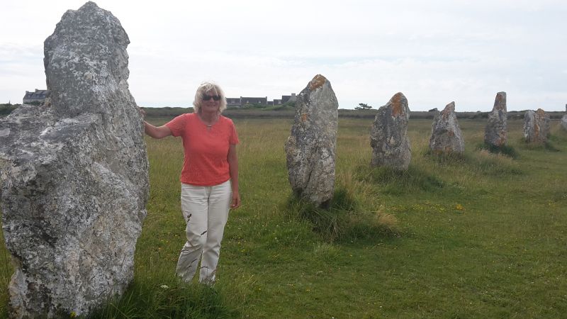
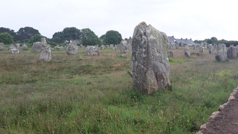
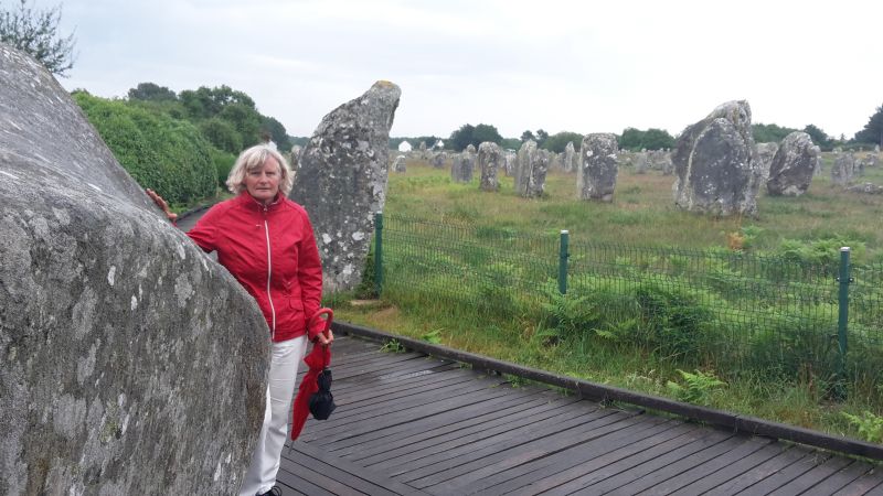
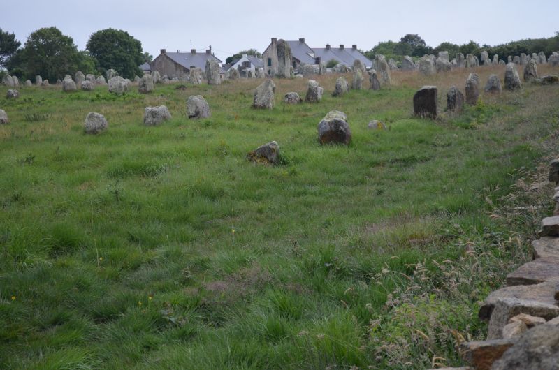
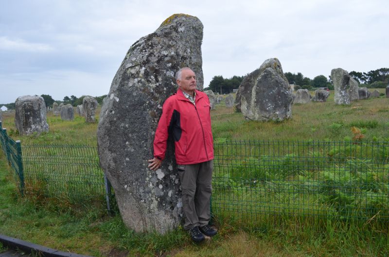
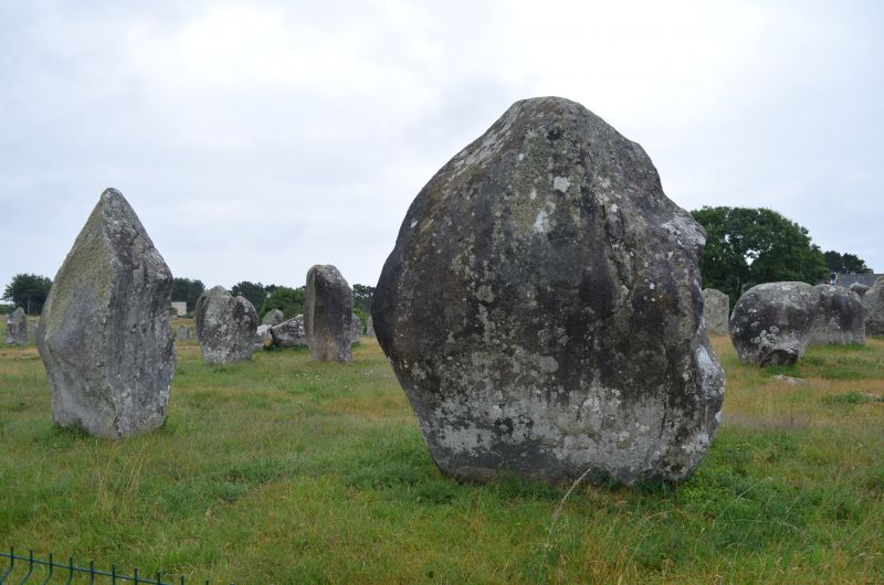
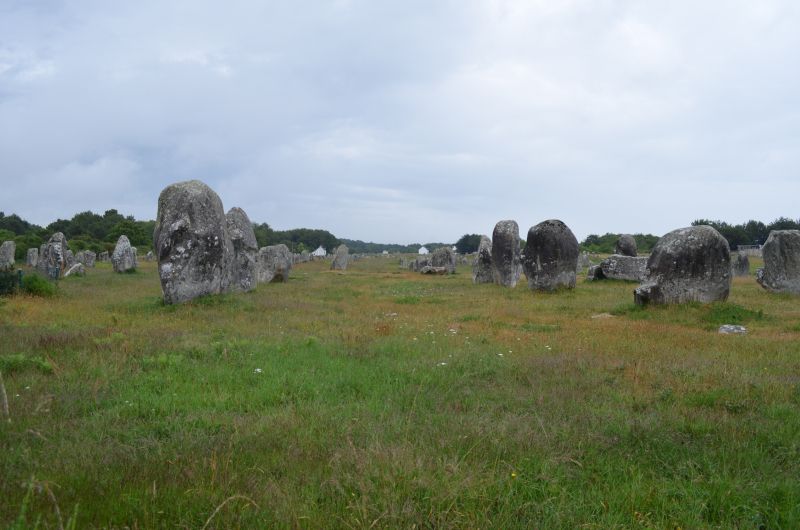
The unsolved mysteries of megalithic culture. The onset of rain could not stop us and so we booted along the rows of stones that gave us a view of the seemingly endless rows of stones. The ideal place for speculation about the meaning of the system; If you add to the 4000 standing stones still standing, those that were destroyed by lightning strikes and by human hands, and those that sank in the sea, this system was the largest of its kind in Europe in the 5th millennium BC - and is still white today no one for what purpose it was built. Carnac, the place name is based on the English word carns for stones. More than five thousand years ago, people set up partially hewn erratic boulders and aligned them in parallel rows. Six of the so-called menhir fields north of Carnac can still be seen today, each with approx. 950 - 1150 stones. They are the largest megalithic complex in the world and have been a UNESCO World Heritage Site since 1996.
Megaliths (Greek: megas = large; lithos = stone). However, most are menhirs now fenced to prevent further erosion from the large crowds that passed through the rows of stones every year. These erosions and the excess powers of some tourists have caused some megaliths to tip over. Other megaliths are missing from the ranks because they were smashed and used as building material.
56340 Carnac, Frankreich
47° 35' 4.9" N 3° 4' 40" W
47.5846930 -3.0777860
• Head toward Place du Marché on Rue du Tumulus. Go for 151 m.
• Take the 3rd exit from roundabout onto Rue de Poul Person. Go for 238 m.
• Take the 1st exit from roundabout onto Rue de Poul Person. Go for 78 m.
• Take the 2nd exit from roundabout onto Rue des Korrigans (D119). Go for 726 m.
• Pass 2 roundabouts and continue on Route du Purgatoire (D119). Go for 3.6 km.
• Keep right toward D768. Go for 280 m.
• Continue on D768. Go for 1.9 km.
• Pass 3 roundabouts and continue on D768. Go for 3.8 km.
• Take ramp onto N165 toward Vannes. Go for 4.9 km.
• Take ramp toward Pluneret/Ste Anne d'Auray/Le Bono/Baden. Go for 173 m.
• Take the 1st exit from Rond-Point de Kernanec roundabout onto D765 toward Lorient/Auray/Pluneret/Ste Anne d'Auray/Le Bono/Baden. Go for 162 m.
• Take the 3rd exit from Rond-Point de Kergoho roundabout onto D765 toward Auray/Le Bono/Baden/Ste Anne d'Auray. Go for 790 m.
• Take the 2nd exit from Rond-Point du Branhoc roundabout onto D17. Go for 87 m.
• Take the 3rd exit from roundabout onto D17. Go for 143 m.
• Continue on D101. Go for 97 m.
• Take the 1st exit from Rond-Point de Kersalé roundabout onto Rue du Branhoc. Go for 65 m.
• Continue on Rue du Branhoc. Go for 147 m.
• Take the 3rd exit from roundabout onto Rue Saint-Fiacre. Go for 120 m.
• Take the 2nd exit from roundabout onto Rue Saint-Fiacre. Go for 251 m.
• Arrive at Rue Saint-Fiacre. Your destination is on the left.
☍
17,7 km
( 18 min.)
Auray, Frankreich
⛅ 17 ° C
In Carnac we drove to a campsite where we didn't like to stay the night, so we drove to Auray where we found a free parking lot at the cemetery. (GPS: 47.6643,2.9733) On arrival it was still raining and we didn't want to do anything that evening.
The next day after breakfast we went to take a closer look at Auray. The old port area was once the third largest port in Brittany. The old pavement that still lies in the streets and alleys dates from this time. Our walk led down to the harbor through the old streets to the church of St. Goustan, which we could also visit. The St. Saveur chapel is right next to it. Crossing the bridge to the other side of the port, we climbed the path to the city center. After an extensive tour, we made our way to Ste. Anne d'Auray.
4 Rue Saint-Fiacre, 56400 Auray, Frankreich
47° 39' 50.6" N 2° 58' 20.1" W
47.6640654 -2.9722525
• Head west on Rue Saint-Fiacre.
• Continue on Rue Saint-Sauveur. Go for 63 m.
• Turn right onto Rue René Mory. Go for 199 m.
• Turn left onto Rue Saint-Fiacre. Go for 91 m.
• Take the 1st exit from roundabout onto Rue Saint-Fiacre. Go for 110 m.
• Take the 1st exit from roundabout onto Rue de la Terre Rouge. Go for 158 m.
• Continue on Rue du Branhoc. Go for 49 m.
• Take the 3rd exit from Rond-Point de Kersalé roundabout onto D101. Go for 141 m.
• Continue on D17. Go for 101 m.
• Take the 1st exit from roundabout onto D17. Go for 93 m.
• Take the 2nd exit from Rond-Point du Branhoc roundabout onto D765. Go for 770 m.
• Take the 4th exit from Rond-Point de Kergoho roundabout onto D765 toward Plumergat/Ste Anne d'Auray/Plougoumelen/Kergohel/Lanriacq. Go for 619 m.
• Take the 2nd exit from roundabout onto D17 BIS. Go for 4.1 km.
• Take the 3rd exit from roundabout onto Rue de Vannes (D19). Go for 996 m.
• Turn sharp left onto Place Yves Nicolazic. Go for 17 m.
• Arrive at Place Yves Nicolazic.
☍
7,5 km
( 10 min.)
Day
Sainte-Anne-d'Auray
☁️ 19 ° C
By chance we became aware of the approximately 6 km northeast of Auray, the most important place of pilgrimage in Brittany: Ste-Anne-d'Auray. In Ste. Anne d'Auray we found a parking lot near the Church of the Pilgrimage (GPS: 47.70511667.2.95601667) and then made our way to the Basilica of the Pilgrimage. Saint is worshiped Anna, the mother of the Virgin Mary. 1623 appeared to the agricultural worker Yves Nicolazic. Anna and asked him to rebuild a dilapidated chapel in her field. In 1625 an old statue of St. Anna found.
The cathedral is built on an ancient power place. A source with very good medicinal water. In the square between the source and the cathedral, even Sirius' cross is immersed in the ground.
According to Breton history, Anna, the grandmother of Jesus, was a Breton who traveled to the Holy Land for her Joachim
Maria, the mother of Jesus, and later Jesus himself was born.
The energies of the church are clear and pure, no astral impurities. It is very worthwhile to meditate here and to connect with Anna.
56400 Sainte-Anne-d'Auray, Frankreich
47° 42' 13" N 2° 57' 1.3" W
47.7036250 -2.9503580
• Head east on Place Yves Nicolazic. Go for 45 m.
• Turn right onto Rue de Vannes (D17). Go for 873 m.
• Take the 1st exit from roundabout onto D17 BIS. Go for 4.1 km.
• Take the 1st exit from roundabout onto D765. Go for 570 m.
• Take the 3rd exit from Rond-Point de Kergoho roundabout onto D765 toward N165/Vannes/Arradon. Go for 244 m.
• Take the 3rd exit from Rond-Point de Kernanec roundabout onto N165 toward Vannes/Arradon. Go for 17.5 km.
• Take ramp toward Rennes/Dinan/Séné/St Avé-Est/Ploërmel/Redon. Go for 467 m.
• Take the 3rd exit from roundabout onto N166 toward Rennes/Dinan/Elven/Ploërmel/Redon. Go for 41.6 km.
• Take ramp onto N24 toward Rennes/Dinan/St Malo. Go for 62.5 km.
• Take ramp onto Rocade Ouest (N136) toward Rocade Sud/Nantes/Angers/Le Mans/Aéroport Rennes-St-Jacques. Go for 7.3 km.
• Take ramp toward Porte d'Angers/Angers/Vern S/ Seiche/La Poterie/C.H.U. Hôpital Sud/Écomusée Pays de Rennes. Go for 436 m.
• Keep left toward La Poterie/Écomusée Pays de Rennes. Go for 109 m.
• Take the 2nd exit from roundabout onto D173 toward Le Blosne/La Poterie. Go for 428 m.
• Take the 1st exit from roundabout onto Rue de Vern toward Rennes-Centre/Le Blosne/La Poterie. Go for 289 m.
• Pass 2 roundabouts and continue on Rue de Vern. Go for 473 m.
• Arrive at Rue de Vern. Your destination is on the left.
☍
136,9 km
(1 hrs. 25 min.)
Rennes
☁️ 20 ° C
(Parking GPS: 48.09785,1.64433333)
Of course we visited the Romanesque cathedral of Rennes, which is adorned with these gildings.
Lycée Descartes, 35200 Rennes, Frankreich
48° 5' 24.4" N 1° 38' 41.7" W
48.0901143 -1.6449285
• Head north on Rue de Vern. Go for 59 m.
• Turn right onto Boulevard Paul Hutin Desgrées toward Z.A. Sud Est. Go for 468 m.
• Take the 2nd exit from roundabout onto Boulevard Paul Hutin Desgrées. Go for 348 m.
• Turn right onto Rue de Châteaugiron (D463). Go for 871 m.
• Turn left and take ramp onto Rocade Sud (N136) toward Caen/Le Mans. Go for 3.5 km.
• Keep left onto Rocade Sud (N136). Go for 41.9 km.
• Keep left onto A81. Go for 24.0 km.
• Take exit 3 toward Château-Gontier/Mayenne. Go for 1.1 km.
• Take the 1st exit from roundabout onto D901 toward Louverné-Sud/St Jean-sur-Mayenne. Go for 263 m.
• Take the 2nd exit from roundabout onto D901. Go for 1.3 km.
• Continue on Rue Nationale (D901). Go for 211 m.
• Take the 3rd exit from roundabout onto D131. Go for 88 m.
• Continue on Route de Saint-Jean (D131). Go for 94 m.
• Take the 2nd exit from roundabout onto Route de Saint-Jean (D131). Go for 222 m.
• Continue on D131. Go for 1.3 km.
• Continue on Lieu-dit L'Effardière (D131). Go for 100 m.
• Continue on D131. Go for 473 m.
• Continue on Lieu-dit La Clouterie (D131). Go for 73 m.
• Continue on D131. Go for 276 m.
• Take the 1st exit from roundabout onto Rue de la Mairie (D131). Go for 230 m.
• Turn right onto Rue du Port. Go for 60 m.
• Arrive at Rue du Port. Your destination is on the left.
☍
77,0 km
( 47 min.)
53240 Saint-Jean-sur-Mayenne, Pays de la Loire
☀️ 34 ° C
Great parking space with shower, toilet, sink
GPS: 48.12756667,0.75195
The night was very calm. Towards morning a thunderstorm passed by, dropping a few raindrops. For breakfast you could sit outside in the sun again. For the onward journey we had to dispose of the toilet and fill up with fresh water, we didn't know the next place to stay. The intermediate goal was clear and that was Orleans.
53240 Saint-Jean-sur-Mayenne, Frankreich
48° 7' 57.6" N 0° 45' 7.1" W
48.1326790 -0.7519770
• Head toward Rue de la Place on Rue du Port. Go for 60 m.
• Continue on Rue de la Mairie (D131). Go for 219 m.
• Take the 3rd exit from roundabout onto D131. Go for 303 m.
• Continue on Lieu-dit La Clouterie (D131). Go for 73 m.
• Continue on D131. Go for 473 m.
• Continue on Lieu-dit L'Effardière (D131). Go for 100 m.
• Continue on D131. Go for 1.3 km.
• Continue on Route de Saint-Jean (D131). Go for 199 m.
• Take the 2nd exit from roundabout onto Route de Saint-Jean (D131). Go for 113 m.
• Continue on D131. Go for 26 m.
• Take the 1st exit from roundabout onto Rue Nationale (D901). Go for 237 m.
• Continue on D901. Go for 1.3 km.
• Take the 2nd exit from roundabout onto D901. Go for 278 m.
• Take the 3rd exit from roundabout onto A81 toward Le Mans. Go for 69.9 km.
• Take the left exit toward Paris/Tours/A28/Alençon/Le Mans-Z.I. Nord onto A11 (L'Océane). Go for 71.9 km.
• Take exit 4 toward Brou/Châteaudun. Go for 968 m.
• Take the 1st exit from roundabout onto D955 toward Brou/Illiers-Combray/Châteaudun. Go for 10.3 km.
• Turn slightly left toward D15 6/Brou-Centre. Go for 90 m.
• Continue on Rue Aristide Briand. Go for 43 m.
• Continue on Rue Aristide Briand. Go for 135 m.
• Continue on Place de l'Hôtel de Ville. Go for 39 m.
• Continue on Rue de l'Hôtel de Ville. Go for 193 m.
• Continue on Rue du Mail. Go for 172 m.
• Continue on Avenue du Président John F. Kennedy. Go for 255 m.
• Continue on Avenue Gallieni (D955). Go for 18.1 km.
• Take the 2nd exit from roundabout onto D999 toward Parc d'Activités de Beauvoir/Parc d'Activités des Garennes. Go for 1.7 km.
• Take the 3rd exit from roundabout onto N10 toward Chartres/Tours/Blois/Parc d'Activités la Varenne Hodier. Go for 914 m.
• Take the 1st exit from roundabout onto N10 toward Tours/Blois/Orléans/Pithiviers/Parcs d'Activités de la Bruyére et de Vilsain. Go for 2.1 km.
• Take the 2nd exit from roundabout onto N10 toward Tours/Blois/Orléans/Pithiviers/Parcs d'Activités de Vilsain. Go for 2.4 km.
• Take the 3rd exit from roundabout onto Route d'Orléans (D955) toward Orléans/Patay. Go for 33.5 km.
• Pass 2 roundabouts and continue on Route Nationale (D955). Go for 4.3 km.
• Take the 2nd exit from roundabout onto Rue Nationale (D2157) toward Orléans/Ingré. Go for 1.1 km.
• Pass 2 roundabouts and continue on Rue Charles Beauhaire (D2157). Go for 6.4 km.
• Turn left onto Boulevard Rocheplatte. Go for 631 m.
• Turn slightly right onto Boulevard de Verdun (D2020) toward Gare S.N.C.F. d'Orléans/Paris/Chartres. Go for 158 m.
• Take ramp onto Boulevard Alexandre Martin. Go for 1.1 km.
• Turn right onto Place du 6 Juin 1944 (D97) toward St Jean de Braye/Parc Floral Orléans-la-Source. Go for 112 m.
• Turn left. Go for 83 m.
• Arrive at your destination on the right.
☍
231,3 km
(2 hrs. 26 min.)
Day
Orléans, Frankreich
☀️ 34 ° C
Good parking lot (GPS: 47.90318333,1.9182) approached not far from the center. We first walked towards the cathedral, the interior was very pleasant with the outside temperature of 38 degrees. The life of the Jeanned'Arc is beautifully depicted in the church window. After visiting the cathedral we went into the old town through beautiful alleys down to the Loare. We ended our tour of the city in the large square with the Jeanned'Arc memorial. The great heat was a problem and we were happy to be able to continue in the air-conditioned WoMo.
4 Boulevard Aristide Briand, 45000 Orléans, Frankreich
47° 54' 11.7" N 1° 55' 6.1" E
47.9032523 1.9183637
• Head toward Rue Louise Weiss. Go for 94 m.
• Turn left onto Rue Louise Weiss (D97). Go for 90 m.
• Keep left toward Orléans-Centre. Go for 49 m.
• Continue on Boulevard de Saint-Euverte (D97). Go for 114 m.
• Turn left onto Place du 6 Juin 1944 (D97) toward Paris/Blois/Centre Ville/Cathédrale/Gare S.N.C.F. d'Orléans/Orléans-Centre. Go for 80 m.
• Continue on Avenue Jean Zay (D97) toward Paris/Blois/Orléans-Centre/Gare S.N.C.F. d'Orléans. Go for 666 m.
• Keep right onto Boulevard Alexandre Martin (D97) toward Paris. Go for 367 m.
• Turn right onto Avenue de Paris (D2020). Go for 1.3 km.
• Pass 3 roundabouts and continue on Rue Nationale (D2020). Go for 2.5 km.
• Turn slightly left onto D2701. Go for 3.5 km.
• Take ramp onto A10 (L'Aquitaine) toward E60/Montargis/Paris/Chartres. Go for 9.9 km.
• Take the exit toward E60/A19/Metz/Nancy/Fontainebleau/Montargis. Go for 1.2 km.
• Continue on A19. Go for 98.7 km.
• Take the exit toward Metz/Nancy/Troyes/Sens onto A19. Go for 29.4 km.
• Take the exit toward Troyes/Metz/Nancy onto A5. Go for 24.2 km.
• Take exit 19 toward St Florentin/Romilly/Aix-en-Othe/Villeneuve l'Archevêque. Go for 829 m.
• Take the 1st exit from roundabout toward Vulaines. Go for 120 m.
• Turn left onto D660 toward N60/Troyes/Nogent S/Seine/Romilly/Aix-en-Othe/St Florentin/Château de Pouy-sur-Vannes. Go for 8.0 km.
• Turn right onto Chemin de la Fontaine (D374 B) toward Aix-en-Othe. Go for 1.1 km.
• Turn right onto Rue d'Aix (D374). Go for 1.9 km.
• Turn right onto Rue du Maréchal Foch. Go for 66 m.
• Arrive at Rue du Maréchal Foch. Your destination is on the left.
☍
184,1 km
(1 hrs. 41 min.)
Aix-en-Othe
☀️ 33 ° C
With our early return home and from Orleans the unbearable heat of 38 ° C during star visits, the planned parking spaces had also changed. So we found this beautiful, private, quiet, shady parking space on our parking space app. (GPS: 48.22848333,3.72276667) Only a few km away from our route.
10160 Aix-en-Othe, Frankreich
48° 13' 21" N 3° 43' 51.3" E
48.2225130 3.7309140
• Head southwest on Rue du Maréchal Foch. Go for 31 m.
• Turn left onto Boulevard Sébastopol. Go for 55 m.
• Turn left onto Place A. Thullier (D31). Go for 84 m.
• Continue on Place de l'Hôtel de Ville (D31). Go for 252 m.
• Continue on Rue Millo (D31). Go for 218 m.
• Continue on Faubourg Saint-Avit (D31). Go for 1.2 km.
• Continue on D31. Go for 3.8 km.
• Continue on Rue Saint-Roch (D31). Go for 277 m.
• Continue on Place Paul de Chaumedey (D31). Go for 29 m.
• Continue on Rue Deheurles Baudin (D31). Go for 427 m.
• Continue on Rue de la Fontaine Bouvotte (D31). Go for 306 m.
• Continue on D31. Go for 1.2 km.
• Continue on Rue Victor Hugo (D31). Go for 737 m.
• Take the 3rd exit from roundabout onto Place du Général de Gaulle (D23). Go for 191 m.
• Continue on Rue de la République (D23). Go for 434 m.
• Turn right onto Rue Jean Hector (D660). Go for 12.4 km.
• Take the 1st exit from roundabout onto E511 toward A5/E54/Sens/Paris/Orléans/Reims/Metz/Nancy/Lyon. Go for 2.2 km.
• Take ramp onto A5 toward Lyon/Metz/Nancy/Reims. Go for 112 km.
• Take the exit toward Metz/Nancy/Vesoul/Langres-Nord onto A31. Go for 101 km.
• Take exit 11 toward Neuves-Maisons/Colombey les Belles. Go for 724 m.
• Take the 2nd exit from roundabout. Go for 496 m.
• Take the 1st exit from roundabout onto D974 toward Thuilley-aux-Groseilles/Neuves-Maisons/Nancy. Go for 9.3 km.
• Continue on D331. Go for 13.7 km.
• Take the 3rd exit from roundabout onto A330 toward Nancy/Z.I. Ludres-Fléville. Go for 1.8 km.
• Take the exit toward Strasbourg/Lunéville onto A33. Go for 15.9 km.
• Take exit 7 toward Lunéville-Château. Go for 650 m.
• Continue toward Route Departementale 400/D400. Go for 59 m.
• Take the 1st exit from roundabout onto Route Departementale 400 (D400). Go for 1.5 km.
• Continue on Route Nationale (N4). Go for 1.7 km.
• Continue on D400. Go for 4.9 km.
• Take the 1st exit from roundabout onto Rue du Général Alfred Chanzy (D914). Go for 290 m.
• Take the 3rd exit from roundabout. Go for 108 m.
• Arrive at your destination on the right.
☍
288,2 km
(2 hrs. 39 min.)
Day
Lunéville
☀️ 32 ° C
After we were on our last leg of the trip, we took a closer look at Lunéville over lunchtime. Lorraine, a sovereign state for almost ten centuries, has one of the largest castles in France,
The Château de Lunéville is a wonderful gateway to the 18th century. A castle that was the largest construction site in Europe after the winter fire of 2003 to 2010.
An impressive sight as soon as you arrive. Free parking spaces are available in front of and next to the castle, unfortunately there is a no parking sign for motorhomes. (GPS: 48.59531667,6.49101667) Since it was a very hot day, we ignored the no parking and parked next to the castle. We didn't spend long outside, short visits to the palace complex and the park. We lacked the time to explore the interior of the castle and it is also closed at lunchtime. .
It was so hot on our little city tour that it was no fun staying in the city for too long. The temperature inside the church was very pleasant.
The castle of Luneville, (Rococo castle) also called little Versailles. The city with the old German name Lünstadt was the residence of the Dukes of Lorraine from 1702 to 1737. During this time, the Rococo castle Lunéville was built, which is still the main attraction of the 20,000-inhabitant city. In 1801 peace between France and Austria was decided here.
Cour du Rocher, 54300 Lunéville, Frankreich
48° 35' 42.7" N 6° 29' 27.2" E
48.5951891 6.4908906
• Head east. Go for 259 m.
• Take the 1st exit from roundabout onto Rue du Général Alfred Chanzy (D914). Go for 282 m.
• Take the 4th exit from roundabout onto Avenue du Général de Gaulle (D400). Go for 934 m.
• Turn left toward Boulevard Georges Pompidou/D31. Go for 68 m.
• Turn left onto Boulevard Georges Pompidou (D31). Go for 1.5 km.
• Take the 1st exit from roundabout onto Avenue de Gerbéviller (D914). Go for 934 m.
• Take the 2nd exit from roundabout onto D914 toward Strasbourg/St Dié/Baccarat/Rambervillers/Gerbéviller/Blainville S/l'Eau. Go for 282 m.
• Turn left onto Route de Herimenil (D98) toward St-Dié/Hériménil/Baccarat. Go for 73 m.
• Take left ramp onto N333 toward St-Dié/Lunéville-Z.I./Baccarat. Go for 30.3 km.
• Take the 2nd exit from roundabout onto N4 toward Strasbourg/Sarrebourg/St Georges. Go for 36.5 km.
• Take the 2nd exit from roundabout toward Saverne/Strasbourg/Saarbrucken/Metz/Paris/Z.I. Maisons Rouges. Go for 427 m.
• Take ramp onto A4 (Autoroute de l'Est) toward Saverne/Strasbourg/E25. Go for 54.0 km.
• Continue on A35. Go for 8.7 km.
• Take exit 6 toward Offenburg/Erstein/Illkirch-Graff. onto M83. Go for 2.6 km.
• Keep right toward M353/Colmar/A35/Offenbourg/Aéroport Entzheim/Eschau/Port de Strasbourg. Go for 284 m.
• Keep left toward M353/Offenbourg/Eschau/Port de Strasbourg. Go for 285 m.
• Take ramp onto Rocade Sud (M353) toward Offenburg/Port de Strasbourg/Eschau. Go for 4.9 km.
• Keep left onto Rocade Sud (M353) toward Karlsruhe/Basel/Offenburg. Go for 1.3 km.
• Continue on Pierre-Pflimlin-Brücke (L98). Go for 4.0 km.
• Pass 2 roundabouts and continue on L98. Go for 6.7 km.
• Continue on B33A. Go for 314 m.
• Keep right onto B33A toward Villingen-Schwenningen/B33/Gengenbach/Kinzigtal/Offenburg. Go for 1.8 km.
• Take ramp onto B3 toward Villingen-Schwenningen/Lahr/Biberach/Kinzigtal/Gengenbach/OG Ost/Süd/Gewerbegebiet Elgersweier/Messe/B33. Go for 1.7 km.
• Keep right onto B33 toward Villingen-Schwenningen/Biberach/Kinzigtal/Gengenbach/Gewerbegebiet Elgersweier-Nord. Go for 23.4 km.
• Keep right onto B33 toward Villingen-Schwenningen/Haslach/Gewerbegebiet Steinach-Ost. Go for 265 m.
• Turn right onto Steinacher Straße (B33). Go for 9.5 km.
• Take ramp onto B294 toward Stuttgart/A81/Freudenstadt/Wolfach. Go for 5.0 km.
• Continue on B294 toward Stuttgart/A81/Singen/Freudenstadt/Schiltach. Go for 9.4 km.
• Continue on B462 toward Rottweil/Schramberg. Go for 8.0 km.
• Turn left onto Schloßstraße (B462) toward Rottweil/Oberndorf/Schramberg-Sulgen/Flughafen. Go for 22.2 km.
• Continue on B14 toward Tuttlingen/Villingen-Schwenningen/Spaichingen/Rottweil-West/Krankenhaus/Stadtmitte/Gewerbegebiet Saline/Süd. Go for 1.3 km.
• Take ramp toward Zimmern o.R./Rottweil/Westkrankenhaus/Stadtmitte. Go for 187 m.
• Turn right onto K5540. Go for 926 m.
• Take the 2nd exit from roundabout onto Marxstraße (L423). Go for 944 m.
• Arrive at Marxstraße (L423). Your destination is on the left.
☍
239,2 km
(2 hrs. 46 min.)
Day
Rottweil
Deutschland
48° 9' 54.9" N 8° 37' 42.4" E
48.1652577 8.6284530