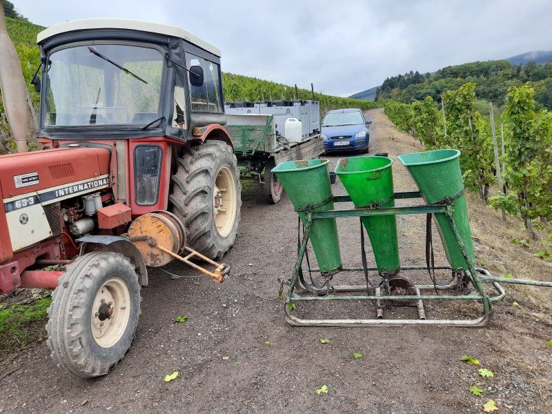
The Baroque Route Saar-Palatinate aroused our interest in this region. During our Saar-Palatinate tour we got to know the small federal state between Saar and Moselle better. Covid-19 prevented us from looking at one or the other place, as several cities were declared hotspots almost every day.
Day
6
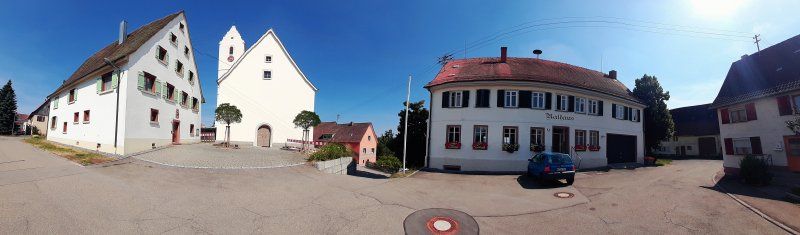
Our home community Neukirch
1120-2020
900 year anniversary
Lochenstraße 6, 78628 Rottweil, Deutschland
48° 11' 53.1" N 8° 41' 43.1" E
48.1980761 8.6953153
• Head toward Wochenbergstraße on Lochenstraße. Go for 98 m.
• Turn right onto Hardtstraße. Go for 203 m.
• Turn right onto Schömberger Straße (B27). Go for 5.3 km.
• Turn left onto L423 toward Dietlingen/Rottweil-Ost. Go for 323 m.
• Turn right onto Balinger Straße (K5562). Go for 8.4 km.
• Continue on Hauptstraße (K5506). Go for 573 m.
• Turn right onto Trichtinger Straße (K5502). Go for 292 m.
• Continue on K5502. Go for 2.1 km.
• Continue on Harthausener Straße (K5502). Go for 579 m.
• Continue on Im Dorf (K5502). Go for 97 m.
• Turn left onto Kirchstraße (K5500) toward Oberndorf/Bochingen/Altoberndorf. Go for 1.5 km.
• Continue on K5500. Go for 983 m.
• Turn right onto Radäcker (K5502). Go for 2.3 km.
• Take the 1st exit from roundabout onto Rankäcker (L415). Go for 746 m.
• Take ramp onto A81 toward Stuttgart. Go for 52.8 km.
• Take exit 24 toward Sindelfingen-West/Böblingen-Hulb onto B464. Go for 10.2 km.
• Take right ramp onto B295 toward Stuttgart/Leonberg/Renningen-Ost. Go for 4.9 km.
• Take ramp onto A8 toward Karlsruhe. Go for 49.9 km.
• Take the exit toward Frankfurt a.M./Mannheim/Karlsruhe/Landau (Pfalz) onto A5 (Autobahndreieck Karlsruhe). Go for 2.0 km.
• Take exit 45 toward KA-Mitte/Landau (Pfalz) onto K9652. Go for 1.4 km.
• Keep left onto K9657. Go for 5.9 km.
• Continue on B10. Go for 7.8 km.
• Keep left onto B10. Go for 160 m.
• Continue on A65. Go for 24.6 km.
• Take exit 15 toward Landau-Nord/Pirmasens/Annweiler onto B10. Go for 44.3 km.
• Take ramp toward Pirmasens/Centrum. Go for 97 m.
• Turn left onto Haseneckstraße. Go for 169 m.
• Turn right onto Haseneckstraße. Go for 527 m.
• Continue on Zeppelinbrücke. Go for 157 m.
• Turn right onto Zeppelinstraße (K2). Go for 546 m.
• Turn right. Go for 15 m.
• Turn left. Go for 99 m.
• Arrive at your destination on the left.
☍
228,9 km
(2 hrs. 27 min.)
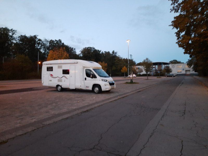
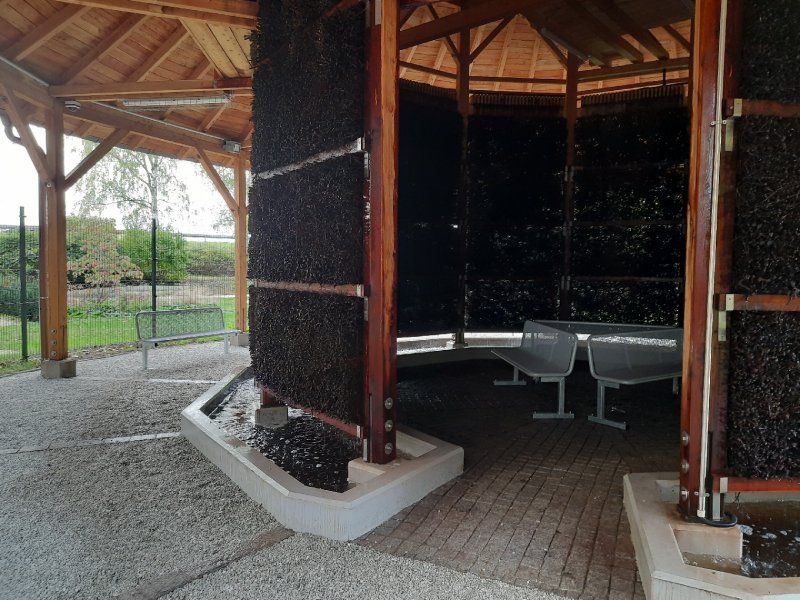
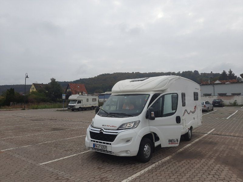
Wohnmobil-Stellplatz Pirmasens
It was already dark when we drove to the parking space (49.204399, 7.60807). We were lucky there was still a space available.
The pitch was easy to drive to, the ground is on firm brown sand, which had the disadvantage that it was carried into the motorhome.
Steinstraße 2, 66953 Pirmasens, Germany
49° 12' 16" N 7° 36' 27" E
49.2044444 7.6075000
• Head northwest. Go for 93 m.
• Turn right toward Zeppelinstraße/K2. Go for 98 m.
• Turn right onto Zeppelinstraße (K2). Go for 134 m.
• Take the 2nd exit from Dr.-Robert-Schelp-Platz roundabout onto Dankelsbachstraße (K2). Go for 246 m.
• Turn right onto Zweibrücker Straße (L482). Go for 24 m.
• Continue on Zweibrücker Straße (K1) toward B10/B270/Gewerbegebiet Nord. Go for 1.2 km.
• Turn right onto Biebermühler Straße (B270). Go for 308 m.
• Take ramp onto B10 toward A8/Saarbrücken/Zweibrücken/A62/Landstuhl. Go for 4.5 km.
• Take ramp onto A62 toward Saarbrücken/Zweibrücken/A8/Flughafen/Gewerbegebiet PS-West. Go for 1.1 km.
• Continue on A8. Go for 12.3 km.
• Take exit 34 toward Contwig/Zweibrücken/Bitche/Hornbach/Flughafen Zweibrücken. Go for 376 m.
• Turn left onto L480 toward Bitche/Hornbach/Contwig/Flughafen Zweibrücken. Go for 473 m.
• Keep right toward Bitche/Hornbach/Flughafen Zweibrücken. Go for 31 m.
• Take the 1st exit from roundabout onto Europaallee (L700) toward Bitche/Hornbach/Flughafen Zweibrücken. Go for 582 m.
• Take the 3rd exit from roundabout onto Europaallee (L700). Go for 1.3 km.
• Take the 2nd exit from roundabout onto Europaallee (L700). Go for 4.1 km.
• Turn right onto L700 toward Pirmasens/Vinningen/Hornbach. Go for 364 m.
• Continue on L478. Go for 358 m.
• Take the 2nd exit from roundabout onto Zweibrücker Straße (B424) toward Hornbach. Go for 360 m.
• Turn right onto Lauerstraße (L478). Go for 161 m.
• Continue on Bahnhofstraße (L478). Go for 68 m.
• Turn left onto Bahnhofstraße. Go for 379 m.
• Arrive at Bahnhofstraße. Your destination is on the right.
☍
28,5 km
( 23 min.)
Day
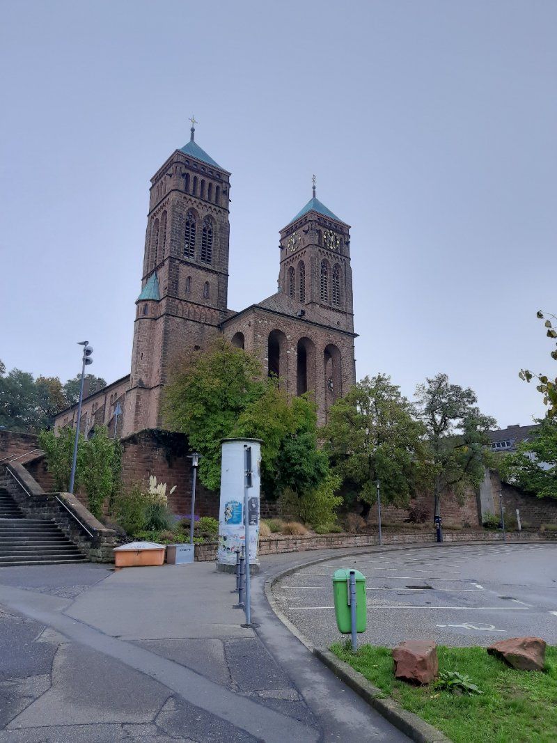
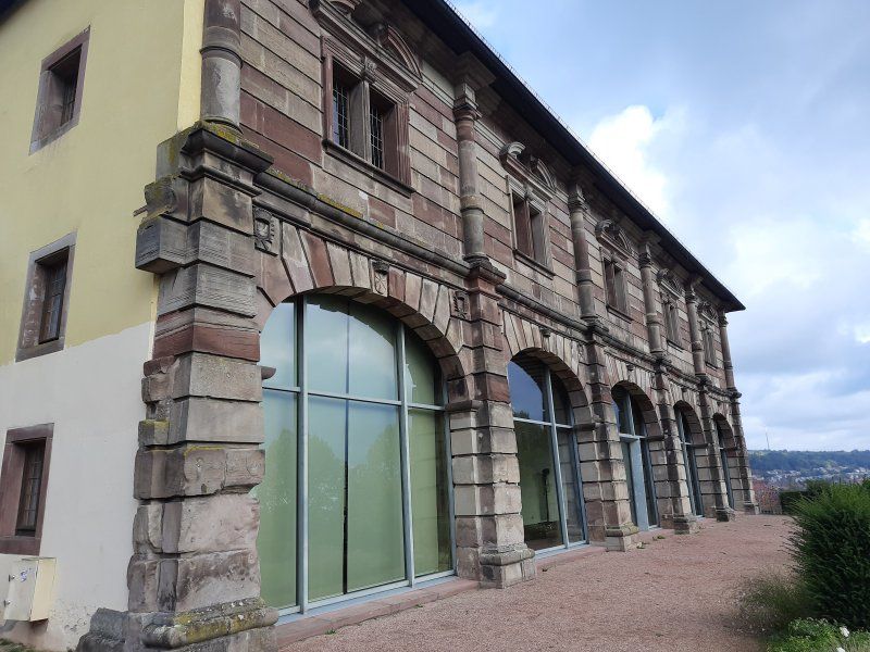
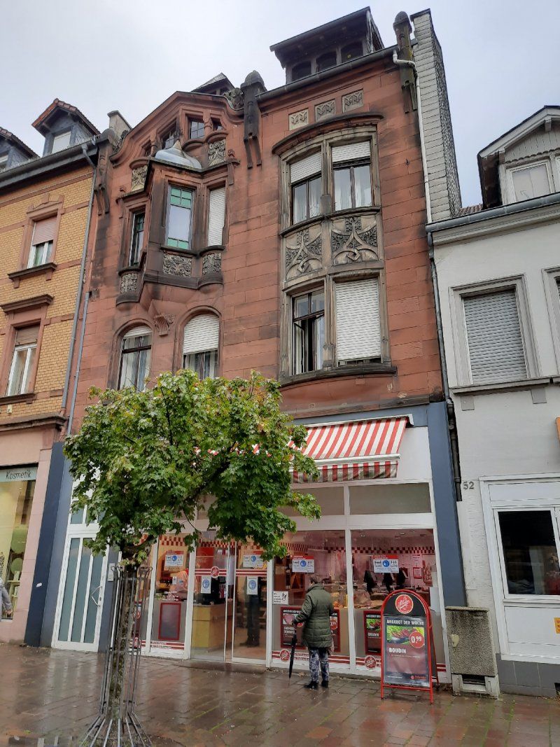
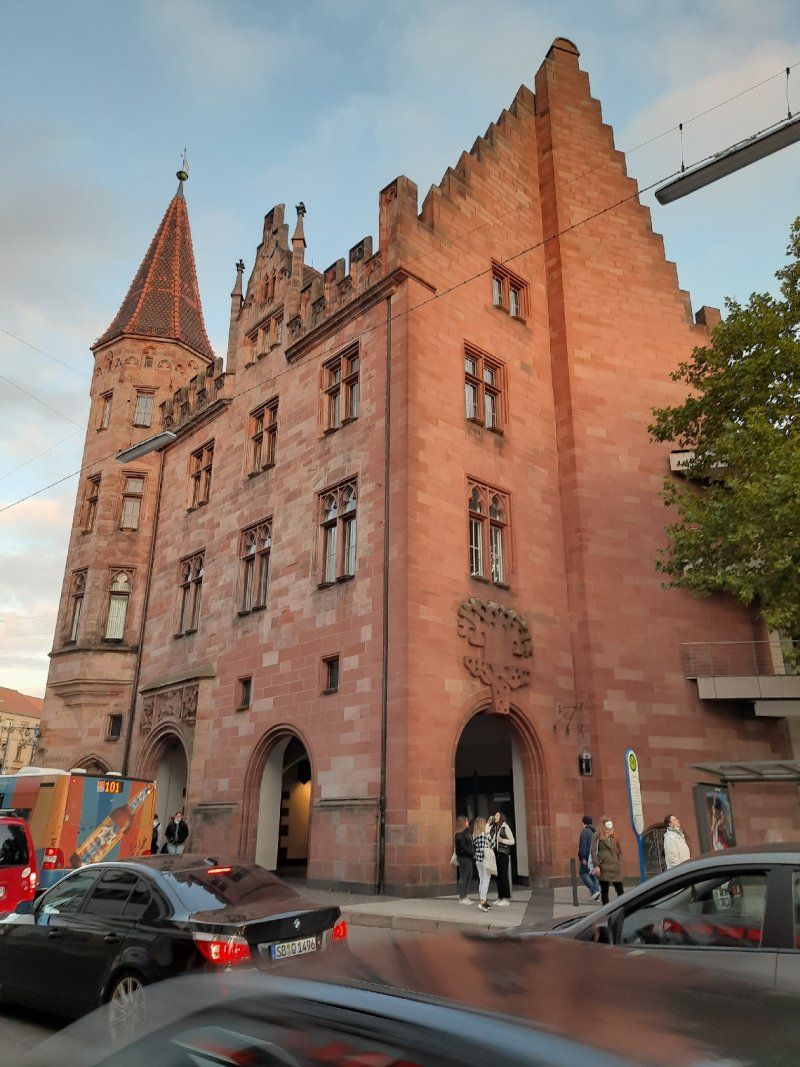
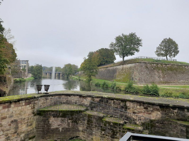
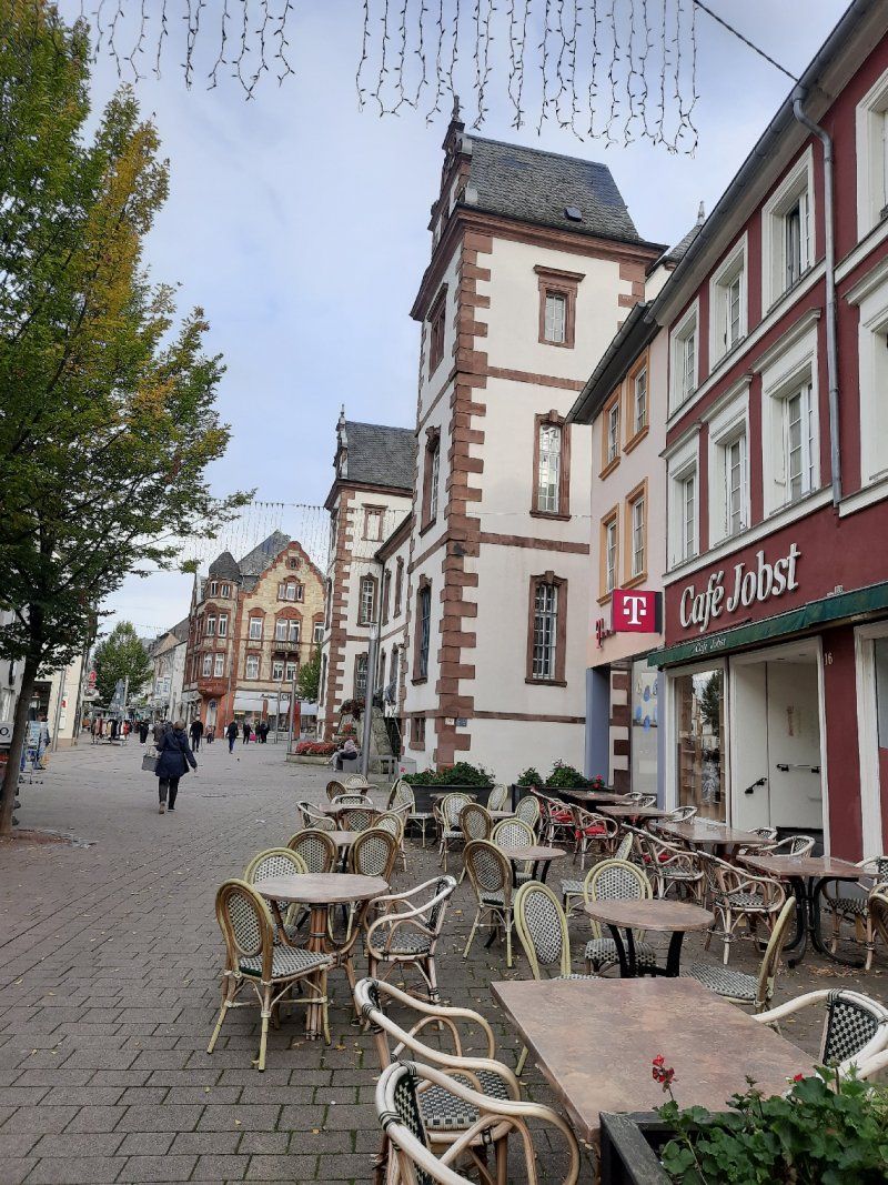
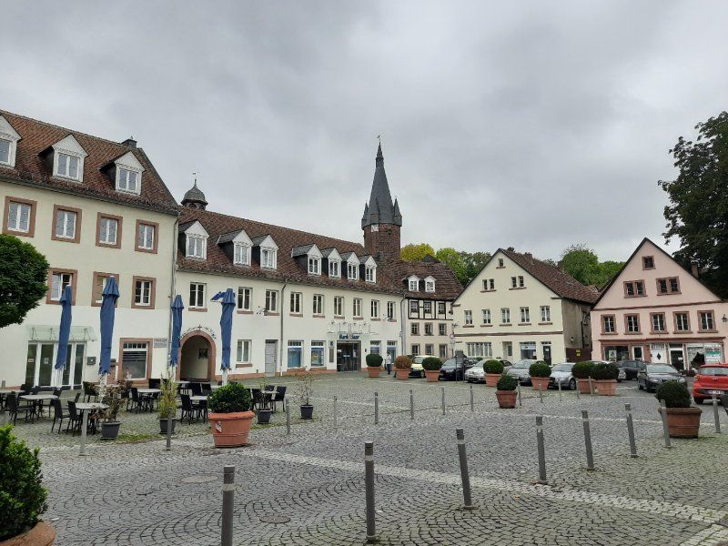
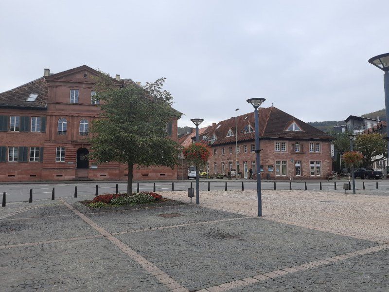
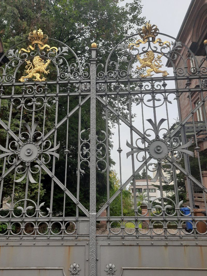
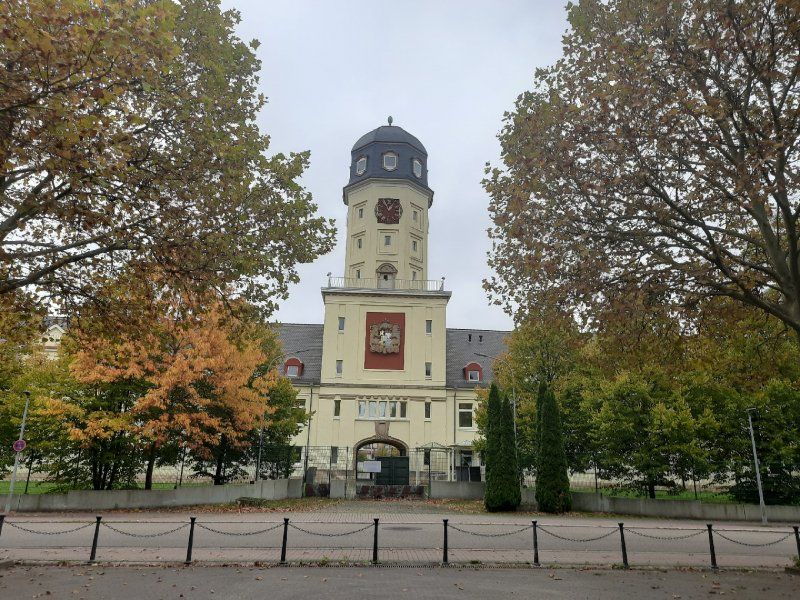
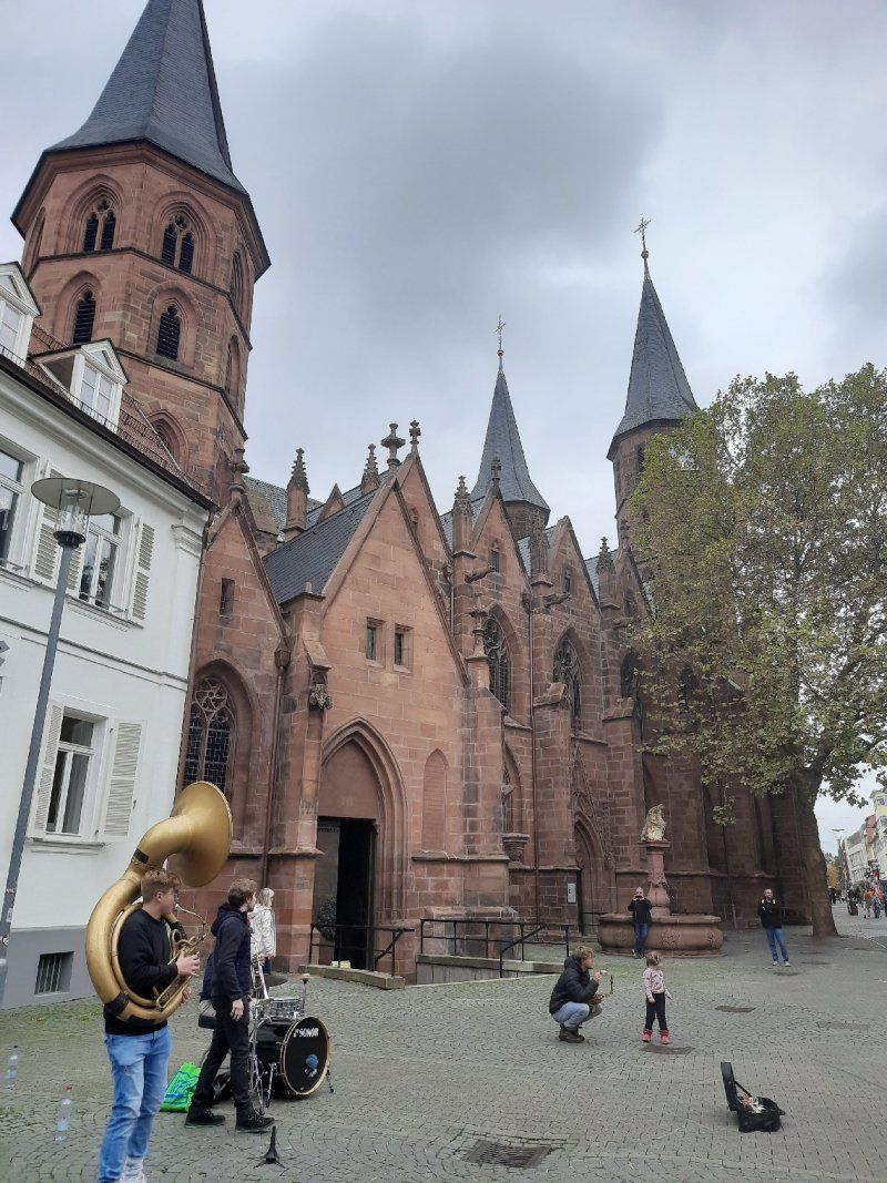
Stadtrundgang Pirmasens
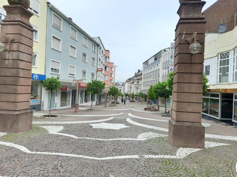
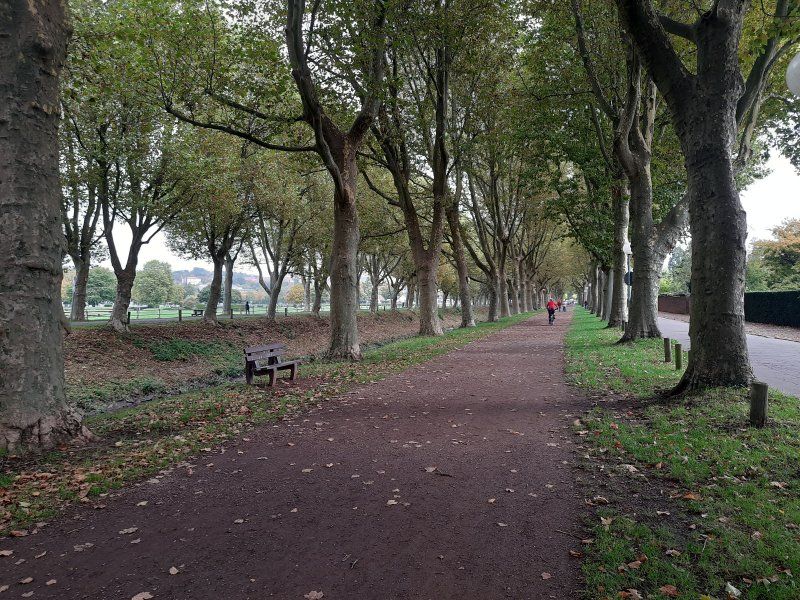
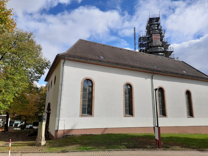
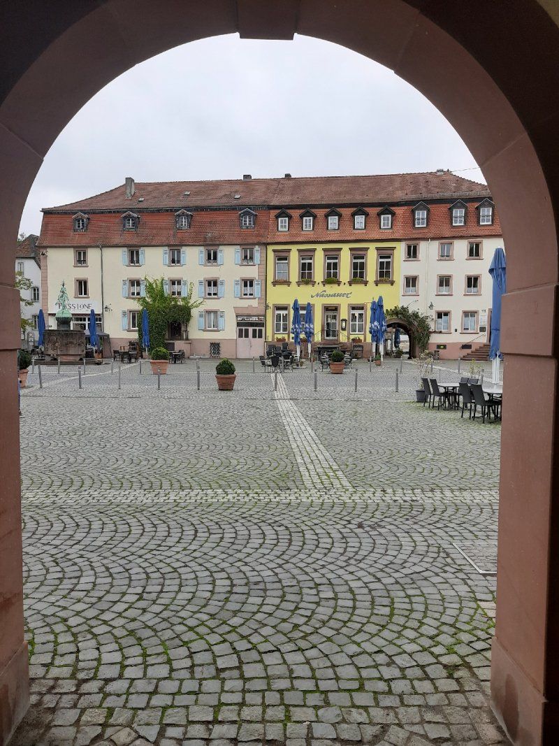
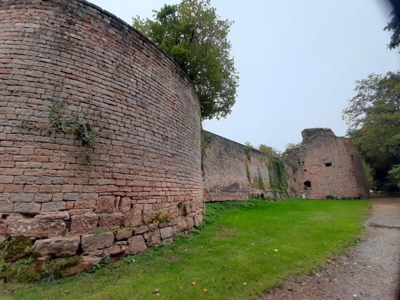
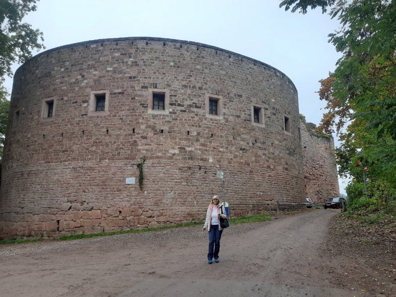
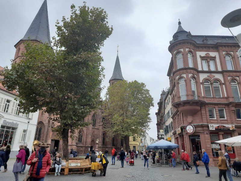
On Sunday morning we set out for a tour of Pirmasens and a hike through the rock forest. The center was only a 10-minute walk from the parking space, a total of around 14 km were ahead of us. And said in advance - we were (almost) alone.
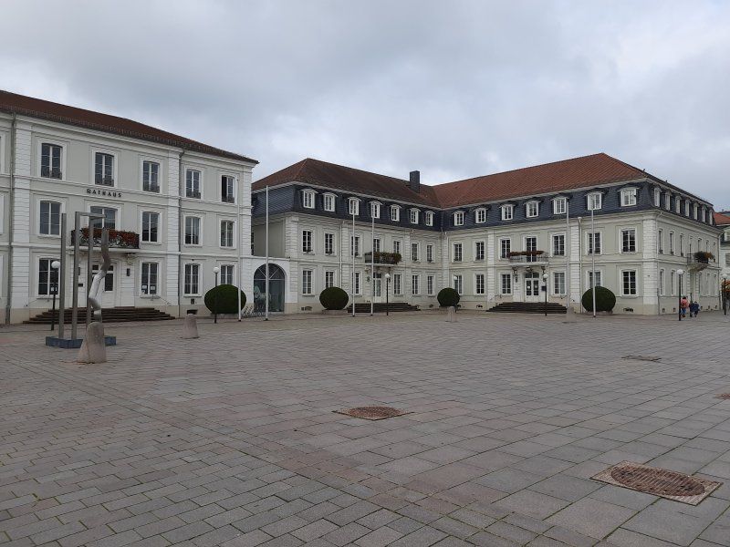
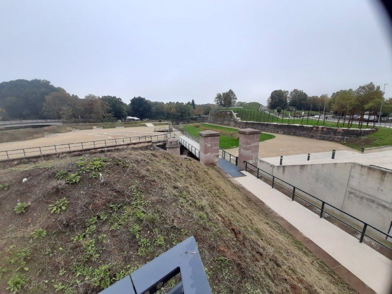
The parade ground in its current form has only existed since 1995. Before that, it was a square paved with small granite stones, which was primarily used as a parking lot and - as is still the case today - as the location of the weekly market. Today the "Exe" is provided with an underground car park that only existed once in its round shape in Germany at the time it was built, namely in Baden-Baden at the Festspielhaus.
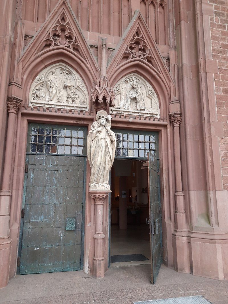
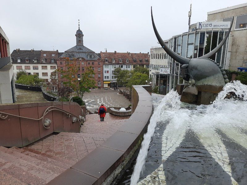
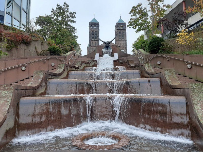
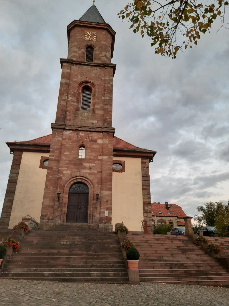
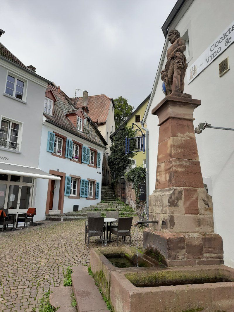
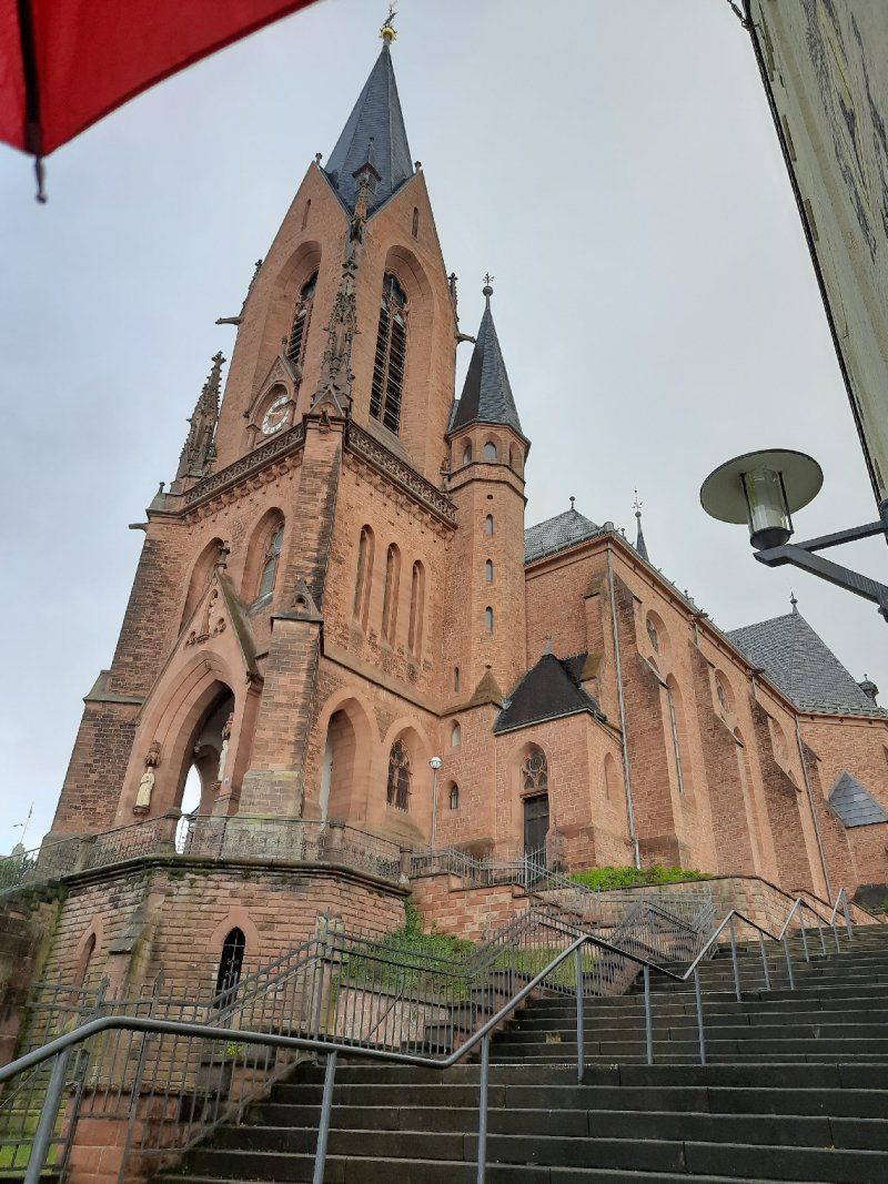
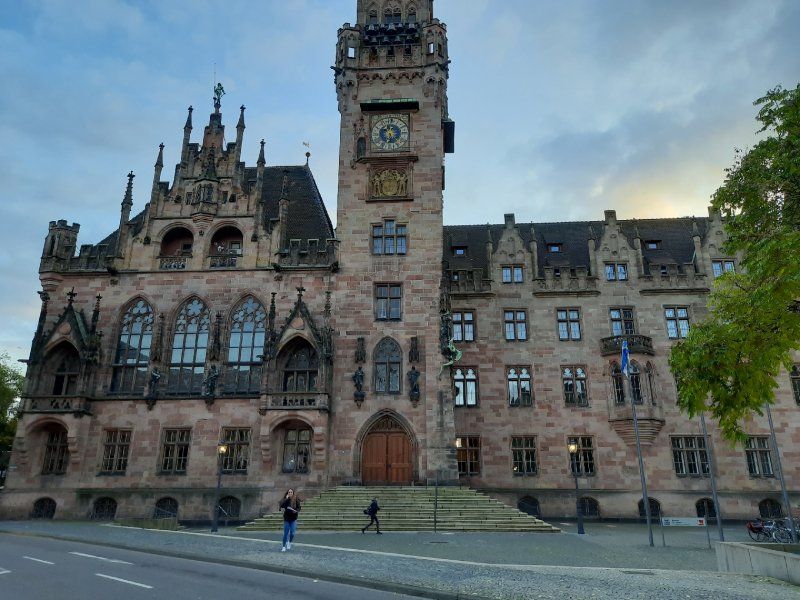
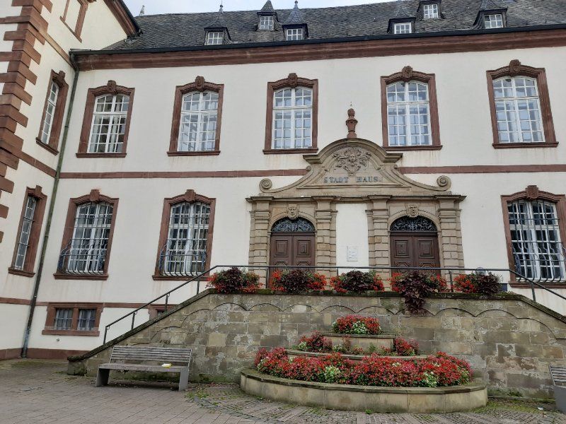
The "Schlossplatz" (also "Unterer Schlossplatz") is the center of Pirmasens. Located on the main street, it connects the "Old Town Hall" with the Pirminius Church via the castle stairs. A water cascade and an oversized bull's head are the eye-catchers of this ascent. At the lower end is the "Old Town Hall". Destroyed in the war and then rebuilt. The carillon also sounds every day at 11:00 a.m. We were surprised to find such a great facility in the middle of the beautiful pedestrian zone.
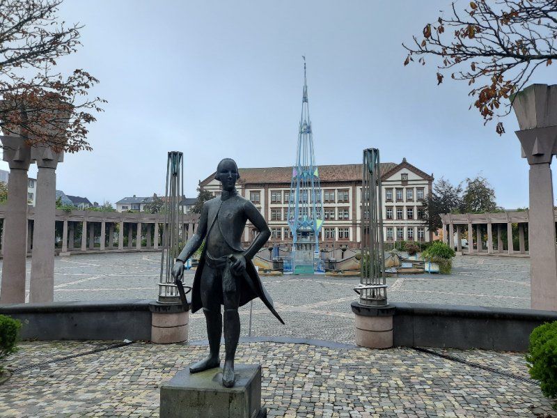
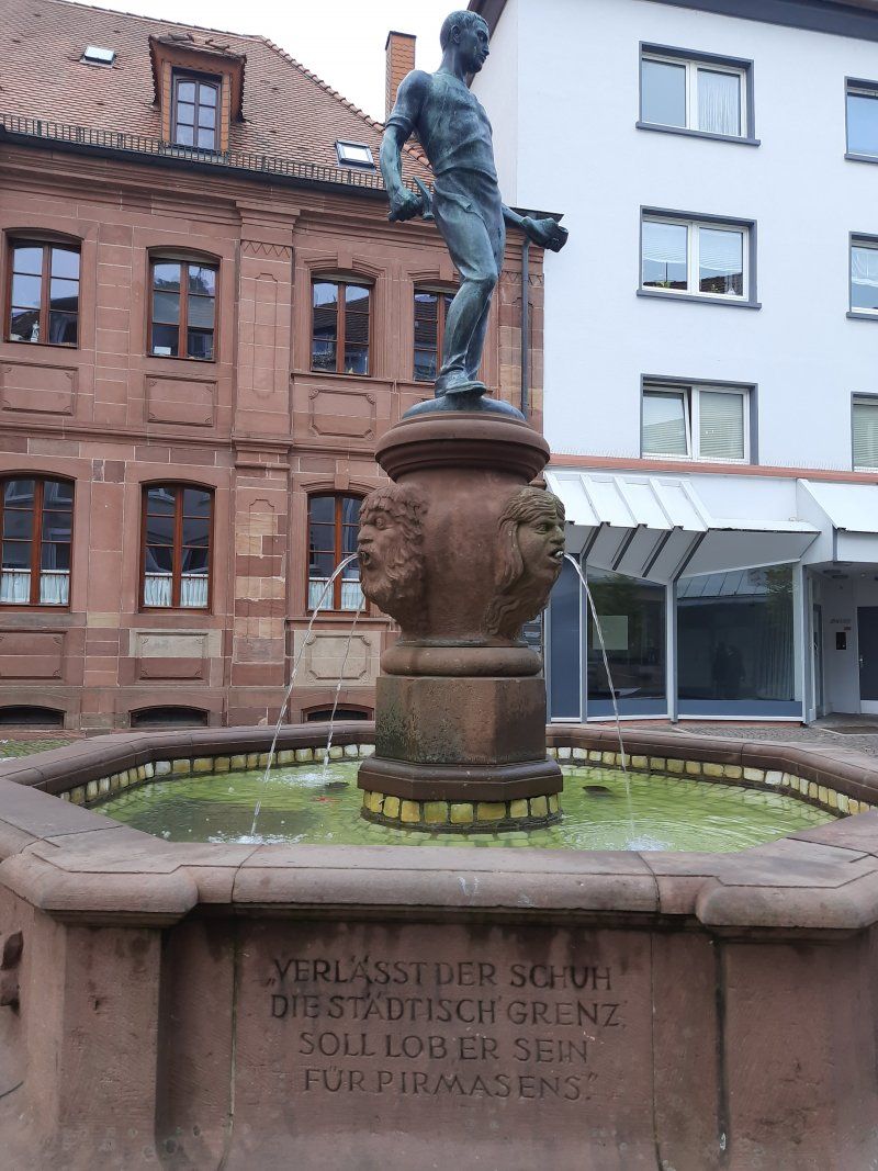
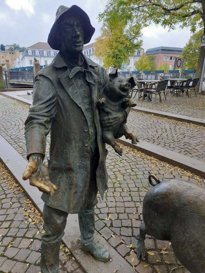
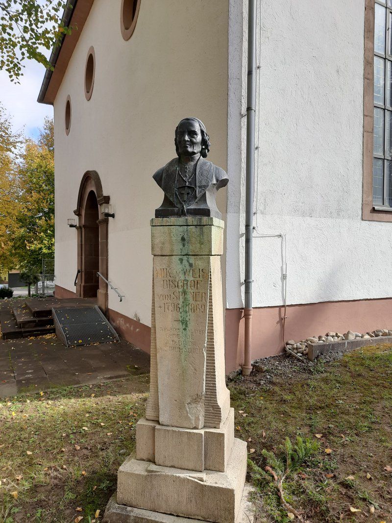
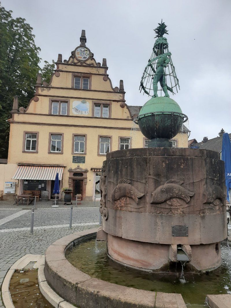
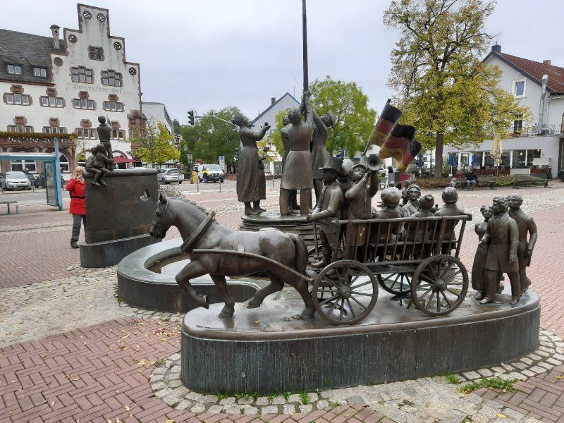
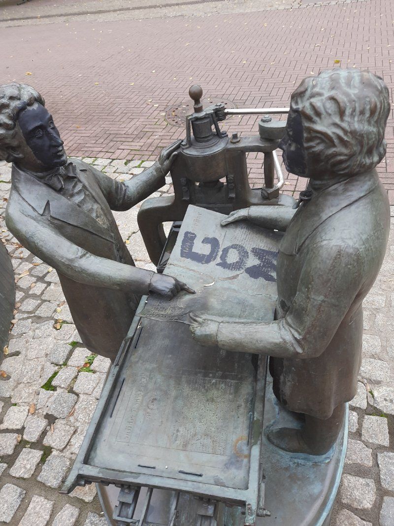
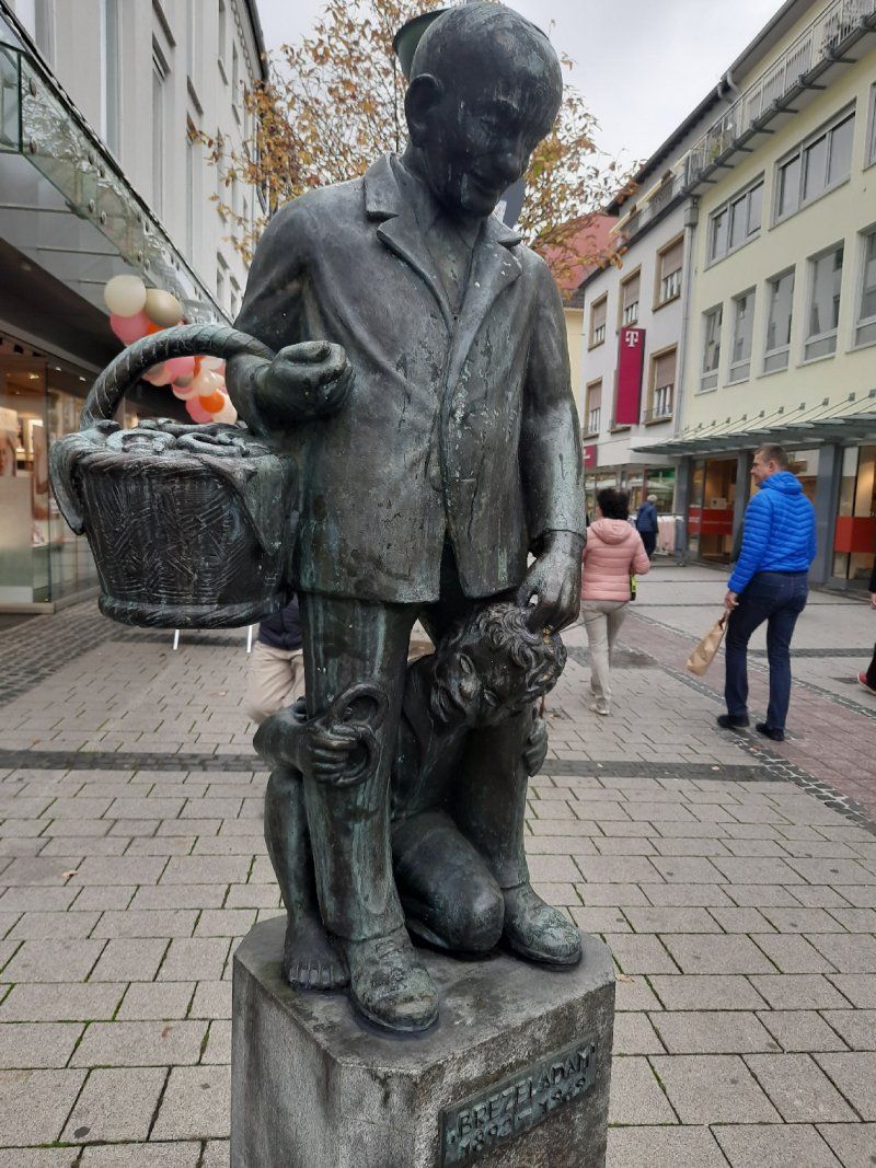
What would the (former) shoe town of Pirmasens be without its shoemaker Jean Joss?
After his apprenticeship as a shoemaker, which he completed in Paris, he settled in Pirmasens and laid the foundation stone for the local shoe industry. It is said that he sent his wife to the Prussian Rhine Province at the beginning of the 19th century to sell shoes there. When other Pirmasens shoemakers saw how much money the Joss couple had made from this trade, they too began to do the same.
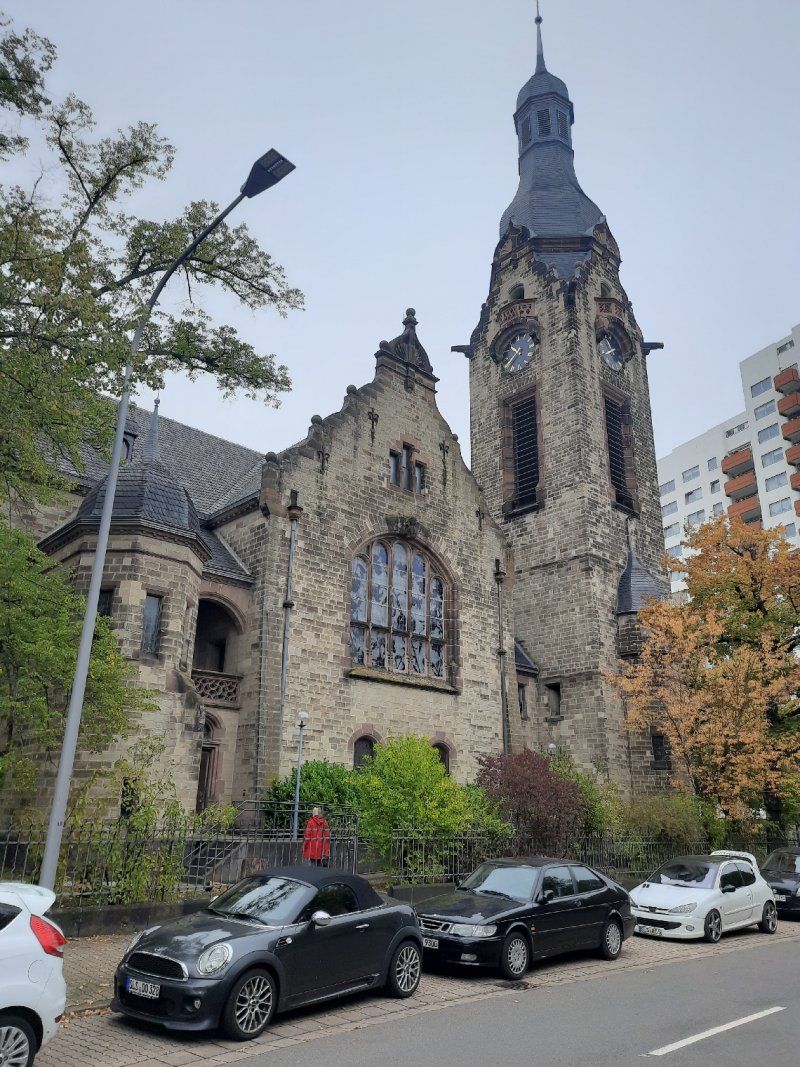
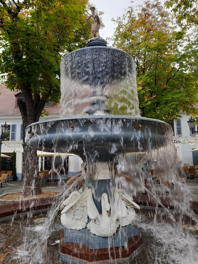
And so began the rise of the “shoe city” - at least that is the legend. Today a bronze figure on the shoemaker's fountain in front of the Luther Church commemorates Jean Joss. The fountain figure had initially stood on the Upper Schloßplatz since 1921, before it was finally placed here in 1981 after the construction of the pedestrian zone. Pithy sayings adorn the octagonal fountain basin, which at least partially express the pride of the Pirmasens in their history.
This is what it says here, for example
"The shoe made us great here,
so don't despise shoes and shoemakers! "
or
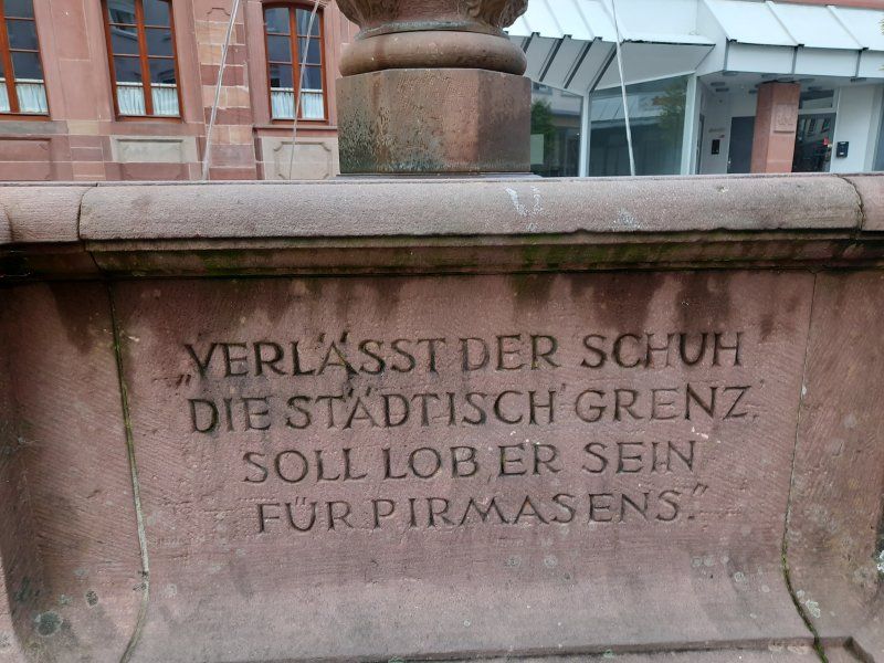
"If the shoe leaves the urban 'border',
should he be praise for Pirmasens! "
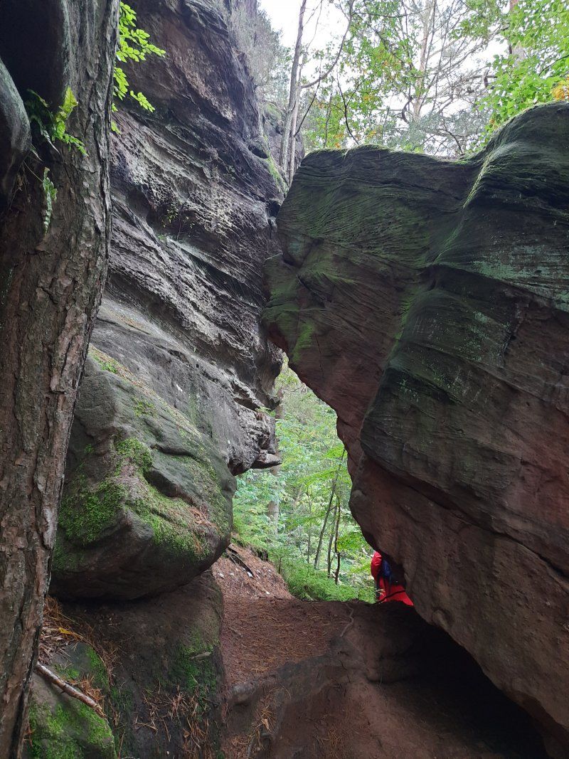
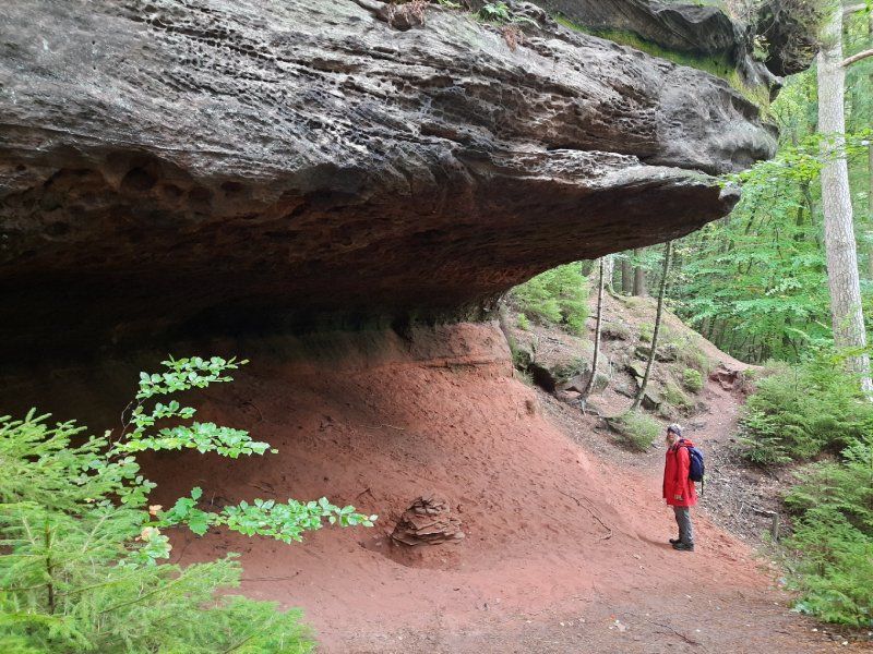
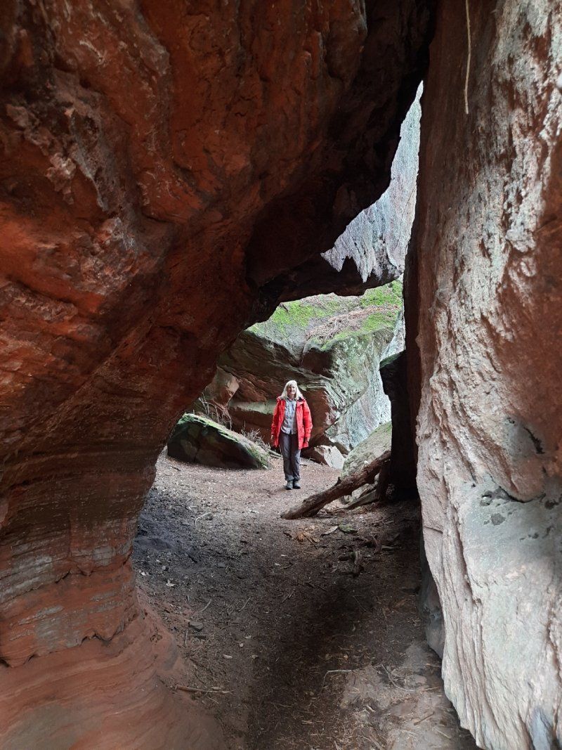
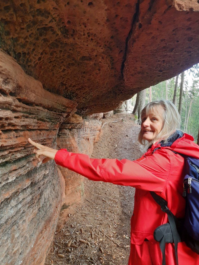
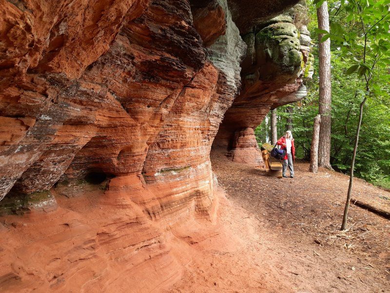
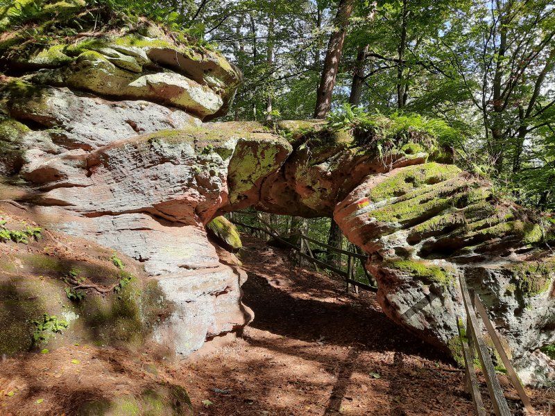
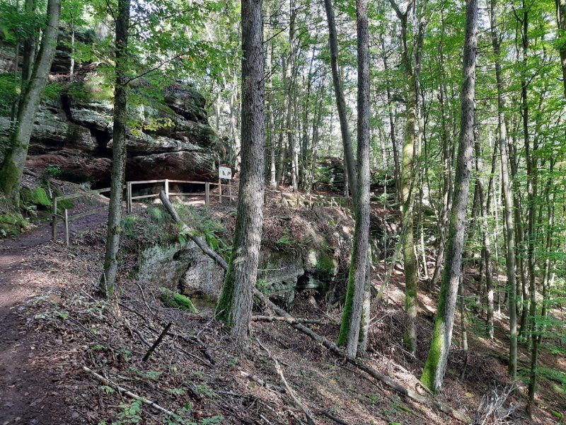
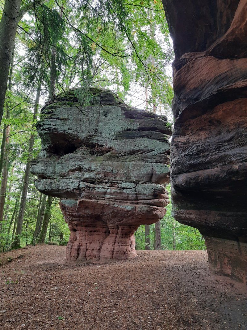
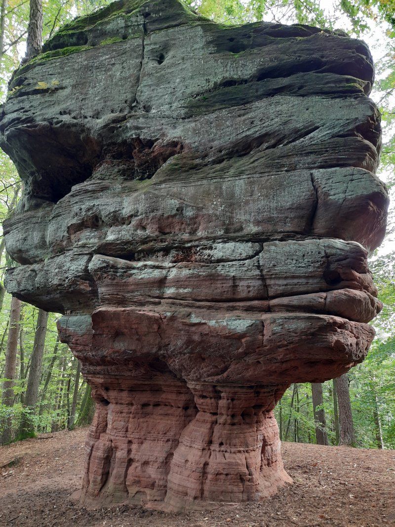
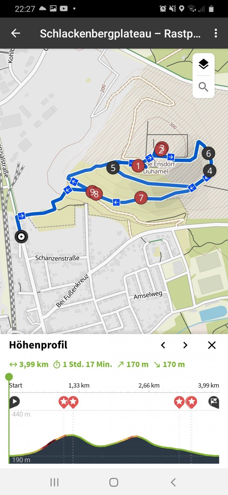
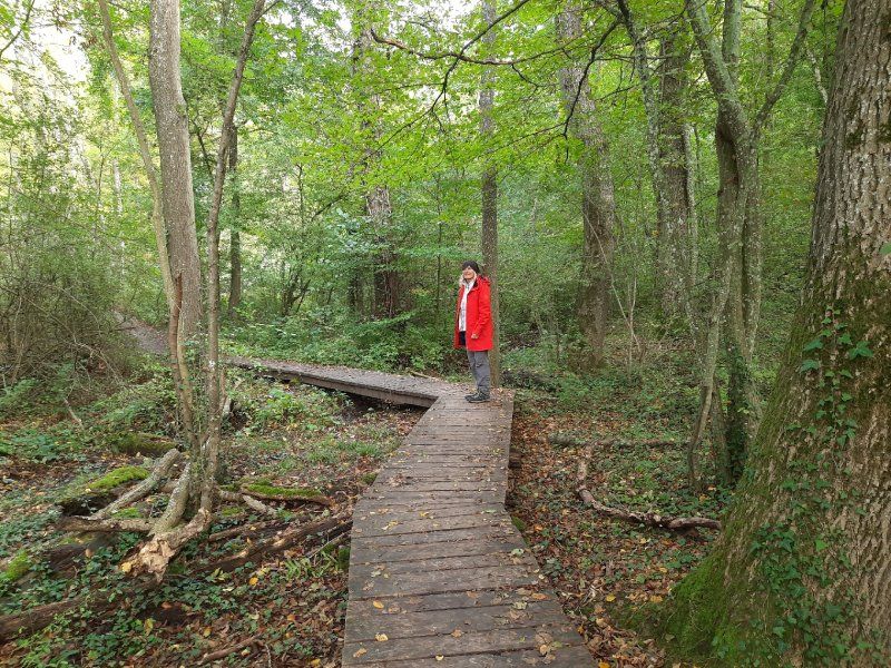
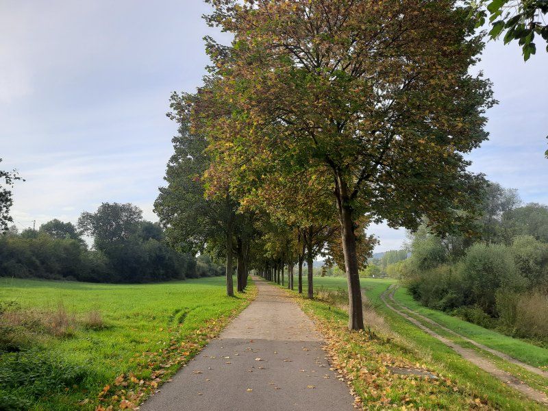
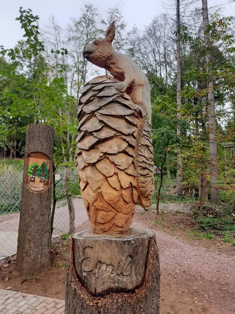
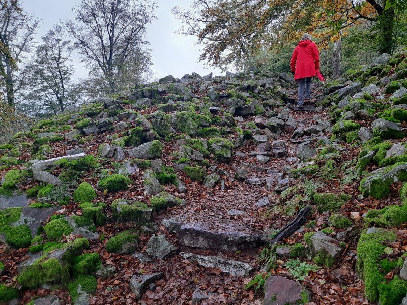
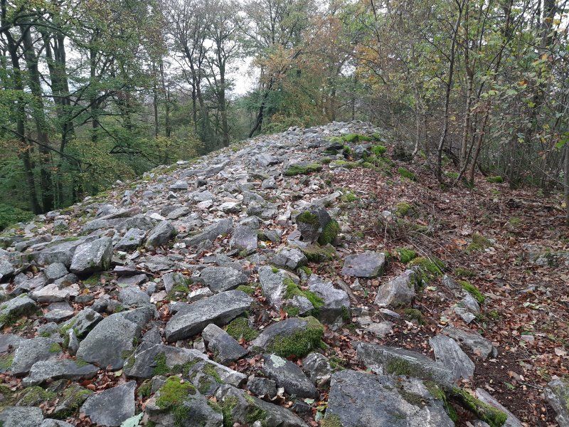
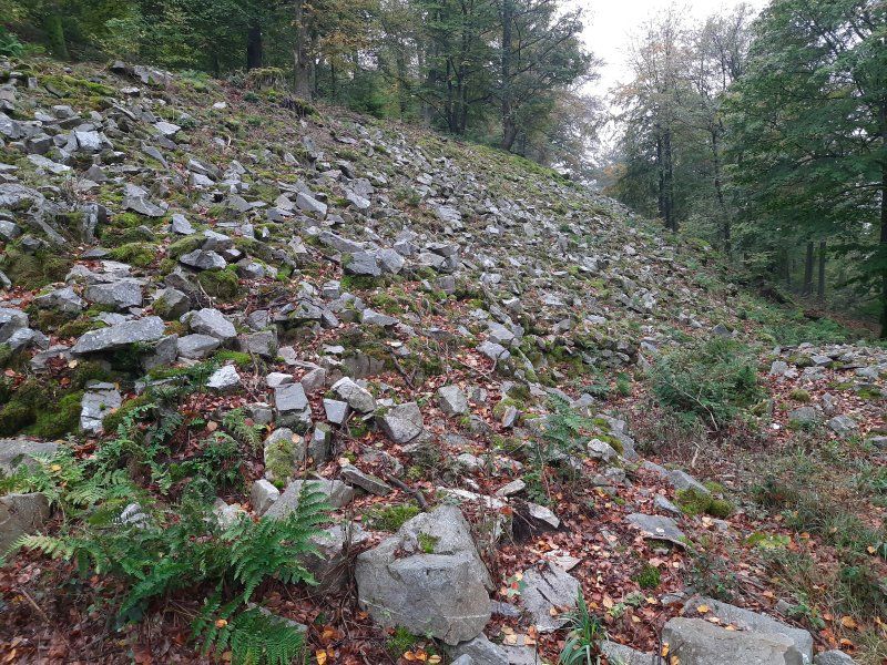
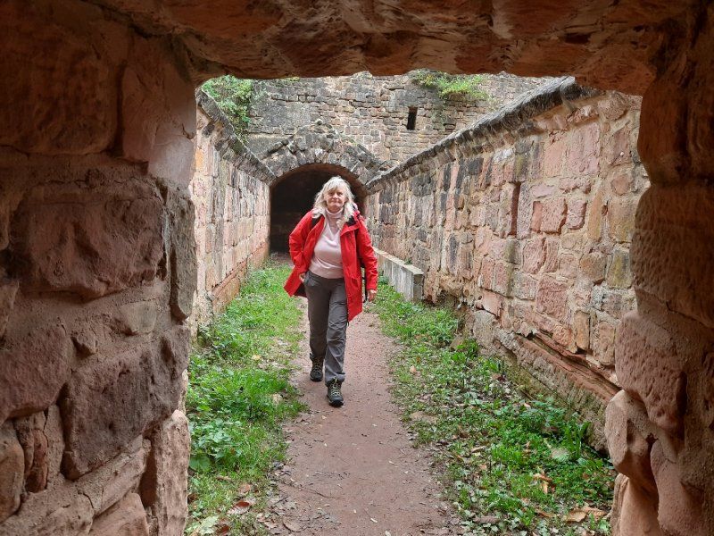
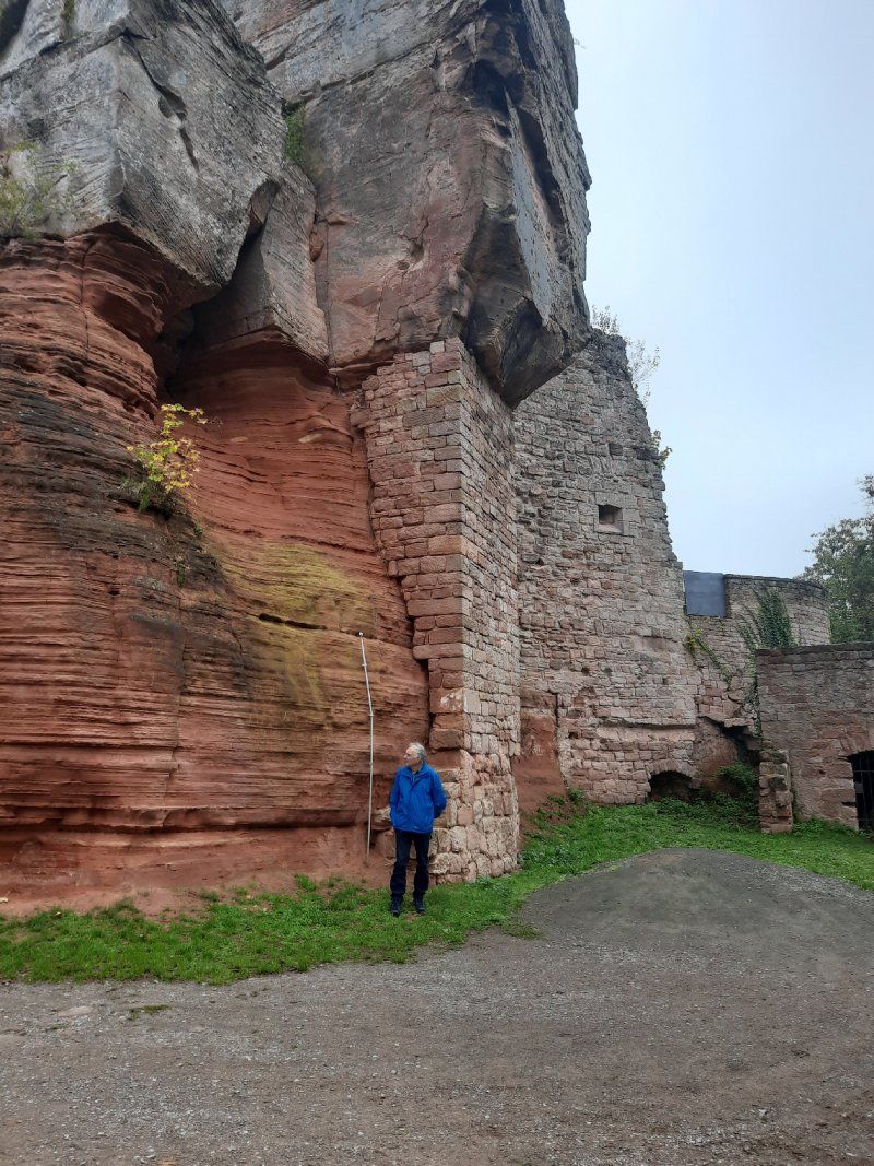
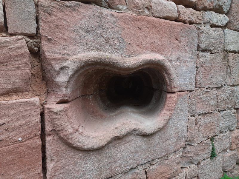
Felsenwald-Wanderung
Rock forest
The tour lives up to its name - through an attractive forest with hidden meadow valleys, streams, springs and ponds, it led us past bizarre sandstone rock formations and through crevices. There were two places to stop for refreshments on the way, the forester's house and ...
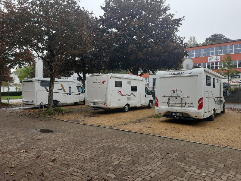
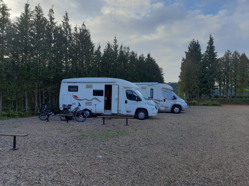
Wohnmobilstellplatz Hornbach
49.183601, 7.36538
Nice local parking space in the monastery town of Hornbach. Larger RVs shouldn't have a problem. Barbecue hut and hut with tables and benches available. The place is divided and graveled.
Wohnmobilstellplatz, Bahnhofstraße 27, 66500 Hornbach, Germany
49° 11' 2" N 7° 21' 56" E
49.1838889 7.3655556
• Head north on Bahnhofstraße. Go for 63 m.
• Turn right onto An der Tuchbleiche. Go for 182 m.
• Turn left onto Brenschelbacher Straße. Go for 326 m.
• Continue on Hauptstraße (B424). Go for 329 m.
• Take the 2nd exit from roundabout onto Zweibrücker Straße (B424) toward Zweibrücken/Althornbach. Go for 7.2 km.
• Take the 1st exit from roundabout onto A8 toward Trier/Saarbrücken. Go for 14.0 km.
• Take exit 27 toward Paris/Metz/Saarbrücken/Flughafen onto A6. Go for 10.3 km.
• Take exit 6 toward St. Ingbert-Mitte/Spiesen-Elversberg/Niederwürzbach/Hassel. Go for 219 m.
• Take the 3rd exit from roundabout onto Südstraße toward St. Ingbert-Süd/Gewerbegebiet Mitte-Schiffelland/Gewerbegebiet Mitte-Pottaschwald. Go for 1.2 km.
• Turn right onto Heinrich-Imbusch-Straße toward Gewerbegebiet Mitte-Schiffland/Gewerbegebiet Pottaschwald. Go for 177 m.
• Continue on Betzentalstraße. Go for 431 m.
• Continue on Wolfshohlstraße. Go for 456 m.
• Continue on Rentamtstraße. Go for 597 m.
• Turn right onto Ensheimer Straße. Go for 30 m.
• Continue on Neue Bahnhofstraße. Go for 270 m.
• Continue on Schlachthofstraße (L119). Go for 120 m.
• Turn right onto Poststraße. Go for 33 m.
• Arrive at Poststraße. Your destination is on the right.
☍
36,0 km
( 29 min.)
Day
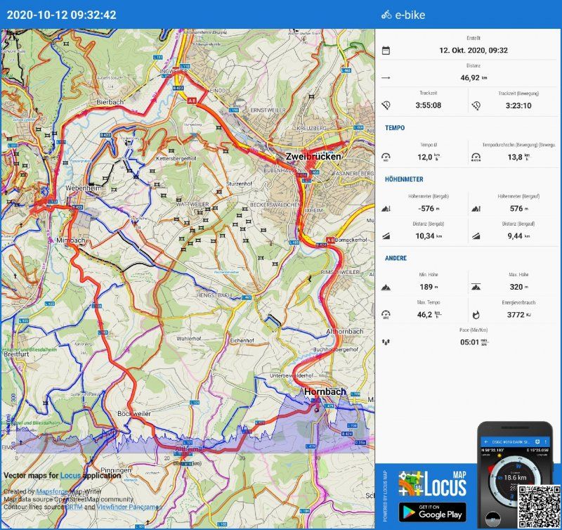
Radtour Zweibrücken 1.Station
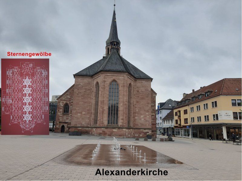
Zweibrücken was our first stop
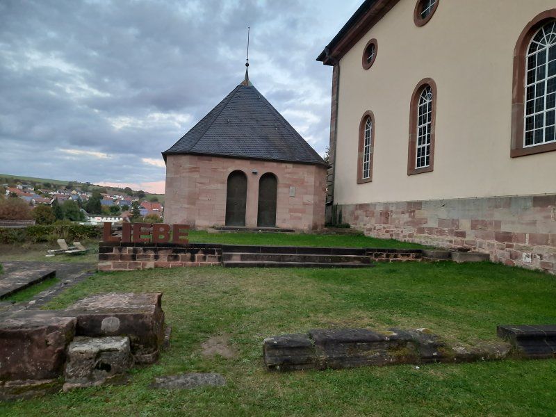
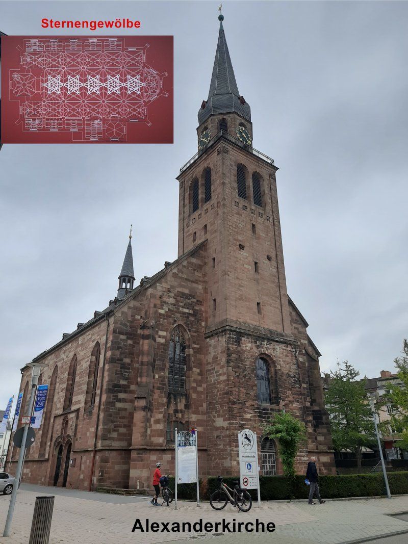
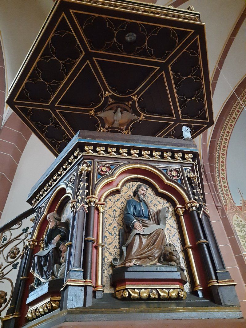
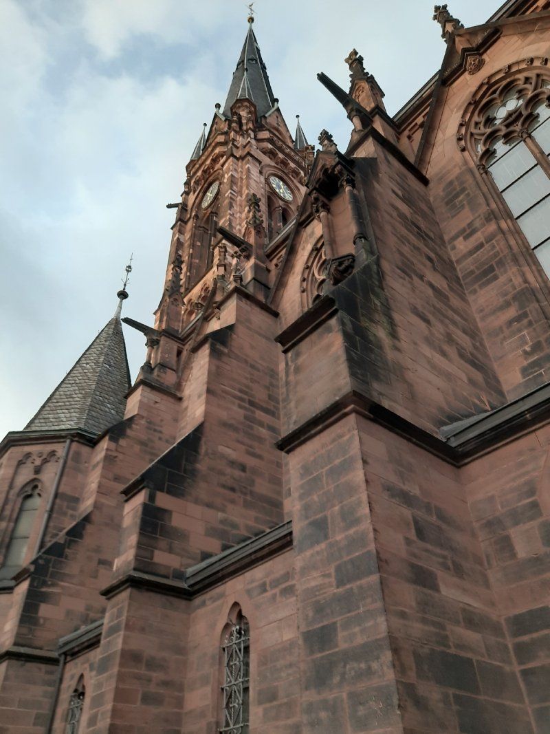
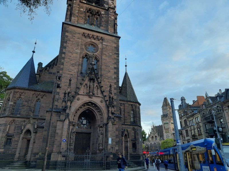
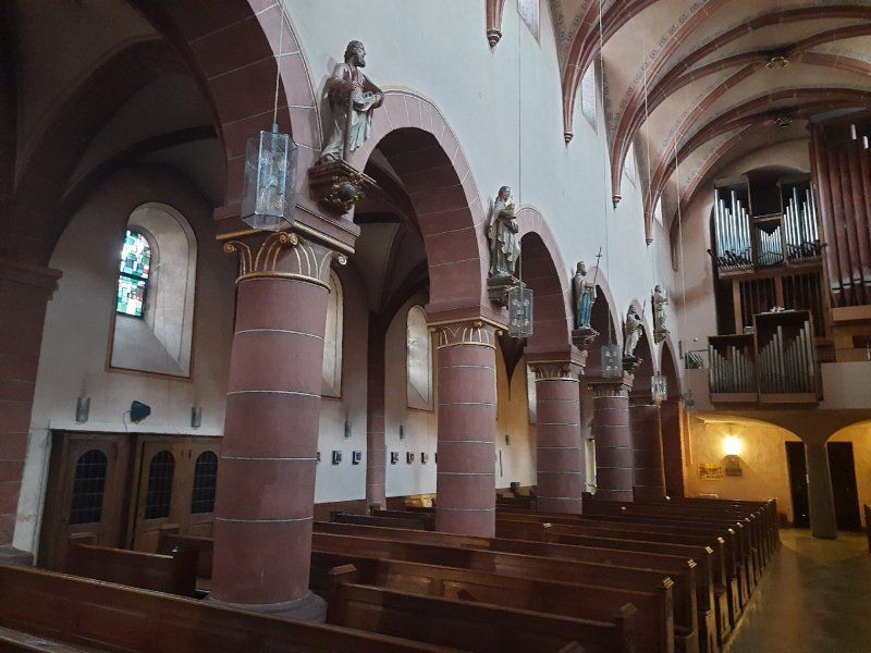
Our city tour began at the Alexander Church. Zweibrücken is on the north side of the signposted Jakobusweg. In the Middle Ages, pilgrims were shown evidence of medieval art along the way. The Alexander Church was built between 1493 and 1515 and is one of the most important building arts of the late Gothic period. The interior was characterized by an extraordinary star vault.
The name Zweibrücken comes from a castle built in the late 12th century, which had a double moat that had to be crossed by two drawbridges.
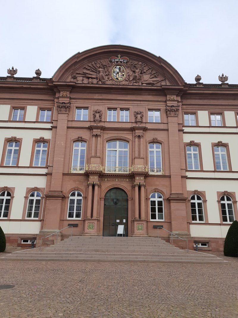
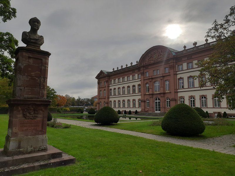
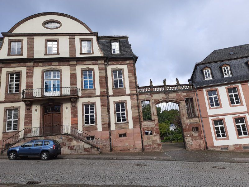
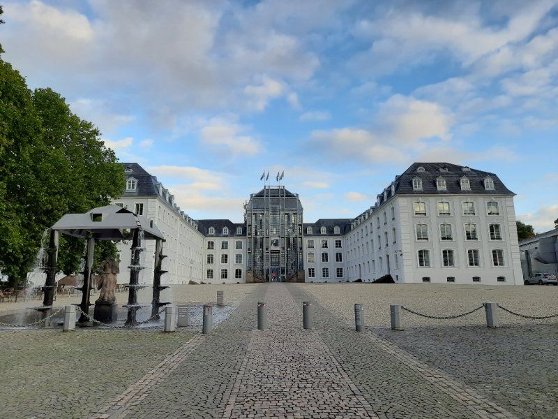
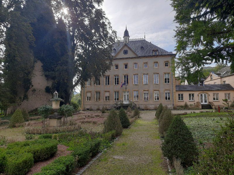
The Duke's Castle in Zweibrücken - built in its current form in 1725 - is the largest secular building in the Palatinate in the baroque style of the Nordic region. Clear lines, few flourishes, Zweibrücken is shaped by the Baroque, built in the style of the Nordic Baroque.
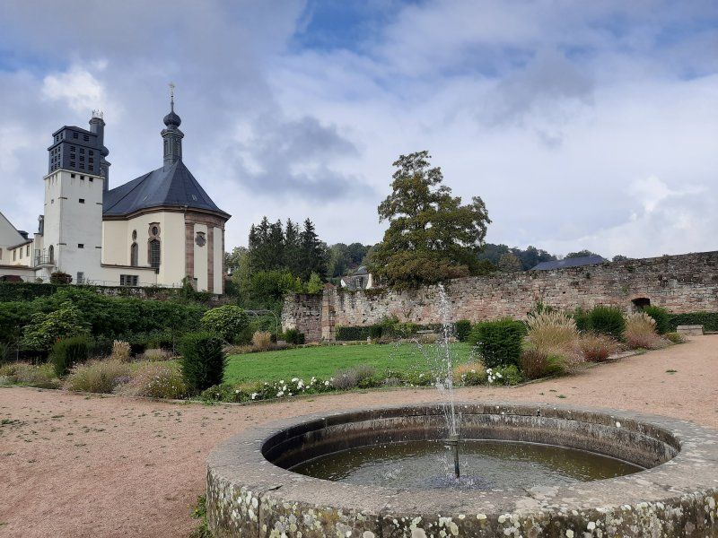
The path led through the palace gardens and past the Rhineland-Palatinate state stud that houses Zweibrücken.
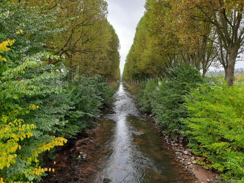
Palace garden When the doctor and botanist Hieronymus Bock became famous in the 16th century with the first German herbal book, the city's green heart began to beat. Garden art reached its peak in the 18th century with spectacular inner-city parks in the baroque style. Only one baroque green vein has survived to this day: the canal and avenue allow you to feel the splendor of that time and make the hearts of walkers beat faster.
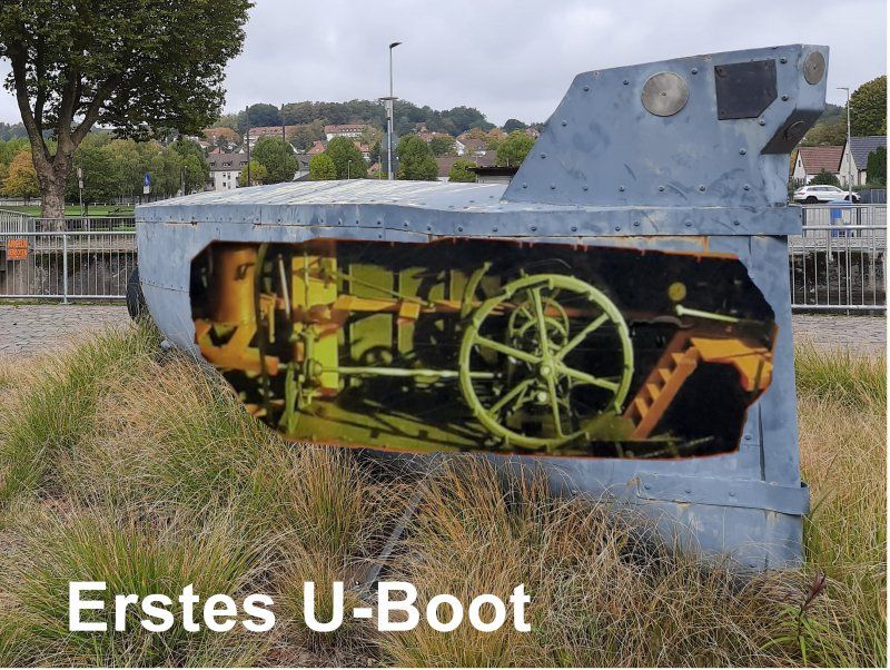
Zweibrücken and the first submarine
The inventor and inventor Wilhelm Bauer (1822 to 1875) constructed the first submarine called Brandtaucher in Kiel in 1849/50 during the German-Danish War. This marked the beginning of the age of underwater ships for Germany. The fire diver sank in the Kiel harbor basin on his first dive on February 1, 1851. The three-man crew, including Bauer himself, managed to save themselves. Wilhelm Bauer worked in Zweibrücken from October 1867 to July 1868. He planned to build an oil-powered submarine engine in the Dingler factory (now Terex). The factory, founded in 1827, was one of the most important steel construction companies in Germany at that time. At that time it was considered to be the world's leading company in the field of steam engine and air apparatus construction. Bauer went down in history as the developer and inventor of submarines through the submarines "Brandtaucher" and the successor model "Seeteufel".
The tour ended at the Duke suburb.
The Herzogsvorstadt is today the oldest preserved building ensemble in Zweibrücken, even the devastating bombing raids of 1945 could not harm it. The Duke's better officials, valets and court gardeners, lived here from 1770 near the castle.
The bike tour continued to Blieskastel
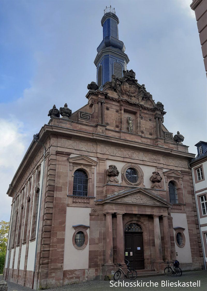
Blieskastel - 2.Station der Radtour
Blieskastel is considered to be one of the best preserved baroque towns in southwest Germany. 154 buildings are listed here. In the city center there is still a lot of old building fabric that was spared from the bombing at the end of the Second World War.
The present-day appearance of downtown Blieskastel was created in the Baroque era. In many places, palaces and mansions determine the image of the former royal seat, which is why it is a stop on Baroque Street Saar-Palatinate. Only remnants of the former castle are left.
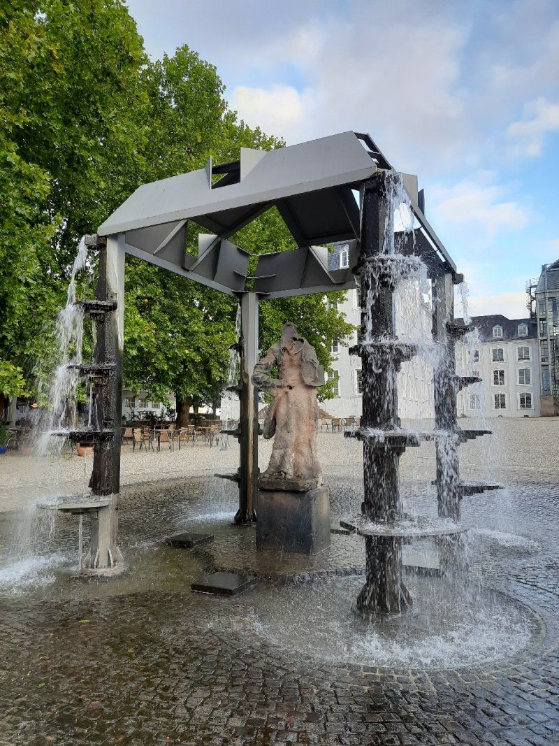
A strong man standing on the fountain, the Greek hero Hercules, muscled and with his club he guards a coat of arms that the Count von der Leyen. A ghastly town keeper had the fountain built for the first time in 1691. The fountain used to be very important for the Blieskasteler because on the one hand there was drinking water and on the other hand there was even more important extinguishing water, there was a very high risk of fire, the houses were all only covered with simple shingles.
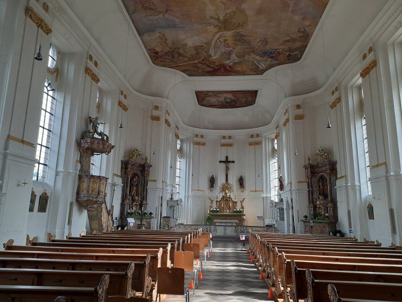
The castle church was one of the many major construction sites that Countess Marianne had to complete as the client after her husband suddenly died. The church was finished in 1778. It belonged to a Franciscan monastery that was housed in the large building to the right of the church. The count couple had recruited the Franciscans to open a Latin school here, another example of enlightened absolutism in which the nobility no longer only had themselves but also the welfare of their subjects in view. The count couple obviously wanted to develop Blieskastel sustainably. The artfully designed sandstone facade of the church is an eye-catcher, here we see a mixture of baroque and style that became more and more fashionable at the end of the 18th century This time two coats of arms are shown, on the left that the Count von der Leyen, on the right, that of those of Dalberg, the nobility of the Countess, underneath is that of Sebastian, hit by arrows, he is the patron saint of the city. The countess immortalized two men who were very important to her on the two vases above the entrance portal, her son Philipp is depicted on the medallion of the left vase and her late husband Franz-Karl is depicted on the one on the right vase. Inside the church, the huge ceiling painting is worth seeing, it shows, among other things, scenes from the life of St. Sebastian.
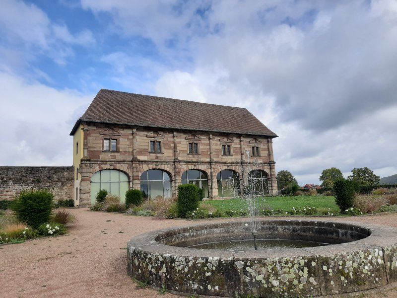
The orangery, the only building spared by the revolutionary troops, could be because it was used as a residential building very early on. At the time of the castle, the orangery was probably the place where the exotic plants from the garden were housed in winter, e.g. oranges and lemon trees, today it's a nice place to get married and there are always concerts and exhibitions. The large arches on the ground floor of the orangery are now glazed, they used to be open, behind that there was a portico in which the nobility could stroll, just as they liked it most in the shade. At that time very important, you wanted to enjoy the beautiful weather, the sun, but just not get dark facial skin, had the lower working class.
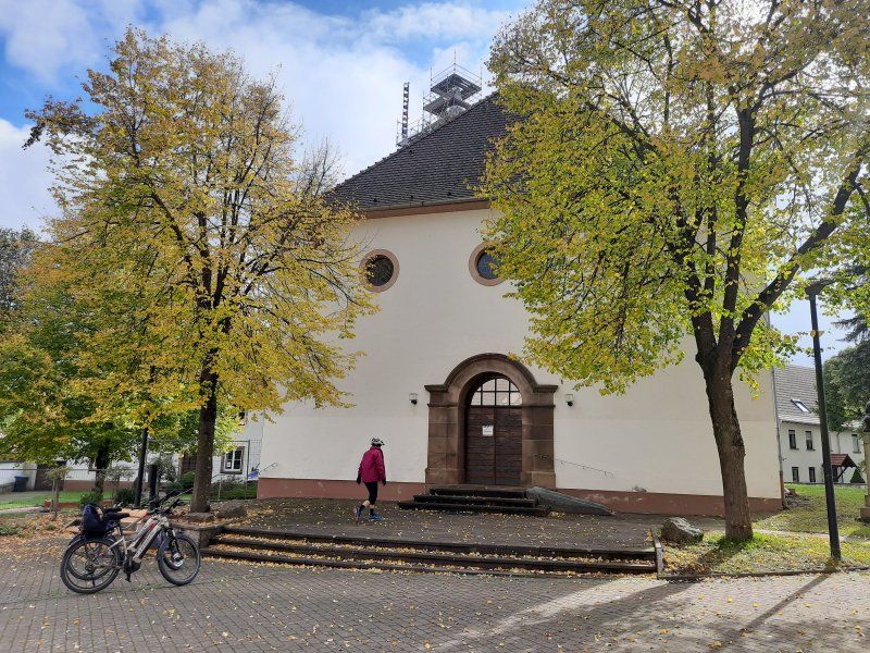
Altheim 3.Station der Radtour
Altheim
Worth seeing in the center of Altheim is the tower of the Catholic parish church St. Andreas, the basement of which dates from the 14th century. The tower was raised in 1499, which shows the year on the upper sound hole on the north side.
After returning we quickly stowed the bikes in the garage before it started raining and after a break we got ready to continue our journey.
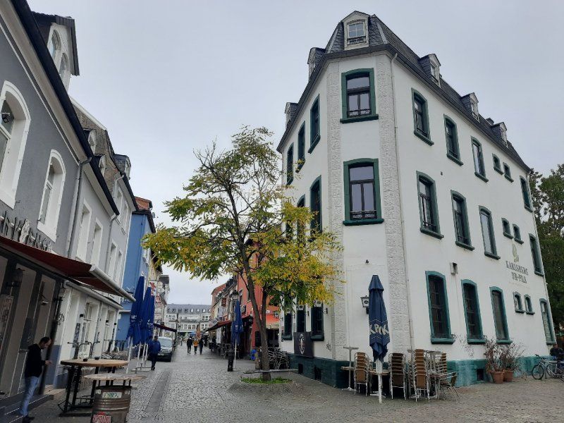
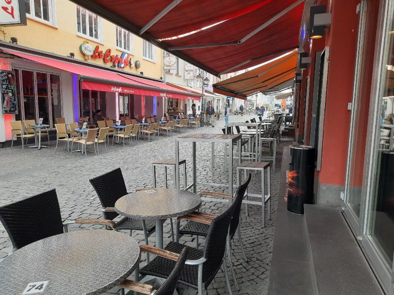
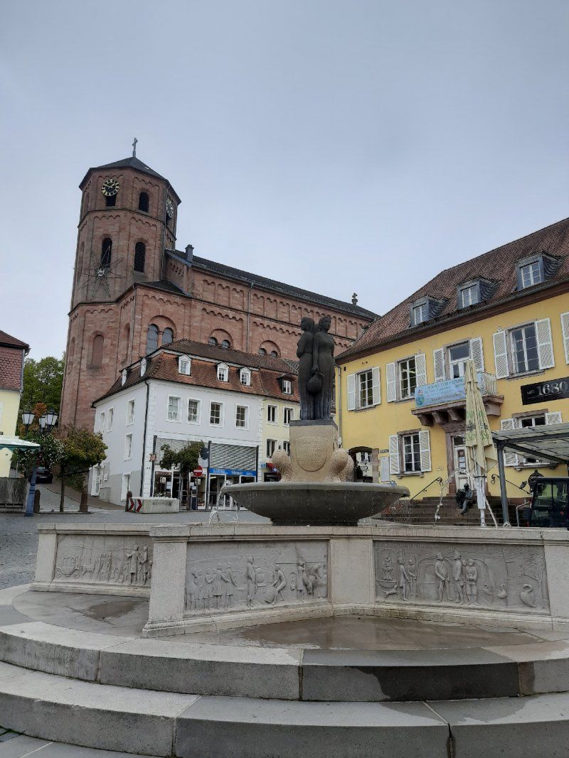
Sankt Ingbert
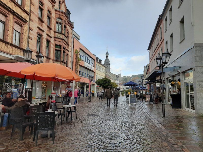
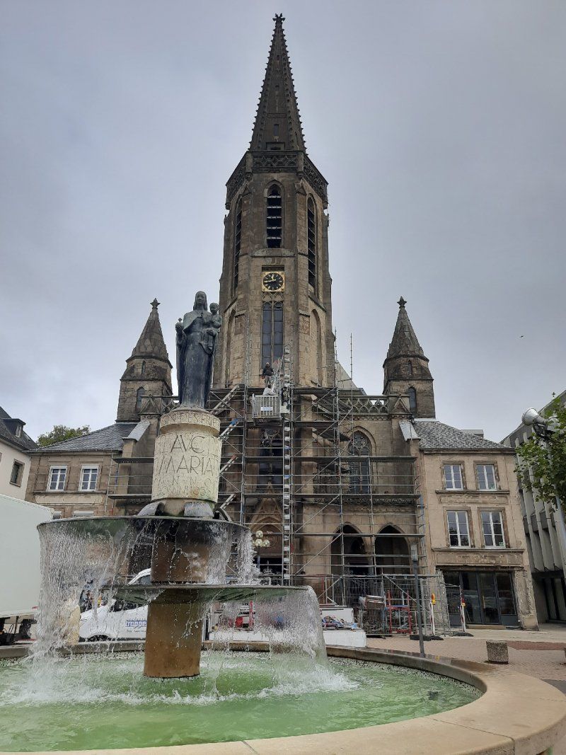
Finding a parking space in Ingberth is extremely difficult, especially for larger vehicles. We used the parking lot at a shopping center not far from the center. On the way to the city center, it started to rain in torrents, the parish church of St Engelbert came as called, which we saw first
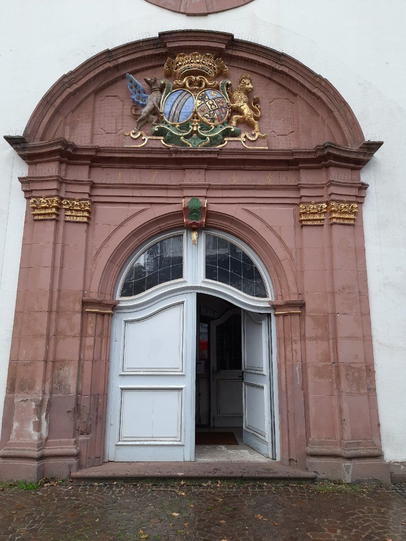
The St. Engelbert Church is the baroque heart of the city of St. Ingbert. It is one of the three landmarks of the city. The only exterior decoration, the beautifully executed large alliance coat of arms of Count Friedrich Ferdinand von der Leyen and his wife Charlotte von Hatzfeldt above the entrance portal.
The carillon
The carillon on the tower of Engelberts Church was put into service on June 30, 2007, it comprises 23 bells.
Every weekday at 12 o'clock the miner's song "Glück auf, Glück auf, der Steiger is coming" can be heard.
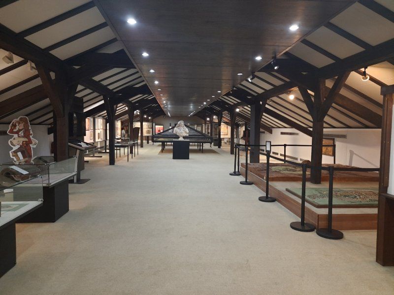
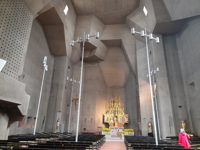
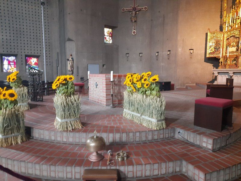
On our city tour we went to St.Josef Church. The Catholic parish church of St. Josef is the second largest church in the Speyer diocese. Only the Speyer Cathedral itself offers more space for believers. The church is one of the three landmarks of the city of St. Ingbert. During repair work on the roof structure, a fire broke out in the top of the church tower on July 17th, 2007, which led to the complete destruction of the roof structure and the bells.
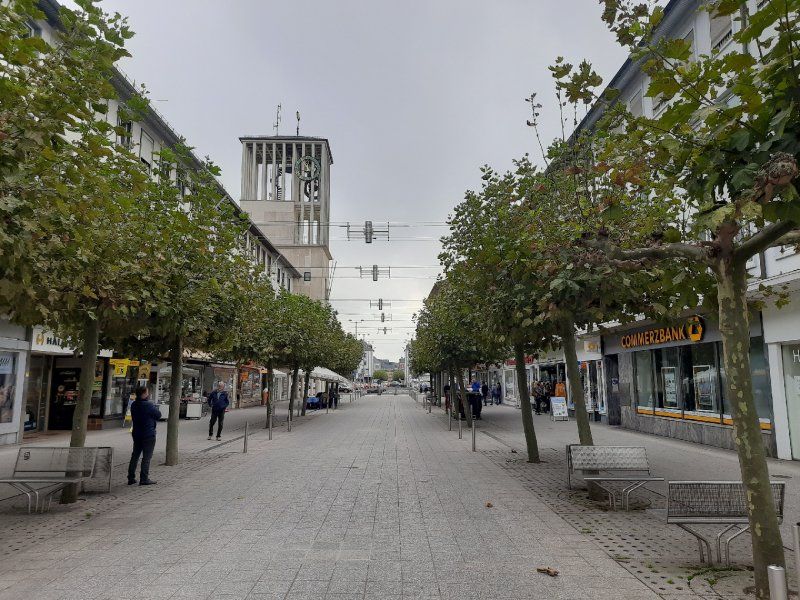
On the way back to the Womo we went through the small pedestrian zone. From 1816 to 1920 St. Ingbert belonged to the Kingdom of Bavaria and the traces of that time can still be discovered everywhere.
66386 St. Ingbert, Deutschland
49° 16' 38.8" N 7° 6' 42.8" E
49.2774456 7.1118995
• Head toward Am Markt on Poststraße. Go for 238 m.
• Turn left onto Rickertstraße. Go for 244 m.
• Turn left onto Kohlenstraße (L119). Go for 274 m.
• Continue on Dudweilerstraße (L250) toward Saarbrücken. Go for 351 m.
• Take the 2nd exit from roundabout onto Dudweilerstraße (L250). Go for 2.6 km.
• Take ramp toward A6/Mannheim/Kaiserslautern/Paris/Metz/Saarbrücken/Sulzbach. Go for 169 m.
• Turn left onto Autobahnzubringer (L126). Go for 776 m.
• Continue on L252. Go for 6.2 km.
• Turn left onto Dudweilerstraße (B41). Go for 203 m.
• Turn right onto Schubertstraße. Go for 79 m.
• Turn left onto Sulzbachstraße. Go for 64 m.
• Turn right onto Ursulinenstraße. Go for 55 m.
• Turn left onto Ursulinenstraße. Go for 148 m.
• Arrive at Ursulinenstraße. Your destination is on the left.
☍
11,4 km
( 14 min.)
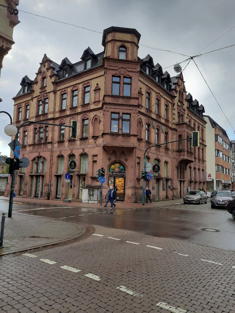
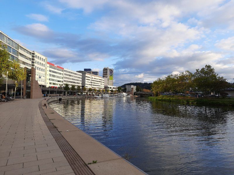
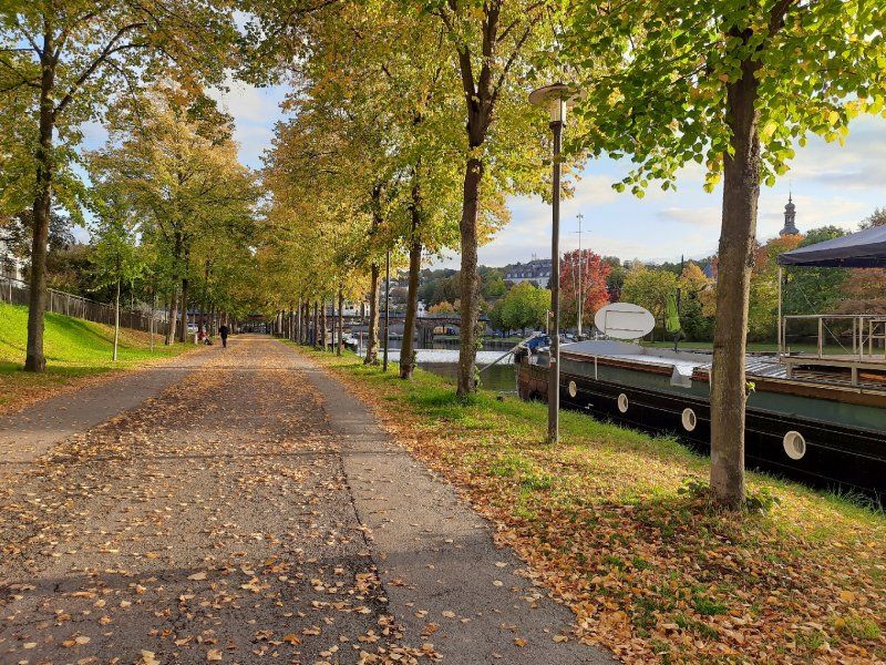
Saarbrücken
We had to plan a lot of time to drive to the parking lot in Saarbrücken. The traffic came to a standstill in places. The parking lot at the Saarhalle was empty and free of charge.
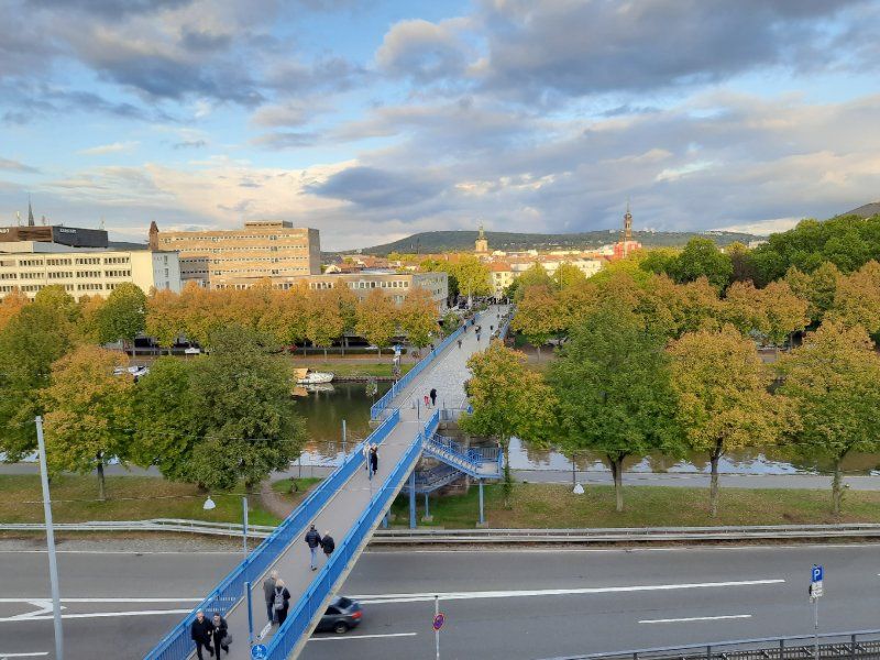
Shortly after our arrival, we set out for a city tour. A 30-minute walk took us along the Saar to the Old Bridge. The name of the city of Saarbrücken does not come from the bridges over the Saar, but from the castle that perched high above the Saar on a sandstone rock: "Sara Brocca": Brocken, rock, in the Saar. Saarbrücken as we know it today has existed since 1909: the two cities were only united in the imperial era. Over the old bridge we went to the castle. A Jewish museum is housed in the castle, which was closed when we arrived. Back over the bridge it went to the St. Johann district. With the town hall built by Kaiser Wilhelm II and the Johanneskirche. After a long stroll and a stop, we went back to the Womo.
In good time before dark we drove to Saarlouis to the pitch to stay overnight.
Deutschland
49° 14' 24.6" N 6° 59' 49" E
49.2401572 6.9969327
• Head toward Mozartstraße on Ursulinenstraße. Go for 338 m.
• Turn right onto Sankt-Johanner-Straße (B51). Go for 433 m.
• Keep left onto Sankt-Johanner-Straße toward Metz/A1/A8/A620/Cityring/Kongresszentrum. Go for 31 m.
• Keep right onto Sankt-Johanner-Straße. Go for 255 m.
• Take the 2nd exit from roundabout onto Saarbrücken-Westspangenbrücke (B268). Go for 369 m.
• Take ramp onto A620 toward Luxembourg/A8/Metz/A6/Messe/Völklingen. Go for 24.3 km.
• Take exit 2 toward Wallerfangen/Saarlouis. Go for 233 m.
• Turn right onto Wallerfanger Straße (L170) toward Saarlouis. Go for 475 m.
• Turn left onto Sankt Nazairer Allee. Go for 671 m.
• Turn left onto Sankt Nazairer Allee. Go for 30 m.
• Turn left. Go for 38 m.
• Arrive at your destination on the left.
☍
27,1 km
( 20 min.)
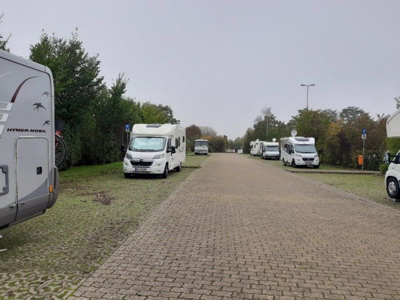
Stellplatz Saarlouis
Saarlouis, the city that was built by Louis XIV to secure his empire by his fortress builder Sébastien Le Prestre de Vauban in a Saar knee, is today a lively city,
Again we drove to a parking space in the dark. There were still enough free spaces to park. The place wasn't lit.
St.Nazairer Allee 6, 66740 Saarlouis, Germany
49° 19' 16" N 6° 44' 33" E
49.3211111 6.7425000
• Head northeast. Go for 38 m.
• Turn right onto Sankt Nazairer Allee. Go for 30 m.
• Turn right onto Sankt Nazairer Allee. Go for 671 m.
• Turn right onto Wallerfanger Straße (L170) toward Wallerfangen/Beaumarais/Metzer Wiesen. Go for 475 m.
• Turn right and take ramp onto A620 toward Luxemburg/Trier/Karlsruhe/A8/Neunkirchen. Go for 1.9 km.
• Continue on A8. Go for 3.8 km.
• Take exit 7 toward Rehlingen/Beckingen/Bouzonville/Siersburg. Go for 349 m.
• Turn left onto L347 toward Bouzonville/Siersburg/Rehlingen. Go for 646 m.
• Continue on Wallerfanger Straße (L170). Go for 160 m.
• Take the 2nd exit from roundabout onto L171. Go for 1.4 km.
• Take the 2nd exit from roundabout onto Hauptstraße (L171). Go for 2.8 km.
• Turn right onto L356. Go for 226 m.
• Continue on Lothringer Straße (L356). Go for 1.3 km.
• Continue on Niedaltdorfer Straße (L358). Go for 918 m.
• Continue on L358. Go for 671 m.
• Turn right onto L171. Go for 1.6 km.
• Turn right onto Neunkircher Straße (L171). Go for 533 m.
• Arrive at Neunkircher Straße (L171).
☍
17,5 km
( 17 min.)
Day
Stadtbesichtigung Saarlouis
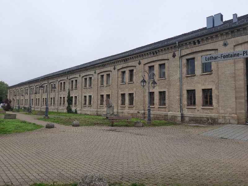
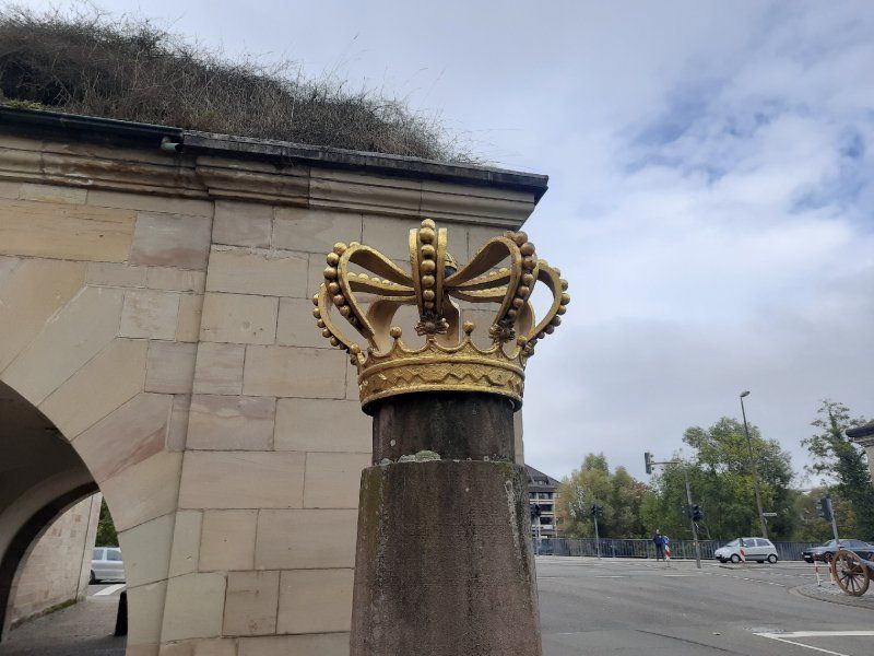
We used the morning for a city tour. From the parking space we first went through the city park, if you follow the network of paths you reach the "Vauban Island", formerly also known as "the Halwe Mond", via a footbridge. This facility was built in 1698 as the “Contregarde de l écluse” to protect the lock bridge. From the “Vauban Island” you can look over to the well-preserved “Bastion VI”. It was called "Bastion de Vaudrevange", since 1821 "Bastion Prince Albrecht". From the platform on it you can enjoy an impressive panoramic view of the area. Numerous information boards provide information about the history of the facility. We continued to the old town. The narrow house fronts are characteristic. Barracks VI in Alte-Brauerei-Straße was built between 1866 and 1869 in place of the original French barracks in the classical style. Its unusual length of 185 m indicates the great strategic importance that the Prussians also attached to the fortress city of Saarlouis. In the building there is an interesting museum that you should definitely visit, free of charge. Opposite you come to the longest beer bar alley in Saarland. On the eve of the 200th anniversary, the baroque church tower of the Ludwigskirche fell victim to a fire. The new monolithic nave, completed in 1970, a striking asymmetrical concrete architecture. We strolled on through the old and new market places and through the German gate. The Prussian royal crown and Prussian coat of arms are still reminiscent of the Prussian era after 1815. The cannons in front of the German Gate were also positioned there in the early 1970s. The casemates were built by the Prussians in the area of the main wall in the course of the expansion of the fortifications between 1824 and 1829 as a bomb-proof defense system. The earth-covered vaults served soldiers and horses as accommodation and command posts in the event of a defense. From here it was the same way back to the Womo, with subsequent drive to the Druid Path.
Rehlingen-Siersburg
The approach to the hikers' car park was at the exit of Rehlingen on a narrow farm road.
Druid path
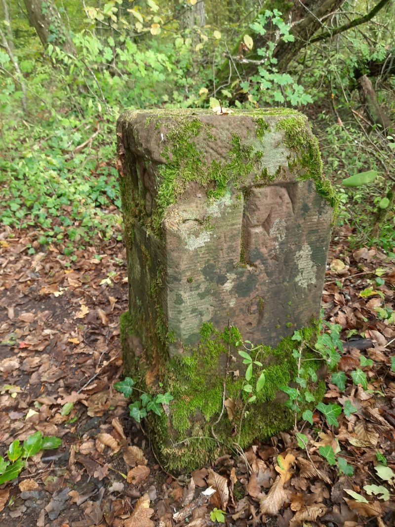
There is a lot to discover on the Druidenpfad in Rehlingen-Siersburg. A Celtic house, a high granary and a barrow were built there. In addition, the history of the buildings and interesting facts about the life of the Celts are told on information boards. An eight kilometer long path (path) leads through orchards and along old boundary stones on the smuggler's path, past mysterious mardelles and Celtic barrows. The Galgenberg tells its story as does the old oak. A Celtic tree calendar takes you into the world of the druids and their knowledge of the value and effect of these plants.
Niedaltdorf, 66780 Rehlingen-Siersburg, Deutschland
49° 20' 30.4" N 6° 35' 26.3" E
49.3417681 6.5906520
• Head toward Hinterstraße on Neunkircher Straße (L171). Go for 533 m.
• Turn left onto Neunkircher Straße (L171). Go for 1.6 km.
• Turn left onto L358. Go for 671 m.
• Continue on Niedaltdorfer Straße (L358). Go for 918 m.
• Continue on Lothringer Straße (L356). Go for 1.3 km.
• Continue on L356. Go for 226 m.
• Turn left onto L171. Go for 2.7 km.
• Take the 1st exit from roundabout onto Hauptstraße (L171). Go for 1.3 km.
• Keep right toward Wallerfanger Straße/L170. Go for 72 m.
• Continue on Wallerfanger Straße (L170). Go for 132 m.
• Continue on L347. Go for 604 m.
• Take ramp onto A8 toward Luxembourg/Merzig. Go for 10.8 km.
• Take exit 6 toward Merzig/Losheim a. See/Hilbringen. Go for 355 m.
• Turn right onto L173 toward Losheim a. See/Merzig. Go for 66 m.
• Turn right. Go for 27 m.
• Turn left. Go for 177 m.
• Turn slightly left. Go for 195 m.
• Turn left toward Saarwiesenring. Go for 95 m.
• Turn left onto Saarwiesenring. Go for 55 m.
• Take the 1st exit from roundabout onto Saarwiesenring. Go for 344 m.
• Arrive at Saarwiesenring. Your destination is on the left.
☍
22,2 km
( 20 min.)
Stellplatz am Freizeitbad in Merzig
Bad Merzig car park
We were undecided whether we should go to the Bietzener Heilwasser bath after the city tour. The decision to do this was also decisive as to whether we would spend the night in the parking lot.
Parking fee in the car park: 2.50 euros
Fee for adjacent parking space with electricity: 7.50 euros pay at the bathroom counter.
After the sightseeing, we decided to go to the parking lot on the banks of the Moselle in Besch.
St. Peter is the largest preserved Romanesque sacral building in the Saarland. The monastery church, which was completed at the beginning of the 13th century, is an excellent late Romanesque building which has largely retained its original shape. The three-aisled basilica with Gothic cross vault from the 16th century.
The centrally located drinking fountain fed by Bietzener medicinal water is ideal for inhalations. Bundles of hawthorn and blackthorn brushwood form the walls of a salt works in the city park. The air blowing through atomizes the water and distributes the healing water finely in the area. The nebulized medicinal water has a beneficial and soothing effect, especially for respiratory diseases.
Saarwiesenring 5, 66663 Merzig, Germany
49° 26' 43" N 6° 37' 27" E
49.4452778 6.6241667
• Head toward Gottfried-von-Cramm-Weg on Saarwiesenring. Go for 314 m.
• Take the 1st exit from roundabout onto Saarwiesenring. Go for 170 m.
• Turn right toward L173. Go for 20 m.
• Turn right onto L173. Go for 181 m.
• Turn right and take ramp onto A8 toward Luxembourg. Go for 21.3 km.
• Take exit 2 toward Thionville/Perl/Moselweinstraße/Gewerbegebiet Besch. Go for 685 m.
• Turn right onto B419 toward Trier/Nennig/Moselweinstraße/Gewerbegebiet Besch. Go for 2.5 km.
• Take ramp. Go for 174 m.
• Turn left onto Gartenstraße. Go for 70 m.
• Continue on Industriestraße. Go for 215 m.
• Turn left onto Brühlweg. Go for 183 m.
• Turn right onto Im Teckert. Go for 83 m.
• Arrive at Im Teckert. Your destination is on the left.
☍
25,9 km
( 17 min.)
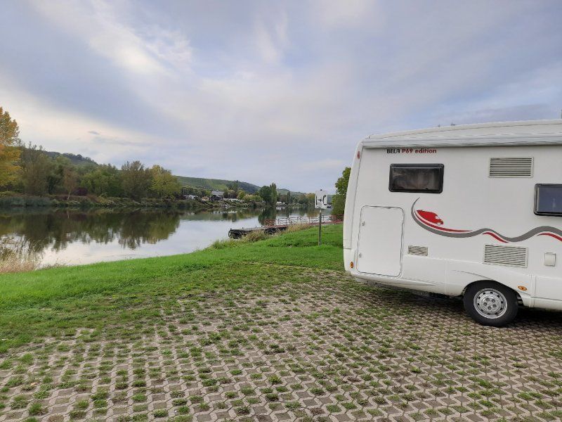
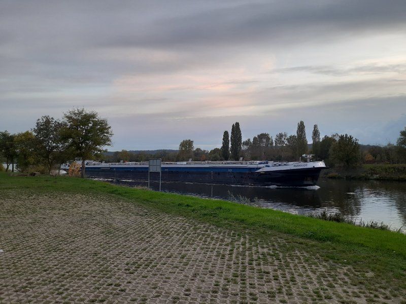
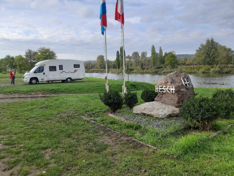
Besch
The parking lot in Besch is inconspicuously located directly on the banks of the Moselle. When we arrived we thought at first that there is no parking space here. Every now and then a Moselle barge chugs by, the place is very quiet.
Brühlweg 1, 66706 Perl, Deutschland
49° 30' 23" N 6° 22' 4.6" E
49.5063937 6.3679527
• Head toward Brühlweg on Im Teckert. Go for 83 m.
• Turn left onto Brühlweg. Go for 183 m.
• Turn right onto Industriestraße. Go for 215 m.
• Continue on Gartenstraße. Go for 20 m.
• Turn right and take ramp onto Obermoselstraße (B419). Go for 4.0 km.
• Take the 1st exit from roundabout onto Am Dreiländereck (B407/B419). Go for 241 m.
• Take the 1st exit from roundabout onto B407 toward Luxembourg/Schengen. Go for 344 m.
• Continue straight ahead. Go for 93 m.
• Turn left toward Route du Vin/CR152. Go for 56 m.
• Continue on Route du Vin (CR152). Go for 85 m.
• Turn slightly left onto Hemmeberreg. Go for 29 m.
• Arrive at Hemmeberreg. Your destination is on the right.
☍
5,4 km
( 6 min.)
Day
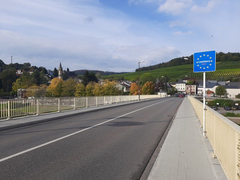
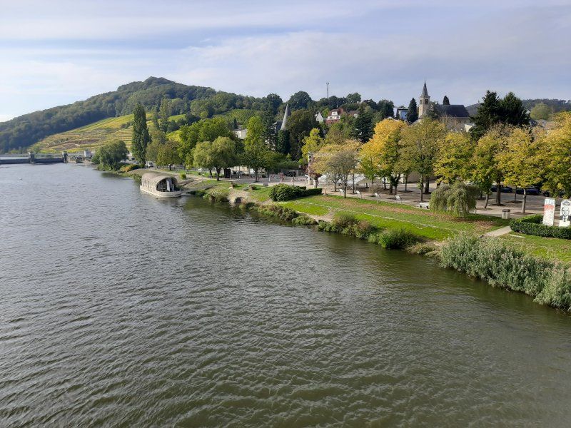
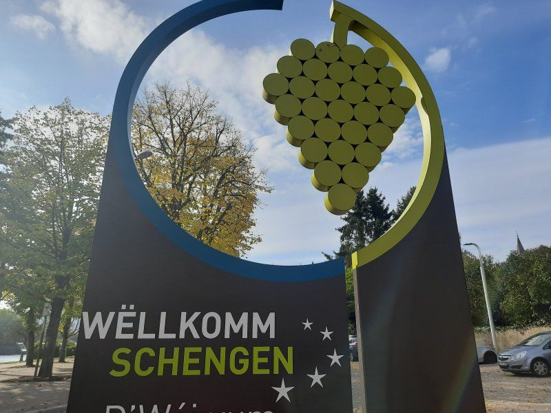
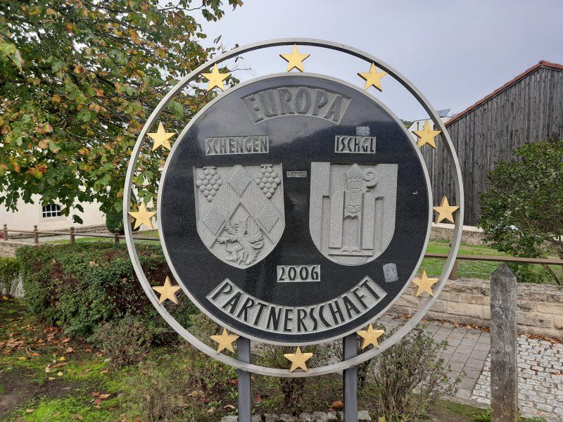
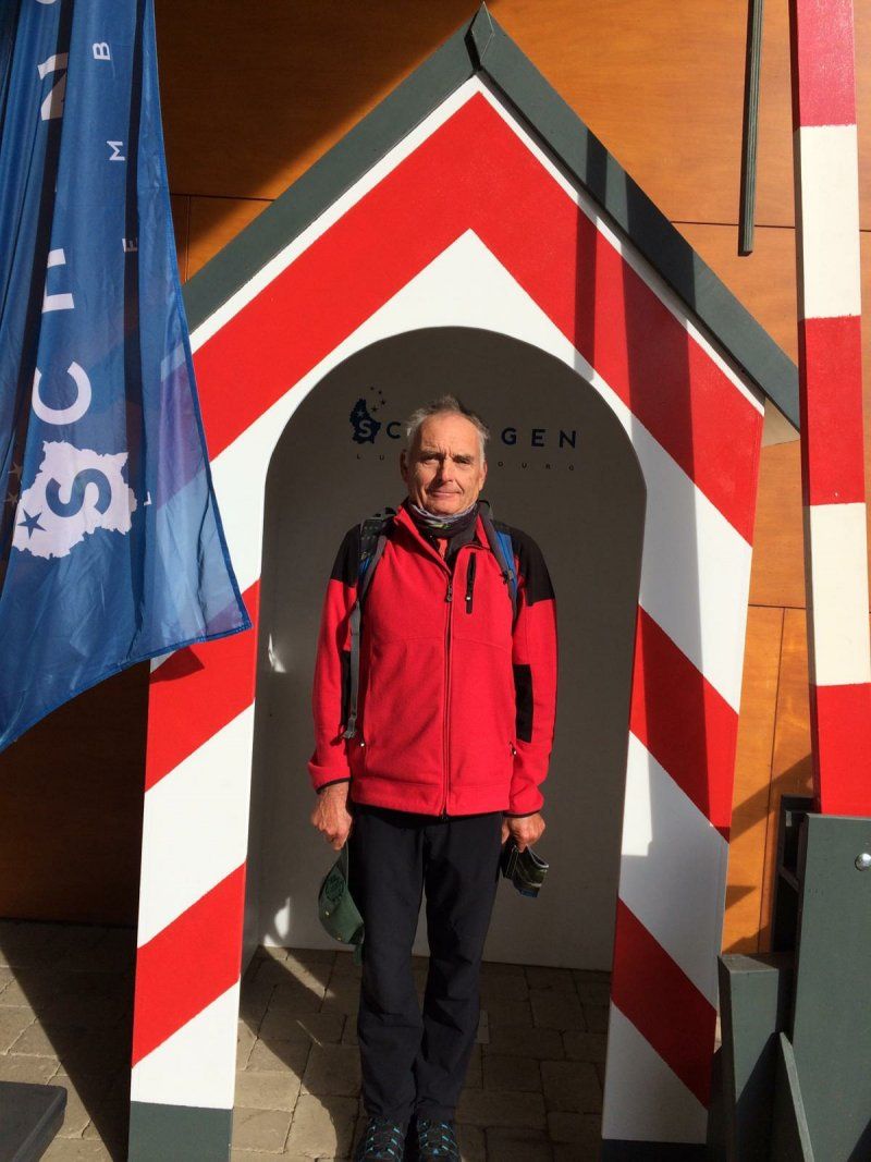
Schengen, Luxemburg
The next morning we set out on foot to the small wine-growing town of Schengen, where on June 14, 1985 the first of the Schengen agreements was signed on the ship Marie Astrid.
49° 28' 15.4" N 6° 21' 54.2" E
49.4709461 6.3650460
• Head toward Baachergaass on Hemmeberreg. Go for 29 m.
• Turn slightly right onto Route du Vin (CR152). Go for 141 m.
• Turn right toward B407. Go for 93 m.
• Continue on B407. Go for 325 m.
• Take the 2nd exit from roundabout onto Am Dreiländereck (B407/B419) toward A8/Saarburg/Perl/Trier/Nennig. Go for 275 m.
• Take the 1st exit from roundabout onto Trierer Straße (L170). Go for 4.2 km.
• Continue on B407 toward Saarburg. Go for 1.7 km.
• Turn right onto Johannesstraße toward Borg/Viezstraße Route du Cidre. Go for 440 m.
• Arrive at Johannesstraße. Your destination is on the left.
☍
7,2 km
( 8 min.)
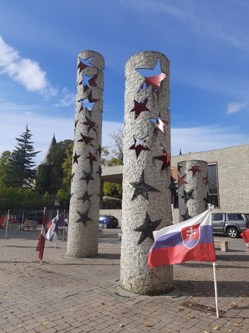
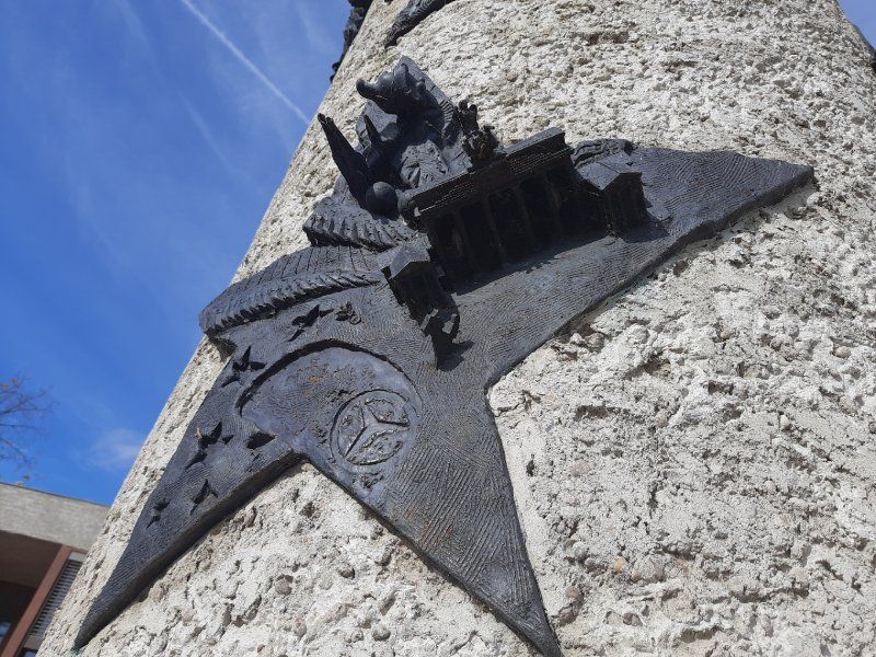
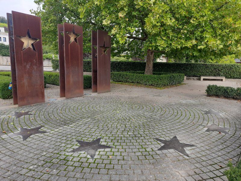
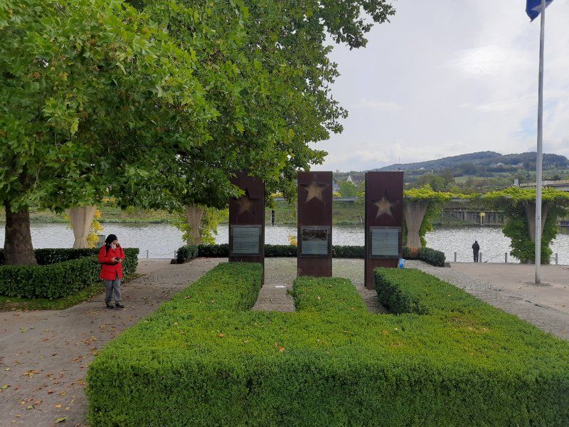
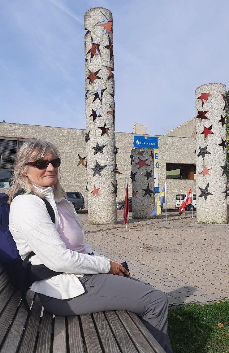
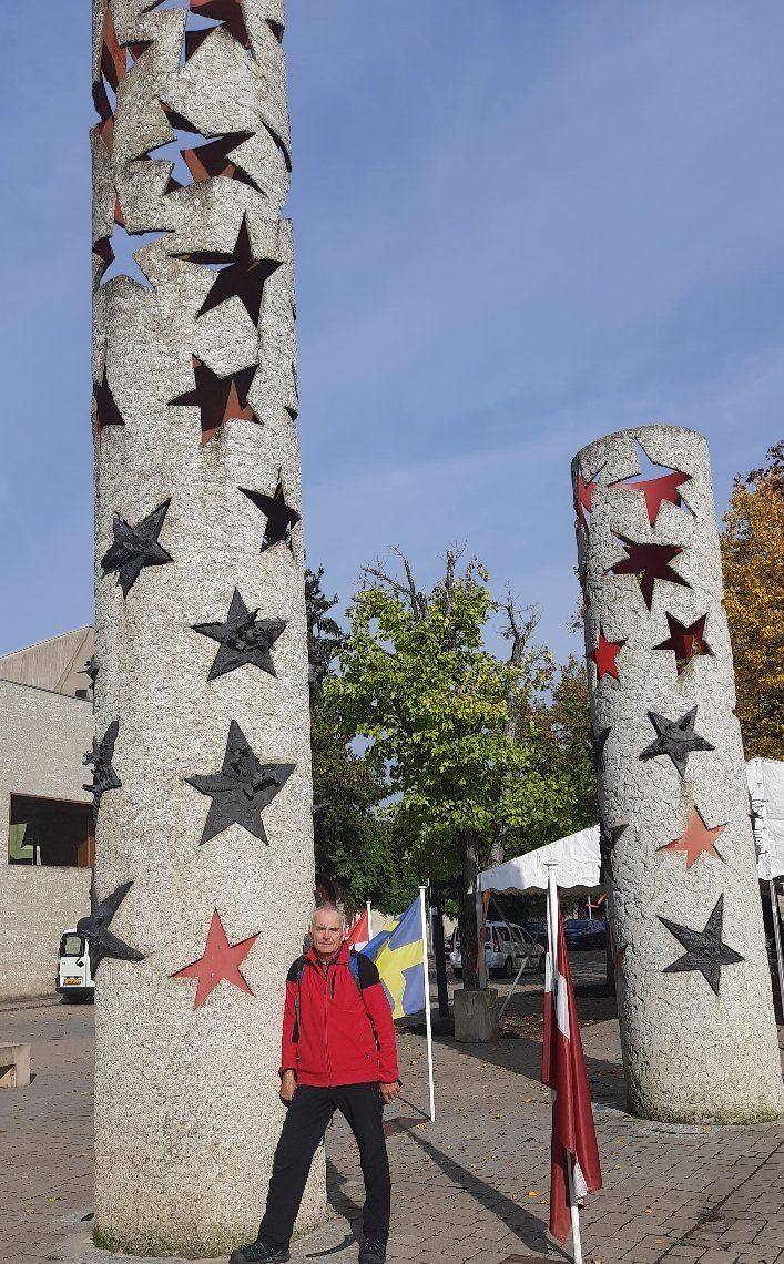
Dreiländereck Schengen
The Luxembourg star architect Francois Valentiny designed the monument and the pillars of the nations with the country stars of all countries that have signed the agreement. An entertaining
An informative walk through the history of Europe and its countries ended the varied excursion destination. On the same bike path along the Moselle (3.9 km) we went back to the Womo.
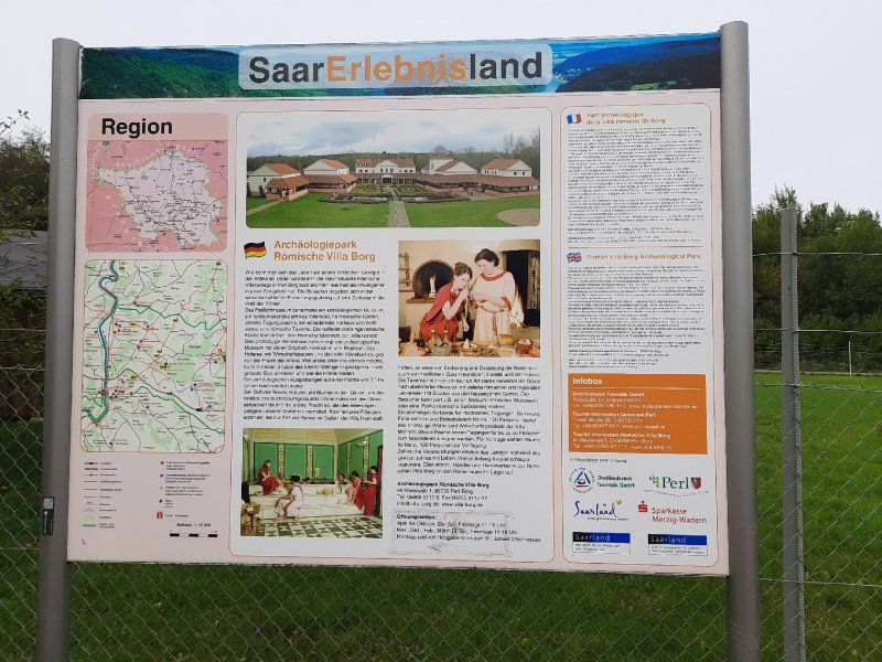
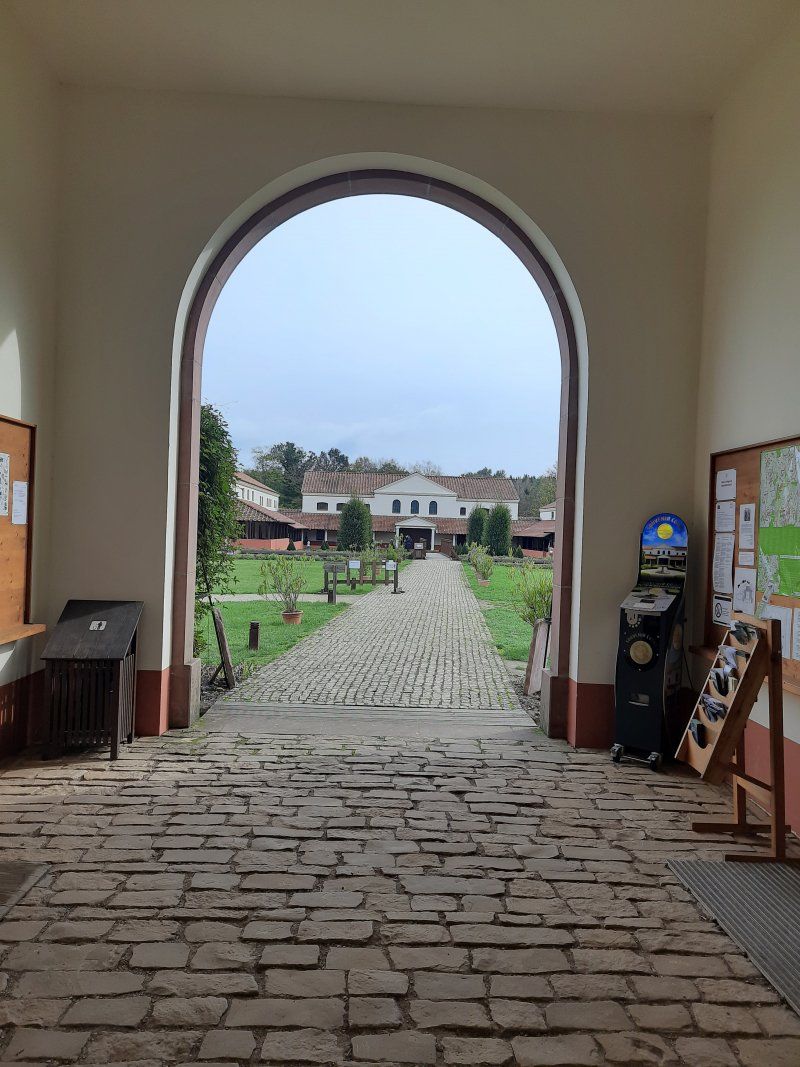
Another destination of today is the Villa Borg, which we then drove to with the mobile home.
Römische Villa Borg
Today's destination is the Celtic village near Nonnenweiler. There are two intermediate stops on the way there, one at the Villa Borg and one at the Saarschleife.
Today is a day with closed roads. The access road to the villa was closed, so we parked 500 m in a parking lot near the Villa Borg.
The Roman Villa Borg was not only excavated, it was completely rebuilt true to the original. The excavation site is unique in Europe and offers authentic insights into the life of the Romans.
It was only a short visit to the villa and only looked at the outside of the Roman villa.
We made sure that we get on quickly to the actual main goal, the Celtic village.
Johannesstraße 23, 66706 Perl, Deutschland
49° 29' 50.5" N 6° 26' 18.9" E
49.4973650 6.4385820
• Head toward Am Hansenberg on Johannesstraße. Go for 267 m.
• Turn left onto Johannesstraße. Go for 81 m.
• Turn right onto B407. Go for 2.0 km.
• Turn right onto L177 toward Mettlach/Orscholz/Oberleuken/Cloef. Go for 6.2 km.
• Take the 2nd exit from roundabout onto Mius-Kiefer-Straße. Go for 215 m.
• Continue on Alfred-Becker-Straße. Go for 88 m.
• Turn right onto Alfred-Becker-Straße. Go for 30 m.
• Continue straight ahead. Go for 299 m.
• Turn left. Go for 348 m.
• Turn right. Go for 67 m.
• Arrive at your destination.
☍
9,6 km
( 10 min.)
Mettlach Cloef -Saarschleife
On the drive to Cloef, we had to take a detour route on which there was no sign that indicated the direction to the Saar loop. Our navigation system guided us along rural roads that were blocked for vehicles over 3.5t.
When we arrived in Cloef, we started looking for a parking space. The parking lot that was approached was completely occupied, another one was blocked for mobile homes, so we had no choice but to park at a supermarket.
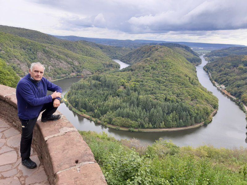
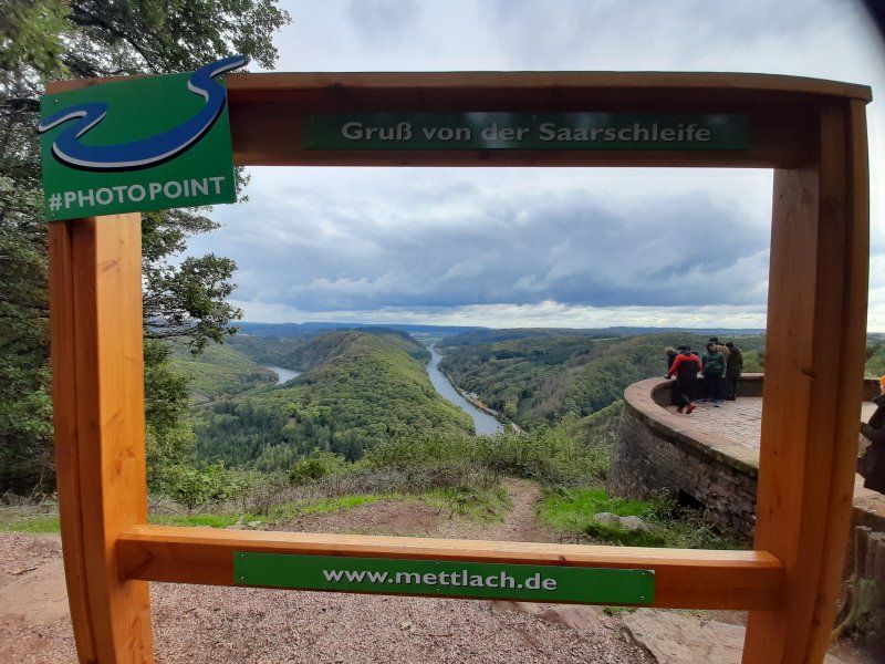
We had to walk a few hundred meters to the lookout point, in the hope that the weather would not worsen even more and that the beautiful landscape with the Saar loop could be seen. A circulating mountain made of hard Taunus quartzite forces the river to make a detour of ten kilometers and thus offers an incomparable natural spectacle, the most beautiful river bend in Germany. The Saarschleife, the symbol of the Saarland.
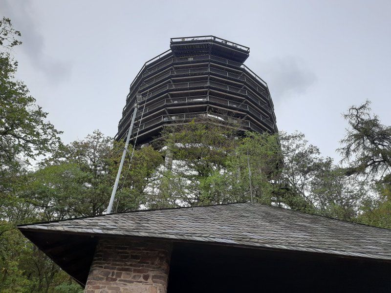
We did not use the tree top path, which you can take further up to lofty heights. On the 42 meter high observation tower you will be rewarded with a wonderful 360 ° view! Germany, Luxembourg and France meet here. From the lookout point it was the shortest way back to the Womo (1.5 km).
The journey then went on to a Celtic village in Nonnenweiler.
Unnamed Road, 66693 Mettlach, Deutschland
49° 30' 6.7" N 6° 32' 26.9" E
49.5018527 6.5407948
• Head west. Go for 67 m.
• Turn left. Go for 348 m.
• Turn right toward Alfred-Becker-Straße. Go for 299 m.
• Continue on Alfred-Becker-Straße. Go for 30 m.
• Turn left onto Alfred-Becker-Straße. Go for 88 m.
• Continue on Mius-Kiefer-Straße. Go for 191 m.
• Take the 1st exit from roundabout onto Cloefstraße (L177). Go for 734 m.
• Take the 2nd exit from roundabout onto L177. Go for 2.3 km.
• Turn right onto L176. Go for 3.4 km.
• Take the 1st exit from roundabout onto B51 toward A8/Merzig/Besseringen. Go for 555 m.
• Turn left onto Britter Straße (L158) toward Losheim/Weiskirchen. Go for 11.6 km.
• Turn right onto B268. Go for 9.4 km.
• Take the 2nd exit from roundabout onto Weiskircher Straße (L148) toward A1/Weiskirchen/Wadern/Gewerbegebiet Im Schachen. Go for 83 m.
• Turn right onto Im Flürchen (L148). Go for 6.8 km.
• Take the 2nd exit from roundabout onto Bahnhofstraße (L149). Go for 1.9 km.
• Take the 2nd exit from roundabout onto L149. Go for 3.1 km.
• Continue on Kasteler Straße (L329). Go for 4.4 km.
• Take the 2nd exit from roundabout onto L329 toward A1. Go for 360 m.
• Take ramp onto A1 toward Köln/Trier. Go for 2.0 km.
• Take exit 136 toward Otzenhausen. Go for 361 m.
• Continue on L147 toward Nonnweiler/Otzenhausen. Go for 446 m.
• Take the 2nd exit from roundabout onto L147. Go for 414 m.
• Turn right onto Hochwaldstraße (L147). Go for 533 m.
• Turn left onto Ringwallstraße (L147). Go for 1.2 km.
• Turn right onto Zum Mütterheim. Go for 181 m.
• Turn left. Go for 61 m.
• Arrive at your destination on the right.
☍
50,8 km
( 48 min.)
Keltische Ringwall Otzenhausen
On the way there it was raining, thank God it stopped raining during the tour.
The Celtic village and ring wall is located in the Hundsrück National Park. The parking lot was easy to drive into.
Admission: Celtic village € 5
After the visit, we hiked to the Celtic ring wall circular route 2.8 km.
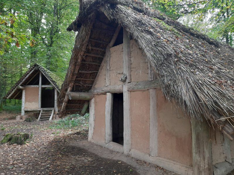
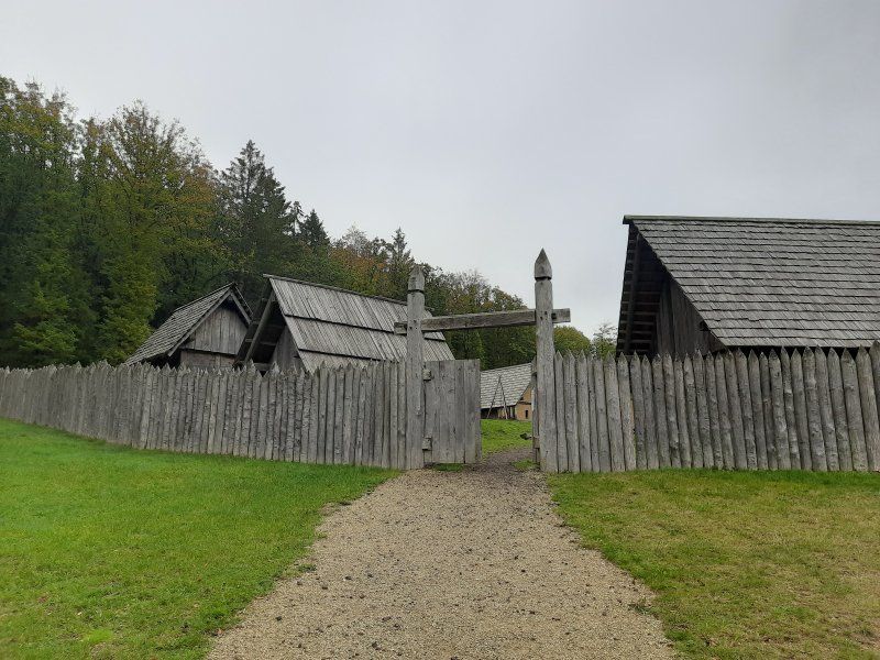
The Celtic ring wall Otzenhausen is one of the most impressive Celtic fortifications in Europe. Even today, ten meter high stone walls bear witness to the monumental ground monument from the 1st century BC.
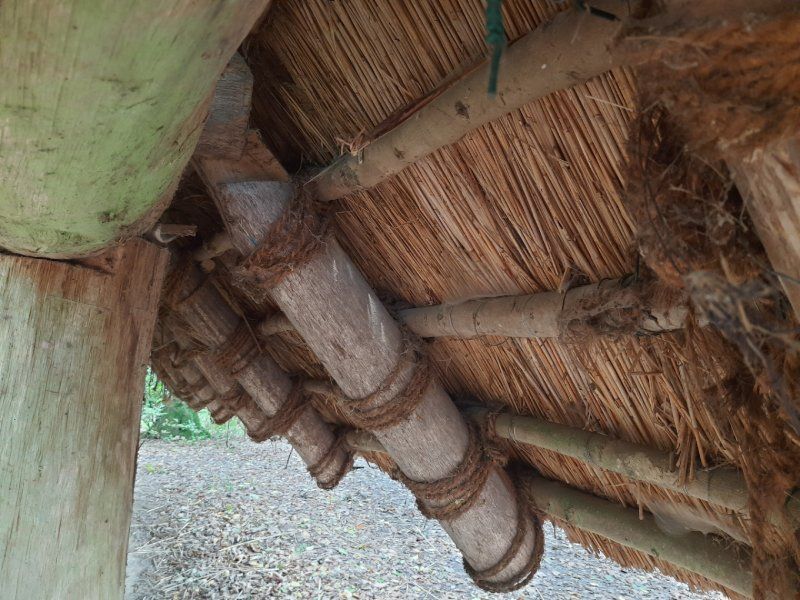
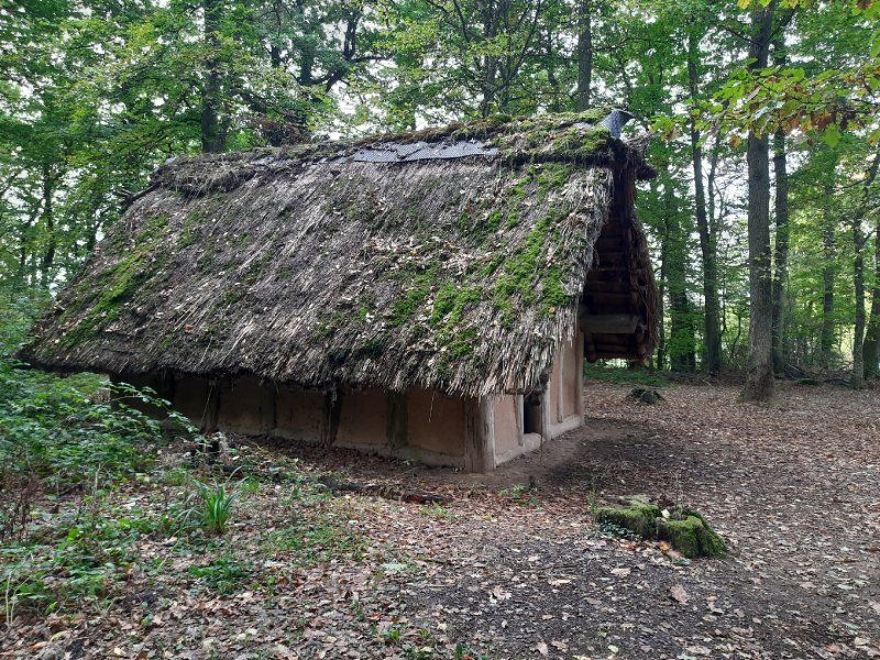
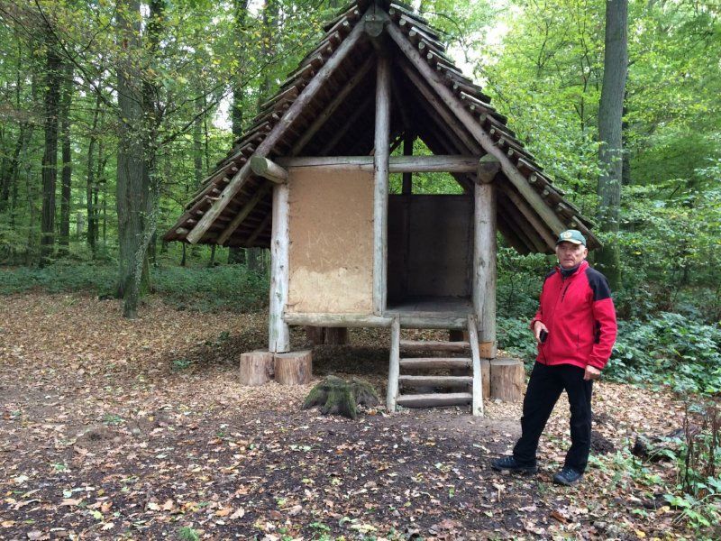
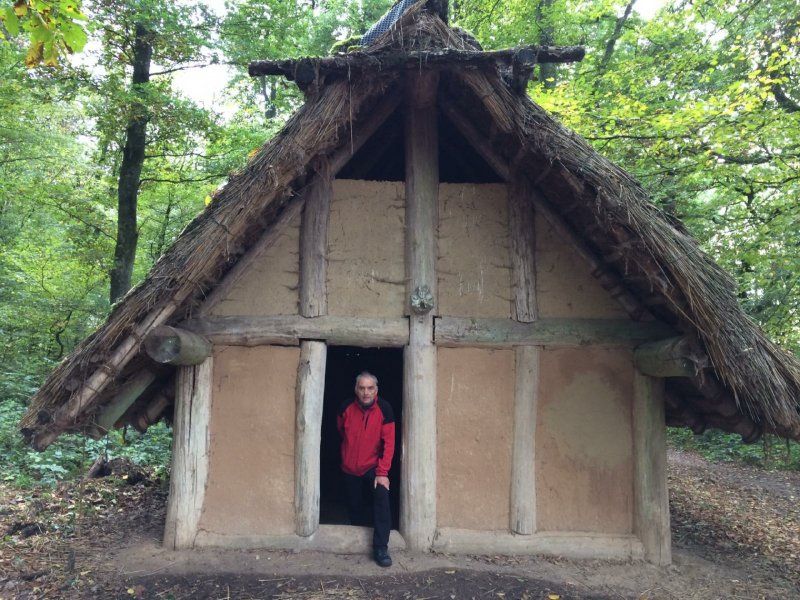
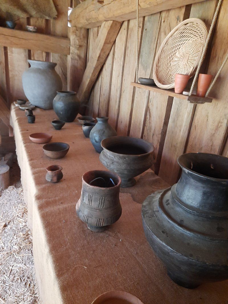
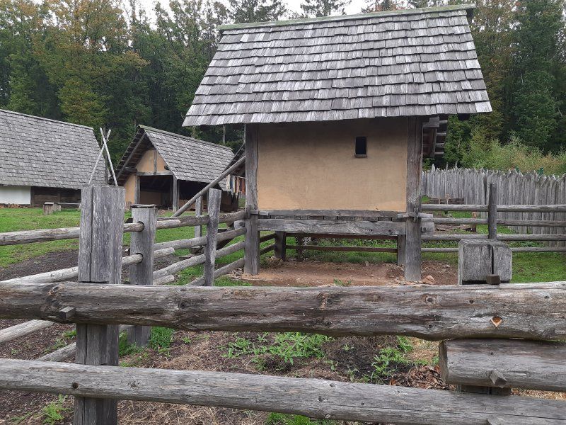
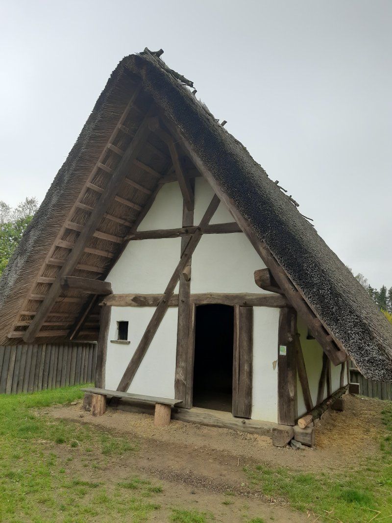
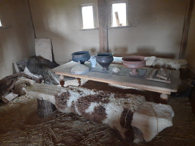
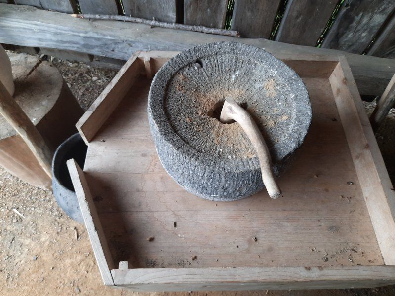
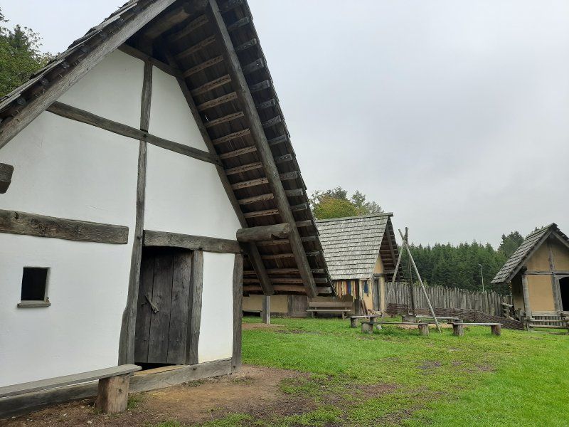
In contrast, a "real" Celtic village has emerged at the foot of the ring wall, in the Celtic Park. A village that could have stood within the huge fortress on the Dollberg 2,000 years ago. The reconstruction of a Celtic settlement is an essential part of the emerging Celtic park. The settlement currently consists of 10 residential, craft and storage buildings, the architecture and construction of which are based on historical findings and models. The settlement is surrounded by a wooden palisade made of sharpened oak trunks, which give the ensemble an authentic character.
Ringwallstraße 78, 66620 Nonnweiler, Deutschland
49° 36' 56.1" N 6° 59' 54.2" E
49.6155831 6.9983768
• Head toward Zum Mütterheim. Go for 61 m.
• Turn right onto Zum Mütterheim. Go for 181 m.
• Turn left onto Ringwallstraße (L147). Go for 1.2 km.
• Turn right onto Hochwaldstraße (L147). Go for 533 m.
• Turn left onto L147. Go for 356 m.
• Take the 1st exit from roundabout onto L147. Go for 243 m.
• Turn left and take ramp onto A62 toward Köln/Koblenz/Trier/Hermeskeil/A1. Go for 1.2 km.
• Continue on A1. Go for 10.5 km.
• Take exit 132 toward Reinsfeld/Kell/Morbach/Thalfang/Flughafen Hahn. Go for 393 m.
• Turn left onto Hunsrückhöhenstraße (B407). Go for 20.1 km.
• Turn left onto Hirschfelderhof (K139) toward Greimerath. Go for 18 m.
• Continue on K139. Go for 2.7 km.
• Continue on Hochwaldstraße (K139). Go for 878 m.
• Turn left onto Hauptstraße (K139). Go for 391 m.
• Continue on K139. Go for 1.4 km.
• Turn left onto Panzhaus (B268). Go for 137 m.
• Turn right onto K139 toward Serrig. Go for 7.4 km.
• Continue on Losheimer Straße (K139). Go for 433 m.
• Turn right onto Hauptstraße (K139). Go for 1.1 km.
• Turn right onto B51. Go for 2.3 km.
• Turn left onto Am Saarufer. Go for 33 m.
• Turn right onto Am Saarufer. Go for 366 m.
• Turn left. Go for 139 m.
• Turn left. Go for 22 m.
• Arrive at your destination on the right.
☍
52,3 km
( 41 min.)
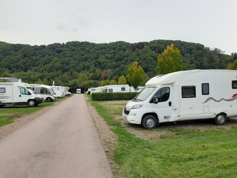
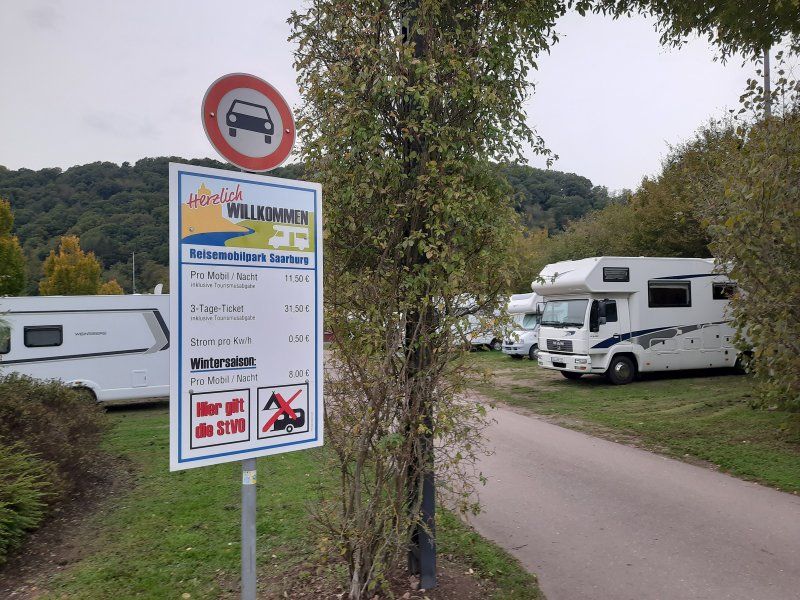
Reisemobilpark Saarburg
After a long and unplanned diversion of the route, we reached the Saarburg parking space annoyed.
Fee: 11.50 €
Electricity: € 0.50 / 1Kw
Shower token: 1.- € (2.- €)
Gas bottle: 11kg € 24.80
Reisemobilpark Saarburg, Am Saarufer 18, 54439 Saarburg, Germany
49° 36' 3" N 6° 33' 12" E
49.6008333 6.5533333
• Head northwest. Go for 22 m.
• Turn right. Go for 139 m.
• Turn right toward Am Saarufer. Go for 12 m.
• Continue on Am Saarufer. Go for 354 m.
• Turn left onto Am Saarufer. Go for 33 m.
• Turn right onto B51. Go for 17.8 km.
• Take the 2nd exit from roundabout onto B51 toward A8/Merzig/Besseringen. Go for 1.8 km.
• Take the 2nd exit from roundabout onto Ortsumgehung Besseringen (B51) toward Merzig/Schwemlingen. Go for 3.2 km.
• Turn right onto B51 toward Schwemlingen/Gewerbegebiet Bruchwiese/Gewerbegebiet Nord-West. Go for 1.7 km.
• Take ramp onto A8 toward Karlsruhe/Neunkirchen/Saarbrücken/A620/Saarlouis. Go for 17.2 km.
• Take exit 9 toward Karlsruhe/Mannheim/Neunkirchen/Dillingen-Süd onto A8. Go for 36.6 km.
• Take exit 23 toward Idar-Oberstein/St. Wendel/Ottweiler/Neunkirchen onto B41. Go for 4.7 km.
• Keep right onto Redener Straße (B41) toward Idar-Oberstein/Sankt Wendel/Ottweiler/Schiffweiler. Go for 947 m.
• Take the 2nd exit from roundabout onto B41 toward Idar-Oberstein/Ottweiler. Go for 7.1 km.
• Turn right onto Saarbrücker Straße (B420) toward Bad Kreuznach/Kusel/Wiebelskirchen/Gewerbegebiet Etzwiese. Go for 170 m.
• Turn left onto Fürther Straße (B420) toward Bad Kreuznach/Kusel. Go for 980 m.
• Turn left onto Am Wingertsbach. Go for 294 m.
• Turn right onto Am Wingertsbach. Go for 620 m.
• Turn left onto Am Wingertsweiher. Go for 69 m.
• Arrive at Am Wingertsweiher. Your destination is on the left.
☍
93,6 km
(1 hrs. 4 min.)
Day
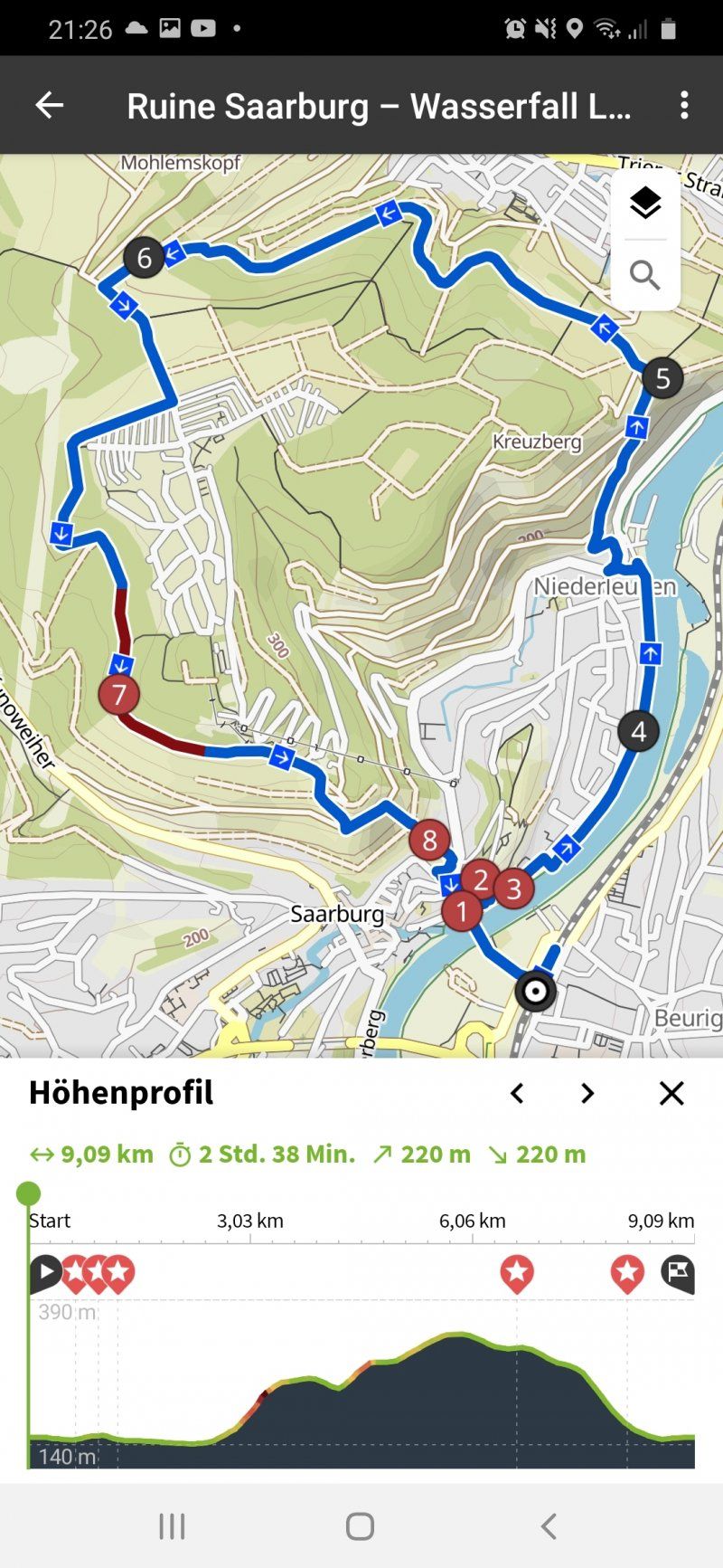
Besichtigung Saarburg
Unfortunately the day started with fog and light drizzle. The temperature was 8 ° C.
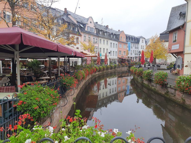
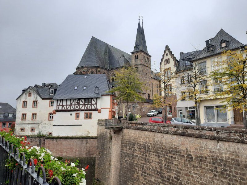
From the parking space we walked through the beautiful old town of Saarburg.
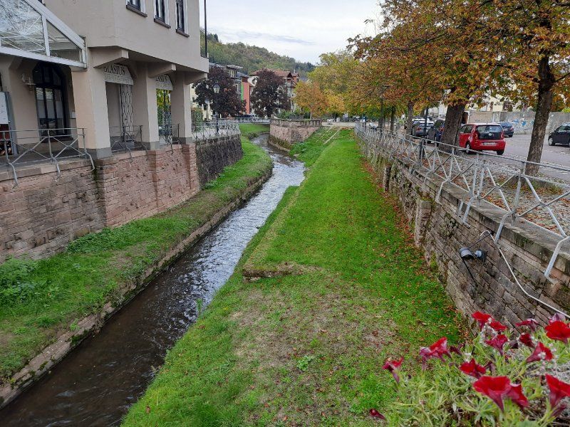
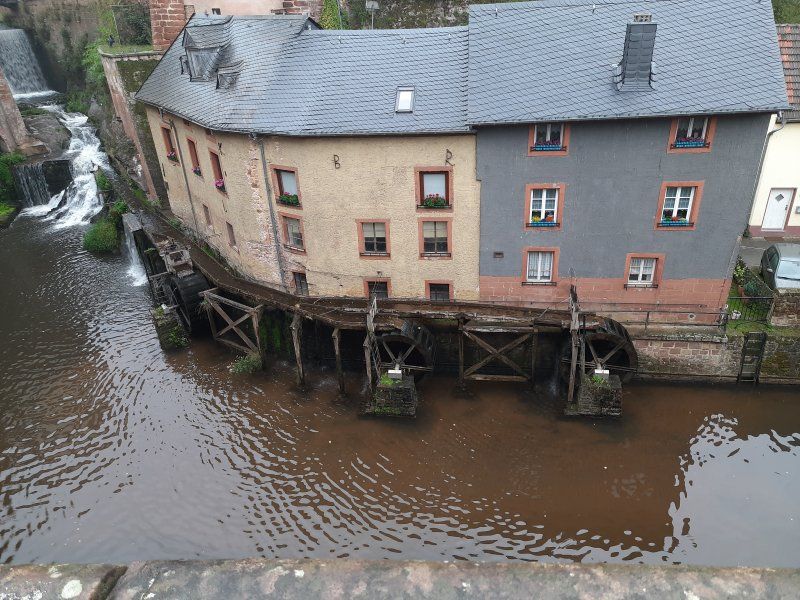
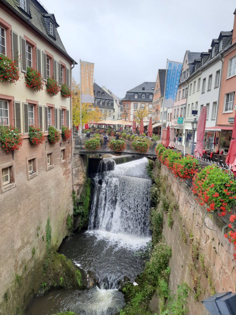
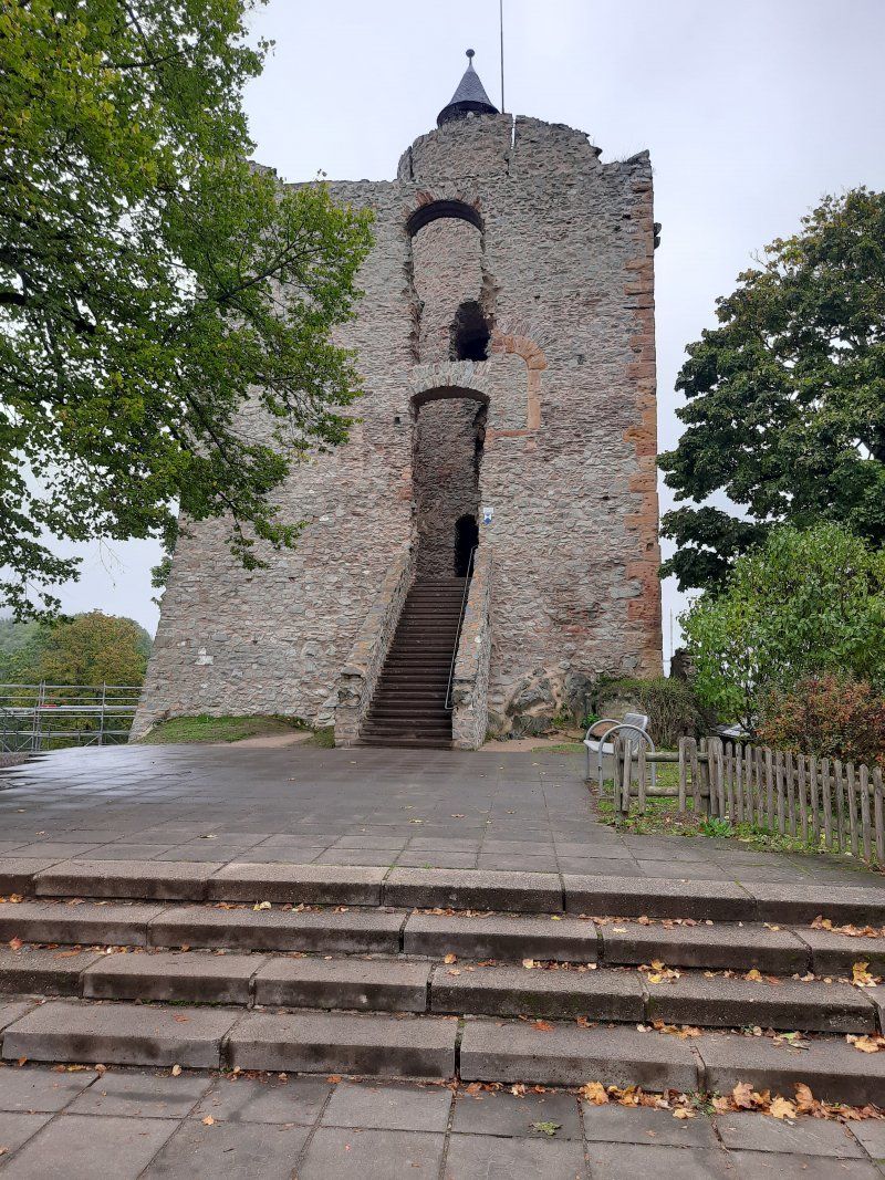
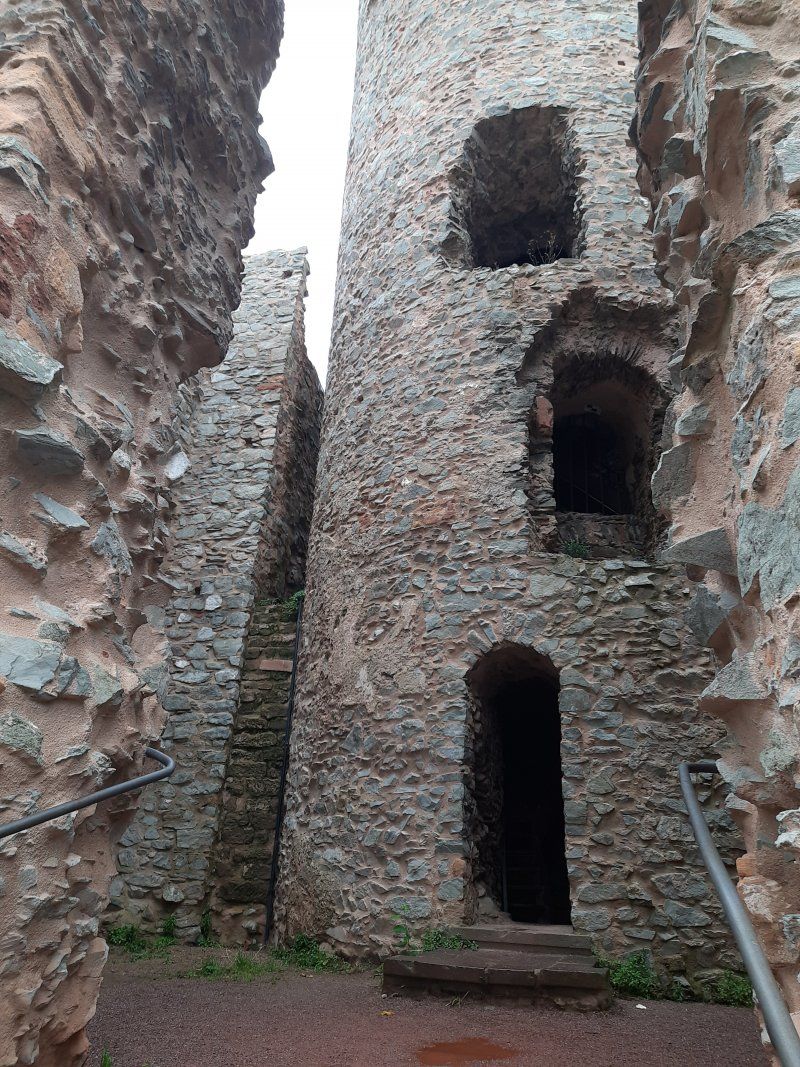
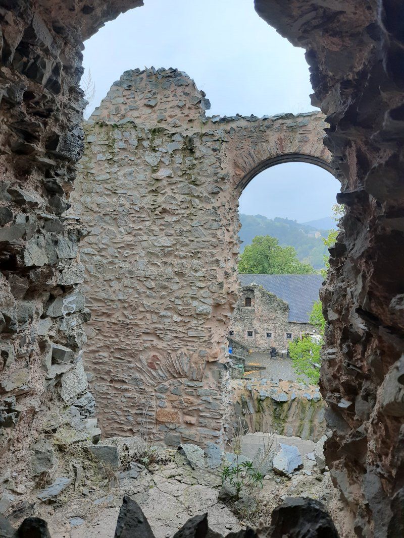
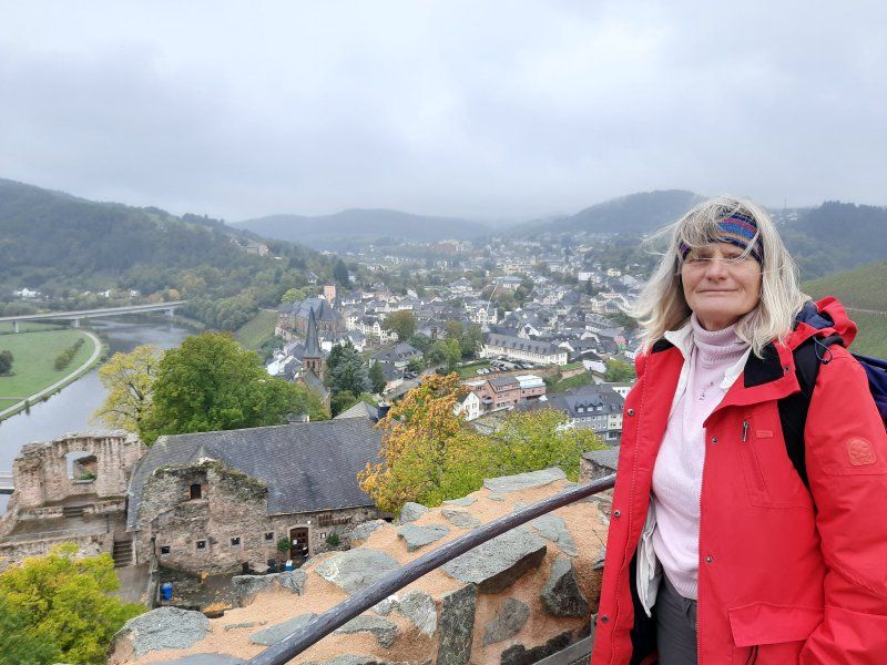
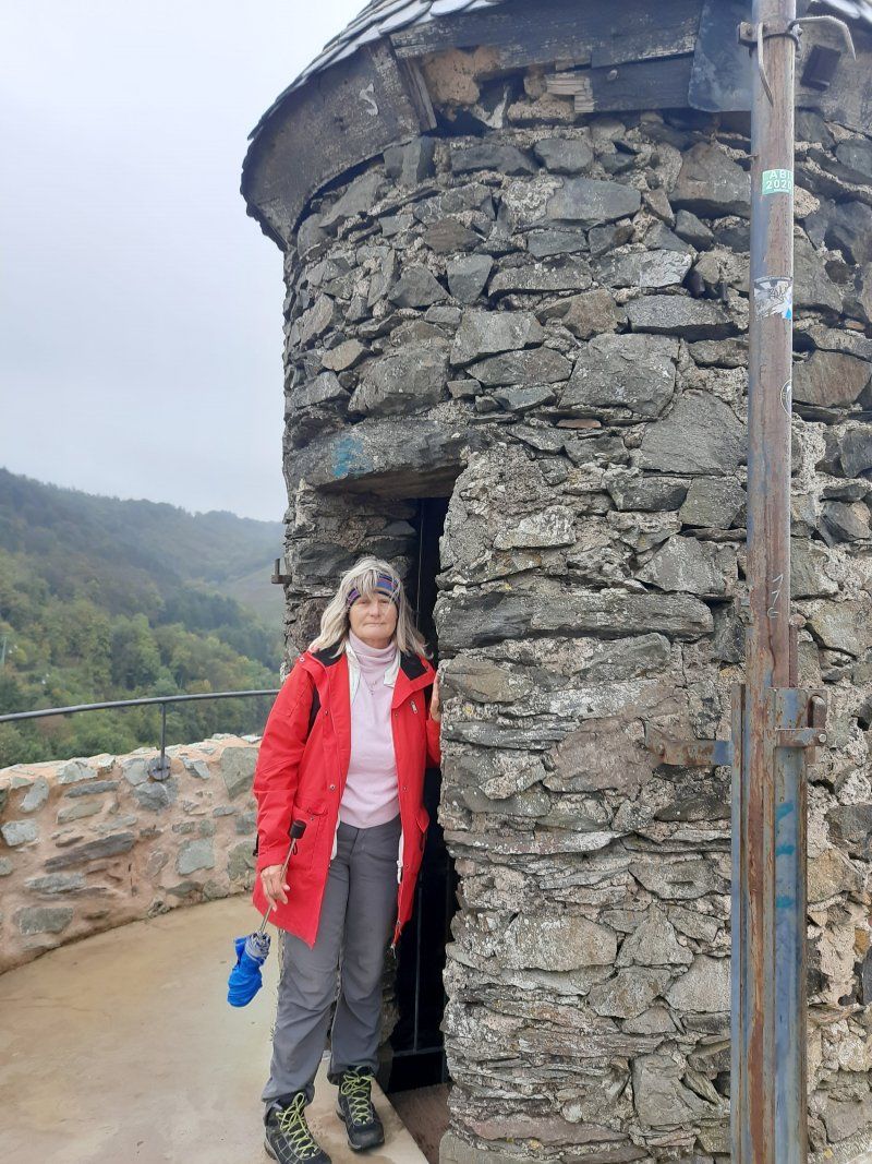
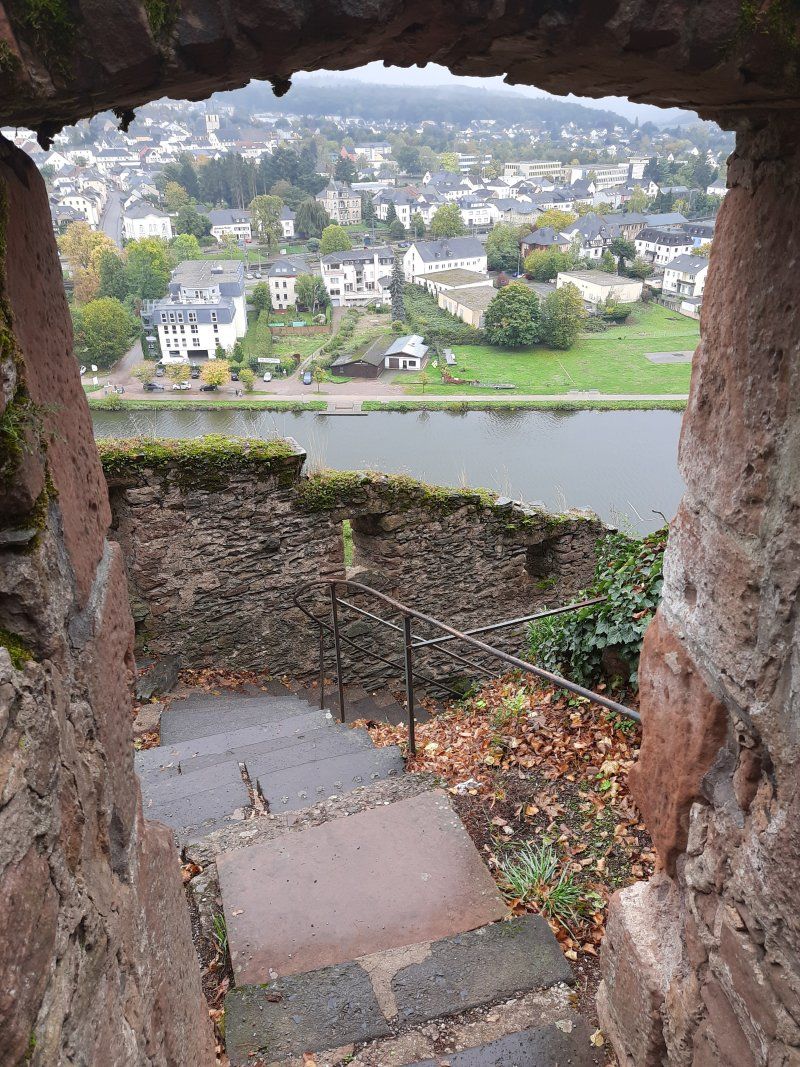
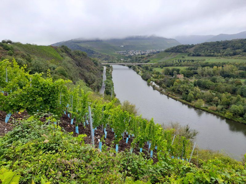
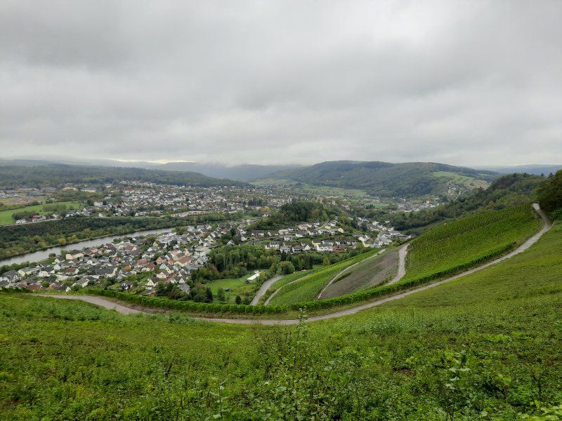
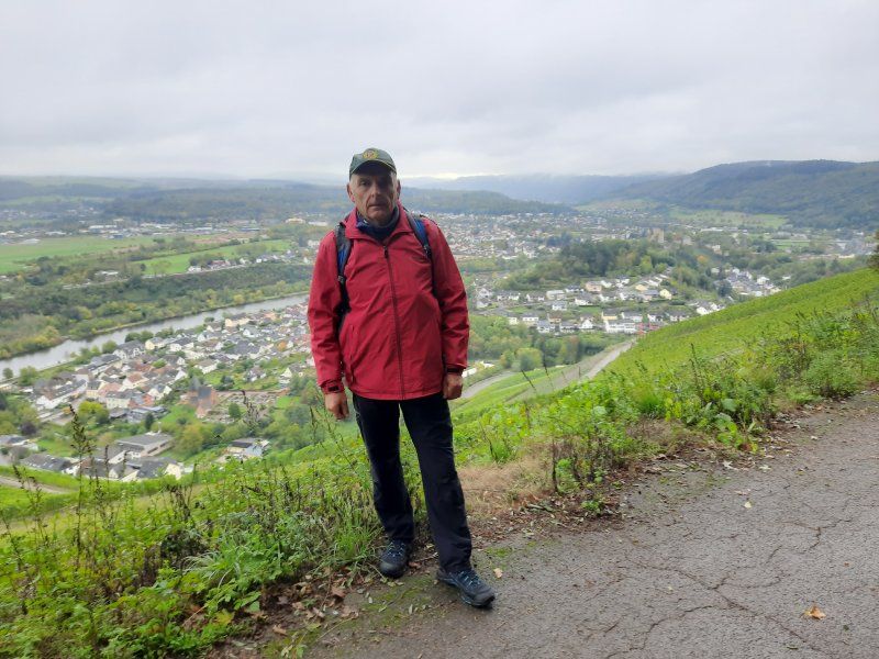
There the old castle of Siegfried the Ardennes Count, who founded Luxembourg in 963, proudly towers over the valley. We started the ascent to the castle ruins with the chapel in front and climbed the tower, which is over twenty meters high, to enjoy the wonderful view of the town and the foggy river landscape. The specialty of the place is the small Leukbach, which is cleverly diverted to form an 18 meter high waterfall in the middle of the town center. The water is still used to generate electricity today. In the past, the town mills were operated using water power. Three mill wheels staggered one behind the other drove the grinders.
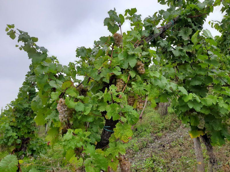
After an extensive tour we went on a short hike through the surrounding vineyards. The harvest was not yet over, vines were still being harvested in individual vineyards.
Ottweiler Stellplatz Am Wingertsweiher
Parking space is easy to drive.
There is a beautiful lake nearby
Parking space 5.- € (pay with envelope)
Weather drizzle, 10 ° C
B420, 66564 Ottweiler, Germany
49° 24' 41" N 7° 10' 50" E
49.4113889 7.1805556
• Head southeast on Am Wingertsweiher. Go for 618 m.
• Continue on Am Wingertsbach. Go for 71 m.
• Turn left onto Am Wingertsbach. Go for 294 m.
• Turn right onto Fürther Straße (B420). Go for 980 m.
• Turn right onto Saarbrücker Straße (B420) toward A8/A623/Neunkirchen. Go for 170 m.
• Turn right onto Bliesstraße (B41) toward Idar-Oberstein/Sankt Wendel. Go for 274 m.
• Turn left onto Schloßstraße. Go for 61 m.
• Turn right onto Weylstraße. Go for 63 m.
• Turn left. Go for 17 m.
• Arrive at your destination on the left.
☍
2,5 km
( 6 min.)
Day
Ottweiler (Stadtrundgang)
Slept well in a very quiet pitch.
Weather overcast / dry
After breakfast, walked to the old town of Ottweiler, 2km away. Nice old town. During a stroll through the old town there are alleys built with historic stone and half-timbered houses to discover, but also the tower of the Protestant parish church known as Zibbelkapp, extensive remains of the city wall and the magnificent stem pavilion with its baroque rose garden. Nevertheless, the tour is not too strenuous as Ottweiler is relatively small.
Disposed of the toilet on return and continued to Homburg.
Ottweiler, Deutschland
49° 24' 15.6" N 7° 9' 46.9" E
49.4043228 7.1630189
• Head toward Weylstraße. Go for 17 m.
• Turn right onto Weylstraße. Go for 63 m.
• Turn left onto Schloßstraße. Go for 61 m.
• Turn right onto Bliesstraße (B41). Go for 274 m.
• Turn left onto Saarbrücker Straße (B420) toward Bad Kreuznach/Kusel/Wiebelskirchen/Gewerbegebiet Etzwiese. Go for 170 m.
• Continue on Saarbrücker Straße (L124) toward Wiebelskirchen/Gewerbegebiet Etzwiese. Go for 4.0 km.
• Turn left onto Ostertalstraße (L121). Go for 1.1 km.
• Turn right onto L287. Go for 3.3 km.
• Take the 2nd exit from roundabout onto Krummeg (L287). Go for 1.1 km.
• Take ramp. Go for 110 m.
• Turn right onto Untere Bliesstraße (L115). Go for 220 m.
• Continue on Untere Bliesstraße (L287) toward Spiesen. Go for 2.8 km.
• Take ramp onto A8 toward Zweibrücken/Homburg/Mannheim/A6/Saarbrücken. Go for 2.6 km.
• Take exit 27 toward Karlsruhe/Mannheim/Kaiserslautern/Homburg onto A6. Go for 4.9 km.
• Take exit 9 toward Homburg onto B423. Go for 3.7 km.
• Turn left onto Richard-Wagner-Straße (L119). Go for 636 m.
• Turn slightly left toward Bahnhofsplatz. Go for 66 m.
• Turn slightly right onto Bahnhofsplatz. Go for 27 m.
• Turn left onto Güterbahnhofstraße. Go for 41 m.
• Turn right. Go for 32 m.
• Arrive at your destination on the left.
☍
25,2 km
( 28 min.)
Homburg
Free parking space
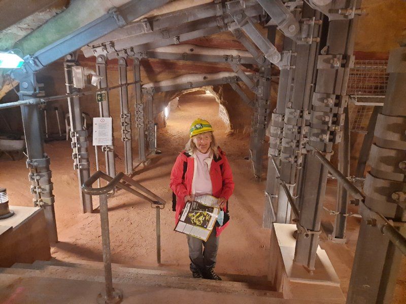
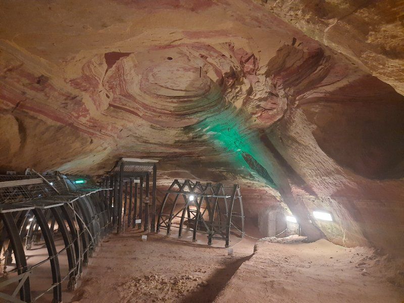
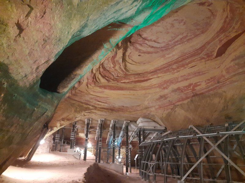
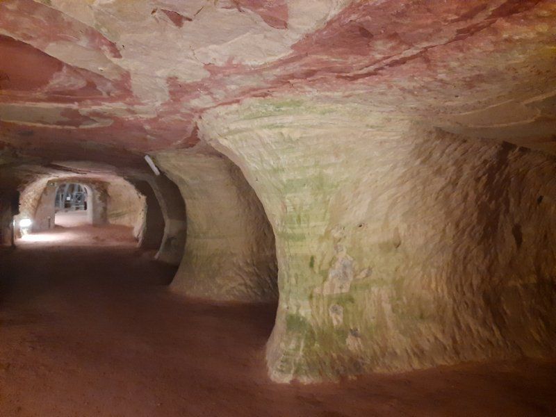
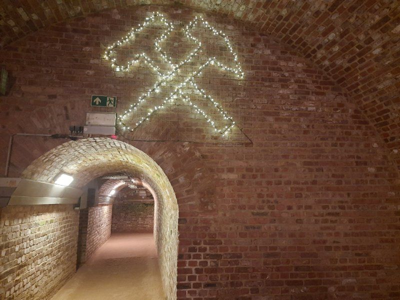
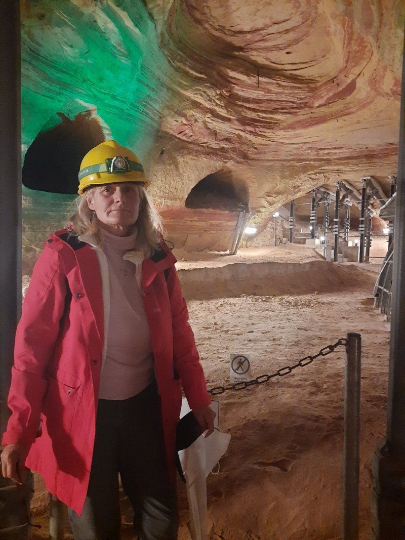
City tour, then we looked at the Schlossberg caves and the castle ruins of Homburg.
Entrance to the Schlossberg caves € 10
Stop in a cafe € 14
Weather overcast, dry, 11 ° C
The Schlossberg caves near Homburg were actually once a mine, today they are Europe's largest red sandstone caves.
In addition to visiting the imposing Schlossberg caves, the highlights of the tour include great views, as well as an old castle ruin in the Karlsberg Castle Forest Park (the Hohenburg castle ruins), an old Celtic cult site and chestnut trees that are over 200 years old.
66424 Homburg, Deutschland
49° 19' 40.1" N 7° 20' 14.5" E
49.3277921 7.3373707
• Head toward Bahnhofsplatz. Go for 43 m.
• Turn right onto Bahnhofsplatz. Go for 110 m.
• Turn right onto Richard-Wagner-Straße (L119). Go for 623 m.
• Turn right onto Bexbacher Straße (B423). Go for 2.9 km.
• Take ramp onto A6 toward Mannheim/Kaiserslautern. Go for 21.3 km.
• Take exit 13 toward Ramstein-Miesenbach/Landstuhl-Ost/Flughafen Air Base/Landstuhl/Gewerbegebiet Ramstein-M./Am Koehlwäldchen. Go for 229 m.
• Turn left onto L363 toward Landstuhl/Gewerbegebiet Ramstein-M./Am Koehlwäldchen. Go for 581 m.
• Turn right onto Saarbrücker Straße (L363). Go for 166 m.
• Turn right onto Bahnstraße (L395) toward Stadthalle/Bahnhof/Krankenhaus DRK. Go for 701 m.
• Turn right onto Von-Richthofen-Straße. Go for 22 m.
• Arrive at Von-Richthofen-Straße. Your destination is on the right.
☍
26,7 km
( 20 min.)
Day
Stellplatz im Zentrum
Fog / dry
little traffic on the way.
Driven to a free parking lot.
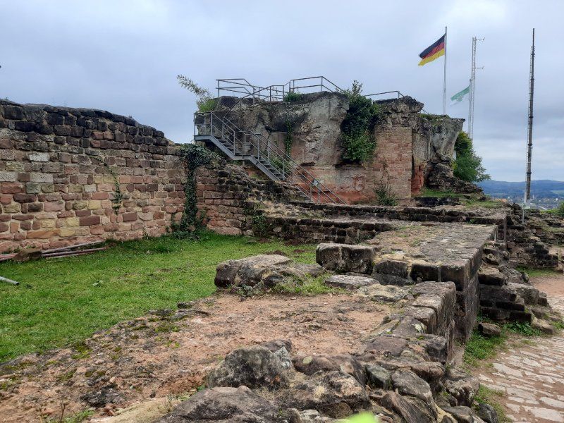
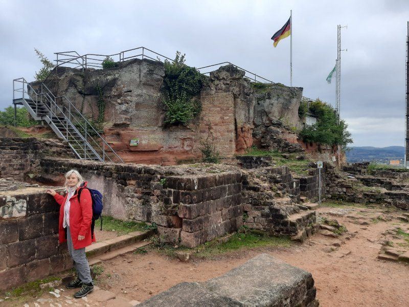
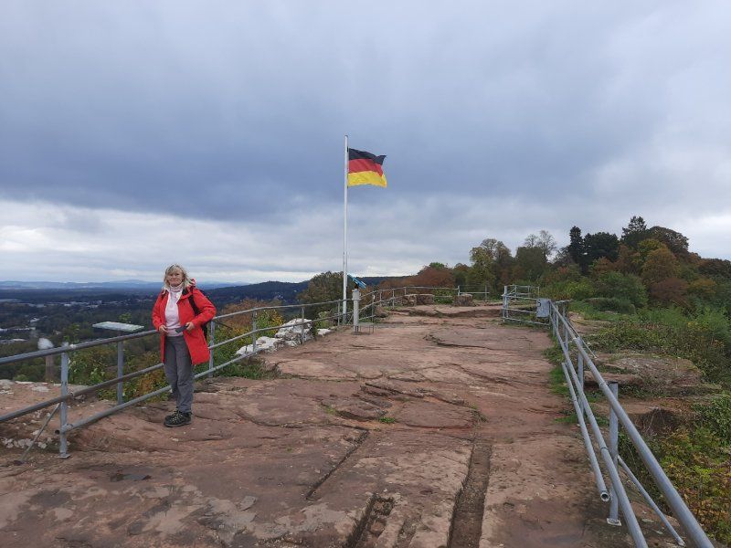
On the way to the city center we saw the castle ruins Nanstein on the hill, which we then visited, but only from the outside. Castle ruins Nanstein, built by Emperor Barbarossa around 1160, the castle came to the Knights of Sickingen clan through marriage in 1475. In 1689, the castle was finally destroyed by French troops during the War of the Palatinate Succession.
The old town wasn't really interesting, we walked quickly through the city and to the mobile home.
Von-Richthofen-Straße 25, 66849 Landstuhl, Germany
49° 24' 57" N 7° 34' 12" E
49.4158333 7.5700000
• Head south on Von-Richthofen-Straße. Go for 412 m.
• Turn right onto Kaiserstraße. Go for 433 m.
• Continue on Saarbrücker Straße. Go for 208 m.
• Turn right onto L363. Go for 553 m.
• Take ramp onto A6 toward Mannheim/B6/Kaiserslautern. Go for 18.0 km.
• Keep right onto Dreieck Kaiserslautern toward Frankfurt a.M./Mainz/Kaisersl.-Centrum/A63. Go for 523 m.
• Take the exit toward Kaiserslautern-Centrum onto L395. Go for 1.2 km.
• Turn left onto Donnersbergstraße (L504) toward B37/B48/Tech. Universität/Hauptbahnhof. Go for 1.5 km.
• Turn left onto Mannheimer Straße (B37) toward Mannheim/A6/Bad Dürkheim/Neustadt/Weinstr. Go for 606 m.
• Arrive at Mannheimer Straße (B37). Your destination is on the right.
☍
23,5 km
( 18 min.)
Day
Wohnmobilstellplatz Daennerplatz
Driven to the parking space at the city cemetery, we didn't stand on the square, but in the free parking lot next door.
Parking fee 10, - € 24h. that was too much for us to park for 3 hours.
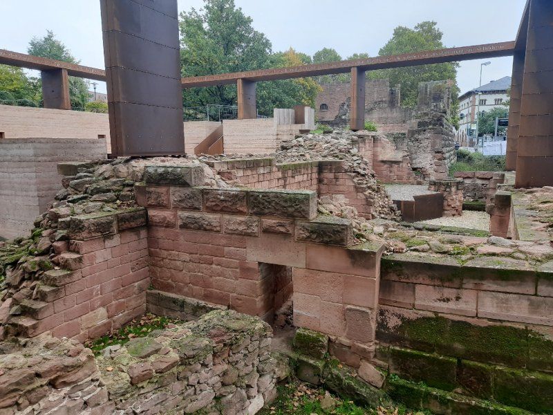
It took about 30 minutes to walk to the city center. First we strolled through the mighty pedestrian zone. By chance we came to the remains of the mighty Kaiserpfalz, (Barbarossa's imperial city). Passing the city theater, we came to an old part of the old town near St. Martin's Church with a beautiful fountain and house facades. The Kaiserbrunnen was the last attraction that we looked at.
Mannheimer Str. 208, 67657 Kaiserslautern, Germany
49° 26' 37.5" N 7° 48' 6.7" E
49.4437600 7.8018600
• Head toward Daennerplatz on Mannheimer Straße (B37). Go for 1.3 km.
• Turn left onto Ludwigshafener Straße (K13) toward Mehlingen/KL-Eselsfürth. Go for 316 m.
• Take the 2nd exit from roundabout onto Ludwigshafener Straße (K13). Go for 930 m.
• Turn left and take ramp onto A6 toward Mannheim. Go for 39.3 km.
• Take exit 21 toward Karlsruhe/Ludwigshafen onto A61. Go for 37.1 km.
• Take the left exit toward Stuttgart/Heilbronn/Karlsruhe onto A6. Go for 7.8 km.
• Take exit 31 toward Basel/Karlsruhe onto A5. Go for 15.6 km.
• Take exit 42 toward Bruchsal onto B35. Go for 2.3 km.
• Take ramp toward Bretten/Bruchsal/Stutensee/Forst/B35. Go for 273 m.
• Turn right onto L556. Go for 1.0 km.
• Continue on Grabener Straße (B35). Go for 16.4 km.
• Continue on B35/B293 toward Stuttgart/Heilbronn/Gölshausen. Go for 4.2 km.
• Turn left onto K3571 toward Knittlingen. Go for 81 m.
• Continue on Unter der Störrmühle (K4519). Go for 104 m.
• Continue on K4519. Go for 806 m.
• Continue on Brettener Straße (K4519). Go for 483 m.
• Turn left onto Brettener Straße (K4519). Go for 748 m.
• Turn right onto Marktstraße. Go for 187 m.
• Arrive at Marktstraße. Your destination is on the right.
☍
128,9 km
(1 hrs. 29 min.)
Knittlingen
Deutschland
49° 1' 26.4" N 8° 45' 29.9" E
49.0240107 8.7582988
• Head west on Marktstraße. Go for 30 m.
• Turn slightly right toward Kirchplatz. Go for 13 m.
• Turn left onto Kirchplatz. Go for 53 m.
• Turn left onto Kirchplatz. Go for 116 m.
• Turn left onto Esselbachstraße. Go for 70 m.
• Turn right onto Pforzheimer Straße (K4520). Go for 750 m.
• Continue on K4520. Go for 239 m.
• Turn left onto K4520. Go for 2.0 km.
• Continue on Runsen (K4520). Go for 52 m.
• Continue on K4520. Go for 282 m.
• Continue on Hauptstraße (K4520). Go for 571 m.
• Continue on Ölbronner Straße (K4520). Go for 400 m.
• Continue on K4520. Go for 508 m.
• Continue on Hindenburgstraße (K4520). Go for 992 m.
• Take the 3rd exit from roundabout onto Obere Steinbeisstraße (L611) toward Maulbronn/Dürrn/Gewerbegebiet Ölbronn-Erlen. Go for 349 m.
• Turn right onto Dürrner Straße (K4525) toward Dürrn. Go for 443 m.
• Continue on K4525. Go for 199 m.
• Continue on Dürrner Straße (K4525). Go for 148 m.
• Continue on K4525. Go for 2.0 km.
• Continue on Friedenstraße (K4525). Go for 303 m.
• Turn right onto Hauptstraße (K4525). Go for 313 m.
• Continue on Hauptstraße (K4527). Go for 669 m.
• Continue on K4527. Go for 1.8 km.
• Continue on Oberfeldle (K4527). Go for 142 m.
• Turn left onto B294. Go for 3.6 km.
• Turn left and take ramp onto A8 toward Stuttgart. Go for 36.9 km.
• Take exit 51 toward Singen/Böblingen/Sindelfingen onto A81. Go for 62.8 km.
• Take exit 33 toward Oberndorf a.N./Alpirsbach/Rosenfeld. Go for 332 m.
• Turn left onto Rankäcker (L415) toward Rosenfeld. Go for 438 m.
• Take the 3rd exit from roundabout onto K5502. Go for 2.4 km.
• Turn left onto K5500. Go for 983 m.
• Continue on Im Täle (K5500). Go for 1.5 km.
• Turn right onto Im Dorf (K5502) toward Dietingen/Böhringen/Harthausen. Go for 97 m.
• Continue on Harthausener Straße (K5502). Go for 579 m.
• Continue on K5502. Go for 2.1 km.
• Continue on Trichtinger Straße (K5502). Go for 292 m.
• Turn left onto Hauptstraße (K5506) toward Rottweil/Rosenfeld. Go for 573 m.
• Continue on Dietinger Straße (K5562) toward Rottweil/Dietingen. Go for 2.3 km.
• Turn left onto K5552 toward Schömberg/Gößlingen/Täbingen. Go for 3.8 km.
• Continue on K7168. Go for 1.4 km.
• Turn right onto Vaihinger-Hof-Straße (K7133). Go for 311 m.
• Continue on K7133. Go for 543 m.
• Continue on K5550. Go for 507 m.
• Continue on Vaihingerhof (K5550). Go for 617 m.
• Continue on Geissenloch (K5550). Go for 1.4 km.
• Turn right onto Schömberger Straße (B27) toward Rottweil/Neukirch. Go for 612 m.
• Turn right onto Hardtstraße. Go for 203 m.
• Turn left onto Lochenstraße. Go for 98 m.
• Arrive at Lochenstraße. Your destination is on the right.
☍
136,8 km
(1 hrs. 43 min.)
Heimatort
Lochenstraße 6, 78628 Rottweil, Deutschland
48° 11' 53.1" N 8° 41' 43.1" E
48.1980761 8.6953153