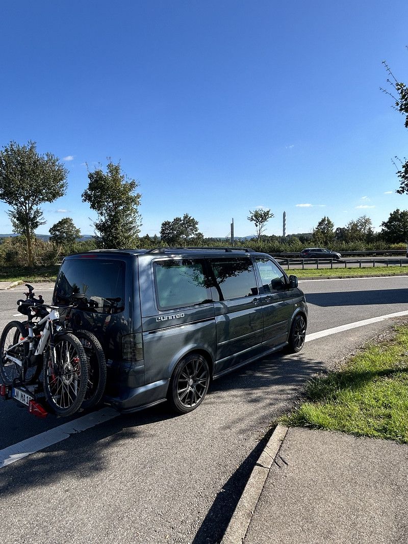
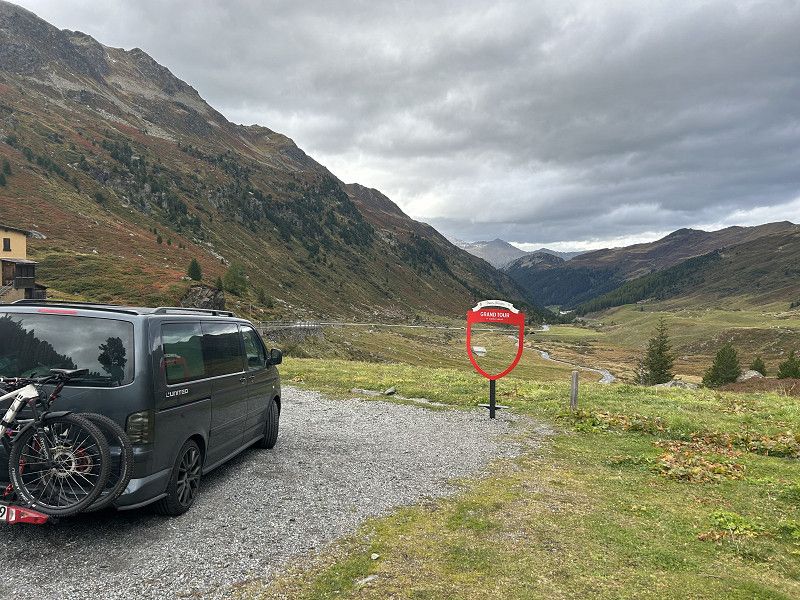
Grand Tour Switzerland opposite.
https://www.myswitzerland.com/de-ch/erlebnisse/erlebnisfahrten/auto-motorrad-grand-tour/foto-spots/
We discovered it too late, but it would have helped with the planning.
A large part is included in the tour.
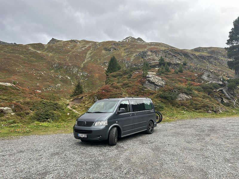
Due to the weather conditions in 2024, we went in a mathematically positive direction and in order to see the Matterhorn we had to cross once.
Conclusion:
Switzerland is a very cool and natural country that can be admired, traveled and explored very well with a tour like this.
In my opinion, 14 days is very short to see everything that is suggested in the Grand Tour. In our 14-day round trip through Switzerland, we left out many destinations, only touched on them or stopped briefly and took a photo, because there was not enough time to admire everything or hike. Due to the weather conditions, we were forced to leave the circuit to reach destinations that require good weather, such as the Matterhorn.
In general, prices in Switzerland are a little higher for food than in Germany. Aldi and Lidl help. Pubs and restaurants were overpriced for us and we avoided them. Coop and Migros have self-service places where you get your money's worth. A data SIM, for example from Sunrise, is recommended and can then be shared with partners via hotspot.
Speed limits are monitored as normal in Germany and the Swiss drive on average 5-10 km/h faster than the limit.
An app like blitzer.de works and can warn you.
Day
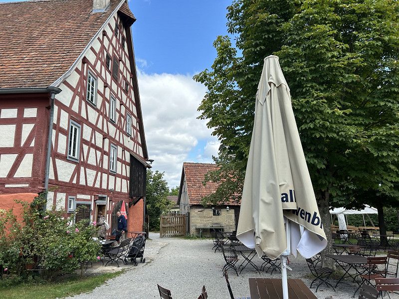
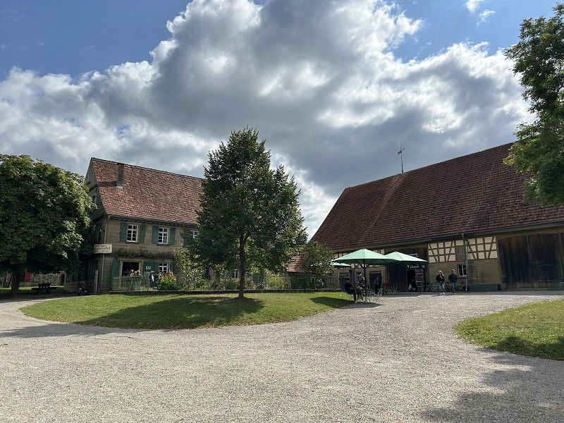
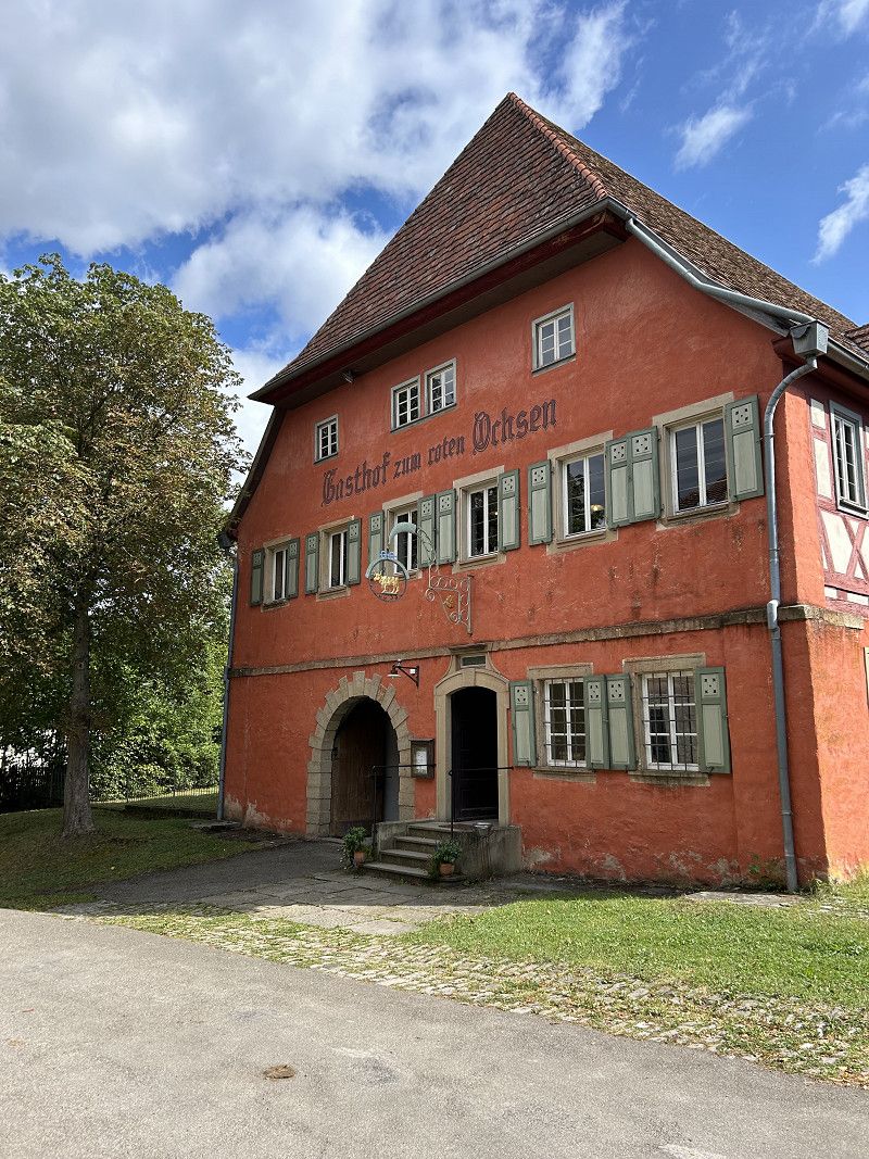
Roter Ochse - Gastronomie
Lunch break on our way to Switzerland
https://der-rote-ochsen.de/
Very good and tasty cuisine.
Dorfstraße, Schwäbisch Hall, Landkreis Schwäbisch Hall, Baden-Württemberg, Germany
49° 8' 8.3" N 9° 41' 55" E
49.1356424 9.6986057
• Head east on Dorfstraße. Go for 483 m.
• Turn slightly left toward Wackershofen. Go for 195 m.
• Turn right onto Wackershofen. Go for 40 m.
• Turn left onto K2576. Go for 4.0 km.
• Turn right onto B14 toward Nürnberg/A6. Go for 246 m.
• Continue on B19A. Go for 2.3 km.
• Take ramp onto A6 toward Nürnberg. Go for 116 km.
• Take the exit toward Berlin/Würzburg/Nürnberg-Nord/Flughafen onto A9. Go for 125 km.
• Take exit 33 toward Dresden/Chemnitz/Hof-Nord onto A72. Go for 106 km.
• Take exit 17 toward Görlitz/Dresden/Chemnitz-Mitte onto A4. Go for 76.2 km.
• Take exit 82 toward Berlin/Cottbus/Flughafen Dresden. Go for 2.0 km.
• Keep left onto A13. Go for 88.2 km.
• Take the left exit toward Potsdam/Berlin/Lübbenau onto A13. Go for 10.9 km.
• Take exit 8 toward Duben/Luckau/Lübben. Go for 388 m.
• Turn right onto B87 toward Frankfurt (Oder)/Lübben. Go for 6.7 km.
• Turn left onto Bahnhofstraße. Go for 574 m.
• Turn left toward Majoransheide. Go for 53 m.
• Continue on Majoransheide. Go for 156 m.
• Turn left onto Majoransheide. Go for 17 m.
• Continue on Brunnenstraße. Go for 96 m.
• Turn left onto Blumenstraße. Go for 83 m.
• Turn right onto Eschenallee. Go for 879 m.
• Arrive at Eschenallee. Your destination is on the right.
☍
540,6 km
(4 hrs. 47 min.)
Eschenallee
Eschenallee 31, Lübben (Spreewald), Dahme-Spreewald, Brandenburg, Deutschland
51° 56' 13.1" N 13° 51' 56" E
51.9369771 13.8655543
• Head toward Heideweg on Eschenallee. Go for 84 m.
• Continue on Am Wäldchen. Go for 392 m.
• Turn slightly left onto Brunnenstraße. Go for 578 m.
• Turn left onto Brunnenstraße. Go for 96 m.
• Continue on Majoransheide. Go for 17 m.
• Turn right onto Majoransheide. Go for 209 m.
• Turn right onto Bahnhofstraße. Go for 574 m.
• Turn right onto Luckauer Straße (B87). Go for 7.1 km.
• Turn right and take ramp onto A13 toward Dresden. Go for 10.3 km.
• Take exit 10 toward Chemnitz/Dresden onto A13. Go for 88.2 km.
• Take exit 23 toward Chemnitz/Prag/Praha/Dresden/Flughafen onto A4. Go for 77.2 km.
• Take exit 68 toward Hof/Zwickau/Chemnitz-Rottluff onto A72. Go for 107 km.
• Take the left exit toward München/Nürnberg/Bayreuth/Flughafen Hof onto A9. Go for 123 km.
• Take exit 52 toward Heilbronn/N.-Hafen onto A6. Go for 153 km.
• Take exit 38 toward Stuttgart/Weinsberg onto A81 (Autobahnkreuz Weinsberg). Go for 50.1 km.
• Take the left exit toward München/Singen/Stuttgart/Flughafen/Messe onto A8. Go for 7.7 km.
• Take exit 51 toward Singen/Böblingen/Sindelfingen onto A81. Go for 33.1 km.
• Take exit 29 toward Bondorf/Eutingen i.G. onto B28. Go for 9.0 km.
• Arrive at Stuttgarter Straße (B28). Your destination is on the left.
☍
668,3 km
(5 hrs. 55 min.)
MTB - Tankstelle
50 cents cheaper than on the A81 and in Switzerland.
Attention: the speed limit in these places is 30 km/h and the speed cameras are on.
Stuttgarter Straße 12, Eutingen im Gäu, Landkreis Freudenstadt, Baden-Württemberg, Deutschland
48° 28' 43.6" N 8° 45' 6.9" E
48.4787866 8.7519116
• Head southwest on Stuttgarter Straße (B28). Go for 315 m.
• Turn left onto Marktstraße (K4709). Go for 660 m.
• Continue on K4709. Go for 2.5 km.
• Continue on Bachhalde (K4709). Go for 441 m.
• Continue on Stauffenbergstraße (K4709). Go for 209 m.
• Turn right onto Rathausstraße (L370). Go for 713 m.
• Turn left onto Waagrain (K4769). Go for 1.4 km.
• Turn right onto K4785. Go for 820 m.
• Turn left and take ramp toward A81/Horb a.N. Go for 297 m.
• Turn right onto B32 toward A81. Go for 1.2 km.
• Take ramp onto A81 toward Singen. Go for 29.3 km.
• Keep right. Go for 174 m.
• Turn slightly right toward Neckarburg West. Go for 41 m.
• Continue on Neckarburg West. Go for 248 m.
• Arrive at your destination on the right.
☍
38,3 km
( 27 min.)
Raststätte
100 km before the finish, a coffee and a look at the elevator shaft inspection tower
A 81, Dietingen, Landkreis Rottweil, Baden-Württemberg, Germany
48° 12' 18" N 8° 37' 12.9" E
48.2050126 8.6202390
• Head southwest. Go for 129 m.
• Continue on A81. Go for 69.5 km.
• Keep left onto A81 toward Schaffhausen/Bietingen. Go for 69 m.
• Take the 1st exit from roundabout onto B34 toward Schaffhausen/Bietingen. Go for 2.0 km.
• Continue on E41/E54. Go for 992 m.
• Continue on A4 toward SH-Herblingen. Go for 7.1 km.
• Take ramp toward Schaffhausen-Nord/Zentrum. Go for 781 m.
• Turn right onto Fulachstrasse (4/15). Go for 588 m.
• Turn right onto Bahnhofstrasse (4/15). Go for 915 m.
• Turn left onto Rheinuferstrasse (13/14/15). Go for 141 m.
• Turn right onto Zürcherstrasse (13/14/15). Go for 351 m.
• Continue on Diessenhoferstrasse (13/14). Go for 1.3 km.
• Arrive at Hauptstrasse (13/14). Your destination is on the left.
☍
83,9 km
( 52 min.)
FZA - Freizeitanlage Schaffhausen
A very well maintained campsite with everything you need.
Kirchweg, Langwiesen, Bezirk Andelfingen, Zurich, Switzerland
47° 41' 11.5" N 8° 39' 27.2" E
47.6865247 8.6575615
• Head northwest on Hauptstrasse (13/14). Go for 1.3 km.
• Turn left onto Zürcherstrasse (15). Go for 2.4 km.
• Turn right and take ramp onto A4 toward Zürich/Winterthur/Rheinfall. Go for 1.2 km.
• Take ramp toward Uhwiesen/Dachsen/Rheinfall. Go for 281 m.
• Turn right onto Lauferstrasse. Go for 471 m.
• Continue on Laufen am Rheinfall. Go for 40 m.
• Turn right onto Laufen am Rheinfall. Go for 115 m.
• Turn right onto Laufen am Rheinfall. Go for 19 m.
• Arrive at Laufen am Rheinfall.
☍
5,8 km
( 7 min.)
Day
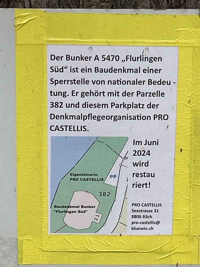
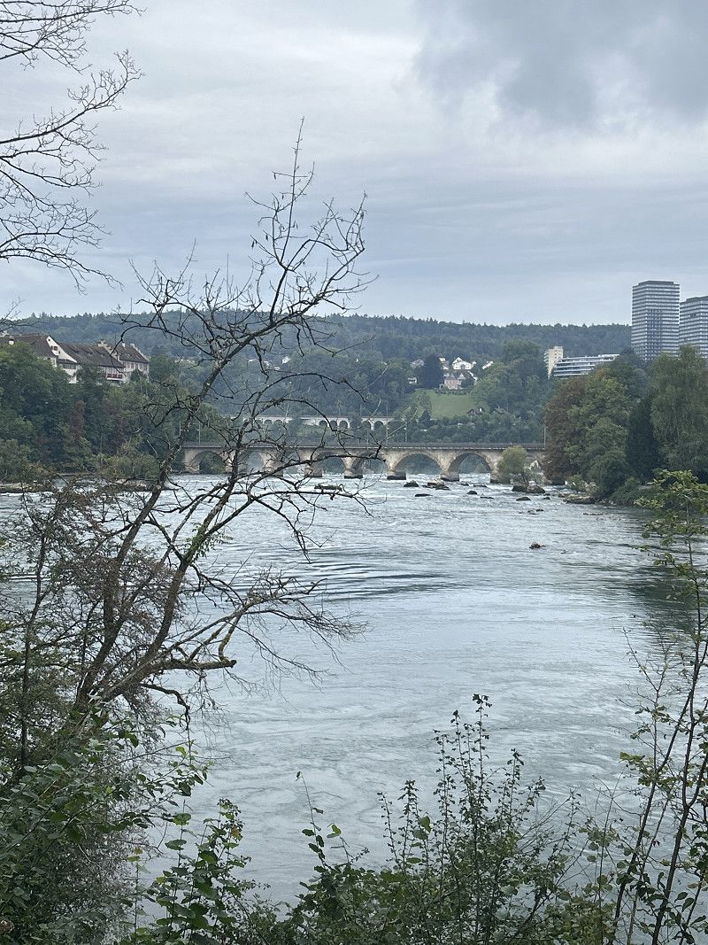
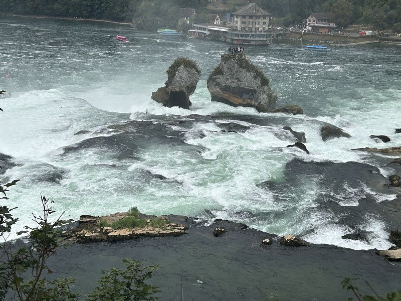
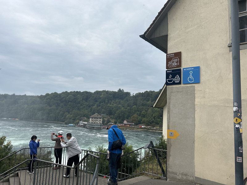
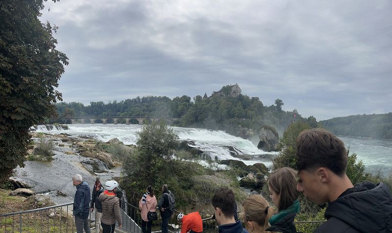
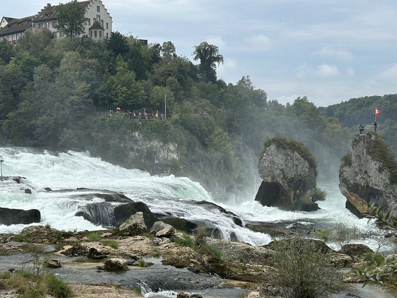
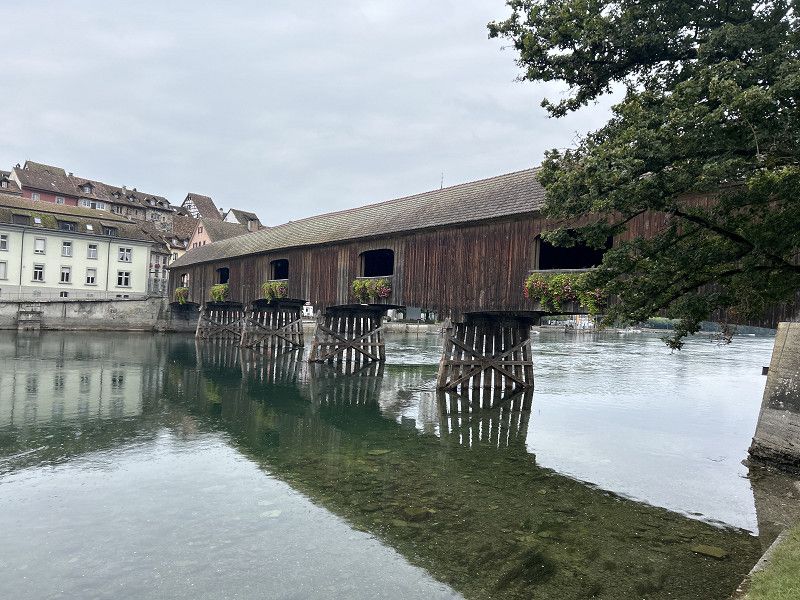
Rheinfall
The bus stops and by bike - visit the Rhine Falls
https://www.komoot.com/de-DE/tour/1863765173?ref=itd
Rheinfall Rundweg, Uhwiesen, Bezirk Andelfingen, Zürich, Schweiz
47° 40' 40.2" N 8° 36' 55.2" E
47.6778348 8.6153284
• Head south on Laufen am Rheinfall. Go for 19 m.
• Turn right onto Laufen am Rheinfall. Go for 117 m.
• Turn left onto Laufen am Rheinfall. Go for 108 m.
• Continue on Lauferstrasse. Go for 621 m.
• Continue on Dorfstrasse. Go for 56 m.
• Turn right and take ramp onto A4 toward Kreuzlingen/Schaffhausen. Go for 2.5 km.
• Take ramp toward Schaffhausen-S/Zentrum/Neuhausen a. Rhf./Kreuzlingen. Go for 419 m.
• Turn left onto Mühlenstrasse (4/13/14) toward Zürich/E41/A4/Basel/E54/Neuhausen a. Rhf. Go for 374 m.
• Turn left onto Schaffhauserstrasse (E54) toward Neuhausen-Zentrum. Go for 560 m.
• Take the 2nd exit from roundabout onto Zentralstrasse toward Ortszentrum. Go for 188 m.
• Arrive at Zentralstrasse.
☍
4,9 km
( 6 min.)
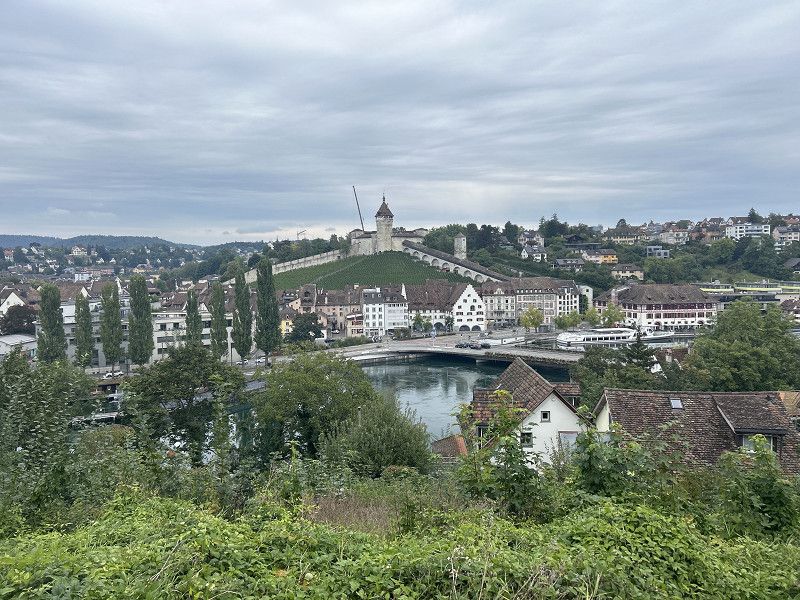
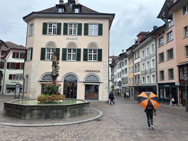
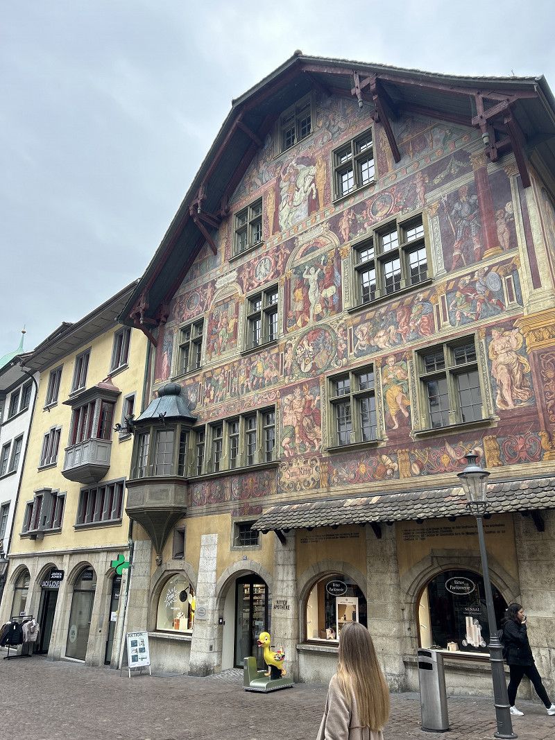
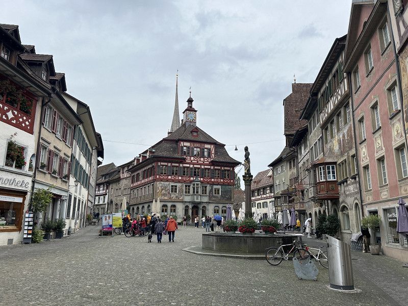
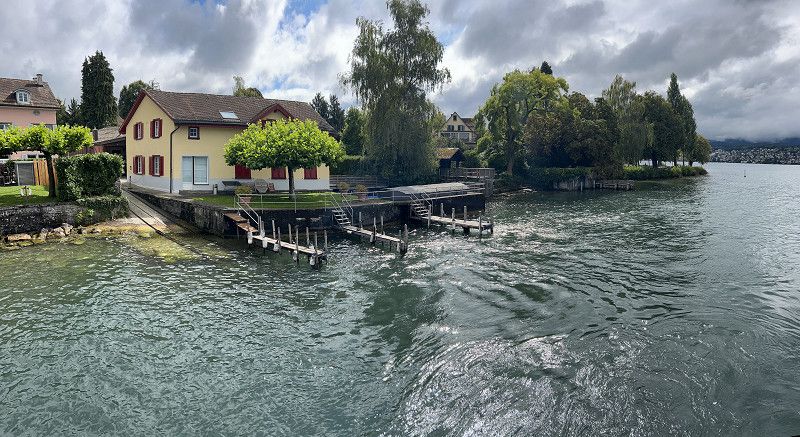
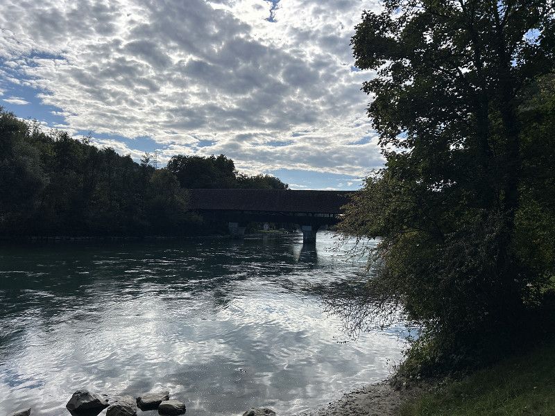
Schaffhausen
After visiting the Rhine Falls, continue by bike to the old town centre of Schaffhausen.
Very nostalgic, perfectly restored and beautiful to look at - even in the rain.
Schaffhausen, Schweiz
47° 41' 10.4" N 8° 37' 20.5" E
47.6862129 8.6223616
• Head south on Zentralstrasse. Go for 7 m.
• Turn right onto Spitzstrasse. Go for 74 m.
• Turn right onto Schaffhauserstrasse (E54). Go for 146 m.
• Take the 2nd exit from roundabout onto Schaffhauserstrasse (E54). Go for 2.0 km.
• Turn right onto Zürcherstrasse (13/14/15). Go for 351 m.
• Continue on Diessenhoferstrasse (13/14). Go for 3.9 km.
• Continue on Diessenhoferstrasse (13). Go for 11.2 km.
• Turn right onto 332 toward Radolfzell/Singen/Ramsen/Stein a Rhein. Go for 1.4 km.
• Take ramp. Go for 171 m.
• Turn left onto Hemishoferstrasse. Go for 2.1 km.
• Continue on Undertor. Go for 132 m.
• Turn right onto Understadt. Go for 19 m.
• Turn left onto Understadt. Go for 32 m.
• Turn right onto Choligass. Go for 98 m.
• Arrive at Choligass. Your destination is on the left.
☍
21,6 km
( 22 min.)
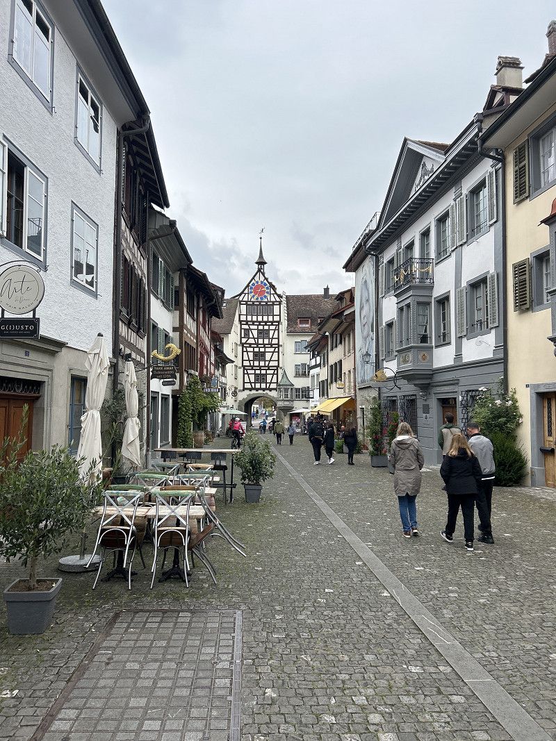
Spaghetteria Wasserfels
Lunch break at Spaghetteria Wasserfels.
This place is 18 km upstream and can be easily reached by bike and is no less nostalgic and antiquity than Schaffhausen. Thumbs up, too.
https://www.komoot.com/de-DE/tour/1863765173?ref=itd
Schiffländi 9, Stein am Rhein, Schaffhausen, Switzerland
47° 39' 36.2" N 8° 51' 25.1" E
47.6600672 8.8569673
• Head toward Undergass on Choligass. Go for 98 m.
• Turn right onto Understadt. Go for 118 m.
• Continue on Rathausplatz. Go for 110 m.
• Turn right onto Rhigass. Go for 62 m.
• Continue on Charregass. Go for 340 m.
• Continue on Wagenhauserstrasse (13). Go for 20 m.
• Take the 1st exit from roundabout onto Wagenhauserstrasse (13). Go for 16.2 km.
• Arrive at Hauptstrasse (13/14). Your destination is on the right.
☍
17,0 km
( 15 min.)
FZA Schaffhausen
A good tour along the Rhine is over.
https://www.komoot.com/de-DE/tour/1863765173?ref=itd
Have fun.
Kirchweg, Langwiesen, Bezirk Andelfingen, Zurich, Switzerland
47° 41' 11.5" N 8° 39' 27.2" E
47.6865247 8.6575615
• Head northwest on Hauptstrasse (13/14). Go for 1.3 km.
• Turn left onto Zürcherstrasse (15). Go for 2.4 km.
• Turn right and take ramp onto A4 toward Zürich/Winterthur/Rheinfall. Go for 20.5 km.
• Take exit 70 toward Zürich/Wülflingen onto A1/A4. Go for 19.1 km.
• Keep left onto A1 toward Zürich-City. Go for 978 m.
• Continue on A1. Go for 496 m.
• Continue on A1L (Dreieck Zürich-Ost). Go for 5.0 km.
• Turn left onto Wasserwerkstrasse. Go for 364 m.
• Turn right onto Neumühlequai. Go for 524 m.
• Turn right onto Walchebrücke. Go for 90 m.
• Turn left onto Bahnhofquai. Go for 70 m.
• Keep right onto Bahnhofquai. Go for 110 m.
• Continue on Bahnhofplatz. Go for 259 m.
• Turn left onto Gessnerallee. Go for 651 m.
• Continue on Selnaustrasse. Go for 262 m.
• Continue on Sihlhölzlistrasse. Go for 320 m.
• Turn right onto Sihlhölzlibrücke (3). Go for 259 m.
• Continue on Manessestrasse (4). Go for 159 m.
• Keep left onto A3W toward A3. Go for 2.0 km.
• Take exit 2 toward Brunau/Adliswil onto 4 (Allmendstrasse). Go for 852 m.
• Keep right onto Allmendstrasse (4) toward Luzern/Adliswil. Go for 2.9 km.
• Turn right onto Soodring. Go for 79 m.
• Arrive at Soodring. Your destination is on the right.
☍
58,6 km
( 53 min.)
Day
Lidl Parkplatz
From the Rhine Falls we head to the next highlight - Zurich.
At first Zurich is ignored - drive through to Thalwil.
Here at Lidl - water and snacks for the Zurich visit.
Soodring 25, Adliswil, Bezirk Horgen, Zurich, Switzerland
47° 19' 9.3" N 8° 31' 13.4" E
47.3192467 8.5203971
• Head toward Farbstrasse on Soodring. Go for 657 m.
• Continue on Poststrasse. Go for 237 m.
• Turn right onto Soodstrasse. Go for 67 m.
• Take the 2nd exit from roundabout onto Albisstrasse. Go for 248 m.
• Take the 3rd exit from roundabout onto Wachtbrücke. Go for 1.4 km.
• Take the 2nd exit from roundabout onto Feldimoosstrasse. Go for 413 m.
• Turn right onto Säumerstrasse. Go for 227 m.
• Continue on Nidelbadstrasse. Go for 922 m.
• Turn right onto Dorfstrasse. Go for 194 m.
• Turn left onto Dorfstrasse. Go for 288 m.
• Turn right onto Seestrasse (3). Go for 1.7 km.
• Turn right onto Gütschliweg. Go for 19 m.
• Turn right. Go for 21 m.
• Arrive at your destination on the right.
☍
6,4 km
( 10 min.)
Parkplatz am Schiffsableger Tahlwil
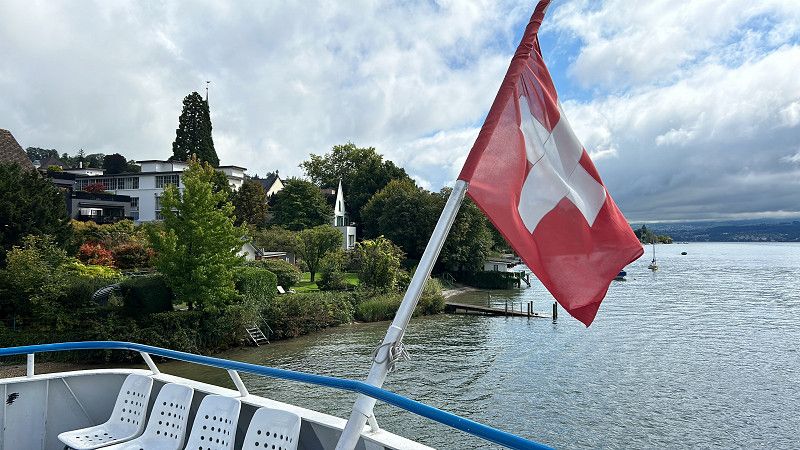
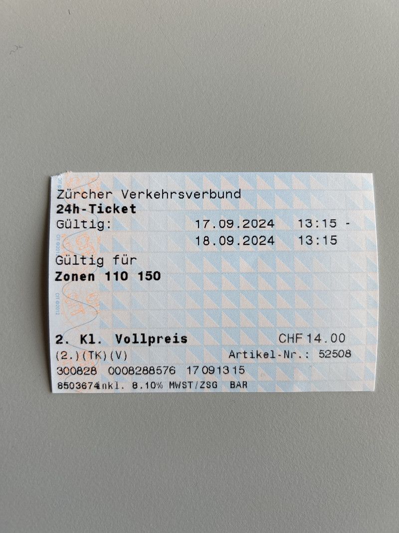
Here you start with the first part of the small Zurich Lake tour.
The day ticket for 14 CHF keeps all transport options open and secures the second part of the return journey of the Small Lake Zurich Tour.
Seestrasse 130, Thalwil, Bezirk Horgen, Zurich, Switzerland
47° 17' 46.1" N 8° 34' 4.5" E
47.2961454 8.5679102
• Head toward Gütschliweg. Go for 21 m.
• Turn left onto Gütschliweg. Go for 19 m.
• Turn left onto Seestrasse (3). Go for 5.9 km.
• Continue on Mythenquai (3). Go for 1.5 km.
• Keep right onto Mythenquai. Go for 677 m.
• Continue on General-Guisan-Quai. Go for 113 m.
• Turn right onto General-Guisan-Quai. Go for 486 m.
• Continue toward Bürkliplatz. Go for 44 m.
• Arrive at Bürkliplatz. Your destination is on the right.
☍
8,8 km
( 13 min.)
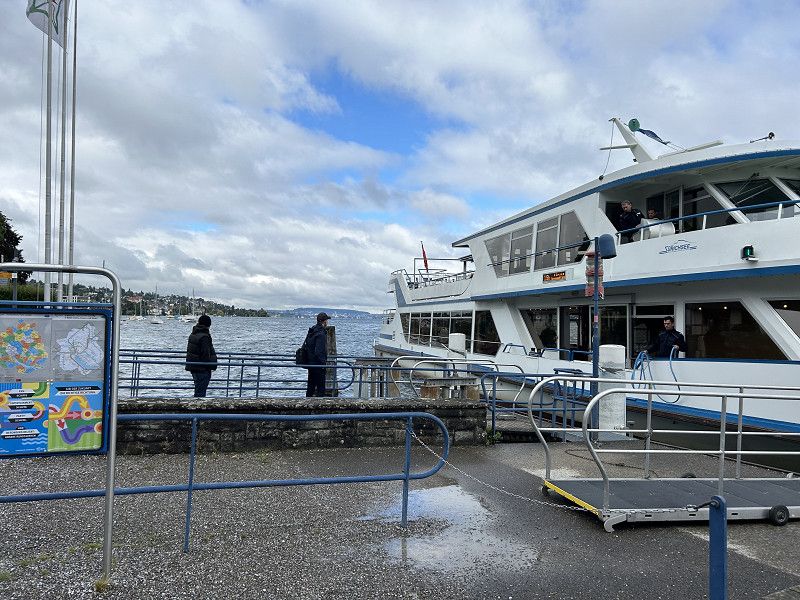
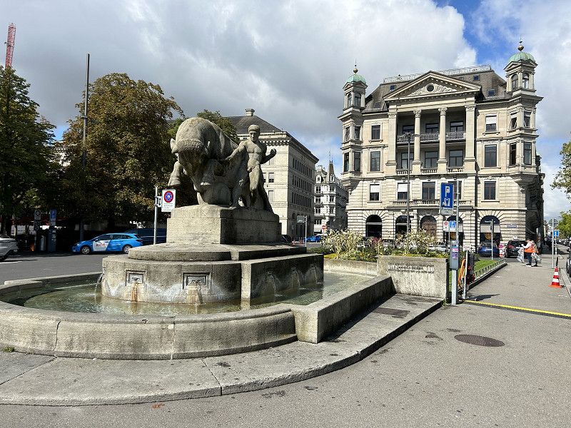
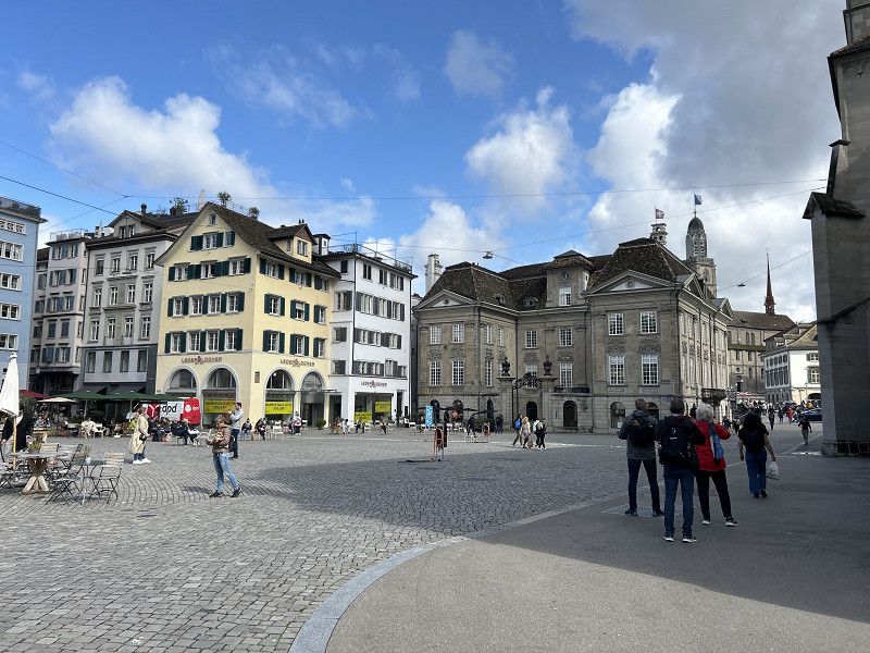
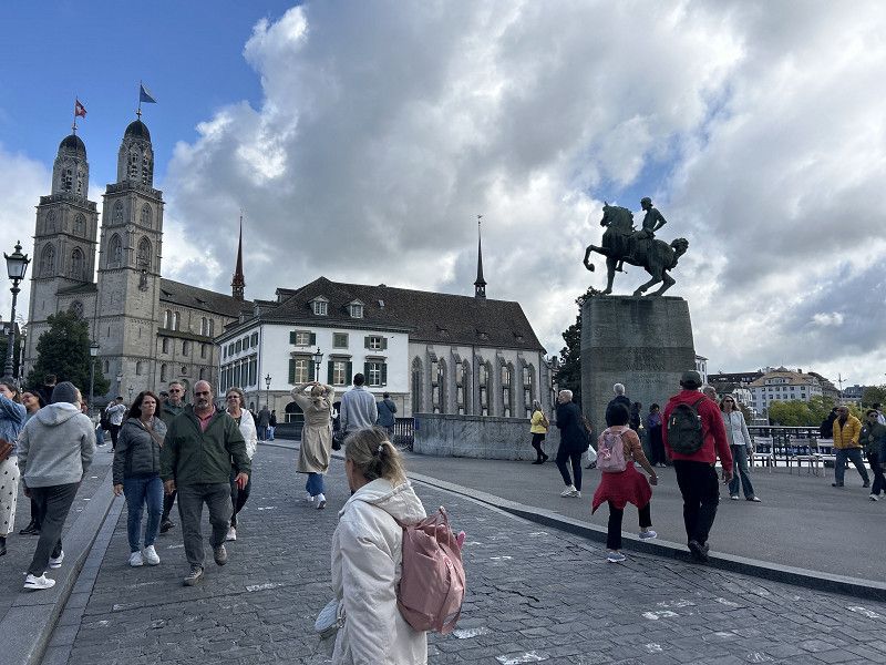
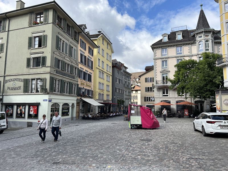
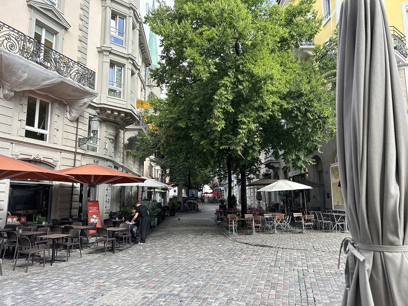
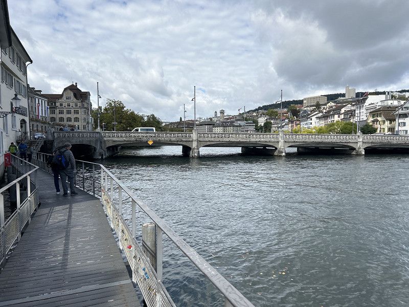
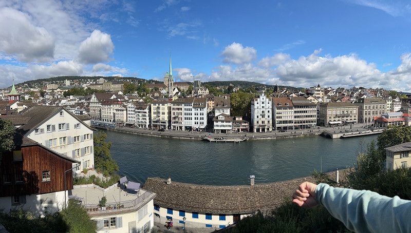
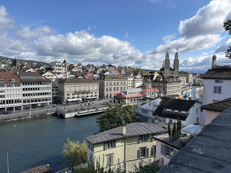
Zürich
Arriving at Bürkiplatz is ideal for starting out in Zurich’s old town.
https://www.komoot.com/de-DE/tour/1865276178?ref=itd
Finally, we took the White Fleet back to the Bulli in Tahlwil.
Bürkliplatz, Zurich, District Zurich, Zurich, Switzerland
47° 21' 58.5" N 8° 32' 26.9" E
47.3662418 8.5408173
• Head northeast on Bürkliplatz. Go for 85 m.
• Make a U-Turn at Quaibrücke onto Bürkliplatz. Go for 143 m.
• Continue on General-Guisan-Quai. Go for 503 m.
• Turn slightly right onto General-Wille-Strasse. Go for 119 m.
• Turn right onto Alfred-Escher-Strasse (3). Go for 951 m.
• Continue on Manessestrasse (4). Go for 159 m.
• Keep left onto A3W toward A3. Go for 2.5 km.
• Take exit 32 toward Basel/Westring-Zürich onto A3. Go for 5.2 km.
• Take the left exit toward Gotthard/Luzern onto A4. Go for 23.1 km.
• Take exit 34 toward Chiasso/Gotthard/Schwyz/Rotkreuz onto A4. Go for 6.7 km.
• Take exit 36 toward Küssnacht/Gersau/Weggis/Meggen/Immensee. Go for 364 m.
• Take the 2nd exit from roundabout onto Zugerstrasse. Go for 979 m.
• Pass 2 roundabouts and continue on Nordstrasse (2). Go for 5.1 km.
• Arrive at Luzernerstrasse (2). Your destination is on the left.
☍
45,8 km
( 33 min.)
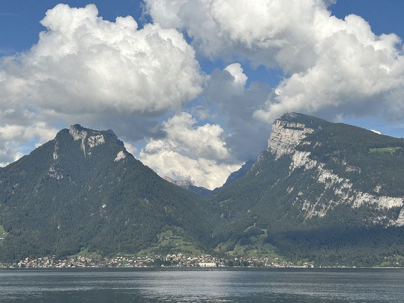
Seecamping Vierwaldstättersee Merlischachen
Very well maintained campsite. Unfortunately in the process of being closed down due to the termination of the lease. The owner is building apartments here, as can be seen throughout the town.
It doesn't matter to us at the moment, we enjoy the time directly at the lake.
Wi-Fi, plumbing and electricity are still in operation.
Luzernerstrasse 271, 6402, Merlischachen / Luzern, Schweiz
47° 3' 42.5" N 8° 24' 10.3" E
47.0618000 8.4028500
• Head southwest on Luzernerstrasse (2). Go for 31 m.
• Turn right toward Räbeweg. Go for 35 m.
• Turn right onto Räbeweg. Go for 77 m.
• Turn left onto Luzernerstrasse (2). Go for 3.7 km.
• Pass 2 roundabouts and continue on Zugerstrasse. Go for 2.3 km.
• Take the 1st exit from roundabout. Go for 93 m.
• Take ramp onto A4 toward Lugano/Gotthard/Schwyz. Go for 10.3 km.
• Take exit 38 toward Goldau/Arth/Lauerz. Go for 280 m.
• Turn right onto Gotthardstrasse (2). Go for 32 m.
• Turn right onto Chräbelstrasse. Go for 181 m.
• Turn right onto Chräbelstrasse. Go for 23 m.
• Turn right. Go for 72 m.
• Turn slightly right. Go for 290 m.
• Arrive at your destination on the right.
☍
17,3 km
( 16 min.)
Day
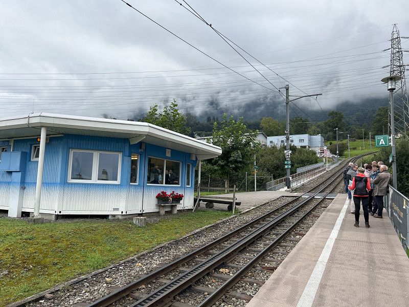
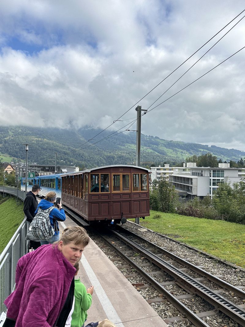
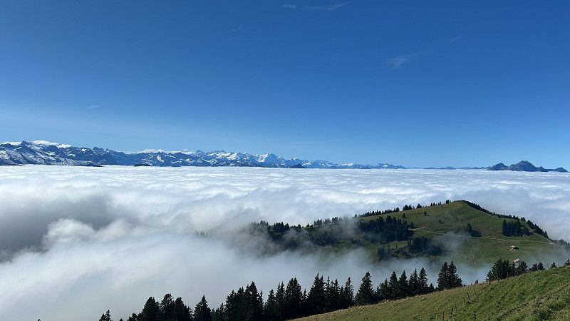
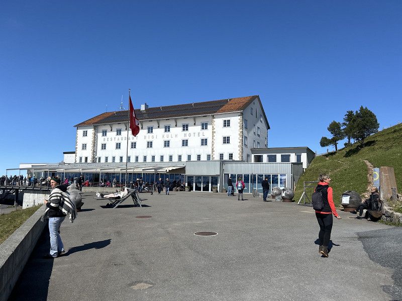
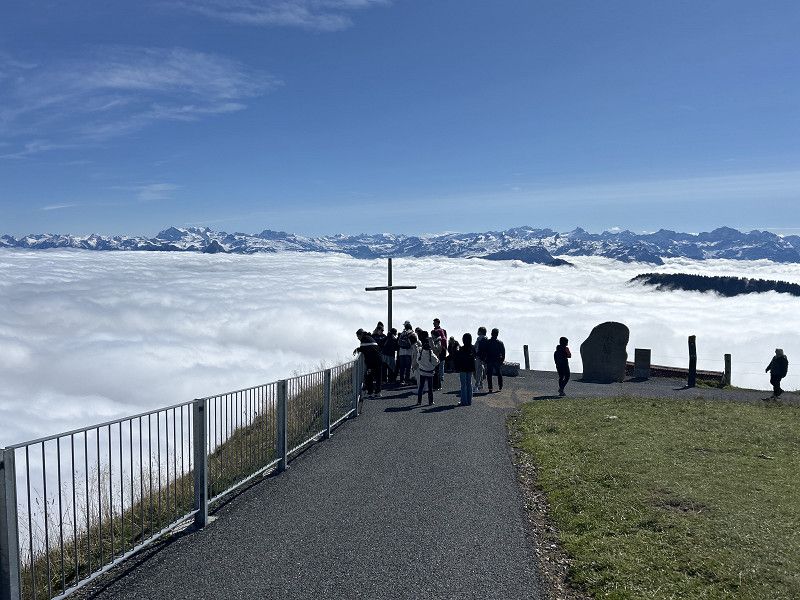
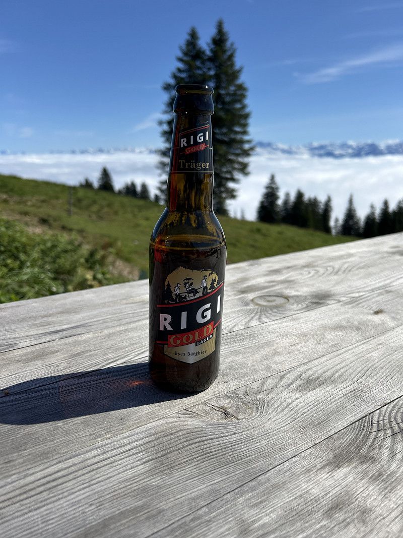
Goldau - Rigi Bahn
At 68 CHF it is very expensive but it is worth it.
The climb is quite long and hard.
Railway line 8 km 45 min.
Parking at the train station for 8CHF.
Chräbelstrasse 4, Goldau, Schwyz, Schwyz, Switzerland
47° 2' 30.8" N 8° 32' 54.9" E
47.0418980 8.5485771
• Head southeast. Go for 18 m.
• Continue on Chräbelstrasse. Go for 23 m.
• Turn left onto Chräbelstrasse. Go for 181 m.
• Turn left onto Gotthardstrasse (2). Go for 168 m.
• Turn left and take ramp onto A4 toward Basel/Luzern/Zürich/Zug. Go for 10.0 km.
• Take exit 36 toward Küssnacht/Meggen/Immensee. Go for 546 m.
• Take the 2nd exit from roundabout onto Zugerstrasse. Go for 979 m.
• Take the 2nd exit from roundabout onto Zugerstrasse (2) toward Luzern/Gersau/Weggis/Küssnacht. Go for 835 m.
• Take ramp onto Nordstrasse toward Gersau/Weggis/Küssnacht/Seebodenalp. Go for 798 m.
• Take the 2nd exit from roundabout onto Südumfahrung toward Gersau/Weggis. Go for 778 m.
• Take the 2nd exit from roundabout onto Grepperstrasse (2b) toward Gersau/Weggis. Go for 5.6 km.
• Take the 2nd exit from roundabout onto Kantonsstrasse (2b). Go for 1.5 km.
• Turn right onto Rigistrasse. Go for 118 m.
• Turn left onto Rigistrasse. Go for 722 m.
• Turn right onto Rigistrasse. Go for 751 m.
• Continue on Rigistrasse. Go for 499 m.
• Turn slightly left onto Rigistrasse. Go for 695 m.
• Turn slightly right onto Rigistrasse. Go for 228 m.
• Turn slightly right onto Rigistrasse. Go for 940 m.
• Continue on Obersentiberg. Go for 60 m.
• Turn right. Go for 9 m.
• Arrive at your destination.
☍
25,4 km
( 31 min.)
Käserei
From the summit cross of Rigi, hike to the cheese dairy and to the Klösterli station and take the train into the valley.
Hiker of 6Km.
https://www.komoot.com/de-DE/tour/1867092129?ref=itd&share_token=aPTkwmHc4V7C8qE43dV4BTRwZBYKDAWpFwph6bRnPkXM1jxzLd
Kulmweg 19, Arth, Schwyz, Schwyz, Switzerland
47° 3' 4.1" N 8° 29' 33.4" E
47.0511263 8.4926114
• Head toward Obersentiberg. Go for 9 m.
• Turn left onto Obersentiberg. Go for 60 m.
• Continue on Rigistrasse. Go for 940 m.
• Turn slightly left onto Rigistrasse. Go for 509 m.
• Turn slightly left onto Rigistrasse. Go for 1.7 km.
• Turn left onto Rigistrasse. Go for 582 m.
• Turn right onto Rigistrasse. Go for 192 m.
• Turn right onto Kantonsstrasse (2b). Go for 1.4 km.
• Take the 3rd exit from roundabout onto Kantonsstrasse (2b). Go for 5.6 km.
• Take the 3rd exit from roundabout onto Grepperstrasse (2b) toward Zentrum. Go for 263 m.
• Take the 3rd exit from roundabout onto Hauptplatz. Go for 64 m.
• Continue on Bahnhofstrasse. Go for 331 m.
• Turn right onto Bahnhofstrasse. Go for 296 m.
• Take the 1st exit from roundabout onto Gsteigstrasse. Go for 77 m.
• Continue toward Bärenmatte. Go for 48 m.
• Continue on Bärenmatte. Go for 16 m.
• Take the 1st exit from roundabout onto Nordstrasse (2) toward Luzern/Meggen/Merlischachen. Go for 10.2 km.
• Take the 3rd exit from roundabout onto Haldenstrasse (2). Go for 2.8 km.
• Keep right onto Bahnhofplatz (2). Go for 489 m.
• Turn right onto Obergrundstrasse (2). Go for 134 m.
• Turn slightly right onto Franziskanerplatz. Go for 103 m.
• Turn right onto Franziskanerplatz. Go for 59 m.
• Turn right. Go for 134 m.
• Arrive at your destination on the right.
☍
25,8 km
( 43 min.)
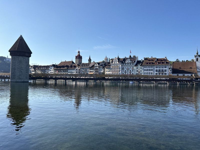
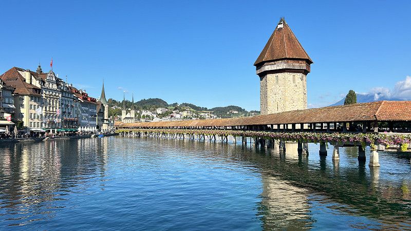
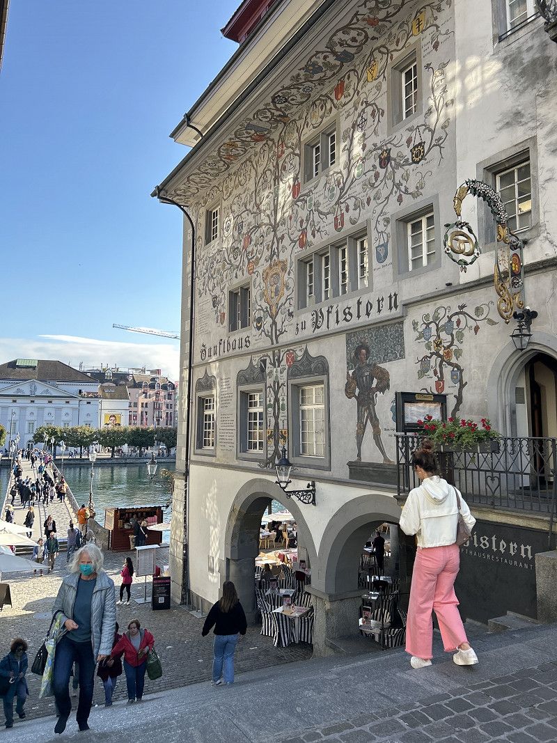
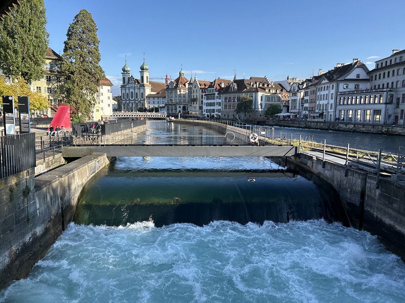
Luzern
A must on the Grand Tour.
Very historic and diverse city center.
Luzern, Schweiz
47° 3' 2" N 8° 18' 19.7" E
47.0505452 8.3054682
• Head north. Go for 55 m.
• Turn right toward Franziskanerplatz. Go for 84 m.
• Turn left onto Franziskanerplatz. Go for 59 m.
• Turn left onto Franziskanerplatz. Go for 103 m.
• Turn right onto Hirschengraben (2). Go for 324 m.
• Keep left onto Kasernenplatz toward Basel/Bern/Zürich/Emmen. Go for 359 m.
• Take ramp onto A2 (Tunnel Reussport). Go for 2.2 km.
• Keep middle onto A14 toward Zürich/Zug/Buchrain. Go for 5.5 km.
• Take exit 3 toward Buchrain/Ebikon/Inwil. Go for 302 m.
• Turn left onto Hauptstrasse. Go for 124 m.
• Continue on Kantonsstrasse. Go for 805 m.
• Continue on Schachenstrasse. Go for 169 m.
• Continue on Schachen. Go for 209 m.
• Continue on Breitfeld. Go for 52 m.
• Continue on Winkel. Go for 134 m.
• Continue on Schachenstrasse. Go for 30 m.
• Continue on Buchrainstrasse. Go for 614 m.
• Continue on Inwilstrasse. Go for 1.4 km.
• Take the 1st exit from roundabout onto Luzernstrasse (26). Go for 3.0 km.
• Pass 2 roundabouts and continue on Hauptstrasse (26). Go for 8.5 km.
• Take the 2nd exit from roundabout onto Hitzkircherstrasse. Go for 495 m.
• Continue on Luzernerstrasse. Go for 688 m.
• Continue on Aargauerstrasse. Go for 844 m.
• Continue on Stierlihof. Go for 109 m.
• Continue on Hauptstrasse. Go for 1.8 km.
• Continue on Ess. Go for 669 m.
• Continue on Vorderdorf. Go for 2.2 km.
• Continue on Neumatt. Go for 781 m.
• Continue on Aescherstrasse. Go for 645 m.
• Turn left onto Aescherstrasse. Go for 968 m.
• Continue on Hauptstrasse. Go for 1.2 km.
• Continue on Seengerstrasse. Go for 1.3 km.
• Continue on Brestenbergstrasse. Go for 1.2 km.
• Continue on Unterdorfstrasse. Go for 464 m.
• Continue on Boniswilerstrasse. Go for 641 m.
• Arrive at Boniswilerstrasse. Your destination is on the right.
☍
38,2 km
( 39 min.)
Day
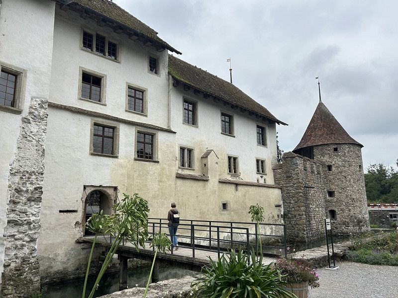
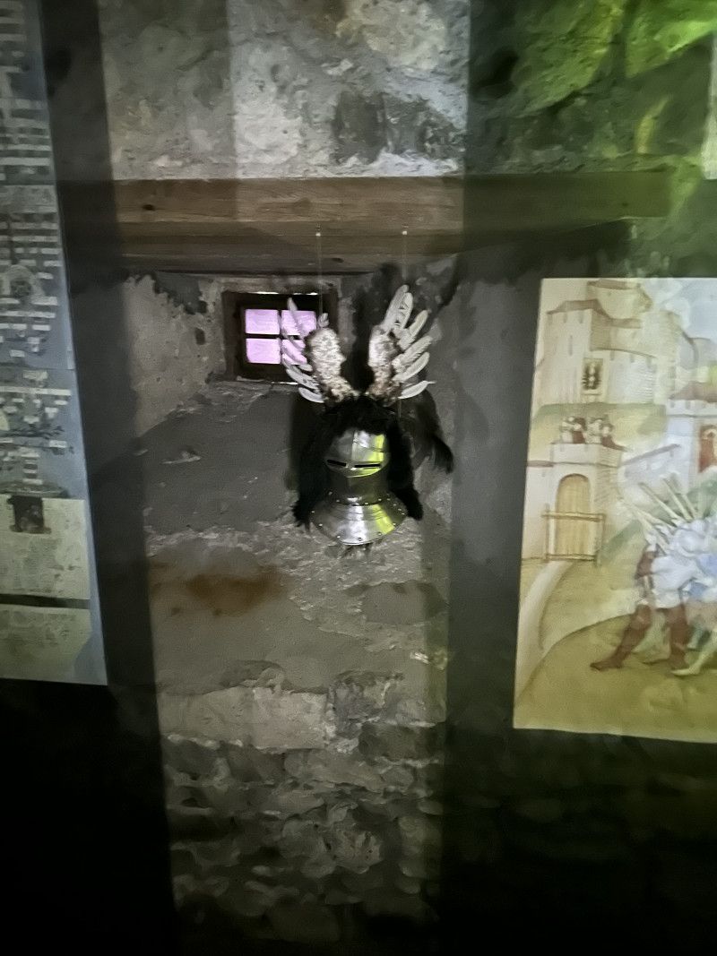
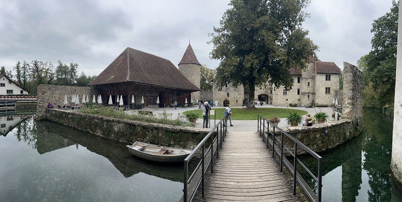
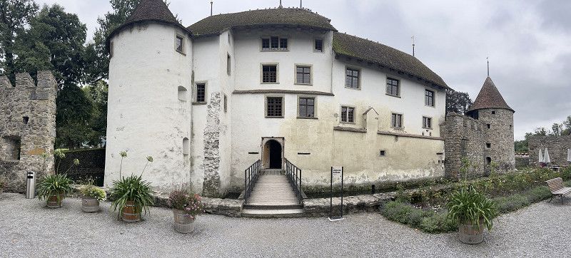
Schloss Hallwyl
For 14CHF you can see and hear historical things here - it's worth it.
Parking available directly in front.
Boniswilerstrasse, Seengen, Bezirk Lenzburg, Aargau, Switzerland
47° 19' 25.6" N 8° 11' 41.5" E
47.3237790 8.1948719
• Head west on Boniswilerstrasse. Go for 710 m.
• Continue on Seengerstrasse. Go for 433 m.
• Take the 2nd exit from roundabout onto Leutwilerstrasse. Go for 969 m.
• Continue on Boniswilerstrasse. Go for 877 m.
• Turn left onto Dorfstrasse. Go for 228 m.
• Turn right onto Dorfstrasse. Go for 272 m.
• Continue on Zetzwilerstrasse. Go for 1.1 km.
• Continue on Wandfluh. Go for 209 m.
• Continue on Zetzwilerstrasse. Go for 46 m.
• Continue on Wandfluhstrasse. Go for 1.4 km.
• Continue on Hinterdorfstrasse. Go for 436 m.
• Turn left onto Hauptstrasse (23). Go for 293 m.
• Turn right onto Gontenschwilerstrasse toward Gontenschwil. Go for 495 m.
• Continue on Zetzwilerstrasse. Go for 326 m.
• Turn left onto Dorfstrasse. Go for 1.9 km.
• Turn right onto Hinterdorfstrasse. Go for 262 m.
• Continue on Schwarzenberg. Go for 1.9 km.
• Continue on Bohler. Go for 280 m.
• Continue on Gontenschwilstrasse. Go for 30 m.
• Turn right toward Rehhag. Go for 542 m.
• Continue on Rehhag. Go for 506 m.
• Turn left onto Rehhag. Go for 2.6 km.
• Continue on Oberdorf. Go for 256 m.
• Continue on Dorf. Go for 96 m.
• Continue on Oberdorf. Go for 16 m.
• Continue on Dorf. Go for 162 m.
• Continue on Unterdorf. Go for 226 m.
• Continue on Dorf. Go for 1.4 km.
• Continue on Schlierbacherstrasse. Go for 854 m.
• Take the 2nd exit from roundabout onto Bahnhofstrasse. Go for 604 m.
• Continue on Knutwilerstrasse. Go for 594 m.
• Continue on Büronerstrasse. Go for 1.3 km.
• Continue on Lindenhof. Go for 510 m.
• Continue on 2. Go for 1.2 km.
• Turn left onto Kantonsstrasse (2). Go for 84 m.
• Turn right onto Mauenseestrasse. Go for 1.9 km.
• Continue on Vogelmatt. Go for 93 m.
• Turn right onto Dorf (23). Go for 4.5 km.
• Take the 2nd exit from roundabout onto Dorf (23). Go for 165 m.
• Pass 4 roundabouts and continue on Bernstrasse (23). Go for 9.4 km.
• Turn right onto Bernstrasse (23). Go for 5.7 km.
• Take the 2nd exit from roundabout onto Bernstrasse (23). Go for 8.6 km.
• Turn right onto Grüttmoosstrasse. Go for 23 m.
• Turn left onto Dorfstrasse. Go for 511 m.
• Continue on Grütt. Go for 633 m.
• Continue on Grüttäbnit. Go for 544 m.
• Continue on Dorfstrasse. Go for 727 m.
• Turn left onto Ausserhof. Go for 5 m.
• Turn right onto Schaukäsereistrasse. Go for 84 m.
• Turn left onto Schaukäsereistrasse. Go for 89 m.
• Arrive at Schaukäsereistrasse. Your destination is on the right.
☍
56,0 km
(1 hrs. 3 min.)
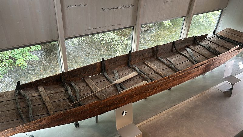
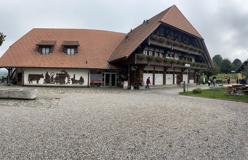
Schaukäserei Emmentaler
Worth a stop for 1 - 2 hours.
No entrance fee with direct parking.
Schaukäsereistrasse 6, Affoltern im Emmental, Emmental administrative district, Bern, Switzerland
47° 3' 49.7" N 7° 43' 53.1" E
47.0637929 7.7314196
• Head northeast on Schaukäsereistrasse. Go for 89 m.
• Turn left onto Schaukäsereistrasse. Go for 88 m.
• Turn left onto Dorfstrasse. Go for 187 m.
• Turn right onto Luegstrasse. Go for 324 m.
• Continue on Rinderweid. Go for 480 m.
• Continue on Schnabel. Go for 1.9 km.
• Continue on Lueg. Go for 183 m.
• Continue on Luegstrasse. Go for 1.9 km.
• Continue on Vorwasen. Go for 587 m.
• Continue on Kaltacker. Go for 526 m.
• Continue on Guetisberg. Go for 1.3 km.
• Continue on Hub. Go for 633 m.
• Continue on Eggen. Go for 1.5 km.
• Continue on Kaltacker-Lueg-Strasse. Go for 324 m.
• Turn left onto Lorraine. Go for 678 m.
• Continue on Wynigenstrasse. Go for 279 m.
• Pass 7 roundabouts. Go for 5.2 km.
• Keep left toward Lausanne/Interlaken/Bern. Go for 213 m.
• Take ramp onto A1 toward Lausanne/Interlaken/Bern. Go for 15.5 km.
• Take the exit toward Lausanne/Fribourg/Neuchâtel/Bern-Neufeld onto A1 (Wankdorf). Go for 6.9 km.
• Take exit 33 toward Aarberg/Wohlen. Go for 590 m.
• Continue on Eymattstrasse. Go for 1.0 km.
• Turn right onto Wohlenstrasse. Go for 66 m.
• Turn left onto Wohlenstrasse. Go for 68 m.
• Arrive at Wohlenstrasse. Your destination is on the left.
☍
40,4 km
( 38 min.)
Tagesziel - Bern
Perfect campsite - all in 2 persons 2 nights 111CHF
Wohlenstrasse 62c, Bern, Bern-Mittelland administrative district, Bern, Switzerland
46° 57' 50.6" N 7° 23' 2.2" E
46.9640427 7.3839450
• Head southwest on Wohlenstrasse. Go for 13 m.
• Turn slightly left onto Wohlenstrasse. Go for 55 m.
• Turn right onto Wohlenstrasse. Go for 66 m.
• Turn left onto Eymattstrasse. Go for 1.0 km.
• Turn right onto Neue Murtenstrasse (1/10). Go for 129 m.
• Take left ramp onto A1 toward Zürich/Basel/Interlaken/Fribourg/Biel/Bienne. Go for 6.7 km.
• Take exit 37 toward Bern-Wankdorf onto Schermenweg. Go for 1.2 km.
• Keep left onto Wankdorfplatz toward Zürich/1/Basel/12/Interlaken/6/Biel/Bienne/Zollikofen/Ittigen. Go for 212 m.
• Take the 3rd exit from roundabout onto Papiermühlestrasse (6) toward Interlaken. Go for 1.5 km.
• Turn left onto Laubeggstrasse (6). Go for 173 m.
• Arrive at Laubeggstrasse (6). Your destination is on the right.
☍
11,1 km
( 12 min.)
Day
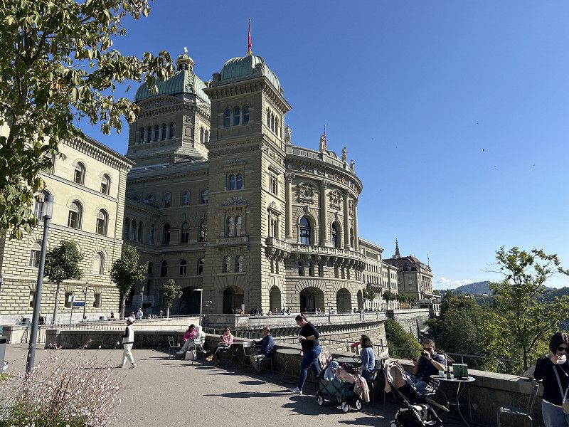
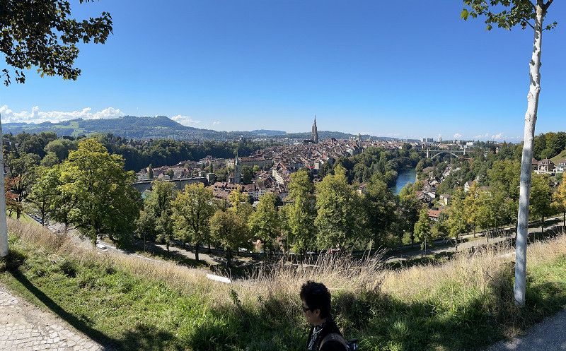
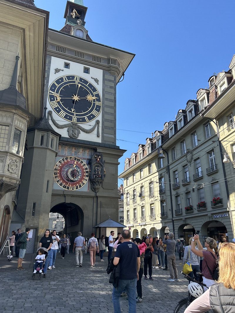
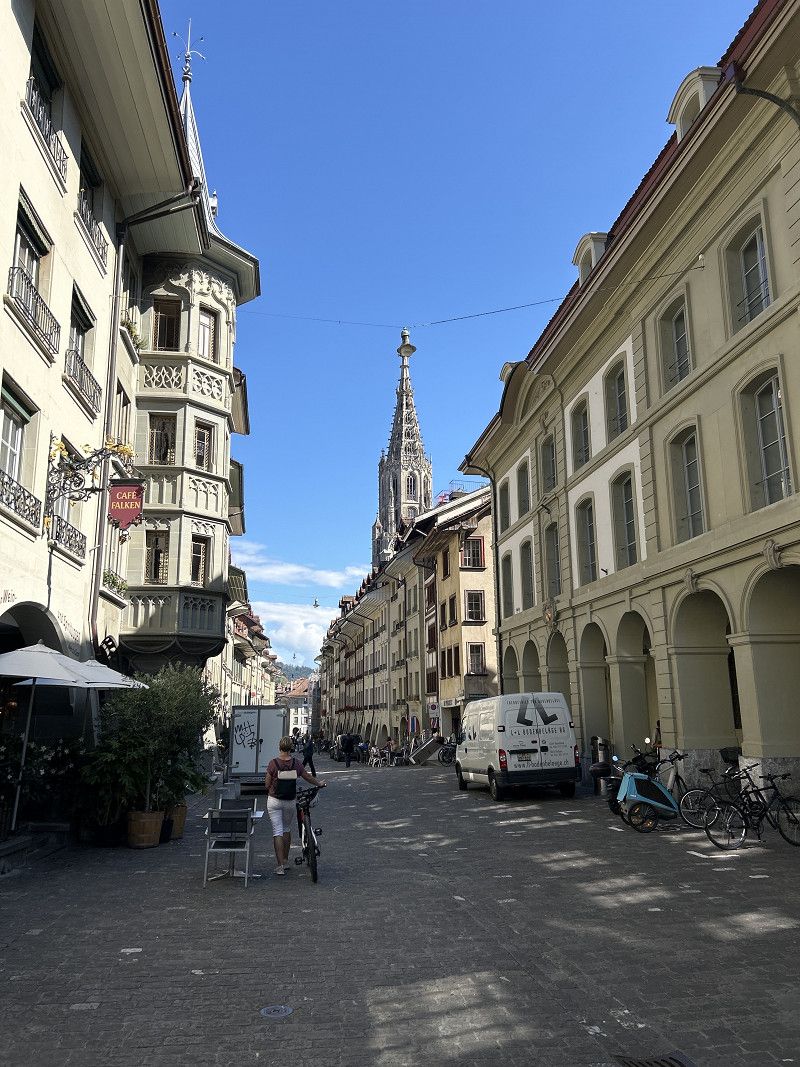
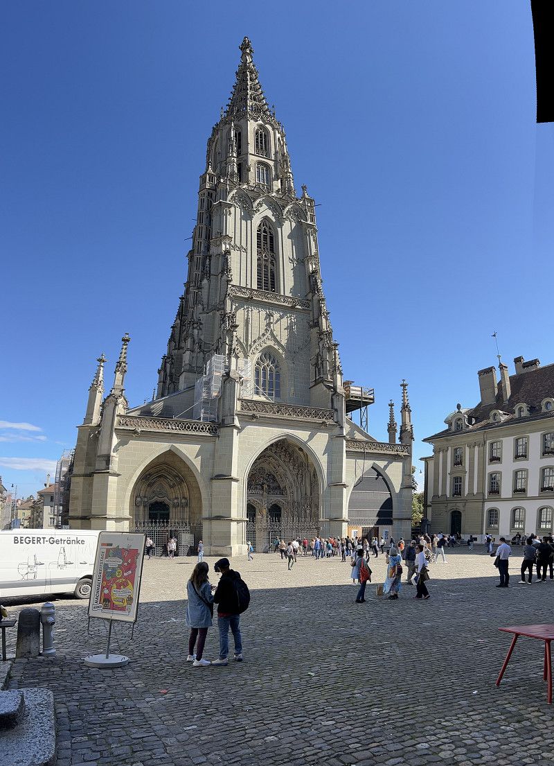
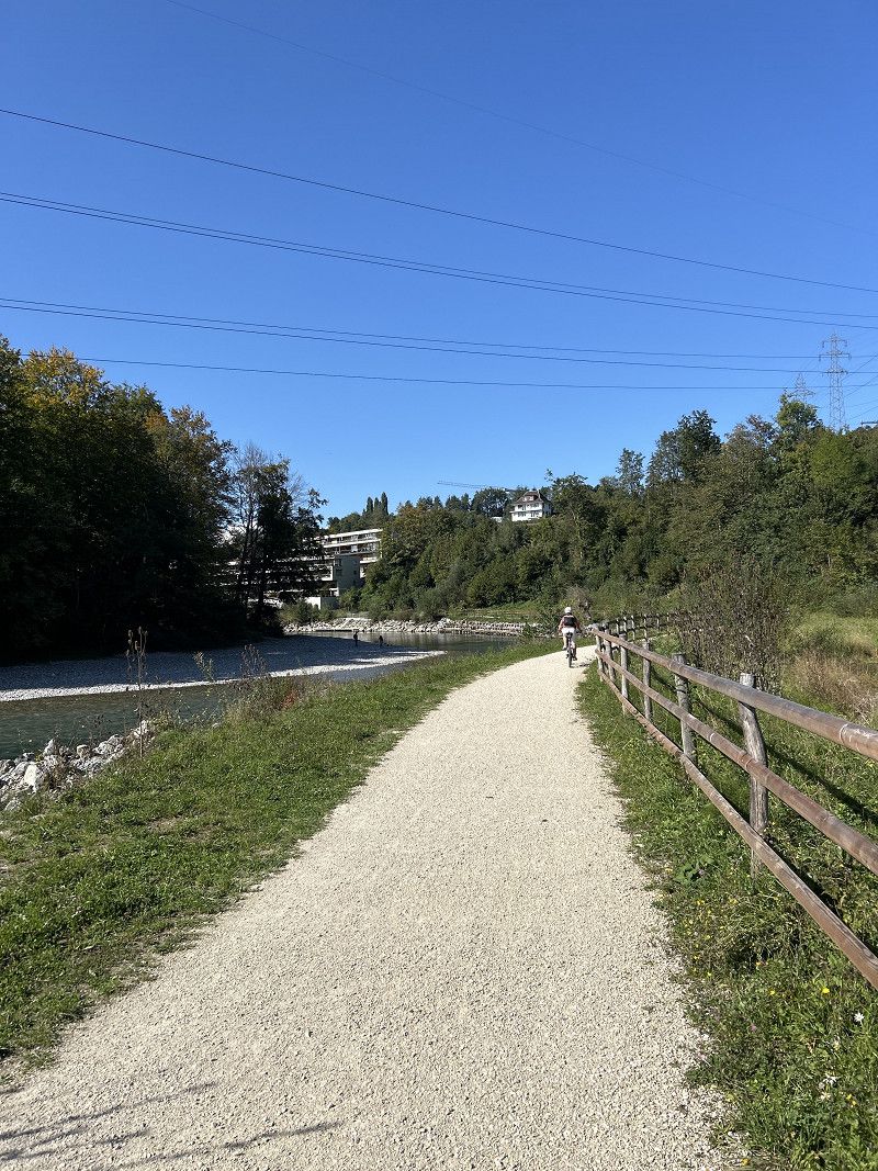
Bern City und entlang der Aare
A must see: the capital of Switzerland.
It's wonderful by bike.
https://www.komoot.com/de-DE/tour/1871194437?ref=itd
Laubeggstrasse, Bern, Verwaltungskreis Bern-Mittelland, Bern, Schweiz
46° 57' 7.1" N 7° 27' 37.1" E
46.9519684 7.4603014
• Head toward Reiterstrasse on Laubeggstrasse (6). Go for 1.2 km.
• Continue on Freudenbergerplatz. Go for 36 m.
• Take ramp onto A6 (Sonnenhof Tunnel) toward Interlaken/Thun. Go for 35.4 km.
• Take ramp onto A6 toward Adelboden/Frutigen. Go for 24.8 km.
• Turn right onto A6. Go for 79 m.
• Take the Lötschbergtunnel car shuttle train. Stay on for 17.2 km.
• Head toward Hauptstrasse. Go for 14 m.
• Turn left onto Hauptstrasse. Go for 373 m.
• Turn right onto A6. Go for 9.9 km.
• Take the 1st exit from roundabout onto Kantonsstrasse (E62) toward Simplon. Go for 330 m.
• Take the 1st exit from Kreisel Schnydrigen roundabout onto Kantonsstrasse (E62) toward Simplon/Brig. Go for 192 m.
• Turn left and take ramp onto A9 toward Simplon/Brig. Go for 10.9 km.
• Take the exit onto Visperautunnel. Go for 2.5 km.
• Continue on Kesswilweg. Go for 89 m.
• Continue on Kantonsstrasse. Go for 289 m.
• Take the 1st exit from roundabout onto Kantonsstrasse. Go for 966 m.
• Continue on Milachru. Go for 2.5 km.
• Continue on Chinegga-Brücke. Go for 1.3 km.
• Take the 2nd exit from roundabout onto Illas. Go for 823 m.
• Continue on Tunnel Stägjitschugge. Go for 2.3 km.
• Continue on Kantonsstrasse. Go for 1.1 km.
• Continue on Grossberg. Go for 3.1 km.
• Take the 2nd exit from roundabout onto Grächenstrasse. Go for 115 m.
• Continue on Eye. Go for 536 m.
• Continue on Eye. Go for 587 m.
• Take the 2nd exit from roundabout onto Rittinen. Go for 5.0 km.
• Continue on Längmatten. Go for 870 m.
• Continue on Breitmatten. Go for 2.9 km.
• Take the 1st exit from roundabout onto Kantonsstrasse. Go for 521 m.
• Continue on Moos. Go for 274 m.
• Continue on Flurstrasse. Go for 370 m.
• Continue on Nikolaital. Go for 436 m.
• Continue on Kantonsstrasse. Go for 344 m.
• Continue on Dorf. Go for 1.9 km.
• Take the 2nd exit from roundabout onto Kantonsstrasse. Go for 102 m.
• Continue on Neue Kantonsstrasse. Go for 120 m.
• Continue on Neue Kantonsstrasse. Go for 356 m.
• Enter the roundabout. Go for 11 m.
• Arrive at your destination.
☍
129,7 km
(2 hrs. 25 min.)
Day
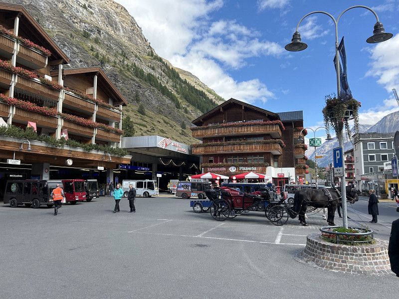
Zermatt
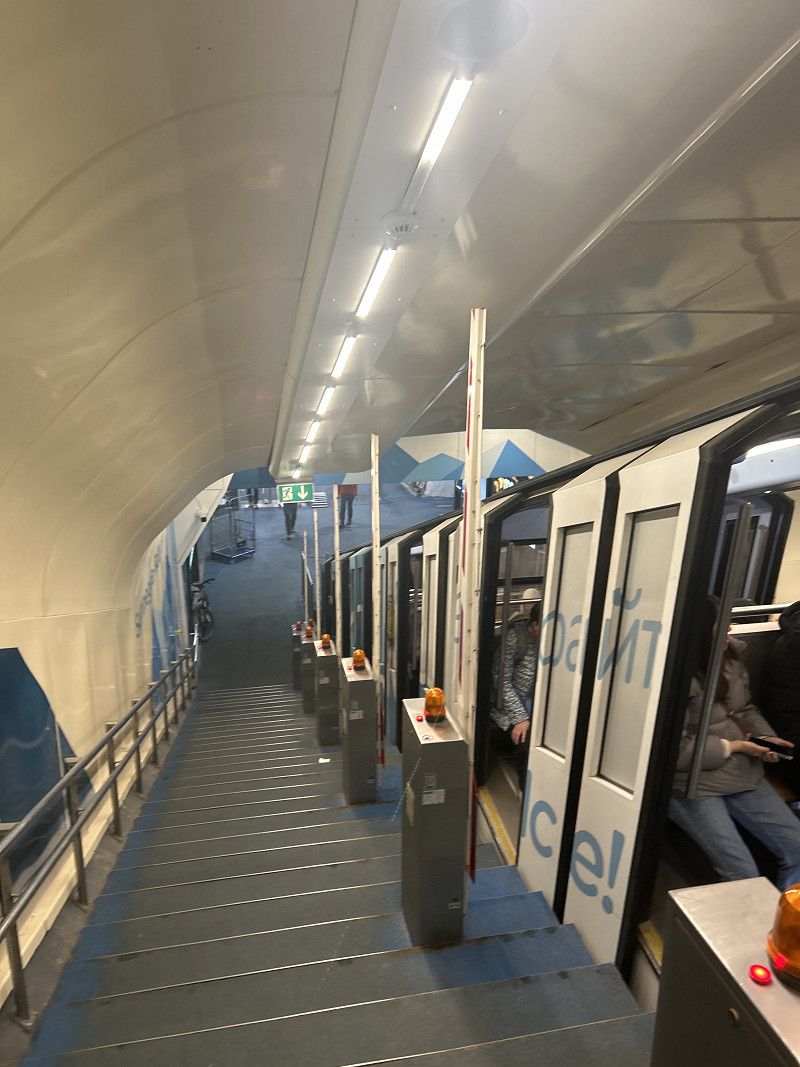
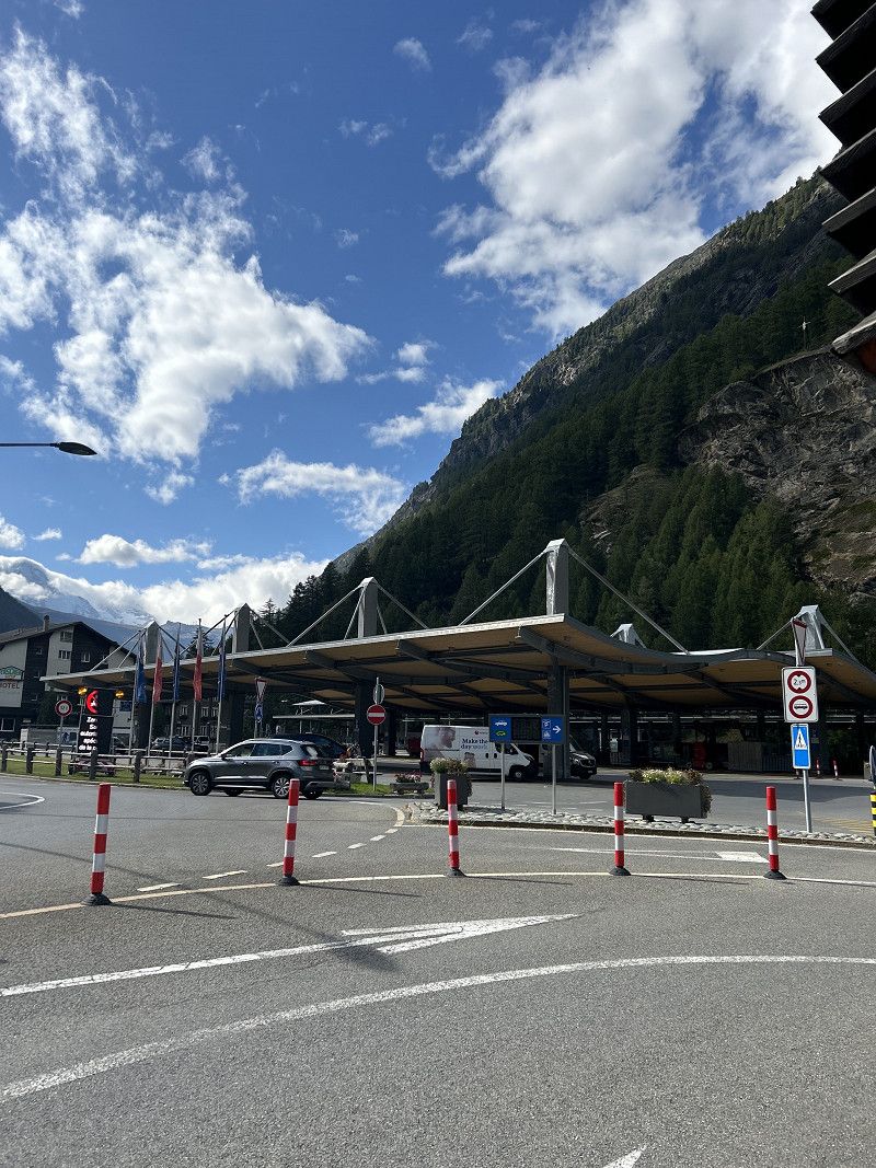
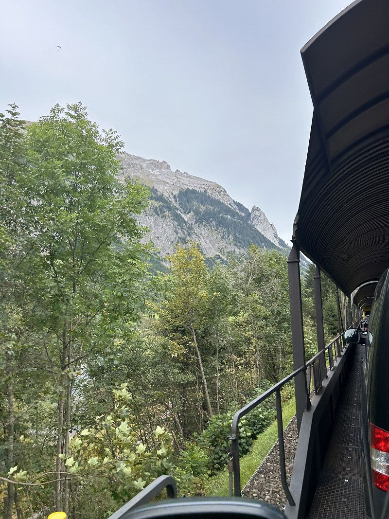
Zermatt is car-free for tourists and can be reached by train from Täsch.
Uphill with the Sunnegga cable car - downhill with the monster scooter.
PS: Our recommendation - realized too late, we went both directions with the cable car.
34CHF (up and down) and 17CHF for the Blaukopfbahn.
The scooters would be 17CHF.
Vispastrasse, Zermatt, Visp, Wallis, Switzerland
46° 1' 19.5" N 7° 45' 5.9" E
46.0220856 7.7516443
• Follow the roundabout. Go for 21 m.
• Take the 2nd exit from roundabout onto Dorf. Go for 356 m.
• Continue on Dorf. Go for 120 m.
• Continue on Kantonsstrasse. Go for 72 m.
• Take the 2nd exit from roundabout onto Kantonsstrasse. Go for 143 m.
• Turn right toward Martinsweg. Go for 7 m.
• Continue on Martinsweg. Go for 67 m.
• Arrive at Martinsweg. Your destination is on the right.
☍
0,8 km
( 1 min.)
Täsch und Bahnhof nach Zermatt
Train ticket 17 and parking 20CHF.
But it is very comfortable.
Kantonsstrasse, Täsch, Visp, Wallis, Switzerland
46° 4' 7.8" N 7° 46' 37.3" E
46.0688230 7.7770239
• Head southwest on Martinsweg. Go for 74 m.
• Turn left onto Kantonsstrasse. Go for 121 m.
• Take the 2nd exit from roundabout onto Kantonsstrasse. Go for 102 m.
• Continue on Neue Kantonsstrasse. Go for 120 m.
• Continue on Neue Kantonsstrasse. Go for 356 m.
• Enter the roundabout. Go for 11 m.
• Arrive at your destination.
☍
0,8 km
( 2 min.)
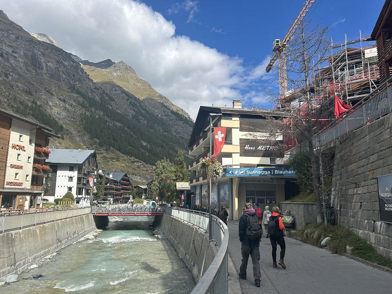
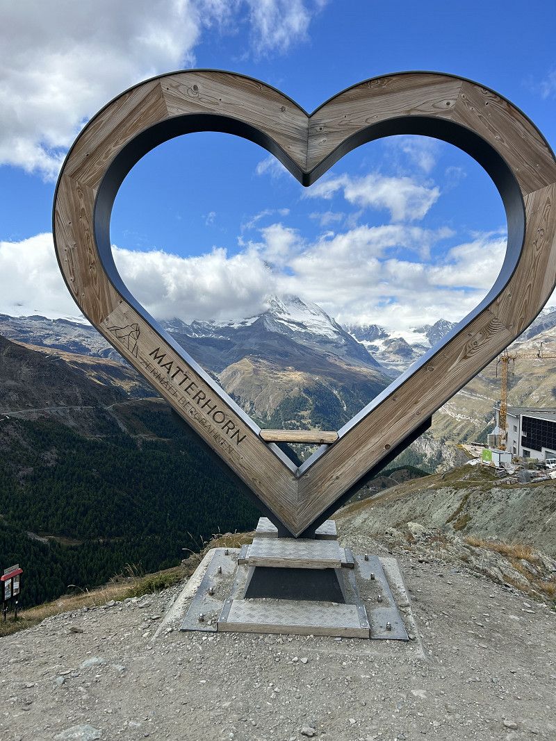
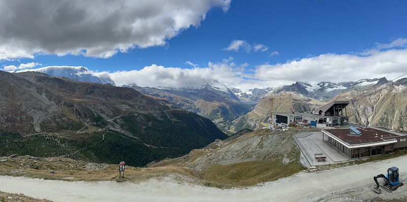
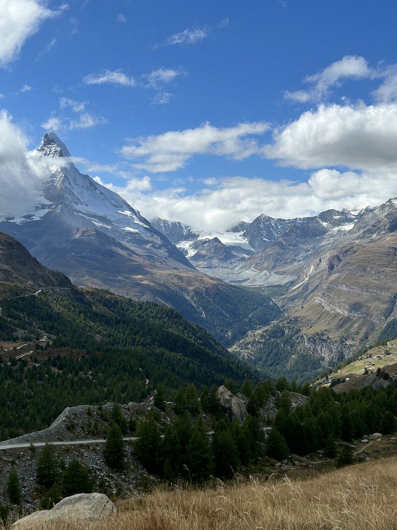
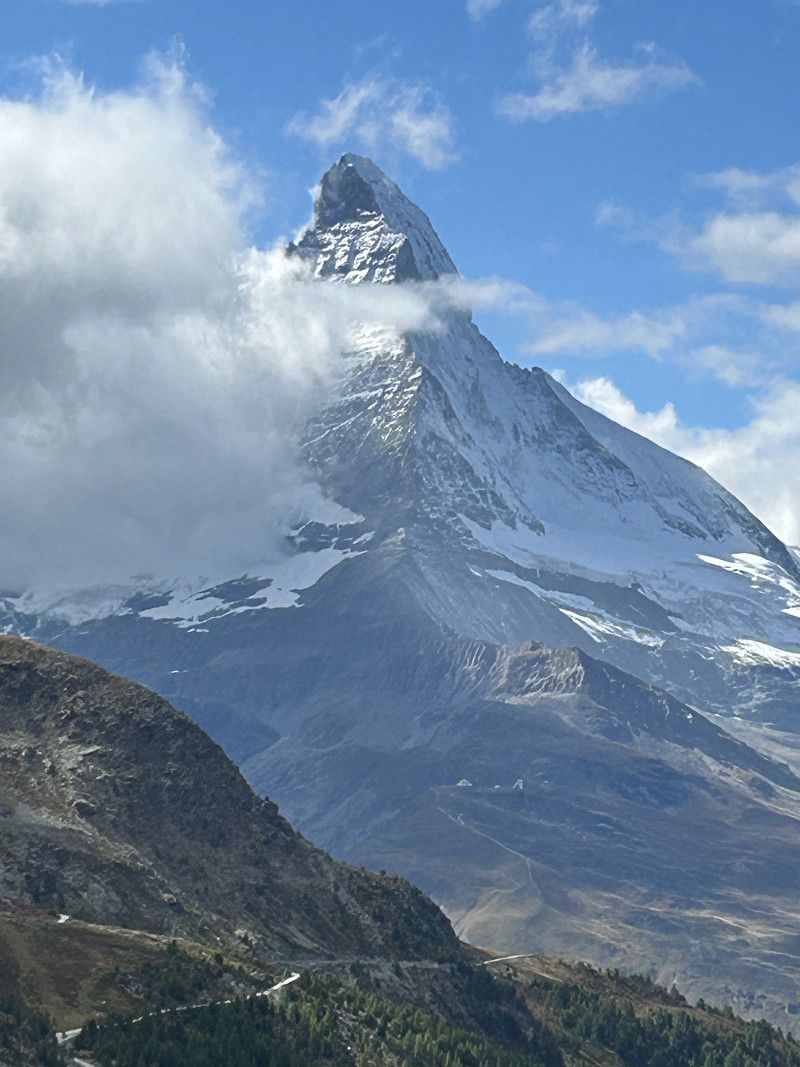
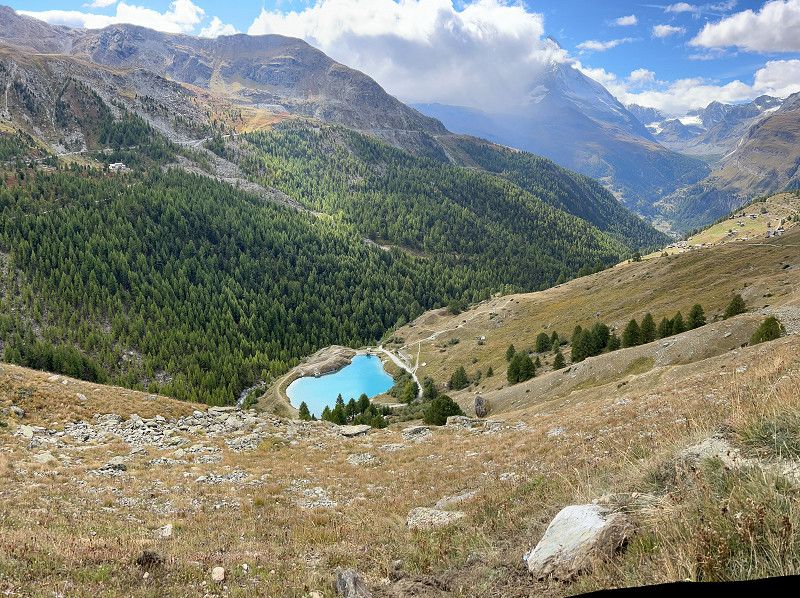
Sunnegga vis-à-vis vom Matterhorn
A must on the Grand Tour and for us the highlight.
Sunnegga Trail Zermatt, Zermatt, Visp, Wallis, Switzerland
46° 1' 1.2" N 7° 46' 12.2" E
46.0170104 7.7700622
• Follow the roundabout. Go for 21 m.
• Take the 2nd exit from roundabout onto Dorf. Go for 356 m.
• Continue on Dorf. Go for 120 m.
• Continue on Kantonsstrasse. Go for 72 m.
• Take the 2nd exit from roundabout onto Kantonsstrasse. Go for 2.1 km.
• Continue on Kantonsstrasse. Go for 308 m.
• Continue on Nikolaital. Go for 287 m.
• Continue on Flurstrasse. Go for 603 m.
• Continue on Moos. Go for 304 m.
• Continue on Kantonsstrasse. Go for 223 m.
• Take the 2nd exit from roundabout. Go for 2.8 km.
• Continue on Breitmatten. Go for 359 m.
• Continue on Längmatten. Go for 622 m.
• Continue on Talstrasse. Go for 4.9 km.
• Take the 1st exit from roundabout. Go for 608 m.
• Continue on Eye. Go for 371 m.
• Continue on Eye. Go for 171 m.
• Continue on Grächenstrasse. Go for 85 m.
• Take the 1st exit from roundabout onto Feld. Go for 3.2 km.
• Continue on Kantonsstrasse. Go for 1.1 km.
• Continue on Tunnel Stägjitschugge. Go for 2.3 km.
• Continue on Kantonsstrasse. Go for 794 m.
• Take the 2nd exit from roundabout. Go for 1.0 km.
• Continue on Chinegga-Brücke. Go for 295 m.
• Continue on Hauptstrasse. Go for 3.4 km.
• Take the 1st exit from roundabout onto Kantonsstrasse. Go for 324 m.
• Keep right onto Kantonsstrasse toward Simplon Brig/Visp. Go for 419 m.
• Continue on Talstrasse. Go for 1.6 km.
• Take the 1st exit from roundabout onto Talstrasse toward Lausanne/Sion Brig/Visp. Go for 1.7 km.
• Take the 3rd exit from roundabout onto Kantonsstrasse (9). Go for 110 m.
• Turn right toward Mühleye. Go for 107 m.
• Turn right onto Mühleye. Go for 375 m.
• Turn slightly right onto Sonnenstrasse. Go for 277 m.
• Turn right. Go for 56 m.
• Arrive at your destination on the right.
☍
31,3 km
( 34 min.)
Camping & Schwimmbad Mühleye
End point of the perfect day.
Mühleye 7, 3930, Visp, Switzerland
46° 17' 53.1" N 7° 52' 22.2" E
46.2980800 7.8728300
• Head toward Sonnenstrasse. Go for 56 m.
• Turn sharp right onto Sonnenstrasse. Go for 360 m.
• Continue on Rosenweg. Go for 108 m.
• Turn left toward Visp West. Go for 312 m.
• Take the 1st exit from Kreisel Wehreya roundabout onto Visp West. Go for 247 m.
• Take ramp onto A9 toward Lausanne/Sion. Go for 8.4 km.
• Take exit 31 toward Gampel-Steg/Lötschberg. Go for 465 m.
• Take the 2nd exit from Kreisel Schnydrigen roundabout onto Kantonsstrasse (E62) toward Lötschberg/Gampel-Steg/Turtmann/Lausanne/Sion. Go for 344 m.
• Take the 2nd exit from roundabout onto Bahnhofstrasse (A6) toward Lötschberg/Lötschental. Go for 10.8 km.
• Continue on Hauptstrasse. Go for 303 m.
• Continue straight ahead. Go for 14 m.
• Take the Lötschbergtunnel car shuttle train. Stay on for 17.2 km.
• Head north on A6. Go for 169 m.
• Turn right onto Bahnhofstrasse. Go for 60 m.
• Turn right onto Eisbahnweg. Go for 216 m.
• Arrive at Eisbahnweg.
☍
39,2 km
(1 hrs. 12 min.)
Day
Eisbahnweg
Suddenly the voice on the sat nav says, “Take the train.” 34CHF and we take the train.
Verwaltungskreis Frutigen-Niedersimmental, Bern, Schweiz
46° 29' 36.1" N 7° 40' 13.4" E
46.4933666 7.6703859
• Head toward Bahnhofstrasse on Eisbahnweg. Go for 216 m.
• Turn left onto Bahnhofstrasse. Go for 60 m.
• Turn slightly right onto A6. Go for 5.7 km.
• Turn left onto Blausee. Go for 333 m.
• Arrive at Blausee. Your destination is on the left.
☍
6,3 km
( 8 min.)
Blausee
Schweiz
46° 31' 56.7" N 7° 39' 53.5" E
46.5324219 7.6648521
• Head toward Kanderstegstrasse on Blausee. Go for 333 m.
• Turn left onto Kanderstegstrasse (A6). Go for 5.8 km.
• Keep left onto Lötschbergstrasse (A6). Go for 7.3 km.
• Turn right onto Aeschistrasse toward Mülenen-Dorf/Gewerbezone Chappelengand. Go for 781 m.
• Continue on Mülenenstrasse. Go for 1.9 km.
• Take the 2nd exit from roundabout onto Alleestrasse. Go for 581 m.
• Continue on Krattigenstrasse. Go for 1.1 km.
• Continue on Aeschistrasse. Go for 578 m.
• Continue on Dorfstrasse. Go for 649 m.
• Continue on Leissigenstrasse. Go for 1.6 km.
• Continue on Mad. Go for 877 m.
• Continue on Hauptstrasse. Go for 641 m.
• Turn right onto Hauptstrasse (6/11). Go for 1.7 km.
• Turn right and take ramp onto A8 toward Interlaken. Go for 7.4 km.
• Take exit 25 toward Grindelwald/Lauterbrunnen/Matten. Go for 267 m.
• Take the 2nd exit from roundabout. Go for 334 m.
• Continue on Umfahrung Wilderswil. Go for 230 m.
• Continue on Umfahrung Wilderswil. Go for 1.4 km.
• Take the 2nd exit from roundabout. Go for 238 m.
• Continue on Tschingelmatta. Go for 162 m.
• Continue on Bir Sagi. Go for 3.2 km.
• Continue on Feldli. Go for 402 m.
• Turn left toward Alte Post. Go for 70 m.
• Continue on Alte Post. Go for 3.1 km.
• Continue on Tschingeley. Go for 832 m.
• Continue on Briggmättli. Go for 231 m.
• Continue on Riedermätteli. Go for 429 m.
• Continue on Gadenstatt. Go for 208 m.
• Continue on Lindi. Go for 310 m.
• Continue on In der Ey. Go for 287 m.
• Continue on Stalden. Go for 747 m.
• Continue on Grindelwaldstrasse. Go for 4.2 km.
• Take the 1st exit from roundabout onto Grundstrasse. Go for 396 m.
• Turn left. Go for 145 m.
• Arrive at your destination on the left.
☍
48,4 km
( 49 min.)
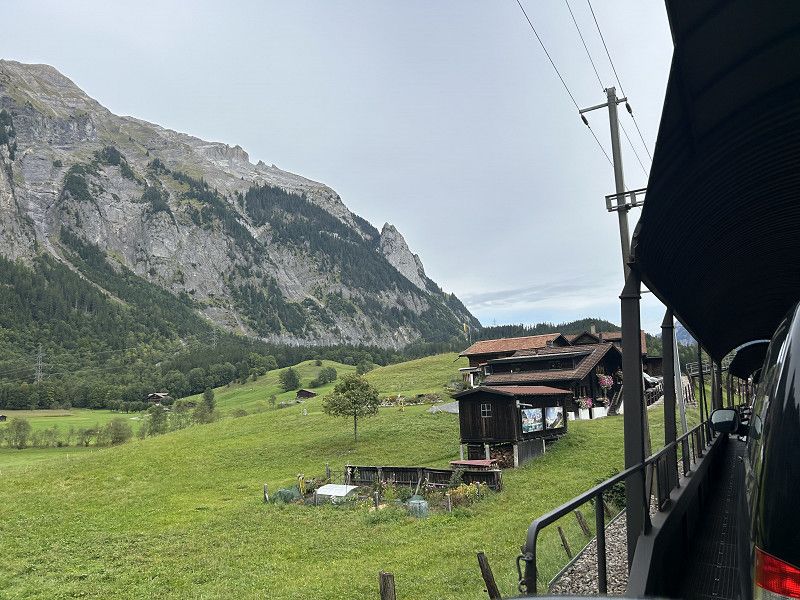
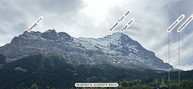
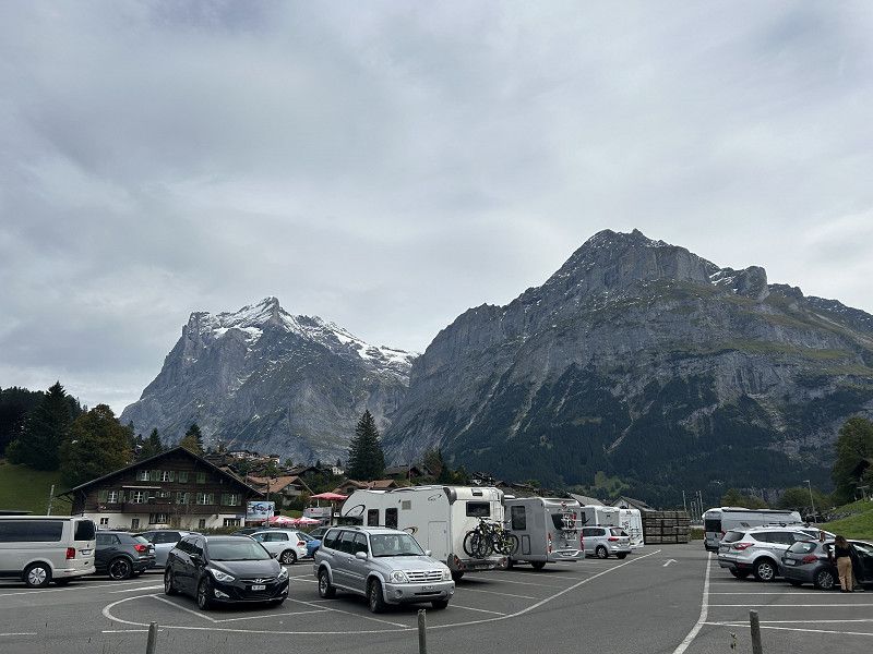
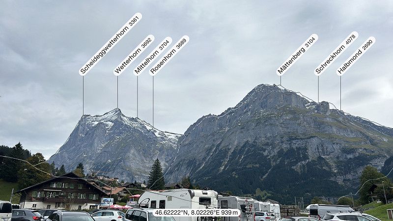
Grindelwald
Very cool - perfect view of the Eiger.
The price of the train journeys - extremely expensive.
E-bike is recommended
Grundstrasse 59a, Grindelwald, Interlaken-Oberhasli administrative district, Bern, Switzerland
46° 37' 22.5" N 8° 1' 26" E
46.6229217 8.0238963
• Head toward Grundstrasse. Go for 38 m.
• Turn left toward Grundstrasse. Go for 107 m.
• Turn right onto Grundstrasse. Go for 404 m.
• Take the 2nd exit from roundabout onto Grindelwaldstrasse. Go for 4.3 km.
• Continue on Ey. Go for 739 m.
• Continue on In der Ey. Go for 270 m.
• Continue on Lindi. Go for 406 m.
• Continue on Gadenstatt. Go for 173 m.
• Continue on Riedermätteli. Go for 314 m.
• Continue on Im Mätteli. Go for 714 m.
• Continue on Tschingeley. Go for 1.9 km.
• Continue on Hauptstrasse. Go for 1.6 km.
• Turn left toward Sandweidli. Go for 1.8 km.
• Continue on Sandweidli. Go for 1.0 km.
• Continue on Lochbrücke. Go for 52 m.
• Continue on Schmitsmatte. Go for 234 m.
• Continue on Schmiedsmatte. Go for 393 m.
• Continue on Tripfi. Go for 109 m.
• Continue on Bei der Zuben. Go for 149 m.
• Continue on Station. Go for 178 m.
• Continue on Greifenbach. Go for 206 m.
• Continue on Auf der Fuhren. Go for 197 m.
• Continue on Beim Alten Schulhaus. Go for 122 m.
• Arrive at Im Rohr.
☍
15,4 km
( 20 min.)
Lauterbrunnen
People upon people - poor place.
No real view of Eger Mönch and Jungfrau.
222 423, Wengen, Interlaken-Oberhasli administrative district, Bern, Switzerland
46° 35' 33.7" N 7° 54' 27.8" E
46.5926948 7.9077179
• Head toward Beim Pfrundhaus on Im Rohr. Go for 122 m.
• Continue on Auf der Fuhren. Go for 197 m.
• Continue on Auf der Fuhren. Go for 206 m.
• Continue on Bei der Zuben. Go for 178 m.
• Continue on Tripfi. Go for 149 m.
• Continue on Tripfi. Go for 109 m.
• Continue on Schmiedsmatte. Go for 393 m.
• Continue on Schmitsmatte. Go for 905 m.
• Continue on Sandweidli. Go for 2.5 km.
• Continue on Feldli. Go for 2.9 km.
• Continue on Bir Sagi. Go for 546 m.
• Continue on Tschingelmatta. Go for 201 m.
• Take the 1st exit from roundabout onto Umfahrung Wilderswil. Go for 1.6 km.
• Continue on Umfahrung Wilderswil. Go for 356 m.
• Take the 2nd exit from roundabout. Go for 38 m.
• Continue on Gsteigstrasse. Go for 68 m.
• Take ramp onto A8 toward Bern/Thun/Spiez/Gunten. Go for 7.5 km.
• Keep left onto A8 toward Bern/Thun/Spiez. Go for 5.1 km.
• Continue on 6/11. Go for 18 m.
• Continue on A8. Go for 608 m.
• Take ramp onto Interlakenstrasse (6/11) toward Spiez/Faulensee. Go for 1.8 km.
• Arrive at Interlakenstrasse (6/11). Your destination is on the right.
☍
25,7 km
( 25 min.)
Restaurant Hecht
Interlakenstrasse 85, Faulensee, Verwaltungskreis Frutigen-Niedersimmental, Bern, Schweiz
46° 40' 27.3" N 7° 42' 11.3" E
46.6742395 7.7031403
• Head north on Interlakenstrasse (6/11). Go for 2.5 km.
• Take the 2nd exit from roundabout onto Oberlandstrasse (6/11). Go for 811 m.
• Take the 2nd exit from roundabout onto Simmentalstrasse (11). Go for 544 m.
• Take the 2nd exit from roundabout onto A6 toward Bern/Thun/Zweisimmen. Go for 38.1 km.
• Take exit 37 toward Lausanne/Fribourg/Bern-Neufeld/Bern-Wankdorf/Ostermundigen/Bolligen onto A1 (Wankdorf). Go for 99.9 km.
• Continue on A1. Go for 2.7 km.
• Take the exit toward Genève onto A1. Go for 50.3 km.
• Keep left onto A1a toward Genève-Lac/Evian. Go for 1.5 km.
• Take exit 2 toward Genève-Lac/Evian onto 1 (Route de Lausanne). Go for 3.2 km.
• Turn left onto Avenue de France. Go for 284 m.
• Continue on Quai Wilson. Go for 598 m.
• Continue on Quai du Mont-Blanc. Go for 653 m.
• Turn left onto Pont du Mont-Blanc. Go for 396 m.
• Continue on Quai du Général-Guisan toward Thonon/Evian/Annemasse/Chamonix. Go for 216 m.
• Turn left onto Quai Gustave-Ador toward Thonon/Evian. Go for 1.8 km.
• Continue on Quai de Cologny toward Thonon/Evian. Go for 2.3 km.
• Continue on Route de Thonon. Go for 1.1 km.
• Keep right onto Route de Thonon toward Collonge/Vésenaz. Go for 337 m.
• Take the 3rd exit from roundabout onto Route d'Hermance. Go for 424 m.
• Turn left onto Chemin de Sous-Caran. Go for 241 m.
• Turn left onto Chemin de la Bise. Go for 339 m.
• Turn left. Go for 27 m.
• Arrive at your destination on the left.
☍
208,2 km
(2 hrs. 6 min.)
TCS Camping Genf Vésenaz
End of day!
Plan for 2 - 3 nights with visit to Geneva and bike tour.
Chemin de la Bise, 1222, Vésenaz, Schweiz
46° 14' 43.9" N 6° 11' 34" E
46.2455300 6.1927900
• Head west. Go for 26 m.
• Turn right toward Chemin de la Bise. Go for 162 m.
• Continue on Chemin de la Bise. Go for 289 m.
• Turn right onto Chemin de Sous-Caran. Go for 241 m.
• Turn right onto Route d'Hermance. Go for 372 m.
• Take the 1st exit from roundabout onto Route de Thonon. Go for 1.4 km.
• Continue on Quai de Cologny. Go for 2.3 km.
• Continue on Quai Gustave-Ador. Go for 1.8 km.
• Arrive at Quai Gustave-Ador. Your destination is on the right.
☍
6,6 km
( 9 min.)
Day
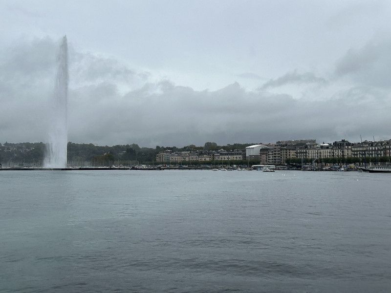
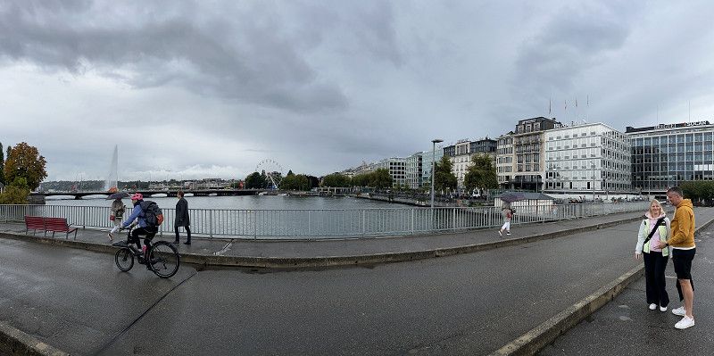
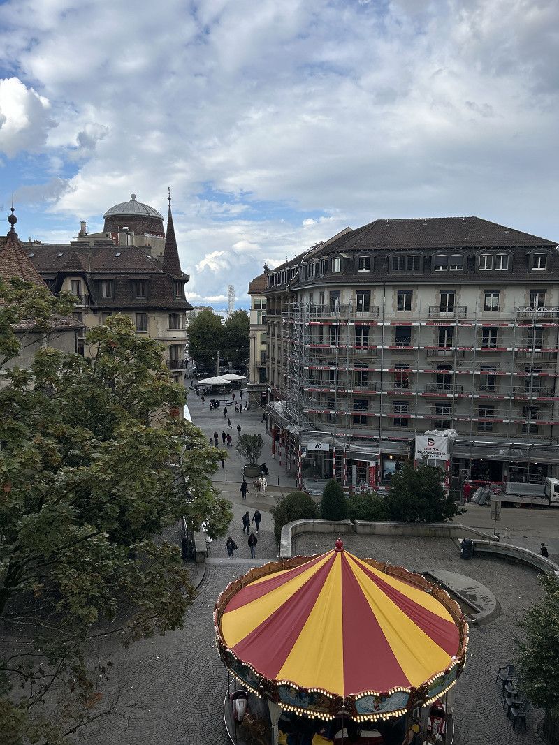
Genf
Very crowded and a big city different from Zurich, Bern and Lucerne.
Home of brands from the fashion and watch world.
https://www.komoot.com/de-DE/tour/1878652806?ref=itd&share_token=arpqD5fV9Flowlm6kz7fkCB2wb0wXwugINBSaw2l51eqMA6ToT
Promenade du Lac, Geneva, Geneva, Switzerland
46° 12' 14.8" N 6° 9' 9.4" E
46.2041153 6.1526132
• Head southwest on Quai Gustave-Ador.
• Turn right onto Quai du Général-Guisan. Go for 216 m.
• Turn slightly left toward Thonon/Evian. Go for 32 m.
• Turn left onto Place du Port toward Thonon/Evian. Go for 38 m.
• Turn right onto Rue du Rhône toward Thonon/Evian. Go for 76 m.
• Turn right onto Rue Robert-Céard toward Thonon/Evian. Go for 38 m.
• Turn right onto Quai du Général-Guisan toward Thonon/Evian. Go for 107 m.
• Turn slightly right onto Quai du Général-Guisan toward Thonon/Evian. Go for 216 m.
• Turn left onto Quai Gustave-Ador toward Thonon/Evian. Go for 1.8 km.
• Continue on Quai de Cologny toward Thonon/Evian. Go for 2.3 km.
• Continue on Route de Thonon. Go for 1.1 km.
• Keep left onto Tunnel de Vésenaz toward Thonon/La Pallanterie. Go for 777 m.
• Continue on Route de Thonon. Go for 438 m.
• Take the 2nd exit from roundabout onto Route de Thonon. Go for 906 m.
• Take the 3rd exit from roundabout onto Route de Thonon toward Thonon/Evian/Hôpital Bellerive. Go for 1.9 km.
• Take the 2nd exit from roundabout onto Route de Thonon. Go for 1.6 km.
• Continue on Avenue de Genève (N5). Go for 524 m.
• Pass 8 roundabouts and continue on Avenue de la Rive (D1005). Go for 28.9 km.
• Arrive at Avenue de la Rive (D1005). Your destination is on the right.
☍
40,8 km
( 41 min.)
Day
Evian Genfer See - Frankreich
Avenue de la Rive 1909, Amphion-les-Bains, Upper Savoy, Auvergne-Rhône-Alpes, France
46° 23' 41.9" N 6° 33' 3.8" E
46.3949610 6.5510516
• Head toward Résidence Bellevue on Avenue de la Rive (D1005). Go for 1.7 km.
• Pass 4 roundabouts and continue on Quai Paul Léger (D1005). Go for 18.7 km.
• Continue on N5. Go for 15 m.
• Continue on Route Cantonale (21). Go for 4.7 km.
• Pass 2 roundabouts and continue on Route Cantonale (21). Go for 1.9 km.
• Turn left onto Route Cantonale (21). Go for 917 m.
• Arrive at Route Cantonale (21). Your destination is on the left.
☍
27,9 km
( 30 min.)
Offizielles WC
Route Cantonale 51, Port-Valais, Monthey, Wallis, Switzerland
46° 21' 44" N 6° 52' 38.7" E
46.3622215 6.8774151
• Head southeast on Route Cantonale (21). Go for 507 m.
• Take the 3rd exit from roundabout onto 144 toward Lausanne/Montreux/Aigle/Villeneuve. Go for 2.3 km.
• Take the 1st exit from roundabout onto 144 toward Aigle/Villeneuve. Go for 2.0 km.
• Turn right onto 9 toward Villeneuve. Go for 569 m.
• Take the 2nd exit from roundabout onto 9 toward Lausanne/Montreux. Go for 517 m.
• Turn left and take ramp onto A9 toward Simplon/Gd-St-Bernard. Go for 76.5 km.
• Continue on E62. Go for 6.7 km.
• Pass 3 roundabouts and continue on Kantonsstrasse (E62). Go for 1.1 km.
• Take the 3rd exit from Kreisel Roschätte roundabout onto Kantonsstrasse (E62) toward Simplon/Brig. Go for 917 m.
• Continue on A9. Go for 5.7 km.
• Take the exit. Go for 355 m.
• Take the 2nd exit from Kreisel Tenne roundabout onto Kantonsstrasse (E62) toward Simplon/Brig/Lötschberg/Gampel/Steg. Go for 788 m.
• Pass 2 roundabouts and continue on Kantonsstrasse (E62). Go for 533 m.
• Turn left and take ramp onto A9 toward Simplon/Brig. Go for 19.5 km.
• Keep left onto A9 toward Brig-Glis/Furka/Grimsel/Nufenen/Simplon. Go for 201 m.
• Take the 3rd exit from roundabout onto Überlandstrasse (19) toward Furka/Grimsel/Nufenen/Brig/Naters/Simplon. Go for 1.4 km.
• Keep left onto 19 toward Furka/Grimsel/Nufenen/Simplon/Naters. Go for 3.5 km.
• Pass 4 roundabouts and continue on Furkastrasse (19). Go for 16.3 km.
• Arrive at Furkastrasse (19). Your destination is on the left.
☍
139,3 km
(1 hrs. 30 min.)
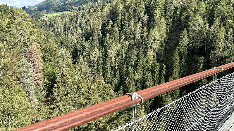
Goms Bridge
Suspension bridge Fürgang - Mühlebach
Furkastrasse, Bellwald, Goms, Wallis, Switzerland
46° 24' 37.8" N 8° 9' 1.9" E
46.4104900 8.1505262
• Head northeast on Furkastrasse (19). Go for 14.5 km.
• Turn right onto Kapellenweg. Go for 69 m.
• Arrive at Kapellenweg. Your destination is on the right.
☍
14,6 km
( 14 min.)
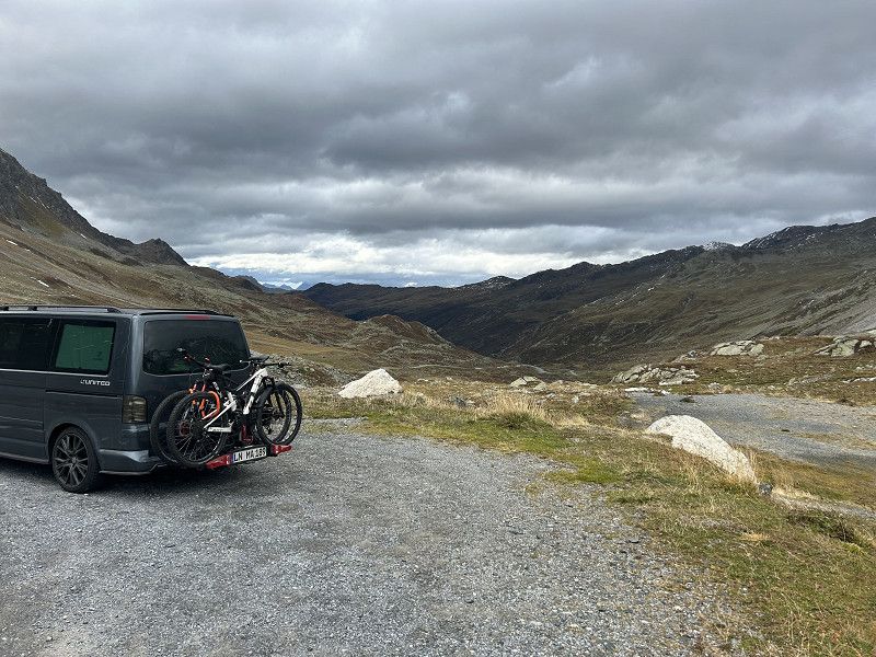
Cooles Panorama - Nufenenpass
Geschinerweg 10, Goms, Goms, Wallis, Switzerland
46° 29' 42.7" N 8° 16' 51.7" E
46.4951901 8.2810388
• Head east on Kapellenweg. Go for 44 m.
• Turn left toward Furkastrasse/19. Go for 101 m.
• Turn right onto Furkastrasse (19). Go for 2.4 km.
• Turn right onto Nufenenstrasse (413) toward Airolo/Nufenen. Go for 35.8 km.
• Turn left toward San Gottardo. Go for 199 m.
• Continue on A2. Go for 226 m.
• Take the 1st exit from roundabout onto A2 toward Milano/Lugano/Bellinzona. Go for 59.0 km.
• Take exit 47 toward Locarno onto 2 (In Tirada). Go for 4.6 km.
• Pass 5 roundabouts and continue on Via Monte Ceneri (406). Go for 4.3 km.
• Keep right onto 406. Go for 1.8 km.
• Take the 2nd exit from roundabout onto A13. Go for 2.3 km.
• Take ramp toward Valle Verzasca/Tenero. Go for 255 m.
• Take the 2nd exit from roundabout onto Via delle Ressighe. Go for 700 m.
• Take the 3rd exit from roundabout. Go for 63 m.
• Continue on Via Naviglio. Go for 189 m.
• Turn slightly right onto Via Naviglio. Go for 64 m.
• Continue on Via Roncaccio. Go for 170 m.
• Arrive at Via Roncaccio. Your destination is on the left.
☍
112,3 km
(1 hrs. 28 min.)
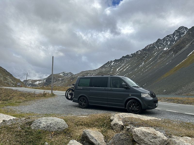
Camping-Rivabella
Visiting Lagos Maggiore after a great ride over the Nufenen Pass.
Via Naviglio 11, Tenero, Distretto di Locarno, Ticino, Switzerland
46° 10' 18.2" N 8° 50' 48.3" E
46.1717117 8.8467470
• Head northeast on Via Roncaccio. Go for 170 m.
• Continue on Via Naviglio. Go for 264 m.
• Take the 1st exit from roundabout onto Via delle Ressighe. Go for 678 m.
• Take the 2nd exit from roundabout onto A13 toward Locarno. Go for 1.1 km.
• Keep left onto A13 toward Brissago/Ascona/Locarno. Go for 5.9 km.
• Keep left onto Galleria Mappo Morettina (A13) toward Brissago/Centovalli/Ascona/Maggia/Onsernone. Go for 1.2 km.
• Keep left onto A13 toward Italia/Brissago/Ascona. Go for 197 m.
• Continue on 13. Go for 2.2 km.
• Turn right onto Via Collinetta. Go for 1.2 km.
• Turn right onto Via Rondonico. Go for 362 m.
• Arrive at Via Rondonico.
☍
13,3 km
( 15 min.)
Day
Ascona - Grand Tour
Time for a wheat
Very cool, manageable little town on the lake.
https://www.komoot.com/de-DE/tour/1881538024?ref=itd
Via Moscia, Ascona, Distretto di Locarno, Ticino, Switzerland
46° 9' 17" N 8° 45' 59.5" E
46.1547224 8.7665249
• Head west on Via Rondonico. Go for 58 m.
• Turn slightly right onto Via Rondonico. Go for 304 m.
• Turn left onto Via Collinetta. Go for 651 m.
• Turn slightly right onto Via Collinetta. Go for 430 m.
• Turn slightly right onto Strada Collinetta. Go for 90 m.
• Turn left onto Via Moscia (13). Go for 2.4 km.
• Keep left onto A13. Go for 973 m.
• Take ramp onto 13 toward Minusio/Muralto/Locarno. Go for 759 m.
• Take the 3rd exit from Piazza Castello roundabout onto Via Giovanni Antonio Orelli (13). Go for 756 m.
• Turn left onto Lungolago Giuseppe Motta (13). Go for 322 m.
• Arrive at Viale Francesco Balli (13). Your destination is on the left.
☍
6,7 km
( 10 min.)
Marktplatz von Locarno
Pole lap with the bike and saw a lot.
https://www.komoot.com/de-DE/tour/1881538024?ref=itd
Via alla Ramogna, Locarno, Distretto di Locarno, Ticino, Switzerland
46° 10' 15.6" N 8° 47' 59" E
46.1709960 8.7997235
• Head north on Viale Francesco Balli (13). Go for 870 m.
• Turn right onto Via San Gottardo (13). Go for 2.7 km.
• Take left ramp onto A13 toward Lugano/Bellinzona. Go for 4.0 km.
• Take the 1st exit from roundabout onto 406 toward E35/E43/A2/A13/Lugano/Gambarogno/Aeroporto. Go for 1.4 km.
• Keep left onto Via Monte Ceneri (406). Go for 373 m.
• Pass 5 roundabouts and continue on Via Cantonale (406). Go for 4.3 km.
• Take the 3rd exit from roundabout onto Via San Gottardo (406). Go for 3.6 km.
• Take the 1st exit from roundabout onto In Tirada (2). Go for 213 m.
• Take ramp onto A2 toward San Gottardo/E43/San Bernardino/A13. Go for 7.5 km.
• Take exit 45 toward E43/Chur/San Bernardino/Bellinzona Nord onto A13 (Diramazione Bellinzona Nord). Go for 87.8 km.
• Take ramp toward Thusis-Süd/St. Moritz/Davos/Lenzerheide/Sils i.D. Go for 383 m.
• Continue on Tunnel Sils. Go for 1.8 km.
• Continue on 417. Go for 5.7 km.
• Turn right toward Solisbrücke. Go for 30 m.
• Continue on Solisbrücke. Go for 68 m.
• Arrive at Solisbrücke.
☍
120,6 km
(1 hrs. 34 min.)
Day
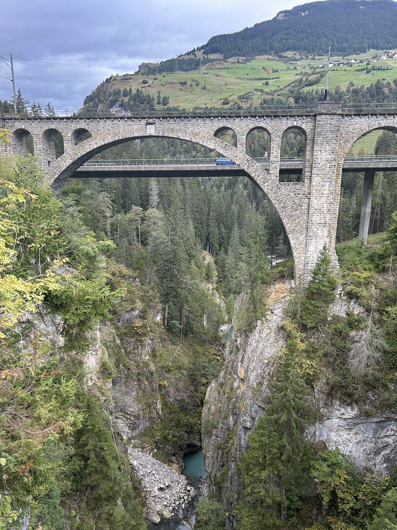
Solisbrücke
Solas Solis, Albula/Alvra, Albula, Grisons, Switzerland
46° 40' 44.1" N 9° 31' 51.2" E
46.6789270 9.5308866
• Head southwest on Solisbrücke. Go for 101 m.
• Turn right toward 417. Go for 38 m.
• Turn right onto 417. Go for 4.7 km.
• Take the 1st exit from roundabout onto 3 toward St. Moritz/Julierpass/Savognin. Go for 21.3 km.
• Turn right. Go for 32 m.
• Arrive at your destination.
☍
26,1 km
( 27 min.)
Stausee Marmorera
Veia Castigl, Surses, Albula, Grisons, Switzerland
46° 30' 37.5" N 9° 38' 1.7" E
46.5104136 9.6337947
• Head toward Julierstrasse. Go for 32 m.
• Turn right onto Julierstrasse (3). Go for 21.8 km.
• Take the 3rd exit from roundabout onto Via Chantunela (27) toward Berninapass/29/Zernez/St. Moritz. Go for 2.9 km.
• Pass 4 roundabouts and continue on Via Grevas (27). Go for 2.5 km.
• Take the 1st exit from roundabout onto Via Dimlej. Go for 67 m.
• Arrive at Via Dimlej. Your destination is on the right.
☍
27,2 km
( 30 min.)
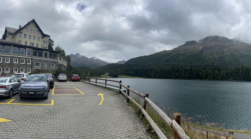
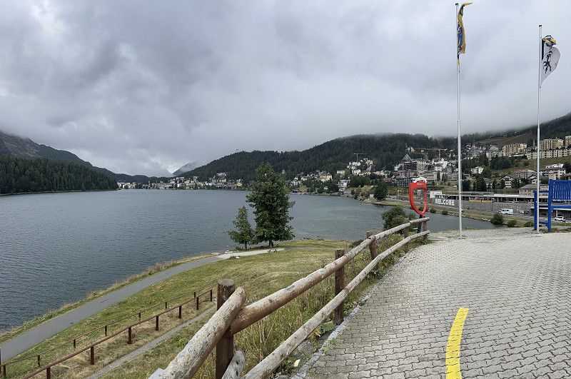
Sank Moritz
Via Dimlej, Sankt Moritz, Maloja, Grisons, Switzerland
46° 29' 50.8" N 9° 50' 52.9" E
46.4974403 9.8480348
• Head northwest on Via Dimlej. Go for 45 m.
• Take the 1st exit from roundabout onto 27. Go for 3.0 km.
• Take the 2nd exit from roundabout onto 27/29. Go for 2.1 km.
• Take the 1st exit from roundabout onto Sviamaint (27) toward Scuol/Zernez/Flughafen. Go for 347 m.
• Take the 1st exit from roundabout onto Cho d'Punt. Go for 270 m.
• Turn left onto Cho d'Punt. Go for 45 m.
• Arrive at Cho d'Punt. Your destination is on the right.
☍
5,9 km
( 6 min.)
Samaden - Aldi
Shopping and lunch at Mikros
Cho d'Punt 43, Samaden, Maloja, Graubünden, Schweiz
46° 31' 45.1" N 9° 52' 29.2" E
46.5292067 9.8747816
• Head west on Cho d'Punt. Go for 45 m.
• Turn right onto Cho d'Punt. Go for 245 m.
• Take the 1st exit from roundabout onto Sviamaint (27). Go for 4.2 km.
• Arrive at 27. Your destination is on the right.
☍
4,5 km
( 3 min.)
Staumauer Inn
Via Chantunela, La Punt Chamues-ch, Maloja, Grisons, Switzerland
46° 33' 39.1" N 9° 54' 21.4" E
46.5608748 9.9059540
• Head northeast on 27. Go for 2.5 km.
• Turn right onto Via Cumünela. Go for 41 m.
• Arrive at Via Cumünela. Your destination is on the left.
☍
2,6 km
( 2 min.)
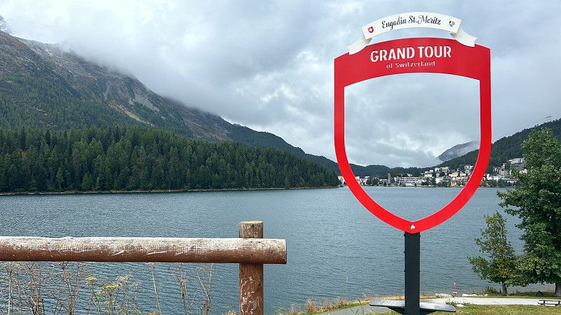
Chamues Fotopoint der Grand Tour
Via Cumünela, La Punt Chamues-ch, Maloja, Grisons, Switzerland
46° 34' 44" N 9° 55' 33.3" E
46.5788784 9.9259219
• Head toward Via d'Alvra on Via Cumünela. Go for 41 m.
• Turn right onto Via Chantunela (27). Go for 3.8 km.
• Take the 2nd exit from roundabout onto 27. Go for 22.5 km.
• Turn left onto Grava (28). Go for 17.7 km.
• Turn right. Go for 33 m.
• Arrive at your destination on the left.
☍
44,0 km
( 46 min.)
Foto Point der Grand Tour
Flüelapassstrasse, Davos, Prättigau/Davos, Grisons, Switzerland
46° 46' 47.2" N 9° 55' 44.7" E
46.7797908 9.9290858
• Head southeast. Go for 301 m.
• Turn left onto 28. Go for 4.4 km.
• Arrive at Flüelapass (28). Your destination is on the left.
☍
4,7 km
( 7 min.)
Zernez Höchste Punkt Flülerpass
Flüelapassstrasse, Zernez, Region Unterengadin/Münstertal, Graubünden, Schweiz
46° 45' 1.5" N 9° 56' 51" E
46.7504199 9.9474864
• Head toward Wägerhus on Flüelapass (28). Go for 12.7 km.
• Continue on Flüelastrasse (417). Go for 97 m.
• Turn left onto Bahnhofstrasse (417). Go for 360 m.
• Turn right onto Bahnhofstrasse (417). Go for 1.8 km.
• Arrive at Promenade (417). Your destination is on the right.
☍
15,0 km
( 18 min.)
Davos
Promenade 87, Davos, Prättigau/Davos, Grisons, Switzerland
46° 47' 58.7" N 9° 49' 30.7" E
46.7996376 9.8251990
• Head southwest on Promenade (417). Go for 345 m.
• Turn left onto Tobelmühlestrasse. Go for 303 m.
• Turn left onto Talstrasse (417). Go for 1.9 km.
• Turn right onto Bahnhofstrasse (417). Go for 386 m.
• Keep middle onto Bahnhofstrasse (417). Go for 14.8 km.
• Pass 2 roundabouts and continue on 28. Go for 26.6 km.
• Continue on Karlihof. Go for 492 m.
• Continue on Ragazerstrasse (3/13). Go for 404 m.
• Take ramp onto A13 toward Zürich/St. Margrethen. Go for 3.8 km.
• Take exit 13 toward Maienfeld/Bad Ragaz. Go for 406 m.
• Turn right toward Insel. Go for 584 m.
• Continue on Insel. Go for 197 m.
• Turn left onto Aeuli (28). Go for 442 m.
• Turn right onto Vorstadtgasse. Go for 278 m.
• Continue on Bovelgasse. Go for 472 m.
• Continue on Bovelgasse-Pola. Go for 575 m.
• Arrive at Bovelgasse-Pola. Your destination is on the right.
☍
52,0 km
( 49 min.)
Mainfeld
Heididorf very beautiful worth a stop
Bovelweg, Maienfeld, Landquart, Grisons, Switzerland
47° 1' 0.8" N 9° 32' 31.1" E
47.0168750 9.5419730
• Head northeast on Bovelgasse-Pola.
• Turn slightly left onto Bovelgasse. Go for 45 m.
• Turn slightly left onto Försterschule. Go for 1.2 km.
• Turn right onto Steigstrasse (28). Go for 1.4 km.
• Take the 2nd exit from roundabout onto Steigstrasse (28). Go for 3.0 km.
• Continue on Neue Churerstrasse (28). Go for 1.0 km.
• Take the 1st exit from roundabout onto Züghüsle (28). Go for 888 m.
• Turn left onto Gagoz. Go for 1.1 km.
• Take the 1st exit from roundabout onto Gagoz. Go for 743 m.
• Continue on Gagoz. Go for 122 m.
• Take ramp onto A13 toward St. Gallen/St. Margrethen. Go for 28.9 km.
• Take exit 5 toward Oberriet/Rüthi/Meiningen. Go for 359 m.
• Turn left onto Rheinstrasse (434) toward Oberriet/Rüthi. Go for 828 m.
• Take the 1st exit from roundabout onto Staatsstrasse (13) toward Appenzell/Altstätten. Go for 1.6 km.
• Turn left onto Eichbergstrasse toward Eichberg/Kobelwies/Hub/Hard. Go for 3.0 km.
• Turn right onto Kobelwiesstrasse. Go for 721 m.
• Continue on Eichbergstrasse. Go for 146 m.
• Turn left onto Härdlistrasse. Go for 849 m.
• Continue on Hölzlisbergstrasse. Go for 4.5 km.
• Continue on Eichbergstrasse. Go for 1.8 km.
• Turn right onto Eggerstandenstrasse. Go for 2.8 km.
• Turn right onto Hirschbergstrasse. Go for 340 m.
• Take the 2nd exit from roundabout onto 448. Go for 565 m.
• Take the 2nd exit from roundabout onto Entlastungsstrasse (448). Go for 789 m.
• Take the 3rd exit from roundabout onto Zielstrasse. Go for 117 m.
• Take the 2nd exit from roundabout onto Zielstrasse. Go for 227 m.
• Turn right onto Blattenheimatstrasse. Go for 199 m.
• Turn right onto Hauptgasse. Go for 122 m.
• Continue on Rinkenbach. Go for 335 m.
• Turn left onto Sankt Antonstrasse. Go for 386 m.
• Turn right onto Kaustrasse. Go for 774 m.
• Turn slightly left onto Kaustrasse. Go for 991 m.
• Continue on Langweid. Go for 36 m.
• Continue on Kaustrasse. Go for 341 m.
• Turn left onto Kaustrasse. Go for 183 m.
• Turn slightly left onto Kaustrasse. Go for 157 m.
• Arrive at Kaustrasse. Your destination is on the left.
☍
60,6 km
( 57 min.)
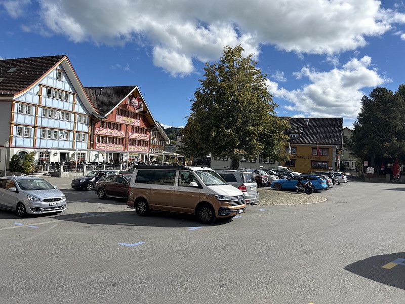
Appenzell
Very classy restaurant.
Very long way to the toilet and 3 km away.
Kaustrasse 125, Appenzell, Appenzell Innerrhoden, Switzerland
47° 19' 23" N 9° 23' 15" E
47.3230424 9.3875053
• Head north on Kaustrasse. Go for 212 m.
• Turn right onto Kaustrasse. Go for 183 m.
• Turn right onto Kaustrasse. Go for 341 m.
• Continue on Langweid. Go for 36 m.
• Continue on Kaustrasse. Go for 1.8 km.
• Turn left onto Sankt Antonstrasse. Go for 386 m.
• Turn right onto Rinkenbach. Go for 335 m.
• Continue on Hauptgasse. Go for 251 m.
• Turn right onto Hauptgasse. Go for 31 m.
• Turn right onto Engelgasse. Go for 52 m.
• Turn left onto Engelgasse. Go for 81 m.
• Turn left onto Hirschengasse. Go for 16 m.
• Arrive at Hirschengasse. Your destination is on the left.
☍
3,7 km
( 7 min.)
Day
Appenzell und Umgebung
Exploring by bike - very doable without an e-bike.
https://www.komoot.com/de-DE/tour/1884055771?ref=itd
Hauptgasse 27, Appenzell, Appenzell Innerrhoden, Switzerland
47° 19' 51.1" N 9° 24' 31" E
47.3308520 9.4085976
• Head north on Hirschengasse.
• Continue on Sternenplatz. Go for 44 m.
• Turn left onto Marktgasse. Go for 50 m.
• Turn left onto Marktgasse. Go for 56 m.
• Turn right onto Zielstrasse. Go for 293 m.
• Take the 2nd exit from roundabout onto Zielstrasse. Go for 98 m.
• Take the 1st exit from roundabout onto Entlastungsstrasse (448). Go for 764 m.
• Take the 1st exit from roundabout onto Gaiserstrasse. Go for 456 m.
• Turn left onto Brauereiplatz. Go for 106 m.
• Arrive at Brauereiplatz. Your destination is on the left.
☍
1,9 km
( 4 min.)
Brauerei Locher
Brewery is always worth it.
Paradise for men.
Untere Blumenrainstrasse, Schwende-Rüte, Appenzell Innerrhoden, Schweiz
47° 19' 51.5" N 9° 24' 46.5" E
47.3309826 9.4129240
• Head northwest on Brauereiplatz. Go for 106 m.
• Turn left onto Gaiserstrasse. Go for 49 m.
• Continue on Weissbadstrasse. Go for 309 m.
• Arrive at Weissbadstrasse. Your destination is on the left.
☍
0,5 km
( 1 min.)
Appenzeller Alpenbitter AG
A must for dad after the brewery.
Weissbadstrasse, Schwende-Rüte, Appenzell Innerrhoden, Schweiz
47° 19' 43.8" N 9° 24' 49.5" E
47.3288300 9.4137500
• Head northwest on Weissbadstrasse. Go for 309 m.
• Continue on Gaiserstrasse. Go for 490 m.
• Take the 3rd exit from roundabout onto Entlastungsstrasse (448). Go for 804 m.
• Take the 2nd exit from roundabout onto Entlastungsstrasse (448). Go for 4.8 km.
• Turn right onto Steinerstrasse. Go for 392 m.
• Continue on Hargarten. Go for 247 m.
• Continue on Sägehüsli. Go for 385 m.
• Continue on Au. Go for 564 m.
• Continue on Stöcken. Go for 448 m.
• Continue on Würzen. Go for 100 m.
• Continue on Boden. Go for 394 m.
• Continue on Niederstein. Go for 77 m.
• Continue on Grunholz. Go for 521 m.
• Continue on Kurzen. Go for 71 m.
• Continue on Steinbruggen. Go for 93 m.
• Continue on Kurzen. Go for 38 m.
• Continue on Dorf. Go for 90 m.
• Turn left onto Dorf (463). Go for 105 m.
• Arrive at Dorf (463). Your destination is on the left.
☍
9,9 km
( 11 min.)
Schaukäserei Appenzell
Also a photo spot for the Grand Tour.
Unfortunately, production was finished, we had already seen that with Emmental.
But it's worth watching.
Dorf 711, Stein (AR), Hinterland, Appenzell Ausserrhoden, Switzerland
47° 22' 24.2" N 9° 20' 41.8" E
47.3733946 9.3449372
• Head north on Dorf (463). Go for 2.5 km.
• Turn left onto Battenhaus. Go for 650 m.
• Continue on Battenhusstrasse. Go for 1.2 km.
• Turn left onto Hauptstrasse (447). Go for 48 m.
• Turn right onto 447. Go for 2.8 km.
• Continue on Wassergasse. Go for 271 m.
• Continue on Schochengasse. Go for 111 m.
• Turn right onto Gartenstrasse. Go for 220 m.
• Turn left onto Oberer Graben. Go for 212 m.
• Turn right onto Oberer Graben. Go for 227 m.
• Turn slightly right onto Unterer Graben. Go for 412 m.
• Keep left onto Sankt Jakob-Strasse. Go for 152 m.
• Keep right onto Sonnenstrasse. Go for 572 m.
• Take ramp onto A1 toward St. Margrethen/Kreuzlingen. Go for 24.6 km.
• Continue on A13. Go for 1.2 km.
• Continue on A13. Go for 930 m.
• Take exit 2 toward Berneck/Lustenau. Go for 352 m.
• Take the 3rd exit from roundabout onto Zollstrasse (435) toward München/Lustenau. Go for 359 m.
• Continue on Lustenauer Straße (L204). Go for 383 m.
• Turn left onto Reichsstraße (L203) toward Bregenz/Höchst Hard/Industrie Nord. Go for 841 m.
• Turn left onto Maria-Theresien-Straße (L203). Go for 1.1 km.
• Turn right onto Zellgasse (L41). Go for 2.9 km.
• Continue on Senderstraße (L41). Go for 2.3 km.
• Turn left and take ramp onto A14 (Rheintal Autobahn) toward Deutschland/Bregenz. Go for 12.8 km.
• Continue on A96. Go for 63.0 km.
• Take the left exit toward Würzburg/Ulm/Stuttgart onto A7. Go for 148 km.
• Take exit 110 toward Nürnberg/Feuchtwangen-Nord onto A6. Go for 73.5 km.
• Take exit 58 toward Fürth/Nürnberg/N.-Hafen/Nürnberg-Münchener Straße/Nürnberg-Kornburg/N.-Zentrum/N.-Messe/N.-Stadion onto B8 (Münchener Straße). Go for 8.0 km.
• Continue on Münchener Straße. Go for 829 m.
• Continue on Hainstraße. Go for 586 m.
• Continue on Regensburger Straße. Go for 896 m.
• Turn right onto Scheurlstraße. Go for 29 m.
• Continue on Marientunnel. Go for 145 m.
• Continue on Marienstraße. Go for 478 m.
• Continue on Lorenzer Straße. Go for 208 m.
• Take the 1st exit from roundabout onto Peter-Vischer-Straße. Go for 201 m.
• Continue on Unterer Bergauerplatz. Go for 35 m.
• Turn right onto Heubrücke. Go for 67 m.
• Continue on Spitalbrücke. Go for 56 m.
• Continue on Hans-Sachs-Platz. Go for 87 m.
• Continue on Spitalgasse. Go for 35 m.
• Arrive at Spitalgasse. Your destination is on the left.
☍
353,8 km
(3 hrs. 31 min.)
Day
Heilig-Geist-Spital
Nuremberg's old town is always worth a stop.
Overnight stay - private.
Hans-Sachs-Platz, Nürnberg, Bayern, Deutschland
49° 27' 10.8" N 11° 4' 45.1" E
49.4530118 11.0791942
• Head west on Spitalgasse. Go for 26 m.
• Turn right onto Spitalgasse. Go for 80 m.
• Continue on Obstmarkt. Go for 131 m.
• Continue on Fünferplatz. Go for 74 m.
• Turn right onto Theresienstraße. Go for 127 m.
• Continue on Theresienplatz. Go for 34 m.
• Continue on Innere Laufer Gasse. Go for 259 m.
• Turn right onto Innerer Laufer Platz. Go for 165 m.
• Continue on Innere Cramer-Klett-Straße. Go for 185 m.
• Turn left onto Rathenauplatz. Go for 252 m.
• Turn right onto Sulzbacher Straße. Go for 6.6 km.
• Take ramp onto A3 toward Regensburg/Amberg/A6/Berlin/München/A9. Go for 5.5 km.
• Take exit 88 toward Berlin/Dresden/Hof/Bayreuth onto A9. Go for 117 km.
• Take exit 33 toward Dresden/Chemnitz/Hof-Nord onto A72. Go for 106 km.
• Take exit 17 toward Görlitz/Dresden/Chemnitz-Mitte onto A4. Go for 76.2 km.
• Take exit 82 toward Berlin/Cottbus/Flughafen Dresden. Go for 2.0 km.
• Keep left onto A13. Go for 88.2 km.
• Take the left exit toward Potsdam/Berlin/Lübbenau onto A13. Go for 10.9 km.
• Take exit 8 toward Duben/Luckau/Lübben. Go for 388 m.
• Turn right onto B87 toward Frankfurt (Oder)/Lübben. Go for 6.7 km.
• Turn left onto Bahnhofstraße. Go for 574 m.
• Turn left toward Majoransheide. Go for 53 m.
• Continue on Majoransheide. Go for 156 m.
• Turn left onto Majoransheide. Go for 17 m.
• Continue on Brunnenstraße. Go for 96 m.
• Turn left onto Blumenstraße. Go for 83 m.
• Turn right onto Eschenallee. Go for 900 m.
• Arrive at Eschenallee. Your destination is on the left.
☍
422,7 km
(3 hrs. 47 min.)
Day
Spreewald wieder da Heim
Eschenallee 31D, Lübben (Spreewald), Dahme-Spreewald, Brandenburg, Germany
51° 56' 13.6" N 13° 51' 53.1" E
51.9371114 13.8647619