Day
Haßloch, Deutschland
67454 Haßloch, Deutschland
49° 21' 39.7" N 8° 15' 28.1" E
49.3610149 8.2578059
• Head toward Ludwig-Eichel-Straße on Brühl. Go for 82 m.
• Turn right onto Schillerstraße. Go for 258 m.
• Continue on Pfarrgasse. Go for 42 m.
• Turn left onto Rösselgasse. Go for 123 m.
• Turn right onto Langgasse. Go for 328 m.
• Turn left onto Pfaffengasse. Go for 378 m.
• Take the 2nd exit from roundabout onto Böhler Straße. Go for 918 m.
• Take ramp. Go for 187 m.
• Turn right onto Holidayparkstraße (L530). Go for 1.4 km.
• Take the 1st exit from roundabout onto A65 toward Ludwigshafen. Go for 9.0 km.
• Take exit 7 toward Koblenz/Mainz onto A61. Go for 138 km.
• Take exit 37 toward Luxemburg/Trier onto A48. Go for 15.2 km.
• Take exit 7 toward Hatzenport/Münstermaifeld/Polch. Go for 485 m.
• Turn left onto L113 toward Hatzenport/Münstermaifeld/Polch. Go for 525 m.
• Take the 2nd exit from roundabout onto L113. Go for 620 m.
• Take the 3rd exit from roundabout onto Trimbser Straße (L113) toward Polch/Münstermaifeld/Burg Eltz. Go for 230 m.
• Turn left onto August-Horch-Straße toward Koblenz/Industriegebiet/Münstermaifeld/Burg Eltz. Go for 297 m.
• Turn left. Go for 70 m.
• Turn left. Go for 19 m.
• Turn right. Go for 42 m.
• Arrive at your destination on the right.
☍
168,4 km
(1 hrs. 45 min.)
Day
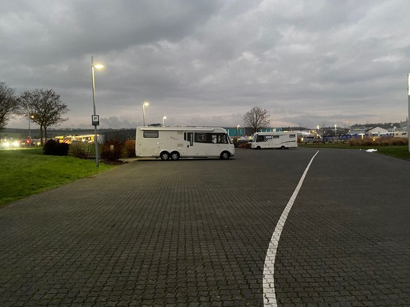
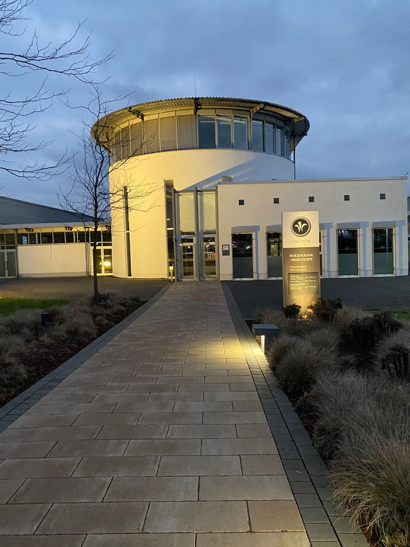
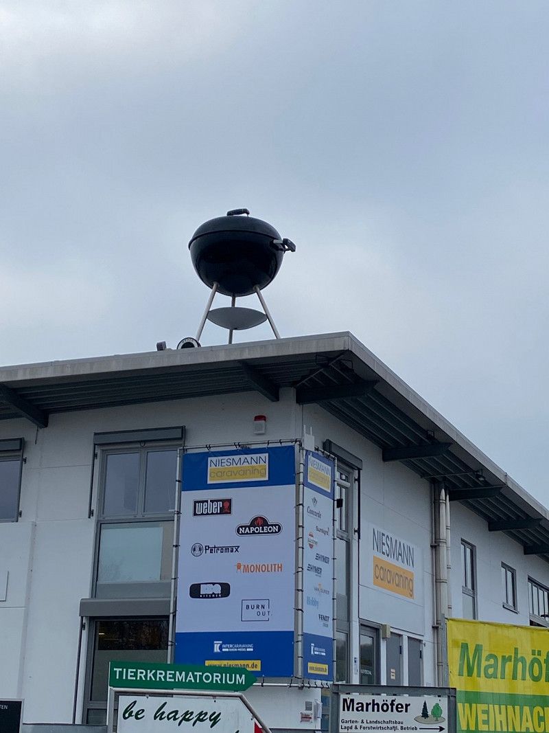
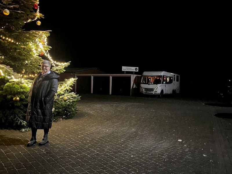
Niesmann+Bischoff GmbH, Clou-Straße, Polch, Deutschland
Had a good breakfast at Hoefer Bakery. Parking at Niesmann is free and everything is available, except for a shower and toilet, of course, but we have that on board.
Clou-Straße 1, 56751 Polch, Deutschland
50° 18' 26.4" N 7° 18' 41.5" E
50.3073260 7.3115140
• Head east. Go for 42 m.
• Turn left. Go for 19 m.
• Turn right toward August-Horch-Straße. Go for 70 m.
• Turn right onto August-Horch-Straße. Go for 297 m.
• Turn right onto Trimbser Straße (L113). Go for 173 m.
• Pass 2 roundabouts and continue on L113. Go for 930 m.
• Take ramp onto A48 toward Koblenz. Go for 24.3 km.
• Take exit 11 toward Neuwied/Bendorf onto B42. Go for 24.8 km.
• Take ramp toward Bad Breisig/B9/Bad Hönningen/Arienheller/Gewerbegebiet Bad Hönningen/Gewerbegebiet Rheinbrohl. Go for 150 m.
• Turn right onto L87. Go for 612 m.
• Take the 1st exit from roundabout onto K15. Go for 1.3 km.
• Turn left onto Hauptstraße. Go for 39 m.
• Turn left onto Auf dem Plänzer. Go for 124 m.
• Turn left onto Rheinallee. Go for 216 m.
• Arrive at Rheinallee. Your destination is on the right.
☍
53,0 km
( 40 min.)
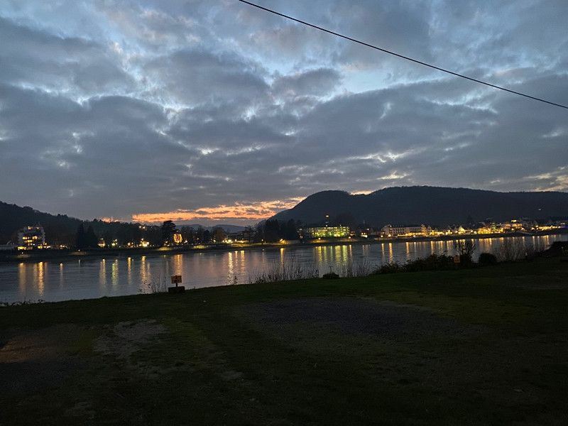
Wellness-Rheinpark-Camping
Camping place very nice, everything available, view of the Rhine. Therme right next to the campsite.
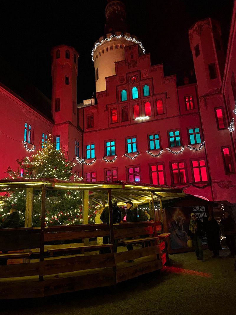
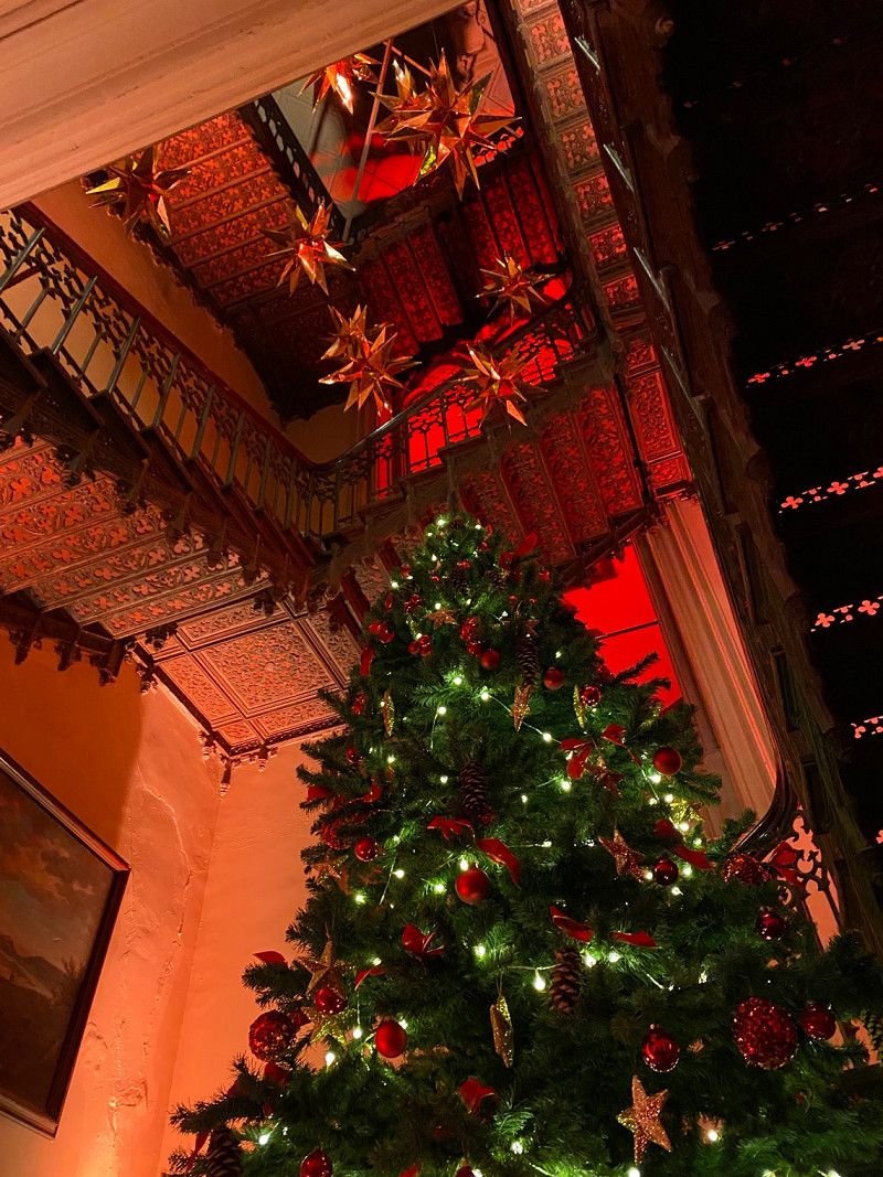
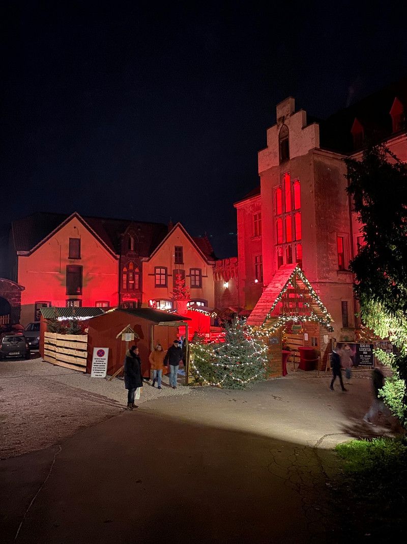
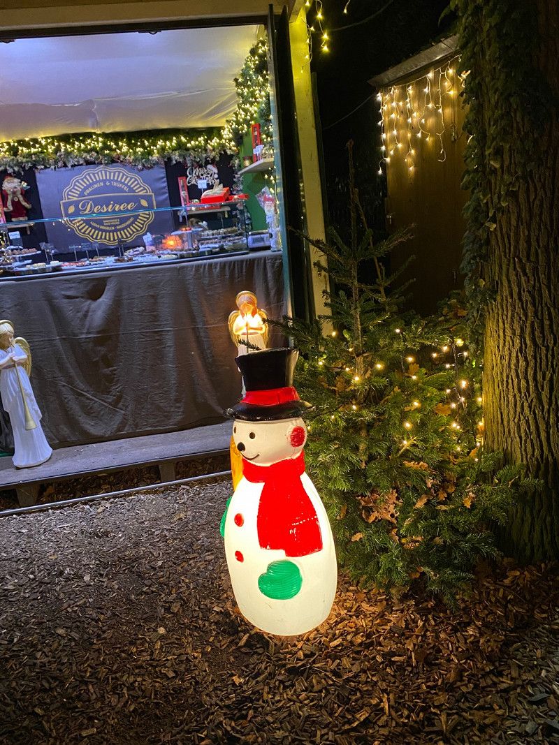
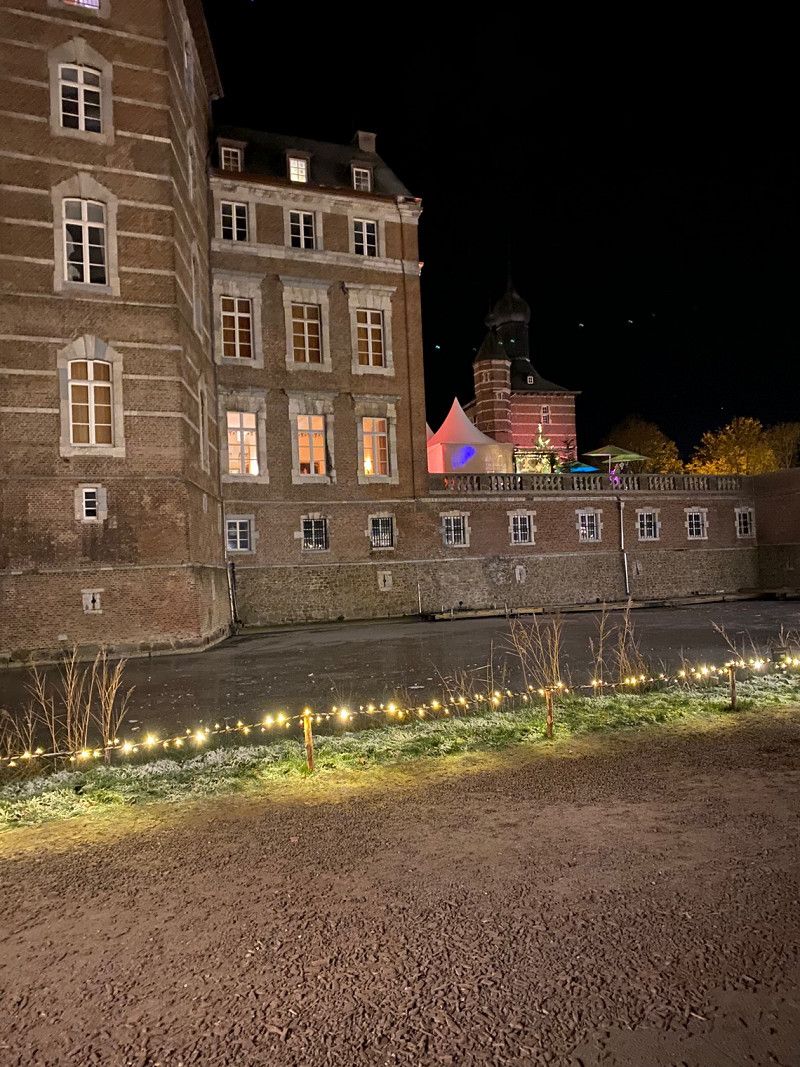
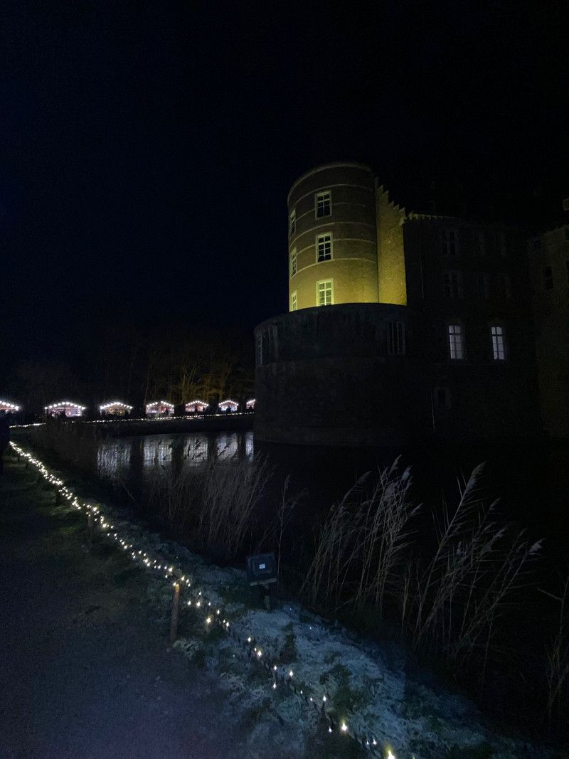
Visited the Christmas market at Arenfels Castle was very nice.
Allée St. Pierre les Nemours 1, 53557, Bad Hönningen, Deutschland
50° 30' 40.2" N 7° 18' 35" E
50.5111800 7.3097200
• Head toward Allée-Saint-Pierre-les-Nemours on Rheinallee. Go for 102 m.
• Turn right onto Schwarzer Weg. Go for 76 m.
• Turn left onto Hauptstraße (K15). Go for 75 m.
• Turn right onto Bahnhofstraße. Go for 91 m.
• Continue on Walther-Feld-Straße. Go for 619 m.
• Turn right onto Hauptstraße. Go for 395 m.
• Take ramp onto B42. Go for 26.1 km.
• Keep left onto B42 toward Flughafen Köln/Bonn-Nordost. Go for 324 m.
• Continue on A59. Go for 24.8 km.
• Take the exit onto A3/A4. Go for 4.0 km.
• Continue on A3. Go for 55.3 km.
• Take exit 15 toward DU-Wedau/Mülheim a.d.R.-Uhlenhorst. Go for 412 m.
• Turn left onto Uhlenhorststraße (L138) toward Duisburg-Wedau/Duisburg-Universität. Go for 3.0 km.
• Turn left onto Am Güterbahnhof toward Dinslaken/A59. Go for 225 m.
• Take ramp onto A59 (Nord-Süd-Straße) toward Dinslaken. Go for 6.6 km.
• Take exit 6 toward Dortmund onto A42 (Emscherschnellweg). Go for 2.9 km.
• Take exit 8 toward Arnheim/Hannover onto A3. Go for 6.3 km.
• Continue on A2 toward Hannover/Emden/Dreieck/Bottrop. Go for 5.8 km.
• Take exit 3 toward Emden/Dorsten onto A31. Go for 36.4 km.
• Take exit 34 toward Borken/Bocholt/Velen onto B67. Go for 2.9 km.
• Take ramp toward Heiden/Velen. Go for 255 m.
• Turn right onto Velener Straße (L829). Go for 4.1 km.
• Take the 2nd exit from roundabout onto L829. Go for 536 m.
• Turn left onto Kardinal-von-Galen-Straße (L581). Go for 223 m.
• Turn left onto Schulstraße. Go for 18 m.
• Arrive at Schulstraße. Your destination is on the left.
☍
181,5 km
(1 hrs. 57 min.)
Day
Velen, Deutschland 1 Mühlenallee
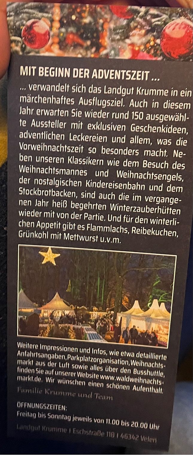
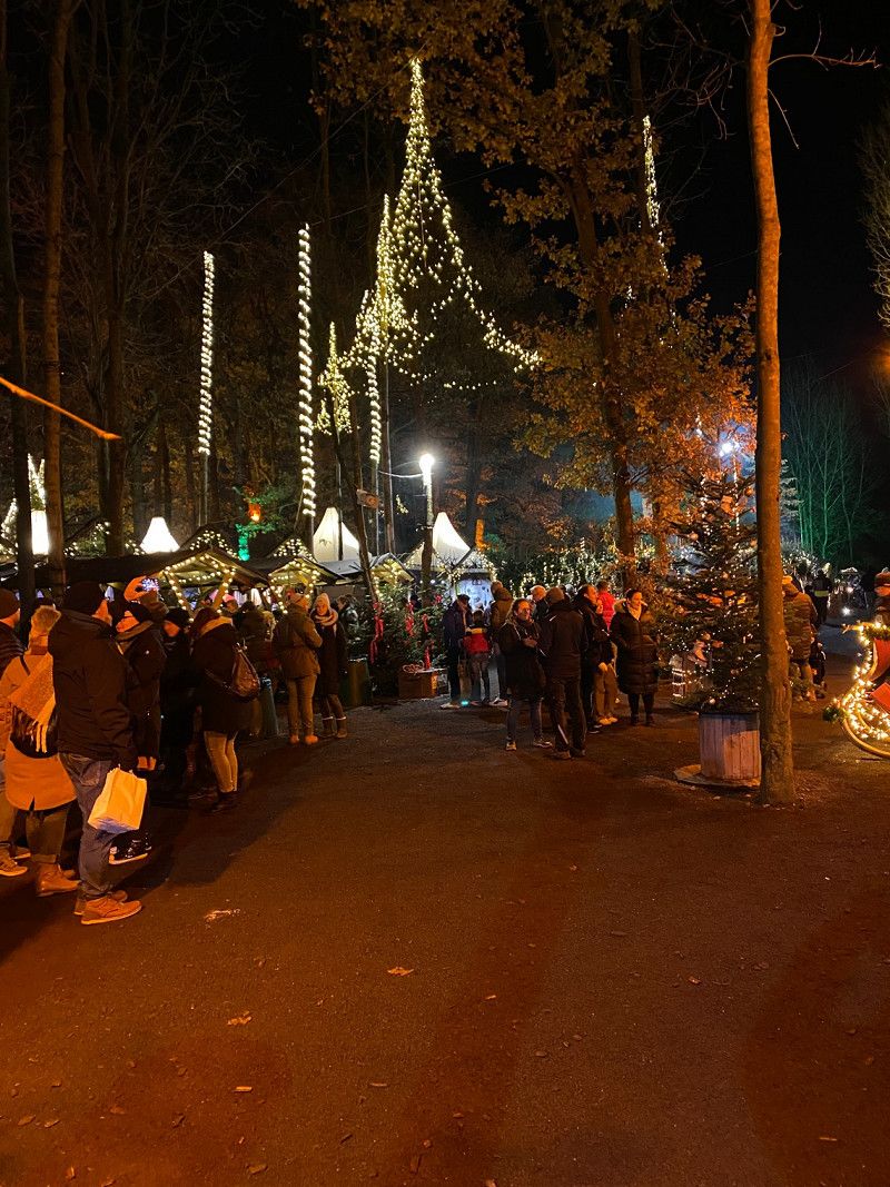
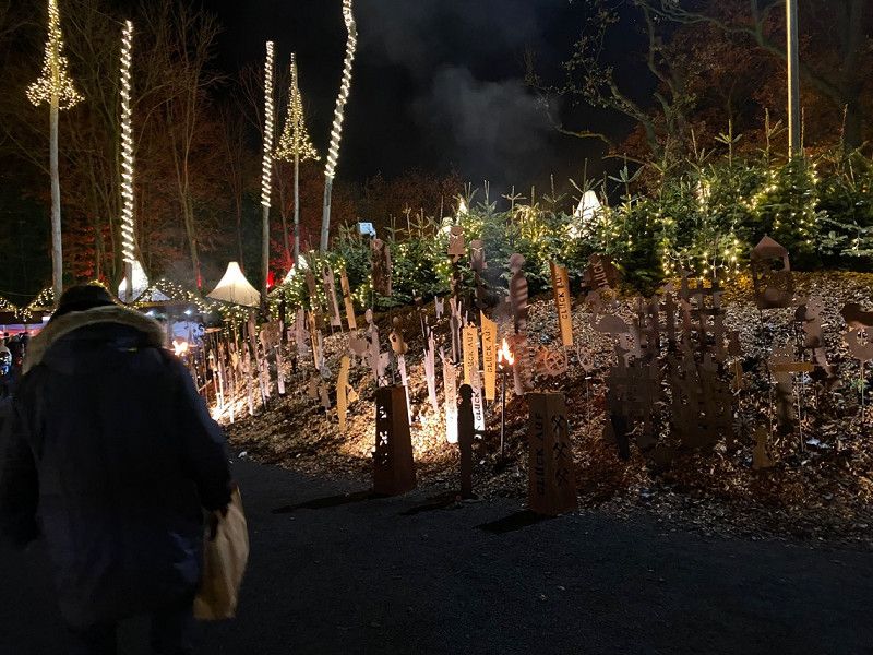
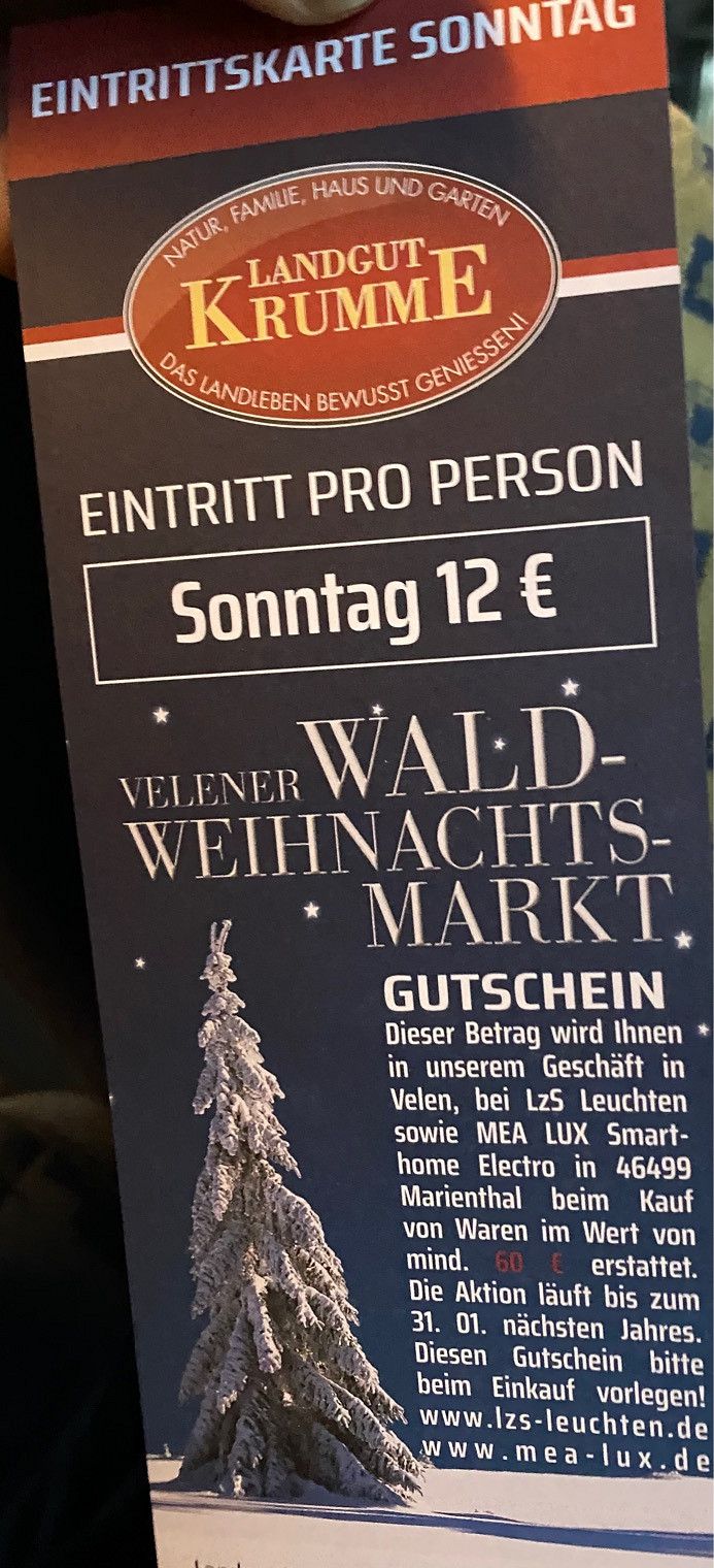
Pitch Velen. Visited the Krumme estate Christmas market, beautiful.
46342 Velen, Deutschland
51° 53' 39.7" N 6° 59' 15.7" E
51.8943629 6.9877005
• Head toward Kardinal-von-Galen-Straße on Schulstraße. Go for 18 m.
• Turn right onto Kardinal-von-Galen-Straße (L581). Go for 223 m.
• Turn left onto Volbertskamp (L581). Go for 408 m.
• Take the 2nd exit from roundabout onto Coesfelder Straße (L829) toward A31/Emden/Münster/Coesfeld/Gescher. Go for 5.2 km.
• Turn left onto Tungerloh-Pröbsting (L608). Go for 340 m.
• Turn right and take ramp toward A31/Coesfeld/Südlohn/Stadtlohn/Gewerbegebiet Gescher-Nord. Go for 198 m.
• Turn right onto B525. Go for 942 m.
• Take ramp onto A31 toward Emden. Go for 49.2 km.
• Take the exit toward Osnabrück/Rheine onto A30. Go for 120 km.
• Take the exit toward Berlin/Hannover onto A2 (Weser-Brücke). Go for 65.1 km.
• Take exit 42 toward Hannover-Herrenhausen/Hannover-Zentrum onto B6 (Am Leineufer). Go for 9.5 km.
• Take the 4th exit from Deisterplatz roundabout onto Deisterstraße toward Zentrum. Go for 288 m.
• Turn right onto Allerweg. Go for 376 m.
• Turn left onto Ritter-Brüning-Straße (L384). Go for 624 m.
• Turn right onto Am Waterlooplatz. Go for 173 m.
• Continue on Am Schützenplatz. Go for 29 m.
• Turn right onto Viktoria-Luise-Weg. Go for 75 m.
• Continue on Schützenplatz. Go for 44 m.
• Continue on Schützenplatz. Go for 63 m.
• Turn left onto Schützenplatz. Go for 68 m.
• Turn left onto Schützenplatz. Go for 44 m.
• Arrive at Schützenplatz. Your destination is on the right.
☍
252,8 km
(2 hrs. 19 min.)
Day
Schützenplatz, Hannover, Deutschland
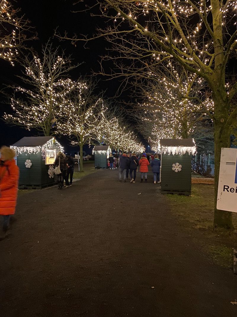
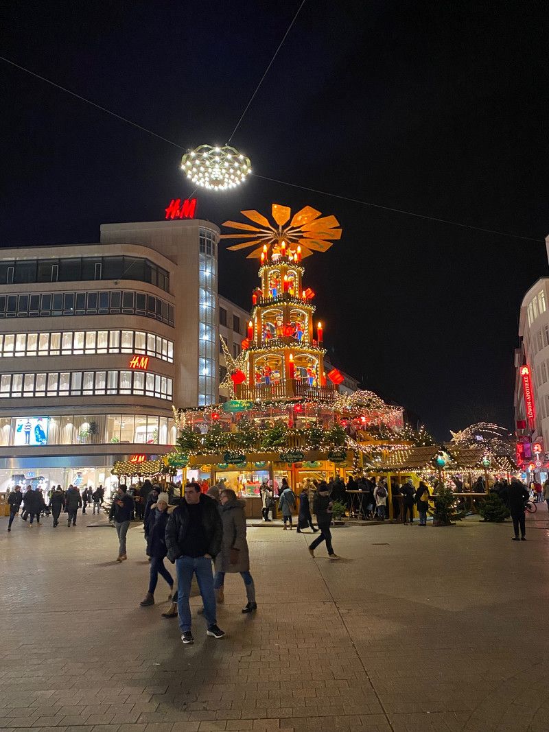
Visited the Hanover Christmas market, the historic market on the banks of the Leine was beautiful.
Standing well on the shooter place, no fee.
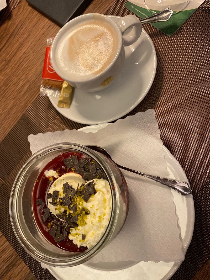
Had a quick breakfast in the Hanover market hall in the morning. Everything easily accessible on foot.
Schützenplatz, 30169 Hannover, Deutschland
52° 21' 46.6" N 9° 43' 48.1" E
52.3629513 9.7300231
• Head east on Schützenplatz. Go for 128 m.
• Continue on Schützenplatz. Go for 38 m.
• Turn left onto Bruchmeisterallee. Go for 159 m.
• Continue on Waterloostraße. Go for 458 m.
• Turn right onto Lavesallee (L384). Go for 90 m.
• Keep left onto Leibnizufer (L380). Go for 1.3 km.
• Turn right onto Schloßwender Straße (L190). Go for 5.6 km.
• Take ramp onto Flughafenstraße (B522) toward Hamburg/Bremen/Langenhagen-Nord/Flughafen. Go for 2.4 km.
• Take ramp onto A352 toward Hamburg/Bremen. Go for 12.6 km.
• Take the exit toward Hamburg/Bremen/Berkhof onto A7. Go for 29.0 km.
• Take exit 48 toward Bremen/Walsrode onto A27. Go for 56.2 km.
• Take exit 22 toward Osnabrück/Oldenburg/Flughafen Bremen onto A1. Go for 10.1 km.
• Take exit 56 toward Bremen-Arsten/Flughafen Bremen onto B6 (Autobahnzubringer Arsten). Go for 6.0 km.
• Continue on Neuenlander Straße (B6) toward Neustadt. Go for 517 m.
• Turn right onto Friedrich-Ebert-Straße. Go for 1.4 km.
• Continue on Wilhelm-Kaisen-Brücke. Go for 90 m.
• Continue on Wilhelm-Kaisen-Brücke. Go for 87 m.
• Turn right onto Franziuseck. Go for 59 m.
• Continue on Werderstraße. Go for 754 m.
• Continue on Kuhhirtenweg. Go for 471 m.
• Turn left. Go for 12 m.
• Arrive at your destination on the left.
☍
127,4 km
(1 hrs. 24 min.)
Day
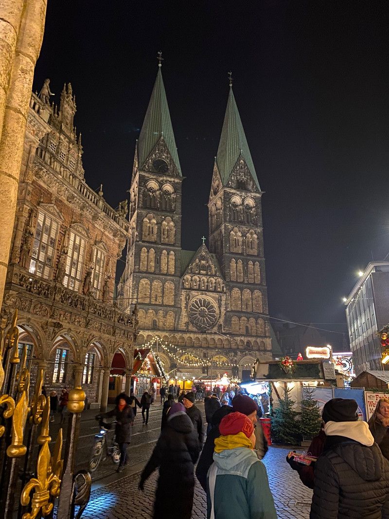
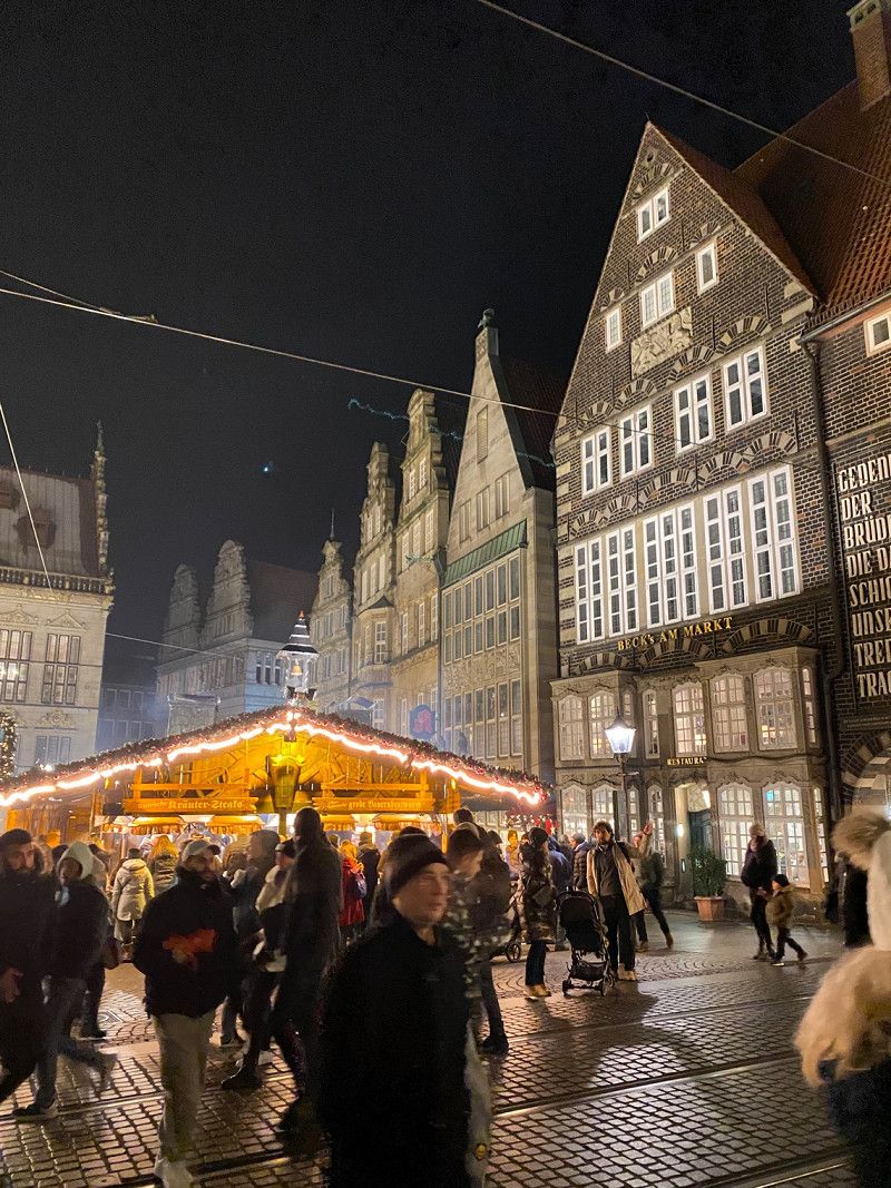
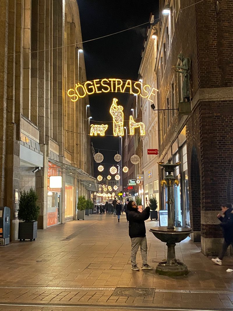
Reisemobil Stellplatz - Am Kuhhirten - Bremen, Kuhhirtenweg, Bremen, Deutschland
Nice parking space, you can quickly reach the city center on foot. Christmas market beautiful.
Kuhhirtenweg, 28201 Bremen, Deutschland
53° 3' 54.5" N 8° 49' 7.5" E
53.0651430 8.8187380
• Head northeast.
• Arrive at your destination on the left.
☍
Distance not available
(Duration not available)
Day
Reisemobil Stellplatz - Am Kuhhirten - Bremen, Kuhhirtenweg, Bremen, Deutschland
Kuhhirtenweg, 28201 Bremen, Deutschland
53° 3' 54.5" N 8° 49' 7.5" E
53.0651430 8.8187380
• Head toward Kuhhirtenweg. Go for 12 m.
• Turn right onto Kuhhirtenweg. Go for 471 m.
• Continue on Werderstraße. Go for 754 m.
• Continue on Franziuseck. Go for 59 m.
• Turn right onto Wilhelm-Kaisen-Brücke. Go for 157 m.
• Make a U-Turn onto Wilhelm-Kaisen-Brücke. Go for 367 m.
• Continue on Wilhelm-Kaisen-Brücke. Go for 81 m.
• Continue on Friedrich-Ebert-Straße. Go for 46 m.
• Turn right onto Osterstraße. Go for 197 m.
• Continue on Westerstraße. Go for 578 m.
• Continue on Große Sortillienstraße. Go for 325 m.
• Turn left onto Friesenwerder toward Hannover/A1/Hamburg/Osnabrück/Oldenburg/A28/Nienburg/B6/Neustädter Hafen. Go for 246 m.
• Take ramp onto Oldenburger Straße (B6) toward A1/A28/Delmenhorst/B75/Neustadt/Flughafen/GVZ. Go for 9.4 km.
• Take left ramp onto A28 toward Oldenburg/Delmenhorst-Adelheide. Go for 34.1 km.
• Take exit 15 toward Oldenburg-Kreyenbrück/Wardenburg/Berne/Kreyenbrück. Go for 358 m.
• Continue on Landwehrstraße (L866) toward Wardenburg/Berne/Kreyenbrück. Go for 201 m.
• Turn left onto Cloppenburger Straße (L870) toward Wardenburg/Kreyenbrück/Klinikum. Go for 2.4 km.
• Turn left onto Sandkruger Straße (K315) toward Kirchhatten/Sandkrug. Go for 1.6 km.
• Arrive at Sandkruger Straße (K315).
☍
51,3 km
( 42 min.)
Day
Day
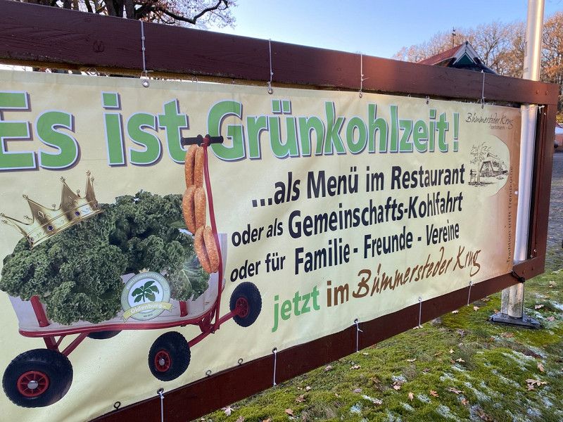
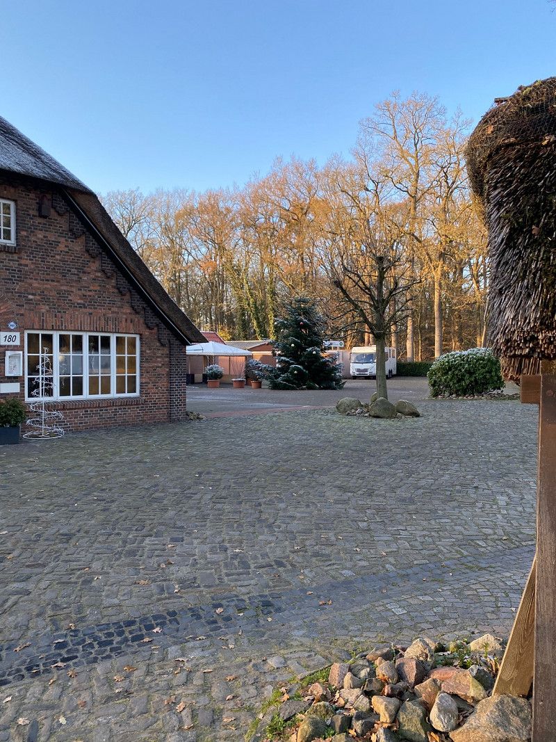
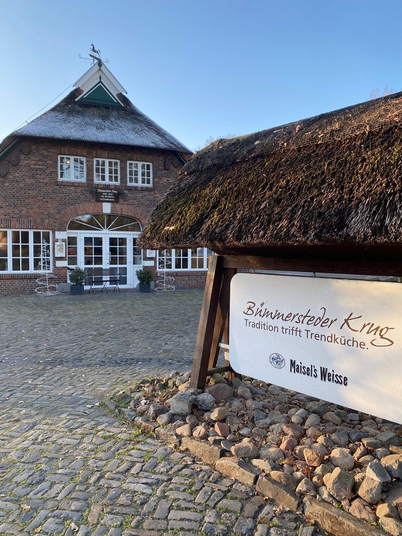
Sandkruger Straße 192, 26133 Oldenburg, Deutschland
Parking space at the restaurant Bümmersteder Krug.
We can only recommend the restaurant, we were allowed to park directly at the restaurant. Had a nice evening, only nice people around us. Great.
Sandkruger Str. 192, 26133 Oldenburg, Deutschland
53° 5' 29.4" N 8° 12' 49.1" E
53.0914918 8.2136345
• Head toward Bümmersteder Tredde on Sandkruger Straße (K315). Go for 1.6 km.
• Turn left onto Cloppenburger Straße (L870) toward Wardenburg. Go for 1.8 km.
• Turn right onto Oberlether Straße (K149). Go for 3.2 km.
• Turn right onto Ammerländer Straße (K141). Go for 6.0 km.
• Turn left onto Küstenkanalstraße (B401) toward Papenburg. Go for 17.9 km.
• Continue on Bundesstraße (B401). Go for 26.6 km.
• Continue on Am Küstenkanal (B401). Go for 17.7 km.
• Take ramp onto A31 toward Oberhausen. Go for 27.1 km.
• Take exit 20 toward Wesuwe/Hebelermeer. Go for 239 m.
• Turn left onto Wierescher Straße (K228) toward Hebelermeer/Fehndorf/Wesuwe Siedlung. Go for 828 m.
• Take the 1st exit from roundabout onto Süd-Nord-Straße (K225) toward Altenberge. Go for 2.8 km.
• Turn left onto Segberg (K242). Go for 633 m.
• Continue on Harener Straße (K242). Go for 47 m.
• Arrive at Harener Straße (K242). Your destination is on the left.
☍
106,4 km
(1 hrs. 15 min.)
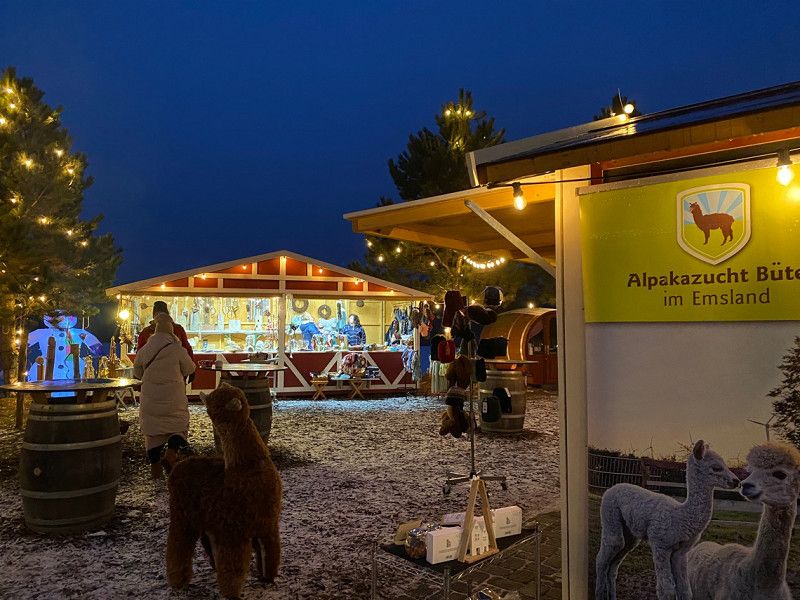
Harener Str. 34, 49733 Haren (Ems), Deutschland
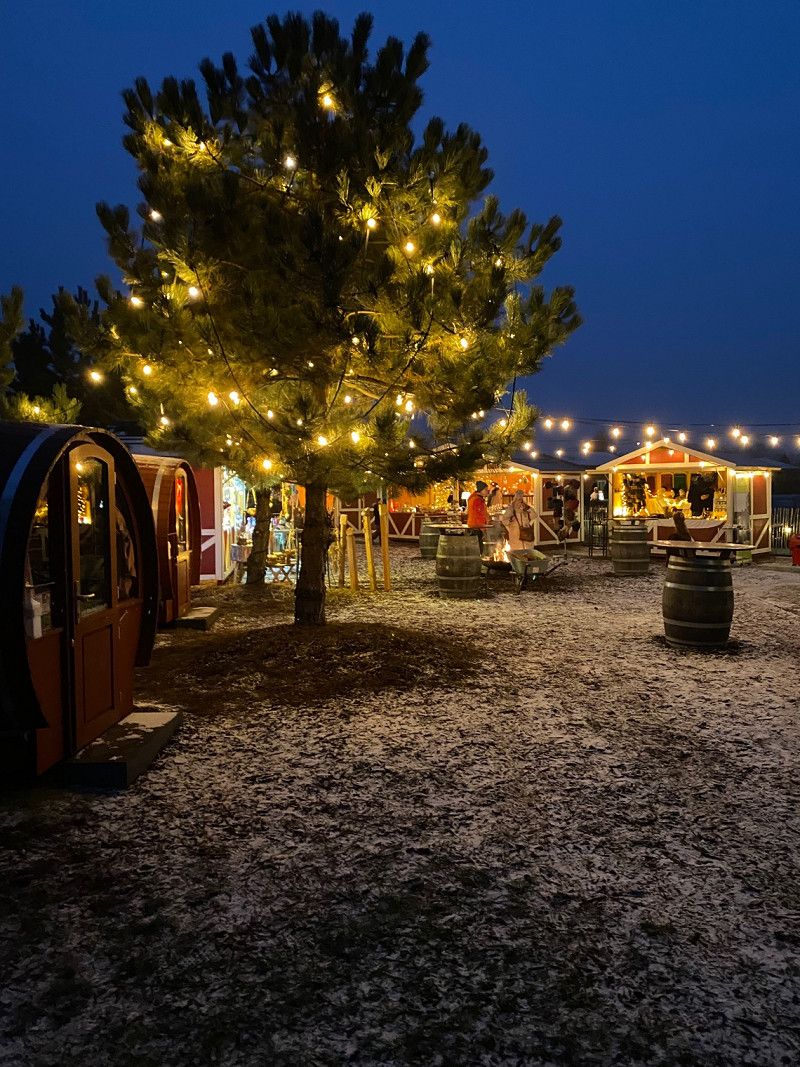
5 star place, well laid out on the lake with a small Christmas market. There is still a small market in the square, at least bread service would be nice.
52° 46' 43.1" N 7° 7' 15.5" E
52.7786353 7.1209589
• Head toward Zur Heide on Harener Straße (K242). Go for 47 m.
• Continue on Segberg (K242). Go for 633 m.
• Turn right onto Süd-Nord-Straße (K225). Go for 2.8 km.
• Take the 3rd exit from roundabout onto Wierescher Straße (K228). Go for 884 m.
• Turn right and take ramp onto A31 toward Oberhausen/Meppen. Go for 142 km.
• Take exit 42 toward Köln/Düsseldorf/Oberhausen onto A2. Go for 7.8 km.
• Continue on A3. Go for 5.1 km.
• Take exit 12 toward Kamp-Lintfort/Venlo onto A42 (Emscherschnellweg). Go for 18.1 km.
• Take the exit onto A57. Go for 35.4 km.
• Take exit 20 toward Heinsberg/Aachen/NE-Holzheim onto A46. Go for 17.4 km.
• Continue on Autobahnkreuz Holz toward Aachen/Koblenz/A61. Go for 1.1 km.
• Continue on A44. Go for 24.9 km.
• Take exit 7 toward Jülich-West/Düren/Koslar. Go for 530 m.
• Take the 3rd exit from roundabout onto B56. Go for 371 m.
• Take the 1st exit from roundabout onto B56. Go for 245 m.
• Take the 2nd exit from roundabout onto L238 toward Stolberg/Eschweiler. Go for 6.2 km.
• Take the 2nd exit from roundabout onto Aldenhovener Straße (L11). Go for 2.5 km.
• Take the 3rd exit from roundabout onto Zum Hagelkreuz (L228). Go for 2.7 km.
• Continue on Frankenplatz. Go for 87 m.
• Turn left onto Dürener Straße. Go for 8 m.
• Turn right onto Hauptstraße. Go for 275 m.
• Continue on Lindenallee. Go for 388 m.
• Turn left onto Langerweher Straße (B264). Go for 3.0 km.
• Pass 2 roundabouts and continue on B264. Go for 2.9 km.
• Turn right onto In der Klaus (K45) toward Schlich/Merode/D'Horn. Go for 125 m.
• Continue on K45. Go for 540 m.
• Continue on D'horner Straße (K45). Go for 600 m.
• Continue on Kreuzherrenstraße. Go for 465 m.
• Turn right onto Kreuzherrenstraße. Go for 73 m.
• Arrive at Kreuzherrenstraße. Your destination is on the right.
☍
277,0 km
(2 hrs. 44 min.)
Day
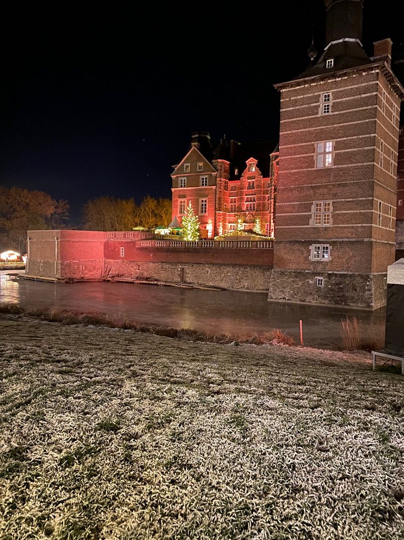
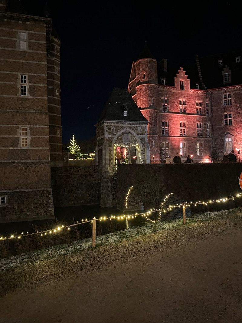
Kreuzherrenstraße 1, 52379 Langerwehe, Deutschland
Kreuzherrenstrasse 1, 52379 Langerwehe
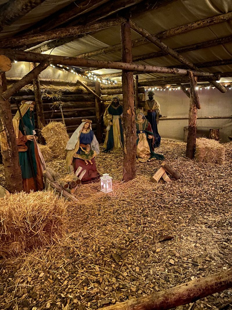
Merode Castle
Christmas market beautiful 🤩
We parked at the Langerwehe sports field car park.
50° 47' 57.5" N 6° 23' 15.8" E
50.7992981 6.3877172
• Head south on Kreuzherrenstraße. Go for 73 m.
• Turn left onto Kreuzherrenstraße. Go for 465 m.
• Continue on D'horner Straße (K45). Go for 600 m.
• Continue on K45. Go for 540 m.
• Continue on In der Klaus (K45). Go for 125 m.
• Turn left onto Bundesstraße (B264). Go for 1.6 km.
• Take the 1st exit from roundabout onto L12 toward A4/Inden. Go for 2.0 km.
• Take the 1st exit from roundabout onto A4 toward Köln. Go for 23.2 km.
• Take exit 8 toward Koblenz onto A61. Go for 17.3 km.
• Continue on A61 toward Koblenz/Weilerswist. Go for 214 km.
• Take exit 61 toward Landau/Neustadt/Weinstr. onto A65. Go for 9.1 km.
• Take exit 10 toward Haßloch/Meckenheim/Holiday-Park. Go for 324 m.
• Turn right onto L530. Go for 365 m.
• Take the 1st exit from roundabout onto Meckenheimer Straße (L530) toward Haßloch-Ost Gewerbegebiet/Haßloch-West. Go for 2.5 km.
• Take the 3rd exit from roundabout onto L532. Go for 703 m.
• Continue on Neustadter Straße. Go for 25 m.
• Continue on Langgasse. Go for 624 m.
• Turn right onto Kirchgasse. Go for 234 m.
• Take the 1st exit from roundabout onto Kirchgasse. Go for 261 m.
• Turn left onto Neugasse. Go for 215 m.
• Turn left onto Brühl. Go for 212 m.
• Arrive at Brühl. Your destination is on the left.
☍
274,8 km
(2 hrs. 36 min.)
Day
Haßloch, Deutschland
It's nicest at home.
67454 Haßloch, Deutschland
49° 21' 39.7" N 8° 15' 28.1" E
49.3610149 8.2578059