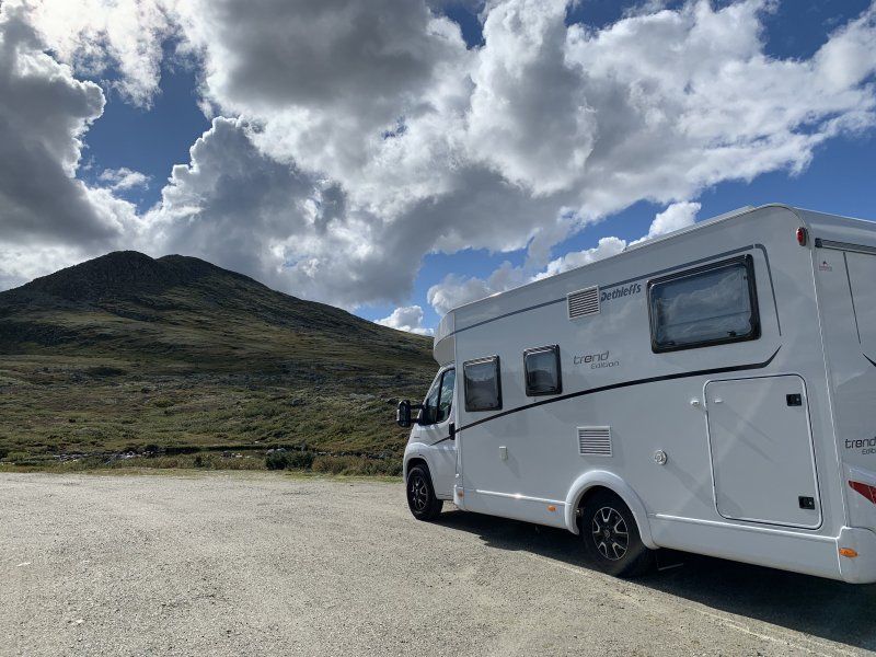
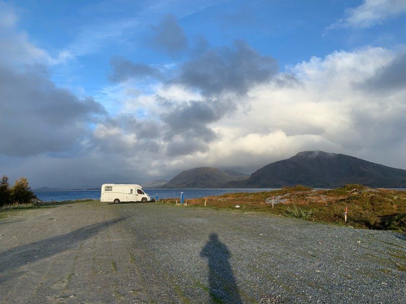
Late summer/ autumn in northern Norway.
With a baby to the North Cape
Across Norway to the North Cape(p)
What is different about the tour in Summer to Mid Sweden?
- There are enough supply and disposal stations (black and gray water) throughout Norway
- Gas can easily be refilled anywhere in Norway (alugas or LPG Norge website) have listed the stations.
- Many places can only be paid with VIPPS (Norwegian account is required)
- It rains more :/
- Shopping is maybe 10% more expensive, products like bananas, bread and fish are sometimes cheaper than in Sweden / Germany
- Supermarkets are smaller and hardly have any organic products
- Diesel costs between €1.20 and €1.50 if you are a bit flexible you pay an average of €1.30
Day
Day
Day
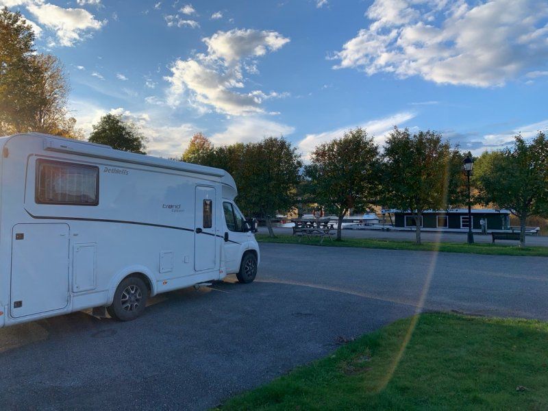
Stena Line Göteborg - Kiel, Elof Lindälvs gata, Göteborg, Schweden
Elof Lindälvs gata, 414 58 Göteborg, Schweden
57° 41' 43.8" N 11° 54' 47.8" E
57.6955090 11.9132835
• Head southeast. Go for 12 m.
• Turn left onto Majnabbehamnen. Go for 54 m.
• Turn slightly left onto Majnabbehamnen. Go for 207 m.
• Turn right onto Majnabbehamnen. Go for 270 m.
• Continue on Majnabbegatan. Go for 70 m.
• Turn left and take ramp onto Oscarsleden (E45.1) toward E20/E45/40/Centrum. Go for 6.2 km.
• Keep right onto Marieholmsleden (E45) toward E6/Karlstad/Angered/Gamlestaden/Partihallarna. Go for 521 m.
• Take ramp onto Marieholmsmotet toward E6/Oslo/155/Hisingen. Go for 432 m.
• Continue on Marieholmstunneln. Go for 514 m.
• Take the exit toward Oslo onto E6 (Kungälvsleden). Go for 175 km.
• Continue on E6 (Svinesundsbroen). Go for 3.8 km.
• Take exit 2 toward Halden/118. Go for 189 m.
• Take the 1st exit from roundabout onto Osloveien (204) toward E204/Halden/Ingedal/118. Go for 2.5 km.
• Take the 1st exit from roundabout onto Svinesundsveien (204). Go for 3.9 km.
• Take the 1st exit from roundabout onto Fridtjof Nansens gate. Go for 88 m.
• Continue on Heimdalsveien. Go for 106 m.
• Continue on Fridtjof Nansens gate. Go for 234 m.
• Take the 1st exit from roundabout onto Mathias Bjørns gate. Go for 74 m.
• Turn right onto Mathias Bjørns gate. Go for 199 m.
• Continue on Walkers gate. Go for 375 m.
• Turn right onto Tomtegata. Go for 562 m.
• Continue on Jernbanebrygga. Go for 42 m.
• Arrive at Jernbanebrygga. Your destination is on the right.
☍
195,1 km
(2 hrs. 5 min.)
Day
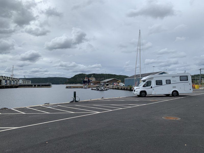
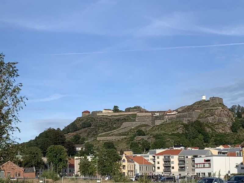
Am Hafen in Halden 150 NOK inkl. Strom
New place right on the water.
Unfortunately right on the train route and main road
Jernbanebrygga 1
59° 7' 8.1" N 11° 22' 48.2" E
59.1189149 11.3800505
• Head toward Jernbanegata on Jernbanebrygga. Go for 77 m.
• Turn left onto Jernbanegata. Go for 213 m.
• Turn right onto Tollbugata. Go for 138 m.
• Continue on Kongens brygge. Go for 82 m.
• Turn slightly left onto Olav Vs gate. Go for 213 m.
• Continue on Olav Vs gate (220). Go for 176 m.
• Turn left onto Bakbanken. Go for 46 m.
• Continue on Fisketorget. Go for 148 m.
• Take the 2nd exit from roundabout onto Walkers gate. Go for 262 m.
• Take the 2nd exit from roundabout onto Walkers gate. Go for 137 m.
• Take the 1st exit from roundabout onto Fridtjof Nansens gate. Go for 253 m.
• Continue on Heimdalsveien. Go for 106 m.
• Continue on Fridtjof Nansens gate. Go for 68 m.
• Take the 2nd exit from roundabout onto Marcus Thranes gate (204). Go for 3.9 km.
• Take the 2nd exit from roundabout onto Svinesundsveien (204). Go for 2.6 km.
• Take the 3rd exit from roundabout toward E6/Oslo/Gøteborg. Go for 122 m.
• Take ramp onto E6 (Osloveien) toward Oslo. Go for 87.9 km.
• Continue on E6 toward Trondheim/Ring 3/Oslo N/Ø. Go for 18.3 km.
• Keep left onto Ring 3 (E6) toward Trondheim/Gardermoen Lufthavn/Sinsen. Go for 3.6 km.
• Keep left onto Hjalmar Brantings vei (150) toward Sinsen/4/Stovner/163. Go for 2.4 km.
• Take ramp onto Trondheimsveien (4) toward Gjøvik. Go for 5.0 km.
• Keep left onto Trondheimsveien (4). Go for 1.5 km.
• Keep left onto Trondheimsveien (4) toward Gjøvik. Go for 4.8 km.
• Pass 3 roundabouts and continue on Hadelandsveien (4). Go for 38.3 km.
• Continue on E16. Go for 4.3 km.
• Keep left onto 4 toward E16/Roa. Go for 61.7 km.
• Pass 2 roundabouts and continue on Lillehammervegen (4). Go for 3.3 km.
• Take the 1st exit from roundabout onto Bryggevegen toward Industriområde Mjøsstranda. Go for 226 m.
• Turn right onto Bryggevegen. Go for 15 m.
• Arrive at Bryggevegen. Your destination is on the left.
☍
239,7 km
(2 hrs. 55 min.)
Day
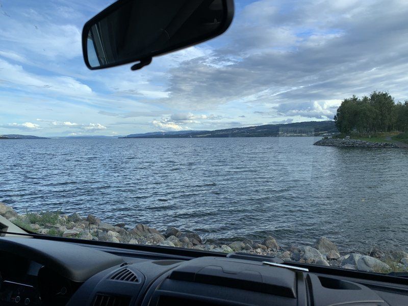
Gjøvik mit Blick auf See
Directly on the water and within walking distance to the city.
100 NOK / night here is coffee and 3 rolls incl. is paid at the gas station.
Supply and disposal on site as well as washing area also for campers
Bryggevegen
60° 47' 44.7" N 10° 42' 3" E
60.7957389 10.7008430
• Head southeast on Bryggevegen.
• Turn right onto Bryggevegen. Go for 25 m.
• Turn slightly right onto Elvegata. Go for 131 m.
• Turn right. Go for 80 m.
• Turn left toward Bryggevegen. Go for 34 m.
• Take the 1st exit from roundabout onto Lillehammervegen (4). Go for 309 m.
• Pass 2 roundabouts and continue on Lillehammervegen (E6). Go for 38.1 km.
• Take the 1st exit from roundabout onto E6. Go for 60.0 km.
• Turn right onto Brugata (2576) toward Atna/Friisvegen. Go for 549 m.
• Turn right onto Kjønnåsvegen (2578). Go for 3.7 km.
• Turn right onto Venabygdsvegen (27). Go for 23.0 km.
• Turn left onto Rondevegen. Go for 15 m.
• Arrive at Rondevegen. Your destination is on the right.
☍
125,9 km
(1 hrs. 41 min.)
Day
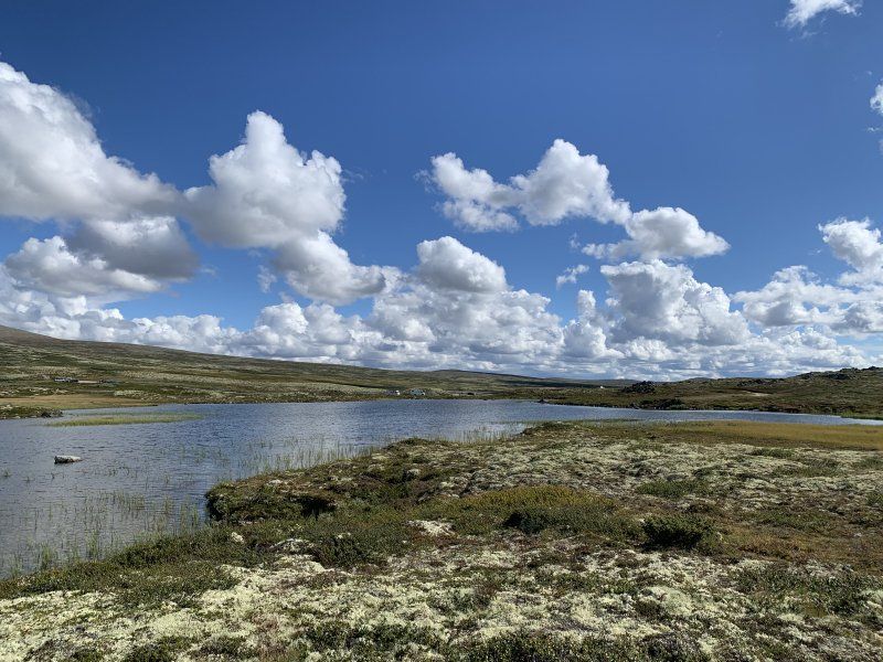
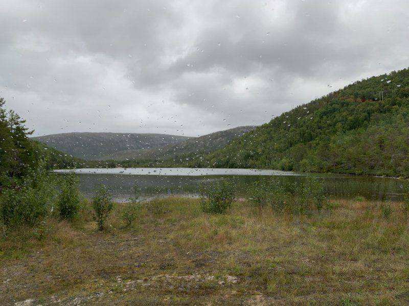
Im Fjäll auf über 900m
Rondevegen
61° 42' 46.3" N 10° 9' 56.7" E
61.7128515 10.1657455
• Head west on Rondevegen. Go for 183 m.
• Turn left onto Rondevegen (27). Go for 9.9 km.
• Turn left onto 27. Go for 48.2 km.
• Turn left onto Folldalsvegen (29). Go for 28.5 km.
• Turn right onto Trondheimsvegen (E6). Go for 47.4 km.
• Pass 3 roundabouts and continue on E6. Go for 114 km.
• Keep right onto Omkjøringsvegen (E6) toward E14/Narvik/Lade. Go for 8.5 km.
• Take ramp toward Vikhammer/Ranheim. Go for 347 m.
• Turn right onto Peder Myhres veg. Go for 7 m.
• Continue toward Kockhaugvegen/950. Go for 13 m.
• Take the 3rd exit from roundabout onto Kockhaugvegen (950). Go for 603 m.
• Take the 2nd exit from roundabout onto Malvikvegen (950). Go for 1.5 km.
• Turn right onto Væresvegen (6672). Go for 874 m.
• Continue on Kjersti Wæhres veg (6672). Go for 148 m.
• Continue on 6672. Go for 280 m.
• Continue toward Væresvegen/6672. Go for 21 m.
• Continue on Markabygdvegen (6672). Go for 2.3 km.
• Turn left onto Markabygdvegen (6672). Go for 759 m.
• Turn left onto Leistadvegen (6706). Go for 360 m.
• Turn right and take ramp onto E6 toward Narvik. Go for 16.6 km.
• Pass 4 roundabouts and continue on E6. Go for 10.9 km.
• Turn right onto Tillervegen (6814) toward Fløan. Go for 734 m.
• Continue on 6814. Go for 260 m.
• Turn right onto Fløanvegen (6814). Go for 2.3 km.
• Turn right onto Steinvikholmvegen. Go for 400 m.
• Turn left. Go for 110 m.
• Arrive at your destination.
☍
295,4 km
(4 hrs. 3 min.)
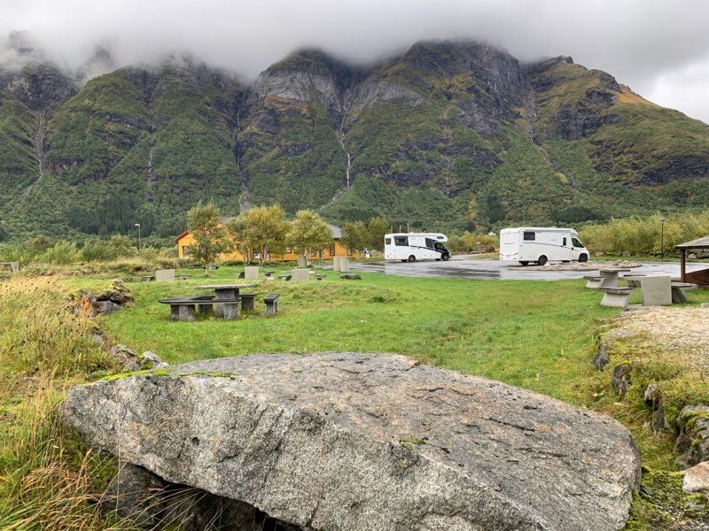
Day
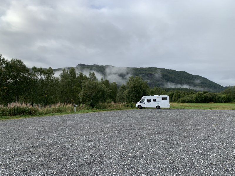
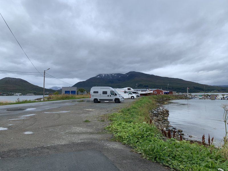
Am Fjord gelegen mit Blick auf Burg 100 NOK
Small space for about 10 vehicles.
100 NOK in cash per night.
fresh water incl.
Steinvikholmvegen
63° 32' 30.3" N 10° 48' 47.8" E
63.5417392 10.8132772
• Head toward Steinvikholmvegen. Go for 110 m.
• Turn right onto Steinvikholmvegen. Go for 400 m.
• Turn left onto Fløanvegen (6814). Go for 2.3 km.
• Turn left onto 6814. Go for 260 m.
• Continue on Tillervegen (6814). Go for 734 m.
• Turn right onto E6. Go for 4.7 km.
• Take the 2nd exit from roundabout onto Riksvegen (E6). Go for 9.8 km.
• Take the 1st exit from roundabout onto Breivegen (E6). Go for 2.8 km.
• Turn right toward Gamle Kongeveg Sør/6854. Go for 387 m.
• Take the 1st exit from roundabout onto Gamle Kongeveg Sør (6854). Go for 1.3 km.
• Continue on Gamle Kongeveg Sør (6854). Go for 3.8 km.
• Continue on 6854. Go for 227 m.
• Continue on 79. Go for 73 m.
• Continue on 6854. Go for 54 m.
• Continue on Kirkaunbakken (6854). Go for 22 m.
• Continue on Gamle E6 (6854). Go for 176 m.
• Turn left onto Eknesvegen (6856). Go for 940 m.
• Turn right and take ramp onto E6 toward E6 N. Go for 8.9 km.
• Pass 9 roundabouts and continue on Kvamsvegen (E6). Go for 312 km.
• Take the 1st exit from roundabout onto E6 toward Narvik. Go for 1.2 km.
• Take the 1st exit from roundabout onto Vollanvegen (E6) toward Narvik. Go for 4.3 km.
• Take the 2nd exit from roundabout onto E6. Go for 5.8 km.
• Turn right onto Luktvassvegen (7327). Go for 258 m.
• Turn left. Go for 19 m.
• Turn right. Go for 19 m.
• Arrive at your destination on the right.
☍
360,2 km
(4 hrs. 55 min.)
Day
Ab 2021 ruhiger da die E6 verlegt wird
Incl. electricity for 100 NOK.
With frost in August it is already pleasant to heat the Womo with electricity
Luktvassvegen 791
65° 54' 19.3" N 13° 18' 12.7" E
65.9053610 13.3035375
• Head southwest. Go for 54 m.
• Turn right. Go for 102 m.
• Turn left toward Luktvassvegen/7327. Go for 19 m.
• Turn right onto Luktvassvegen (7327). Go for 156 m.
• Turn left onto Luktvassvegen (7327). Go for 102 m.
• Turn right onto E6. Go for 73.7 km.
• Take the 2nd exit from roundabout onto E6 toward Narvik. Go for 102 m.
• Take the 1st exit from roundabout onto E6 toward Narvik. Go for 747 m.
• Pass 5 roundabouts and continue on Selforsveien (E6). Go for 2.7 km.
• Take the 1st exit from roundabout onto Saltfjellveien (E6) toward Narvik. Go for 173 km.
• Take the 1st exit from roundabout onto Storgaten (E6) toward Narvik. Go for 416 m.
• Take the 1st exit from roundabout onto Follaveien (E6) toward Narvik. Go for 117 km.
• Take the 2nd exit from roundabout onto E6. Go for 804 m.
• Turn right. Go for 86 m.
• Arrive at your destination.
☍
369,1 km
(4 hrs. 45 min.)
Day
Platz für 1 Wohnmobil an kleinem See direkt an E6
Good for an overnight stay
Free of charge
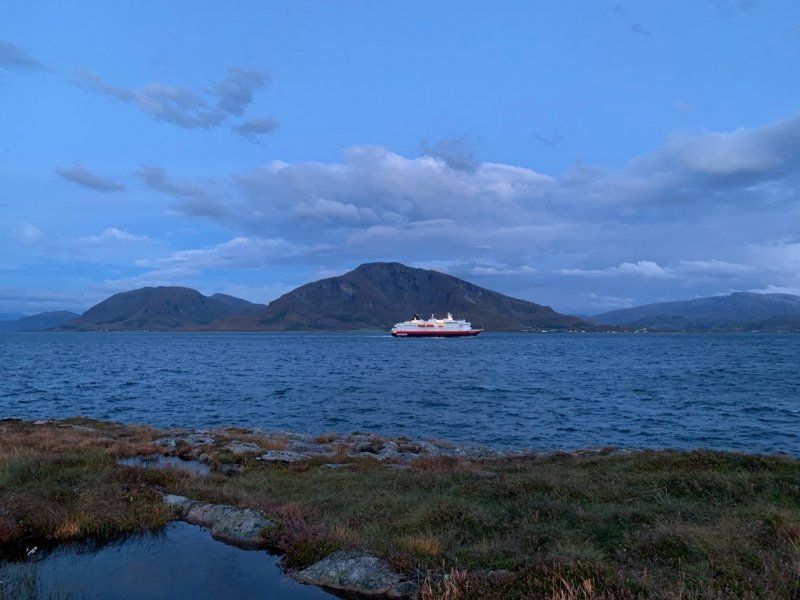
Quiet in the evening and the next morning "only" 40 minutes to the ferry, which everyone has to take because there are no tunnels/bridges.
Departures approx. every 1.5 hours
Hamarøyveien
67° 57' 48.4" N 15° 57' 3.5" E
67.9634329 15.9509735
• Head toward Hamarøyveien. Go for 86 m.
• Turn right onto Hamarøyveien (E6). Go for 45.9 km.
• Turn left onto 85 toward E10/Ferge Lødingen/Ferge Å i Lofoten. Go for 257 m.
• Take the Bognes-Lødingen Ferry. Stay on for 23.3 km.
• Head toward Sjøvegen on 85. Go for 312 m.
• Turn right onto 85. Go for 2.0 km.
• Continue on Kong Olavs vei (E10). Go for 15.8 km.
• Take the 1st exit from roundabout onto Kong Olavs vei (E10). Go for 32.5 km.
• Take the 1st exit from roundabout onto Kong Olavs vei (E10) toward Narvik/Evenes Lufthavn. Go for 60.5 km.
• Take the 2nd exit from roundabout onto Nordmoveien (E6/E10). Go for 578 m.
• Pass 6 roundabouts and continue on E6. Go for 145 km.
• Turn right onto Øvergårdveien (E6/E8) toward Alta/Kilpisjärvi/Kirkenes. Go for 43.4 km.
• Keep left onto Skibotsveien (E6/E8) toward Kirkenes/Skibotn. Go for 340 m.
• Continue on Skibotsveien (E6). Go for 131 km.
• Turn left onto Storengveien (7954) toward Storeng. Go for 187 m.
• Turn left. Go for 64 m.
• Arrive at your destination on the right.
☍
500,5 km
(7 hrs. 35 min.)
Day
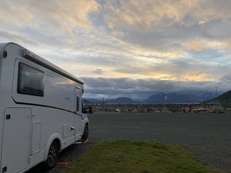
Sicht auf den Fjord und Hafen 150 NOK
Located directly at the port with supply and disposal
Good for one night
Hans Lillengs vei 3
69° 54' 29.4" N 21° 19' 38" E
69.9081592 21.3272235
• Head toward Storengveien. Go for 64 m.
• Turn right onto Storengveien (7954). Go for 187 m.
• Turn left onto E6. Go for 3.2 km.
• Turn right onto Oksfjordveien toward Øvergård. Go for 3.8 km.
• Continue on Kvænangsveien (E6). Go for 127 km.
• Take the 1st exit from roundabout onto Aronnesveien (870) toward Aronnes. Go for 280 m.
• Take the 1st exit from roundabout onto Aronnesveien (870). Go for 4.8 km.
• Turn right onto Aronnesveien (870). Go for 72 m.
• Turn right onto Altaveien (E6). Go for 80.6 km.
• Turn right onto Hatterveien (E6) toward Kirkenes. Go for 23.1 km.
• Turn left onto E69 toward Nordkapp/Honningsvåg. Go for 2.6 km.
• Continue on Øverland (E69). Go for 113 m.
• Continue on E69. Go for 4.6 km.
• Continue on Solberg (E69). Go for 84 m.
• Continue on E69. Go for 8.6 km.
• Continue on Sørset (E69). Go for 138 m.
• Continue on E69. Go for 3.4 km.
• Continue on Skarvbergtunnelen (E69). Go for 4.7 km.
• Continue on E69. Go for 4.2 km.
• Continue on Sortviktunnelen (E69). Go for 490 m.
• Continue on E69. Go for 15.4 km.
• Continue on Stranda (E69). Go for 1.6 km.
• Continue on E69. Go for 12 m.
• Continue on Stranda (E69). Go for 1.8 km.
• Continue on E69. Go for 425 m.
• Continue on Reinelva (E69). Go for 2.7 km.
• Continue on E69. Go for 1.9 km.
• Continue on Indre Mannskarvika (E69). Go for 389 m.
• Continue on E69. Go for 8.8 km.
• Continue on Porsangervika (E69). Go for 1.3 km.
• Continue on E69. Go for 706 m.
• Continue on Porsangervika (E69). Go for 381 m.
• Continue on E69. Go for 3.2 km.
• Continue on Kåfjord (E69). Go for 6.1 km.
• Continue on E69. Go for 154 m.
• Continue on Vesterpollen (E69). Go for 44 m.
• Continue on Laholmen (E69). Go for 66 m.
• Continue on Nordkapptunnelen (E69). Go for 6.8 km.
• Continue on E69. Go for 733 m.
• Continue on Veidnesbrua (E69). Go for 675 m.
• Continue on E69. Go for 9 m.
• Continue on Sarnesveien (E69). Go for 1.5 km.
• Continue on E69. Go for 480 m.
• Continue on Sarnestunnelen (E69). Go for 225 m.
• Continue on E69. Go for 48 m.
• Continue on Sarnesveien (E69). Go for 2.6 km.
• Continue on E69. Go for 118 m.
• Continue on Ørntind (E69). Go for 371 m.
• Continue on Sarnesveien (E69). Go for 555 m.
• Continue on E69. Go for 422 m.
• Continue on Sarnesveien (E69). Go for 1.4 km.
• Continue on E69. Go for 111 m.
• Continue on Honningsvågtunnelen (E69). Go for 4.5 km.
• Continue on E69. Go for 108 m.
• Continue on Kobbhullveien (E69). Go for 1.3 km.
• Continue on E69. Go for 511 m.
• Turn left onto Nordkappveien (E69). Go for 637 m.
• Continue on E69. Go for 154 m.
• Continue on Skipsfjorden (E69). Go for 5.2 km.
• Continue on E69. Go for 13.0 km.
• Turn left onto E69. Go for 12.4 km.
• Arrive at E69. Your destination is on the right.
☍
371,3 km
(5 hrs. 15 min.)
Day
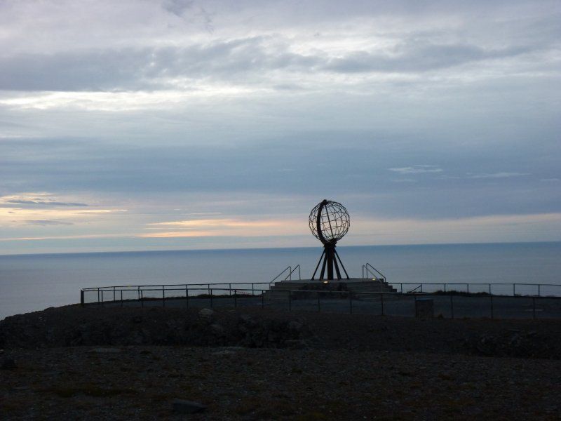
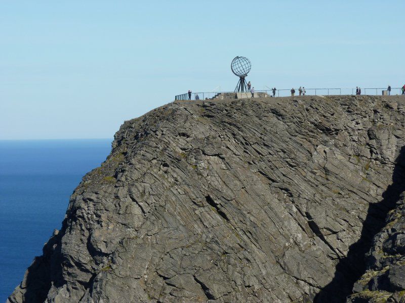
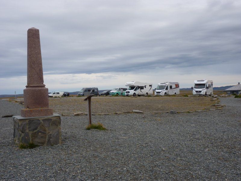
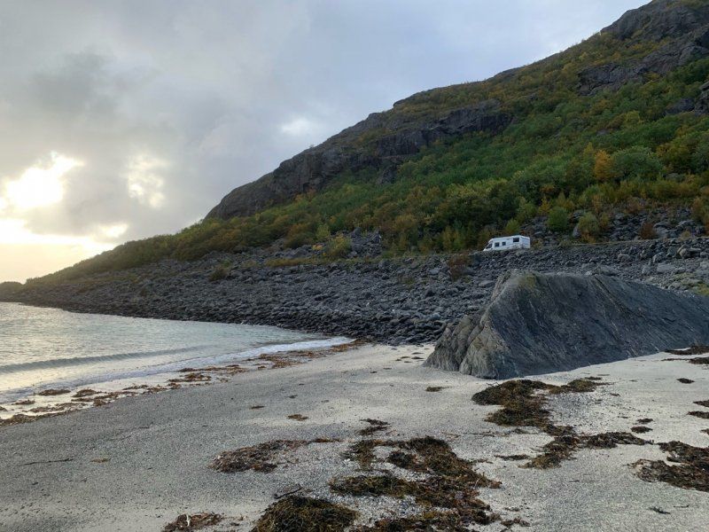
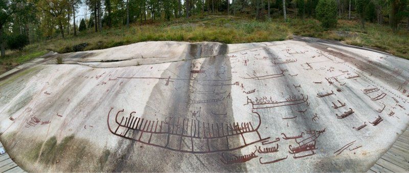
Nordkap(p)
Thanks to Corona and the low season, only a few motorhomes on the North Cape
Magerøya
71° 10' 11" N 25° 47' 1.4" E
71.1697087 25.7837253
• Head south on E69. Go for 5 m.
• Arrive at E69. Your destination is on the left.
☍
0,0 km
( )
Day
Nordkap(p) Tag2
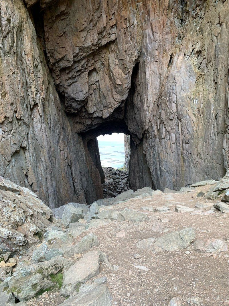
The North Cape(p) can be an expensive place.
The overnight stay costs 35€ and entry per person 25€
The entrance fee is actually only to use the toilets and to go into a cave in the mountain.
We arrived shortly before 5 p.m., so we didn’t have to pay the entrance fee, but we weren’t allowed into the cave either.
Many campers who stayed overnight only arrived after 5 p.m. and thus saved the €35.
If you are lucky, like us, you will be in the first row on the far left, this is the only place where the sea and the globe can be seen from the car.
We had such good weather that we stayed a second day.
Magerøya
71° 10' 10.2" N 25° 46' 59.3" E
71.1694891 25.7831301
• Head south on E69. Go for 9.4 km.
• Continue on E69. Go for 2.9 km.
• Turn right onto E69. Go for 13.0 km.
• Continue on Skipsfjorden (E69). Go for 5.2 km.
• Continue on E69. Go for 154 m.
• Continue on Nordkappveien (E69). Go for 637 m.
• Turn right onto E69. Go for 511 m.
• Continue on Kobbhullveien (E69). Go for 1.3 km.
• Continue on E69. Go for 108 m.
• Continue on Honningsvågtunnelen (E69). Go for 4.5 km.
• Continue on E69. Go for 111 m.
• Continue on Sarnesveien (E69). Go for 1.4 km.
• Continue on E69. Go for 422 m.
• Continue on Sarnesveien (E69). Go for 555 m.
• Continue on Ørntind (E69). Go for 371 m.
• Continue on E69. Go for 118 m.
• Continue on Sarnesveien (E69). Go for 2.6 km.
• Continue on E69. Go for 48 m.
• Continue on Sarnestunnelen (E69). Go for 225 m.
• Continue on E69. Go for 480 m.
• Continue on Sarnesveien (E69). Go for 1.5 km.
• Continue on E69. Go for 9 m.
• Continue on Veidnesbrua (E69). Go for 675 m.
• Continue on E69. Go for 733 m.
• Continue on Nordkapptunnelen (E69). Go for 6.8 km.
• Continue on Laholmen (E69). Go for 66 m.
• Continue on Vesterpollen (E69). Go for 44 m.
• Continue on E69. Go for 154 m.
• Continue on Kåfjord (E69). Go for 6.1 km.
• Continue on E69. Go for 3.2 km.
• Continue on Porsangervika (E69). Go for 381 m.
• Continue on E69. Go for 706 m.
• Continue on Porsangervika (E69). Go for 1.3 km.
• Continue on E69. Go for 8.8 km.
• Continue on Indre Mannskarvika (E69). Go for 389 m.
• Continue on E69. Go for 1.9 km.
• Continue on Reinelva (E69). Go for 2.7 km.
• Continue on E69. Go for 425 m.
• Continue on Stranda (E69). Go for 1.8 km.
• Continue on E69. Go for 12 m.
• Continue on Stranda (E69). Go for 1.6 km.
• Continue on E69. Go for 15.4 km.
• Continue on Sortviktunnelen (E69). Go for 490 m.
• Continue on E69. Go for 4.2 km.
• Continue on Skarvbergtunnelen (E69). Go for 4.7 km.
• Continue on E69. Go for 3.4 km.
• Continue on Sørset (E69). Go for 138 m.
• Continue on E69. Go for 8.6 km.
• Continue on Solberg (E69). Go for 84 m.
• Continue on E69. Go for 4.6 km.
• Continue on Øverland (E69). Go for 113 m.
• Continue on E69. Go for 2.6 km.
• Turn right onto E6. Go for 23.1 km.
• Continue on Repparfjordveien (94) toward Hammerfest. Go for 53.7 km.
• Take the 2nd exit from roundabout onto Storsvingen (94). Go for 1.6 km.
• Continue on Kirkegata (94). Go for 62 m.
• Continue on Strandgata (94). Go for 221 m.
• Continue on 94. Go for 12 m.
• Continue on Strandgata (94). Go for 438 m.
• Continue on Nedre Molla (94). Go for 315 m.
• Continue on Fuglenesveien (94). Go for 888 m.
• Turn right onto Forsølveien. Go for 540 m.
• Turn right onto Nedre Myrvei. Go for 235 m.
• Turn right onto Snefrida Nilsens vei. Go for 150 m.
• Turn sharp left onto Snefrida Nilsens vei. Go for 526 m.
• Turn slightly right onto Melkøyveien. Go for 38 m.
• Turn right onto 8124. Go for 7.0 km.
• Turn slightly right onto Langbuktveien. Go for 1.0 km.
• Arrive at Langbuktveien. Your destination is on the right.
☍
217,4 km
(3 hrs. 39 min.)
Day
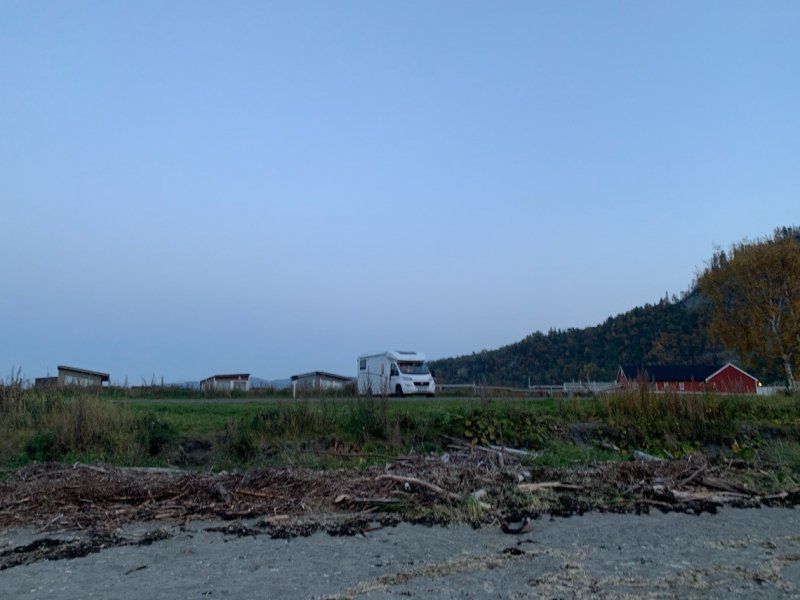
Hammerfest - 10 Min. Entfernt
Close to Hammerfest as the pitch in Hammerfest costs NOK 280.
This place is not directly signposted as a mobile home parking space, but a garbage container was placed here by the municipality.
It seems that there are always mobile homes here, there were two of us, but due to the closed border, we are usually only on the pitches with one or two other vehicles.
This place here is nice and quiet and sheltered from the wind, right on the fjord. With a bit of luck, the reindeer will pass the camper directly
On the way here you will pass two large supermarkets.
Supply and disposal is possible in Hammerfest.
Kvaløya Fálá
70° 43' 7.2" N 23° 49' 18.5" E
70.7186696 23.8217917
• Head toward Leirbuktveien on Langbuktveien. Go for 1.0 km.
• Turn slightly left onto 8124. Go for 7.0 km.
• Turn left onto Melkøyveien. Go for 38 m.
• Turn slightly left onto Snefrida Nilsens vei. Go for 526 m.
• Turn sharp right onto Snefrida Nilsens vei. Go for 150 m.
• Turn left onto Nedre Myrvei. Go for 235 m.
• Turn left onto Forsølveien. Go for 302 m.
• Turn left onto Forsølveien. Go for 238 m.
• Turn left onto Fuglenesveien (94). Go for 888 m.
• Continue on Nedre Molla (94). Go for 315 m.
• Continue on Strandgata (94). Go for 438 m.
• Continue on 94. Go for 12 m.
• Continue on Strandgata (94). Go for 221 m.
• Continue on Kirkegata (94). Go for 1.6 km.
• Take the 2nd exit from roundabout onto Storsvingen (94). Go for 53.7 km.
• Turn right onto Repparfjorddalen (E6). Go for 80.7 km.
• Take the 4th exit from roundabout onto Aronnesveien (870) toward Aronnes. Go for 4.9 km.
• Take the 3rd exit from roundabout onto Aronnesveien (870). Go for 331 m.
• Take the 3rd exit from roundabout onto Altaveien (E6) toward Narvik. Go for 87.7 km.
• Turn right onto Gárgu. Go for 250 m.
• Turn slightly right. Go for 90 m.
• Arrive at your destination on the right.
☍
240,6 km
(3 hrs. 38 min.)
Day
Kostenfreier Stellplatz mit Ver- und Entsorgung am Fjord
Right on the E6 but still quiet with a view of the fjord.
Free with 3-4 seats.
Supermarket and gas station nearby
Strandveien 15
69° 56' 27.1" N 22° 2' 46.4" E
69.9408624 22.0462095
• Head toward Strandveien. Go for 90 m.
• Turn slightly left onto Gárgu. Go for 250 m.
• Turn right onto Kvænangsveien (E6). Go for 39.9 km.
• Turn left onto Oksfjordveien. Go for 3.8 km.
• Turn left onto Oksfjordveien (E6). Go for 178 km.
• Turn right onto E8 toward Tromsø. Go for 68.5 km.
• Take the 3rd exit from roundabout onto Bruvegen (862). Go for 1.8 km.
• Turn right onto Skippergata (862). Go for 55 m.
• Turn left onto Elvegata (862). Go for 74 m.
• Turn right onto Storgata (862). Go for 247 m.
• Take the 3rd exit from roundabout onto 862. Go for 393 m.
• Take the 2nd exit from roundabout onto 862. Go for 226 m.
• Take the 1st exit from roundabout onto 862. Go for 1.9 km.
• Take the 2nd exit from roundabout onto Kvaløyvegen (862/63). Go for 276 m.
• Take the 3rd exit from roundabout onto Kvaløyvegen (862). Go for 1.1 km.
• Pass 6 roundabouts and continue on Eidvegen (862). Go for 8.5 km.
• Arrive at Eidvegen (862). Your destination is on the right.
☍
304,7 km
(4 hrs. 20 min.)
Day
Tromsö Nähe / Kosten?
10 minutes from Tromso in a port.
We stood here with two other campers.
Street is noisy and the view of the harbor isn't that great either.
OK for one night
Kvaløya
69° 40' 32.7" N 18° 45' 6.9" E
69.6757434 18.7519191
• Head toward Jensvollvegen on Eidvegen (862). Go for 15.0 km.
• Take the 2nd exit from roundabout onto Straumsvegen (858). Go for 3.2 km.
• Take the 1st exit from roundabout onto 858. Go for 34.4 km.
• Turn left onto Malangsveien (858). Go for 20.2 km.
• Turn right onto 858. Go for 5.1 km.
• Turn right onto 7906. Go for 496 m.
• Continue on Sagelvvassveien (7906). Go for 243 m.
• Continue on 7906. Go for 12.0 km.
• Turn right onto E6. Go for 25.3 km.
• Turn right onto 855 toward Senja/Finnsnes. Go for 29.9 km.
• Continue on 86. Go for 3.5 km.
• Continue on Storgata (86). Go for 1.2 km.
• Take the 1st exit from roundabout onto Strandveien (86). Go for 1.3 km.
• Continue on 86. Go for 1.3 km.
• Continue on Laukhellaveien (86). Go for 1.5 km.
• Continue on 86. Go for 10 m.
• Continue on Laukhellaveien (86). Go for 2.7 km.
• Continue on Høgliveien (86). Go for 358 m.
• Continue on 86. Go for 328 m.
• Continue on Høgliveien (86). Go for 526 m.
• Continue on 86. Go for 115 m.
• Continue on Høgliveien (86). Go for 586 m.
• Continue on 86. Go for 542 m.
• Continue on Høgliveien (86). Go for 3.3 km.
• Continue on 86. Go for 68 m.
• Continue on Høgliveien (86). Go for 1.6 km.
• Continue on 86. Go for 636 m.
• Continue on Høgliveien (86). Go for 120 m.
• Continue on 86. Go for 782 m.
• Continue on Svandalsveien (86). Go for 11.9 km.
• Continue on 86. Go for 15.7 km.
• Turn slightly right toward Straumsnes. Go for 169 m.
• Turn sharp right onto Straumsnes. Go for 536 m.
• Arrive at Straumsnes. Your destination is on the right.
☍
194,7 km
(3 hrs. 8 min.)
Day
Senja Geheimtipp - Sicht auf Fjord
Senja is still an insider tip, at least that's how it's described.
We had a nice free seat with a great view.
3 parking spaces
Senja
69° 24' 15.5" N 17° 19' 7.9" E
69.4043044 17.3188689
• Head southwest on Straumsnes. Go for 536 m.
• Turn sharp left toward 86. Go for 169 m.
• Turn slightly left onto 86. Go for 3.9 km.
• Turn left onto 862. Go for 6.3 km.
• Continue on Bergsfjordveien (862). Go for 9.8 km.
• Turn right onto 862. Go for 13.2 km.
• Continue on Mefjordveien (7868). Go for 30 m.
• Continue on 7868. Go for 236 m.
• Continue on Mefjordveien (7868). Go for 2.0 km.
• Continue on 7868. Go for 380 m.
• Continue on Mefjordveien (7868). Go for 3.1 km.
• Turn left onto Brakkeveien. Go for 78 m.
• Arrive at Brakkeveien.
☍
39,7 km
(1 hrs. 7 min.)
Day
Tolle Sicht 100 NOK mit Feuerstelle in Hütte mit Aussicht
Senja is worth a trip.
Past sandy beaches and golden toilets.
A new mobile home parking space is currently being built here in Mefjordvær.
Above the place you can stand for 100 NOK, but only Norwegians with VIPPS can pay this...
Great view of the sea and the mountains.
Senja
69° 31' 16.3" N 17° 26' 15.2" E
69.5211846 17.4375536
• Head toward Mefjordveien on Brakkeveien. Go for 78 m.
• Continue on Mefjordveien (7868). Go for 3.1 km.
• Continue on 7868. Go for 380 m.
• Continue on Mefjordveien (7868). Go for 2.0 km.
• Continue on 7868. Go for 236 m.
• Continue on Mefjordveien (7868). Go for 30 m.
• Continue on 862. Go for 13.2 km.
• Turn left onto Bergsfjordveien (862). Go for 9.8 km.
• Continue on 862. Go for 6.3 km.
• Turn left onto 86. Go for 11.8 km.
• Continue on Svandalsveien (86). Go for 8.0 km.
• Turn right onto Brygghaugveien (7856). Go for 6.3 km.
• Turn right onto Tranøyveien (860). Go for 4.5 km.
• Continue on 860. Go for 7 m.
• Continue on Tranøyveien (860). Go for 21.5 km.
• Turn right onto Tranøyveien (8600). Go for 21 m.
• Continue on Skrolsvikveien (8600). Go for 11.9 km.
• Continue on Skrolsvikveien (8600). Go for 5.9 km.
• Turn right onto Vasskråa. Go for 365 m.
• Arrive at Vasskråa. Your destination is on the left.
☍
105,5 km
(2 hrs. 38 min.)
Day
Skrolsvik, Norwegen
Skrollsvika, Norwegen
69° 3' 45" N 16° 49' 18" E
69.0625015 16.8216633
• Head toward Skrolsvikveien on Vasskråa. Go for 365 m.
• Turn left onto Skrolsvikveien (8600). Go for 711 m.
• Turn right onto Skrolsvikveien. Go for 728 m.
• Turn left. Go for 39 m.
• Arrive at your destination on the left.
☍
1,8 km
( 4 min.)
Day
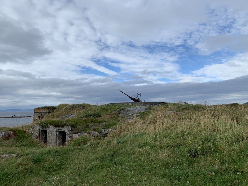
Senja
Old defense system WW2
200 NOK
Because of a storm from SW we drove again...
69° 3' 26" N 16° 47' 22.5" E
69.0572213 16.7895866
• Head south. Go for 39 m.
• Turn slightly left toward Skrolsvikveien. Go for 547 m.
• Continue on Skrolsvikveien. Go for 322 m.
• Turn right onto Skrolsvikveien (8600). Go for 5.2 km.
• Continue on Skrolsvikveien (8600). Go for 11.9 km.
• Continue on Tranøyveien (8600). Go for 21 m.
• Turn left onto Tranøyveien (860). Go for 21.5 km.
• Continue on 860. Go for 7 m.
• Continue on Tranøyveien (860). Go for 13.0 km.
• Continue on 860. Go for 4.8 km.
• Continue on Islandsbotnveien (860). Go for 871 m.
• Continue on 860. Go for 1.1 km.
• Continue on Islandsbotnveien (860). Go for 726 m.
• Continue on 860. Go for 789 m.
• Turn right onto Laukhellaveien (86). Go for 2.7 km.
• Continue on 86. Go for 10 m.
• Continue on Laukhellaveien (86). Go for 1.5 km.
• Continue on 86. Go for 1.3 km.
• Continue on Strandveien (86). Go for 1.3 km.
• Take the 3rd exit from roundabout onto Storgata (86). Go for 1.2 km.
• Continue on 86. Go for 3.4 km.
• Turn right onto 86. Go for 13.9 km.
• Continue on Vikaveien (84). Go for 4.9 km.
• Continue on Bjørgaveien (7840). Go for 9.0 km.
• Continue on Espenesveien (7840). Go for 1.7 km.
• Continue on 7840. Go for 165 m.
• Continue on Espenesveien (7840). Go for 5.3 km.
• Turn left onto Espenesveien (7840). Go for 3.7 km.
• Turn right onto Finnlandsveien (7842). Go for 2.9 km.
• Arrive at Finnlandsveien (7842).
☍
113,8 km
(2 hrs. 13 min.)
Finnlandsveien 263–299
150 NOK incl. supply and disposal and free washing machine
Campsite with some nice Womo places right on the water.
We paid for one night and were allowed to stay for two.
The second night we were all alone.
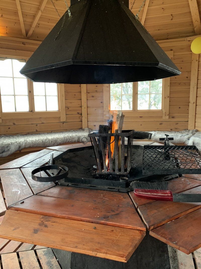
Cabin with fire pit for rainy days
69° 5' 40.4" N 17° 37' 39.7" E
69.0945435 17.6276815
• Head northeast on Finnlandsveien (7842). Go for 2.9 km.
• Continue on Brøstadveien (7840). Go for 1.2 km.
• Turn left onto Lundeveien (852). Go for 2.7 km.
• Continue on 852. Go for 30 m.
• Continue on Lundeveien (852). Go for 884 m.
• Continue on Bjørkebakkveien (84). Go for 25.6 km.
• Turn right onto Heiaveien (84). Go for 17.6 km.
• Turn left onto Spansdalveien (84). Go for 11.7 km.
• Turn right onto E6. Go for 27.7 km.
• Take the 1st exit from roundabout onto Nordmoveien (E6) toward Bjerkvik. Go for 555 m.
• Take the 1st exit from roundabout onto Kong Olavs vei (E10) toward 83/Harstad/Å i Lofoten. Go for 51.7 km.
• Turn left onto 824 toward Ramsund/Vuopmegeahci/Trøsemarka/Evenskjer. Go for 623 m.
• Continue on Skånlandsveien (832). Go for 61 m.
• Continue on 832. Go for 3.3 km.
• Turn left onto Skjærran. Go for 292 m.
• Arrive at Skjærran. Your destination is on the right.
☍
146,8 km
(2 hrs. 10 min.)
Day
Kostenfreier Stellplatz
Well located on the way to Lofoten/ Vesteralen.
Place at a small harbor with a direct view of the narrow fjord with shipping traffic.
Free disposal and supply.
Supermarket 300m away
Good for 1-2 nights.
! House and hardware store right next door
Skjærran 23
68° 35' 0.6" N 16° 33' 55.5" E
68.5834961 16.5654085
• Head east on Skjærran. Go for 292 m.
• Turn left onto 832. Go for 125 m.
• Continue on Skånlandsveien (832). Go for 63 m.
• Continue on 832. Go for 203 m.
• Continue on Skånlandsveien (832). Go for 293 m.
• Continue on 832. Go for 234 m.
• Continue on Skånlandsveien (832). Go for 352 m.
• Continue on 832. Go for 1.3 km.
• Turn left onto Kong Olavs vei (E10). Go for 4.6 km.
• Take the 2nd exit from roundabout onto Tjeldsundveien (E10) toward Sortland/Lødingen/Å i Lofoten. Go for 32.5 km.
• Take the 1st exit from roundabout onto Kong Olavs vei (E10). Go for 15.9 km.
• Turn right onto Kong Olavs vei (E10). Go for 18.1 km.
• Take the 2nd exit from roundabout onto Våtvollveien (85). Go for 14.4 km.
• Turn left onto Kong Olavs vei (85). Go for 14.3 km.
• Continue on Strandveien (85). Go for 4.6 km.
• Continue on Kringelveien (82). Go for 5.1 km.
• Continue on 82. Go for 430 m.
• Continue on Lilandveien (82). Go for 5.2 km.
• Continue on Reinsnesveien (82). Go for 14.5 km.
• Continue on 82. Go for 14.4 km.
• Continue on Buksnes (82). Go for 139 m.
• Continue on 82. Go for 1.5 km.
• Continue on Godbakken (82). Go for 96 m.
• Continue on 82. Go for 1.3 km.
• Continue on Toftar (82). Go for 102 m.
• Continue on 82. Go for 315 m.
• Continue on Alset (82). Go for 101 m.
• Continue on 82. Go for 7.2 km.
• Turn left onto 7698. Go for 21.3 km.
• Arrive at 7698.
☍
179,0 km
(2 hrs. 57 min.)
Day
Andøya
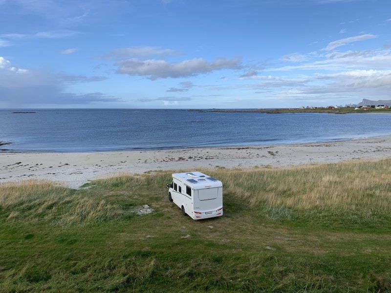
Beautifully situated right on the sandy beach.
Meadow ground and space for about 6 campers
Free of charge
No supply and disposal
69° 7' 15.1" N 15° 37' 5.6" E
69.1208496 15.6182091
• Head north on 7698. Go for 2.8 km.
• Continue on 7702. Go for 6.4 km.
• Continue on Skogvoll (7702). Go for 98 m.
• Continue on 7702. Go for 15.5 km.
• Continue on Laksebakkveien (7702). Go for 483 m.
• Continue on Skoleveien (7702). Go for 550 m.
• Continue on 7702. Go for 4.9 km.
• Continue on Bleiksveien (7702). Go for 753 m.
• Continue on 7702. Go for 111 m.
• Turn left onto Bleiksveien (82). Go for 172 m.
• Continue on Bleiksveien (82). Go for 919 m.
• Turn left. Go for 82 m.
• Turn left. Go for 52 m.
• Arrive at your destination on the left.
☍
32,9 km
( 33 min.)
Day
Andenes Camping 200 NOK Meerblick und Waschmaschine
Small campsite in front of the city with washing machine, supply and disposal
Andøya
69° 18' 14.2" N 16° 4' 0.7" E
69.3039551 16.0668606
• Head northeast. Go for 52 m.
• Turn right toward Bleiksveien/82. Go for 82 m.
• Turn right onto Bleiksveien (82). Go for 1.1 km.
• Continue on 82. Go for 22.0 km.
• Continue on Sandmelra (82). Go for 94 m.
• Continue on Dverbergveien (82). Go for 4.4 km.
• Continue on 82. Go for 10.1 km.
• Continue on Torvhågveien (82). Go for 181 m.
• Continue on 82. Go for 14.7 km.
• Continue on Alset (82). Go for 101 m.
• Continue on 82. Go for 315 m.
• Continue on Toftar (82). Go for 102 m.
• Continue on 82. Go for 1.3 km.
• Continue on Godbakken (82). Go for 96 m.
• Continue on 82. Go for 1.5 km.
• Continue on Buksnes (82). Go for 139 m.
• Continue on 82. Go for 14.4 km.
• Continue on Reinsnesveien (82). Go for 14.5 km.
• Continue on Lilandveien (82). Go for 5.2 km.
• Continue on 82. Go for 430 m.
• Continue on Kringelveien (82). Go for 5.1 km.
• Turn right onto Kong Olavs vei (82). Go for 1.2 km.
• Take the 1st exit from roundabout onto Vesterålsgata (820). Go for 621 m.
• Continue on Vesterålsveien (820). Go for 14.3 km.
• Turn right onto 821. Go for 8.1 km.
• Continue on Åsen (821). Go for 71 m.
• Continue on 821. Go for 10.8 km.
• Continue on Sortlandsveien (821). Go for 2.9 km.
• Continue on 821. Go for 355 m.
• Continue on Storgata (821). Go for 999 m.
• Turn right onto Kapt. Eriksensvei. Go for 72 m.
• Turn right onto Byeveien. Go for 41 m.
• Arrive at Byeveien. Your destination is on the left.
☍
135,5 km
(2 hrs. 4 min.)
Day
Myre Abglegenes Fiacherdörfchen
Well-developed gravel course with great views of the sea and mountains.
No supply and disposal, no electricity
The road here is very narrow for the last 6km and has many small potholes.
The place costs 125 NOK with VIPPS to pay - apparently someone doesn't come by to check us
Myre, Norwegen
68° 54' 55.2" N 15° 4' 46.1" E
68.9153215 15.0794821
• Head toward Fjellveien on Byeveien. Go for 166 m.
• Turn right onto Fjellveien. Go for 161 m.
• Turn left onto Storgata (821). Go for 755 m.
• Continue on 821. Go for 355 m.
• Continue on Sortlandsveien (821). Go for 2.9 km.
• Continue on 821. Go for 10.8 km.
• Continue on Åsen (821). Go for 71 m.
• Continue on 821. Go for 8.1 km.
• Turn left onto Vesterålsveien (820). Go for 14.3 km.
• Continue on Vesterålsgata (820). Go for 598 m.
• Take the 2nd exit from roundabout onto Kong Olavs vei (82). Go for 1.2 km.
• Turn right onto Strandveien (85). Go for 4.6 km.
• Continue on Kong Olavs vei (85). Go for 14.3 km.
• Turn right onto Våtvollveien (85). Go for 14.3 km.
• Take the 1st exit from roundabout onto E10. Go for 28.1 km.
• Turn left onto 7630. Go for 857 m.
• Continue on Steinbakken (7630). Go for 102 m.
• Continue on 7630. Go for 5.6 km.
• Continue on Raftstranda Nordre (7630). Go for 101 m.
• Continue on 7630. Go for 429 m.
• Continue on Raftstranda Søndre (7630). Go for 99 m.
• Continue on 7630. Go for 591 m.
• Turn slightly right. Go for 55 m.
• Turn right. Go for 27 m.
• Arrive at your destination on the right.
☍
108,8 km
(1 hrs. 44 min.)
Day
Direkt am Sehr engen Fjord. Schiffe sind nur einen „Steinwurf“ entfernt
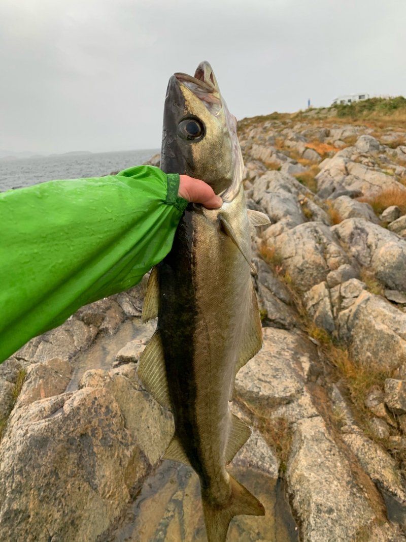
For 225 NOK you stand here directly at the fjord.
Very good fishing with some dolphins and seals swimming by.
Hurtigruten and other ships pass right by
Supply and disposal with electricity for 225 NOK
Payment is made at the machine. We are here in mid-September. Many apps say the place is closed (there are still some Norwegians here...)
Hinnøya Iinnasuolu
68° 24' 4.7" N 15° 6' 39" E
68.4013062 15.1108330
• Head south. Go for 50 m.
• Turn left onto 7630. Go for 687 m.
• Continue on Raftstranda Søndre (7630). Go for 99 m.
• Continue on 7630. Go for 429 m.
• Continue on Raftstranda Nordre (7630). Go for 101 m.
• Continue on 7630. Go for 5.6 km.
• Continue on Steinbakken (7630). Go for 102 m.
• Continue on 7630. Go for 857 m.
• Turn left onto E10. Go for 19.9 km.
• Turn right onto Kong Olavs vei (82). Go for 1.2 km.
• Turn left onto Midnattsolveien (7638). Go for 5.8 km.
• Continue on Sellåter (7638). Go for 115 m.
• Continue on Midnattsolveien (7638). Go for 2.1 km.
• Continue on Morfjordneset (7638). Go for 102 m.
• Continue on Midnattsolveien (7638). Go for 1.6 km.
• Continue on 7638. Go for 12 m.
• Continue on Morfjorden (7638). Go for 75 m.
• Continue on Midnattsolveien (7638). Go for 1.6 km.
• Continue on 7638. Go for 16 m.
• Continue on Midnattsolveien (7638). Go for 3.3 km.
• Continue on 7638. Go for 16 m.
• Continue on Midnattsolveien (7638). Go for 501 m.
• Continue on Sommarhusstranda (7638). Go for 68 m.
• Continue on Midnattsolveien (7638). Go for 1.8 km.
• Continue on 7638. Go for 15 m.
• Continue on Midnattsolveien (7638). Go for 3.2 km.
• Arrive at Midnattsolveien (7638).
☍
49,3 km
( 52 min.)
Day
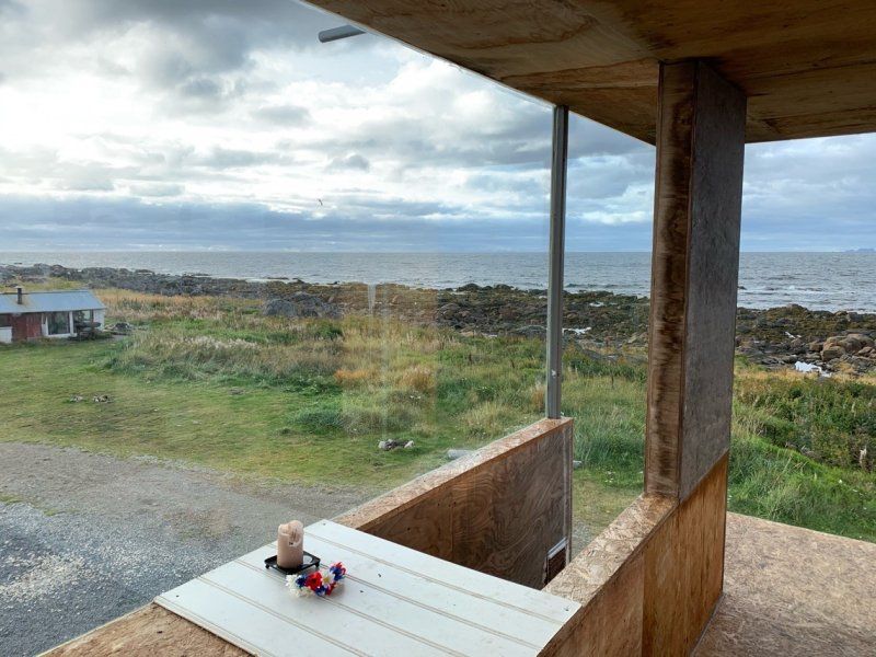
Rolfs Bar - kostenfrei Sicht aufs Meer/ Vesterälen
Free place, gravel and with barbecue areas.
There is a small hut with a bench, oven and table (Rolfs Bar)
There is also a "modern" glass shelter on 2.5 floors. Very nice for a great evening with candlelight
View of the open sea / Vesteralen and the Lofoten in the background.
Small cul-de-sac from the road, the last 500m bad dirt road, but ok
- No supply and disposal, no electricity
Austvagoya
68° 25' 25.3" N 14° 33' 48.2" E
68.4237061 14.5633902
• Head southwest on Midnattsolveien (7638). Go for 4.1 km.
• Continue on 7638. Go for 1.5 km.
• Continue on Midnattsolveien (7638). Go for 3.7 km.
• Turn left onto Midnattsolveien (7638). Go for 8.2 km.
• Continue on 7638. Go for 13 m.
• Continue on Midnattsolveien (7638). Go for 9.0 km.
• Continue on Jordneset (7638). Go for 73 m.
• Continue on Midnattsolveien (7638). Go for 18 m.
• Turn sharp right onto Vestpollveien (E10). Go for 15.8 km.
• Take the 1st exit from roundabout onto Kong Olavs vei (E10). Go for 63.5 km.
• Turn right onto Leiteveien (7606). Go for 821 m.
• Continue on Leiteveien (7606). Go for 737 m.
• Turn right onto Vikveien. Go for 26 m.
• Turn slightly left onto Vikveien. Go for 2.8 km.
• Turn right onto Uttakleivveien (7716). Go for 702 m.
• Continue on 7716. Go for 65 m.
• Turn left. Go for 15 m.
• Arrive at your destination on the left.
☍
111,1 km
(1 hrs. 49 min.)
Day
Vestagoya
Very stormy night predicted, here you are somewhat protected (update: wind has turned to W, so little protection)
Cost in the season 160 NOK
No supply and disposal
Small place for 5-6 campers with a great beach and easy hiking opportunities
68° 11' 57.2" N 13° 31' 55.9" E
68.1992188 13.5321953
• Head east. Go for 15 m.
• Turn right onto 7716. Go for 65 m.
• Continue on Uttakleivveien (7716). Go for 702 m.
• Continue on Voieveien (7716). Go for 4.7 km.
• Turn right onto Offersøyveien (7716). Go for 2.5 km.
• Turn right onto Flesveien (E10). Go for 54.3 km.
• Continue on Moskenesveien (E10). Go for 3.3 km.
• Continue on Kong Olavs vei (E10). Go for 207 m.
• Continue on Moskenesveien (E10). Go for 1.4 km.
• Turn sharp left. Go for 68 m.
• Arrive at your destination.
☍
67,1 km
(1 hrs. 15 min.)
Day
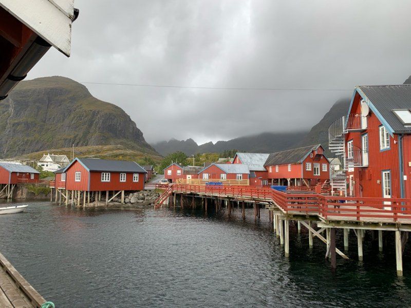
Å i Lofoten
Heavy storm accompanied us on the Lofoten.
We saw Reine and Co briefly in the rain/storm.
In Å we stayed at the central parking lot.
In season it is probably full here, signs limit parking to 6 hours.
In the museum we were told how to stay there without any problems.
Very sloping place, in the south of Lofoten there are fewer places to sleep.
Moskenesöya
67° 52' 47.4" N 12° 58' 39.5" E
67.8798297 12.9776316
• Head toward Kong Olavs vei. Go for 81 m.
• Continue on E10. Go for 8 m.
• Continue on Kong Olavs vei (E10). Go for 325 m.
• Turn slightly left onto Kong Olavs vei (E10). Go for 870 m.
• Continue on Kong Olavs vei (E10). Go for 207 m.
• Continue on Moskenesveien (E10). Go for 3.3 km.
• Turn right onto Birger Eriksens vei (E10). Go for 388 m.
• Turn right onto Birger Eriksens vei (E10). Go for 127 m.
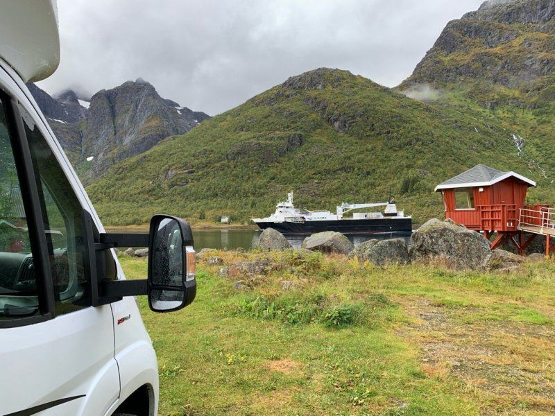
• Take the Moskenes-Bodø Ferry. Stay on for 96.9 km.
• Head east on Terminalveien (80). Go for 271 m.
• Turn right onto Terminalveien (80). Go for 32 m.
• Turn right onto Terminalveien (80). Go for 30 m.
• Take the 1st exit from roundabout onto Jernbaneveien (80). Go for 482 m.
• Take the 2nd exit from roundabout onto Jernbaneveien (80). Go for 145 m.
• Take the 3rd exit from roundabout onto Sjøgata (80). Go for 589 m.
• Pass 7 roundabouts and continue on 80. Go for 17.1 km.
• Take the 1st exit from roundabout onto 17. Go for 74.9 km.
• Turn right onto Forstrandveien (7444). Go for 1.5 km.
• Continue toward Skarveien. Go for 1.3 km.
• Continue on Skarveien. Go for 3.8 km.
• Turn right onto 17. Go for 898 m.
• Turn right onto Strandveien (7436). Go for 108 m.
• Turn left. Go for 38 m.
• Continue straight ahead. Go for 24 m.
• Arrive at your destination on the left.
☍
203,3 km
(4 hrs. 38 min.)
Day
Am Strand gelegene Anlage ist gut für eine Nacht
With supply and disposal
Free of charge
Susceptible to storms (about 100m away is a protected parking lot
Great spot for swimming and barbecuing in summer
Strandveien 2
66° 57' 38" N 13° 48' 11.8" E
66.9605622 13.8032801
• Head west. Go for 134 m.
• Turn right onto Strandveien (7436). Go for 108 m.
• Turn right onto 17. Go for 20.4 km.
• Take the 2nd exit from roundabout onto Chr. Tidemanns vei (17). Go for 51.8 km.
• Turn left onto Kirkeveien (17) toward Steinkjer/Ågskardet. Go for 3.0 km.
• Take the Forøy-Ågskardet Ferry. Stay on for 2.7 km.
• Head toward Myranveien on Ågveien (17). Go for 28.1 km.
• Take the Jektvik-Kilboghamn Ferry. Stay on for 18.8 km.
• Head southwest on 17. Go for 58.9 km.
• Turn right onto Nesnaveien (17). Go for 13.6 km.
• Arrive at 17.
☍
197,5 km
(4 hrs. 1 min.)
Day
Kostenfreie Parkmöglichkeit ( Flucht vor dem Sturm IV)
It has been storming and raining heavily for 4 days now. Again and again hurricane gusts and heavy rain.
On the way here there are some nice places that we unfortunately couldn't use because of the renewed storm warning.
Here you are "quite well" protected
Sörfjorden
66° 17' 21.5" N 13° 16' 2.6" E
66.2893066 13.2673798
• Head southwest on 17. Go for 17.1 km.
• Take the Nesna-Levang Ferry. Stay on for 8.3 km.
• Head east on Leirfjordveien (17). Go for 9.9 km.
• Turn left onto 78 toward Mosjøen. Go for 21.2 km.
• Turn left onto 7330 toward Fustvatnet. Go for 1.0 km.
• Continue on Brattbakkvegen (7330). Go for 8.1 km.
• Turn left onto Luktvassvegen (7327). Go for 321 m.
• Turn left onto Luktvassvegen (7327). Go for 102 m.
• Turn left onto E6. Go for 268 m.
• Arrive at E6. Your destination is on the right.
☍
66,3 km
(1 hrs. 32 min.)
Day
An alter E6 - jetzt kostenfrei
We were already at this place on the outward journey, meanwhile the new E6 has opened and has therefore become quieter.
Now on 09/21/20 the place costs 0.00 NOK, electricity still works :).
On 08/31 it still cost 100 NOK
* Since something inland is not a hurricane :)
Easy to navigate even after heavy rain and during floods
Brattbakkvegen 37
65° 54' 25.8" N 13° 18' 1.1" E
65.9071655 13.3003177
• Head east on E6. Go for 268 m.
• Turn right onto Luktvassvegen (7327). Go for 423 m.
• Turn right onto Brattbakkvegen (7330). Go for 8.1 km.
• Continue on 7330. Go for 1.0 km.
• Turn right onto 78. Go for 21.2 km.
• Turn left onto 17 toward Steinkjer/Brønnøysund. Go for 22.8 km.
• Take the 2nd exit from roundabout onto Søvikveien (17). Go for 37.6 km.
• Arrive at Tjøttaveien (17). Your destination is on the left.
☍
91,3 km
(1 hrs. 15 min.)
Day
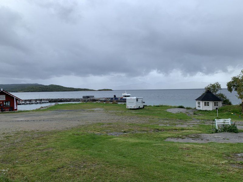
Am Hafen mit guten Angelmöglichkeiten
Directly at the marina with a view of the sea.
There is good fishing from the mole ?.
Here the ferry continues south.
Small supper market in town.
No supply and disposal
No electricity
Cost 100 NOK
Tjøtta, Norwegen
65° 49' 22.8" N 12° 25' 37.2" E
65.8229906 12.4270048
• Head toward Nervegen on Tjøttaveien (17). Go for 94 m.
• Turn left onto Svinesveien (7262). Go for 25 m.
• Turn right onto 839. Go for 105 m.
• Take the Tjøtta-Igerøy Ferry. Stay on for 21.8 km.
• Take the Igerøy-Horn Ferry. Stay on for 13.3 km.
• Head south on 17. Go for 11.0 km.
• Turn right onto 76. Go for 505 m.
• Continue on Russesletta (76). Go for 183 m.
• Continue on Sømnaveien (76). Go for 245 m.
• Continue on 76. Go for 983 m.
• Continue on Sømnaveien (76). Go for 1.1 km.
• Continue on Storgata (54). Go for 711 m.
• Continue on Storgata. Go for 102 m.
• Turn right onto E. Olsens gate. Go for 77 m.
• Turn left onto Masterberggata. Go for 752 m.
• Turn right onto Bryggeveien. Go for 209 m.
• Turn right onto 54. Go for 1.3 km.
• Continue on Klubbveien (54). Go for 182 m.
• Continue on 54. Go for 1.3 km.
• Continue on Nordhus (54). Go for 2.9 km.
• Continue on 54. Go for 661 m.
• Turn slightly left onto Torgveien (54). Go for 1.4 km.
• Continue on Myrset (54). Go for 138 m.
• Continue on Torgveien (54). Go for 1.8 km.
• Turn left onto 54. Go for 1.6 km.
• Continue on 54. Go for 800 m.
• Turn slightly left onto 54. Go for 191 m.
• Continue on Indrehatten. Go for 59 m.
• Arrive at Indrehatten. Your destination is on the right.
☍
63,6 km
(2 hrs. 7 min.)
Day
Camping Torghatten - Perfekt zum Angeln
Very nice place.
Very nice outside of the high season, the well-known Torghatten (hole in the rock) is only a 25-minute walk. Ascent also good with baby and backpack.
280 NOK with electricity
Torghatten, 8909, Brønnøysund, Norwegen
65° 23' 37.4" N 12° 5' 53.3" E
65.3937300 12.0981500
• Head south on Indrehatten.
• Arrive at Indrehatten. Your destination is on the right.
☍
Distance not available
(Duration not available)
Day
Camping Torghatten
Two days - only had to pay for one :)
Great spot for fishing - it goes straight down to 20-50m
Torghatten, 8909, Brønnøysund, Norwegen
65° 23' 37.4" N 12° 5' 53.3" E
65.3937300 12.0981500
• Head south on Indrehatten. Go for 5 m.
• Turn right toward Indrehatten. Go for 50 m.
• Turn slightly left onto Indrehatten. Go for 75 m.
• Continue on 54. Go for 2.6 km.
• Turn right onto Torgveien (54). Go for 1.8 km.
• Continue on Myrset (54). Go for 138 m.
• Continue on Torgveien (54). Go for 1.4 km.
• Turn slightly right onto 54. Go for 661 m.
• Continue on Nordhus (54). Go for 2.9 km.
• Continue on 54. Go for 1.3 km.
• Continue on Klubbveien (54). Go for 182 m.
• Continue on 54. Go for 1.3 km.
• Turn left onto Bryggeveien. Go for 209 m.
• Turn left onto Masterberggata. Go for 752 m.
• Turn right onto E. Olsens gate. Go for 77 m.
• Turn left onto Storgata. Go for 813 m.
• Continue on Sømnaveien (54). Go for 1.1 km.
• Continue on 76. Go for 983 m.
• Continue on Sømnaveien (76). Go for 245 m.
• Continue on Russesletta (76). Go for 183 m.
• Continue on 76. Go for 505 m.
• Continue on Mosheim (17). Go for 46.7 km.
• Turn right onto 7210. Go for 871 m.
• Turn left onto Ytterkvaløyveien. Go for 1.6 km.
• Arrive at Ytterkvaløyveien.
☍
66,5 km
(1 hrs. 20 min.)
Day
Tolle Bucht - einsam und Badestrand
Secluded bay with swimming area.
Free of charge
Without supply and disposal
toilets on site
Probably a popular place in summer, we were alone.
Space for 4-5 vehicles
Here you really stand alone in nature with a great view
Kvaløya
65° 12' 36.3" N 12° 0' 42.1" E
65.2100830 12.0116956
• Head northeast on Ytterkvaløyveien. Go for 1.6 km.
• Turn right onto 7210. Go for 871 m.
• Turn right onto 17. Go for 195 m.
• Take the Vennesund-Holm Ferry. Stay on for 5.6 km.
• Head north on Holmsveien (17). Go for 20.7 km.
• Turn right onto Hollupveien (802) toward Bogen/Leka Ferge. Go for 5.7 km.
• Continue on Gravvikvegen (771). Go for 30.4 km.
• Turn right onto Foldavegen (770). Go for 10.4 km.
• Turn left onto 7110. Go for 1.5 km.
• Continue on Engan (7110). Go for 111 m.
• Continue on 7110. Go for 2.2 km.
• Continue on Gjerdet (7110). Go for 148 m.
• Continue on 7110. Go for 1.4 km.
• Continue on Myrvoll (7110). Go for 140 m.
• Continue on 7110. Go for 813 m.
• Turn left onto Skagavegen (769). Go for 5.8 km.
• Take the Hofles-lund Ferry. Stay on for 7.2 km.
• Head toward Harranesvegen on 769. Go for 14.5 km.
• Turn left. Go for 171 m.
• Arrive at your destination on the right.
☍
109,5 km
(2 hrs. 52 min.)
Day
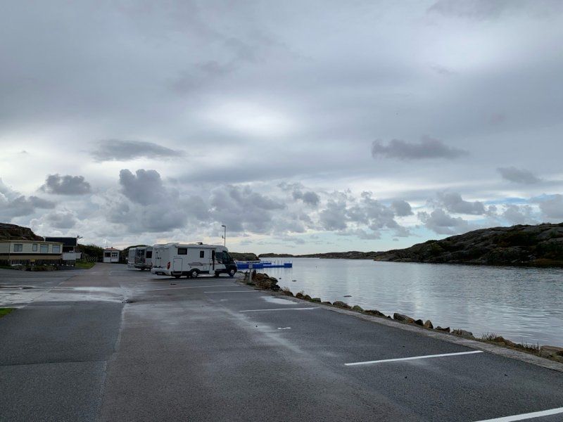
An Marina gelegen 200 NOK inkl. Strom
Nice place for 5-) Womos directly at the Marina.
200 NOK including electricity
Supply and disposal
Payment with Visa possible.
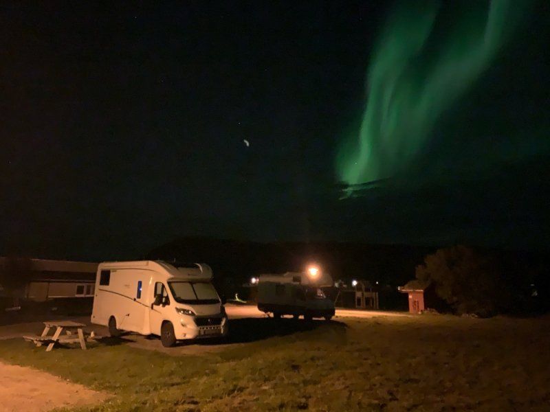
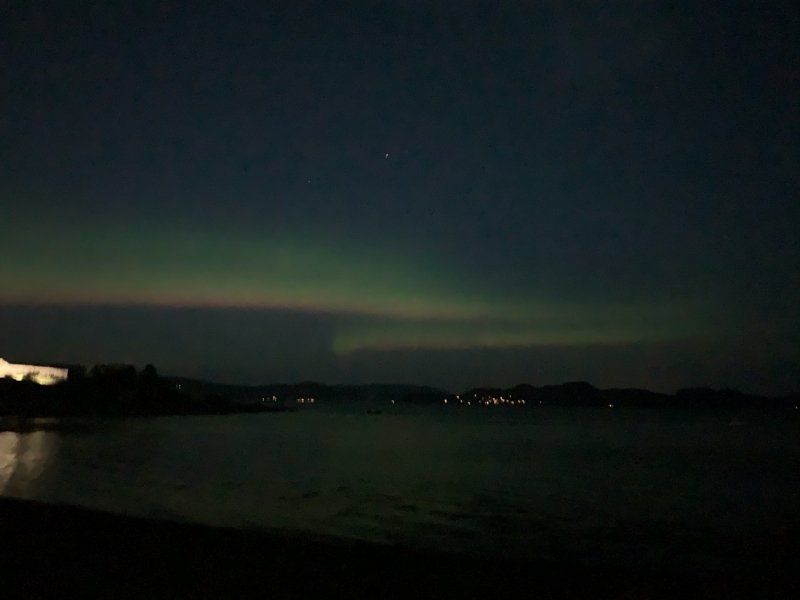
“Northern Lights seen”
Salsnes, Norwegen
64° 41' 24.6" N 11° 26' 22.7" E
64.6901535 11.4396314
• Head south.
• Arrive at your destination on the right.
☍
Distance not available
(Duration not available)
Day
Zwei Tage geblieben
We stayed two days.
Fishing possible but not such a good spot
Salsnes, Norwegen
64° 41' 24.6" N 11° 26' 22.7" E
64.6901535 11.4396314
• Head north. Go for 171 m.
• Turn left onto 769. Go for 37.7 km.
• Pass 3 roundabouts and continue on Namdalsvegen (769). Go for 1.2 km.
• Take the 1st exit from roundabout onto Jernbanegata (769). Go for 224 m.
• Take the 2nd exit from roundabout onto 769. Go for 1.6 km.
• Take the 1st exit from roundabout onto Nøsthaugvegen (769). Go for 1.4 km.
• Take the 2nd exit from roundabout onto Veg Nr 26 (17). Go for 62.8 km.
• Turn right onto Kvamsvegen (E6). Go for 5.3 km.
• Pass 7 roundabouts and continue on Steinkjervegen (E6). Go for 8.9 km.
• Keep left onto E6 toward Trondheim. Go for 29.6 km.
• Pass 2 roundabouts and continue on E6. Go for 21.5 km.
• Continue on E6. Go for 3.0 km.
• Take ramp. Go for 458 m.
• Take the 2nd exit from roundabout onto E6. Go for 3.1 km.
• Take the 1st exit from roundabout onto Breivegen (E6). Go for 9.8 km.
• Take the 1st exit from roundabout onto Riksvegen (E6). Go for 3.7 km.
• Take ramp. Go for 140 m.
• Turn left onto Svevegen. Go for 336 m.
• Turn right onto Fløanvegen (6814). Go for 2.1 km.
• Turn right onto Steinvikholmvegen. Go for 400 m.
• Turn left. Go for 77 m.
• Arrive at your destination.
☍
193,4 km
(2 hrs. 54 min.)
Day
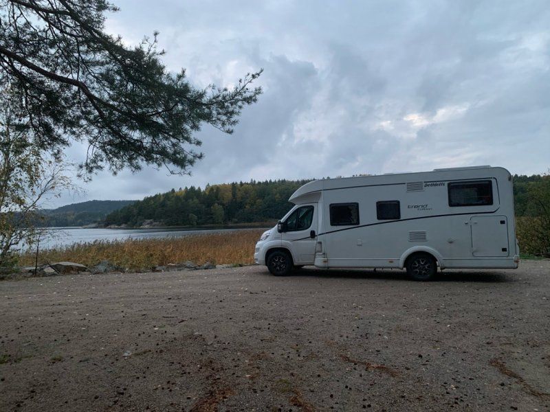
Schöner kleiner Platz 100 NOK ohne Strom
We were here on the way there
Cuter in September
Steinvikholmvegen
63° 32' 29.6" N 10° 48' 49.6" E
63.5415478 10.8137698
• Head toward Steinvikholmvegen. Go for 77 m.
• Turn right onto Steinvikholmvegen. Go for 400 m.
• Turn left onto Fløanvegen (6814). Go for 2.3 km.
• Turn left onto 6814. Go for 70 m.
• Turn right and take ramp onto E6. Go for 3.0 km.
• Pass 4 roundabouts and continue on E6. Go for 24.9 km.
• Take ramp toward Vikhammer/Bostad. Go for 239 m.
• Turn left onto Leistadvegen (6706) toward Bostad. Go for 412 m.
• Turn right onto Markabygdvegen (6672). Go for 759 m.
• Turn right onto Markabygdvegen (6672). Go for 2.3 km.
• Continue toward Væresvegen/6672. Go for 21 m.
• Continue on 6672. Go for 280 m.
• Continue on Kjersti Wæhres veg (6672). Go for 148 m.
• Continue on Væresvegen (6672). Go for 874 m.
• Turn left onto Malvikvegen (950). Go for 1.5 km.
• Take the 2nd exit from roundabout. Go for 60 m.
• Continue on Kockhaugvegen (950). Go for 29 m.
• Take ramp onto E6 toward Trondheim. Go for 9.1 km.
• Keep left onto Omkjøringsvegen (E6) toward E39/Oslo/Heimdal. Go for 3.1 km.
• Keep left onto E6 toward Oslo/E39. Go for 7.4 km.
• Take exit 30 toward Ålesund/Orkanger/707/715. Go for 549 m.
• Take the 2nd exit from roundabout onto E39 toward Ålesund/Orkanger. Go for 4.2 km.
• Take ramp toward Industriområde Øysand. Go for 291 m.
• Turn right onto Gamle Kongeveg. Go for 71 m.
• Continue on Øysandvegen. Go for 95 m.
• Turn right onto Øysandvegen. Go for 121 m.
• Continue on Gamle Kongeveg. Go for 191 m.
• Arrive at Gamle Kongeveg.
☍
62,5 km
( 58 min.)
Day
Øysand Camping
The new pitch in Trondheim was just too loud for us - this place is a bit outside.
If you drive a few kilometers along the fjord, you will come across very good fishing spots.
-50 to - 100m straight from the shore :)
Øysand, 7224, Melhus, Norwegen
63° 19' 37" N 10° 13' 10" E
63.3269400 10.2194400
• Head southwest on Gamle Kongeveg. Go for 191 m.
• Continue on Øysandvegen. Go for 121 m.
• Turn left onto Øysandvegen. Go for 95 m.
• Continue on Gamle Kongeveg. Go for 71 m.
• Continue on Øybergvegen. Go for 70 m.
• Turn left and take ramp onto E39 toward Trondheim. Go for 4.4 km.
• Take the 1st exit from roundabout onto E6. Go for 149 m.
• Take the 2nd exit from roundabout onto E6 toward Oslo. Go for 71.1 km.
• Keep left onto Trondheimsveien (E6). Go for 31.4 km.
• Pass 3 roundabouts and continue on E6. Go for 48.2 km.
• Turn left onto Folldalsvegen (29) toward Folldal. Go for 3.3 km.
• Arrive at Folldalsvegen (29). Your destination is on the left.
☍
159,1 km
(2 hrs. 10 min.)
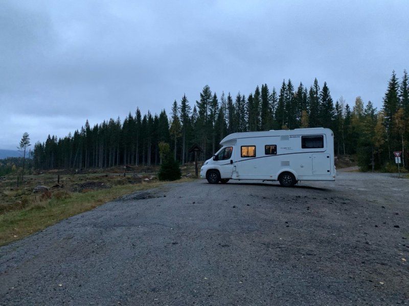
Day
Zwischen Dovre Nationalpark und Rondanne NP
Located just off the side road and just a few minutes from the E6.
Space for 3 vehicles up to approx. 8m
No supply and disposal
Free of charge
Here you are in the middle of nature, directly on a lake.
If you follow the path on the dam, you can take a nice walk in the mountains.
- right on the E6, only a few km away we saw a herd of musk oxen :)
Folldalsvegen
62° 12' 44.1" N 9° 36' 6.8" E
62.2122627 9.6019011
• Head north on Folldalsvegen (29). Go for 3.3 km.
• Turn left onto Trondheimsvegen (E6). Go for 31.0 km.
• Take the 1st exit from roundabout onto Romsdalsvegen (E136) toward Ålesund/Åndalsnes. Go for 55.4 km.
• Take the 3rd exit from roundabout onto Romsdalsvegen (E136). Go for 49.0 km.
• Turn left onto Sørsidevegen (E136) toward Ålesund. Go for 43.4 km.
• Take the 2nd exit from roundabout onto Brastadstranda (E39) toward Ålesund. Go for 21.5 km.
• Turn left onto Giskemovegen (522). Go for 176 m.
• Continue on Valgermo (522). Go for 97 m.
• Continue on Giskemovegen (522). Go for 142 m.
• Continue on 522. Go for 43 m.
• Continue on Giskemovegen (522). Go for 1.0 km.
• Turn left onto Storfjordvegen (650). Go for 43.0 km.
• Turn left onto 63. Go for 34.7 km.
• Turn right. Go for 157 m.
• Arrive at your destination on the right.
☍
283,0 km
(3 hrs. 53 min.)
Day
Isterdalsvegen
A must have for the Trollstigen
62° 27' 11.5" N 7° 39' 48.5" E
62.4531807 7.6634816
• Head north. Go for 78 m.
• Turn right. Go for 160 m.
• Turn left toward Isterdalsvegen/63. Go for 95 m.
• Turn left onto Isterdalsvegen (63). Go for 34.7 km.
• Turn right onto 63. Go for 4.3 km.
• Turn left onto 63. Go for 156 m.
• Take the Linge-Eidsdal Ferry. Stay on for 2.6 km.
• Head toward Ytterdalsgata on 63. Go for 11.8 km.
• Turn right onto Indreeidstunnelen (63). Go for 5.2 km.
• Turn right onto Ørnevegen (63) toward Geiranger. Go for 8.2 km.
• Turn right onto Maråkvegen. Go for 73 m.
• Continue on Maråkvegen. Go for 260 m.
• Turn right. Go for 26 m.
• Arrive at your destination on the right.
☍
67,7 km
(1 hrs. 40 min.)
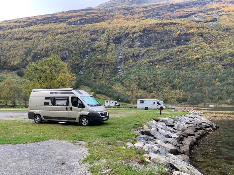
Geiranger Camping - 260 NOK mit toller Sicht
Thanks to Corona, closed borders and vacation time, we were here with a few other campers.
Unfortunately also without cruise ships.
Seat in low season 260 NOK (-40 NOK) - all seats cost the same, otherwise you probably pay more for the first row.
6216, Geiranger, Norwegen
62° 5' 59.1" N 7° 12' 13.6" E
62.0997400 7.2037700
• Head southeast. Go for 18 m.
• Turn slightly left toward Maråkvegen. Go for 8 m.
• Turn left onto Maråkvegen. Go for 200 m.
• Continue on Maråkvegen. Go for 133 m.
• Turn left onto Geirangervegen (63). Go for 204 m.
• Turn left onto 63. Go for 119 m.
• Take the Geiranger-Hellesylt Ferry. Stay on for 20.1 km.
• Head toward Hellesyltvegen on 60. Go for 578 m.
• Turn right onto Hellesyltvegen (60). Go for 878 m.
• Turn left onto Langedalsvegen (60). Go for 25.0 km.
• Turn left onto E39 toward Bergen/Stryn/60. Go for 8.3 km.
• Turn left onto Nordfjordvegen (15) toward Stryn. Go for 15.8 km.
• Take the 2nd exit from roundabout onto Tonningsgata (15) toward Otta. Go for 66.1 km.
• Turn left toward Skjåkvegen. Go for 78 m.
• Continue on Skjåkvegen. Go for 185 m.
• Arrive at Skjåkvegen.
☍
137,8 km
(2 hrs. 42 min.)
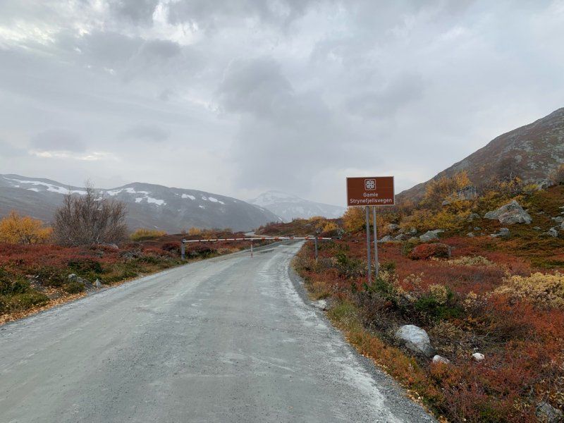
Day
Grotli, Norwegen
A hiker's car park, just in front of the barrier to Gamle Strynefjellsvegen, which was already closed in October.
So a very nice parking lot as you can walk along Gamle Strynefjellsvegen :).
Parking at over 900m and therefore correspondingly cool
Free of charge
No supply and disposal
No electricity
62° 2' 2.4" N 7° 41' 27.1" E
62.0340000 7.6908629
• Head south on Skjåkvegen. Go for 263 m.
• Turn left onto 15. Go for 57.6 km.
• Take the 2nd exit from roundabout onto Bergomsvegen (15) toward Otta. Go for 24.7 km.
• Turn right onto Fjellvegen (51). Go for 75.7 km.
• Turn left. Go for 80 m.
• Arrive at your destination.
☍
158,3 km
(2 hrs. 5 min.)
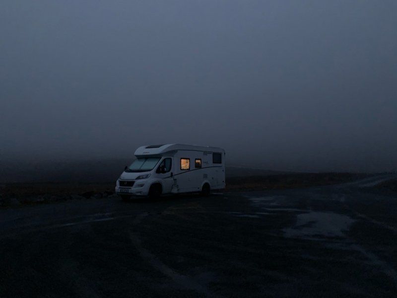
Day
Es war extrem neblig - kostenfrei
Free of charge
No supply and disposal
Very quiet
Bygdinvegen
61° 18' 10.3" N 8° 48' 33.3" E
61.3028729 8.8092543
• Head northeast. Go for 96 m.
• Turn left onto 51. Go for 47.0 km.
• Turn left onto Tyinvegen (E16). Go for 4.2 km.
• Take the 2nd exit from roundabout onto Oslovegen (E16). Go for 12.7 km.
• Turn left onto Tonsåslinna (33) toward Gjøvik/Dokka. Go for 77.0 km.
• Pass 2 roundabouts and continue on 33. Go for 709 m.
• Take the 1st exit from roundabout onto 4 toward Oslo. Go for 39.7 km.
• Turn left onto 180 toward Minnesund/Hurdal. Go for 26.0 km.
• Turn left onto Vestsidevegen (180). Go for 3.4 km.
• Take the 2nd exit from roundabout onto Minneåsvegen. Go for 144 m.
• Continue on Brustadvegen. Go for 198 m.
• Continue on Minneåsvegen. Go for 4.3 km.
• Turn right onto Hermodts plass. Go for 41 m.
• Arrive at Hermodts plass.
☍
215,5 km
(3 hrs. 9 min.)
Day
Waldparkplatz im Winter 50 NOK
After 5km very narrow road, uphill, but in good condition, you reach this small parking lot.
In winter 50 NOK
No supply and disposal no electricity
Hermodts Plass
60° 24' 44.2" N 11° 7' 6.4" E
60.4122792 11.1184307
• Head toward Tisjøvegen on Hermodts plass. Go for 41 m.
• Turn right onto Minneåsvegen. Go for 1.9 km.
• Continue on Minneåsen. Go for 4.3 km.
• Turn right onto Feiringvegen (33). Go for 2.6 km.
• Take the 2nd exit from roundabout onto 33 toward E6/Trondheim/Oslo. Go for 206 m.
• Take the 1st exit from roundabout onto E6 toward Oslo. Go for 38.2 km.
• Continue on E6. Go for 12.1 km.
• Take exit 45 toward Nannestad/Lillestrøm/Skedsmokorset/Gjerdrum. Go for 313 m.
• Take the 1st exit from roundabout onto Presthagaveien (120) toward Lillestrøm. Go for 275 m.
• Take the 2nd exit from roundabout onto Kirkeveien (120). Go for 2.7 km.
• Take the 3rd exit from roundabout onto Kirkeveien (120). Go for 676 m.
• Take the 2nd exit from roundabout onto Kirkeveien (120). Go for 206 m.
• Take the 2nd exit from roundabout onto Fetveien (22/120). Go for 901 m.
• Pass 3 roundabouts and continue on Fetveien (22). Go for 1.5 km.
• Take the 2nd exit from roundabout onto Fetveien (22) toward Fetsund. Go for 2.2 km.
• Pass 3 roundabouts and continue on Fetveien (22). Go for 5.2 km.
• Take the 1st exit from roundabout onto Fetveien (22) toward Mysen/169/Løken. Go for 6.0 km.
• Pass 4 roundabouts and continue on Vandugbakken (129). Go for 40.3 km.
• Take the 1st exit from roundabout onto Folkenborgveien (692). Go for 95 m.
• Turn left onto Jernbanegaten. Go for 498 m.
• Arrive at Jernbanegaten.
☍
120,1 km
(1 hrs. 48 min.)
Day
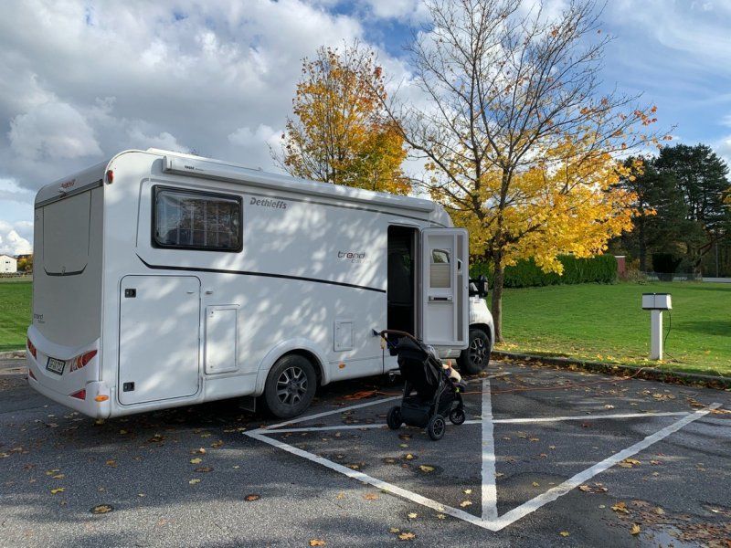
Kostenfreier Stellplatz mit Strom
Located directly in the city with electricity and supply and disposal.
Free of charge
From April to October
Jernbanegata 17
59° 33' 4" N 11° 19' 31" E
59.5511166 11.3252913
• Head south on Jernbanegaten. Go for 122 m.
• Continue on Kapellveien. Go for 381 m.
• Continue on Møbelgata. Go for 147 m.
• Turn right onto Smedgaten (129). Go for 323 m.
• Take the 2nd exit from roundabout onto Smedgaten (129). Go for 685 m.
• Turn right onto Trømborgveien (22). Go for 13.0 km.
• Turn left onto Bærbyveien. Go for 3.9 km.
• Turn left onto Strømfossveien (124). Go for 23.7 km.
• Arrive at Rakkestadveien (124).
☍
42,3 km
( 42 min.)
Strømfoss, Aremark, Norwegen
In the low season free parking space directly at the steamboat jetty.
Garbage disposal only
No supply and disposal
Nice for one night
Straight ground
Suitable for all sizes
1798 Aremark, Norwegen
59° 18' 2.8" N 11° 39' 37.9" E
59.3007683 11.6605276
• Head southeast on Rakkestadveien (124). Go for 673 m.
• Turn right onto Aremarkveien (21). Go for 32.1 km.
• Turn left onto Georg Feydts gate (103) toward Holtet/22/Øberg. Go for 115 m.
• Continue on Øbergveien (103). Go for 2.9 km.
• Turn left onto Iddeveien (220). Go for 4.2 km.
• Turn right onto Iddeveien. Go for 477 m.
• Turn slightly left onto Iddeveien. Go for 28 m.
• Turn slightly right onto Iddeveien. Go for 1.1 km.
• Turn left onto Skriverøveien. Go for 16 m.
• Turn right onto Skriverøveien. Go for 45 m.
• Continue on Stenhoggerveien. Go for 83 m.
• Turn slightly left onto Skriverøveien. Go for 739 m.
• Turn left. Go for 399 m.
• Arrive at your destination.
☍
42,9 km
( 45 min.)
Day
Kostenfrei im Wald/ am Fjord
free parking,
Bit remote.
No supply and disposal
Some walkers pass by, but they don't bother and are friendly :)
Very quiet and great water location - no fishing or swimming
1765
59° 3' 26.8" N 11° 25' 6.2" E
59.0574367 11.4183876
• Head toward Skriverøveien. Go for 399 m.
• Turn right onto Skriverøveien. Go for 573 m.
• Continue on Skriverøveien. Go for 166 m.
• Turn slightly right onto Stenhoggerveien. Go for 83 m.
• Continue on Skriverøveien. Go for 45 m.
• Turn left onto Skriverøveien. Go for 16 m.
• Turn right toward Iddeveien. Go for 949 m.
• Continue on Iddeveien. Go for 633 m.
• Turn right onto 220. Go for 25.8 km.
• Continue on Vassbotten (165). Go for 9.7 km.
• Continue on 165. Go for 25.3 km.
• Turn right onto Norra Bohusvägen. Go for 1.1 km.
• Continue on Kolstorp. Go for 673 m.
• Turn left toward Lundby. Go for 90 m.
• Continue on Lundby. Go for 183 m.
• Continue on Björkhaga. Go for 698 m.
• Continue on Nytorp. Go for 2.0 km.
• Continue on Grind. Go for 287 m.
• Continue on Hekullen. Go for 501 m.
• Continue on 163. Go for 4.1 km.
• Turn left toward Yllene. Go for 68 m.
• Continue on Yllene. Go for 2.4 km.
• Continue on Yllene Sörgård. Go for 134 m.
• Continue on Yllene Hed. Go for 527 m.
• Continue on Skogbyhed. Go for 4.2 km.
• Continue on Gerlesborg Bräcke. Go for 74 m.
• Turn right toward Övre Hogslättsvägen. Go for 808 m.
• Turn right onto Övre Hogslättsvägen. Go for 604 m.
• Arrive at your destination.
☍
82,1 km
(1 hrs. 18 min.)
Day
Schweden Nähe Weltkulturerbe Felszeichnungen
Quiet and lots of meadow
With electricity 150 SEC
Gray and black water disposal
No drinking water!
Between the Rock Carvings World Heritage Site and Smogen/ Kungshamn
Good for one night
457 48
58° 29' 45.5" N 11° 20' 20.3" E
58.4959801 11.3389629
• Head toward Övre Hogslättsvägen. Go for 404 m.
• Continue on Övre Hogslättsvägen. Go for 1.6 km.
• Continue on Skärholmen Sågen. Go for 404 m.
• Continue on Arslätt. Go for 186 m.
• Turn right onto Brygge (174). Go for 867 m.
• Turn left onto Sjöbackarna. Go for 1.1 km.
• Continue on Säm. Go for 302 m.
• Continue on Säm Grindstugan. Go for 168 m.
• Continue on Heljeröd. Go for 647 m.
• Continue on Heljeröd Nyborg. Go for 133 m.
• Continue on Heljeröd. Go for 830 m.
• Turn left onto Haga. Go for 275 m.
• Continue on Liseberg. Go for 153 m.
• Continue on Valla Östergård Dammen. Go for 156 m.
• Continue on Haga. Go for 384 m.
• Continue on Torp. Go for 910 m.
• Continue on Tossene. Go for 233 m.
• Turn right onto Tossene. Go for 149 m.
• Continue on Tossene Rättaregården. Go for 164 m.
• Continue on Tossene. Go for 542 m.
• Continue on Prästbacka. Go for 1.7 km.
• Continue on Prästbacka Dammen. Go for 100 m.
• Continue on Håbacka. Go for 983 m.
• Continue on Askum Kronogård. Go for 467 m.
• Continue on Askum Kronogård Åkerbo. Go for 91 m.
• Continue on Askum Kronogård Lissbacka. Go for 45 m.
• Continue on Askum Kronogård Annelund. Go for 83 m.
• Continue on Lilla Askum. Go for 165 m.
• Continue on Askums kyrka. Go for 185 m.
• Continue on Lilla Askum. Go for 54 m.
• Turn right onto Lycke (171). Go for 119 m.
• Turn left onto Lycke (171). Go for 7.1 km.
• Turn left onto Wiggersviks camping. Go for 47 m.
• Arrive at Wiggersviks camping. Your destination is on the left.
☍
20,8 km
( 24 min.)
Day
Campingplatz 150 SEK in Nebensaison
In the low season a very nice place, since there are no other tourists here, it also only costs 150SEK / night.
Direct location on the water and Kungshamn is about a 25-minute walk.
You should use a bike to go to Smogen, but in the off-season, unlike in summer, there is nothing going on here.
We're slowly getting closer to Gothenburg and that's the end of our 50 days in Norway :)
Wiggersvik 5, 45691, Kungshamn, Schweden
58° 21' 47.2" N 11° 16' 51.6" E
58.3631000 11.2810100
• Head south on Wiggersviks camping.
• Arrive at Wiggersviks camping. Your destination is on the left.
☍
Distance not available
(Duration not available)
Day
Wiggersviks Familjecamping
Two days
Wiggersvik 5, 45691, Kungshamn, Schweden
58° 21' 47.2" N 11° 16' 51.6" E
58.3631000 11.2810100
• Head toward Wiggersvik on Wiggersviks camping. Go for 47 m.
• Turn right onto Wiggersvik (171). Go for 7.1 km.
• Turn right onto Lycke (171). Go for 7.3 km.
• Take the 2nd exit from roundabout onto Åby Varpet (171). Go for 6.5 km.
• Take the 2nd exit from roundabout onto 162. Go for 5.7 km.
• Take the 2nd exit from roundabout onto E6 toward Göteborg/Uddevalla/Munkedal. Go for 21.0 km.
• Take exit 96.2 toward 160/Orust/Tjörn/Lysekil. Go for 371 m.
• Take the 1st exit from roundabout onto 161 toward 160/Orust/Tjörn/Lysekil. Go for 942 m.
• Take the 1st exit from roundabout onto Hedkärr (161). Go for 7.0 km.
• Take the 3rd exit from roundabout onto Rotvik (160). Go for 13.6 km.
• Turn right onto Röravägen. Go for 137 m.
• Take the 1st exit from roundabout onto Ängsvägen. Go for 446 m.
• Arrive at Ängsvägen. Your destination is on the right.
☍
70,2 km
( 58 min.)
Day
Sjöbodsvägen - auf dem Weg nach Göteborg- Marina mit Strom 170 SEK
Well frequented place at a marina.
We haven't had that many Womos in the last 50 days?
Don't stand in the first row for the first time!!!
Sjöbodsvägen
58° 14' 21.5" N 11° 40' 30.2" E
58.2392941 11.6750496
• Head toward Fågelsångsvägen on Ängsvägen. Go for 427 m.
• Take the 3rd exit from roundabout onto Röravägen. Go for 180 m.
• Turn right onto Stenungsundsvägen (160). Go for 23.6 km.
• Take the 2nd exit from roundabout onto 160. Go for 3.9 km.
• Keep right onto 160. Go for 5.6 km.
• Take ramp onto E6 toward Göteborg. Go for 38.0 km.
• Take exit 75A toward Centrum onto E45. Go for 5.7 km.
• Take ramp toward Kiel. Go for 178 m.
• Continue on Majnabbegatan. Go for 23 m.
• Continue on Majnabbehamnen. Go for 257 m.
• Turn slightly left onto Majnabbehamnen. Go for 273 m.
• Arrive at your destination on the left.
☍
78,0 km
(1 hrs. 4 min.)
Day
Stena Line Göteborg - Kiel, Elof Lindälvs gata, Göteborg, Schweden
return after 50 days :)
Elof Lindälvs gata, 414 58 Göteborg, Schweden
57° 41' 43.8" N 11° 54' 47.8" E
57.6955090 11.9132835