Departure from Enschede to Diekirch, campsite on der Sauer, Route de Gisdorf.
Day
Enschede, Nederland
Oosterstraat 309, 7532 SP Enschede, Nederland
52° 13' 28.4" N 6° 55' 50.7" E
52.2245654 6.9307585
• Head toward Noord Esmarkerrondweg on Oosterstraat. Go for 124 m.
• Turn left onto Noord Esmarkerrondweg. Go for 625 m.
• Turn left onto Gronausestraat. Go for 896 m.
• Turn right onto Oostweg toward Almelo (N35)/Hengelo (N35)/Gronau (N35)/Münster (N35)/Enschede/Amsterdam (N35). Go for 390 m.
• Take the 2nd exit from roundabout onto Oostweg. Go for 1.6 km.
• Turn left onto N35 toward N54/Gronau/Münster. Go for 2.5 km.
• Continue on B54. Go for 10.3 km.
• Take ramp onto A31 toward Oberhausen. Go for 73.5 km.
• Take exit 42 toward Köln/Düsseldorf/Oberhausen onto A2. Go for 7.8 km.
• Continue on A3. Go for 5.1 km.
• Take exit 12 toward Kamp-Lintfort/Venlo onto A42 (Emscherschnellweg). Go for 3.3 km.
• Take exit 6 toward Duisburg onto A59 (Nord-Süd-Straße). Go for 15.8 km.
• Take the exit toward Essen/DU-Rahm onto A524. Go for 6.9 km.
• Take the left exit toward Köln onto A3. Go for 37.4 km.
• Take exit 23 toward Köln-Nord/Koblenz/Aachen onto A1. Go for 39.3 km.
• Take exit 109 toward Trier/B51/Euskirchen onto A1. Go for 37.7 km.
• Take exit 114 toward Blankenheim/Dahlem/Trier onto B51. Go for 38.1 km.
• Take ramp onto B51/B410. Go for 7.2 km.
• Take the 2nd exit from roundabout onto B51 toward Luxemburg/A60/Trier/Bitburg/E42/Schloßheck. Go for 223 m.
• Turn left onto L11 toward Schloßheck. Go for 588 m.
• Continue on L16. Go for 608 m.
• Turn left onto Prümer Straße (K119). Go for 1.6 km.
• Continue on K119. Go for 484 m.
• Continue on Finkendell (K119). Go for 314 m.
• Continue on K119. Go for 1.5 km.
• Continue on Prümerweg (K119). Go for 503 m.
• Turn left onto Marktplatz (B410). Go for 86 m.
• Take the 1st exit from roundabout onto Marktplatz (B410). Go for 10.5 km.
• Turn left onto L13 toward Neuerburg/Karlshausen. Go for 6.8 km.
• Turn right onto Hauptstraße (L10). Go for 2.9 km.
• Turn left onto L1. Go for 11.9 km.
• Turn right onto Antoniusstraße (B50) toward Vianden. Go for 2.1 km.
• Turn left onto Templerstraße (L6) toward Wallendorf/Roth a.d.Our. Go for 560 m.
• Turn left onto Ourtalstraße (L6). Go for 170 m.
• Continue on An der Ourbrücke (L6). Go for 124 m.
• Continue on Ourbrücke (L6). Go for 15 m.
• Continue on Ponte d'Our. Go for 57 m.
• Turn left onto N10. Go for 3.0 km.
• Turn left onto Route de Diekirch (N17). Go for 5.0 km.
• Take the 2nd exit from roundabout onto Bleesbrueck (N17). Go for 769 m.
• Turn left onto CR356A. Go for 249 m.
• Continue on Rue du Pont (CR356A). Go for 142 m.
• Turn right onto Rue Principale (CR356). Go for 504 m.
• Continue on CR356. Go for 15 m.
• Continue on Route de Gilsdorf (CR356). Go for 73 m.
• Turn right onto Bei der Tirelbaach. Go for 157 m.
• Turn slightly left onto Camping op der Sauer. Go for 165 m.
• Arrive at Camping op der Sauer. Your destination is on the right.
☍
339,5 km
(3 hrs. 35 min.)
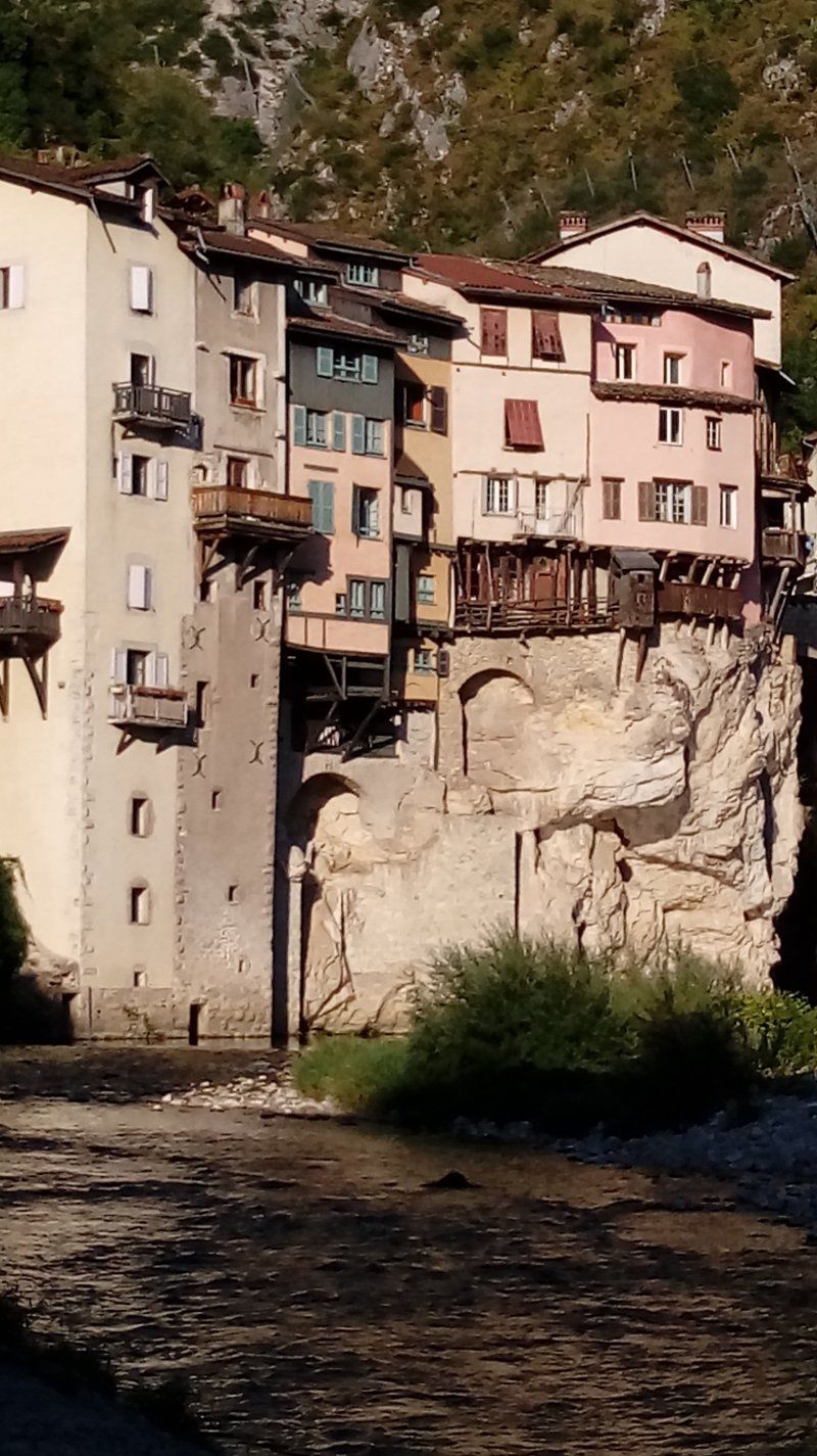
Camping Op der Sauer
Route de Gilsdorf, 9201, Diekirch, Luxemburg
49° 52' 1.9" N 6° 10' 25" E
49.8672000 6.1736000
• Head west on Camping op der Sauer. Go for 367 m.
• Turn slightly right onto Loumillen. Go for 198 m.
• Turn slightly right onto Loumillen. Go for 13 m.
• Turn right onto Route de Gilsdorf (CR356). Go for 36 m.
• Take the 1st exit from roundabout onto Route de Gilsdorf (CR356). Go for 537 m.
• Turn right onto Route de Larochette (N14). Go for 148 m.
• Turn right onto Rue Alexis Heck (N17a). Go for 262 m.
• Keep left onto Esplanade (N17) toward Ettelbruck/Clervaux. Go for 303 m.
• Keep right onto Bamertal (N7) toward Clervaux/St. Vith/Ettelbruck/B7/Bastogne. Go for 2.6 km.
• Take the 2nd exit from Rond-Point Friedhaff roundabout onto B7 toward Luxembourg/Mersch/Ettelbruck/Erpeldange/N27. Go for 8.3 km.
• Keep left onto A7 toward Luxembourg/Mersch/Colmar-Berg Industrie-Komplex. Go for 24.9 km.
• Take the exit toward Bruxelles/Metz/Luxembourg-Gare/E29 onto A1. Go for 9.5 km.
• Take the exit toward Metz/Saarbrücken/Livange onto A3. Go for 9.8 km.
• Take the exit toward Saarbrücken/Remich/Hellange onto A13. Go for 21.8 km.
• Continue on A8 (Moseltalbrücke). Go for 37.1 km.
• Take exit 9 toward Karlsruhe/Mannheim/Neunkirchen/Dillingen-Süd onto A8. Go for 62.3 km.
• Take exit 34 toward Contwig/Hornbach/Bitche. Go for 433 m.
• Turn right onto L480 toward Contwig/Zweibrücken/Hornbach/Bitche/Flughafen. Go for 186 m.
• Keep right toward Bitche/Hornbach/Flughafen Zweibrücken. Go for 31 m.
• Take the 1st exit from roundabout onto Europaallee (L700) toward Bitche/Hornbach/Flughafen Zweibrücken. Go for 582 m.
• Take the 3rd exit from roundabout onto Europaallee (L700). Go for 1.3 km.
• Take the 2nd exit from roundabout onto Europaallee (L700). Go for 5.5 km.
• Continue on B424. Go for 243 m.
• Continue on D35 A. Go for 11.6 km.
• Take the 3rd exit from roundabout onto D620 toward Haguenau/Bitche/Wissembourg. Go for 3.7 km.
• Turn left onto D35 toward Bitche-Centre. Go for 2.2 km.
• Turn left onto Rue du Colonel Teyssier (D35). Go for 504 m.
• Turn right onto Rue Bombelles. Go for 268 m.
• Arrive at Rue Bombelles. Your destination is on the left.
☍
204,7 km
(2 hrs. 9 min.)
Day
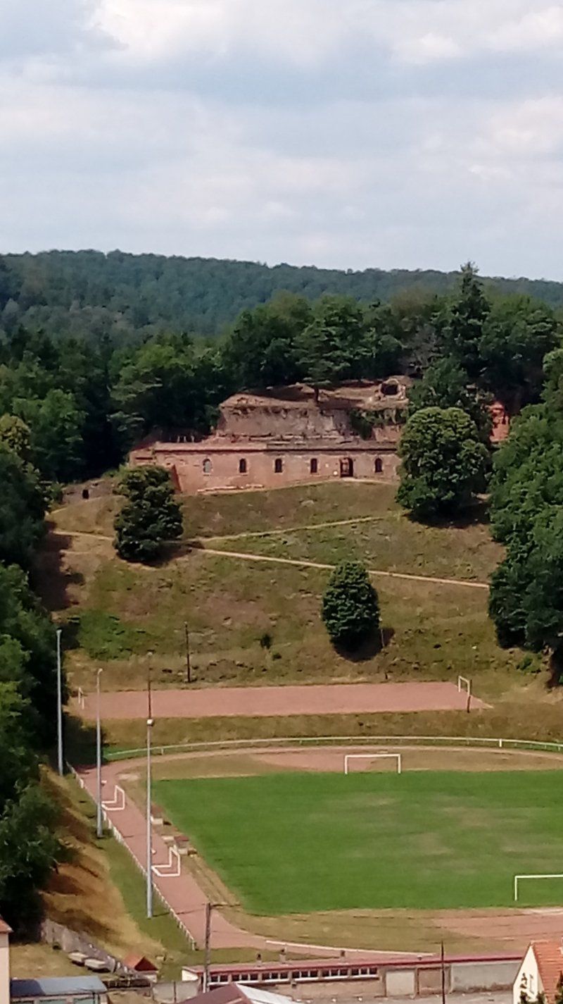
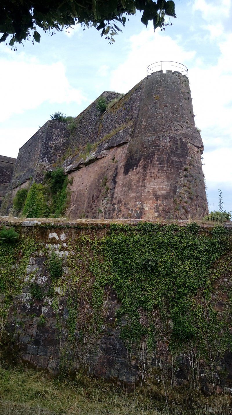
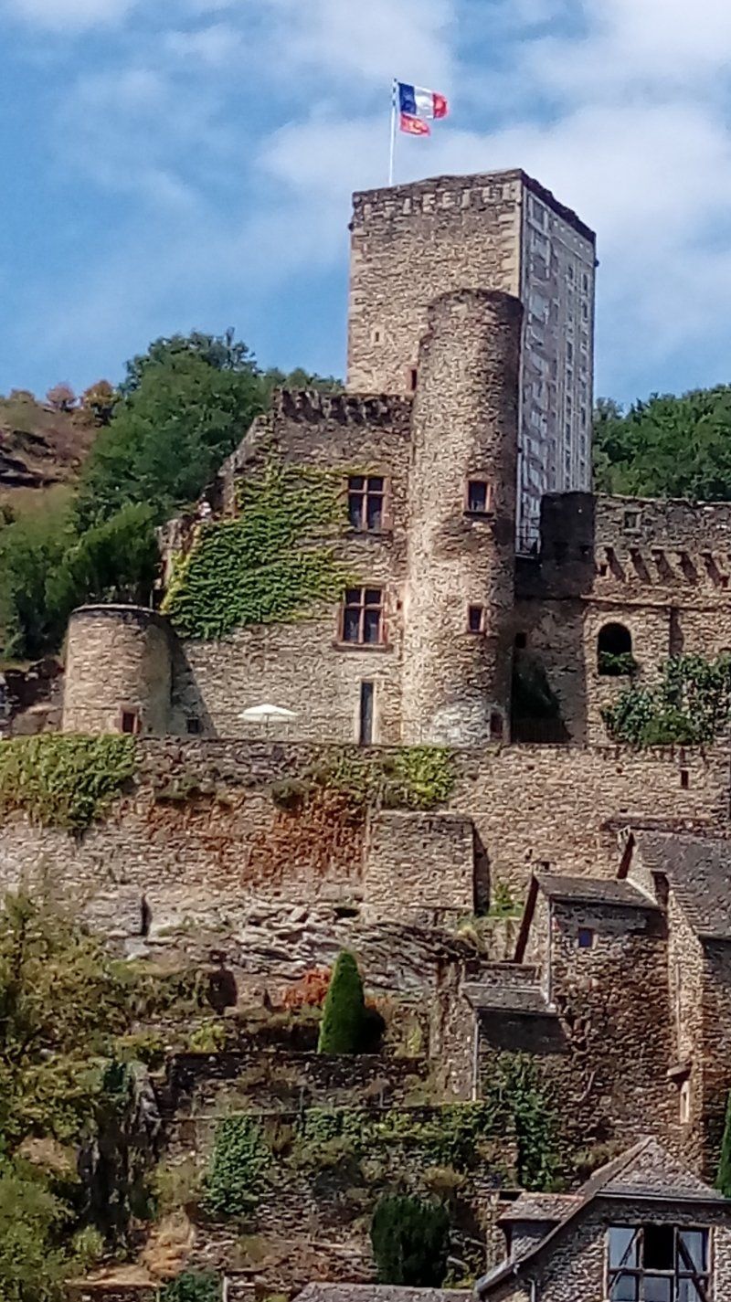
Via, Citadelle de Bitche
Rue Bombelle, 57230, Bitche, Frankrijk
49° 3' 16" N 7° 26' 2" E
49.0544444 7.4338889
• Head toward Rue des Tilleuls on Rue Bombelles. Go for 279 m.
• Take the 1st exit from Rue des Tilleuls roundabout onto Rue des Tilleuls. Go for 384 m.
• Turn left onto Rue Général Schneider. Go for 79 m.
• Turn right onto Rue de la Paix (D662). Go for 49 m.
• Turn left onto Rue de la Paix (D662). Go for 2.5 km.
• Turn left onto D37 toward Ingwiller/Lemberg/Schwangerbach. Go for 5.4 km.
• Take the 2nd exit from roundabout onto Grand Rue (D37). Go for 6.0 km.
• Continue on D712. Go for 7.1 km.
• Continue on Rue des Champs (D919). Go for 60 m.
• Take the 2nd exit from roundabout onto Rue des Champs (D919). Go for 5.7 km.
• Keep right onto Rue Bellevue (D919). Go for 222 m.
• Take the 2nd exit from roundabout onto Rue Bellevue (D919). Go for 605 m.
• Turn slightly left onto Rue Bellevue (D919). Go for 610 m.
• Take the 2nd exit from roundabout onto Rue Bellevue (D919). Go for 341 m.
• Turn right onto Route de Bouxwiller (D6). Go for 545 m.
• Take the 2nd exit from roundabout onto D6. Go for 4.3 km.
• Take the 1st exit from roundabout onto D517. Go for 968 m.
• Take the 1st exit from roundabout onto D133 toward A4 (Paris)/Saverne/Dossenheim-sur-Zinsel/Griesbach-le-Bastberg/Neuwiller-lès-Saverne. Go for 2.7 km.
• Take the 2nd exit from roundabout onto D133 toward A4/Phalsbourg/Saverne/Dossenheim-sur-Zinsel. Go for 1.1 km.
• Continue on D633. Go for 1.8 km.
• Take the 2nd exit from roundabout onto Montée du Tilleul (D14) toward Saverne/A4/Steinbourg. Go for 2.2 km.
• Take the 2nd exit from roundabout onto D6. Go for 1.5 km.
• Take the 1st exit from roundabout onto D716. Go for 1.8 km.
• Turn left onto D219. Go for 759 m.
• Continue on Rue du Général Leclerc (D219). Go for 471 m.
• Take the 2nd exit from roundabout onto Rue du Général Leclerc (D219). Go for 201 m.
• Turn right onto Rue Haute (D219). Go for 120 m.
• Turn left onto Rue du Haut-Barr (D219). Go for 1.5 km.
• Take the 2nd exit from roundabout onto Quai du Canal. Go for 396 m.
• Turn left onto Grand Rue. Go for 38 m.
• Arrive at Grand Rue. Your destination is on the left.
☍
49,8 km
( 51 min.)
Saverne, Frankrijk
67700 Saverne, Frankrijk
48° 44' 31.1" N 7° 21' 41.9" E
48.7419630 7.3616470
• Head toward Quai du Château on Grand Rue. Go for 65 m.
• Turn left onto Rue du Griffon. Go for 98 m.
• Keep left onto Rue du Griffon. Go for 69 m.
• Turn left onto Route de Paris (D1004). Go for 257 m.
• Turn right onto Rue du Général Leclerc (D171) toward Haegen/Château du Ht Barr. Go for 970 m.
• Turn left onto Rue du Maire Knoepffler. Go for 257 m.
• Turn right onto Rue du Père Libermann. Go for 36 m.
• Arrive at Rue du Père Libermann. Your destination is on the right.
☍
1,8 km
( 4 min.)
Seasonova Camping Les Portes d'Alsace
40 rue du pere libermann, 67700, Saverne, Frankrijk
48° 43' 55.2" N 7° 21' 20.2" E
48.7320000 7.3556000
• Head toward Rue du Maire Knoepffler on Rue du Père Libermann. Go for 36 m.
• Turn right onto Rue du Maire Knoepffler. Go for 183 m.
• Turn right onto Rue du Schneeberg. Go for 57 m.
• Turn left onto Rue du Rossignol. Go for 488 m.
• Turn slightly left onto Chemin d'Otterswiller. Go for 264 m.
• Continue on Rue du Niederbarr. Go for 546 m.
• Turn right onto Route Nationale (D1004). Go for 884 m.
• Take the 2nd exit from roundabout onto D1004 toward Strasbourg/Wasselonne/Marmoutier. Go for 1.5 km.
• Take the 3rd exit from roundabout onto D1004 toward Strasbourg/Wasselonne/Marmoutier. Go for 791 m.
• Take the 3rd exit from roundabout onto Route Nationale (D1004) toward Strasbourg/Wasselonne/Singrist. Go for 1.0 km.
• Pass 5 roundabouts and continue on Route du Kronthal (D1004). Go for 11.4 km.
• Take the 2nd exit from roundabout onto D422 toward Wangen/Molsheim/Westhoffen. Go for 485 m.
• Take the 3rd exit from roundabout onto D422 toward Molsheim/Scharrachbergheim-I. Go for 1.4 km.
• Pass 3 roundabouts and continue on D422. Go for 3.5 km.
• Take the 3rd exit from roundabout onto D422 toward Molsheim/Soultz les B. Go for 3.4 km.
• Take the 1st exit from roundabout onto Rue de Saverne (D422) toward Mutzig/Molsheim. Go for 796 m.
• Turn left onto Rue de Saverne. Go for 85 m.
• Turn right onto Place des 24 Comtes. Go for 77 m.
• Turn left onto Place des Vingt-Quatre Comtes. Go for 38 m.
• Arrive at Place des Vingt-Quatre Comtes. Your destination is on the right.
☍
26,8 km
( 32 min.)
Day
Molsheim, Frankrijk
67120 Molsheim, Frankrijk
48° 32' 37.4" N 7° 29' 29.4" E
48.5437150 7.4915120
• Head south on Place des Vingt-Quatre Comtes.
• Continue on Place du Marché. Go for 40 m.
• Turn right onto Rue de Saverne. Go for 141 m.
• Turn left onto Rue du Maréchal Foch. Go for 141 m.
• Turn right onto Rue Saint-Georges. Go for 90 m.
• Keep right onto Place de la Liberté. Go for 165 m.
• Turn left onto Rue Charles Mistler. Go for 205 m.
• Take the 2nd exit from roundabout onto Rue Charles Mistler. Go for 97 m.
• Turn left. Go for 16 m.
• Arrive at your destination on the right.
☍
0,9 km
( 3 min.)
Camping Municipal
Rue des sports 6, 67120, Molsheim, Frankrijk
48° 32' 28.5" N 7° 30' 0.5" E
48.5412400 7.5001300
• Head toward Rue Charles Mistler. Go for 16 m.
• Turn right onto Rue Charles Mistler. Go for 69 m.
• Take the 3rd exit from roundabout onto Rue des Sports. Go for 373 m.
• Turn left onto Avenue de la Gare (D422) toward Dorlisheim/Obernai/Strasbourg. Go for 1.7 km.
• Take the 2nd exit from roundabout onto D500 toward Schirmeck/Obernai. Go for 7.5 km.
• Keep left onto D500 toward A35/Colmar/Sélestat/Barr. Go for 185 m.
• Take ramp onto A35. Go for 30.7 km.
• Continue on D83. Go for 4.9 km.
• Take ramp onto D416 BIS toward Ostheim/Beblenheim/Riquewihr. Go for 986 m.
• Take the 1st exit from roundabout onto Route de Ribeauvillé (D416) toward Beblenheim/Riquewihr/Ribeauville. Go for 1.2 km.
• Turn left onto D300. Go for 1.9 km.
• Continue on Route d'Ostheim (D300). Go for 416 m.
• Continue on Rue de Hoen (D300). Go for 498 m.
• Continue on Rue du 5 Décembre (D300). Go for 378 m.
• Turn right onto Route du Vin (D1 BIS). Go for 196 m.
• Take the 4th exit from roundabout onto Route de Colmar (D300). Go for 1.5 km.
• Take the 3rd exit from roundabout onto Avenue Jacques Preiss (D300). Go for 355 m.
• Turn left onto Place Fernand Zeyer (D300). Go for 13 m.
• Arrive at Place Fernand Zeyer (D300). Your destination is on the right.
☍
52,9 km
( 37 min.)
Day
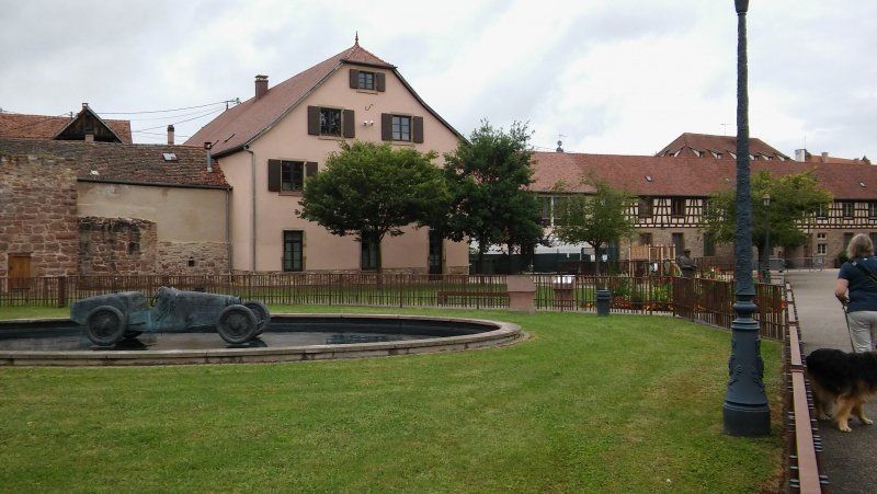
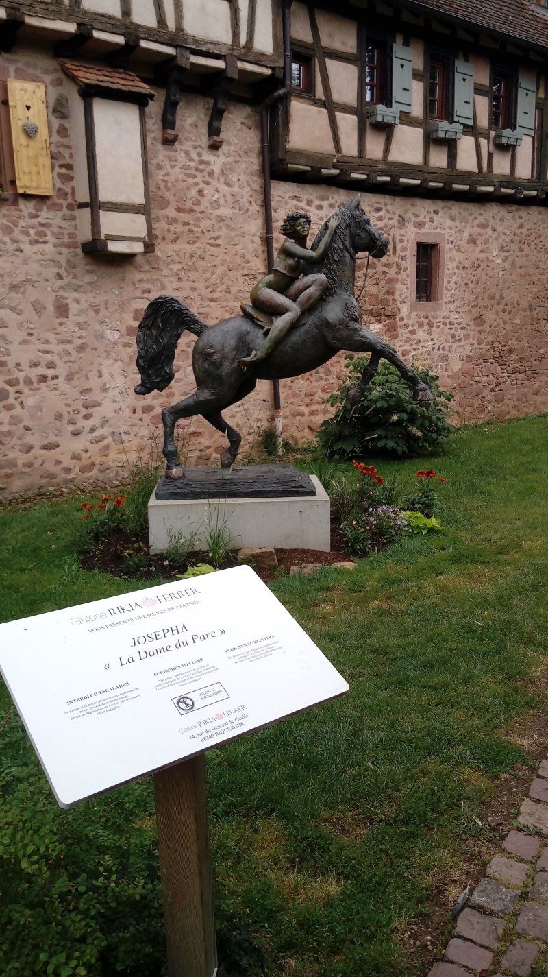
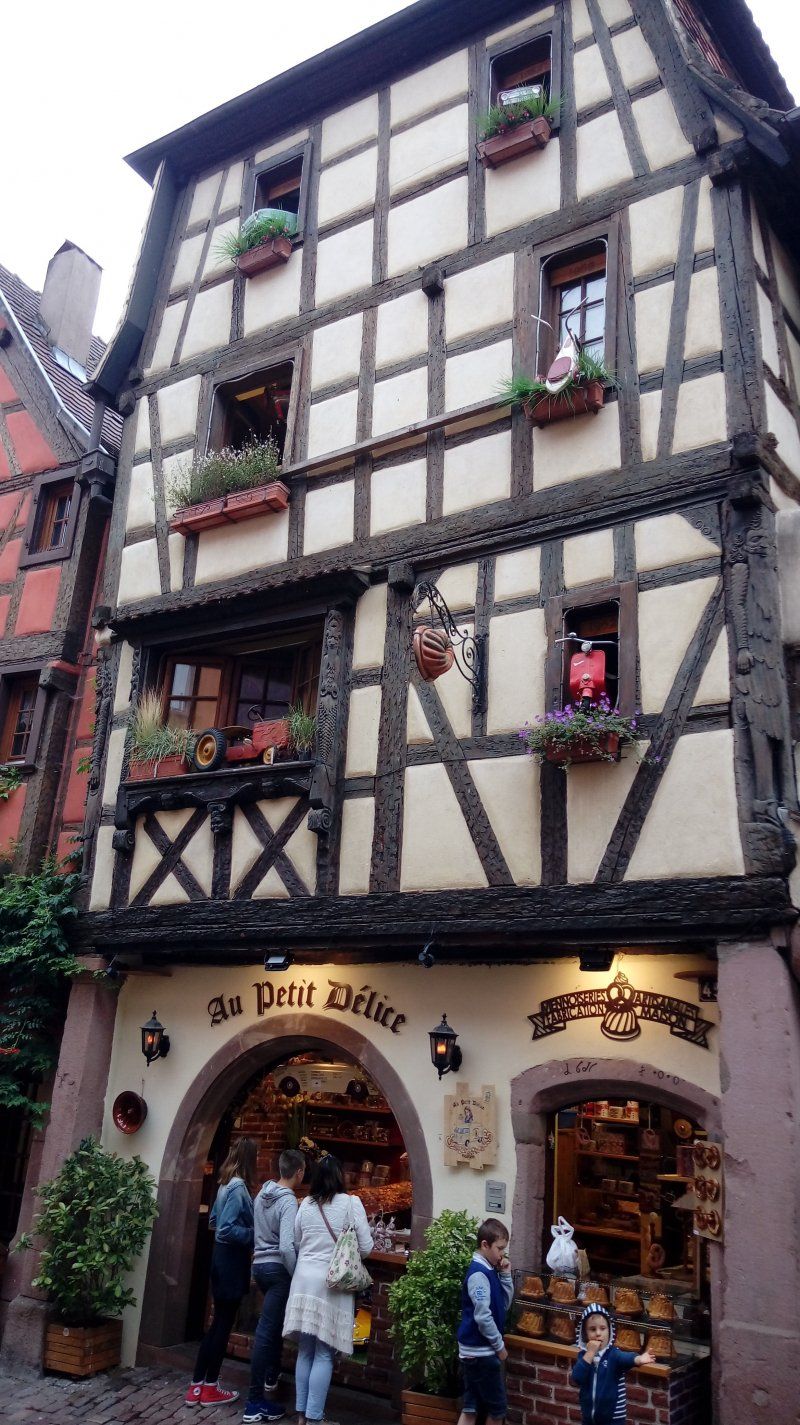
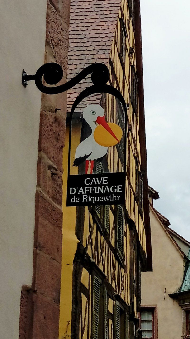
Riquewihr, Frankrijk
68340 Riquewihr, Frankrijk
48° 9' 58.2" N 7° 17' 59.4" E
48.1661580 7.2998220
• Head south on Place Fernand Zeyer (D300). Go for 184 m.
• Turn left onto Rue Mandlé. Go for 176 m.
• Turn left onto Heftweg. Go for 760 m.
• Continue on Route de Colmar (D300). Go for 854 m.
• Take the 3rd exit from roundabout. Go for 414 m.
• Arrive at your destination on the right.
☍
2,4 km
( 4 min.)
Camping de Riquewihr
Route des Vins 1, 68340, Riquewihr, Frankrijk
48° 9' 43.6" N 7° 19' 2.3" E
48.1621000 7.3173000
• Head southeast. Go for 268 m.
• Turn right toward Route du Vin/D1 BIS. Go for 31 m.
• Take the 3rd exit from roundabout onto Route du Vin (D1 BIS). Go for 3.3 km.
• Take the 2nd exit from roundabout onto D10. Go for 3.5 km.
• Take the 3rd exit from Rond-Point du Florimont roundabout onto D415 toward A35/Colmar. Go for 1.9 km.
• Take the 1st exit from roundabout onto Avenue de Lorraine (D83) toward Épinal/Belfort/Colmar/Munster/Wintzenheim/Ingersheim. Go for 250 m.
• Pass 3 roundabouts and continue on D83. Go for 4.2 km.
• Take the 3rd exit from roundabout onto D83 toward Belfort/Basel/Mulhouse/Rouffach/Z.A. les Erlen. Go for 23.1 km.
• Take the 2nd exit from roundabout onto D83 toward Belfort/Thann/Cernay. Go for 18.8 km.
• Take ramp onto A36 (La Comtoise) toward Lyon/Belfort. Go for 101 km.
• Take exit 4.1 toward Besançon-Palente/Roulans/Marchaux. Go for 1.2 km.
• Continue straight ahead. Go for 40 m.
• Take the 3rd exit from roundabout toward Thise/Besançon. Go for 135 m.
• Continue on D486. Go for 11.1 km.
• Take the 1st exit from roundabout onto Rue de Belfort (D683). Go for 197 m.
• Take the 1st exit from roundabout onto Rue de Belfort (D683). Go for 990 m.
• Take the 3rd exit from Rue de Belfort roundabout onto Rue de Belfort (D683). Go for 1.7 km.
• Take the 2nd exit from roundabout onto Esplanade Colonel Jean Maurin (D683) toward A36. Go for 94 m.
• Turn left onto Avenue du Maréchal Foch (E23). Go for 364 m.
• Turn right onto Pont Robert Schwint. Go for 172 m.
• Turn left onto Avenue Élisée Cusenier. Go for 198 m.
• Turn right onto Rue de la République. Go for 362 m.
• Continue on Place du 8 Septembre. Go for 73 m.
• Arrive at Place du 8 Septembre. Your destination is on the right.
☍
173,4 km
(1 hrs. 54 min.)
Day
Besançon, Frankrijk
25000 Besançon, Frankrijk
47° 14' 16.2" N 6° 1' 26.6" E
47.2378290 6.0240539
• Head toward Grande Rue on Place du 8 Septembre. Go for 14 m.
• Turn slightly left onto Grande Rue. Go for 103 m.
• Turn left onto Rue Moncey. Go for 129 m.
• Turn left onto Rue des Granges. Go for 167 m.
• Turn right onto Rue de la République. Go for 139 m.
• Turn left onto Rue Proudhon. Go for 69 m.
• Continue on Rue Pierre-Joseph Proudhon. Go for 147 m.
• Continue on Pont Robert Schwint. Go for 172 m.
• Continue on Avenue Denfert-Rochereau. Go for 355 m.
• Continue on Rue de la Cassotte. Go for 331 m.
• Continue on Rue des 2 Princesses. Go for 71 m.
• Turn left onto Rue Alexis Chopard. Go for 201 m.
• Turn right onto Rue de Belfort (D683). Go for 1.0 km.
• Pass 2 roundabouts. Go for 1.2 km.
• Take left ramp onto Rue de Belfort (D683). Go for 1.6 km.
• Turn right. Go for 31 m.
• Take the 2nd exit from roundabout. Go for 60 m.
• Arrive at your destination on the left.
☍
5,8 km
( 12 min.)
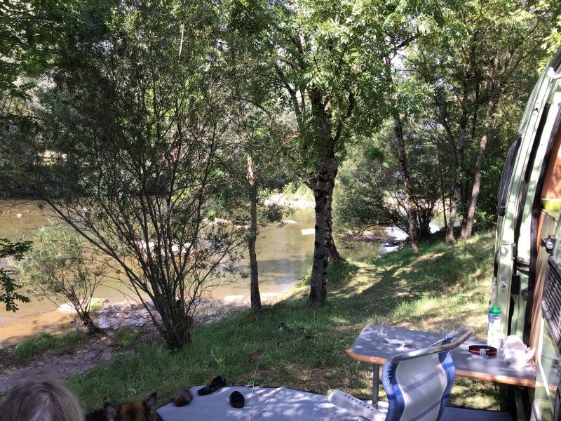
Camping de Besançon-Chalezeule
route de Belfort 12, 25220, Chalezeule, Frankrijk
47° 15' 55.4" N 6° 4' 15.6" E
47.2654000 6.0710000
• Head east. Go for 44 m.
• Take the 2nd exit from roundabout. Go for 61 m.
• Turn right onto Route de Belfort (D683). Go for 1.1 km.
• Continue toward Chalèze. Go for 60 m.
• Take the 1st exit from roundabout toward Chalèze. Go for 46 m.
• Continue on Rue de l'Écluse (D323). Go for 187 m.
• Continue on Rue de Besançon (D323). Go for 281 m.
• Continue on Rue de Besançon (D411). Go for 149 m.
• Continue on Rue de la Malate (D411). Go for 1.2 km.
• Continue on Chemin de la Malate (D411). Go for 1.0 km.
• Continue on Rue de l'Aqueduc (D411). Go for 2.2 km.
• Turn left onto Chemin des Vignes. Go for 536 m.
• Continue on Chemin de Chevriot Dessus. Go for 1.6 km.
• Turn sharp right onto Chemin Stratégique (D143). Go for 2.0 km.
• Continue on D143. Go for 45 m.
• Continue on Route des Buis (D143). Go for 766 m.
• Turn left onto Chemin de Fontain (D143). Go for 1.0 km.
• Turn right onto Lieu-dit Ruroie (D104). Go for 8.4 km.
• Take the 3rd exit from roundabout onto N83 toward Arbois. Go for 33.8 km.
• Take the 1st exit from roundabout onto N83. Go for 1.7 km.
• Take ramp toward Arbois. Go for 204 m.
• Turn left onto Route de Lyon (D469 E). Go for 972 m.
• Turn right onto Rue du Prieuré. Go for 101 m.
• Turn right onto Place de Faramand (D469). Go for 13.6 km.
• Turn left onto Route Napoléon (N5). Go for 31.1 km.
• Take the 3rd exit from roundabout onto N5 toward Genève/Morez/Morbier. Go for 1.3 km.
• Take the 1st exit from roundabout onto N5 toward St Laurent en G. Go for 748 m.
• Turn left onto Place Charles Thévenin. Go for 65 m.
• Turn right onto Rue du Parc. Go for 49 m.
• Turn left. Go for 24 m.
• Arrive at your destination on the left.
☍
104,5 km
(1 hrs. 33 min.)
Day
Saint-Laurent-en-Grandvaux, Frankrijk
39150 Saint-Laurent-en-Grandvaux, Frankrijk
46° 34' 30.9" N 5° 57' 22.7" E
46.5752560 5.9563000
• Head toward Rue du Parc. Go for 24 m.
• Turn right onto Rue du Parc. Go for 49 m.
• Turn left onto Place Charles Thévenin. Go for 65 m.
• Turn right onto Rue de Genève (N5). Go for 453 m.
• Turn right onto Rue du Camping. Go for 74 m.
• Arrive at Rue du Camping. Your destination is on the right.
☍
0,7 km
( 1 min.)
Camping Municipal Le Champs De Mars
rue du camping 8, 39150, St Laurent En Grandvaux, Frankrijk
46° 34' 34.7" N 5° 57' 44.6" E
46.5763000 5.9624000
• Head toward Rue de Genève on Rue du Camping. Go for 74 m.
• Turn right onto Rue de Genève (N5). Go for 290 m.
• Pass 3 roundabouts and continue on Route Blanche (D1005). Go for 20.7 km.
• Turn left onto Rue de la Frontière (D415) toward Genève Par Nyon/Lausanne/La Cure/Bois d'Amont/Nyon/La Suisse. Go for 345 m.
• Turn right onto Rue de la Frontière (D29) toward Genève Par Nyon/Nyon/Lausanne/La Cure. Go for 205 m.
• Turn left onto Impasse des Douanes. Go for 27 m.
• Continue on Route de France. Go for 128 m.
• Continue on Route de France (123). Go for 7.6 km.
• Take the 1st exit from roundabout onto Route de Nyon (123) toward Nyon. Go for 8.9 km.
• Pass 2 roundabouts and continue on Route Blanche. Go for 1.7 km.
• Take the 3rd exit from roundabout onto Route Blanche toward Nyon. Go for 420 m.
• Take the 3rd exit from roundabout onto Route Blanche toward Nyon/Signy. Go for 358 m.
• Take ramp onto A1 toward Genève. Go for 32.3 km.
• Continue on A41. Go for 26.2 km.
• Take exit 17 toward Annecy-Nord/Annecy/Annecy le Vieux/Aéroport Meythet. Go for 1.1 km.
• Keep left. Go for 15 m.
• Continue toward Annecy/Annecy le Vieux/Thônes/Centre Hospitalier/P+R/Aéroport. Go for 34 m.
• Take the 2nd exit from roundabout onto D908 B toward Annecy/Thônes. Go for 117 m.
• Take the 4th exit from roundabout onto Voie de Metz (D3508) toward Annecy/Annecy-le-Vx. Go for 1.1 km.
• Keep left onto Voie de Metz (D1201) toward Annecy-Centre/Annecy-le-Vieux/Thônes/Parc des Glaisins. Go for 393 m.
• Keep left onto Voie de Metz (D1201) toward Annecy-Centre/Thônes. Go for 552 m.
• Continue on Avenue de Brogny. Go for 1.9 km.
• Take the 3rd exit from roundabout onto Rue Jean Jaurès. Go for 564 m.
• Turn right onto Avenue d'Albigny (D909). Go for 160 m.
• Turn left onto Quai Eustache Chappuis (D1508). Go for 178 m.
• Turn left onto Esplanade de l'Hôtel de Ville. Go for 157 m.
• Turn right. Go for 16 m.
• Arrive at your destination on the right.
☍
105,6 km
(1 hrs. 31 min.)
Day
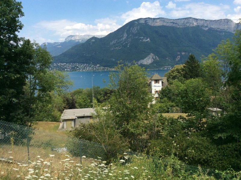
Annecy, Frankrijk
45° 53' 56.7" N 6° 7' 46.3" E
45.8990887 6.1295411
• Head east. Go for 16 m.
• Turn left onto Esplanade de l'Hôtel de Ville. Go for 157 m.
• Turn left onto Quai Eustache Chappuis (D1508). Go for 418 m.
• Take the 1st exit from roundabout onto Avenue du Tresum toward Thônes/Le Château/Z.I. de Vovray. Go for 387 m.
• Take the 2nd exit from roundabout onto Boulevard de la Corniche (D41). Go for 541 m.
• Keep right onto Route du Semnoz (D41). Go for 321 m.
• Turn right onto Route du Semnoz. Go for 31 m.
• Arrive at Route du Semnoz. Your destination is on the left.
☍
1,9 km
( 5 min.)
Camping Municipal Le Belvédère
8 route du Semmoz, 74000, Annecy, Frankrijk
45° 53' 27.2" N 6° 7' 55.2" E
45.8909000 6.1320000
• Head south on Route du Semnoz. Go for 31 m.
• Turn left onto Route du Semnoz (D41). Go for 321 m.
• Continue on Boulevard de la Corniche (D41). Go for 482 m.
• Take the 2nd exit from roundabout onto Boulevard de la Corniche. Go for 289 m.
• Take the 2nd exit from Place du Paradis roundabout onto Avenue du Crêt du Maure toward Vieille Ville/Loverchy-les Balmettes. Go for 420 m.
• Turn right onto Avenue Lucien Boschetti toward Thônes. Go for 236 m.
• Continue on Avenue du Rhône (D5) toward Seynod. Go for 289 m.
• Take the 3rd exit from roundabout onto Avenue de Chambéry (D1201) toward Chambéry. Go for 672 m.
• Take the 1st exit from Rond-Point de la Croisée roundabout onto D3508 toward Bourg en B./Meythet/Thônes. Go for 1.3 km.
• Take ramp onto A41 toward Lyon/Chambéry. Go for 33.6 km.
• Take exit 13 toward Aix les Bains-le Lac/Drumettaz-Clarafond/Viviers du Lac onto Échangeur d'Aix-les-Bains-Sud. Go for 1.1 km.
• Take the 2nd exit from roundabout onto Route de l'Échangeur (D127) toward Aix les Bains/Viviers du Lac/Chambéry. Go for 717 m.
• Take the 3rd exit from roundabout onto Chemin de la Laitière (D50 E) toward Tresserve. Go for 1.1 km.
• Take the 3rd exit from roundabout onto Chemin de Belledonne (D50). Go for 724 m.
• Continue on Montée de Terre Nue (D50). Go for 948 m.
• Take the 3rd exit from roundabout onto Lieu-dit Les Rives du Lac (D1201) toward Chambéry/Lyon/Bourg en B./Aéroport Chambéry-Aix. Go for 343 m.
• Turn right onto Route du Bourget (D1201 A). Go for 1.5 km.
• Take the 1st exit from roundabout onto D1201 A toward Bourg en B./Lyon/Le Bourget du Lac/Belley. Go for 708 m.
• Take the 1st exit from roundabout onto D1504 toward Lyon/Bourg en B./Yenne/Le Bourget du Lac. Go for 566 m.
• Take ramp toward Le Bourget-du-Lac/Le Lac. Go for 84 m.
• Turn left onto D14. Go for 22 m.
• Continue on Route du Tunnel (D14). Go for 340 m.
• Turn right onto Route du Tunnel. Go for 35 m.
• Arrive at Route du Tunnel. Your destination is on the right.
☍
45,9 km
( 37 min.)
Day
Le Bourget-du-Lac, Frankrijk
45° 38' 57.8" N 5° 51' 32.7" E
45.6493920 5.8590760
• Head west on Route du Tunnel.
• Arrive at Route du Tunnel. Your destination is on the right.
☍
Distance not available
(Duration not available)
Le Bourget-du-Lac, Lille aux Signes
Le Bourget-du-Lac, Frankrijk
45° 38' 57.8" N 5° 51' 32.7" E
45.6493920 5.8590760
• Head east on Route du Tunnel. Go for 35 m.
• Turn right onto Route du Tunnel (D14). Go for 61 m.
• Continue on Place Commandant Jeandet. Go for 487 m.
• Take the 3rd exit from roundabout onto Route de Chambéry. Go for 234 m.
• Take the 2nd exit from roundabout onto D1504 toward A41/A43/Chambéry. Go for 942 m.
• Take the 1st exit from roundabout onto Route de Chambéry (D1504) toward A41/A43/Chambéry. Go for 2.5 km.
• Take ramp onto Avenue du Bourget du Lac (D1201) toward N201/A41/A43/Chambéry/La Motte-Servolex/Z.I. les Landiers-Nord. Go for 3.8 km.
• Take ramp toward Chambéry-Centre/Valence/Cognin/Massif de la Chartreuse/Chambéry-le Haut. Go for 105 m.
• Keep left toward Chambéry-Centre. Go for 499 m.
• Turn right onto Pont des Chèvres (D1006) toward Lyon Par les Échelles/Valence/Cognin/Massif de la Chartreuse/Z.I. Gd Verger. Go for 335 m.
• Pass 5 roundabouts and continue on Avenue de Lyon (D1006). Go for 2.9 km.
• Take the 4th exit from roundabout onto Avenue Robert Badinter (D1006) toward Lyon/Valence/Les Échelles. Go for 440 m.
• Pass 2 roundabouts and continue on Avenue Robert Badinter (D1006). Go for 18.1 km.
• Take the 2nd exit from roundabout onto D520 toward Lyon/Voiron/Valence/Entre Deux Guiers/St Laurent du Pont/Z.A. du Maillet. Go for 2.6 km.
• Pass 3 roundabouts and continue on Route des Échelles (D520). Go for 4.8 km.
• Turn right onto Avenue Jules Ferry (D28). Go for 96 m.
• Turn right onto Rue Jean Moulin. Go for 27 m.
• Arrive at Rue Jean Moulin. Your destination is on the right.
☍
38,0 km
( 40 min.)
Day
Saint-Laurent-du-Pont, Frankrijk
38380 Saint-Laurent-du-Pont, Frankrijk
45° 23' 16.5" N 5° 44' 3.3" E
45.3879100 5.7342480
• Head toward Place de la Vielle Tour on Rue Jean Moulin. Go for 110 m.
• Turn right onto Avenue Charles de Gaulle. Go for 104 m.
• Turn right onto Avenue Jean Jaurès (D520). Go for 5.7 km.
• Turn left onto Route de la Chartreuse (D520 A). Go for 9.4 km.
• Take the 3rd exit from Place Docteur Thévenet roundabout onto Avenue de Stalingrad (D520 A). Go for 182 m.
• Turn right onto Avenue de Stalingrad (D3 A). Go for 569 m.
• Turn right onto Avenue du 11 Novembre (D1075). Go for 302 m.
• Take the 4th exit from roundabout onto D3 toward A48 (Grenoble)/A49 (Valence)/Grenoble/Veurey Voroize/Z.I. le Fontanil. Go for 834 m.
• Take the 2nd exit from roundabout onto Route de l'Isère (D3). Go for 1.1 km.
• Take the 1st exit from roundabout onto A48 toward Lyon/Rives/Valence. Go for 1.4 km.
• Keep right onto A49 toward Marseille/Valence. Go for 33.1 km.
• Take exit 9 toward Pont en Royans/St Marcellin. Go for 393 m.
• Continue on Lieu-dit Les Echavagnes. Go for 109 m.
• Take the 1st exit from roundabout onto D518 toward St Romans/Pont en Royans/Villard de Lans. Go for 3.5 km.
• Turn right onto Route de Valence (D1532). Go for 901 m.
• Take the 2nd exit from roundabout onto Route de Valence (D1532) toward Romans/Valence/St Just de Claix/Z.I. Sud les Bavorgnes. Go for 1.6 km.
• Turn right onto Route des Barillats. Go for 685 m.
• Continue on Route des Marandans. Go for 637 m.
• Turn left. Go for 17 m.
• Arrive at your destination on the right.
☍
60,7 km
( 48 min.)
Flower Camping Le Lac du Marandan, Les Marandans, Saint-Romans, Frankrijk
657 Les Marandans, 38160 Saint-Romans, Frankrijk
45° 6' 11.6" N 5° 17' 33.6" E
45.1032120 5.2926630
• Head toward Route des Marandans. Go for 17 m.
• Turn right onto Route des Marandans. Go for 637 m.
• Continue on Route des Barillats. Go for 685 m.
• Turn right onto Route de Valence (D1532). Go for 1.2 km.
• Take the 3rd exit from roundabout onto Route de Bluvinaye (D71) toward Pont en Royans/Villard de Lans/Grottes de Choranche. Go for 6.0 km.
• Turn right onto Place du Breuil. Go for 211 m.
• Turn left. Go for 26 m.
• Arrive at your destination on the right.
☍
8,8 km
( 10 min.)
Day
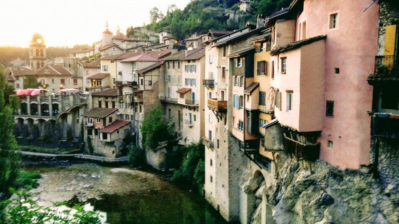
Pont-en-Royans, Frankrijk
38680 Pont-en-Royans, Frankrijk
45° 3' 39.3" N 5° 20' 39" E
45.0609170 5.3441580
• Head southeast.
• Arrive at your destination on the right.
☍
Distance not available
(Duration not available)
Pont-en-Royans, Aire de camping-car
38680 Pont-en-Royans, Frankrijk
45° 3' 39.3" N 5° 20' 39" E
45.0609170 5.3441580
• Head toward Place du Breuil. Go for 26 m.
• Turn right onto Place du Breuil. Go for 211 m.
• Turn left onto Rue Gambetta (D518/D531). Go for 803 m.
• Turn left onto Lieu-dit Le Pavillon (D531). Go for 6.6 km.
• Take the 3rd exit from roundabout onto Route de Provence (D1532) toward A49/Valence/St Nazaire en R./Bourg-de-Péage. Go for 1.8 km.
• Continue on Place de la Tour Potevine (D532). Go for 3.5 km.
• Take the 1st exit from roundabout onto D325 A toward A49/Romans/Valence/Eymeux. Go for 274 m.
• Take the 2nd exit from roundabout onto A49 toward Valence. Go for 15.9 km.
• Continue on N532. Go for 10.6 km.
• Continue on E713. Go for 240 m.
• Continue on N7. Go for 9.5 km.
• Keep left onto E713 toward E15/A7/Marseille/Montélimar/Privas/Lyon. Go for 405 m.
• Keep left onto Échangeur de Valence-Sud (E713) toward Marseille/Avignon/Montélimar/Privas. Go for 153 m.
• Take ramp onto A7 (Autoroute du Soleil). Go for 28.3 km.
• Take exit 17 toward Montélimar/Dieulefit/Le Teil. Go for 715 m.
• Take the 2nd exit from roundabout onto N7 toward Montélimar/Avignon/Le Teil/Dieulefit. Go for 2.7 km.
• Arrive at N7. Your destination is on the left.
☍
81,7 km
( 54 min.)
Day
La Coucourde, Frankrijk
26740 La Coucourde, Frankrijk
44° 38' 48.6" N 4° 46' 53.2" E
44.6468412 4.7814322
• Head southwest on N7.
• Arrive at N7. Your destination is on the left.
☍
Distance not available
(Duration not available)
La Coucourde, camping Floral
26740 La Coucourde, Frankrijk
44° 38' 48.6" N 4° 46' 53.2" E
44.6468412 4.7814322
• Head southwest on N7. Go for 7 m.
• Turn right onto Rue Royale. Go for 36 m.
• Turn right onto Rue Royale. Go for 283 m.
• Turn left onto Place Henri Freydier (N7). Go for 2.2 km.
• Take the 2nd exit from roundabout onto A7 (Autoroute du Soleil) toward Marseille. Go for 64.8 km.
• Keep right onto A9 (Échangeur d'Orange) toward Barcelone/Toulouse/Montpellier/Nîmes. Go for 29.0 km.
• Take exit 23 toward Beaucaire/Tarascon/Uzès/Remoulins/Pont du Gard. Go for 732 m.
• Take the 3rd exit from roundabout onto D6100 toward Nîmes/Alès/Beaucaire/Tarascon/Remoulins/Uzès/Pont du Gard. Go for 1.9 km.
• Take the 2nd exit from Carrefour de l'Arnède roundabout onto Impasse des Oliviers (D6101) toward Alès/Bagnols S/C./Pont du Gard. Go for 565 m.
• Take the 3rd exit from roundabout onto Route de Bagnols (D6086) toward Montélimar/Alès/Bagnols S/C./Uzès/Pont du Gard. Go for 1.3 km.
• Take the 3rd exit from roundabout toward Alès/Uzès/Pont du Gard. Go for 53 m.
• Turn right onto Chemin des Croisées (D19 A). Go for 1.2 km.
• Take the 2nd exit from roundabout onto Route Impériale (D19 A) toward Alès/Uzès/Pont du Gard. Go for 486 m.
• Take the 2nd exit from roundabout onto Route d'Uzès (D19) toward Alès/Uzès/Pont du Gard. Go for 587 m.
• Take the 3rd exit from roundabout toward Pont du Gard/Rive Gauche. Go for 109 m.
• Continue on Route du Pont du Gard (D981). Go for 335 m.
• Arrive at Route du Pont du Gard (D981).
☍
103,7 km
( 58 min.)
Day
Pont du Gard (Rive Droite), D981, Vers-Pont-du-Gard, Frankrijk
D981, 30210 Vers-Pont-du-Gard, Frankrijk
43° 56' 50.4" N 4° 32' 7.2" E
43.9473264 4.5353443
• Head west on Route du Pont du Gard (D981).
• Arrive at Route du Pont du Gard (D981).
☍
Distance not available
(Duration not available)
Aire de Camping-car
D981, 30210 Vers-Pont-du-Gard, Frankrijk
43° 56' 50.4" N 4° 32' 7.2" E
43.9473264 4.5353443
• Head east on Route du Pont du Gard (D981). Go for 335 m.
• Continue toward D981. Go for 37 m.
• Take the 3rd exit from roundabout onto D981 toward Alès/Vers/Uzès. Go for 747 m.
• Continue toward Alès/Uzès/Collias. Go for 34 m.
• Take the 2nd exit from roundabout onto D981 toward Alès/Uzès/Collias. Go for 3.2 km.
• Pass 4 roundabouts and continue on Route de Remoulins (D981). Go for 7.6 km.
• Take the 2nd exit from roundabout onto Route de Nîmes (D979) toward Alès/Uzès-Centre Ville. Go for 455 m.
• Take the 2nd exit from roundabout onto Route de Nîmes (D979). Go for 474 m.
• Take the 3rd exit from roundabout onto Avenue Georges Pompidou (D981) toward Alès. Go for 684 m.
• Pass 6 roundabouts and continue on D981. Go for 18.6 km.
• Take the 3rd exit from roundabout onto D981. Go for 6.5 km.
• Take the 3rd exit from roundabout onto Route d'Uzès (D981) toward Alès. Go for 4.1 km.
• Take the 1st exit from roundabout onto Rocade Est (D60) toward Mende/Aubenas/Salindres. Go for 436 m.
• Pass 2 roundabouts and continue on Rocade Est (D60). Go for 1.5 km.
• Take the 3rd exit from roundabout onto Avenue de Croupillac (D60) toward Mende/Aubenas/Salindres/Bruèges-Croupillac/Z.A. Rocade Nord. Go for 725 m.
• Pass 3 roundabouts and continue on Rocade Nord (D60). Go for 2.6 km.
• Keep left toward St Martin-Centre/Génolhac. Go for 167 m.
• Continue on D60. Go for 846 m.
• Take the 2nd exit from roundabout onto Avenue Marcel Paul (D906) toward Génolhac. Go for 595 m.
• Take the 2nd exit from roundabout onto Avenue du 8 Mai 1945 (D906). Go for 46.9 km.
• Take the 3rd exit from roundabout onto D901. Go for 2.4 km.
• Take the 1st exit from roundabout onto D906. Go for 21.6 km.
• Take the 2nd exit from roundabout onto Lieu-dit Le Pradillou (D906). Go for 20.6 km.
• Turn left onto Avenue du Docteur Conturie (N88) toward Villefort. Go for 1.2 km.
• Turn right onto Route de Naussac (D26) toward Auroux/Grandrieu/Rocles. Go for 551 m.
• Turn left onto Route de la Tuilerie (D34). Go for 759 m.
• Continue on D34. Go for 1.4 km.
• Continue on Lieu-dit Bonjour (D34). Go for 75 m.
• Continue on D34. Go for 1.9 km.
• Continue on Lieu-dit Matrone (D34). Go for 104 m.
• Continue on D34. Go for 1.6 km.
• Turn right toward Lieu-dit Les Besses Hautes. Go for 744 m.
• Continue on Lieu-dit Les Besses Hautes. Go for 275 m.
• Turn slightly right. Go for 714 m.
• Turn slightly left. Go for 266 m.
• Turn slightly left. Go for 1.2 km.
• Arrive at your destination.
☍
151,8 km
(2 hrs. 37 min.)
Day
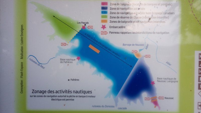
Lac de Naussac, Langogne, Frankrijk
Lac de Naussac, 48300 Langogne, Frankrijk
44° 44' 49" N 3° 47' 55" E
44.7469440 3.7986110
• Head northeast.
• Arrive at your destination.
☍
Distance not available
(Duration not available)
Lac de Naussac, Aire de Camping-car
Lac de Naussac, 48300 Langogne, Frankrijk
44° 44' 49" N 3° 47' 55" E
44.7469440 3.7986110
• Head toward Lieu-dit Rondin des Bois. Go for 2.3 km.
• Continue on Lieu-dit Les Besses Hautes. Go for 861 m.
• Turn right onto D34. Go for 2.3 km.
• Continue on Lieu-dit Les Braux (D34). Go for 109 m.
• Continue on D34. Go for 806 m.
• Continue on Lieu-dit Braye (D34). Go for 56 m.
• Turn left onto D988. Go for 16.9 km.
• Turn right onto Route de l'Habitarelle (N88) toward Mende/Laubert/Parc National des Cévènnes. Go for 26.4 km.
• Take the 1st exit from roundabout onto Avenue Paulin Daude (D42) toward St Chély d'Apcher/Centre Hospitalier/Chaldecoste. Go for 559 m.
• Take the 2nd exit from roundabout onto Avenue Georges Clemenceau (D806) toward Clermont-Fd Par N106/St Chély d'Apcher/Le Chastel Nouvel/Z.A.E. Causse-d'Auge/Centre Hospitalier. Go for 420 m.
• Continue on Avenue du 8 Mai 1945 (D806). Go for 1.3 km.
• Take the 2nd exit from roundabout onto Viaduc de Rieucros toward Clermont Fd/Millau/Rodez/Alès/Florac/Marvejols. Go for 440 m.
• Take the 1st exit from roundabout onto Avenue du 11 Novembre (D42) toward Barjac/Chabrits. Go for 641 m.
• Take the 3rd exit from roundabout onto Avenue Jean Moulin (D42). Go for 144 m.
• Continue on Route de Chabrits (D42). Go for 370 m.
• Continue on Route de Chabrits (D42). Go for 256 m.
• Take the 2nd exit from roundabout onto Route de Chabrits (D42). Go for 3.7 km.
• Continue on D42. Go for 596 m.
• Continue on Lieu-dit Baraque de Recurat (D42). Go for 92 m.
• Continue on D42. Go for 624 m.
• Continue on Lieu-dit Baraque de la Planchette (D42). Go for 289 m.
• Continue on Lieu-dit La Planchette (D142). Go for 703 m.
• Continue on Rue de la Ginèze (D142). Go for 908 m.
• Turn right onto Avenue de la Résistance (D142). Go for 239 m.
• Turn left onto Chemin des Peupliers. Go for 121 m.
• Arrive at your destination on the left.
☍
61,2 km
(1 hrs. 1 min.)
Day
Barjac, Camping Le Clos des Peupliers
2 Chemin des peupliers, 48000 Barjac, Frankrijk
44° 30' 3.5" N 3° 24' 26.2" E
44.5009590 3.4072850
• Head toward Avenue de la Résistance. Go for 9 m.
• Continue on Chemin des Peupliers. Go for 112 m.
• Turn left onto Avenue de la Résistance (D142). Go for 170 m.
• Turn right onto N88 toward A75/Marvejols/Chanac. Go for 14.7 km.
• Take the 1st exit from roundabout onto N88 toward Clermont-Fd/Montpellier/Rodez/Millau. Go for 3.5 km.
• Take ramp onto A75 (La Méridienne) toward Montpellier/Rodez/Millau. Go for 6.0 km.
• Take exit 39.2 toward St Germain du Teil. Go for 369 m.
• Turn left onto D52. Go for 237 m.
• Continue on Lieu-dit Malbousquet (D52). Go for 178 m.
• Continue on D52. Go for 498 m.
• Take the 2nd exit from roundabout onto D809. Go for 1.9 km.
• Turn right onto Route de la Vallée (D988). Go for 8.1 km.
• Turn left onto Rue de la Place. Go for 201 m.
• Turn slightly left onto Rue de la Place. Go for 8 m.
• Turn left onto Rue Principale. Go for 181 m.
• Turn left onto Rue Principale. Go for 23 m.
• Arrive at Rue Principale. Your destination is on the left.
☍
36,1 km
( 29 min.)
Day
Saint-Laurent-d'Olt, Frankrijk
12560 Saint-Laurent-d'Olt, Frankrijk
44° 26' 46.1" N 3° 6' 39.9" E
44.4461430 3.1110699
• Head south on Rue Principale.
• Arrive at Rue Principale. Your destination is on the left.
☍
Distance not available
(Duration not available)
Saint-Laurent-d'Olt, Aire de campingcar
12560 Saint-Laurent-d'Olt, Frankrijk
44° 26' 46.1" N 3° 6' 39.9" E
44.4461430 3.1110699
• Head south on Rue Principale.
• Take the 1st exit from roundabout onto Rue Principale. Go for 337 m.
• Continue on Rue de la Gare. Go for 99 m.
• Turn sharp right toward D518. Go for 180 m.
• Turn right onto D518. Go for 125 m.
• Turn left onto Route du Gévaudan (D988). Go for 1.1 km.
• Continue on D45. Go for 25.8 km.
• Turn left onto D28. Go for 1.6 km.
• Turn left and take ramp onto N88 toward Rodez/Bertholène. Go for 18.9 km.
• Pass 2 roundabouts and continue on Rocade de Saint-Mayme (N88). Go for 3.2 km.
• Take the 3rd exit from Giratoire de Saint-Marc roundabout onto Rocade de Saint-Mayme (N88) toward Decazeville/Montauban/Albi. Go for 1.8 km.
• Take the 2nd exit from Giratoire des Moutiers roundabout onto N88 toward Decazeville/Montauban/Aéroport. Go for 504 m.
• Take the 2nd exit from Giratoire de Saint-Félix roundabout onto Avenue de la Gineste (D840) toward Decazeville/Montauban/Villefranche-de-Rouergue/St-Félix/Aéroport. Go for 379 m.
• Take the 2nd exit from Giratoire de la Gineste roundabout onto Avenue de la Gineste (D840) toward Decazeville/Montauban/Villefranche-de-Rouergue/Aéroport. Go for 1.1 km.
• Take the 3rd exit from Giratoire de Calcomier roundabout onto Route de Rignac (D994) toward Cahors/Montauban/Druelle/Rignac/Villefranche de Rouergue. Go for 2.0 km.
• Pass 2 roundabouts and continue on D994. Go for 16.2 km.
• Turn left onto C1 toward Belcastel/Le Bes/Lintes. Go for 37 m.
• Turn right onto C1. Go for 1.8 km.
• Continue on Lieu-dit Le Bessou. Go for 1.3 km.
• Turn left onto Lieu-dit La Barrière (D285). Go for 6 m.
• Continue on D285. Go for 104 m.
• Arrive at D285. Your destination is on the left.
☍
76,5 km
(1 hrs. 2 min.)
Day
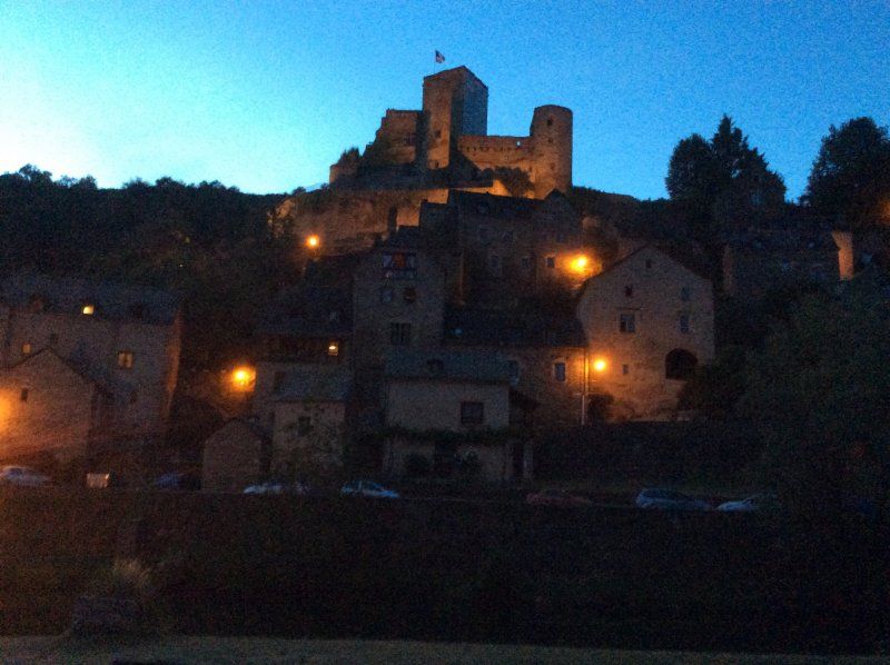
Belcastel, Frankrijk
12390 Belcastel, Frankrijk
44° 23' 14.8" N 2° 20' 4.4" E
44.3874440 2.3345560
• Head northeast on D285.
• Arrive at D285. Your destination is on the left.
☍
Distance not available
(Duration not available)
Belcastel, Camping Le Grand Bourg
12390 Belcastel, Frankrijk
44° 23' 14.8" N 2° 20' 4.4" E
44.3874440 2.3345560
• Head northeast on D285. Go for 436 m.
• Keep left onto D285. Go for 60 m.
• Turn left toward Route du Château. Go for 327 m.
• Continue on Route du Château. Go for 170 m.
• Turn left. Go for 66 m.
• Turn right toward Lieu-dit Le Bessou. Go for 654 m.
• Continue on Lieu-dit Le Bessou. Go for 1.6 km.
• Continue on C1. Go for 258 m.
• Turn left onto C1. Go for 37 m.
• Turn left onto D994. Go for 4.1 km.
• Pass 2 roundabouts and continue on D994. Go for 4.8 km.
• Turn right onto D994 toward La Remise/Roussennac/Montbazens/Decazeville. Go for 6.5 km.
• Turn right onto Lieu-dit Le Fargal (D994). Go for 361 m.
• Continue on Avenue Marius Garric (D994). Go for 585 m.
• Continue on Avenue du Planhol (D994). Go for 515 m.
• Continue on Avenue du Ségala (D5). Go for 689 m.
• Turn left onto Avenue de la Résistance (D994). Go for 20.4 km.
• Take the 1st exit from roundabout onto Avenue Gambetta (D994). Go for 178 m.
• Take the 2nd exit from roundabout onto Rue du Port (D840) toward Cahors/Brive/Figeac/Capdenac-le-Haut. Go for 3.0 km.
• Take the 2nd exit from roundabout onto D840. Go for 515 m.
• Continue toward A20/Cahors/Sarlat/St Cirq-Lapopie/Livernon/Villefranche de R. Go for 40 m.
• Take the 4th exit from roundabout onto D802 toward A20/Cahors/Sarlat/St Cirq-Lapopie/Livernon/Villefranche de R. Go for 1.9 km.
• Take the 3rd exit from roundabout onto D802 toward A20/Cahors/Sarlat/Livernon/St Cirq-Lapopie/Z.A. de Lafarrayrie. Go for 5.8 km.
• Take the 3rd exit from Giratoire du Drauzon roundabout toward Livernon/Musée de Cuzals/Grotte de Pech Merle. Go for 72 m.
• Continue toward D802. Go for 92 m.
• Continue on D802. Go for 4.3 km.
• Take the 2nd exit from roundabout toward Cahors/Sarlat/Livernon/Gourdon. Go for 58 m.
• Continue on D802. Go for 4.7 km.
• Continue on D13. Go for 33 m.
• Continue on D802. Go for 4.4 km.
• Pass 2 roundabouts and continue on D802. Go for 23.0 km.
• Take the 2nd exit from roundabout toward A20/E9/Cahors/Brive/Montauban. Go for 90 m.
• Continue toward L'Occitane/A20. Go for 659 m.
• Take ramp onto A20 (L'Occitane) toward Paris/Limoges/Brive la G. Go for 24.0 km.
• Take exit 55 toward Beaulieu S/D./Souillac. Go for 2.1 km.
• Take the 3rd exit from roundabout onto Route de Martel (D804) toward Sarlat/Souillac. Go for 1.8 km.
• Take the 3rd exit from roundabout onto Avenue du Général de Gaulle (D820) toward Cahors/Sarlat/Centre Ville. Go for 335 m.
• Take the 2nd exit from roundabout onto Avenue du Général de Gaulle (D820) toward Sarlat/Cahors/Gourdon/Centre Ville/Rocamadour. Go for 531 m.
• Turn right onto Avenue de Sarlat (D804) toward Carlux/Sarlat/Cazoulès/Musée de l'Automate/Château de Fénelon. Go for 101 m.
• Arrive at Place Barnicou (D804). Your destination is on the left.
☍
119,2 km
(1 hrs. 31 min.)
Day
Souillac, Frankrijk
46200 Souillac, Frankrijk
44° 53' 37.1" N 1° 28' 43" E
44.8936260 1.4786130
• Head southwest on Place Barnicou (D804).
• Arrive at Place Barnicou (D804). Your destination is on the left.
☍
Distance not available
(Duration not available)
Souillac, Les Ondines
46200 Souillac, Frankrijk
44° 53' 37.1" N 1° 28' 43" E
44.8936260 1.4786130
• Head southwest on Place Barnicou (D804). Go for 1.5 km.
• Take the 3rd exit from roundabout onto Avenue de Sarlat (D804) toward Sarlat/Cazoulès/Carlux. Go for 15.4 km.
• Continue on D703 toward D704 A/Sarlat/Montignac/Z.A.E Périgord Noir. Go for 116 m.
• Continue on Route de l'Enéa (D704 A). Go for 6.0 km.
• Take the 2nd exit from roundabout onto Route de Souillac (D704 A) toward Sarlat. Go for 755 m.
• Continue on Avenue du Périgord (D704) toward Sarlat. Go for 1.8 km.
• Take the 3rd exit from roundabout onto Avenue Simone Veil (D704) toward Sarlat/Brive/Périgueux/Bergerac/Sarlat-Centre Ville. Go for 668 m.
• Pass 2 roundabouts and continue on Avenue du Colonel Beltrame (D704). Go for 814 m.
• Take the 3rd exit from roundabout onto Avenue de la Dordogne (D46) toward Bergerac/St André Allas/Vézac/Vitrac. Go for 206 m.
• Take the 2nd exit from roundabout onto Avenue de la Dordogne (D46) toward Bergerac. Go for 586 m.
• Take the 1st exit from roundabout onto Avenue Joséphine Baker (D57) toward Bergerac. Go for 7.1 km.
• Continue on D49 toward Bergerac/Lalinde/Beynac/Château de Beynac. Go for 817 m.
• Continue on D703 toward Bergerac/Lalinde/Beynac/Château de Beynac. Go for 17.6 km.
• Take the 2nd exit from roundabout onto Voie de la Vallée (D25) toward Bergerac/Périgueux/Le Buisson/Lalinde. Go for 526 m.
• Take the 1st exit from roundabout onto Voie de la Vallée (D25) toward Le Buisson/Périgueux. Go for 6.8 km.
• Keep right onto Avenue d'Aquitaine (D29 E) toward Bergerac/Lalinde/Z.A.E. la Seguinie. Go for 799 m.
• Take the 2nd exit from roundabout onto Route de Bergerac (D29) toward Bergerac/Badefols/Lalinde. Go for 14.5 km.
• Continue on D8 E4. Go for 930 m.
• Turn right onto Place du 8 Mai 1945 (D703) toward Mauzac/Ste Alvère/Cingles de Trémolat et Limeuil. Go for 29 m.
• Turn left onto Boulevard de Stalingrad (D8 E3) toward Bergerac/Périgueux/Beaumont/Couze. Go for 662 m.
• Turn right onto Avenue Paul Langevin (D703) toward Bergerac/Port de Couze/Beaumont. Go for 913 m.
• Take the 2nd exit from roundabout onto Avenue Jean Moulin (D703). Go for 1.6 km.
• Continue on Avenue du Port de Couze (D660). Go for 7.4 km.
• Pass 4 roundabouts and continue on Avenue de la Roque (D660). Go for 6.6 km.
• Take the 3rd exit from roundabout onto N21 toward Aéroport Bergerac Roumanière. Go for 4.3 km.
• Take the 3rd exit from roundabout onto N21 toward Agen/Bouniagues/Issigeac/Aéroport Bergerac Roumanière. Go for 670 m.
• Turn left onto Allée Jacqueline Auriol (C205) toward Aéroport Bergerac Roumanière. Go for 882 m.
• Turn left. Go for 21 m.
• Turn right. Go for 200 m.
• Arrive at your destination.
☍
100,1 km
(1 hrs. 30 min.)
Day
Via Bergerac Dordogne Périgord Airport, Route d'Agen, Bergerac, Frankrijk
Route d'Agen, 24100 Bergerac, Frankrijk
44° 49' 27" N 0° 31' 5.6" E
44.8241663 0.5182322
• Head toward Allée Jacqueline Auriol. Go for 98 m.
• Turn sharp right onto Allée Jacqueline Auriol (C205). Go for 1.2 km.
• Turn right onto N21. Go for 563 m.
• Take the 3rd exit from roundabout onto D936 E1 toward Bordeaux/Mont de Marsan. Go for 1.2 km.
• Pass 3 roundabouts and continue on D936 E1. Go for 3.3 km.
• Take the 3rd exit from Rond-Point de la Cavaille roundabout onto D936 toward Bordeaux/Ste Foy la Grande. Go for 706 m.
• Pass 2 roundabouts and continue on Route de Bordeaux (D936). Go for 15.0 km.
• Take the 3rd exit from roundabout onto Lieu-dit La Guerenne Nord (D936) toward Libourne/Bordeaux. Go for 639 m.
• Take the 2nd exit from roundabout onto D936 E6 toward Ste Foy la Gde/Z.A.E. de l'Arbalestrier. Go for 578 m.
• Pass 2 roundabouts and continue on Avenue du Maréchal Juin (D936 E6). Go for 2.0 km.
• Turn right onto Boulevard Gratiolet. Go for 332 m.
• Continue on Place Jean Jaurès. Go for 28 m.
• Turn right onto Rue de la République (D130). Go for 175 m.
• Turn left onto Rue des Frères Reclus. Go for 52 m.
• Turn left onto Place Gambetta. Go for 33 m.
• Arrive at Place Gambetta. Your destination is on the left.
☍
25,9 km
( 27 min.)
Sainte-Foy-Le-Grande, Frankrijk
33220 Sainte-Foy-la-Grande, Frankrijk
44° 50' 30.5" N 0° 12' 54" E
44.8418050 0.2150060
• Head west on Place Gambetta.
• Arrive at Place Gambetta. Your destination is on the left.
☍
Distance not available
(Duration not available)
Sainte-Foy-Le-Grande, camping de La Bastide
33220 Sainte-Foy-la-Grande, Frankrijk
44° 50' 30.5" N 0° 12' 54" E
44.8418050 0.2150060
• Head west on Place Gambetta. Go for 17 m.
• Turn left onto Rue Louis Pasteur. Go for 49 m.
• Turn left onto Rue de la République (D130). Go for 53 m.
• Turn right onto Rue des Frères Reclus. Go for 56 m.
• Turn right onto Rue Alsace-Lorraine. Go for 158 m.
• Turn right onto Boulevard Gratiolet. Go for 36 m.
• Continue on Place Jean Jaurès. Go for 28 m.
• Turn left onto Place Jean Jaurès (D130). Go for 71 m.
• Continue on Avenue Ithier Gorin (D130). Go for 49 m.
• Continue on Rue du Maréchal Leclerc (D130). Go for 10 m.
• Continue on Avenue du Maréchal Leclerc (D130). Go for 142 m.
• Turn right onto Avenue de Verdun (D936 E6). Go for 225 m.
• Continue on Avenue de Bordeaux (D936 E2). Go for 371 m.
• Pass 4 roundabouts and continue on Avenue du Périgord (D936). Go for 20.0 km.
• Turn left onto Place Pierre Orus (D936 E3) toward Pujols/Pellegrue/Sauveterre/Centre Ville. Go for 153 m.
• Continue on Allée de la République (D17). Go for 189 m.
• Turn left onto Quai Camille Pelletan. Go for 57 m.
• Arrive at Quai Camille Pelletan. Your destination is on the left.
☍
21,7 km
( 23 min.)
Day
Via Castillon-la-Bataille, Frankrijk
33350 Castillon-la-Bataille, Frankrijk
44° 51' 7.4" N 0° 2' 34.8" W
44.8520670 -0.0430080
• Head toward Allée de la République on Quai Camille Pelletan. Go for 57 m.
• Turn right onto Allée de la République (D17). Go for 183 m.
• Continue on Place Pierre Orus (D936 E3). Go for 153 m.
• Turn left onto Avenue John Talbot (D936). Go for 1.5 km.
• Pass 15 roundabouts and continue on Avenue de Verdun (D670). Go for 16.3 km.
• Continue on Square du 15ème Dragon. Go for 134 m.
• Turn right onto Rue Thiers. Go for 257 m.
• Arrive at Rue Thiers. Your destination is on the left.
☍
18,5 km
( 21 min.)
Via Libourne, Frankrijk
33500 Libourne, Frankrijk
44° 54' 46.8" N 0° 14' 38.3" W
44.9129980 -0.2439850
• Head toward Rue Étienne Sabatié on Rue Thiers. Go for 44 m.
• Turn right onto Rue Étienne Sabatié. Go for 414 m.
• Turn left onto Place Decazes (D670). Go for 419 m.
• Take the 3rd exit from Place Jean Moulin roundabout onto Rue du Président Wilson (D670) toward A10/Bordeaux/Saintes/Royan/Fronsac/St André de C. Go for 1.8 km.
• Pass 5 roundabouts and continue on Route du Fronsadais (D670). Go for 16.1 km.
• Take the 1st exit from roundabout onto Chemin du Pas de Monac (D248) toward A10/Paris/Royan/Saintes/Blaye/Salignac/Aubie et Espessas. Go for 540 m.
• Keep right onto D248. Go for 58 m.
• Take the 2nd exit from roundabout onto D1510 toward A10/Paris/Royan/Saintes/Blaye. Go for 1.3 km.
• Keep right toward Paris/A10/Paris Par Angoulême/Angoulême/Cognac/St Antoine/Zone Industrielle de St André. Go for 515 m.
• Continue on Route de Paris (D1010). Go for 206 m.
• Pass 2 roundabouts and continue on D1010. Go for 793 m.
• Take the 3rd exit from roundabout onto A10 (L'Aquitaine) toward Paris/Nantes/Saint/Royan. Go for 114 km.
• Take exit 34 toward St Jean d'Angély/Aulnay. Go for 929 m.
• Take the 3rd exit from roundabout onto D939 toward Cognac/St Jean d'Angély. Go for 1.6 km.
• Take the 2nd exit from Giratoire de l'Aumônerie roundabout onto D939 toward Cognac/St Jean d'Angély-Centre/Niort/Saintes/Angoulême. Go for 784 m.
• Take ramp toward Niort/St Jean d'Angély-Centre/Cognac/Saintes/St Jean d'Angély Centre. Go for 270 m.
• Take the 1st exit from roundabout onto D150 toward Cognac/Saintes/St Jean d'Angély Centre/Centre Ville. Go for 86 m.
• Continue on Faubourg de Niort (D150). Go for 704 m.
• Continue on Boulevard du 14 Juillet (D150). Go for 350 m.
• Turn right onto Avenue Général Leclerc (D127). Go for 343 m.
• Turn right onto Rue des Capucins. Go for 74 m.
• Turn right onto Rue Rose. Go for 34 m.
• Turn slightly right onto Rue Tour Ronde. Go for 77 m.
• Arrive at Rue Tour Ronde. Your destination is on the left.
☍
141,1 km
(1 hrs. 23 min.)
Saint-Jean-d'Angély, Frankrijk
17400 Saint-Jean-d'Angély, Frankrijk
45° 56' 41.4" N 0° 31' 3.9" W
45.9448230 -0.5177630
• Head toward Rue du Palais on Rue Tour Ronde. Go for 22 m.
• Turn left onto Place de l'Hôtel de Ville. Go for 45 m.
• Turn right onto Place de l'Hôtel de Ville. Go for 9 m.
• Continue on Place de l'Hôtel de Ville. Go for 17 m.
• Continue on Place des Martyrs. Go for 28 m.
• Continue on Boulevard Jacques Caillaud. Go for 223 m.
• Turn left onto Boulevard du 14 Juillet (D150). Go for 100 m.
• Continue on Faubourg de Niort (D150). Go for 704 m.
• Continue on D150. Go for 54 m.
• Take the 2nd exit from roundabout onto D150 toward A10/Niort/Rochefort/Surgères/La Rochelle. Go for 236 m.
• Take the 2nd exit from roundabout onto D939 toward A10/Niort/Surgères/La Rochelle/Rochefort. Go for 1.0 km.
• Pass 2 roundabouts. Go for 1.6 km.
• Take ramp onto A10 (L'Aquitaine) toward Paris/Nantes/Poitiers/Niort. Go for 32.7 km.
• Take exit 33 toward Marais Poitevin/Niort-Sud onto N248. Go for 3.0 km.
• Take ramp toward Niort. Go for 347 m.
• Take the 1st exit from roundabout onto D650 toward Niort. Go for 2.4 km.
• Pass 2 roundabouts and continue on Avenue Saint-Jean d'Angély (D650). Go for 3.3 km.
• Take the 3rd exit from roundabout onto Avenue Saint-Jean d'Angély (D850) toward Niort-Centre. Go for 1.6 km.
• Continue on Avenue Saint-Jean d'Angély (D850 E). Go for 364 m.
• Continue on Avenue Saint-Jean d'Angély. Go for 436 m.
• Pass 2 roundabouts and continue on Avenue Saint-Jean d'Angély. Go for 404 m.
• Take the 2nd exit from Place Saint-Jean roundabout onto Rue du Général Largeau (D744). Go for 218 m.
• Take the 2nd exit from roundabout onto Rue du Général Largeau (D744). Go for 76 m.
• Take the 1st exit from Place Delphin Debenest roundabout onto Rue du Palais. Go for 155 m.
• Continue on Place des Tribunaux. Go for 28 m.
• Turn right onto Rue de l'Ancien Musée. Go for 36 m.
• Arrive at Rue de l'Ancien Musée. Your destination is on the left.
☍
49,1 km
( 34 min.)
Day
Via Niort, Frankrijk
79000 Niort, Frankrijk
46° 19' 25.4" N 0° 27' 53.2" W
46.3237160 -0.4647770
• Head toward Rue Émile Beche on Rue de l'Ancien Musée. Go for 36 m.
• Turn left onto Place des Tribunaux. Go for 28 m.
• Continue on Rue du Palais. Go for 137 m.
• Take the 1st exit from Place Delphin Debenest roundabout onto Rue de l'Espingole (D744). Go for 304 m.
• Take the 3rd exit from Boulevard Main roundabout onto Rue Gambetta (D744). Go for 462 m.
• Take the 3rd exit from roundabout onto Avenue du Maréchal de Lattre de Tassigny (D744). Go for 404 m.
• Take the 2nd exit from Rond-Point des Combattants d'Indochine roundabout onto Avenue du Maréchal de Lattre de Tassigny (D648) toward La Roche S/Yon/Les Sables-d'O./Nantes/Cholet/Fontenay le Comte/Coulonges S/l'Autize. Go for 270 m.
• Take the 3rd exit from Avenue du Maréchal de Lattre de Tassigny roundabout onto Avenue de Nantes (D648) toward Nantes/Cholet. Go for 3.5 km.
• Pass 2 roundabouts and continue on D648. Go for 3.9 km.
• Continue on Route de Niort à Sainte-Hermine (D148). Go for 1.6 km.
• Pass 2 roundabouts and continue on Route de Fontenay le Comte (D148). Go for 5.3 km.
• Take the 2nd exit from roundabout toward Bordeaux/Limoges/Poitiers/La Roche S/Yon/Les Sables d'O./Nantes/Angers/Cholet. Go for 868 m.
• Take ramp onto A83 toward Angers/Nantes/Cholet/La Roche S/Y./Les Sables d'O. Go for 49.6 km.
• Take exit 6 toward Les Sables d'One. Go for 1.6 km.
• Take the 3rd exit from roundabout onto D948 toward Les Sables d'One/La Roche S/Yon/La Chaize le Vicomte/Mareuil S/Lay. Go for 20.5 km.
• Continue on D160. Go for 3.9 km.
• Take ramp toward Noirmoutier/St Nazaire/Aizenay/St Jean de Monts. Go for 330 m.
• Pass 3 roundabouts and continue on Route de la Roche-sur-Yon (D948). Go for 39.3 km.
• Take ramp toward Noirmoutier/Beauvoir S/Mer/St Jean de Mts. Go for 212 m.
• Take the 4th exit from roundabout onto D948 toward Noirmoutier/Beauvoir S/Mer. Go for 2.5 km.
• Keep left onto D205. Go for 3.7 km.
• Take the 1st exit from Porte de Saint-Jean roundabout onto Route de Challans (D753). Go for 1.9 km.
• Take the 2nd exit from roundabout onto Route de Challans (D753). Go for 3.3 km.
• Continue on D753. Go for 37 m.
• Continue on Route de Challans (D753). Go for 399 m.
• Continue on Rue du Général de Gaulle (D753). Go for 177 m.
• Take the 2nd exit from roundabout onto Rue de l'Océan (D753). Go for 210 m.
• Continue on Route de Saint-Jean de Monts (D753). Go for 2.1 km.
• Take the 2nd exit from roundabout onto Route de Challans (D753). Go for 2.5 km.
• Take the 2nd exit from roundabout onto Rue de Challans (D753). Go for 254 m.
• Pass 2 roundabouts and continue on Rue de Challans (D753). Go for 722 m.
• Take the 1st exit from roundabout onto Rue du Général de Gaulle (D38). Go for 445 m.
• Arrive at Rue du Général de Gaulle (D38). Your destination is on the left.
☍
150,5 km
(1 hrs. 36 min.)
Saint-Jean-de-Monts, Frankrijk
85160 Saint-Jean-de-Monts, Frankrijk
46° 47' 36.5" N 2° 3' 42.4" W
46.7934640 -2.0617863
• Head northwest on Rue du Général de Gaulle (D38).
• Arrive at Rue du Général de Gaulle (D38). Your destination is on the left.
☍
Distance not available
(Duration not available)
St Jean de mont, Les Sirenes
85160 Saint-Jean-de-Monts, Frankrijk
46° 47' 36.5" N 2° 3' 42.4" W
46.7934640 -2.0617863
• Head northwest on Rue du Général de Gaulle (D38). Go for 469 m.
• Take the 1st exit from roundabout onto Rue du Général de Gaulle (D38). Go for 249 m.
• Take the 1st exit from roundabout onto Route de Beauvoir (D51). Go for 411 m.
• Take the 3rd exit from roundabout onto Route de Beauvoir (D51). Go for 209 m.
• Continue on D38 BIS. Go for 933 m.
• Take the 2nd exit from roundabout onto D38 BIS. Go for 693 m.
• Take the 3rd exit from roundabout onto D38 B. Go for 1.3 km.
• Take the 4th exit from roundabout onto D205. Go for 1.7 km.
• Pass 4 roundabouts and continue on D205. Go for 12.3 km.
• Continue on D948. Go for 2.1 km.
• Keep left onto D32 toward St Nazaire/La Garnache/Machecoul/Nantes. Go for 8.9 km.
• Take the 2nd exit from roundabout onto Lieu-dit Le Champ Rocand (D32) toward St Nazaire/Nantes. Go for 1.9 km.
• Continue on Route de Challans (D95). Go for 3.6 km.
• Take the 2nd exit from Rond-Point de la Seiglerie roundabout onto Route de Challans (D95) toward St Nazaire/Nantes. Go for 1.4 km.
• Take the 2nd exit from Rond-Point du Moulin Mocrat roundabout onto Lieu-dit Les Buissonnets (D117) toward St Philbert de Gd Lieu/Nantes. Go for 22.1 km.
• Continue on Lieu-dit La Guillauderie (D178). Go for 4.7 km.
• Continue on M178. Go for 2.2 km.
• Take ramp onto A83. Go for 3.8 km.
• Take the exit toward Paris/Poitiers onto N844 (Périphérique Sud). Go for 8.6 km.
• Take ramp onto A811 toward Paris/Angers/Ancenis/Ste Luce S/Loire/Carquefou. Go for 6.0 km.
• Take ramp toward Nort S/ Erdre/Carquefou-Centre. Go for 996 m.
• Keep left toward M178. Go for 314 m.
• Continue on M178. Go for 2.6 km.
• Continue on D178. Go for 1.1 km.
• Pass 8 roundabouts and continue on Route de Nantes (D178). Go for 14.1 km.
• Take the 3rd exit from roundabout onto Rue Saint-Georges (D164) toward Centre Ville. Go for 797 m.
• Pass 2 roundabouts and continue on Rue de la Paix (D164). Go for 376 m.
• Continue on Rue Aristide Briand (D164). Go for 134 m.
• Arrive at Rue Aristide Briand (D164). Your destination is on the left.
☍
104,1 km
(1 hrs. 19 min.)
Day
Nort-sur-Erdre, Frankrijk
44390 Nort-sur-Erdre, Frankrijk
47° 26' 22.4" N 1° 30' 3.3" W
47.4395520 -1.5009189
• Head west on Rue Aristide Briand (D164).
• Arrive at Rue Aristide Briand (D164). Your destination is on the left.
☍
Distance not available
(Duration not available)
Nort-sur-Erdre, Port Mulon
44390 Nort-sur-Erdre, Frankrijk
47° 26' 22.4" N 1° 30' 3.3" W
47.4395520 -1.5009189
• Head toward Rue Gambetta on Rue Aristide Briand (D164). Go for 865 m.
• Pass 2 roundabouts and continue on D164. Go for 10.3 km.
• Turn right onto Lieu-dit Bout de Bois (D537) toward Rennes/Nozay/Bout de Bois. Go for 828 m.
• Continue on Lieu-dit Le Pommain. Go for 792 m.
• Take ramp onto N137. Go for 71.6 km.
• Take ramp onto Rocade Sud (N136) toward E3/Le Mans/Caen/C.H.U. Hôpital Sud. Go for 7.7 km.
• Keep left onto Rocade Sud (N136). Go for 913 m.
• Take ramp onto Rocade Est (N136) toward Caen/Cherbourg. Go for 4.8 km.
• Take ramp onto A84 toward Porte de Normandie/Fougères/Mt St Michel/Caen/Cherbourg/Liffré. Go for 66.5 km.
• Continue on N175. Go for 7.5 km.
• Take ramp onto D673 toward Granville. Go for 516 m.
• Take the 2nd exit from roundabout toward Cherbourg/Sartilly/Jullouville/Granville. Go for 124 m.
• Continue on Avenue des Réfractaires et Maquisards (D673). Go for 560 m.
• Take the 2nd exit from roundabout onto Route de Granville (D673) toward Sartilly/Granville/Cherbourg. Go for 2.1 km.
• Take the 3rd exit from roundabout onto Lieu-dit La Moinerie (D973) toward Granville/Sartilly. Go for 3.4 km.
• Pass 8 roundabouts and continue on Avenue des Vendéens (D973). Go for 16.5 km.
• Take the 3rd exit from Rond-Point de Sherborne roundabout onto Boulevard des Amériques (D135). Go for 381 m.
• Take the 2nd exit from roundabout onto Boulevard des Amériques (D135). Go for 327 m.
• Turn right onto Rue de la Crête (D911). Go for 525 m.
• Take the 3rd exit from Rond-Point d'Hacqueville roundabout onto Rue Saint-Gaud (D911). Go for 412 m.
• Take the 2nd exit from Rond-Point Saint-Gaud roundabout onto Rue Saint-Gaud (D911). Go for 376 m.
• Continue on Boulevard des Amiraux Granvillais. Go for 324 m.
• Take the 2nd exit from Rond-Point des Amiraux Granvillais roundabout onto Boulevard des Amiraux Granvillais. Go for 366 m.
• Turn right onto Rue Saintonge. Go for 70 m.
• Turn right onto Rue Lecampion (D924). Go for 124 m.
• Continue on Rue Paul Poirier (D924). Go for 47 m.
• Turn sharp left onto Rue de l'Abreuvoir. Go for 32 m.
• Turn right onto Rue du Commandant Yvon. Go for 6 m.
• Arrive at Rue du Commandant Yvon. Your destination is on the left.
☍
197,9 km
(2 hrs. 2 min.)
Day
Granville, Frankrijk
48° 50' 15.3" N 1° 35' 50.3" W
48.8375790 -1.5973020
• Head east on Rue du Commandant Yvon. Go for 130 m.
• Turn left onto Rue Couraye (D924). Go for 510 m.
• Take the 2nd exit from Avenue du Maréchal Leclerc roundabout onto Place Pierre Sémard (D468). Go for 985 m.
• Take the 1st exit from roundabout onto Route de Coutances (D971 E5). Go for 534 m.
• Take the 3rd exit from Route de Coutances roundabout onto Route de Coutances (D971 E5). Go for 315 m.
• Pass 4 roundabouts and continue on D971 E5. Go for 3.1 km.
• Take the 3rd exit from roundabout onto Lieu-dit Le Vau Tertreux (D971) toward Cherbourg/Bréhal/Coutances. Go for 2.3 km.
• Take the 2nd exit from roundabout onto D971 toward Coutances/Bréhal. Go for 702 m.
• Take the 2nd exit from roundabout onto D971 E6 toward Bréhal/Bricqueville S/M. Go for 1.5 km.
• Turn left onto Rue de la Poste (D20). Go for 6.1 km.
• Pass 2 roundabouts and continue on D20. Go for 4.6 km.
• Turn right onto Rue Jean-Claude Ménard (D20). Go for 46 m.
• Turn left onto Rue du Docteur André Pigaux (D20). Go for 4.1 km.
• Pass 7 roundabouts and continue on D650. Go for 45.1 km.
• Keep left onto D650. Go for 1.9 km.
• Take the 2nd exit from roundabout onto D650. Go for 2.2 km.
• Continue toward D903. Go for 70 m.
• Continue on D650. Go for 7.6 km.
• Continue on D904. Go for 1.6 km.
• Continue on D650. Go for 3.4 km.
• Take the 1st exit from roundabout onto D650. Go for 5.7 km.
• Take the 3rd exit from roundabout onto Route de Barneville. Go for 129 m.
• Take the 1st exit from roundabout onto Route de Barneville. Go for 859 m.
• Turn left onto Rue Centrale (D4). Go for 105 m.
• Arrive at Rue Centrale (D4). Your destination is on the left.
☍
93,6 km
(1 hrs. 26 min.)
Day
Les Pieux, Frankrijk
50340 Les Pieux, Frankrijk
49° 30' 47.5" N 1° 48' 29.9" W
49.5131919 -1.8083040
• Head southwest on Rue Centrale (D4).
• Arrive at Rue Centrale (D4). Your destination is on the left.
☍
Distance not available
(Duration not available)
Les Pieux, Le Grand Large
50340 Les Pieux, Frankrijk
49° 30' 47.5" N 1° 48' 29.9" W
49.5131919 -1.8083040
• Head southwest on Rue Centrale (D4).
• Turn right onto Route de Flamanville (D4). Go for 75 m.
• Continue on Place du Grand Bourg. Go for 97 m.
• Continue on Route de la Forgette (D117). Go for 33 m.
• Continue on Place du Grand Bourg (D117). Go for 19 m.
• Turn right onto Rue Centrale (D4). Go for 339 m.
• Take the 2nd exit from roundabout onto Route de Cherbourg. Go for 438 m.
• Take the 1st exit from roundabout onto Route de Cherbourg (D23). Go for 282 m.
• Take the 2nd exit from roundabout onto D23. Go for 1.1 km.
• Continue on Lieu-dit La Belle Étoile (D23). Go for 307 m.
• Continue on D23. Go for 754 m.
• Continue on Hameau du Point du Jour (D23). Go for 443 m.
• Continue on Lieu-dit Le Point du Jour (D23). Go for 1.2 km.
• Continue on D23. Go for 517 m.
• Continue on Lieu-dit Les Bois (D23). Go for 122 m.
• Continue on D23. Go for 66 m.
• Continue on Lieu-dit Les Masses (D23). Go for 1.4 km.
• Continue on D23. Go for 1.3 km.
• Continue on Lieu-dit Lande des Bouillons (D23). Go for 167 m.
• Continue on D23. Go for 307 m.
• Continue on Lieu-dit La Cocotterie (D23). Go for 94 m.
• Continue on D23. Go for 134 m.
• Continue on Hameau Bihel (D23). Go for 466 m.
• Continue on D23. Go for 453 m.
• Continue on Lieu-dit Les Vieilles Maisons (D23). Go for 488 m.
• Continue on Lieu-dit Hôtel Beuvril (D23). Go for 478 m.
• Continue on D23. Go for 404 m.
• Turn right onto Rue du Hautbourg (D900). Go for 3.3 km.
• Turn left onto Rue Pierre Marie (D66). Go for 178 m.
• Continue on Rue Saint-Roch (D66). Go for 191 m.
• Continue on Rue de la République (D50). Go for 181 m.
• Turn right onto Rue Paul Philippe. Go for 121 m.
• Turn left onto Rue de Bricqueville (D902). Go for 158 m.
• Take the 2nd exit from roundabout onto Rue du 11 Novembre (D902). Go for 11.0 km.
• Take ramp onto N13 toward Montebourg/Carentan/Caen. Go for 108 km.
• Take ramp toward Deauville/Trouville/Rouen. Go for 456 m.
• Keep left onto A13 (Autoroute de Normandie) toward Deauville/Trouville/Le Havre/Rouen/Paris/Troarn/Dozulé. Go for 50.1 km.
• Take the exit toward Le Havre/Amiens/Calais/Honfleur/Pont de Normandie onto A29. Go for 18.0 km.
• Continue on N1029. Go for 7.1 km.
• Continue on A29. Go for 84.2 km.
• Continue on A28. Go for 13.2 km.
• Take exit 9 toward Le Four Rouge/Neufchâtel en Bray. Go for 226 m.
• Turn left onto D928 toward Neufchâtel en B./Quièvrecourt. Go for 2.3 km.
• Take the 2nd exit from roundabout onto Grande Rue Saint-Pierre (D928). Go for 405 m.
• Take the 3rd exit from roundabout onto Grande Rue Fausse Porte (D928). Go for 165 m.
• Continue on Place Notre-Dame (D928). Go for 183 m.
• Take the 3rd exit from roundabout onto Rue Baron d'Haussez (D1314). Go for 107 m.
• Turn left onto Espace François Mitterrand. Go for 33 m.
• Arrive at Espace François Mitterrand. Your destination is on the left.
☍
311,3 km
(3 hrs. 1 min.)
Day
Neufchâtel-en-Bray, Frankrijk
76270 Neufchâtel-en-Bray, Frankrijk
49° 43' 58" N 1° 26' 30.8" E
49.7327710 1.4418910
• Head southwest on Espace François Mitterrand.
• Arrive at Espace François Mitterrand. Your destination is on the left.
☍
Distance not available
(Duration not available)
Neufchâtel-en-Bray, Sainte Claire
76270 Neufchâtel-en-Bray, Frankrijk
49° 43' 58" N 1° 26' 30.8" E
49.7327710 1.4418910
• Head toward Rue du Pot d'Étain on Espace François Mitterrand. Go for 52 m.
• Turn right onto Rue du Pot d'Étain. Go for 32 m.
• Turn right onto Rue du Pot d'Étain. Go for 57 m.
• Turn right onto Rue Baron d'Haussez (D1314). Go for 129 m.
• Take the 3rd exit from roundabout onto Grande Rue Saint-Jacques (D928). Go for 245 m.
• Turn right onto Rue du Val Boury (D60). Go for 417 m.
• Continue on Route d'Aumale (D60). Go for 532 m.
• Continue on D60. Go for 3.3 km.
• Turn right onto D929. Go for 3.5 km.
• Turn right and take ramp onto A29 toward Amiens. Go for 54.9 km.
• Take the exit toward Reims/Lille/Paris/Amiens-Sud onto A16 (L'Européenne). Go for 3.9 km.
• Take the exit toward Reims/Lille/Paris-Est/A1/Amiens-Sud onto E44. Go for 1.1 km.
• Continue on A29. Go for 10.2 km.
• Take the exit toward Paris/Lille/Reims/St Quentin onto A29. Go for 32.7 km.
• Take the exit toward Paris/Lille/Bruxelles/Péronne. Go for 1.9 km.
• Take the left exit toward Lille/Calais/Bruxelles/Péronne onto A1 (Autoroute du Nord). Go for 92.5 km.
• Take the exit toward La Madeleine/Lille-St Maurice onto N356 (Boulevard Périphérique Est de Lille). Go for 2.0 km.
• Keep right onto N356 toward Gand (Gent)/Roubaix/Marcq en Baroeul/Mons en Baroeul/Tourcoing. Go for 3.4 km.
• Keep left onto N356 toward Tourcoing/Gand (Gent)/Roubaix-Centre/Wasquehal/Croix. Go for 2.1 km.
• Continue on A22. Go for 11.7 km.
• Continue on E17. Go for 101 km.
• Continue on E34 (Ring Antwerpen 2). Go for 8.6 km.
• Take the exit toward E313/Luik/Eindhoven/Aken/Aachen onto E34 (Antwerpen-Oost). Go for 9.4 km.
• Keep right onto E34 (Ranst) toward Eindhoven/Turnhout. Go for 49.2 km.
• Continue on A67. Go for 18.0 km.
• Take the left exit toward 's-Hertogenbosch/Nijmegen/Tilburg/E25 onto A2 (Randweg Eindhoven). Go for 10.6 km.
• Continue on A50 (Knooppunt Ekkersweijer) toward Nijmegen/Helmond. Go for 56.6 km.
• Keep left onto A50. Go for 19.2 km.
• Take the exit toward Zwolle/Apeldoorn/Oberhausen/Arnhem onto A12/A50. Go for 6.5 km.
• Take the exit toward Apeldoorn/Zwolle onto A50. Go for 21.8 km.
• Take the exit toward Hengelo/Deventer onto A1. Go for 49.0 km.
• Take the exit toward Osnabrück/Enschede/Hengelo onto A1/A35. Go for 3.9 km.
• Take the exit toward Münster/Enschede/Hengelo-Zuid onto A35. Go for 10.8 km.
• Take exit 26A toward Enschede-West/26b/Doetinchem/Haaksbergen. Go for 1.6 km.
• Turn right onto Westerval (N18). Go for 3.4 km.
• Turn left onto Parkweg toward Bedrijventerrein Rigtersbleek. Go for 218 m.
• Turn right onto Parkweg. Go for 573 m.
• Turn left onto Parkweg. Go for 289 m.
• Continue on Parkweg toward Centrum. Go for 583 m.
• Turn left onto De Ruyterlaan. Go for 199 m.
• Turn right onto Hengelosestraat. Go for 104 m.
• Continue on Raiffeisenstraat. Go for 257 m.
• Continue on Deurningerstraat. Go for 10 m.
• Turn right onto Deurningerstraat. Go for 255 m.
• Turn left toward Hengelosestraat. Go for 36 m.
• Turn right onto Hengelosestraat. Go for 40 m.
• Continue on Stationsplein. Go for 23 m.
• Turn left onto Willem Wilminkplein. Go for 100 m.
• Turn right onto Kloosterstraat. Go for 36 m.
• Arrive at Kloosterstraat. Your destination is on the right.
☍
597,1 km
(5 hrs. 24 min.)
Day
Enschede, Nederland
52° 13' 17.5" N 6° 53' 37.2" E
52.2215372 6.8936619