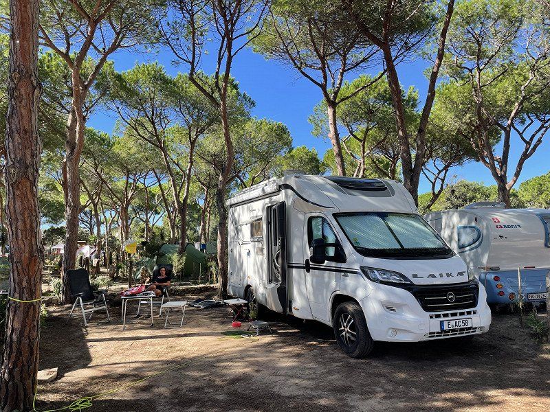
In September / October we went to Sardinia for 5 weeks. It must have been our 15th trip to this beautiful island. This time we vacationed with our daughter's family with 2 grandchildren and visited a few places from previous stays for 3 weeks. The focus was on child-friendly campsites. Then we continued alone for 2 weeks with city tours and looking for new places and parking spaces. From Porto Torres we took the night ferry back home via Genoa.
Day
Essen, Deutschland
It's raining 🌧. The best conditions to start your holiday in Sardinia.
51° 27' 20.3" N 7° 0' 41.6" E
51.4556432 7.0115552
• Head toward Friedensplatz on I. Hagen. Go for 16 m.
• Turn left onto Kennedyplatz. Go for 73 m.
• Turn slightly left onto I. Hagen. Go for 10 m.
• Turn left onto II. Hagen. Go for 105 m.
• Continue on Theaterplatz. Go for 38 m.
• Turn left onto Theaterplatz. Go for 92 m.
• Turn right onto I. Dellbrügge. Go for 228 m.
• Turn right onto Gildehofstraße (K14). Go for 493 m.
• Keep left onto Helbingstraße (K14) toward Düsseldorf/A52/Messe/Gruga/Rellinghausen. Go for 1.6 km.
• Take ramp onto A52 toward Düsseldorf. Go for 14.4 km.
• Take exit 25 toward Krefeld/Köln/Oberhausen onto A3. Go for 52.1 km.
• Continue on A3 toward Frankfurt a.M. Go for 161 km.
• Take exit 48 toward Basel/Stuttgart/Darmstadt/Mainz onto A67. Go for 25.1 km.
• Continue on E35 (Darmstädter Kreuz) toward Basel/Karlsruhe/Heidelberg/A5. Go for 1.1 km.
• Continue on A5. Go for 214 km.
• Take exit 59 toward Riegel/Emmendingen/Sasbach (Rhein)/Endingen. Go for 231 m.
• Turn right onto L113 toward Marckolsheim/Sasbach a.K./Endingen a.K./Riegel a.K. Go for 3.1 km.
• Take the 3rd exit from roundabout onto L113 toward Marckolsheim/Sasbach a.K./Wyhl a.K./Endingen a.K. Go for 2.3 km.
• Take the 3rd exit from roundabout onto K5146 toward Endingen a.K. Go for 353 m.
• Continue on Forchheimer Straße (K5146). Go for 172 m.
• Take the 3rd exit from roundabout onto Forchheimer Straße (K5146). Go for 657 m.
• Arrive at Forchheimer Straße (K5146). Your destination is on the right.
☍
477,5 km
(4 hrs. 13 min.)
Endingen am Kaiserstuhl, Deutschland
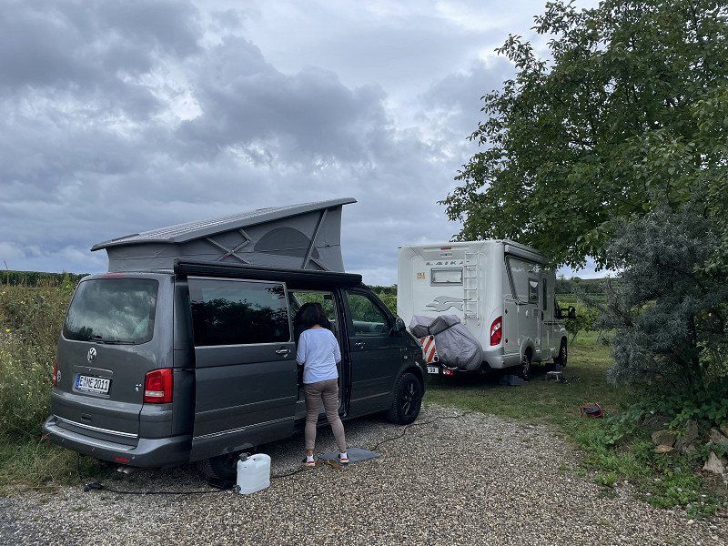
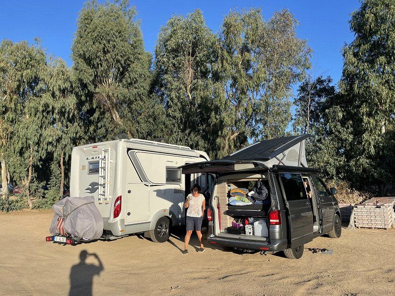
After we had to leave 2 places because of overcrowding, we approached this place, which we knew from a tour of Germany. This is where we meet our children.
Although the space was already more than full, the owner cleared a small corner for us. We can only repeat our praise from our last stay here - really nice operators, great wash house and nice parking space. Simply a special recommendation!
79346 Endingen am Kaiserstuhl, Deutschland
48° 8' 33.5" N 7° 42' 0.5" E
48.1426320 7.7001376
• Head south on Forchheimer Straße (K5146).
• Turn left onto Königschaffhauser Straße. Go for 85 m.
• Continue on Hauptstraße. Go for 501 m.
• Continue on Riegeler Straße. Go for 133 m.
• Take the 1st exit from roundabout onto Riegeler Straße. Go for 214 m.
• Continue on K5145. Go for 1.9 km.
• Continue on Endinger Straße (K5145). Go for 552 m.
• Take the 2nd exit from roundabout onto L116 toward A5. Go for 519 m.
• Take the 2nd exit from roundabout onto L116. Go for 508 m.
• Turn right onto L113 toward A5/Emmendingen/Gewerbegebiet Riegel-Oberwald. Go for 836 m.
• Turn left and take ramp onto A5 toward Basel/Freiburg. Go for 76.3 km.
• Continue on A2. Go for 14.1 km.
• Keep right onto A2 (Verzweigung Augst) toward Chiasso/Gotthard/Luzern/Bern/Arisdorf. Go for 28.2 km.
• Take the left exit toward Chiasso/Gotthard/Luzern/Zürich/Rothrist onto A1/A2. Go for 8.9 km.
• Take exit 47 toward Chiasso/Gotthard/Luzern/Reiden onto A2 (Verzweigung Wiggertal). Go for 236 km.
• Take exit 54 toward Chiasso Centro. Go for 182 m.
• Turn slightly left onto Via Como (2) toward Chiasso Centro. Go for 825 m.
• Pass 2 roundabouts and continue on Via Como (2). Go for 337 m.
• Take the 3rd exit from roundabout onto Via dei Pedroni (2). Go for 678 m.
• Continue on Via Bellinzona. Go for 71 m.
• Continue on Via Bellinzona. Go for 38 m.
• Pass 2 roundabouts and continue on Via Bellinzona. Go for 1.8 km.
• Take the 2nd exit from roundabout onto Via Luigi Camozzi toward Milano/A9/Varese. Go for 158 m.
• Take the 2nd exit from Largo Ceresio roundabout onto Via Nino Bixio. Go for 1.7 km.
• Continue on Piazzale Santa Teresa. Go for 58 m.
• Take the 1st exit from roundabout onto Viale Fratelli Rosselli. Go for 122 m.
• Turn right onto Viale Massenzio Masia. Go for 217 m.
• Keep right onto Via Fratelli Recchi. Go for 151 m.
• Continue on Piazzale San Rocchetto. Go for 51 m.
• Continue on Viale Innocenzo XI. Go for 783 m.
• Continue on Viale Franklin Delano Roosevelt. Go for 345 m.
• Continue on Via Achille Grandi toward Milano-Chiasso/A9/Cantù/Milano/Varese. Go for 413 m.
• Take the 1st exit from roundabout onto Piazza San Rocco. Go for 1.3 km.
• Turn left onto Via Filippo Turati toward Bergamo/Lecco/Cantù. Go for 85 m.
• Turn left onto Via Donatori di Sangue. Go for 230 m.
• Turn left onto Via Oltrecolle. Go for 209 m.
• Take the 1st exit from roundabout onto Via dei Lavatoi toward Autostrada/A9/Cantù/Milano/Varese. Go for 483 m.
• Keep left onto Via Canturina. Go for 843 m.
• Pass 2 roundabouts. Go for 924 m.
• Continue straight ahead. Go for 27 m.
• Take the 1st exit from roundabout toward Casnate con B./Villa Guardia/A59. Go for 187 m.
• Turn right onto Tangenziale di Como (A59) toward Villa Guardia/E35/E62/Milano. Go for 2.0 km.
• Take ramp onto A9 (Autostrada dei Laghi) toward E62/A8/Milano. Go for 21.9 km.
• Take the left exit onto A8 (Autostrada dei Laghi). Go for 5.1 km.
• Take the exit toward E64/Torino/A4/Genova/A7/Bologna/A1 onto A50 (Tangenziale Ovest). Go for 32.2 km.
• Continue on A1 (Autostrada del Sole). Go for 96.1 km.
• Take the exit toward Parma Ovest/La Spezia onto A15 (Autostrada della Cisa). Go for 51.1 km.
• Take the exit toward Berceto. Go for 671 m.
• Turn left onto Strada Provinciale di Valbona (SP114) toward P.Sso Cisa/SS62/Berceto/Bosco C./Corniglio. Go for 3.7 km.
• Turn left onto Via Enrico Berlinguer. Go for 309 m.
• Turn left onto Via Pianello. Go for 42 m.
• Turn slightly right onto Via Divisione Julia. Go for 128 m.
• Turn slightly right onto Via Divisione Julia. Go for 54 m.
• Turn slightly left onto Piazza San Giovanni Bosco. Go for 82 m.
• Turn slightly left onto Piazza San Giovanni Bosco. Go for 11 m.
• Continue on Via Giuseppe Saragat. Go for 57 m.
• Turn right onto Via Giuseppe Saragat. Go for 17 m.
• Arrive at Via Giuseppe Saragat. Your destination is on the left.
☍
594,2 km
(6 hrs. )
Day
Via Saragat, 16, Berceto, Parma, Italien
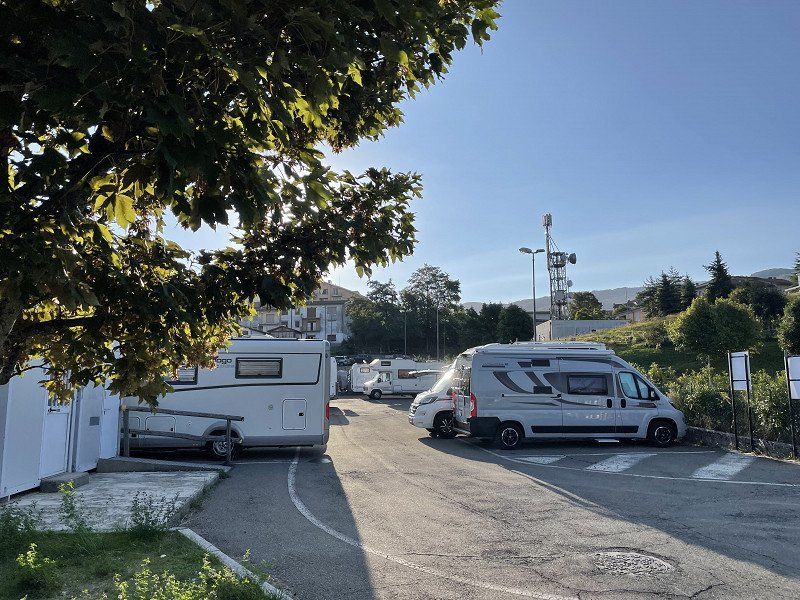
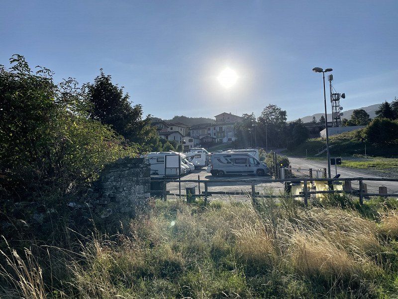
Pitch from park4 Night
Nice parking space in the mountains for €10, but not suitable for larger motorhomes. Parking bays very narrow and over 6m it becomes critical. Otherwise recommended.
On the other side there is a keep-fit course that offers a welcome change for both adults and children. With the dog you can go for a walk over the adjacent meadows.
Via Saragat, 16, 43042 Berceto PR, Italien
44° 30' 41.4" N 9° 59' 13.1" E
44.5115016 9.9869645
• Head southwest on Via Giuseppe Saragat. Go for 17 m.
• Turn left onto Via Giuseppe Saragat. Go for 57 m.
• Continue on Piazza San Giovanni Bosco. Go for 18 m.
• Turn left onto Piazza San Giovanni Bosco. Go for 55 m.
• Turn right onto Via al Rio. Go for 14 m.
• Continue on Via Divisione Julia. Go for 26 m.
• Turn right onto Via Martiri della Libertà (SP523r). Go for 235 m.
• Turn right onto Piazza Micheli. Go for 38 m.
• Continue on Via Giovanni Lucchi. Go for 315 m.
• Continue on Via Volontari del Sangue (SP114). Go for 4.0 km.
• Turn right and take ramp onto A15 (Autostrada della Cisa) toward La Spezia. Go for 49.6 km.
• Take the exit toward Firenze/A11/E76/Livorno onto A12 (Autostrada Azzurra). Go for 116 km.
• Continue on Strada Statale Aurelia (SS1). Go for 39.3 km.
• Take ramp onto Strada Statale della Val di Cornia (SS398) toward Venturina/Sardegna. Go for 7.8 km.
• Take ramp onto Strada della Base Geodetica (SP23bis) toward Piombino/Isola d'Elba. Go for 1.3 km.
• Keep left onto Strada Provinciale Fiorentina-Montegemoli (SP23bis). Go for 214 m.
• Continue on Strada Provinciale della Principessa (SP23). Go for 203 m.
• Keep right onto Località Asca (SP23). Go for 453 m.
• Pass 3 roundabouts and continue on Località Gagno (SP23). Go for 1.6 km.
• Continue on Viale dell'Unità d'Italia. Go for 365 m.
• Pass 2 roundabouts and continue on Viale dell'Unità d'Italia. Go for 1.8 km.
• Turn left onto Viale della Resistenza. Go for 398 m.
• Continue on Via Felice Cavallotti. Go for 154 m.
• Take the 1st exit from roundabout onto Via Portovecchio. Go for 139 m.
• Take the 1st exit from roundabout onto Via Pisa. Go for 236 m.
• Continue on Via Ignazio Silone. Go for 264 m.
• Keep left onto Via Ignazio Silone toward Porto. Go for 57 m.
• Take the 3rd exit from Largo Enzo Tortora roundabout onto Largo Enzo Tortora. Go for 166 m.
• Continue on Viale Regina Margherita. Go for 121 m.
• Take the 1st exit from roundabout onto Piazza Salvadore Allende. Go for 63 m.
• Continue on Via Carlo Alberto Dalla Chiesa. Go for 466 m.
• Continue on Piazzale Premuda. Go for 164 m.
• Take the 2nd exit from roundabout onto Piazzale Premuda. Go for 96 m.
• Turn left onto Piazzale Premuda. Go for 33 m.
• Arrive at Piazzale Premuda. Your destination is on the left.
☍
225,8 km
(2 hrs. 13 min.)
Day
Piombino Marittima, Piombino, Livorno, Italien
57025 Piombino, Livorno, Italien
42° 55' 43" N 10° 32' 40.8" E
42.9286183 10.5446727
• Head northeast on Piazzale Premuda. Go for 33 m.
• Turn right onto Piazzale Premuda. Go for 27 m.
• Turn left. Go for 20 m.
• Turn left. Go for 75 m.
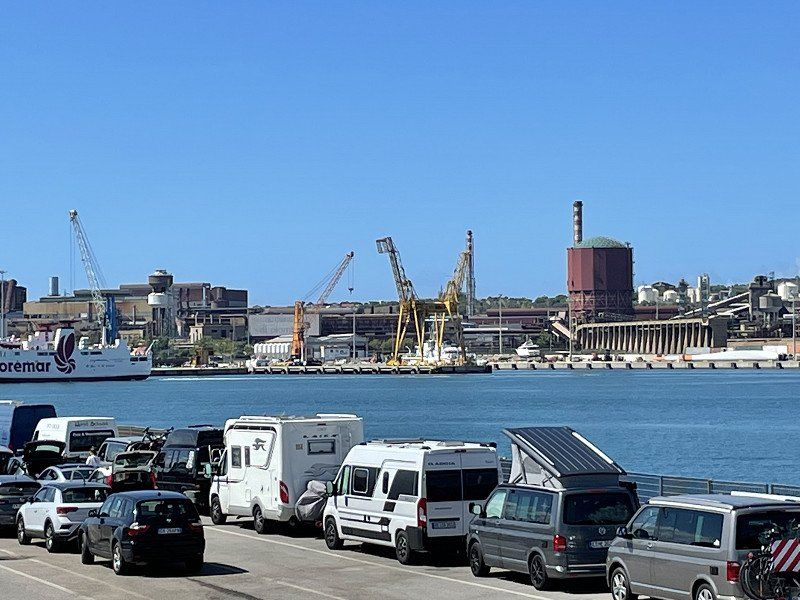
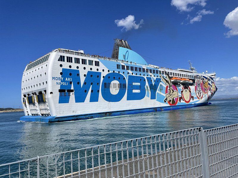
• Take the Piombino-Olbia Ferry. Stay on for 268 km.
• Head west on Banchina Isola Bianca. Go for 344 m.
• Arrive at Banchina Isola Bianca. Your destination is on the right.
☍
268,2 km
(7 hrs. 14 min.)
Porto Olbia, Via Madagascar, Olbia, Sassari, Italien
Via Madagascar, 18A, 07026 Olbia SS, Italien
40° 55' 26.4" N 9° 31' 15.7" E
40.9239923 9.5210139
• Head northwest on Banchina Isola Bianca. Go for 313 m.
• Take the 2nd exit from roundabout onto Via Isola di Mezzo. Go for 190 m.
• Take the 1st exit from roundabout onto Via Isola di Mezzo toward Olbia Centro. Go for 418 m.
• Keep left onto Via Isola di Mezzo toward Porto Cervo/S.Teresa di G./Palau/Arzachena/Portisco. Go for 351 m.
• Continue on Strada Statale Orientale Sarda (SS125). Go for 2.1 km.
• Take the 2nd exit from roundabout onto Strada Statale Orientale Sarda (SS125). Go for 4.1 km.
• Take the 2nd exit from roundabout onto Strada Statale Orientale Sarda (SS125) toward Arzachena/Palau/Olbia. Go for 13.9 km.
• Take the 2nd exit from roundabout onto Strada Statale Orientale Sarda (SS125) toward Cannigione/Arzachena/Palau. Go for 1.2 km.
• Keep right toward SP13. Go for 79 m.
• Turn right onto SP13. Go for 3.7 km.
• Continue on Via Nazionale (SP13). Go for 720 m.
• Turn slightly right onto Via Lungomare Andrea Doria. Go for 221 m.
• Continue on Lungomare Andrea Doria. Go for 638 m.
• Turn slightly right onto Via Nazionale (SP13). Go for 160 m.
• Turn slightly right onto Strada Comunale Cannigione-Saline (SP13). Go for 87 m.
• Continue on Strada Comunale Cannigione-Saline (SP13). Go for 917 m.
• Continue on Strada Comunale Cannigione-Saline (SP13). Go for 1.3 km.
• Turn right onto Località Isuledda. Go for 778 m.
• Turn slightly left. Go for 15 m.
• Arrive at your destination on the right.
☍
31,3 km
( 40 min.)
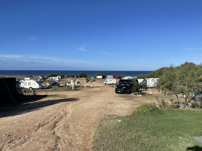
Camping Village Isuledda
Since the ferry was a bit late, we first went to a pizzeria and only got to the campsite after 11:00 p.m. There we slept on the overnight place and were then able to check in at 8:00 in the morning.
Località La Conia, 07020, Cannigione, Italien
41° 7' 55.6" N 9° 26' 36" E
41.1321187 9.4433398
• Head northeast.
• Arrive at your destination on the right.
☍
Distance not available
(Duration not available)
Day
Camping Village Isuledda
We already know the CP from previous stays. There are extra parking spaces for ACSI card holders, but they were ok for us.
Località La Conia, 07020, Cannigione, Italien
41° 7' 55.6" N 9° 26' 36" E
41.1321187 9.4433398
• Head northeast.
• Arrive at your destination on the right.
☍
Distance not available
(Duration not available)
Day
Camping Village Isuledda
Località La Conia, 07020, Cannigione, Italien
41° 7' 55.6" N 9° 26' 36" E
41.1321187 9.4433398
• Head southwest. Go for 211 m.
• Continue on Località Isuledda. Go for 582 m.
• Turn left onto Strada Comunale Cannigione-Saline (SP13). Go for 148 m.
• Turn right onto Località Micalosu. Go for 849 m.
• Continue on Località Micalosu. Go for 1.0 km.
• Turn slightly right onto Località Rena. Go for 3.5 km.
• Continue on Via Umberto I. Go for 1.9 km.
• Take the 3rd exit from roundabout onto Via Raimondo Chiodino. Go for 321 m.
• Turn right onto Viale Costa Smeralda (SS125). Go for 11.5 km.
• Take the 1st exit from roundabout onto SS133 toward Palau Porto. Go for 268 m.
• Take the 1st exit from roundabout onto SS133. Go for 229 m.
• Take the 1st exit from roundabout onto SS133. Go for 501 m.
• Continue on Via Nazionale (SS133). Go for 559 m.
• Turn right onto Via Gallura. Go for 92 m.
• Turn left onto Via Cagliari. Go for 31 m.
• Turn right onto Via Capo d'Orso. Go for 94 m.
• Take the 2nd exit from roundabout onto Via Capo d'Orso. Go for 1.3 km.
• Continue toward Anulare del Vecchio Marino. Go for 69 m.
• Continue on Via Capo d'Orso. Go for 1.1 km.
• Continue on SP123. Go for 546 m.
• Turn right onto Località Cala di Lepre. Go for 255 m.
• Continue on Via Cala Lepre. Go for 116 m.
• Turn left toward Via Porto Mannu. Go for 451 m.
• Continue on Via Porto Mannu. Go for 58 m.
• Turn slightly right onto Via Porto Mannu. Go for 127 m.
• Take the 2nd exit from roundabout onto Via Porto Mannu. Go for 660 m.
• Turn right onto Capo d'Orso (SP123). Go for 333 m.
• Arrive at Capo d'Orso (SP123). Your destination is on the left.
☍
26,9 km
( 43 min.)
Day
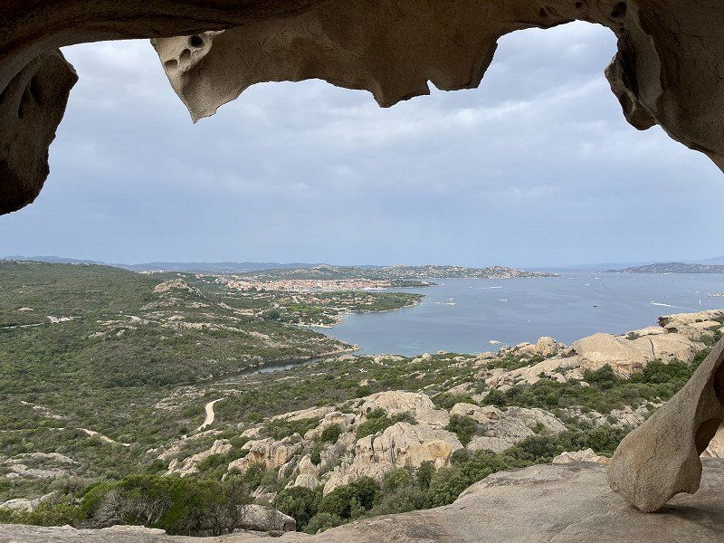
Capo d'Orso, Palau, Sassari, Italien
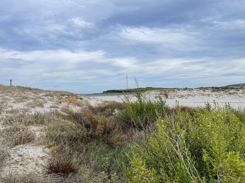
A visit from the bear was a must, even if the natural charm of days gone by has suffered somewhat due to barriers and railings. In the past, you could simply climb the rock. Today €3 per person is due for this. Parking isn't free either. But at least the people here live from tourism and that's why you can accept such developments.
On the way to our next parking space on the west coast, we follow the SS 131, which is similar to the highway. Here you can, for example, make a detour to the fountain sanctuary of Santa Christina (located directly on the SS 131 behind the Cagliari/Oristano cross) or to the hot springs in Fordongianus (also on the route behind the Cagliari/Oristano cross) with Roman archaeological site. We have been there a few times, so we went straight to Mari Ermi.
07020 Capo d'Orso, Sassari, Italien
41° 10' 9.5" N 9° 25' 7.2" E
41.1693014 9.4186611
• Head toward Località Capo d'Orso on Capo d'Orso (SP123). Go for 333 m.
• Turn left toward Via Porto Mannu. Go for 74 m.
• Continue on Via Porto Mannu. Go for 566 m.
• Take the 1st exit from roundabout. Go for 31 m.
• Continue on Via Porto Mannu. Go for 617 m.
• Turn right toward Via Cala Lepre. Go for 11 m.
• Continue on Via Cala Lepre. Go for 105 m.
• Continue on Località Cala di Lepre. Go for 255 m.
• Turn left onto SP123. Go for 546 m.
• Continue on Via Capo d'Orso. Go for 1.1 km.
• Continue toward Anulare del Vecchio Marino. Go for 69 m.
• Continue on Via Capo d'Orso. Go for 1.3 km.
• Take the 3rd exit from roundabout onto Via delle Ginestre. Go for 402 m.
• Turn right onto Via Baragge (SP121). Go for 188 m.
• Turn left onto Via Nazionale (SP121). Go for 241 m.
• Continue on SS133. Go for 485 m.
• Take the 2nd exit from roundabout onto SS133. Go for 281 m.
• Take the 2nd exit from roundabout onto SS133. Go for 295 m.
• Take the 2nd exit from roundabout onto Strada Statale Orientale Sarda (SS125). Go for 10.8 km.
• Keep right onto Viale Costa Smeralda (SP115) toward Bassacutena/Circonvallazione/Olbia/Tempio/Arzachena. Go for 267 m.
• Turn left toward Circonvallazione/Olbia/Tempio. Go for 57 m.
• Continue on Circonvallazione Arzachena. Go for 1.7 km.
• Take the 1st exit from roundabout onto Viale Paolo Dettori (SS427) toward Calangianus/Tempio/Luogosanto/Sant'Antonio di G. Go for 756 m.
• Continue toward SS427. Go for 101 m.
• Continue on Località Lu Ciaccaru (SS427). Go for 676 m.
• Continue on Strada Statale N. (SS427). Go for 1.6 km.
• Continue on SS427. Go for 12.1 km.
• Continue on Via Arzachena (SS427). Go for 424 m.
• Continue on Piazza Sant'Antonio (SS427). Go for 991 m.
• Continue on SS427. Go for 3.7 km.
• Take the 1st exit from roundabout onto SP38. Go for 5.4 km.
• Continue on SP136. Go for 1.3 km.
• Turn slightly left toward SP137. Go for 26 m.
• Continue on SP136. Go for 5.4 km.
• Continue on SP136. Go for 407 m.
• Take the 1st exit from roundabout. Go for 1.7 km.
• Turn right onto SS127. Go for 4.3 km.
• Take the 1st exit from roundabout onto Via Olbia (SS127). Go for 2.6 km.
• Take the 3rd exit from roundabout onto Via Italia Unita (SS127). Go for 10.6 km.
• Continue on SS672. Go for 30.7 km.
• Continue on SS672. Go for 7.5 km.
• Keep left onto SS672. Go for 537 m.
• Continue on SP68. Go for 2.2 km.
• Continue on SP3. Go for 448 m.
• Take ramp onto SS131 toward Cagliari. Go for 90.3 km.
• Take ramp onto SP15 toward Tramatza. Go for 752 m.
• Turn slightly left onto Via Cagliari (SP13). Go for 361 m.
• Continue on SP13. Go for 3.8 km.
• Take the 3rd exit from roundabout. Go for 372 m.
• Keep right. Go for 1.3 km.
• Continue straight ahead. Go for 33 m.
• Take the 2nd exit from roundabout. Go for 1.6 km.
• Take the 2nd exit from roundabout onto SP10. Go for 4.2 km.
• Turn left onto SP11. Go for 1.3 km.
• Take the 2nd exit from roundabout onto SP66. Go for 7.4 km.
• Turn left toward SP7. Go for 93 m.
• Continue on SP7. Go for 2.8 km.
• Turn right. Go for 5.0 km.
• Turn left. Go for 244 m.
• Turn slightly right. Go for 299 m.
• Arrive at your destination on the right.
☍
233,2 km
(2 hrs. 56 min.)
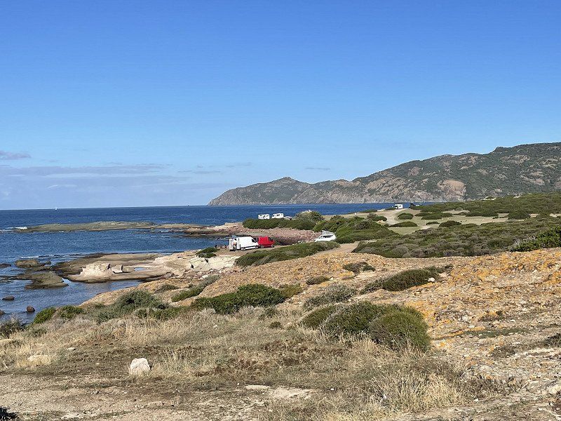
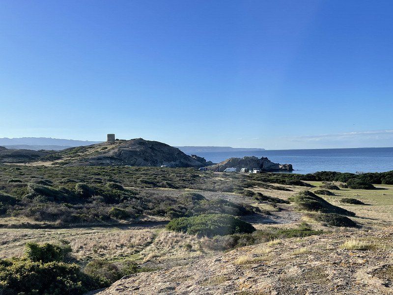
Mari Ermi, Oristano, Italien
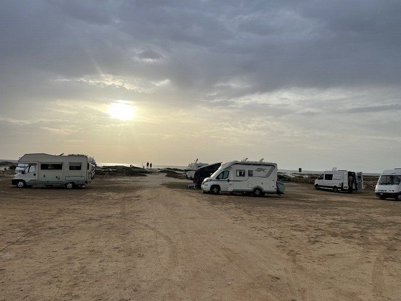
Pitch at the rice grain beach
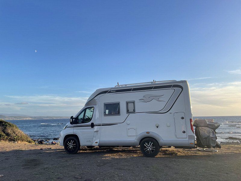
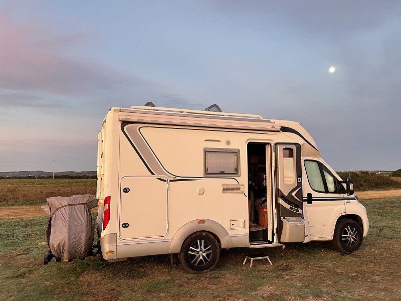
A lot has changed since our last stay in 2018. But for €15/N including electricity it's still a great place to stay. Nevertheless, we want to continue the next day, since it's less fun with a Bulli without a toilet and running water (the water pump has failed).
09072 Mari Ermi OR, Italien
39° 58' 1.9" N 8° 24' 2.9" E
39.9671920 8.4007950
• Head southwest. Go for 30 m.
• Turn right. Go for 215 m.
• Turn right toward SP7. Go for 5.3 km.
• Turn right onto SP7. Go for 5.1 km.
• Continue on SP6. Go for 6.0 km.
• Continue toward Via Tharros/SP1. Go for 68 m.
• Take the 1st exit from roundabout onto Via Tharros (SP1). Go for 739 m.
• Continue on Via Cristoforo Colombo (SP1). Go for 640 m.
• Take the 3rd exit from Piazza della Torre roundabout onto Via Stella Maris (SP1). Go for 519 m.
• Turn right onto SP2. Go for 921 m.
• Turn right onto Strada Consortile. Go for 53 m.
• Arrive at Strada Consortile. Your destination is on the right.
☍
19,6 km
( 21 min.)
Day
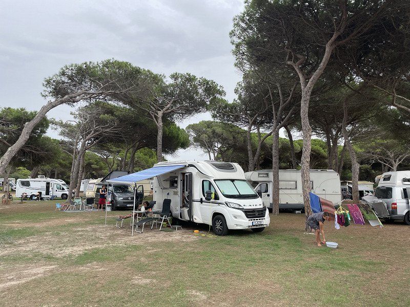
Camping Village Spinnaker
After staying at the rice grain beach, we want to use a little more campsite infrastructure. But there are only 3 places left and then directly at the animation. So keep looking and drive to the next campsite.
Strada Torregrande - Pontile - Località Brabau, 09170, Oristano, Italien
39° 54' 13" N 8° 31' 50.1" E
39.9036202 8.5305957
• Head northeast on Strada Consortile. Go for 53 m.
• Turn left onto SP2. Go for 921 m.
• Turn right onto Via Stella Maris (SP1). Go for 1.8 km.
• Take the 2nd exit from roundabout onto Strada Provinciale Oristano Torre Grande (SP1). Go for 3.5 km.
• Take the 1st exit from roundabout onto SP54. Go for 1.4 km.
• Pass 2 roundabouts and continue on Via Cagliari. Go for 609 m.
• Take the 2nd exit from roundabout onto Via Tirso. Go for 242 m.
• Turn left onto Via Sardegna. Go for 903 m.
• Continue on Via Guglielmo Marconi. Go for 356 m.
• Continue on Via Renato Marroccu. Go for 1.3 km.
• Continue on SP70. Go for 747 m.
• Take ramp onto Strada Statale Carlo Felice (SS131) toward Cagliari. Go for 4.3 km.
• Take ramp toward Porto Oristano Sud/Arborea/Santa Giusta. Go for 338 m.
• Turn left onto SP49. Go for 11.4 km.
• Continue on Corso Roma (SP49). Go for 369 m.
• Turn right onto Corso Italia. Go for 181 m.
• Arrive at Corso Italia. Your destination is on the left.
☍
28,5 km
( 26 min.)
Camping S`Ena Arrubia
After a good half hour we reach this campsite. There are still many pitches available and after the first acclimatization phase we have to realize that this CP represents the optimal symbiosis between nature, infrastructure and relaxation. He has everything you need. The dog in particular gets his money's worth and there is also a good pizza.
Str. A Mare 29, 09092, Arborea, Italien
39° 46' 24.2" N 8° 34' 48.7" E
39.7734000 8.5801900
• Head west on Corso Italia.
• Arrive at Corso Italia. Your destination is on the left.
☍
Distance not available
(Duration not available)
Day
Camping S`Ena Arrubia
Str. A Mare 29, 09092, Arborea, Italien
39° 46' 24.2" N 8° 34' 48.7" E
39.7734000 8.5801900
• Head west on Corso Italia.
• Arrive at Corso Italia. Your destination is on the left.
☍
Distance not available
(Duration not available)
Day
Camping S`Ena Arrubia
Str. A Mare 29, 09092, Arborea, Italien
39° 46' 24.2" N 8° 34' 48.7" E
39.7734000 8.5801900
• Head west on Corso Italia. Go for 37 m.
• Turn left onto Via Torino. Go for 141 m.
• Turn left onto Via Felice Porcella. Go for 220 m.
• Turn right onto Corso Roma (SP49). Go for 409 m.
• Continue on SP49. Go for 1.2 km.
• Take the 2nd exit from roundabout onto SP49. Go for 844 m.
• Take the 3rd exit from roundabout. Go for 107 m.
• Continue on SP49. Go for 2.4 km.
• Continue on Via Val d'Aosta (SP22/SP49). Go for 393 m.
• Continue on SP22/SP49. Go for 1.4 km.
• Turn left onto Strada di Bonifica. Go for 1.3 km.
• Turn right toward Strada Statale Sud Occidentale Sarda/SS126. Go for 13 m.
• Turn right onto Strada Statale Sud Occidentale Sarda (SS126). Go for 158 m.
• Turn left onto Strada Provinciale 92. Go for 932 m.
• Take the 3rd exit from roundabout onto Strada Provinciale di Terralba (SP61). Go for 3.4 km.
• Take ramp onto Strada Statale Carlo Felice (SS131) toward Cagliari. Go for 31.1 km.
• Take ramp toward SS293/SS197. Go for 1.0 km.
• Take left ramp onto SS293. Go for 4.4 km.
• Keep right onto SS547. Go for 323 m.
• Turn left onto Via Circonvallazione. Go for 854 m.
• Turn left onto Corso Vittorio Emanuele III (SS547). Go for 2.8 km.
• Continue on Piazza della Repubblica. Go for 50 m.
• Continue on Via Roma. Go for 854 m.
• Pass 2 roundabouts and continue on Via Sicilia (SS547). Go for 13.3 km.
• Continue on SS547. Go for 17 m.
• Continue on Via Sicilia (SS547). Go for 278 m.
• Turn left onto Via Carlo Sanna (SS128). Go for 88 m.
• Turn right onto Via M. Coraddu (SP23). Go for 673 m.
• Continue on Strada Provinciale di Goni (SP23). Go for 5.4 km.
• Continue on SP23. Go for 114 m.
• Take the 1st exit from roundabout onto Via Umberto I (SP23). Go for 813 m.
• Continue on SP23. Go for 3.2 km.
• Continue on Strada Provinciale di Goni (SP23). Go for 2.6 km.
• Turn right onto Strada Comunale Siurgus Silius (SP26). Go for 6.3 km.
• Continue on SP26. Go for 66 m.
• Continue on Via Carbonia. Go for 414 m.
• Turn left onto Strada Senza Nome 2. Go for 89 m.
• Continue on Strada Comunale Silius Ballao. Go for 5.0 km.
• Turn left onto SS387. Go for 3.6 km.
• Continue on Vico 3 Cagliari (SS387). Go for 212 m.
• Turn right onto Via Vincenzo Sulis (SS387). Go for 649 m.
• Continue on SS387. Go for 8.5 km.
• Continue on Strada Statale N 387 del Gerrei (SS387). Go for 5.5 km.
• Continue on SS387. Go for 9.1 km.
• Take the 1st exit from roundabout onto SS387. Go for 125 m.
• Continue on Via Nazionale (SS387). Go for 1.8 km.
• Continue on SS387. Go for 490 m.
• Take the 2nd exit from roundabout onto SS387. Go for 1.5 km.
• Take the 1st exit from roundabout onto Strada Statale Orientale Sarda (SS125). Go for 7.6 km.
• Turn left onto Località Is Perdigonis. Go for 749 m.
• Turn slightly right onto Località Is Perdigonis. Go for 248 m.
• Turn left. Go for 162 m.
• Arrive at your destination on the left.
☍
132,9 km
(1 hrs. 51 min.)
Day
4Mori Family Village
The complete opposite to CP S'Ena Arruba, but a paradise for grandchildren to play and have fun. The CP is tailored to young families and event seekers. The price is therefore also much higher. At €48 for 2 people with a dog, it's not a bargain. But the grandkids are having fun.
Loc. Is. Perdigonis ex S.S. 125 - KM 58, 09043, Muravera, Italien
39° 22' 29.1" N 9° 35' 52.8" E
39.3747600 9.5980100
• Head northeast. Go for 136 m.
• Turn right. Go for 18 m.
• Turn right. Go for 14 m.
• Arrive at your destination on the left.
☍
0,2 km
( )
Day
4 Mori Family Village, Strada Statale 125 Orientale Sarda, Località Is Perdigonis, Metropolitanstadt Cagliari, Italien
SS 125 Orientale Sarda, Km 58, 09043 Località Is Perdigonis CA, Italien
39° 22' 31.5" N 9° 35' 57.8" E
39.3754111 9.5994002
• Head south.
• Arrive at your destination on the left.
☍
Distance not available
(Duration not available)
Day
4Mori Family Village - Villaggio per Famiglie, Strada Statale 125 Orientale Sarda, Località Is Perdigonis, Metropolitanstadt Cagliari, Italien
SS 125 Orientale Sarda, Km 58, 09043 Località Is Perdigonis CA, Italien
39° 22' 31.5" N 9° 35' 57.8" E
39.3754111 9.5994002
• Head north. Go for 14 m.
• Turn left. Go for 18 m.
• Turn right toward Località Is Perdigonis. Go for 26 m.
• Turn right onto Località Is Perdigonis. Go for 997 m.
• Turn right onto Strada Statale Orientale Sarda (SS125). Go for 5.8 km.
• Turn right onto Viale dei Platani. Go for 199 m.
• Turn left onto Via Sarrabus. Go for 922 m.
• Turn left toward Via Roma/SS125. Go for 44 m.
• Turn right onto Via Roma (SS125). Go for 940 m.
• Take the 2nd exit from roundabout onto SS387. Go for 344 m.
• Take ramp onto Ponte Flumendosa. Go for 7.9 km.
• Take ramp toward Murtas/Ex SS125. Go for 358 m.
• Turn right onto Strada Statale Orientale Sarda (SS125). Go for 2.6 km.
• Turn sharp left. Go for 1.4 km.
• Turn left. Go for 29 m.
• Turn right. Go for 854 m.
• Turn right. Go for 764 m.
• Turn left toward Via Maestrale. Go for 1.6 km.
• Turn slightly right onto Via Maestrale. Go for 109 m.
• Continue on Via del Corallo. Go for 154 m.
• Take the 1st exit from roundabout onto Porto Corallo. Go for 208 m.
• Arrive at Porto Corallo.
☍
25,3 km
( 32 min.)
Stellplatz Bellavista Camper Service
The place is beautifully situated and has direct access to the beach. But since there is no significant difference to the 4Mori in terms of the beach, we continue.
SP99, 09040 Porto Tramatzu SU, Italien
39° 27' 7.7" N 9° 38' 13.3" E
39.4521407 9.6370333
• Head south on Porto Corallo. Go for 338 m.
• Turn right toward Via dei Tamerici. Go for 83 m.
• Continue on Via dei Tamerici. Go for 618 m.
• Turn right toward SP99. Go for 900 m.
• Turn slightly right onto SP99. Go for 3.4 km.
• Turn right onto Strada Statale Orientale Sarda (SS125). Go for 6.1 km.
• Turn left toward Nuova SS125. Go for 117 m.
• Take ramp onto Nuova SS125. Go for 9.1 km.
• Take ramp toward SS125/Tertenia/Villaputzu. Go for 315 m.
• Turn left onto Strada Statale Orientale Sarda (SS125) toward Tertenia. Go for 8.2 km.
• Take the 2nd exit from roundabout onto SS125 Orientale Sarda toward Olbia/Tertenia. Go for 5.4 km.
• Continue on Strada Statale Orientale Sarda (SS125). Go for 5.6 km.
• Keep left onto SS125var. Go for 10.6 km.
• Keep left toward Strada Statale Orientale Sarda/SS125. Go for 3.5 km.
• Continue on Strada Statale Orientale Sarda (SS125). Go for 5.5 km.
• Turn right onto Strada Statale Orientale Sarda (SS125). Go for 160 m.
• Keep right onto Strada Statale Orientale Sarda (SS125). Go for 648 m.
• Turn right onto Strada Statale Orientale Sarda (SS125). Go for 2.5 km.
• Continue on Via Tirreno. Go for 473 m.
• Turn left onto Strada Vicinale Pauli. Go for 295 m.
• Arrive at your destination on the left.
☍
63,8 km
( 52 min.)
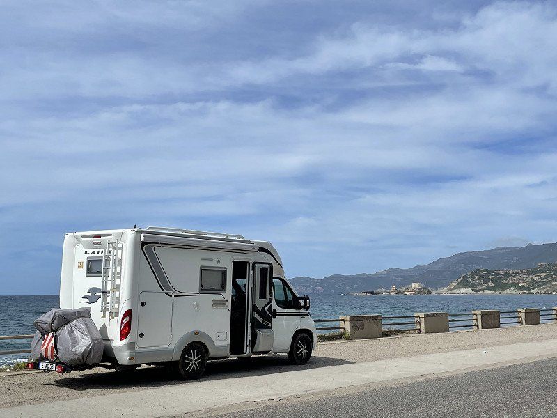
Baia Cea Lounge Bar, Tortolì, Nuoro, Italien
Unfortunately, our beloved parking space in Cea from previous trips has lost its charm. For 25 €/N, the sanitary facilities no longer meet the requirements. On the other hand, the beach and the great scenery with the red rocks are untouchable. The stay is definitely worth it for this. But one night was enough for us.
08048 Tortolì, Nuoro, Italien
39° 52' 9.8" N 9° 40' 55" E
39.8693810 9.6819306
• Head west. Go for 134 m.
• Continue on Strada Vicinale Pauli. Go for 161 m.
• Turn right onto Via Tirreno. Go for 473 m.
• Continue toward Strada Statale Orientale Sarda/SS125. Go for 2.0 km.
• Continue on Strada Statale Orientale Sarda (SS125). Go for 329 m.
• Turn right onto Strada Statale Orientale Sarda (SS125). Go for 825 m.
• Turn left. Go for 51 m.
• Turn right toward Nuova S.S. 125. Go for 680 m.
• Continue on Nuova S.S. 125. Go for 3.8 km.
• Take the 3rd exit from roundabout onto Strada Statale Orientale Sarda (SS125). Go for 857 m.
• Take ramp toward Lanusei. Go for 130 m.
• Continue on Via V. Pirastu (SS198). Go for 2.1 km.
• Keep right toward Strada Provinciale Villagrande Tortolì/SP27. Go for 107 m.
• Continue on Strada Provinciale Villagrande Tortolì (SP27). Go for 15.6 km.
• Turn sharp left onto Viale Europa (SP27). Go for 5.2 km.
• Turn right onto SS389/Var. Go for 14.4 km.
• Continue on SS389. Go for 17 m.
• Continue on SS389/Var. Go for 36.8 km.
• Continue on Tunnel Pontesardo (SS389). Go for 1.2 km.
• Take left ramp onto SS389. Go for 864 m.
• Take ramp onto SS131d.C.N. toward Olbia/Siniscola. Go for 61.2 km.
• Take ramp toward Budoni/SS125. Go for 605 m.
• Turn right toward Via Nazionale/SS125. Go for 570 m.
• Turn left onto Via Nazionale (SS125). Go for 682 m.
• Turn right. Go for 460 m.
• Turn right. Go for 25 m.
• Arrive at your destination on the right.
☍
149,3 km
(1 hrs. 40 min.)
Day
Camping Pedra - Cupa
Cheap accommodation costs with the ADAC card, a good parking space, a beautiful beach and a rustic beach bar with the best pizza - what more could you want! The kids love it here and we stay for about 24€/n 5 days (contrary to our usual habit).
Budoni itself is very touristy and the prices are based on the nearby Costa Smeralda.
Via Nazionale, 08020, Budoni, Italy
40° 42' 11.6" N 9° 42' 59.7" E
40.7032200 9.7165900
• Head southeast.
• Arrive at your destination on the right.
☍
Distance not available
(Duration not available)
Day
Camping Pedra - Cupa
Via Nazionale, 08020, Budoni, Italy
40° 42' 11.6" N 9° 42' 59.7" E
40.7032200 9.7165900
• Head southeast.
• Arrive at your destination on the right.
☍
Distance not available
(Duration not available)
Day
Camping Pedra - Cupa
Via Nazionale, 08020, Budoni, Italy
40° 42' 11.6" N 9° 42' 59.7" E
40.7032200 9.7165900
• Head southeast.
• Arrive at your destination on the right.
☍
Distance not available
(Duration not available)
Day
Camping Pedra - Cupa
Via Nazionale, 08020, Budoni, Italy
40° 42' 11.6" N 9° 42' 59.7" E
40.7032200 9.7165900
• Head southeast.
• Arrive at your destination on the right.
☍
Distance not available
(Duration not available)
Day
Camping Pedra - Cupa
The next day it's time to set off in different directions - our daughter drives with the children towards Porto Torres to the ferry and we continue on our own. We definitely want to go back to Berchida.
Via Nazionale, 08020, Budoni, Italy
40° 42' 11.6" N 9° 42' 59.7" E
40.7032200 9.7165900
• Head northwest. Go for 25 m.
• Turn left toward Via Nazionale/SS125. Go for 460 m.
• Turn left onto Via Nazionale (SS125). Go for 11.1 km.
• Turn left onto Via Antonio Gramsci (SP24). Go for 1.9 km.
• Take the 1st exit from roundabout onto Strada Posada-la Caletta (SP24). Go for 2.2 km.
• Turn right onto Via Antonio Gramsci (SP24). Go for 46 m.
• Turn left onto Via Palermo (SP3). Go for 127 m.
• Turn right onto Via Palermo (SP3). Go for 714 m.
• Take the 2nd exit from roundabout onto SP3. Go for 2.2 km.
• Continue on Strada Statale Orientale Sarda (SS125). Go for 12.0 km.
• Turn left. Go for 3.8 km.
• Arrive at your destination.
☍
34,6 km
( 41 min.)
Day
Berchida, Berchida, Siniscola, Nuoro, Italien
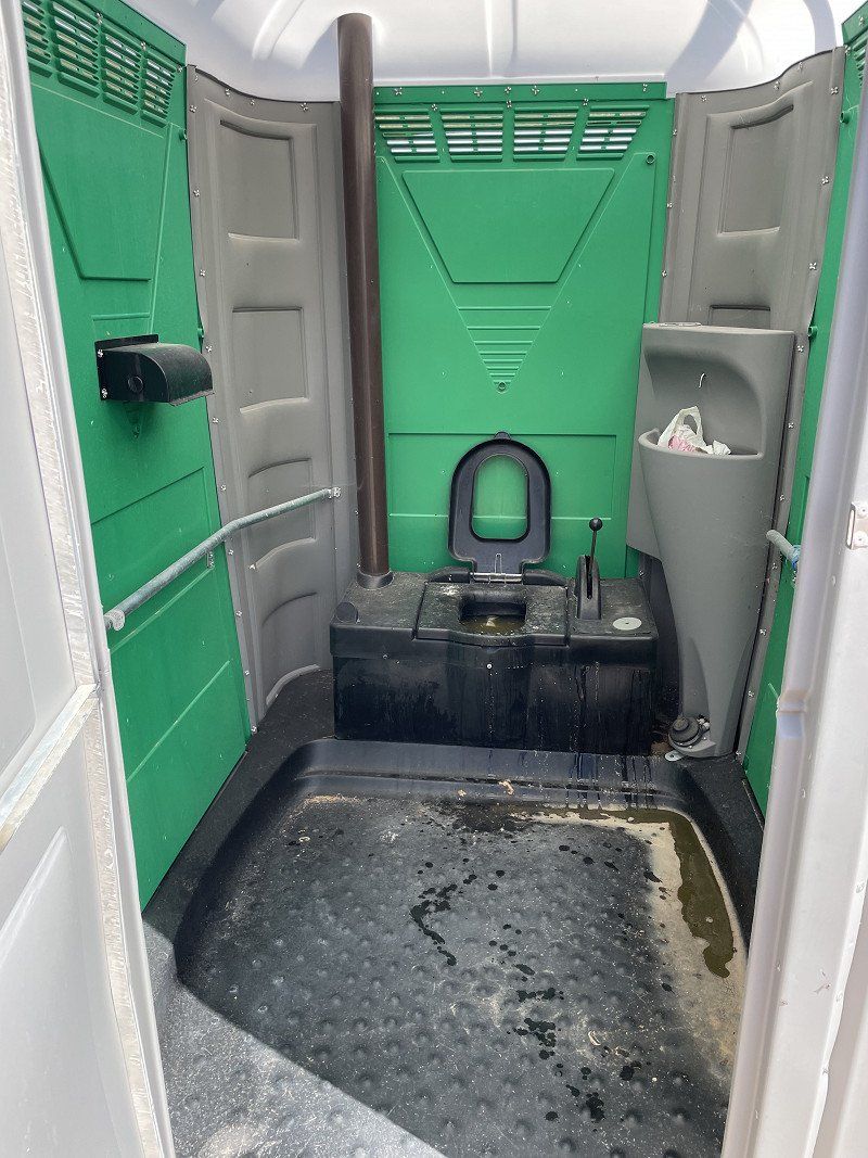
After the bumpy journey to the parking space, we are amazed when we have to stop at a ticket booth. We should pay 25€/N; There is no off-season, but now electricity and supply and disposal. We pay politely and drive to the last electricity column before access to the beach. The generator set up to generate electricity creates an atmosphere similar to that of a construction site - day and night. Since the weather doesn't want to give us a real feeling of well-being for the beautiful beach, we leave our dream place from the old days a little discouraged the next day. Before that, we are still shocked by the foul-smelling and totally dirty disposal. No, unfortunately we have to remove this place from our favorites.
We decide to drive back to the west side and slowly approach our planned city tour in the northwest.
Berchida, 08029 Siniscola NU, Italien
40° 28' 34" N 9° 48' 33.9" E
40.4761155 9.8094143
• Head northwest. Go for 3.8 km.
• Turn left onto Strada Statale Orientale Sarda (SS125). Go for 18.4 km.
• Turn slightly left toward Via Grazia Deledda. Go for 10 m.
• Arrive at Via Grazia Deledda. Your destination is on the left.
☍
22,2 km
( 27 min.)
Day
Orosei, Nuoro, Italien
08028 Orosei NU, Italien
40° 22' 36.4" N 9° 41' 48.3" E
40.3767849 9.6967464
• Head toward Via S'Ortale on Via Sebastiano Satta (SS125). Go for 10 m.
• Turn sharp left onto Via Sebastiano Satta (SS125). Go for 1.3 km.
• Keep right toward Località Poiolos. Go for 38 m.
• Take the 1st exit from roundabout onto Località Poiolos. Go for 1.0 km.
• Keep left toward SS129. Go for 19 m.
• Continue on SS129. Go for 7.2 km.
• Turn left onto Via Grazia Deledda. Go for 141 m.
• Arrive at Via Grazia Deledda.
☍
9,7 km
( 9 min.)
Galtellì, Nuoro, Italien
08020 Galtellì, Nuoro, Italien
40° 23' 5.6" N 9° 36' 43.8" E
40.3848973 9.6121554
• Head south on Via Grazia Deledda. Go for 78 m.
• Turn slightly right onto Via Grazia Deledda. Go for 23 m.
• Turn right onto Via Francesco Ciusa. Go for 153 m.
• Turn right onto Via Nazionale (SS129). Go for 463 m.
• Turn left onto Via Vadu 'e Donna. Go for 257 m.
• Take the 2nd exit from roundabout. Go for 1.8 km.
• Turn left onto SP25. Go for 9.9 km.
• Turn right onto SP38. Go for 92 m.
• Turn left. Go for 215 m.
• Continue toward SS131d.C.N. Go for 217 m.
• Turn right and take ramp onto SS131d.C.N. toward Nuoro. Go for 20.6 km.
• Take ramp toward Nuoro/Lanusei. Go for 444 m.
• Keep left onto SS389. Go for 2.3 km.
• Keep left toward Viale Antonio Segni. Go for 76 m.
• Continue on Viale Antonio Segni. Go for 1.2 km.
• Take the 1st exit from roundabout onto Strada Statale Nuoro-Bitti. Go for 264 m.
• Take the 1st exit from roundabout onto Strada Statale Nuoro-Bitti. Go for 119 m.
• Take the 2nd exit from roundabout onto Piazza Sardegna. Go for 92 m.
• Continue on Via Lucania. Go for 127 m.
• Turn left onto Viale del Lavoro. Go for 69 m.
• Turn right onto Via La Marmora. Go for 237 m.
• Arrive at Via La Marmora.
☍
38,6 km
( 30 min.)
Nuoro, Italien
08100 Nuoro, Italien
40° 19' 12.9" N 9° 19' 35.2" E
40.3202421 9.3264377
• Head toward Via Veneto on Via La Marmora. Go for 15 m.
• Turn left onto Via Veneto. Go for 111 m.
• Turn left onto Via Brigata Sassari. Go for 124 m.
• Turn right onto Scalinata San Giuseppe. Go for 56 m.
• Turn left onto Via Trieste. Go for 415 m.
• Take the 1st exit from roundabout onto Strada Statale Nuoro-Bitti. Go for 238 m.
• Take the 2nd exit from roundabout onto Viale Antonio Segni. Go for 1.3 km.
• Continue on SS389. Go for 2.3 km.
• Take left ramp onto SS131d.C.N. toward Cagliari/Sassari. Go for 50.7 km.
• Take ramp onto Strada Statale Carlo Felice (SS131) toward Sassari/Nuoro/Cagliari/Oristano. Go for 20.0 km.
• Take ramp onto SP15 toward Tramatza. Go for 752 m.
• Turn slightly left onto Via Cagliari (SP13). Go for 361 m.
• Continue on SP13. Go for 3.8 km.
• Take the 3rd exit from roundabout. Go for 372 m.
• Keep right. Go for 1.3 km.
• Continue straight ahead. Go for 33 m.
• Take the 2nd exit from roundabout. Go for 1.6 km.
• Take the 2nd exit from roundabout onto SP10. Go for 5.6 km.
• Turn slightly right onto Strada Statale Nord Occidentale Sarda (SS292). Go for 7.0 km.
• Turn left. Go for 22 m.
• Turn right. Go for 217 m.
• Keep right. Go for 134 m.
• Arrive at your destination on the left.
☍
96,4 km
(1 hrs. 5 min.)
Camping Bella Sardinia, Torre del Pozzo, Oristano, Italien
We have already approached this place once before in 2011 and left it distraught. We want to try again, but fail right away when registering and turn back. Nothing against the place, but just not our thing.
We still want to try the nearby CP Nurapolis.
09073 Torre del Pozzo, Province of Oristano, Italien
40° 4' 14.7" N 8° 29' 41" E
40.0707419 8.4947286
• Head southeast. Go for 351 m.
• Turn right. Go for 143 m.
• Turn right. Go for 1.2 km.
• Arrive at your destination on the right.
☍
1,7 km
( 4 min.)
Campeggio Nurapolis
As we walk around the square, we become aware of our age. Mostly young people dance across the pine-covered square to the sound of techno music. Again, nothing against the place, but again not our thing. We move on and decide to drive to the rice grain beach.
loc. Is Arenas Stada Statale 292 km 109.400, 09070, Narbolia, Italy
40° 4' 13.6" N 8° 29' 2.8" E
40.0704500 8.4841200
• Head southeast. Go for 1.2 km.
• Turn left toward Strada Statale Nord Occidentale Sarda/SS292. Go for 165 m.
• Turn right onto Strada Statale Nord Occidentale Sarda (SS292). Go for 8.2 km.
• Take the 1st exit from roundabout onto SP66. Go for 7.4 km.
• Turn left toward SP7. Go for 93 m.
• Continue on SP7. Go for 2.8 km.
• Turn right. Go for 5.0 km.
• Turn left. Go for 244 m.
• Turn slightly right. Go for 299 m.
• Arrive at your destination on the right.
☍
25,4 km
( 27 min.)
Mari Ermi, Oristano, Italien
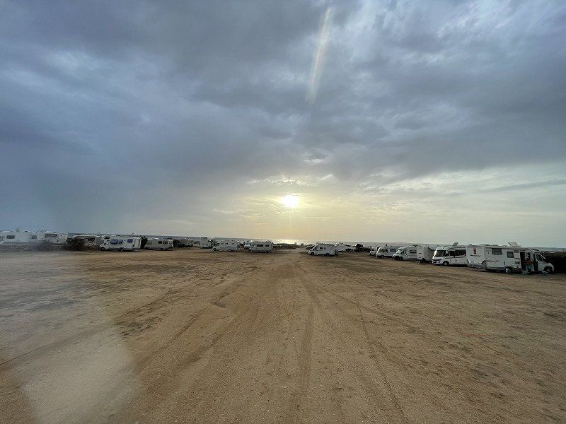
This time we drive to the last of the 3 Muras pitches seen from Mari Ermi. However, the approach is again via the hobble track from Is Arutas. It is very well described in Park4night and actually shines with the better sanitary facilities. For €10/N without electricity, we are in good hands here.
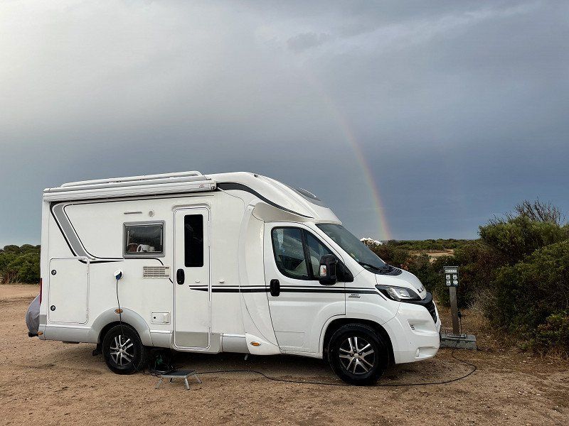
Unfortunately, there was another incident with our dear front-wheel drive. Unfortunately, the slightly damp, but level ground in the front area of the square prevented the move to a slightly higher pitch. Only a friendly Kieler with a four-wheel drive Grand California made the move possible and pulled us out of the mud. It goes without saying that I then looked directly at mobile for a Hymer ML-T with all-wheel drive. But who wants or can currently pay these prices! So, on with front-wheel drive and hopefully helpful campers.
09072 Mari Ermi OR, Italien
39° 58' 1.9" N 8° 24' 2.9" E
39.9671920 8.4007950
• Head southwest.
• Arrive at your destination on the right.
☍
Distance not available
(Duration not available)
Day
Mari Ermi, Oristano, Italien
09072 Mari Ermi OR, Italien
39° 58' 1.9" N 8° 24' 2.9" E
39.9671920 8.4007950
• Head southwest.
• Arrive at your destination on the right.
☍
Distance not available
(Duration not available)
Day
Mari Ermi, Oristano, Italien
09072 Mari Ermi OR, Italien
39° 58' 1.9" N 8° 24' 2.9" E
39.9671920 8.4007950
• Head southwest.
• Arrive at your destination on the right.
☍
Distance not available
(Duration not available)
Day
Mari Ermi, Oristano, Italien
09072 Mari Ermi OR, Italien
39° 58' 1.9" N 8° 24' 2.9" E
39.9671920 8.4007950
• Head southwest. Go for 30 m.
• Turn right. Go for 215 m.
• Turn right toward SP7. Go for 5.3 km.
• Turn left toward SP7. Go for 28 m.
• Turn left onto SP7. Go for 2.9 km.
• Turn right onto SP66. Go for 7.3 km.
• Take the 3rd exit from roundabout onto Strada Statale Nord Occidentale Sarda (SS292). Go for 26.5 km.
• Take the 1st exit from roundabout onto Strada Statale Nord Occidentale Sarda (SS292). Go for 1.2 km.
• Keep left onto Via Eleonora d'Arborea. Go for 33 m.
• Arrive at Via Eleonora d'Arborea. Your destination is on the right.
☍
43,5 km
( 42 min.)
Day
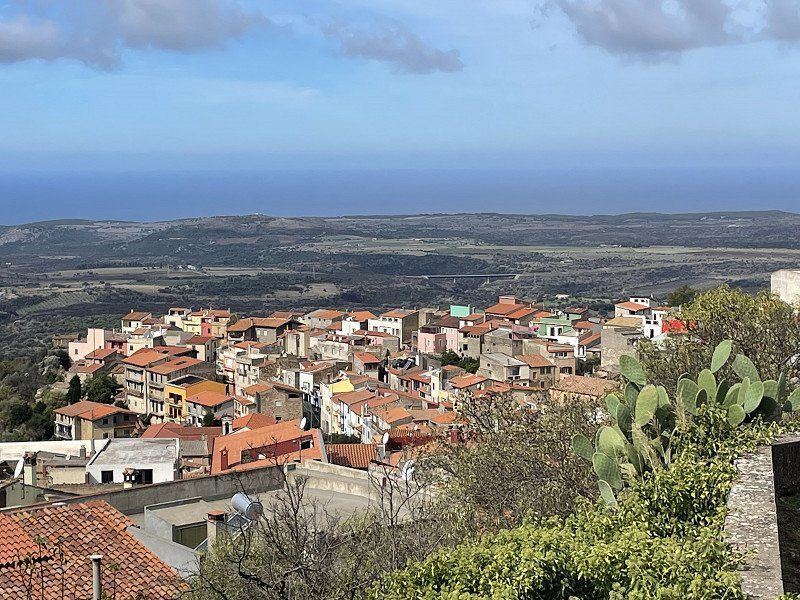
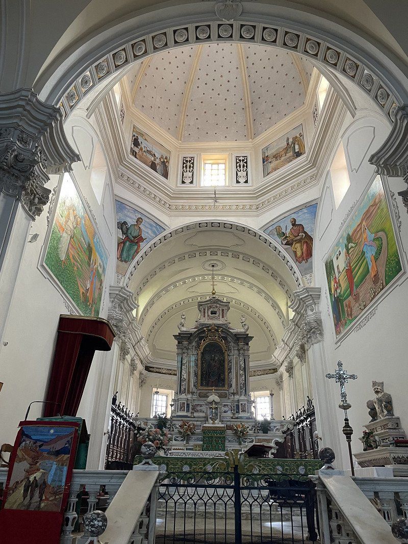
Cuglieri, Oristano, Italien
We parked at 20 Viale Regina Margherita. (see Park4night). From there we did a tour of the small town, including the church of Santa Maria della Neve. A delicious cappuccino formed the end of our stay.
09073 Cuglieri, Oristano, Italien
40° 11' 16.1" N 8° 33' 54.8" E
40.1877987 8.5652105
• Head north on Via Eleonora d'Arborea. Go for 15 m.
• Turn right onto Via Sa Serra. Go for 227 m.
• Turn left onto Corso Umberto I (SS292). Go for 1.1 km.
• Take the 1st exit from roundabout onto Strada Statale Nord Occidentale Sarda (SS292). Go for 11.3 km.
• Turn left onto Via Vittorio Emanuele III (SP35). Go for 324 m.
• Turn left. Go for 31 m.
• Turn left toward Strada Comunale Magomadas-Turas. Go for 55 m.
• Continue on Strada Comunale Magomadas-Turas. Go for 4.6 km.
• Turn sharp left toward Lungomare Mediterraneo. Go for 1.6 km.
• Continue on Lungomare Mediterraneo. Go for 771 m.
• Turn right onto Viale Italia. Go for 214 m.
• Arrive at Viale Italia.
☍
20,2 km
( 26 min.)
Bosa Marina, Oristano, Italien
08013 Bosa Marina OR, Italien
40° 17' 27.7" N 8° 28' 41.5" E
40.2910350 8.4781948
• Head toward Via Cristoforo Colombo on Viale Italia. Go for 22 m.
• Turn right onto Via Cristoforo Colombo. Go for 499 m.
• Take the 1st exit from roundabout onto Via Cristoforo Colombo (SS129bis). Go for 490 m.
• Continue on Via Nazionale (SS129bis). Go for 1.2 km.
• Turn left onto Via Roma (SP19). Go for 80 m.
• Continue on Ponte Vecchio (SP19). Go for 109 m.
• Continue on Piazza Duomo (SP19). Go for 40 m.
• Arrive at Piazza Duomo (SP19). Your destination is on the left.
☍
2,5 km
( 4 min.)
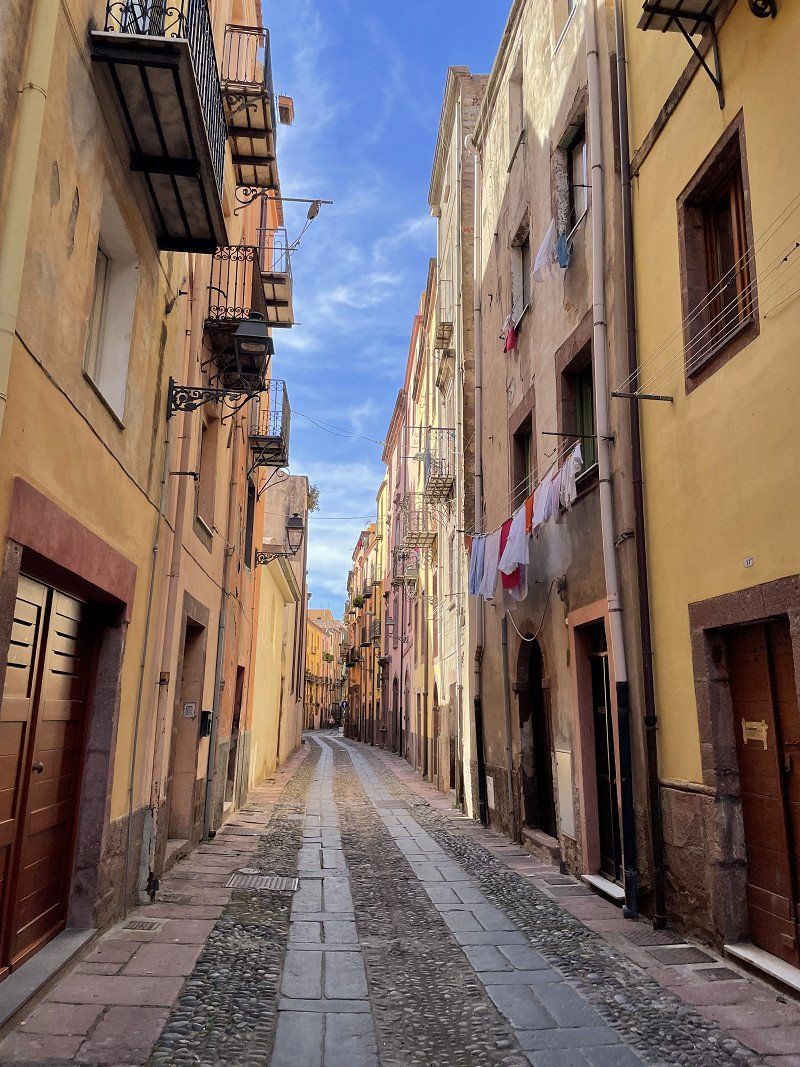
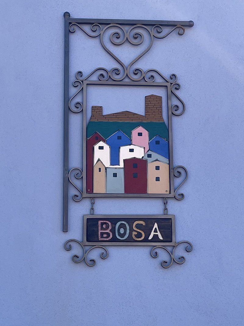
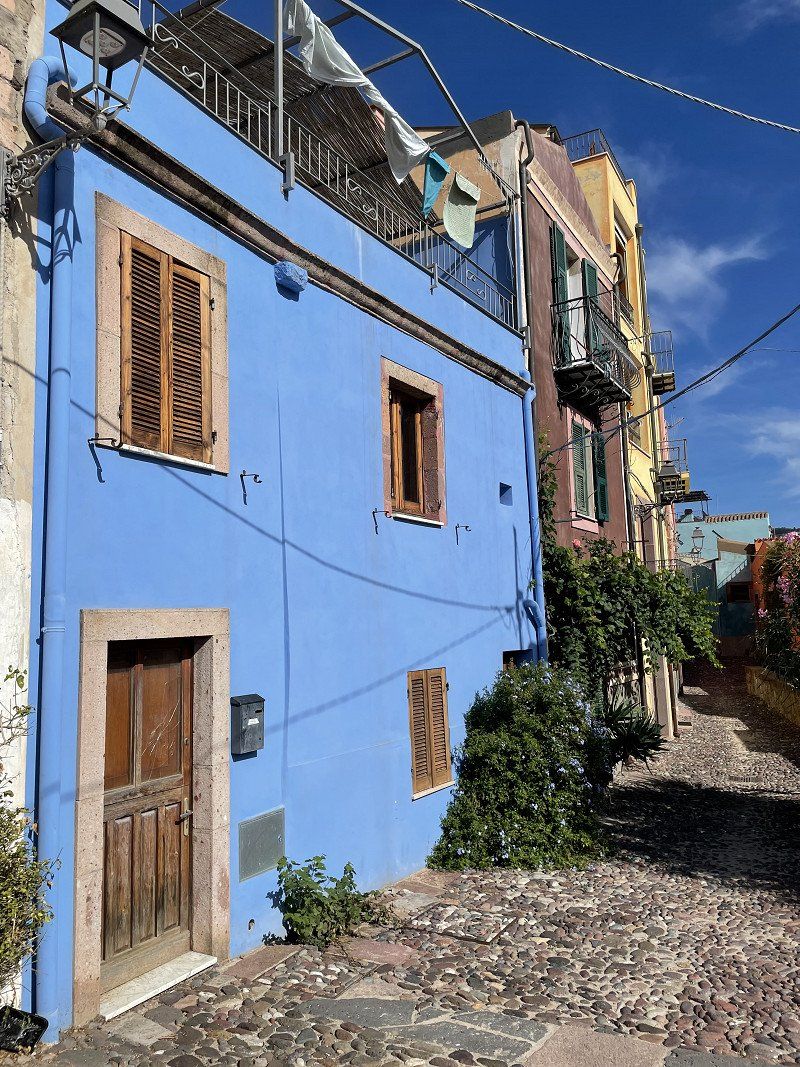
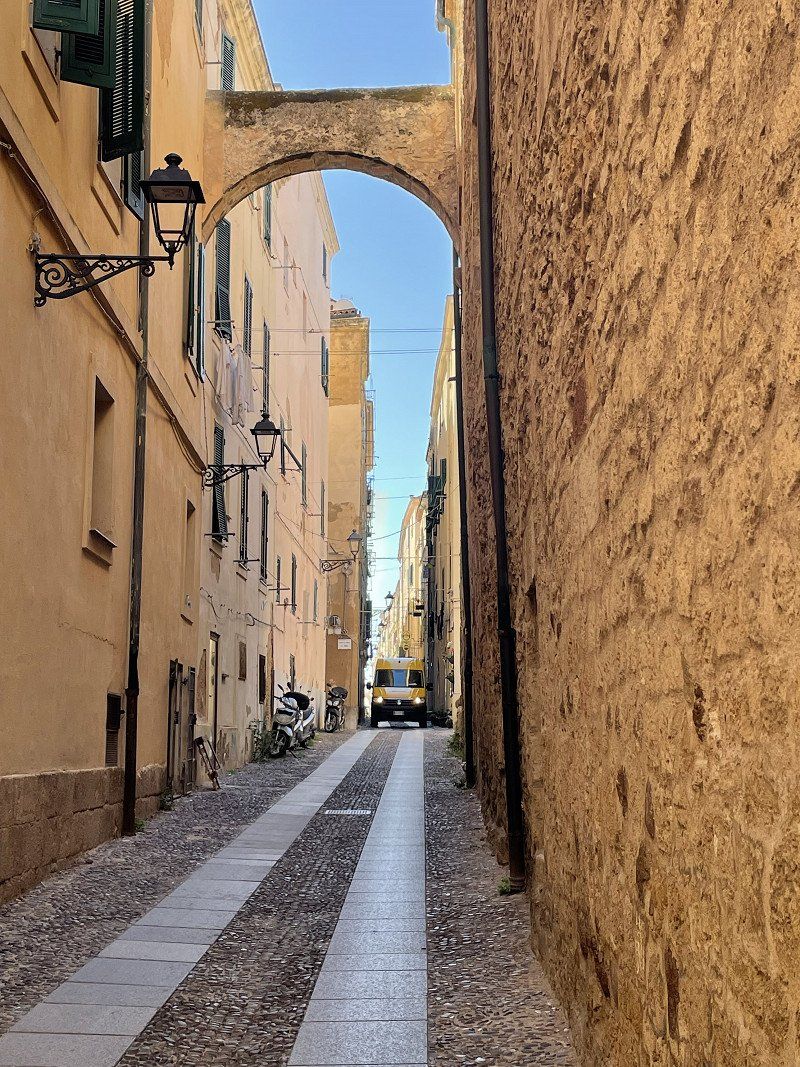
Bosa, Oristano, Italien
We were last in this great city at the end of the 90s. We drove to the parking lot at 25 Via Spano via Park4night. Here you are right next to a pedestrian bridge. From there you can be in the city center in about 10 minutes.
We did a detailed tour of the city and enjoyed the great buildings and streets. The high proportion of properties for sale was somewhat shocking. Apparently a lot of people are drawn away from this colorful city.
08013 Bosa, Oristano, Italien
40° 17' 42.8" N 8° 30' 13.2" E
40.2952312 8.5036658
• Head toward Corso Vittorio Emanuele II on Piazza Duomo (SP19). Go for 7 m.
• Turn left onto Corso Vittorio Emanuele II (SP49). Go for 129 m.
• Turn left onto Via Palestro. Go for 72 m.
• Turn right onto Lungo Temo Alcide De Gasperi. Go for 893 m.
• Continue on Lungotemo Giorgio Amendola. Go for 699 m.
• Take ramp onto SP49. Go for 306 m.
• Take the 2nd exit from roundabout onto SP49. Go for 6.4 km.
• Arrive at SP49.
☍
8,5 km
( 11 min.)
Torre Argentina, 08013 Bosa, Oristano, Italien
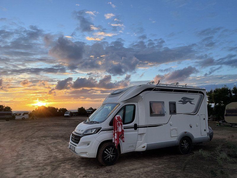
A great pitch right by the sea. There used to be a campsite here. Unfortunately, the entire infrastructure of the place is no longer available. There are neither garbage cans nor supply and disposal facilities here. The owner comes in the evening and collects €15. There is then a great sunset and sea air free Womo.
The coastal road from Bosa to Alghero is one of the most beautiful tours on the island. Great views of the coast are reminiscent of the west coast of Corsica, although in Sardinia the roads are wider and better developed. The journey is most beautiful early in the morning, as there is little traffic and the light underscores the great impressions of the landscape.
Bosa, 08013 Bosa OR, Italien
40° 19' 9.9" N 8° 26' 38" E
40.3194082 8.4438910
• Head west on SP49.
• Arrive at SP49.
☍
Distance not available
(Duration not available)
Day
Torre Argentina, 08013 Bosa, Oristano, Italien
Bosa, 08013 Bosa OR, Italien
40° 19' 9.9" N 8° 26' 38" E
40.3194082 8.4438910
• Head west on SP49. Go for 12.9 km.
• Continue on SP105. Go for 18.0 km.
• Continue on Strada Provinciale Alghero-Bosa (SP105). Go for 4.6 km.
• Continue on Viale della Resistenza (SP105). Go for 300 m.
• Turn left onto Via Fratelli John e Robert Kennedy. Go for 144 m.
• Turn right onto Via Alcide De Gasperi. Go for 306 m.
• Turn left onto Viale Giovanni XXIII (SS292). Go for 994 m.
• Turn right onto Via 20 Settembre. Go for 184 m.
• Turn right onto Via Alberto La Marmora. Go for 28 m.
• Turn right onto Via Nuoro. Go for 15 m.
• Arrive at Via Nuoro. Your destination is on the left.
☍
37,5 km
( 44 min.)
Day
Alghero, Sassari, Italien
Here, too, we were already at the end of the 90s. We parked at the port in the Banchina Rafael Catardi (see Park4night) for free. The tour of the old town with the obligatory liquorice ice cream and a delicious cappuccino took us about 2 hours.
From Alghero we headed north in search of a CP.
07041 Alghero, Sassari, Italien
40° 33' 28.6" N 8° 19' 9.5" E
40.5579517 8.3192949
• Head toward Via Angelo Roth on Via Nuoro. Go for 107 m.
• Continue on Piazza della Mercede. Go for 86 m.
• Turn right onto Viale Giovanni XXIII (SS292). Go for 1.5 km.
• Take the 1st exit from roundabout onto Via Don Giovanni Minzoni (SS127bis). Go for 222 m.
• Take the 2nd exit from roundabout onto Via Don Giovanni Minzoni (SS127bis). Go for 260 m.
• Keep left toward Via Don Giovanni Minzoni/SS127bis. Go for 55 m.
• Take the 3rd exit from roundabout onto Via Don Giovanni Minzoni (SS127bis). Go for 1.3 km.
• Take the 2nd exit from roundabout onto SP42. Go for 851 m.
• Continue toward Diramazione del Calich/SS291dir. Go for 46 m.
• Take the 3rd exit from roundabout onto Diramazione del Calich (SS291dir). Go for 4.1 km.
• Turn right onto Strada Statale della Nurra (SS291). Go for 4.5 km.
• Turn left onto Strada Vicinale Guardia Grande. Go for 3.5 km.
• Turn right onto Strada Vicinale Guardia Grande. Go for 580 m.
• Turn slightly left onto Strada Vicinale Funtana Muras Casas. Go for 952 m.
• Turn right onto Strada Vicinale Nuraghe Risola. Go for 1.4 km.
• Turn left onto SP55bis. Go for 643 m.
• Turn right. Go for 1.2 km.
• Arrive at your destination on the left.
☍
21,4 km
( 32 min.)
Camping Village Glamping Torre del Porticciolo
Very nice campsite with its own beach. We paid €28 here with an ADAC card.
Località Porticciolo, 07041, Alghero, Italy
40° 38' 33.8" N 8° 11' 24.7" E
40.6427276 8.1902057
• Head south. Go for 30 m.
• Turn left. Go for 199 m.
• Turn left. Go for 2.3 km.
• Turn right toward SP69. Go for 4.0 km.
• Turn left onto SP69. Go for 10.4 km.
• Turn left onto Via Argentiera (SP18). Go for 1.7 km.
• Turn left onto Via Argentiera (SP18). Go for 5.0 km.
• Turn left onto Via Argentiera (SP18). Go for 13 m.
• Turn slightly left onto Via La Plata (SP18). Go for 192 m.
• Continue on Strada Vicinale Monte Fiocca Tronco A (SP18). Go for 83 m.
• Turn slightly right onto Piazza Camillo Marchese Argentiera (SP18). Go for 266 m.
• Continue on Via Fancello (SP18). Go for 154 m.
• Continue on Viale Umberto I (SP18). Go for 51 m.
• Continue on Via Bazzinita (SP18). Go for 113 m.
• Continue on Via Pozzo Podestà (SP18). Go for 302 m.
• Turn right onto Via Ettore Mura. Go for 101 m.
• Arrive at Via Ettore Mura. Your destination is on the right.
☍
24,9 km
( 41 min.)
Day
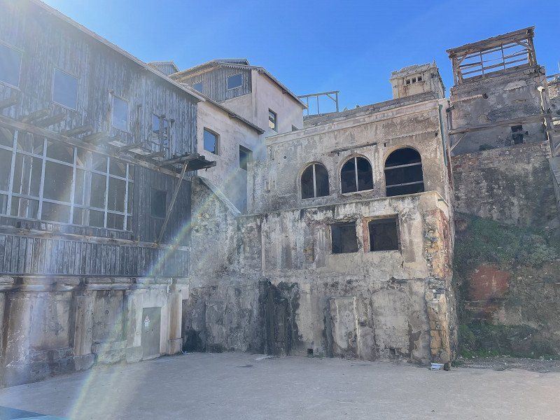
Argentiera, Sassari, Italien
The former mining settlement of Argentiera offers a great backdrop and an equally fantastic beach. Silver was mined here until the 1960s. You can still admire the silver-streaked rock while snorkeling.
40° 44' 1.9" N 8° 8' 53.9" E
40.7338696 8.1483093
• Head toward Via Pasquale Paoli on Via Ettore Mura. Go for 101 m.
• Turn left onto Piazza Cantina (SP18). Go for 302 m.
• Continue on Via Bazzinita (SP18). Go for 113 m.
• Continue on Viale Umberto I (SP18). Go for 51 m.
• Continue on Via Fancello (SP18). Go for 154 m.
• Continue on Piazza Camillo Marchese Argentiera (SP18). Go for 266 m.
• Turn slightly left onto Strada Vicinale Monte Fiocca Tronco A (SP18). Go for 83 m.
• Continue on Via La Plata (SP18). Go for 192 m.
• Turn slightly right onto Via Argentiera (SP18). Go for 13 m.
• Turn right onto Via Argentiera (SP18). Go for 4.9 km.
• Keep left onto Via Argentiera (SP18). Go for 116 m.
• Continue on Via Lampianu (SP57). Go for 1.6 km.
• Continue on SP57. Go for 5.4 km.
• Continue on Via Nule (SP57). Go for 232 m.
• Continue on SP57. Go for 5.9 km.
• Continue on Strada Provinciale 57 (SP57). Go for 746 m.
• Take the 3rd exit from roundabout onto Strada Provinciale Porto Torres-Stintino-la Pelosa (SP34). Go for 3.4 km.
• Pass 3 roundabouts and continue on Strada Provinciale Stintino-Porto Torres (SP34). Go for 8.8 km.
• Take the 1st exit from roundabout onto Via Sassari. Go for 208 m.
• Arrive at Via Sassari. Your destination is on the right.
☍
32,6 km
( 38 min.)
Stintino, Sassari, Italien
Before we go to the parking space, we dare a short trip to the "hairy", the dream beach Pelosa. We only drive past with the Womo. The whole stretch of coast is very touristy and interspersed with many hotels.
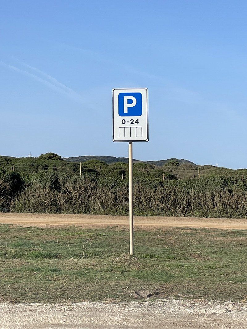
In one of the roundabouts in front of Stintino there is a direct descent to a lagoon. There are several pitches right by the sea. Parking is permitted here from 0-24h, ie any manipulation such as turning out chairs, extending awnings or driving on wheel chocks is prohibited. Staying a few meters from the camper on the beach, on the other hand, is not a problem. Since this is only a parking lot, there is no supply and disposal. There are several parking spaces at Park4night.
07040 Stintino SS, Italien
40° 56' 24.5" N 8° 13' 24.9" E
40.9401332 8.2235889
• Head north on Via Sassari. Go for 209 m.
• Take the 2nd exit from roundabout onto Strada Provinciale Stintino-Porto Torres (SP34). Go for 1.0 km.
• Pass 3 roundabouts and continue on Strada Provinciale Porto Torres-Stintino-la Pelosa (SP34). Go for 11.2 km.
• Take the 3rd exit from roundabout onto SP57. Go for 11.0 km.
• Take the 3rd exit from roundabout onto Strada Provinciale Porto Torres-Stintino-la Pelosa (SP34). Go for 1.5 km.
• Take the 1st exit from roundabout onto SS131. Go for 528 m.
• Take the 2nd exit from roundabout onto SS131 toward Porto Torres Centro/Castelsardo/S. Teresa G. Go for 2.1 km.
• Take ramp onto Via dell'Industria toward Porto Torres Centro/Castelsardo/S. Teresa Gallura. Go for 2.3 km.
• Take the 1st exit from roundabout onto Via Sassari (SS131). Go for 371 m.
• Take the 2nd exit from roundabout onto SS131. Go for 4.4 km.
• Turn right onto Strada Vicinale Monte d'Accoddi. Go for 305 m.
• Arrive at Strada Vicinale Monte d'Accoddi.
☍
34,9 km
( 31 min.)
Day
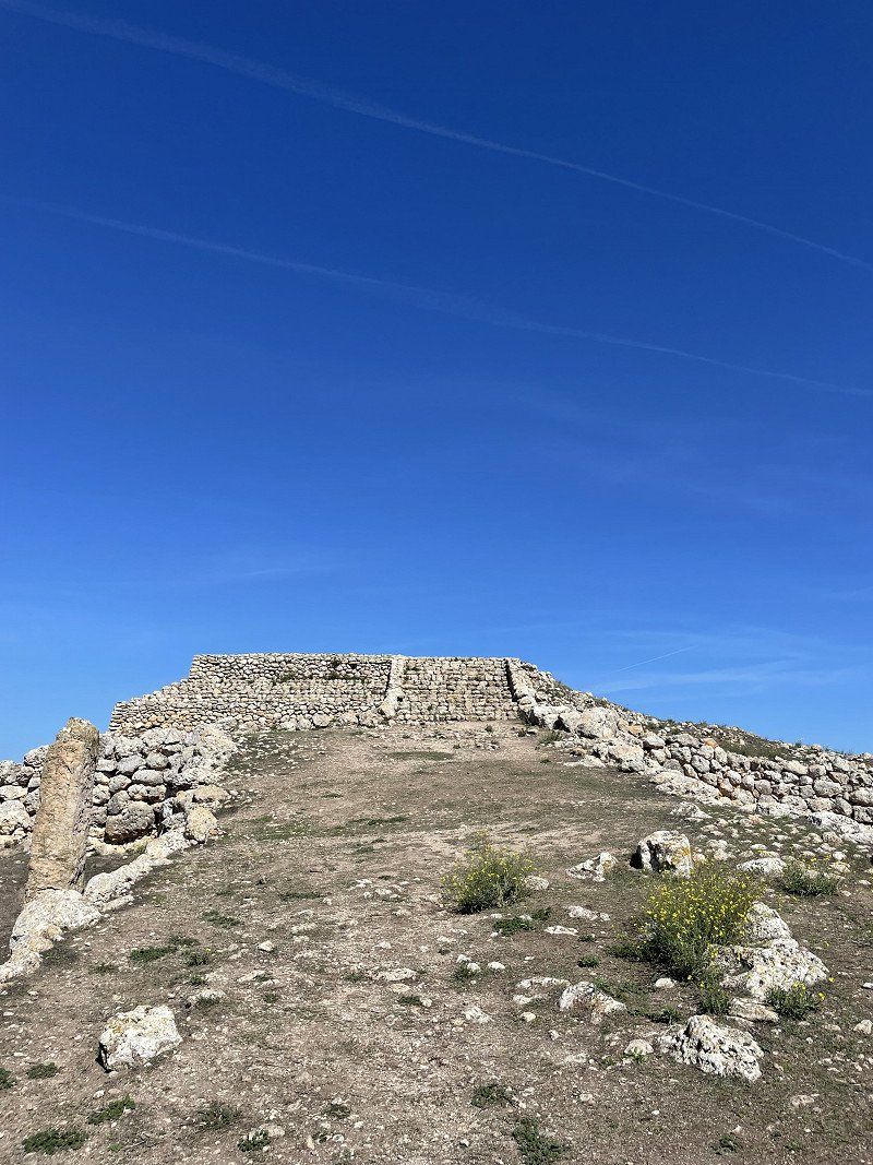
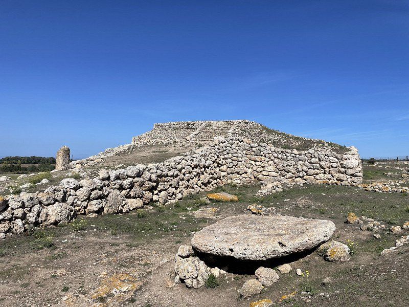
Altare prenuragico di Monte d'Accoddi, SV Monte d'Accoddi, Sassari, Italien
An old place of worship from the Ozieri culture, which probably existed before the Nuraghers. At the entrance you will receive a video presentation to get you in the mood.
SV Monte d'Accoddi, 07100 Sassari SS, Italien
40° 47' 26.4" N 8° 26' 56.3" E
40.7906678 8.4489799
• Head northeast on Strada Vicinale Monte d'Accoddi. Go for 239 m.
• Turn right onto Strada Statale Carlo Felice (SS131). Go for 1.3 km.
• Take the 4th exit from roundabout onto Strada Comunale Platamona. Go for 2.6 km.
• Take the 1st exit from roundabout onto Via Grazia Deledda (SP25). Go for 2.8 km.
• Take the 2nd exit from roundabout onto Strada Provinciale Sorso-Li Pidriazzi (SP25). Go for 1.1 km.
• Turn slightly left onto Località Bagnu (SP48). Go for 3.8 km.
• Take the 2nd exit from roundabout onto SP48. Go for 2.8 km.
• Turn left onto Strada Statale dell'Anglona (SS200). Go for 8.7 km.
• Turn right onto Strada Provinciale Sassari Santa Teresa. Go for 8.9 km.
• Keep left. Go for 9.4 km.
• Keep left toward SP90. Go for 3.4 km.
• Pass 3 roundabouts and continue on SP90. Go for 33.7 km.
• Take the 3rd exit from roundabout. Go for 200 m.
• Keep right. Go for 44 m.
• Turn right. Go for 98 m.
• Arrive at your destination on the right.
☍
79,1 km
(1 hrs. 11 min.)
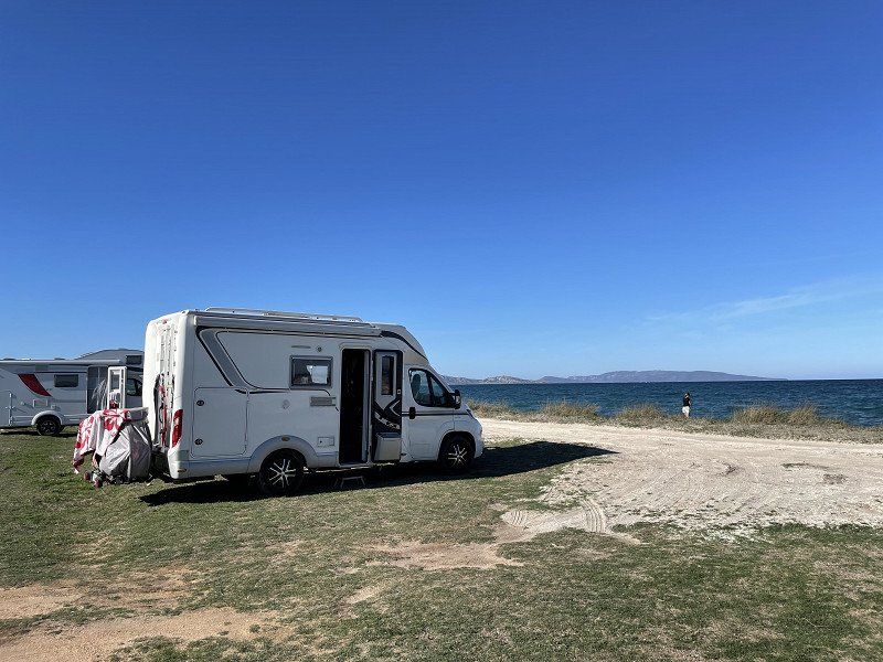
Baia blu La Tortuga, Vignola Mare, Sassari, Italien
Before we return home to autumnal Germany, we want to get a taste of camping air for a few more days and have chosen the CP Baia Blue, which we have visited several times in the past few years. There are different assessments of this very large CP on the Internet. We have always had a great time here and the staff is extremely friendly. This time we had a place right by the sea. With ACSI we paid 22€/N.
There is now also a real aqua park with lots of great play facilities for children and a sports pool for swimmers.
Pineta di, 07020 Vignola Mare SS, Italien
41° 7' 27.7" N 9° 4' 7.6" E
41.1243625 9.0687883
• Head east.
• Arrive at your destination on the right.
☍
Distance not available
(Duration not available)
Day
Baia blu La Tortuga, Vignola Mare, Sassari, Italien
Pineta di, 07020 Vignola Mare SS, Italien
41° 7' 27.7" N 9° 4' 7.6" E
41.1243625 9.0687883
• Head east.
• Arrive at your destination on the right.
☍
Distance not available
(Duration not available)
Day
Baia blu La Tortuga, Vignola Mare, Sassari, Italien
Pineta di, 07020 Vignola Mare SS, Italien
41° 7' 27.7" N 9° 4' 7.6" E
41.1243625 9.0687883
• Head east. Go for 168 m.
• Turn right toward Strada Castelsardo-Santa Teresa Gallura/SP90. Go for 55 m.
• Turn right onto Strada Castelsardo-Santa Teresa Gallura (SP90). Go for 217 m.
• Pass 4 roundabouts. Go for 41.4 km.
• Continue on SP90. Go for 2.6 km.
• Turn right onto Strada Provinciale Castelsardo Santa Teresa (SP90). Go for 2.0 km.
• Turn left onto Strada Statale Castelsardo (SS134). Go for 354 m.
• Continue on SS134. Go for 111 m.
• Continue on Strada Statale Castelsardo (SS134). Go for 64 m.
• Arrive at Strada Statale Castelsardo (SS134). Your destination is on the left.
☍
46,8 km
( 45 min.)
Day
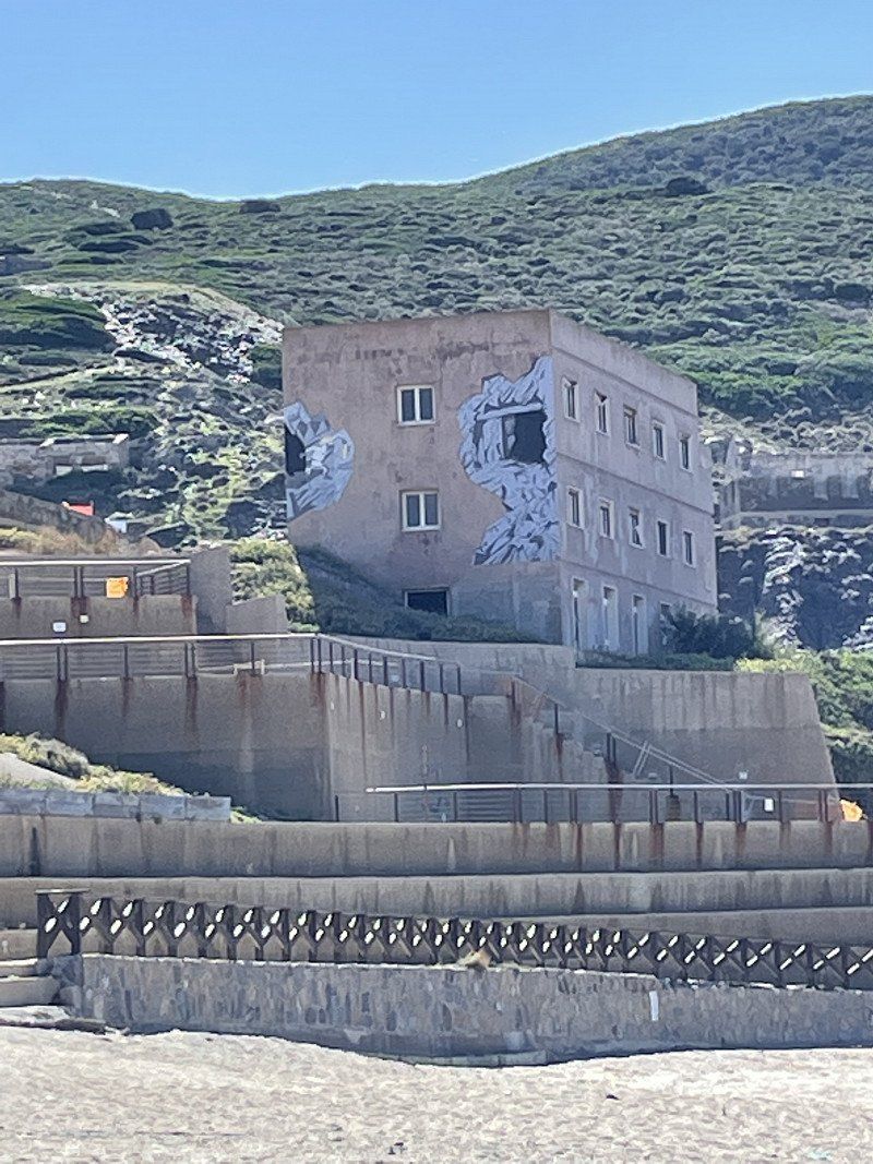
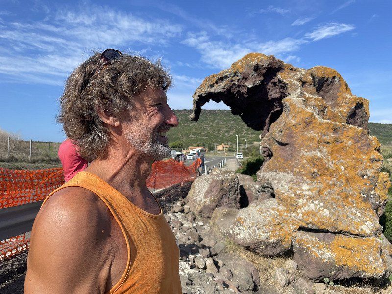
Elefantenfels, Strada Statale 134 Km 19,300, Castelsardo, Sassari, Italien
I leave the attached picture uncommented.
Strada Statale 134 Km 19,300, 07031 Castelsardo SS, Italien
40° 53' 22.9" N 8° 44' 46.4" E
40.8896867 8.7462183
• Head northwest on Strada Statale Castelsardo (SS134). Go for 64 m.
• Continue on SS134. Go for 111 m.
• Continue on Strada Statale Castelsardo (SS134). Go for 4.7 km.
• Turn left onto Piazza Panedda (SS134). Go for 42 m.
• Continue on Via Roma (SS200). Go for 423 m.
• Arrive at Strada Statale dell'Anglona (SS200). Your destination is on the right.
☍
5,3 km
( 8 min.)
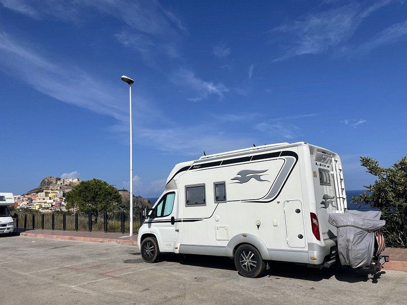
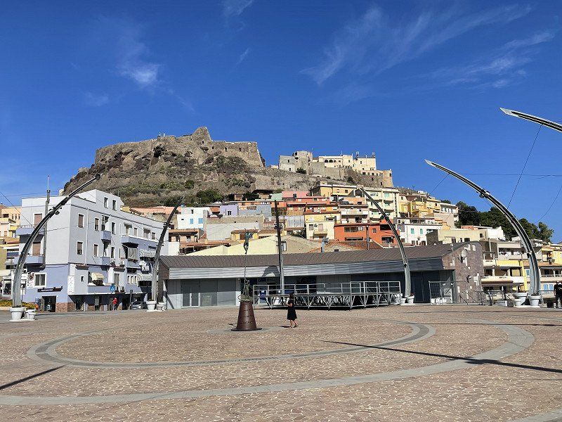
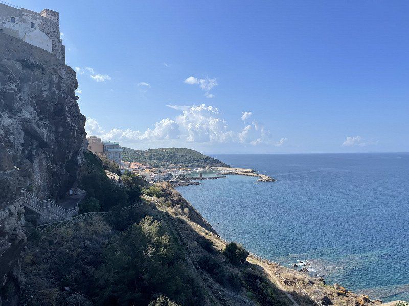
Castelsardo, Sassari, Italien
This was our first visit to Castelsardo. We parked in the large parking lot in front of the cemetery (coming from the east in front of the city).
Many small streets with colorful houses and one or the other church welcome the visitor. In contrast to Bosa or Alghero, there were hardly any houses for sale here. The residents seem to like it here and the numerous tourists seem to make a good living.
07031 Castelsardo, Sassari, Italien
40° 54' 49.3" N 8° 42' 30.9" E
40.9136920 8.7085920
• Head toward Via Silvio Pellico on Strada Statale dell'Anglona (SS200). Go for 872 m.
• Turn left toward Strada Provinciale Sassari Santa Teresa. Go for 2.2 km.
• Take ramp onto Strada Provinciale Sassari Santa Teresa. Go for 5.9 km.
• Turn left onto Strada Statale dell'Anglona (SS200). Go for 8.8 km.
• Turn right onto SP48. Go for 2.7 km.
• Take the 2nd exit from roundabout onto Località Lu Padru (SP48). Go for 3.9 km.
• Turn right onto Località Badde Fustiggiu (SP25). Go for 1.1 km.
• Pass 3 roundabouts and continue on SS131. Go for 8.5 km.
• Take the 2nd exit from roundabout onto Via dell'Industria. Go for 2.4 km.
• Take ramp onto SS131 toward Sassari/Olbia/Nuoro/Oristano/Cagliari. Go for 2.1 km.
• Take ramp toward Stintino/Alghero/Aeroporto Alghero. Go for 313 m.
• Take the 1st exit from roundabout onto SS131 toward Stintino/Alghero. Go for 570 m.
• Take the 2nd exit from roundabout onto Strada Provinciale Porto Torres-Stintino-la Pelosa (SP34). Go for 1.3 km.
• Continue straight ahead. Go for 35 m.
• Take the 2nd exit from roundabout. Go for 165 m.
• Continue on SP57. Go for 10.8 km.
• Take the 1st exit from roundabout onto Strada Provinciale Porto Torres-Stintino-la Pelosa (SP34). Go for 3.4 km.
• Pass 3 roundabouts and continue on Strada Provinciale Stintino-Porto Torres (SP34). Go for 8.8 km.
• Take the 1st exit from roundabout onto Via Sassari. Go for 208 m.
• Arrive at Via Sassari. Your destination is on the right.
☍
64,2 km
( 55 min.)
Stintino, Sassari, Italien
We wanted to spend our last night in Sardinia again in the lagoon near Stintino. Since our ferry doesn't leave until the evening of the next day, we can enjoy one last day at the beach here.
07040 Stintino SS, Italien
40° 56' 24.5" N 8° 13' 24.9" E
40.9401332 8.2235889
• Head north on Via Sassari. Go for 209 m.
• Take the 2nd exit from roundabout onto Strada Provinciale Stintino-Porto Torres (SP34). Go for 1.0 km.
• Pass 3 roundabouts and continue on Strada Provinciale Porto Torres-Stintino-la Pelosa (SP34). Go for 11.2 km.
• Take the 3rd exit from roundabout onto SP57. Go for 11.0 km.
• Take the 3rd exit from roundabout onto Strada Provinciale Porto Torres-Stintino-la Pelosa (SP34). Go for 1.5 km.
• Take the 2nd exit from roundabout onto Strada Provinciale Porto Torres-Stintino-la Pelosa (SP34). Go for 1.9 km.
• Pass 2 roundabouts and continue on Strada Provinciale Porto Torres-Stintino-la Pelosa (SP34). Go for 788 m.
• Take the 3rd exit from roundabout onto Via dell'Industria toward Stazione Marittima. Go for 356 m.
• Take the 2nd exit from roundabout onto Via Amerigo Vespucci. Go for 903 m.
• Turn right toward Imbarco/Grimaldi-Tirrenia/Genova. Go for 125 m.
• Turn left. Go for 15 m.
• Turn left. Go for 101 m.
• Arrive at your destination on the right.
☍
29,2 km
( 28 min.)
Day
Porto Torres Port, Via Amerigo Vespucci, Porto Torres, Sassari, Italien
At 8:30 p.m. our ferry leaves our beloved holiday island. After 11 hours we reach Genoa.
Via Amerigo Vespucci, 07046 Porto Torres SS, Italien
40° 50' 12.8" N 8° 22' 41.6" E
40.8368921 8.3782339
• Head north. Go for 102 m.
• Turn right. Go for 118 m.
• Turn left. Go for 15 m.
• Turn right toward Via Amerigo Vespucci. Go for 125 m.
• Turn left onto Via Amerigo Vespucci toward Cagliari-Sassari/Nuoro-Oristano/Alghero-Stintino/Porto Torres/Centro. Go for 830 m.
• Take the 1st exit from roundabout onto Via dell'Industria toward Sassari/SS131/Olbia/Nuoro/Oristano/Cagliari/Alghero/Stintino/SP34. Go for 321 m.
• Take the 2nd exit from roundabout onto Via dell'Industria toward Sassari/Cagliari/SS131. Go for 2.6 km.
• Take the 1st exit from roundabout onto Via Sassari (SS131). Go for 371 m.
• Take the 2nd exit from roundabout onto SS131. Go for 883 m.
• Turn left onto SP25. Go for 4.5 km.
• Pass 2 roundabouts and continue on Strada Provinciale Sorso-Li Pidriazzi (SP25). Go for 3.9 km.
• Turn slightly left onto Località Bagnu (SP48). Go for 3.8 km.
• Take the 2nd exit from roundabout onto SP48. Go for 2.8 km.
• Turn left onto Strada Statale dell'Anglona (SS200). Go for 8.7 km.
• Turn right onto Strada Provinciale Sassari Santa Teresa. Go for 8.9 km.
• Keep left. Go for 9.4 km.
• Keep left toward Strada Castelsardo-Santa Teresa Gallura/SP90. Go for 3.4 km.
• Pass 4 roundabouts and continue on Strada Castelsardo-Santa Teresa Gallura (SP90). Go for 51.8 km.
• Take the 1st exit from roundabout onto Strada Statale Santa Teresa-Ponte Liscia (SS133bis). Go for 434 m.
• Turn slightly left toward Via Aa17. Go for 32 m.
• Continue on Via Aa17. Go for 854 m.
• Turn slightly left onto Via Sandro Pertini. Go for 227 m.
• Turn right onto SP161. Go for 455 m.
• Turn right onto SP161. Go for 96 m.
• Take the Santa Teresa di Gallura-Bonifacio Ferry. Stay on for 18.2 km.
• Head toward Quai Banda del Ferro. Go for 78 m.
• Continue on Quai Sott a Portigliola. Go for 129 m.
• Continue on Rue Sauveur-Paul Étienne. Go for 193 m.
• Continue on San Rocu (T40). Go for 672 m.
• Turn right onto Rue Paul Nicolai (D58). Go for 185 m.
• Turn left toward Avenue Sylvère Bohn/T40. Go for 315 m.
• Turn right onto Avenue Sylvère Bohn (T40) toward Ajaccio/Bastia/Porto Vecchio. Go for 1.4 km.
• Take the 1st exit from roundabout onto T10 toward Porto Vecchio/Bastia. Go for 19.6 km.
• Pass 4 roundabouts and continue on T10. Go for 3.5 km.
• Take the 2nd exit from roundabout onto T10 toward Bastia/Calvi. Go for 598 m.
• Pass 5 roundabouts and continue on T10. Go for 3.6 km.
• Take the 3rd exit from roundabout onto Avenue de Bastia (T10) toward Bastia/Calvi/Solenzara. Go for 2.5 km.
• Take the 3rd exit from roundabout onto T10 toward Bastia/Calvi/Solenzara. Go for 6.0 km.
• Pass 16 roundabouts and continue on Lieu-dit Chiosu di a Croce (T10). Go for 108 km.
• Take the 2nd exit from roundabout onto T11 toward Vescovato-Arena/Bastia/Aéroport Poretta/La Mer. Go for 1.3 km.
• Pass 2 roundabouts and continue on T11. Go for 14.8 km.
• Take the 3rd exit from roundabout onto T11 toward Bastia. Go for 2.6 km.
• Turn left toward Avenue Sampiero Corso/T11. Go for 423 m.
• Continue on Avenue Sampiero Corso (T11). Go for 843 m.
• Keep right onto Avenue Sampiero Corso (T11). Go for 825 m.
• Keep left onto Avenue Sampiero Corso (T11) toward Montesoro. Go for 106 m.
• Keep right onto Avenue Sampiero Corso (T11). Go for 483 m.
• Keep left onto T11 toward Centre Ville/Le Port. Go for 3.2 km.
• Keep left toward Rue Chanoine Leschi. Go for 207 m.
• Continue on Rue Chanoine Leschi. Go for 230 m.
• Keep right. Go for 230 m.
• Turn right. Go for 129 m.
• Turn right. Go for 230 m.
• Take the Bastia-Livorno Ferry. Stay on for 121 km.
• Head toward Piazzale dei Marmi on Calata Siena. Go for 135 m.
• Continue on Piazza del Portuale. Go for 174 m.
• Turn left onto Calata Carrara. Go for 23 m.
• Take the 1st exit from roundabout onto Via Andrea Costa. Go for 158 m.
• Take the 1st exit from roundabout onto Via Andrea Costa. Go for 345 m.
• Take the 1st exit from roundabout onto Via Guido Donegani toward Autostrada. Go for 646 m.
• Continue on Via Enrico Mattei toward Autostrada. Go for 1.1 km.
• Turn right onto Viale Genova (SP224) toward Zona Industriale Picchianti/Grosseto-Roma. Go for 584 m.
• Turn left onto Strada Statale Aurelia (SS1). Go for 1.6 km.
• Continue toward Strada Provinciale delle Sorgenti/SP4. Go for 43 m.
• Take the 1st exit from roundabout onto Strada Provinciale delle Sorgenti (SP4). Go for 1.1 km.
• Take ramp onto Variante Aurelia (SS1) toward Genova/A12/Firenze/A11/Pisa. Go for 1.0 km.
• Keep left onto A12 (Diramazione Livorno) toward Genova/E80/Firenze/A11/E74/Rosignano M./E80/Roma/E80/Pisa/SS1. Go for 4.0 km.
• Take the left exit toward Genova/E76/Firenze/A11 onto A12 (Autostrada Azzurra). Go for 171 km.
• Continue on A7 (Autostrada Milano-Genova). Go for 4.7 km.
• Take the left exit toward Porto Terminal Crociere onto Viadotto della Camionale. Go for 383 m.
• Keep right onto Viadotto della Camionale toward Porto Passeggeri. Go for 227 m.
• Continue on Via Ariberto Albertazzi. Go for 226 m.
• Turn right onto Via Ariberto Albertazzi. Go for 143 m.
• Keep right onto Via Ariberto Albertazzi. Go for 83 m.
• Continue on Calata San Benigno. Go for 57 m.
• Keep left onto Via al Ponte Assereto. Go for 285 m.
• Arrive at Via al Ponte Assereto. Your destination is on the left.
☍
603,7 km
(10 hrs. 27 min.)
Day
Porto di Genova Terminal Traghetti, Piazzale dei Traghetti Iqbal Masih, Genua, Italien
Traghetti, Piazzale dei Traghetti Iqbal Masih, 16126 Genova GE, Italien
44° 24' 39.3" N 8° 54' 32.4" E
44.4109046 8.9089945
• Head toward Calata della Chiappella on Via al Ponte Assereto. Go for 66 m.
• Turn left toward Piazzale Cristoforo Colombo. Go for 95 m.
• Turn left onto Piazzale Cristoforo Colombo. Go for 9 m.
• Turn left onto Via della Chiappella. Go for 385 m.
• Turn right onto Via Ariberto Albertazzi. Go for 286 m.
• Keep left onto Viadotto della Camionale toward Aeroporto/Autostrade. Go for 156 m.
• Keep left onto Viadotto della Camionale toward Centro/Nervi/Autostrade. Go for 154 m.
• Keep left onto Viadotto della Camionale toward Autostrade. Go for 99 m.
• Take ramp onto A7 (Autostrada Milano-Genova). Go for 125 km.
• Take the exit toward Varese-Como onto A50 (Tangenziale Ovest). Go for 21.0 km.
• Take the exit toward Varese/Gravellona T./A26/Como-Chiasso/A9 onto A8 (Autostrada dei Laghi). Go for 4.9 km.
• Take the exit toward Como/Chiasso onto A9 (Autostrada dei Laghi). Go for 23.7 km.
• Take the exit toward Como Centro. Go for 725 m.
• Take the 3rd exit from roundabout onto Via del Dos toward Varese/Chiasso. Go for 589 m.
• Take the 2nd exit from roundabout onto Via Gabriele D'Annunzio (SP17) toward Chiasso/S.Fermo. Go for 2.0 km.
• Pass 2 roundabouts and continue on Via Roma (SP17). Go for 539 m.
• Take the 1st exit from roundabout onto Via Alessandro Noseda (SP17). Go for 216 m.
• Take the 2nd exit from roundabout onto Strada Provinciale Garibaldina (SP17). Go for 2.1 km.
• Take the 2nd exit from Largo Ceresio roundabout onto Via Luigi Camozzi. Go for 179 m.
• Take the 3rd exit from roundabout onto Via Bellinzona toward Chiasso/Cernobbio/Menaggio. Go for 748 m.
• Take the 3rd exit from roundabout onto Via Bellinzona toward Milano/A9/Svizzera. Go for 1.1 km.
• Take the 1st exit from roundabout onto Via Bellinzona. Go for 60 m.
• Continue on Via Bellinzona. Go for 142 m.
• Continue on Via Maestri Comacini (2). Go for 538 m.
• Take the 1st exit from roundabout onto Via Como (2). Go for 227 m.
• Take the 1st exit from roundabout toward Lugano. Go for 173 m.
• Take ramp onto A2 toward Lugano. Go for 237 km.
• Take the exit onto A1/A2. Go for 8.5 km.
• Take exit 45 toward E25/Basel/Egerkingen onto A2. Go for 28.1 km.
• Take exit 9 toward Zürich/Rheinfelden onto A3. Go for 2.0 km.
• Take exit 14 toward Deutschland/Rheinfelden-West. Go for 1.3 km.
• Continue on A861. Go for 88 m.
• Continue on A861. Go for 4.1 km.
• Take the exit onto A98. Go for 2.1 km.
• Take ramp toward Maulburg/Minseln. Go for 615 m.
• Turn left onto Am Kalkofen (K6333) toward Maulburg/Minseln. Go for 559 m.
• Turn right onto Nordschwabener Straße. Go for 566 m.
• Continue on K6336. Go for 2.8 km.
• Continue on Schopfheimer Straße (K6336). Go for 735 m.
• Continue on K6336. Go for 1.3 km.
• Continue on Dinkelbergstraße (K6336). Go for 1.5 km.
• Continue on Wiechser Straße (K6336). Go for 502 m.
• Take the 2nd exit from roundabout onto Wiechser Straße. Go for 237 m.
• Turn right onto Bismarckstraße. Go for 350 m.
• Continue on Bahnhofstraße. Go for 285 m.
• Continue on Hebelstraße. Go for 154 m.
• Take the 3rd exit from roundabout onto Schwarzwaldstraße (K6353). Go for 301 m.
• Take the 2nd exit from roundabout onto Himmelreichstraße. Go for 400 m.
• Take the 2nd exit from roundabout onto Austraße. Go for 66 m.
• Turn left onto Austraße. Go for 62 m.
• Arrive at Austraße. Your destination is on the right.
☍
478,8 km
(5 hrs. 10 min.)
Schopfheim, Deutschland
We make a stopover at my wife's uncle's. After a great dinner we enjoy a bottle or two of wine.
The next day at 11 a.m. we leave Schopfheim in the direction of Essen. After a good 8 hour drive we arrive back home.
79650 Schopfheim, Deutschland
47° 39' 6.7" N 7° 49' 24.9" E
47.6518603 7.8235713
• Head east on Austraße. Go for 62 m.
• Turn right onto Austraße. Go for 21 m.
• Take the 2nd exit from roundabout onto Himmelreichstraße. Go for 390 m.
• Take the 3rd exit from roundabout onto Wehrer Straße (K6353). Go for 293 m.
• Take the 3rd exit from roundabout onto Wehrer Straße (K6353). Go for 226 m.
• Take ramp. Go for 154 m.
• Turn right onto B317. Go for 7.7 km.
• Take the 2nd exit from roundabout onto B317 toward Basel/Lörrach. Go for 5.5 km.
• Take ramp onto A98 toward Basel/Karlsruhe. Go for 7.3 km.
• Take exit 1 toward Karlsruhe/Stuttgart/Freiburg onto A5. Go for 287 km.
• Continue on E35 (Darmstädter Kreuz) toward Köln/Wiesbaden/Mainz/A67. Go for 952 m.
• Continue on A67. Go for 22.2 km.
• Take the left exit toward Köln/Wiesbaden onto A3. Go for 167 km.
• Continue on A3. Go for 47.1 km.
• Take exit 16 toward Essen onto A52. Go for 12.4 km.
• Take exit 28 toward Essen-Rüttenscheid/B224 onto L176 (Anschlussstelle Essen-Rüttenscheid). Go for 547 m.
• Keep left onto Norbertstraße toward Messe/Gruga. Go for 1.2 km.
• Turn left onto Alfredstraße (B224). Go for 1.6 km.
• Continue on Bismarckstraße (K15). Go for 1.1 km.
• Turn right onto Am Waldthausenpark toward Zentrum. Go for 96 m.
• Turn slightly left onto Am Waldthausenpark. Go for 22 m.
• Turn right onto Alfred-Herrhausen-Brücke. Go for 21 m.
• Continue on Am Waldthausenpark. Go for 138 m.
• Turn right onto II. Hagen. Go for 31 m.
• Turn left onto Theaterplatz. Go for 55 m.
• Turn left onto I. Hagen. Go for 80 m.
• Arrive at I. Hagen.
☍
562,5 km
(5 hrs. 22 min.)
Day
Essen, Deutschland
Conclusion:
We drove about 3900 km and about 1000 km of it over Sardinia. We were able to get to know many new impressions and places. But we also had to notice not so nice developments at some locations. Nevertheless, Sardinia is always worth a trip. Next year we want to orientate ourselves more northwards. But there will definitely be a reunion with this great island.
51° 27' 20.3" N 7° 0' 41.6" E
51.4556432 7.0115552